Center for Brooklyn History
Map Collections
Search
About
Othmer Library & Archives
Submit search query
Refine 16 records
Clear filters
2
Location
Bay Ridge (New York, N.Y.)
108
Bedford-Stuyvesant (New York, N.Y.)
67
Boerum Hill (New York, N.Y.)
6
Brooklyn (New York, N.Y.)
891
Brooklyn Heights (New York, N.Y.)
76
Brooklyn-Queens Expressway (New York, N.Y.)
3
Carroll Gardens (New York, N.Y.)
21
Clinton Hill (New York, N.Y.)
10
Cobble Hill (New York, N.Y.)
7
Columbia Street Waterfront District (New York, N.Y.)
3
Downtown Brooklyn (New York, N.Y.)
29
Dyker Heights (New York, N.Y.)
23
Fort Greene (New York, N.Y.)
22
Fort Hamilton (New York, N.Y.)
31
Gowanus (New York, N.Y.)
12
Greenpoint (New York, N.Y.)
38
Park Slope (New York, N.Y.)
16
Prospect Heights (New York, N.Y.)
16
Queens (New York, N.Y.)
83
Red Hook (New York, N.Y.)
19
Sunset Park (New York, N.Y.)
53
Williamsburg (New York, N.Y.)
36
Windsor Terrace (New York, N.Y.)
10
Show 3 more
Subject
Central business districts
10
Election districts
36
Electric railroads
5
Express highways
3
Landowners
434
Local transit
63
Real property
619
Recreation
5
Streets
46
Subways
55
Tunnels
16
Date
20th Century
469
or enter range:
from
to
Genres
Cadastral maps
597
Manuscript maps
365
Map
191
Road maps
83
Thematic maps
60
Tourist maps
55
Transportation maps
120
Zoning maps
55
Sort by:
Date (earliest)
Date (most recent)
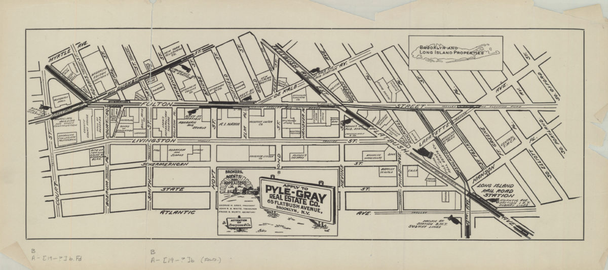
[Map of the Fulton Street area in downtown Brooklyn]
[Map of the Fulton Street area in downtown Brooklyn]
[19??]
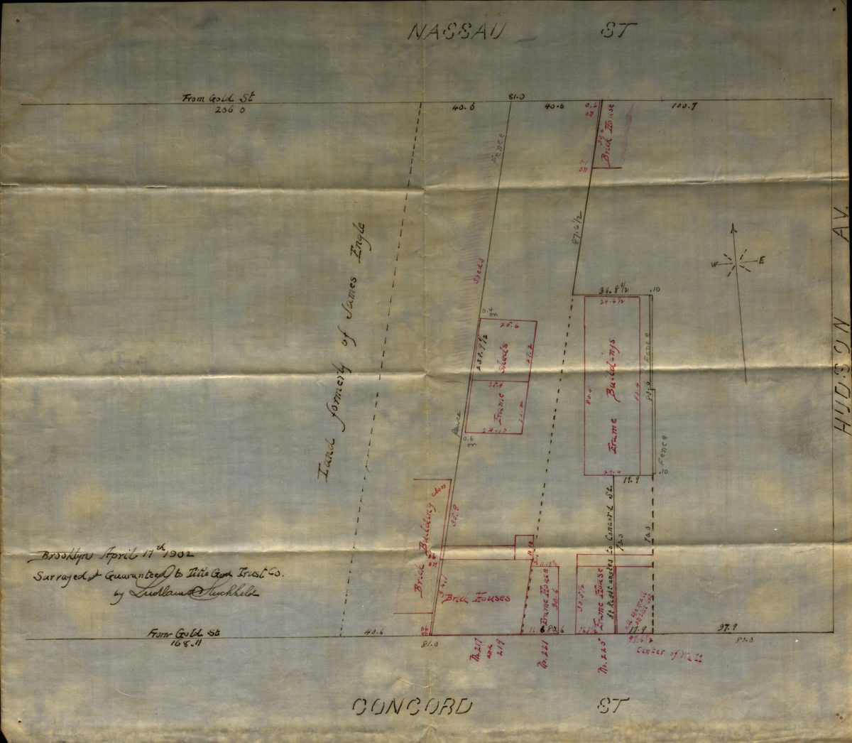
[Map of Hudson Avenue at Nassau Street and Concord Street]
[Map of Hudson Avenue at Nassau Street and Concord Street]
1902
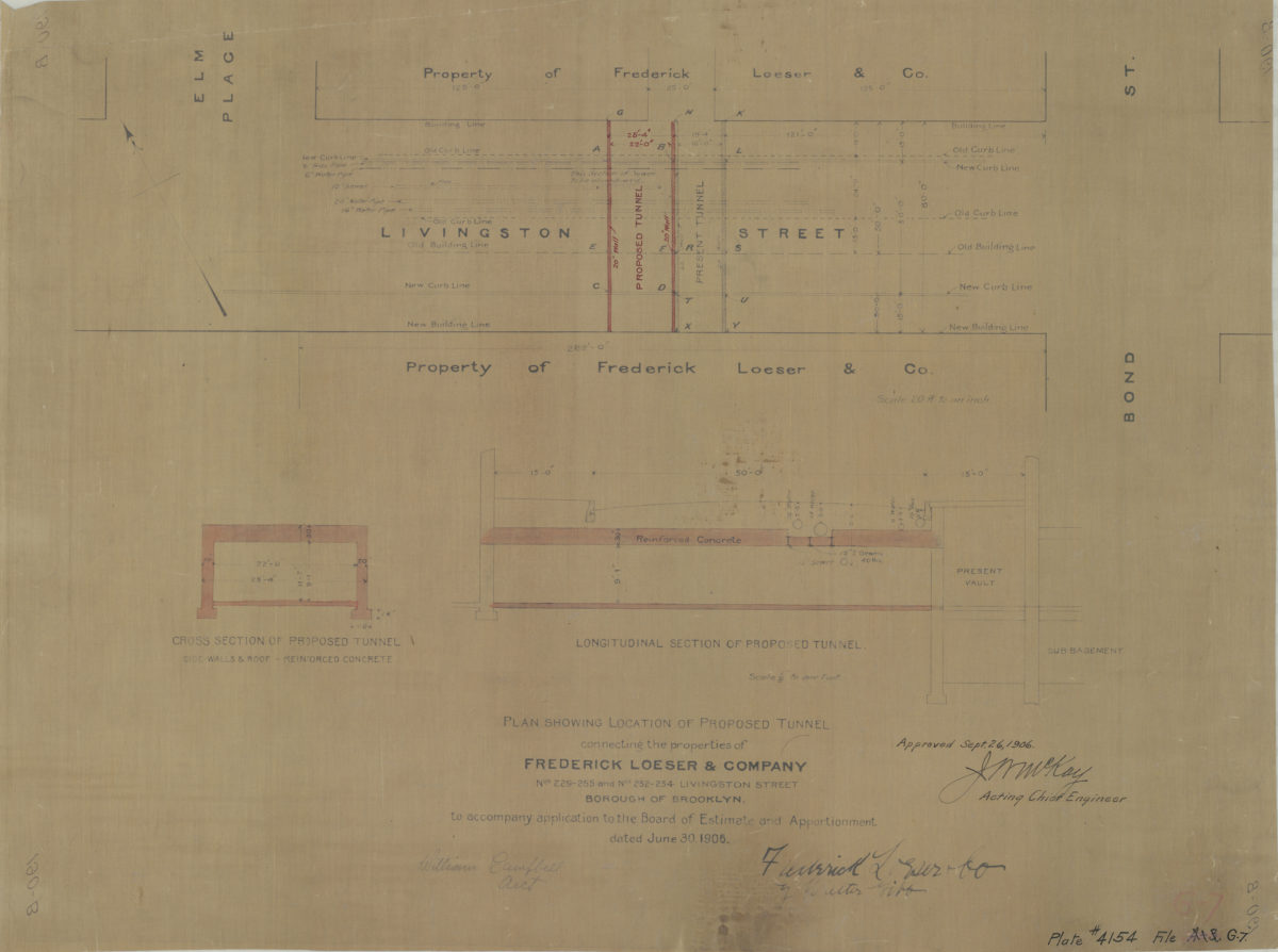
Plan showing location of proposed tunnel connecting the properties of Frederick Loeser & Company, nos. 229-255 and nos. 252-254 Livingston Street, Borough of Brooklyn:dated June 30, 1906
Plan showing location of proposed tunnel connecting the properties of Frederick Loeser & Company, nos. 229-255 and nos. 252-254 Livingston Street, Borough of Brooklyn:dated June 30, 1906
1906
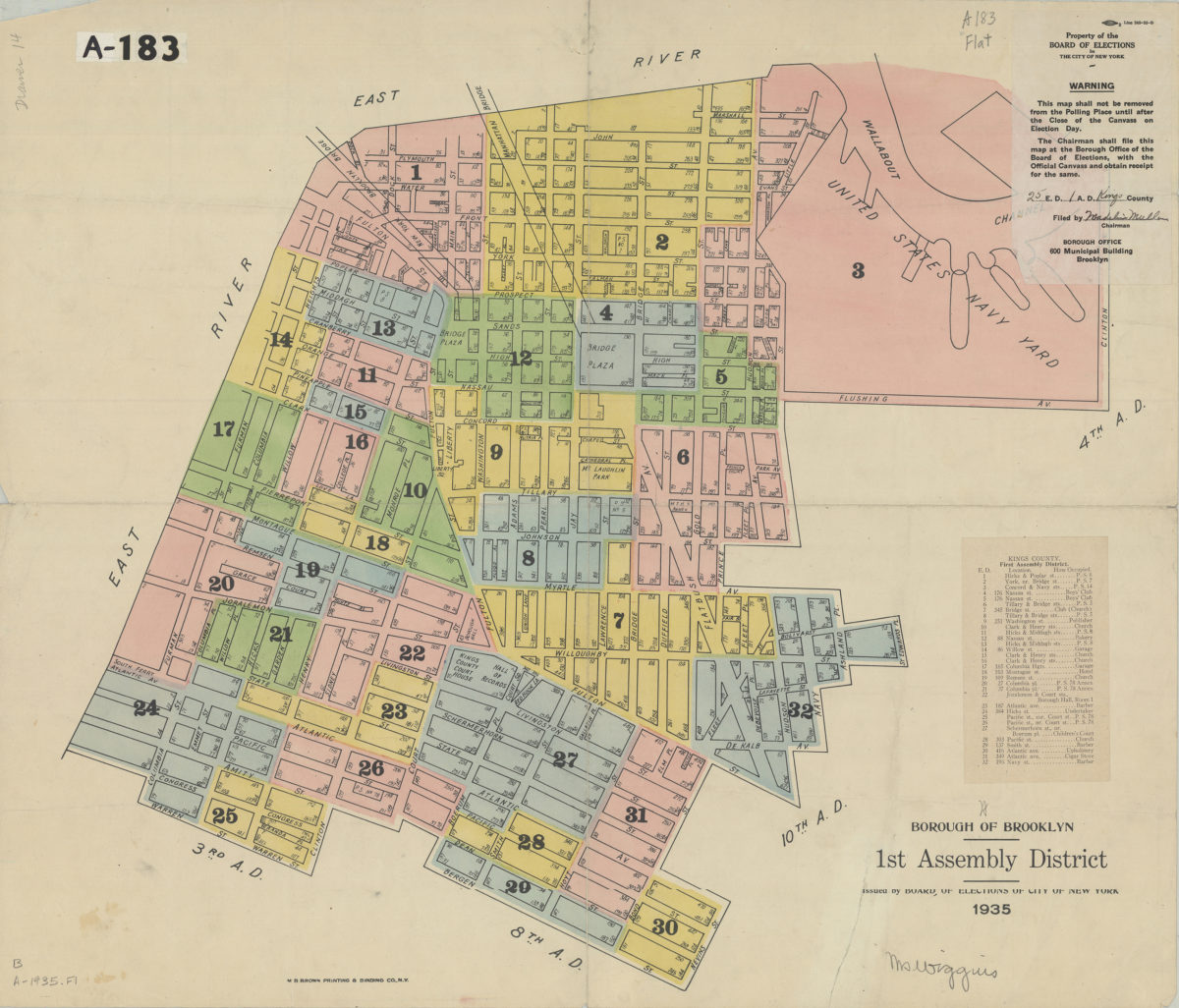
Borough of Brooklyn 1st Assembly District, 1935: issued by the Board of Elections of City of New York
Borough of Brooklyn 1st Assembly District, 1935: issued by the Board of Elections of City of New York
1935
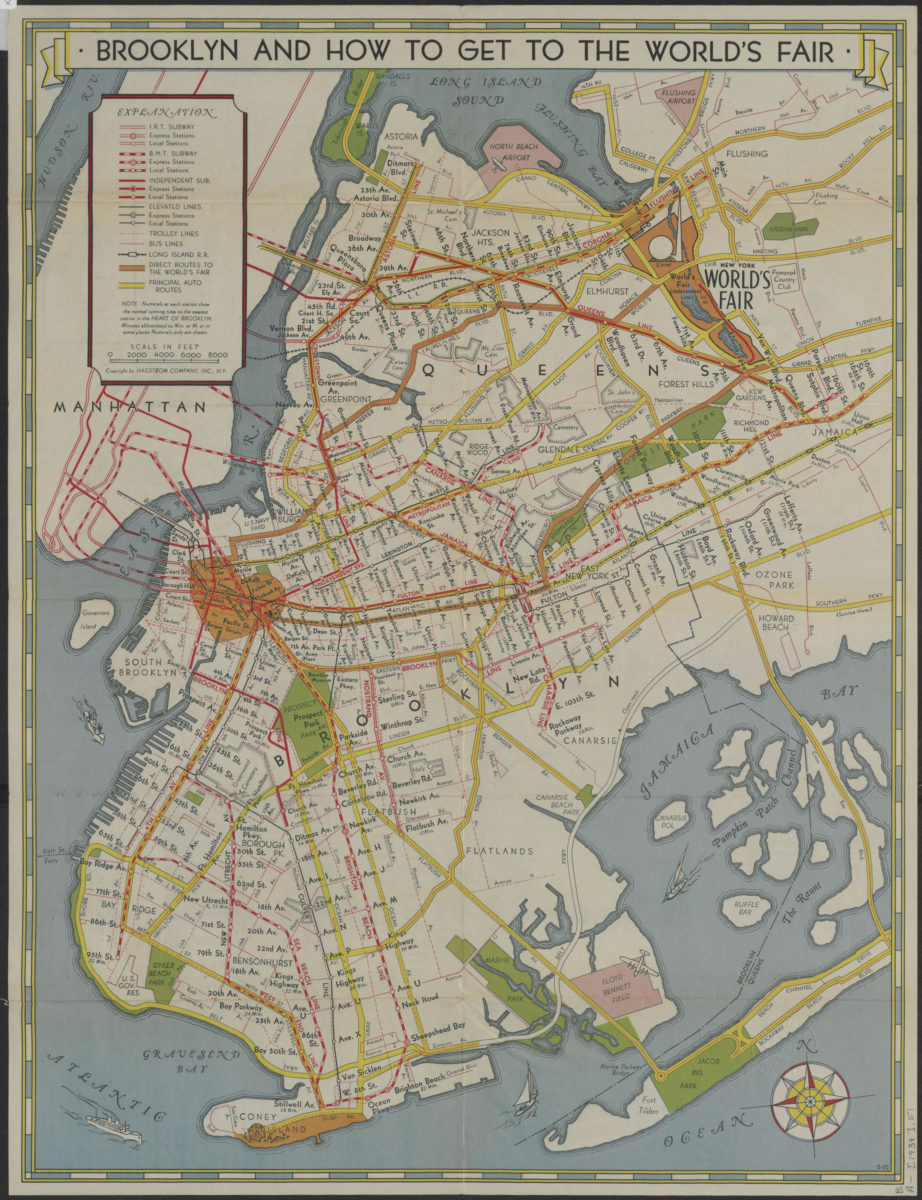
How to get to the New York World’s Fair, and The heart of Brooklyn: issued by the Downtown Brooklyn Association, Inc
How to get to the New York World’s Fair, and The heart of Brooklyn: issued by the Downtown Brooklyn Association, Inc
[1939]
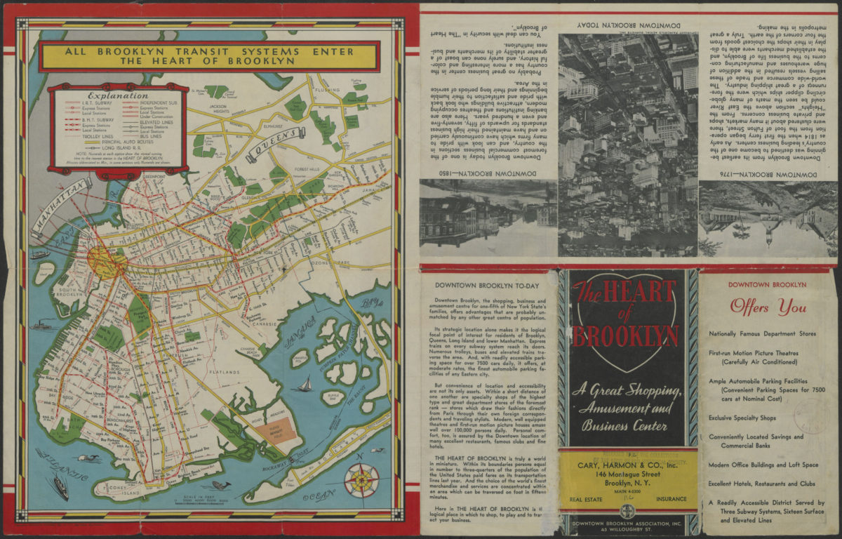
The heart of Brooklyn: a great shopping, amusement and business center: Downtown Brooklyn Association, Inc
The heart of Brooklyn: a great shopping, amusement and business center: Downtown Brooklyn Association, Inc
[1940]
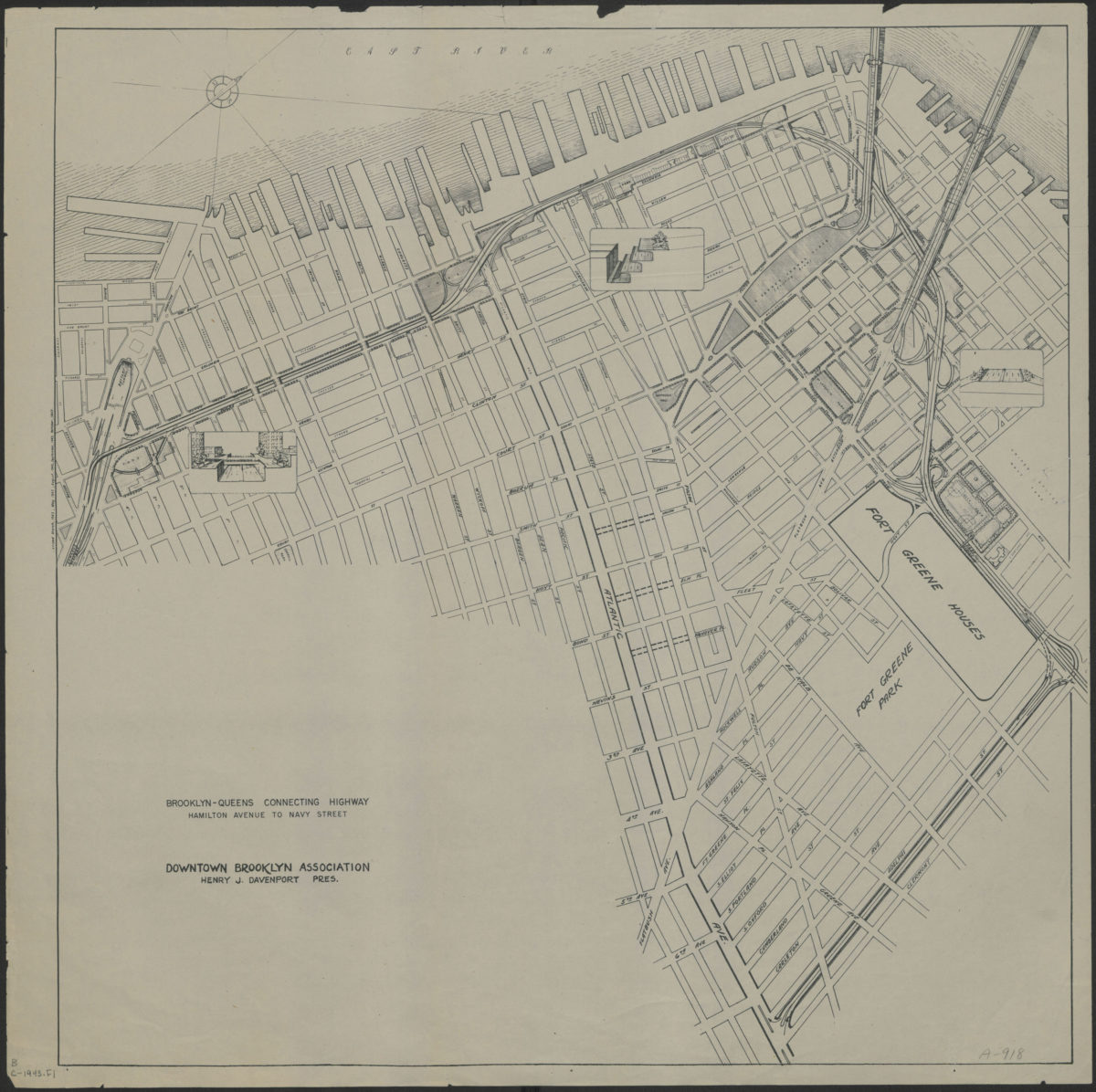
Brooklyn-Queens connecting highway: Hamilton Avenue to Navy Street: Downtown Brooklyn Association
Brooklyn-Queens connecting highway: Hamilton Avenue to Navy Street: Downtown Brooklyn Association
[1943]
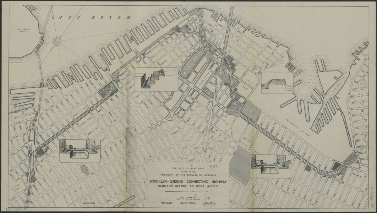
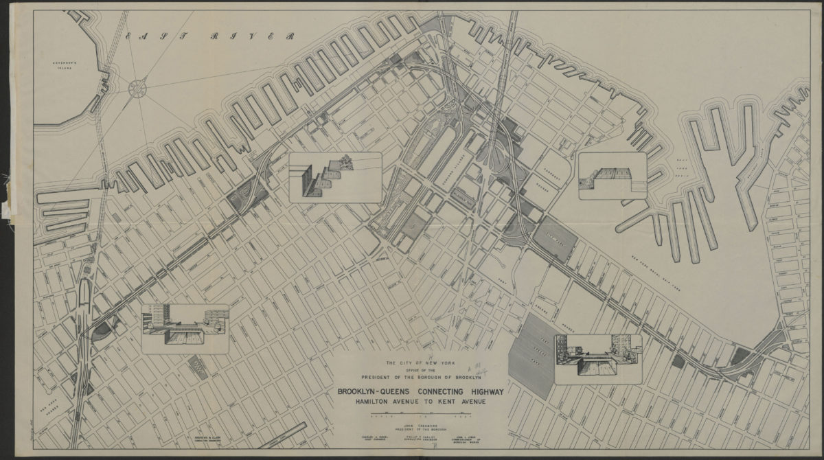
Brooklyn-Queens connecting highway: Hamilton Avenue to Kent Avenue
Brooklyn-Queens connecting highway: Hamilton Avenue to Kent Avenue
[1949]
Brooklyn-Queens connecting highway: Hamilton Avenue to Kent Avenue
Brooklyn-Queens connecting highway: Hamilton Avenue to Kent Avenue
1949
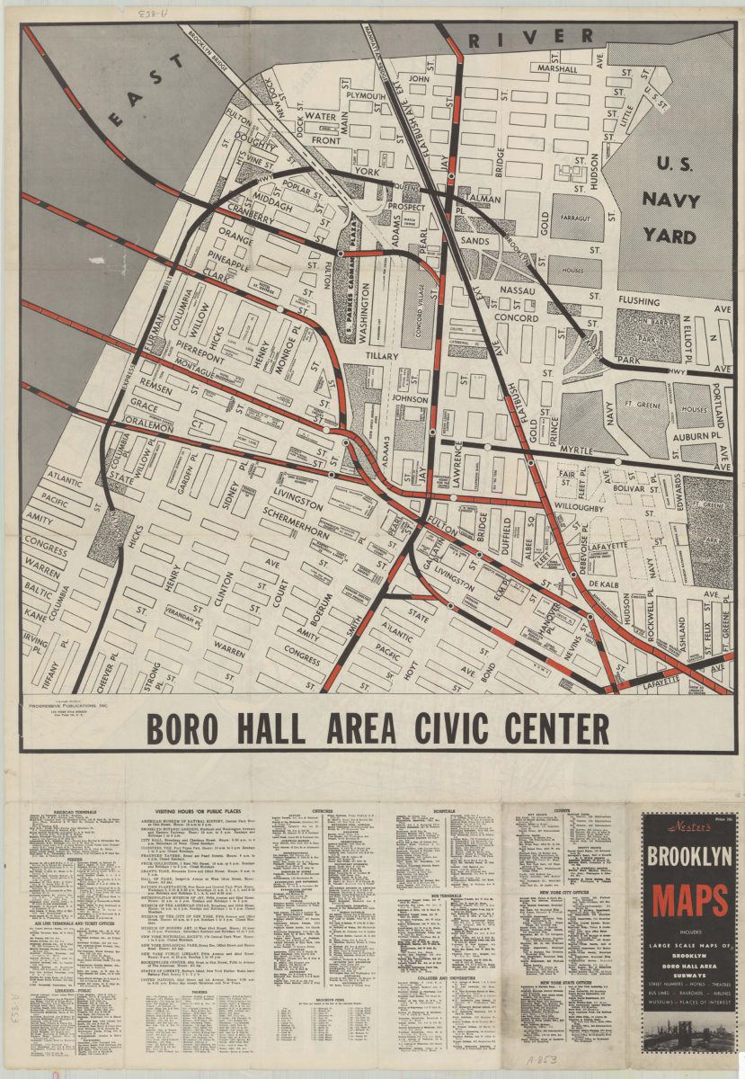
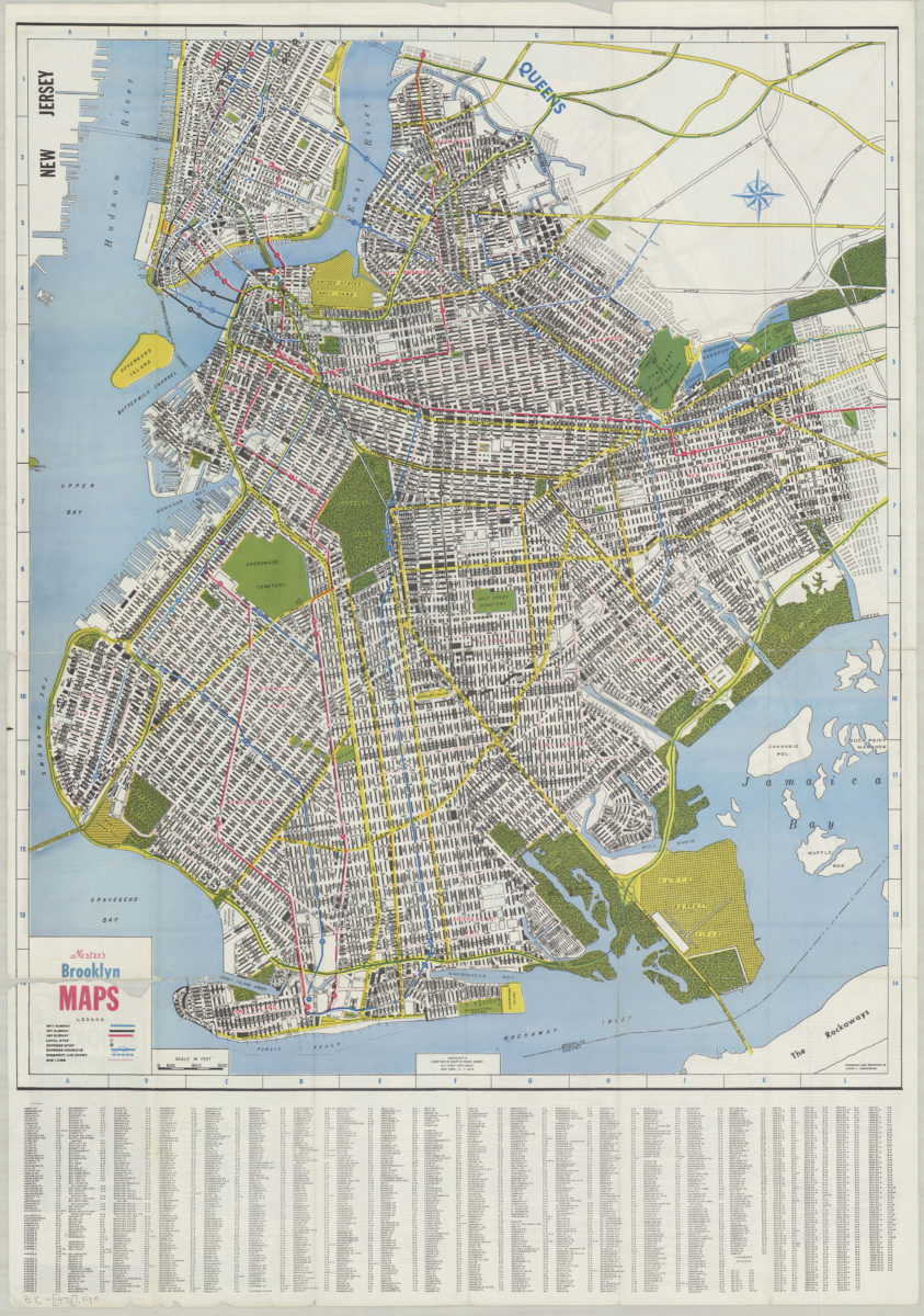
Nester’s Brooklyn maps: cartography by Dante Di Matteo
Nester’s Brooklyn maps: cartography by Dante Di Matteo
[1955; 1955]
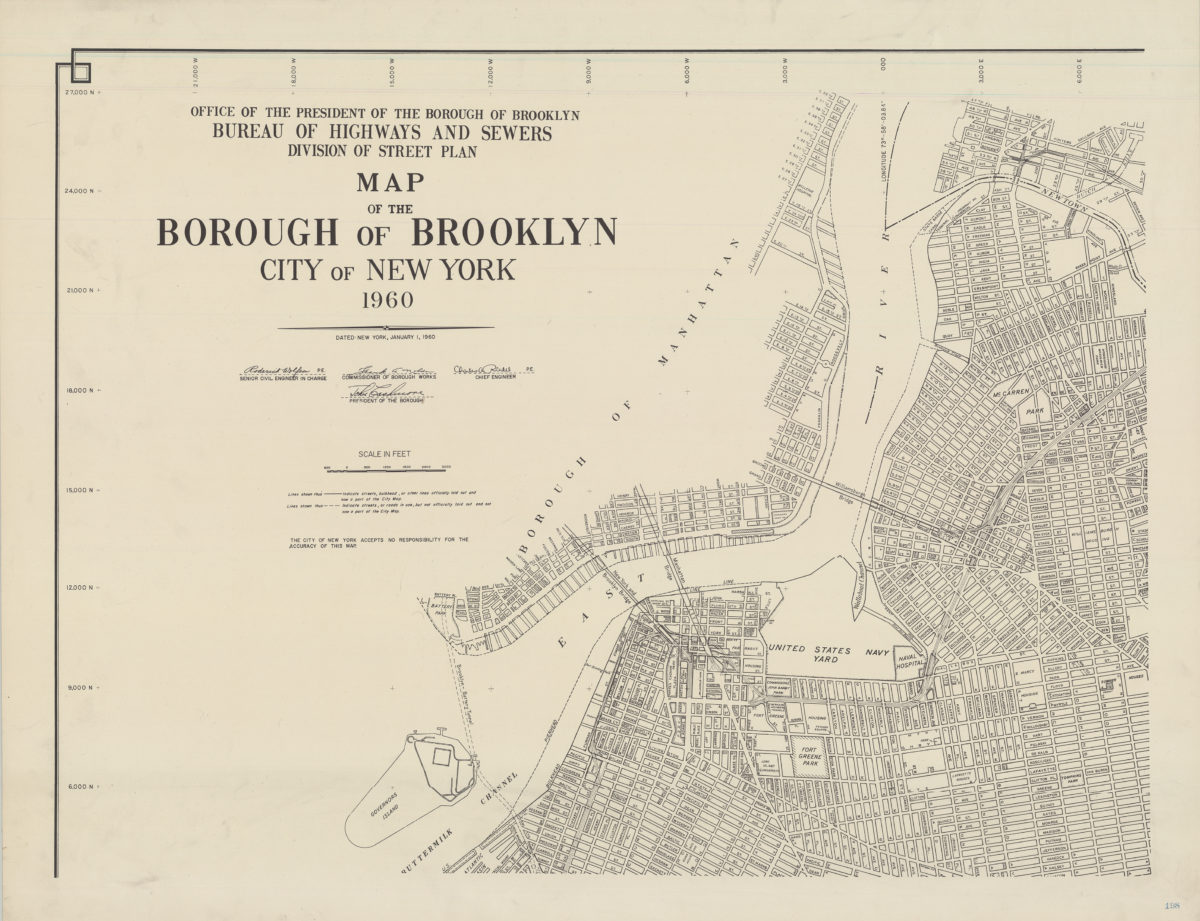
Map of the Borough of Brooklyn, City of New York, 1960
Map of the Borough of Brooklyn, City of New York, 1960
1960
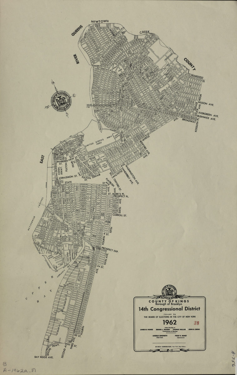
County of Kings, Borough of Brooklyn, 14th Congressional District: issued by the Board of Elections in the City of New York
County of Kings, Borough of Brooklyn, 14th Congressional District: issued by the Board of Elections in the City of New York
1962
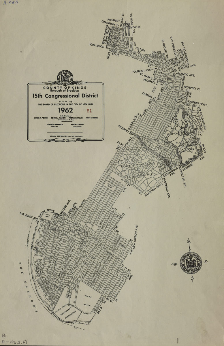
County of Kings, Borough of Brooklyn, 15th Congressional District: issued by the Board of Elections in the City of New York
County of Kings, Borough of Brooklyn, 15th Congressional District: issued by the Board of Elections in the City of New York
1962
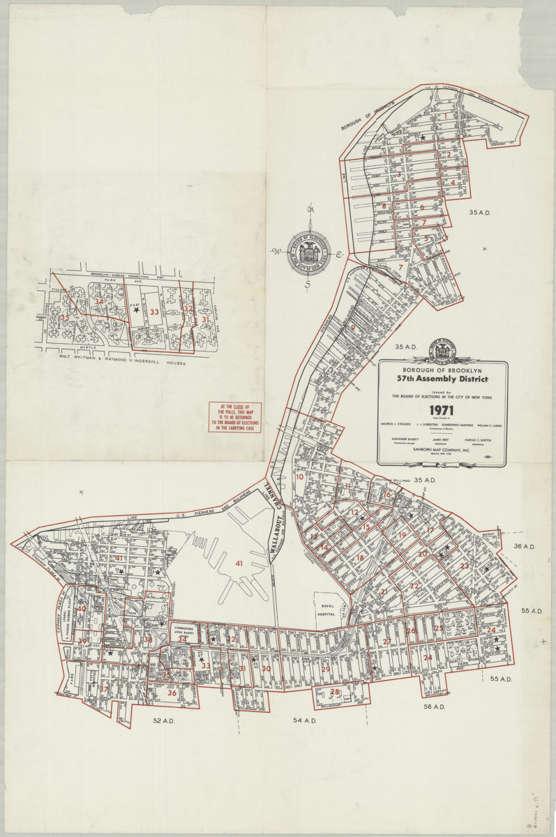
Borough of Brooklyn 57th Assembly District, 1971: issued by the Board of Elections in the City of New York
Borough of Brooklyn 57th Assembly District, 1971: issued by the Board of Elections in the City of New York
1971
Nester’s Brooklyn maps: produced and designed by Lewis J. Nesterman
Nester’s Brooklyn maps: produced and designed by Lewis J. Nesterman
[1976]
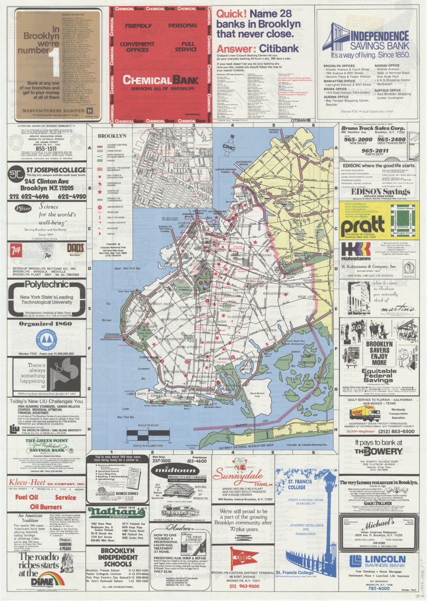
Brooklyn
Brooklyn
1977