Center for Brooklyn History
Map Collections
Search
About
Othmer Library & Archives
Submit search query
Refine 8 records
Clear filters
2
Location
Bronx (New York, N.Y.)
10
Brooklyn (New York, N.Y.)
891
Coney Island (New York, N.Y.)
22
Connecticut
7
Long Island (N.Y.)
197
Manhattan (New York, N.Y.)
120
New England
8
New Jersey
27
New York (N.Y.)
164
New York (State)
95
Westchester County (N.Y.)
11
Subject
Long Island, Battle of, New York, N.Y. , 1776
7
Roads
117
White Plains, Battle of, White Plains, N.Y., 1776
3
Date
19th Century
945
20th Century
469
or enter range:
from
to
Genres
Bathymetric maps
94
Early maps
35
Historical maps
53
Military maps
23
Road maps
83
Topographic maps
70
Sort by:
Date (earliest)
Date (most recent)
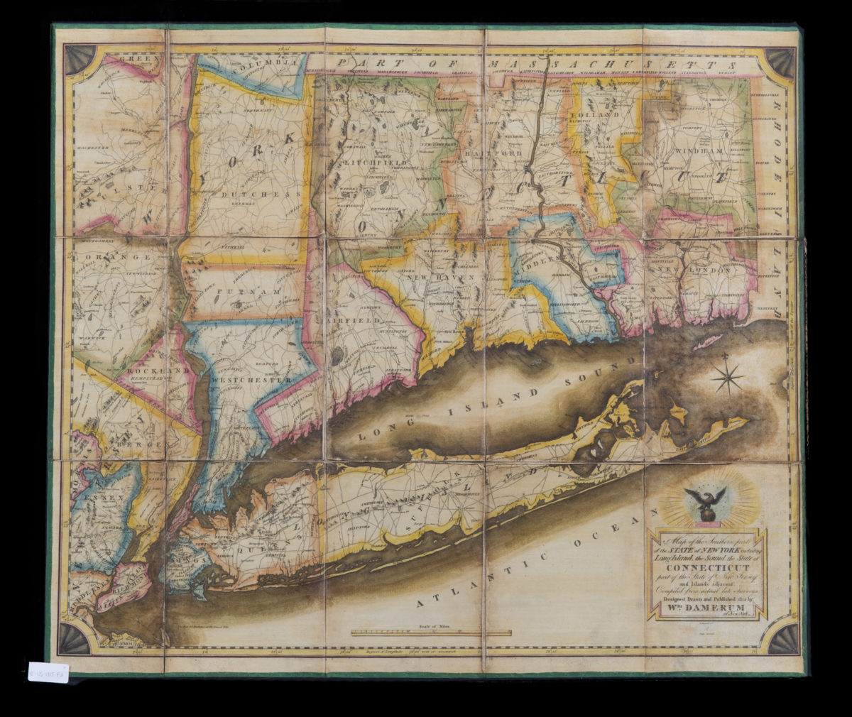
Map of the southern part of the state of New York including Long Island, the Sound, the state of Connecticut, part of the state of New Jersey and islands adjacent. Compiled from actual late surveys: designed, drawn … by Wm. Damerum
Map of the southern part of the state of New York including Long Island, the Sound, the state of Connecticut, part of the state of New Jersey and islands adjacent. Compiled from actual late surveys: designed, drawn … by Wm. Damerum
1815
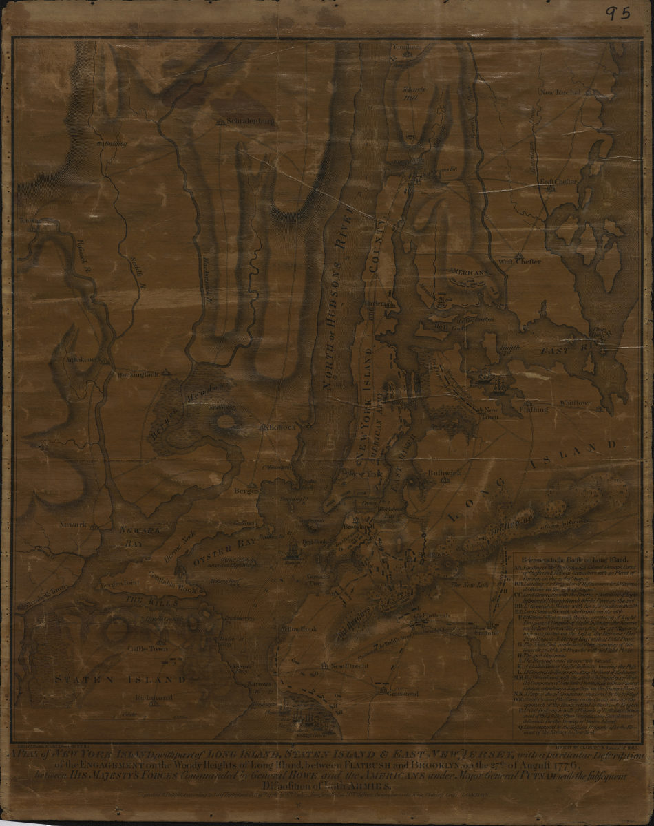
A plan of New York Island, with part of Long Island, Staten Island & East New Jersey: with a particular description of the Engagement on the Woody Heights of Long Island, between Flatbush and Brooklyn, on the 27th of August 1776
A plan of New York Island, with part of Long Island, Staten Island & East New Jersey: with a particular description of the Engagement on the Woody Heights of Long Island, between Flatbush and Brooklyn, on the 27th of August 1776
[1865]
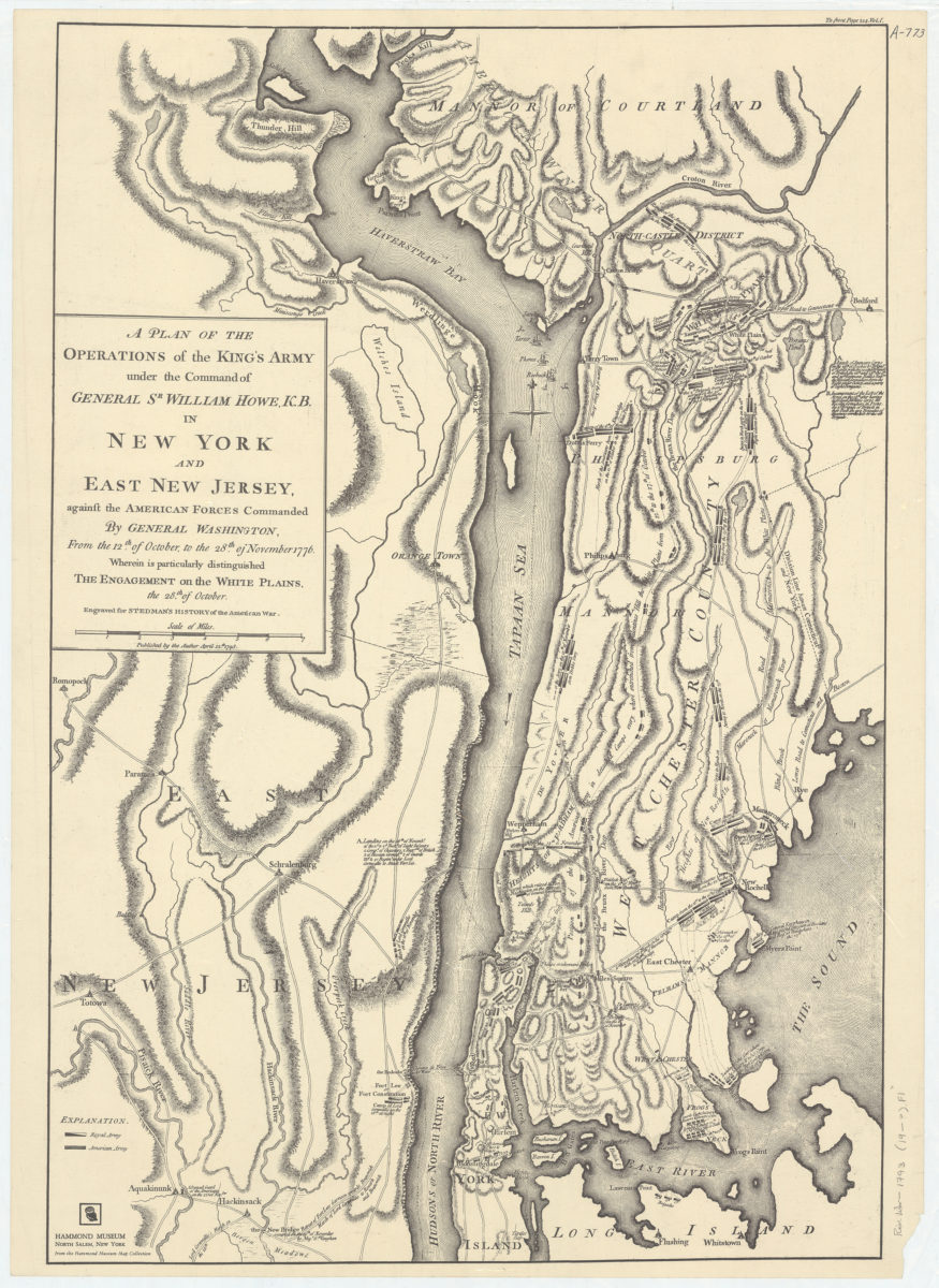
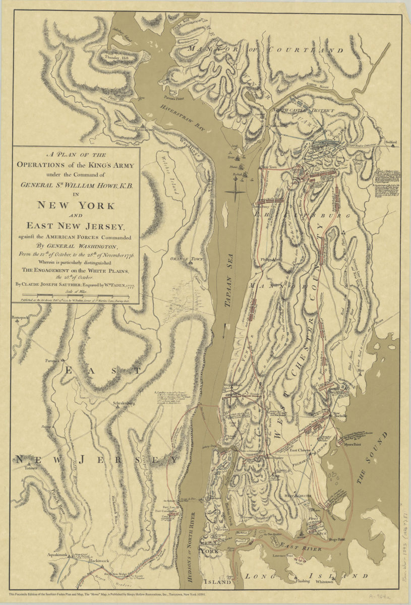
A plan of the operations of the King’s army under the command of General Sr. William Howe, K.B., in New York and East New Jersey against the American forces commanded by General Washington, from the 12th of October, to the 28th of November 1776
A plan of the operations of the King’s army under the command of General Sr. William Howe, K.B., in New York and East New Jersey against the American forces commanded by General Washington, from the 12th of October, to the 28th of November 1776
[19??]
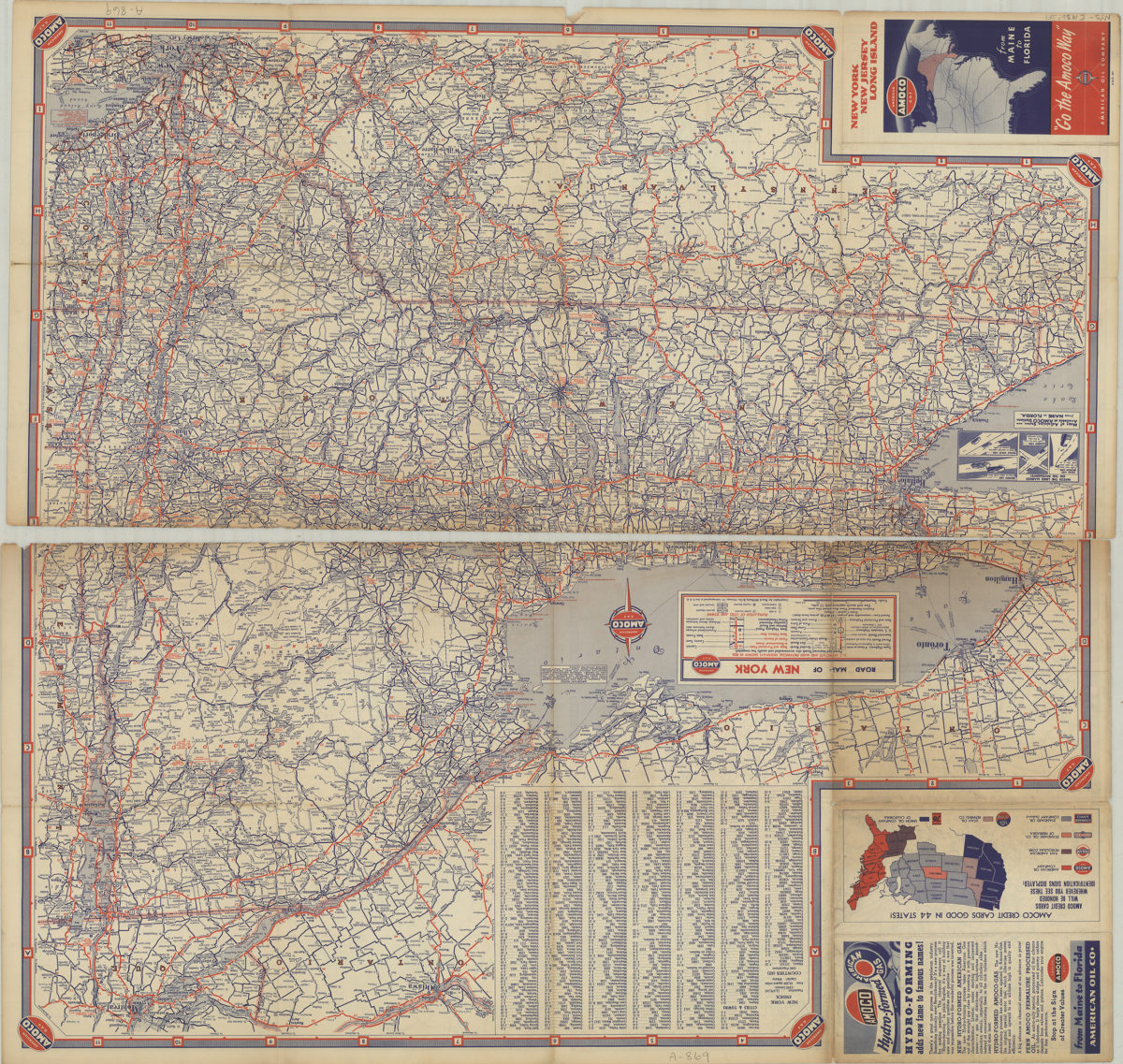
New York, New Jersey, Long Island: [compliments of] Amoco
New York, New Jersey, Long Island: [compliments of] Amoco
[1936]
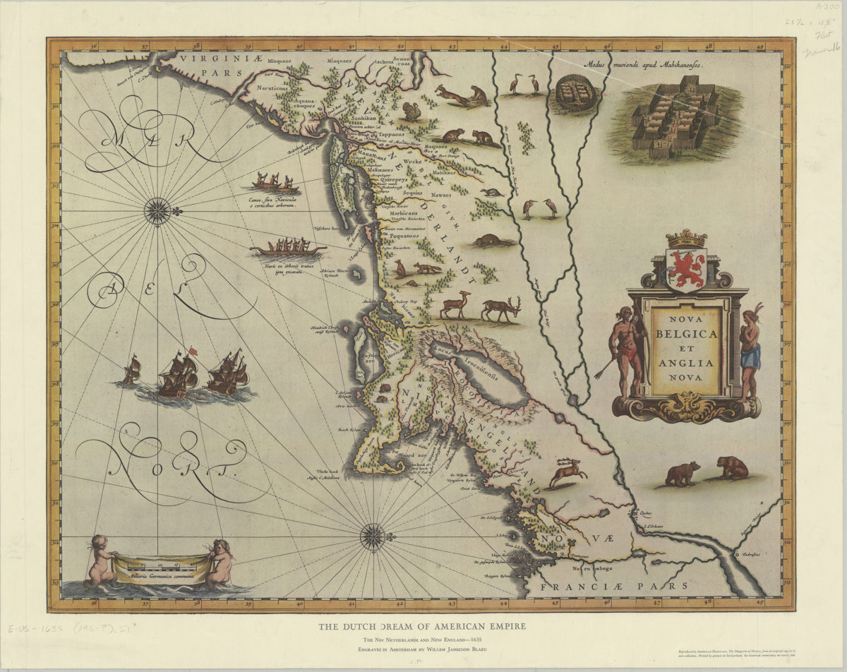
The Dutch dream of American empire: the New Netherlands and New England, 1635: engraved in Amsterdam by Willem Janszoon Blaeu
The Dutch dream of American empire: the New Netherlands and New England, 1635: engraved in Amsterdam by Willem Janszoon Blaeu
[195?]
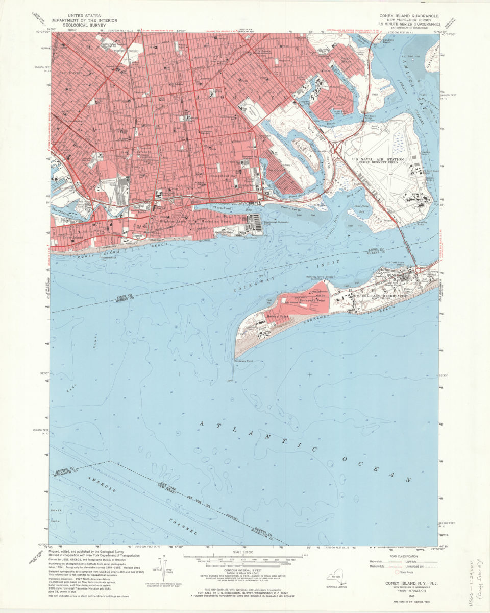
Coney Island quadrangle, New York–New Jersey: 7.5 minute series (topographic): mapped, edited, and published by the Geological Survey ; revised in cooperation with New York Department of Transportation
Coney Island quadrangle, New York–New Jersey: 7.5 minute series (topographic): mapped, edited, and published by the Geological Survey ; revised in cooperation with New York Department of Transportation
1968
Coney Island quadrangle, New York–New Jersey
Coney Island quadrangle, New York–New Jersey
[1969]
A plan of the operations of the King’s army under the command of General Sr. William Howe, K.B. in New York and East New Jersey against the American forces commanded by General Washington, from the 12th of October, to the 28th of November 1776
A plan of the operations of the King’s army under the command of General Sr. William Howe, K.B. in New York and East New Jersey against the American forces commanded by General Washington, from the 12th of October, to the 28th of November 1776
[ca. 1976]