Center for Brooklyn History
Map Collections
Search
About
Othmer Library & Archives
Submit search query
Refine 9 records
Clear filters
2
Location
Brooklyn (New York, N.Y.)
891
New York (N.Y.)
164
New York Bight (N.J. and N.Y.)
1
New York Harbor (N.Y. and N.J.)
16
New York Region
5
Raritan Bay (N.J. and N.Y.)
1
Subject
Harbors
11
Lighthouses
1
Nautical charts
14
Piers
25
Date
18th Century
12
19th Century
945
20th Century
469
or enter range:
from
to
Genres
Bathymetric maps
94
Early maps
35
Nautical charts
30
Sort by:
Date (earliest)
Date (most recent)
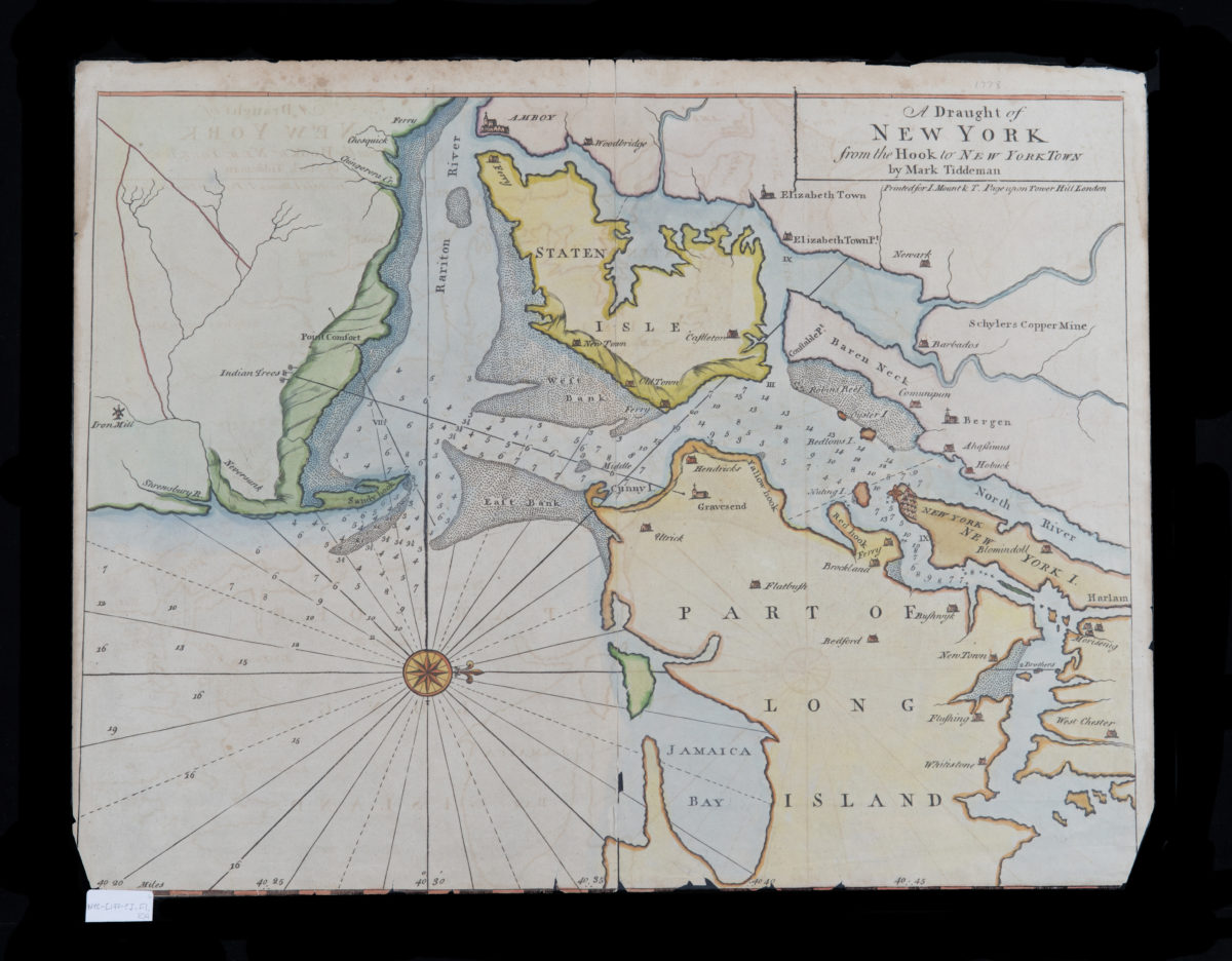
A draught of New York from the Hook to New York Town: by Mark Tiddeman
A draught of New York from the Hook to New York Town: by Mark Tiddeman
[1773-1780]
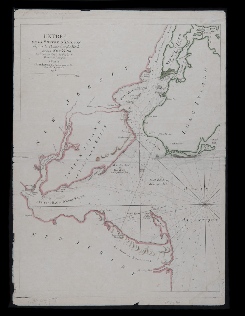
Entrée de la riviere d’Hudson depuis la Pointe Sandy Hook jusqu’a New York, les bancs, les sondes, les guides &c.: traduit de l’Anglais
Entrée de la riviere d’Hudson depuis la Pointe Sandy Hook jusqu’a New York, les bancs, les sondes, les guides &c.: traduit de l’Anglais
1778
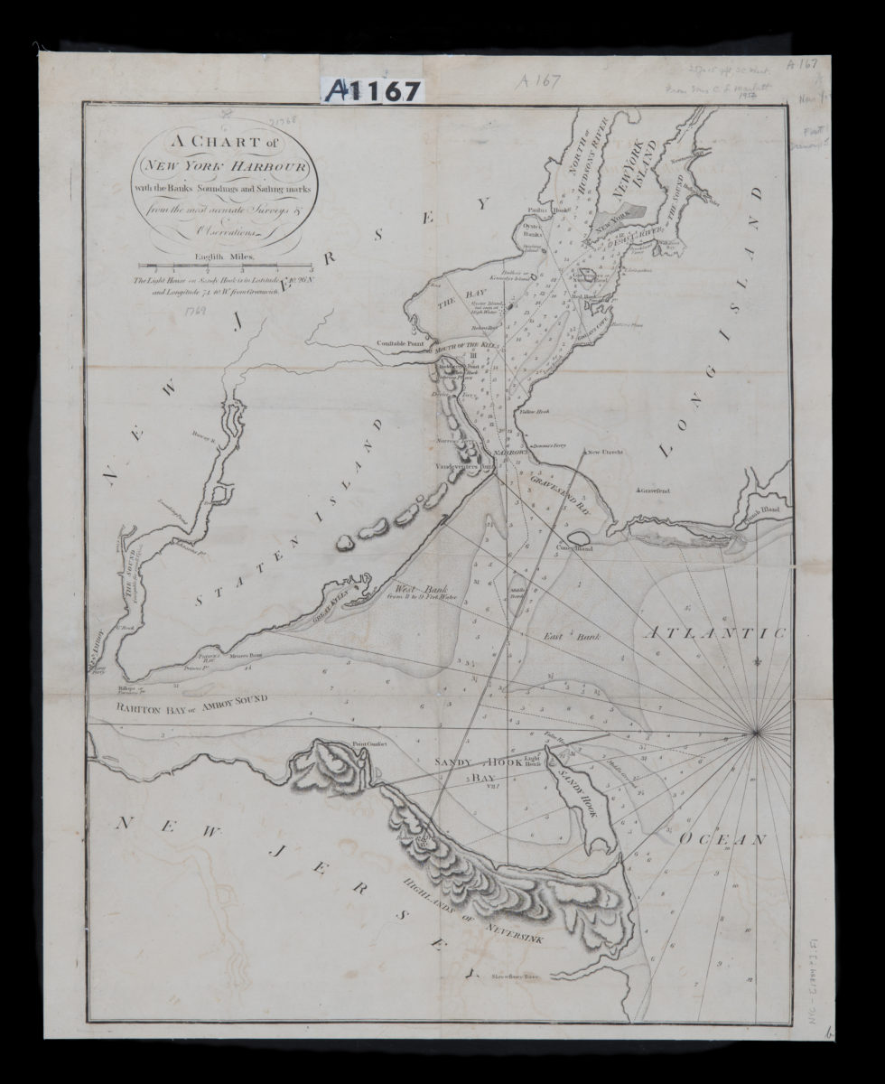
A chart of New York Harbour: with the banks, soundings and sailing marks from the most accurate surveys & observations
A chart of New York Harbour: with the banks, soundings and sailing marks from the most accurate surveys & observations
[1784]
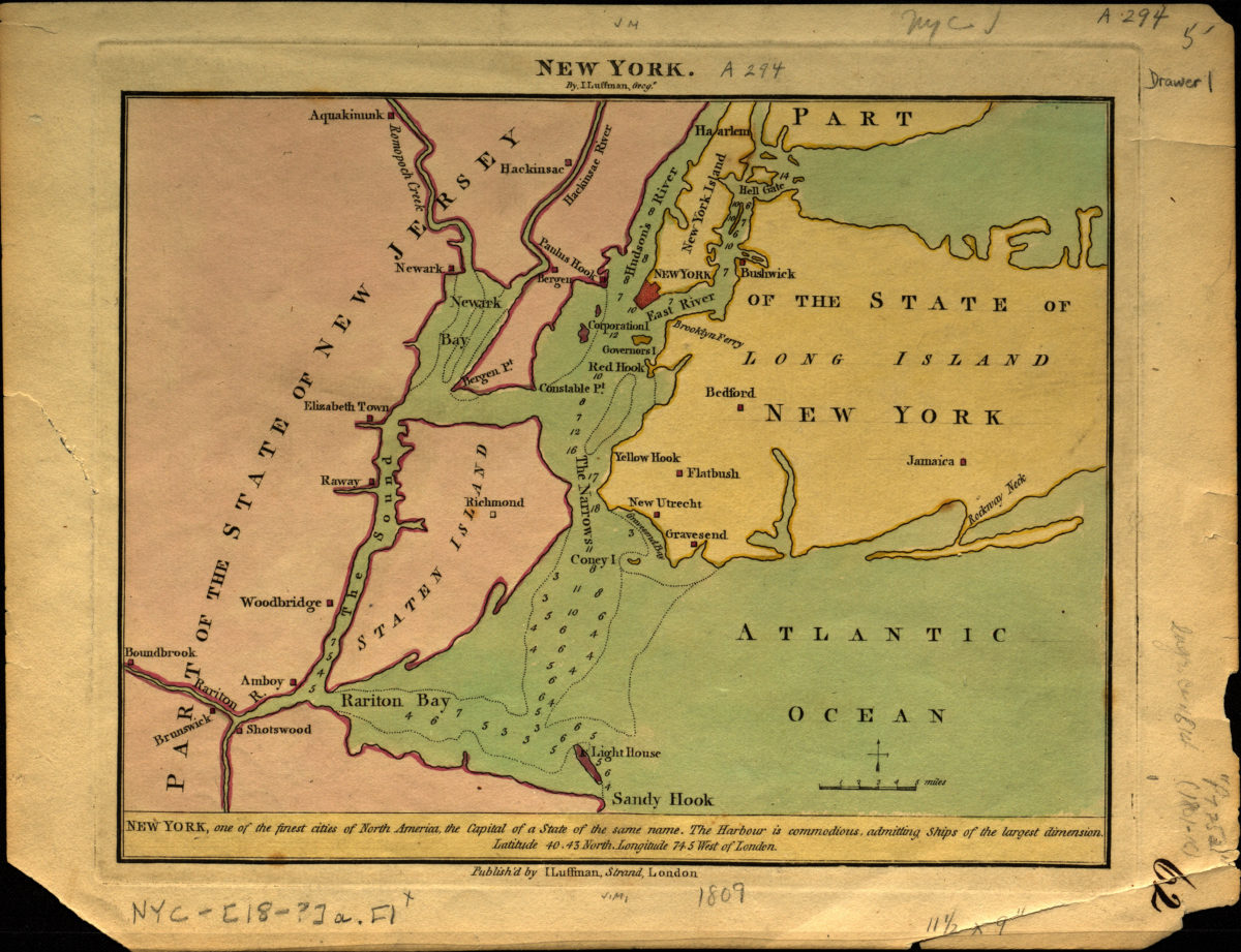
New York
New York
[1809]
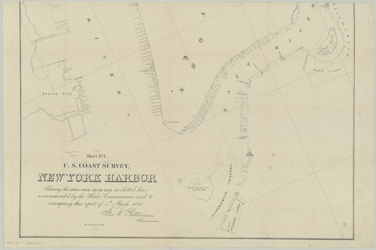
Sheet no. 1, U.S. Coast Survey, New York Harbor: showing the exterior pier head line in dotted line as recommended by the Harbor Commissioners and to accompany their report of 5th March 1856
Sheet no. 1, U.S. Coast Survey, New York Harbor: showing the exterior pier head line in dotted line as recommended by the Harbor Commissioners and to accompany their report of 5th March 1856
[1856]
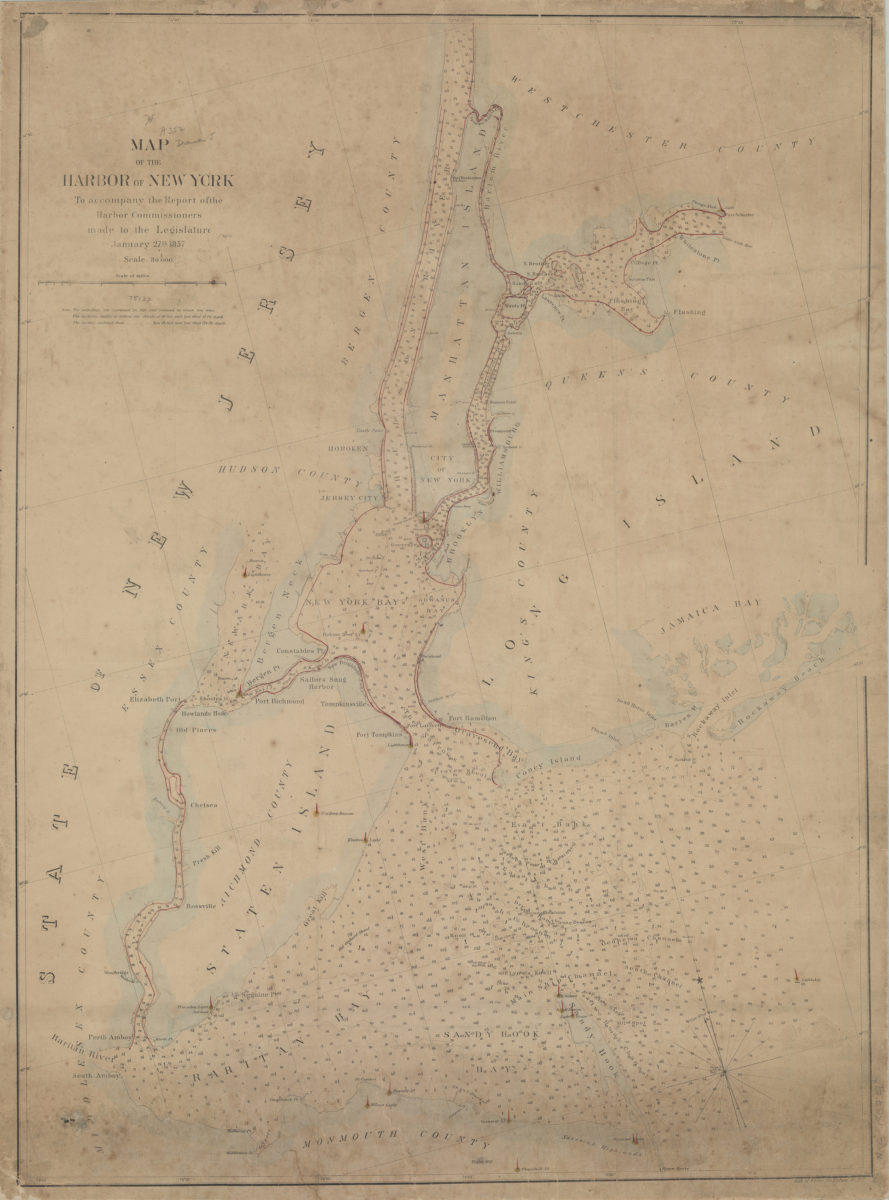
Map of the Harbor of New York: to accompany the report of the Harbor Commissioners made to the Legislature, January 27th, 1857
Map of the Harbor of New York: to accompany the report of the Harbor Commissioners made to the Legislature, January 27th, 1857
[1857]
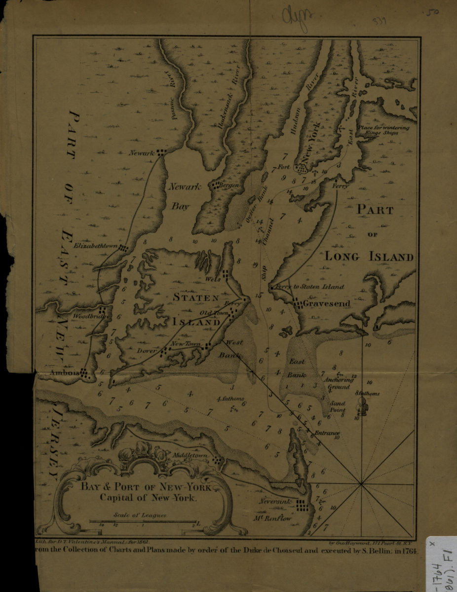
Bay & port of New-York, capital of New-York
Bay & port of New-York, capital of New-York
[1861]
A chart of New York Harbour: with the soundings, views of land marks, and nautical directions for the use of pilotage: composed from surveys and observations of Lieutenants John Knight, John Hunter of the Navy, & others
A chart of New York Harbour: with the soundings, views of land marks, and nautical directions for the use of pilotage: composed from surveys and observations of Lieutenants John Knight, John Hunter of the Navy, & others
[ca. 1968]
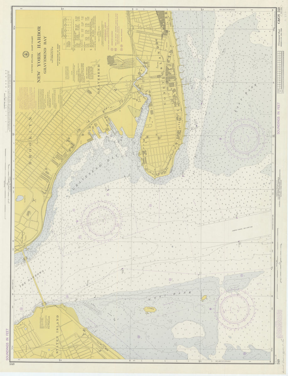
United States – East coast, New York Harbor, Gravesend Bay: National Ocean Survey
United States – East coast, New York Harbor, Gravesend Bay: National Ocean Survey
1974