Center for Brooklyn History
Map Collections
Search
About
Othmer Library & Archives
Submit search query
Refine 6 records
Clear filters
2
Location
Brooklyn (New York, N.Y.)
891
Long Island (N.Y.)
197
New Jersey
27
New York (N.Y.)
164
New York (State)
95
New York Metropolitan Area
40
Pennsylvania
4
Queens (New York, N.Y.)
83
Ravenswood (New York, N.Y.)
4
Subject
Bicycle trails
17
Local transit
63
Pavements
3
Railroads
72
Roads
117
Streets
46
Date
19th Century
945
or enter range:
from
to
Genres
Road maps
83
Statistical maps
8
Transportation maps
120
Sort by:
Date (earliest)
Date (most recent)
Vernon Avenue, or Turnpike Road to Williamsburgh
Vernon Avenue, or Turnpike Road to Williamsburgh
[1853]
Colton’s railroad & township map of the state of New York: with parts of the adjoining states & Canada: drawn by Geo. W. Colton
Colton’s railroad & township map of the state of New York: with parts of the adjoining states & Canada: drawn by Geo. W. Colton
1856; [ca. 1852]
Section 1, cyclists’ road map of New Jersey
Section 1, cyclists’ road map of New Jersey
[ca. 1890]
Map showing improved pavements in the city of Brooklyn in 1891
Map showing improved pavements in the city of Brooklyn in 1891
1891
Colton’s road map of Long Island
Colton’s road map of Long Island
1891
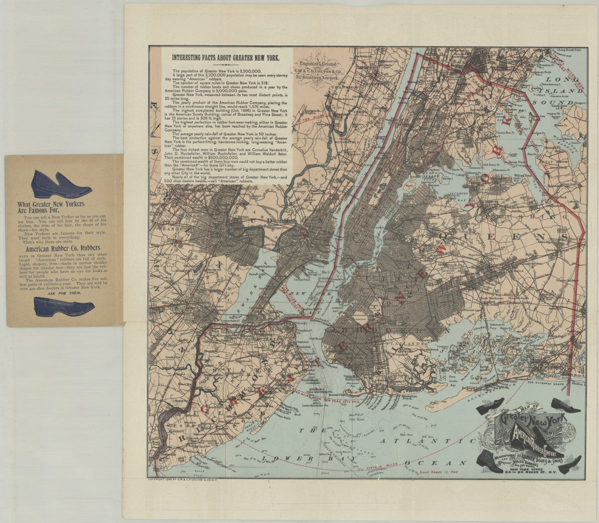
Pocket map of greater New York: showing the good roads in and about greater New York, together with a map of New York City proper
Pocket map of greater New York: showing the good roads in and about greater New York, together with a map of New York City proper
[ca. 1896]