Center for Brooklyn History
Map Collections
Search
About
Othmer Library & Archives
Submit search query
Refine 7 records
Clear filters
3
Location
Cold Spring Harbor (N.Y.)
1
East Hampton (N.Y.)
1
Long Island (N.Y.)
197
Riverhead (N.Y.)
3
Shelter Island (N.Y.)
2
Subject
Landowners
434
Real property
619
Roads
117
Date
20th Century
469
or enter range:
from
to
Genres
Pictorial maps
38
Road maps
83
Tourist maps
55
Sort by:
Date (earliest)
Date (most recent)
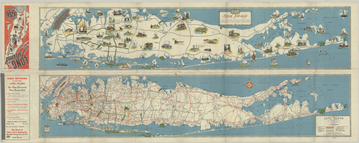
Long Island: AAA ; Automobile Club of New York
Long Island: AAA ; Automobile Club of New York
[1939]
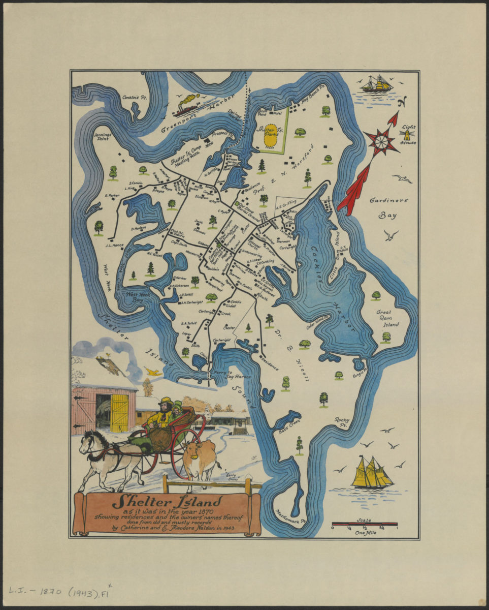
Shelter Island as it was in the year 1870: showing residents and the owners’ names thereof : done from old and musty records: by Catherine and E. Theodore Nelson in 1943
Shelter Island as it was in the year 1870: showing residents and the owners’ names thereof : done from old and musty records: by Catherine and E. Theodore Nelson in 1943
[1943]
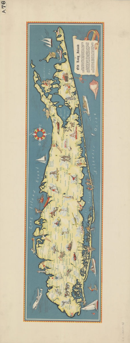
Old Long Island
Old Long Island
[1947; 1947]
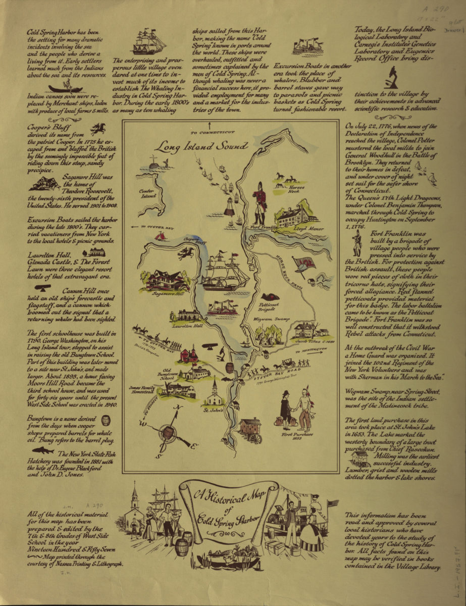
A historical map of Cold Spring Harbor
A historical map of Cold Spring Harbor
1957
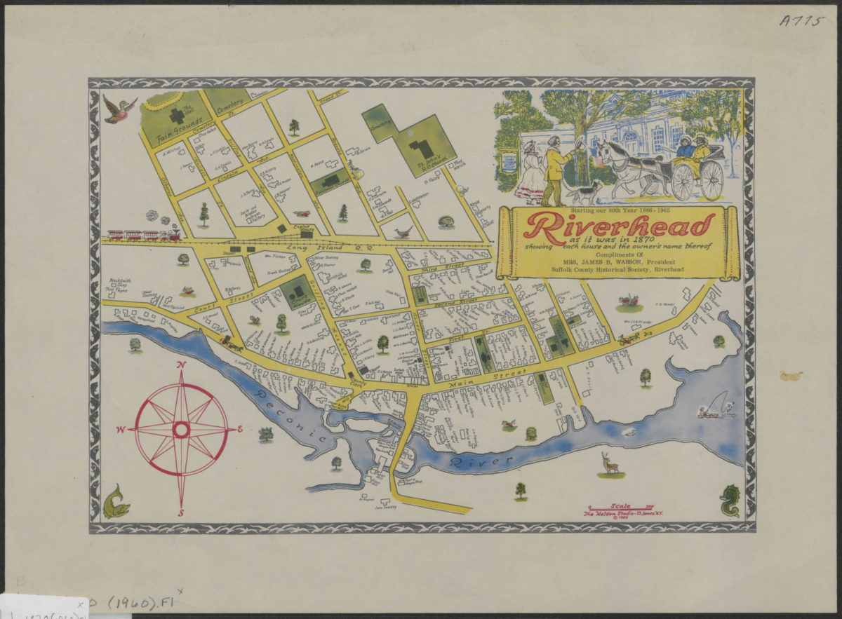
Riverhead as it was in 1870: showing each house and the owner’s name thereof
Riverhead as it was in 1870: showing each house and the owner’s name thereof
[ca. 1960]
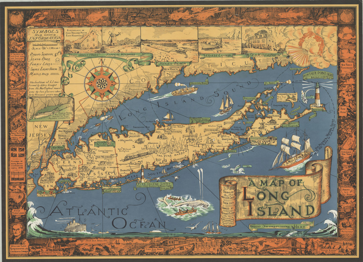
A map of Long Island: drawn by Courtland Smith, from data compiled by Richard Foster
A map of Long Island: drawn by Courtland Smith, from data compiled by Richard Foster
[ca. 1961]
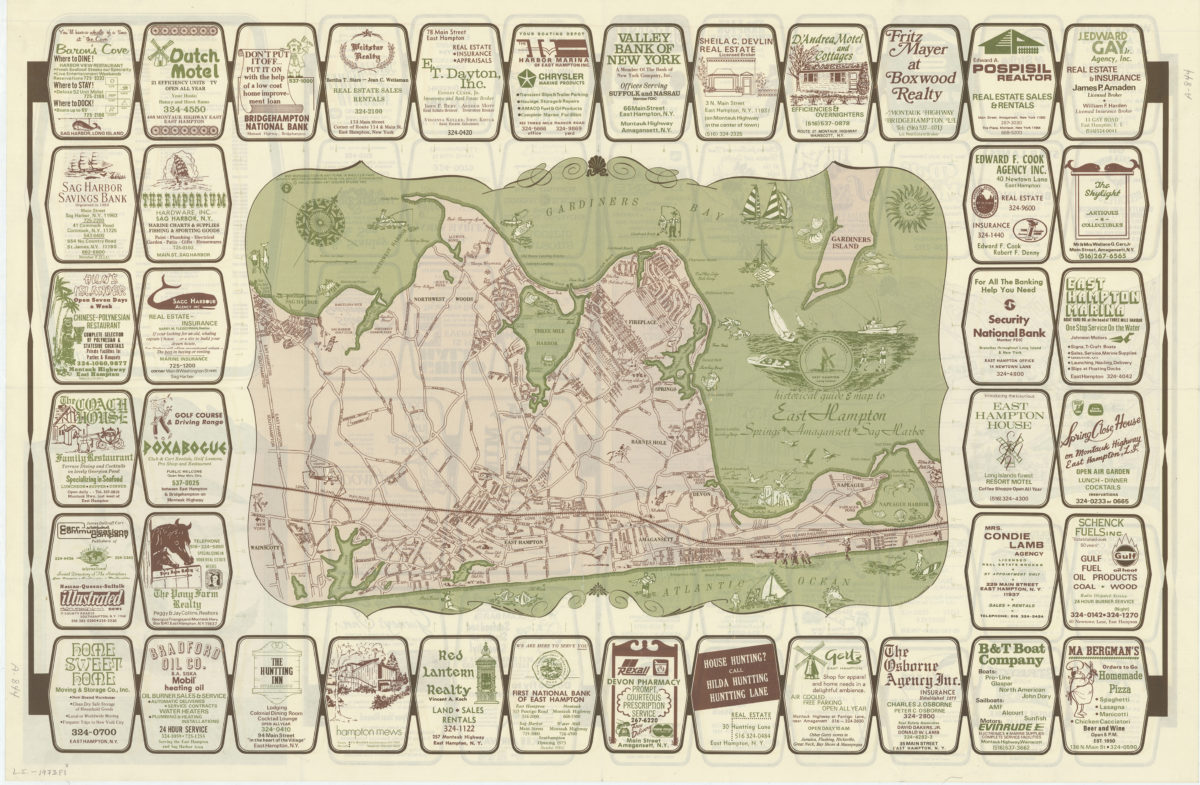
Historical guide and map to East Hampton: Springs, Amagansett, Sag Harbor
Historical guide and map to East Hampton: Springs, Amagansett, Sag Harbor
[ca. 1973]