Center for Brooklyn History
Map Collections
Search
About
Othmer Library & Archives
Submit search query
Refine 8 records
Clear filters
2
Location
Brooklyn (New York, N.Y.)
891
Great Neck (N.Y.)
3
Long Island (N.Y.)
197
Manhattan (New York, N.Y.)
120
New York (N.Y.)
164
Oyster Bay (N.Y.)
9
Subject
Indian land transfers
1
Land titles
1
Landowners
434
Names, Personal
1
Real property
619
Date
19th Century
945
20th Century
469
or enter range:
from
to
Genres
Cadastral maps
597
Historical maps
53
Manuscript maps
365
Sort by:
Date (earliest)
Date (most recent)
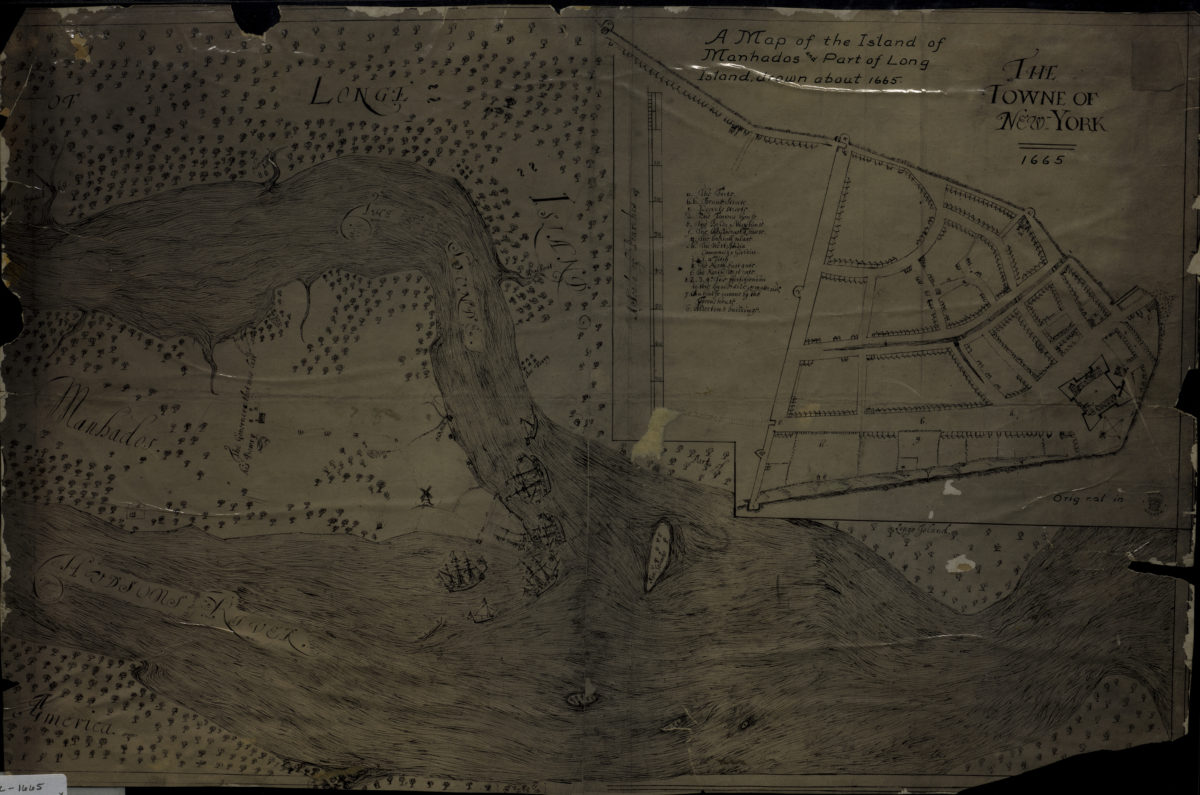
A map of the island of Manhados and part of Long Island, drawn about 1665
A map of the island of Manhados and part of Long Island, drawn about 1665
[18??]
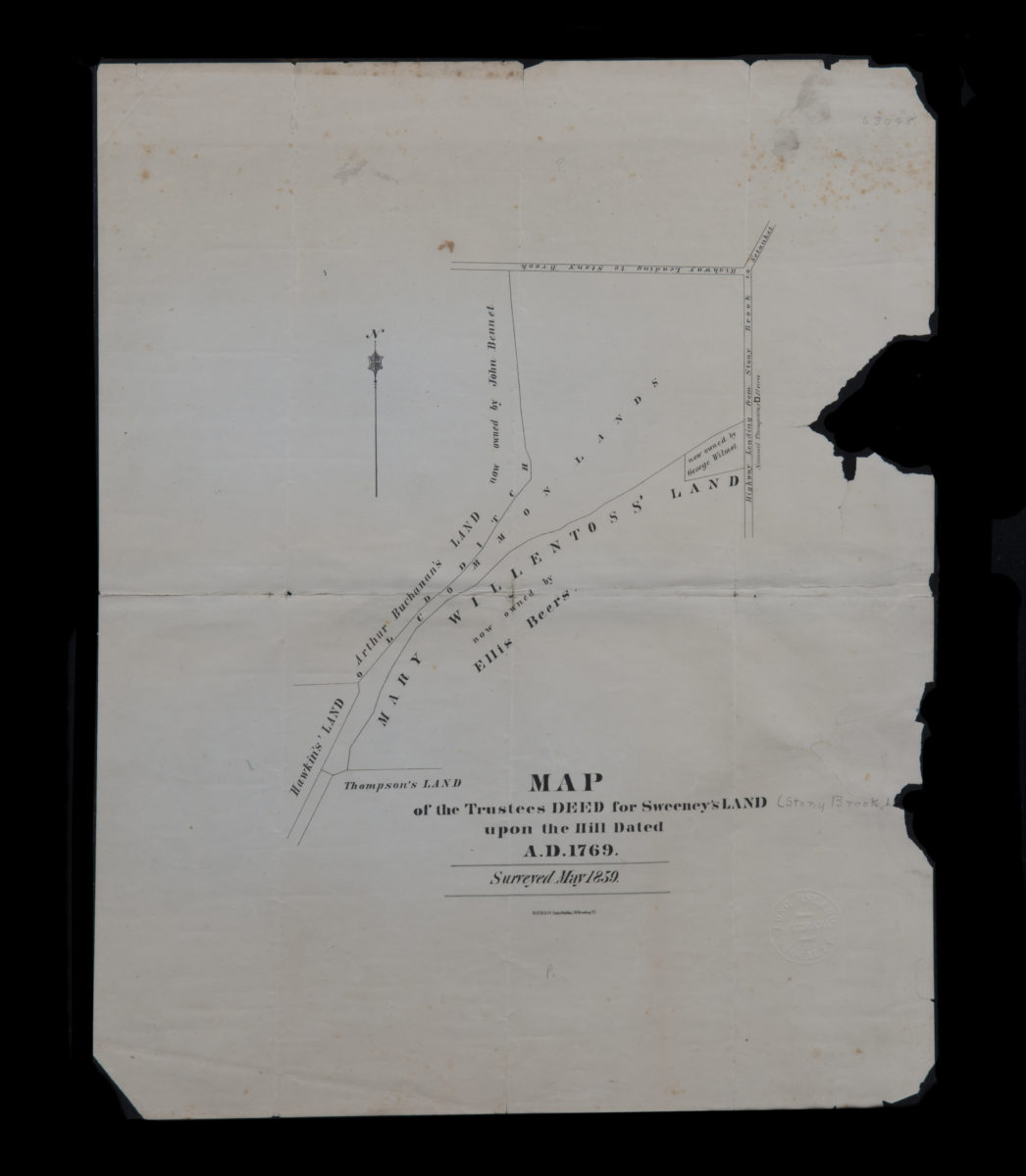
Map of the trustees deed for Sweeney’s land upon the hill dated A.D. 1769
Map of the trustees deed for Sweeney’s land upon the hill dated A.D. 1769
[1859]
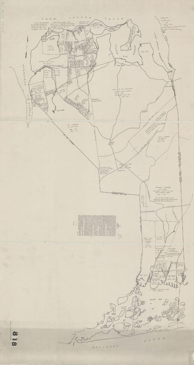
Map of the town of Oyster Bay, N.Y.: John Cox Jr
Map of the town of Oyster Bay, N.Y.: John Cox Jr
[19??]
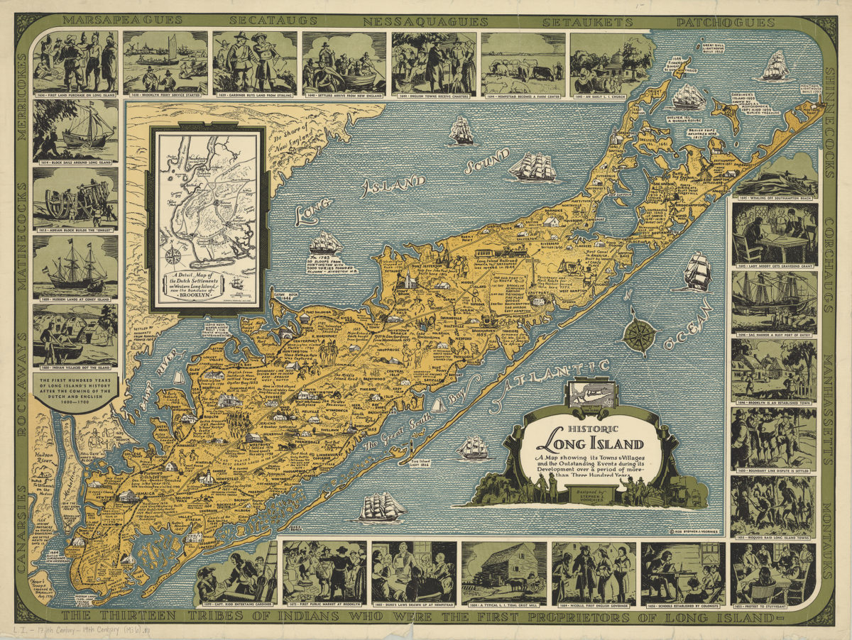
Historic Long Island: a map showing its towns & villages and the outstanding events during its development over a period of more than three hundred years: designed by Stephen J. Voorhies
Historic Long Island: a map showing its towns & villages and the outstanding events during its development over a period of more than three hundred years: designed by Stephen J. Voorhies
[ca. 1936]
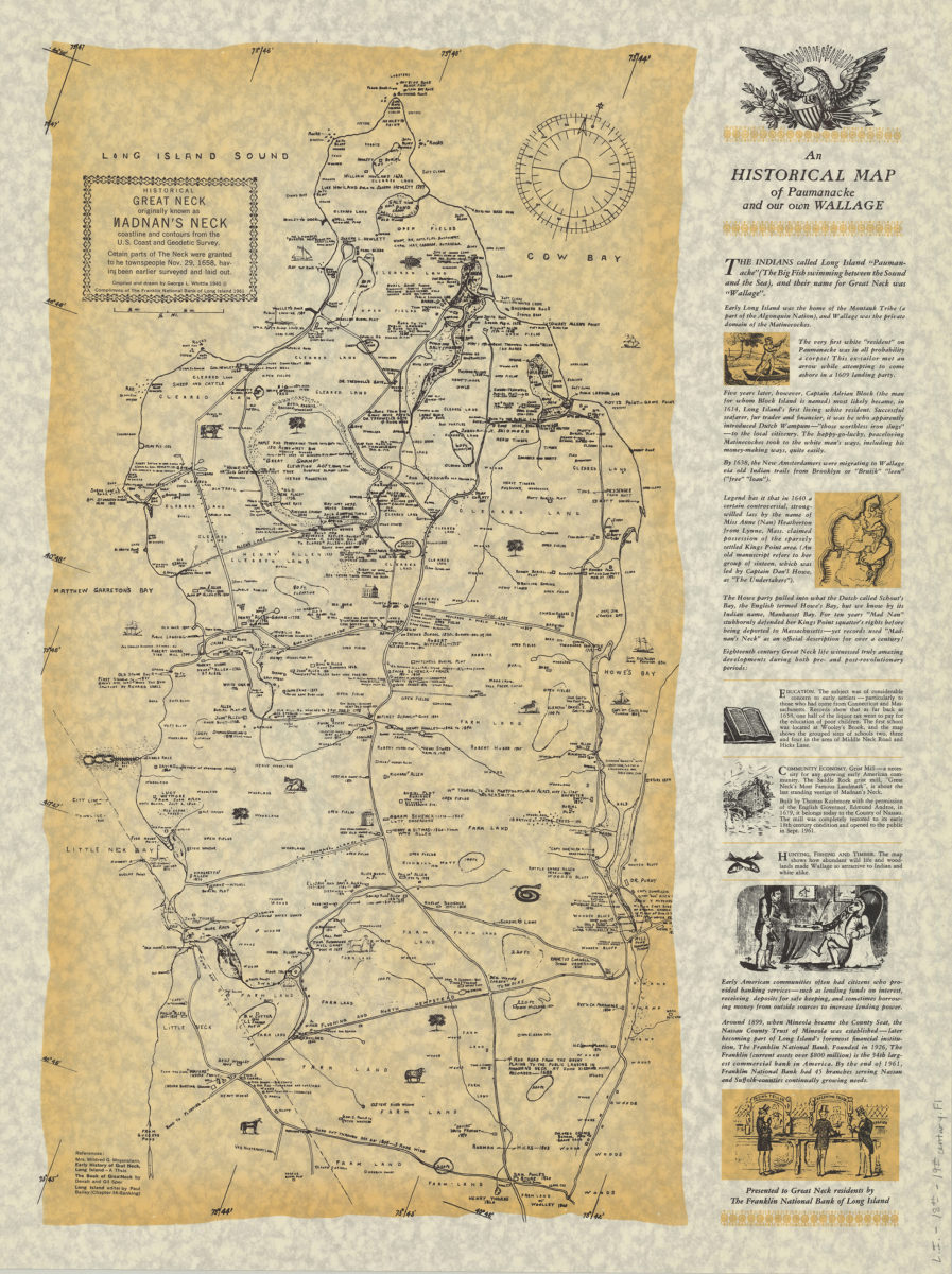
An historical map of Paumanacke and our own Wallage: compiled and drawn by George L. Whittle
An historical map of Paumanacke and our own Wallage: compiled and drawn by George L. Whittle
[ca. 1940, 1961]
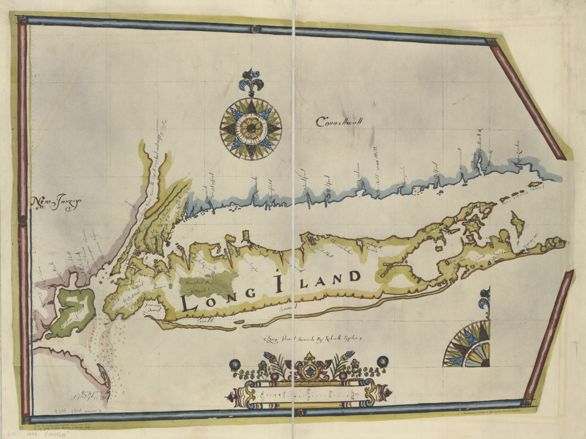
Long Iland sirvaide: by Robartt [sic] Ryder
Long Iland sirvaide: by Robartt [sic] Ryder
1949
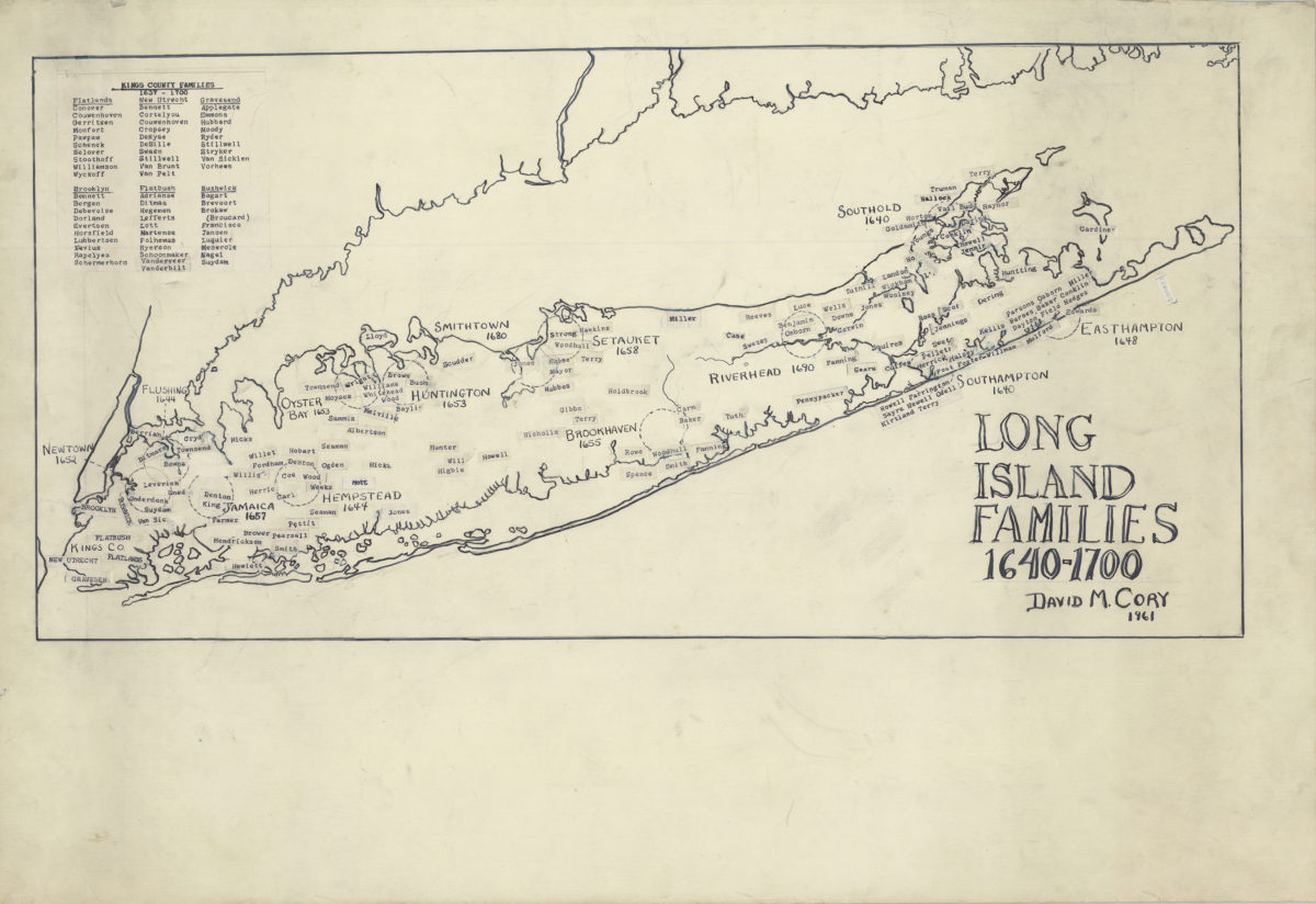
Long Island families, 1640-1700
Long Island families, 1640-1700
1961
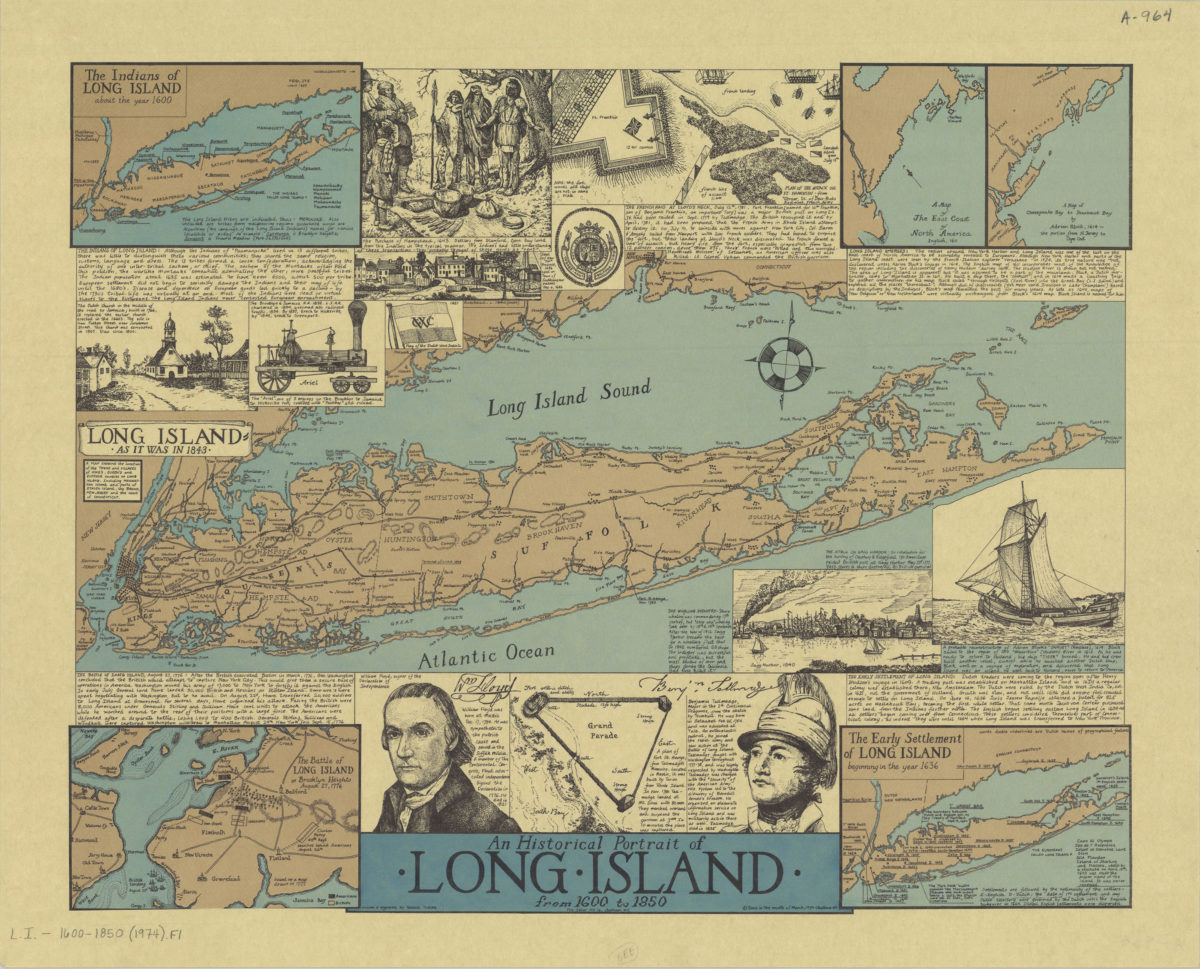
An historical portrait of Long Island from 1600 to 1850: drawn & engraved by Ronald Toelke
An historical portrait of Long Island from 1600 to 1850: drawn & engraved by Ronald Toelke
[ca. 1974]