Center for Brooklyn History
Map Collections
Search
About
Othmer Library & Archives
Submit search query
Refine 6 records
Clear filters
2
Location
Brooklyn (New York, N.Y.)
891
Brooklyn Heights (New York, N.Y.)
76
Fulton Ferry Historic District (New York, N.Y.)
5
Manhattan (New York, N.Y.)
120
New York (N.Y.)
164
Subject
ferries
32
Landowners
434
Piers
25
Real property
619
Roads
117
Wharves
1
Date
19th Century
945
or enter range:
from
to
Genres
Cadastral maps
597
Manuscript maps
365
Sort by:
Date (earliest)
Date (most recent)
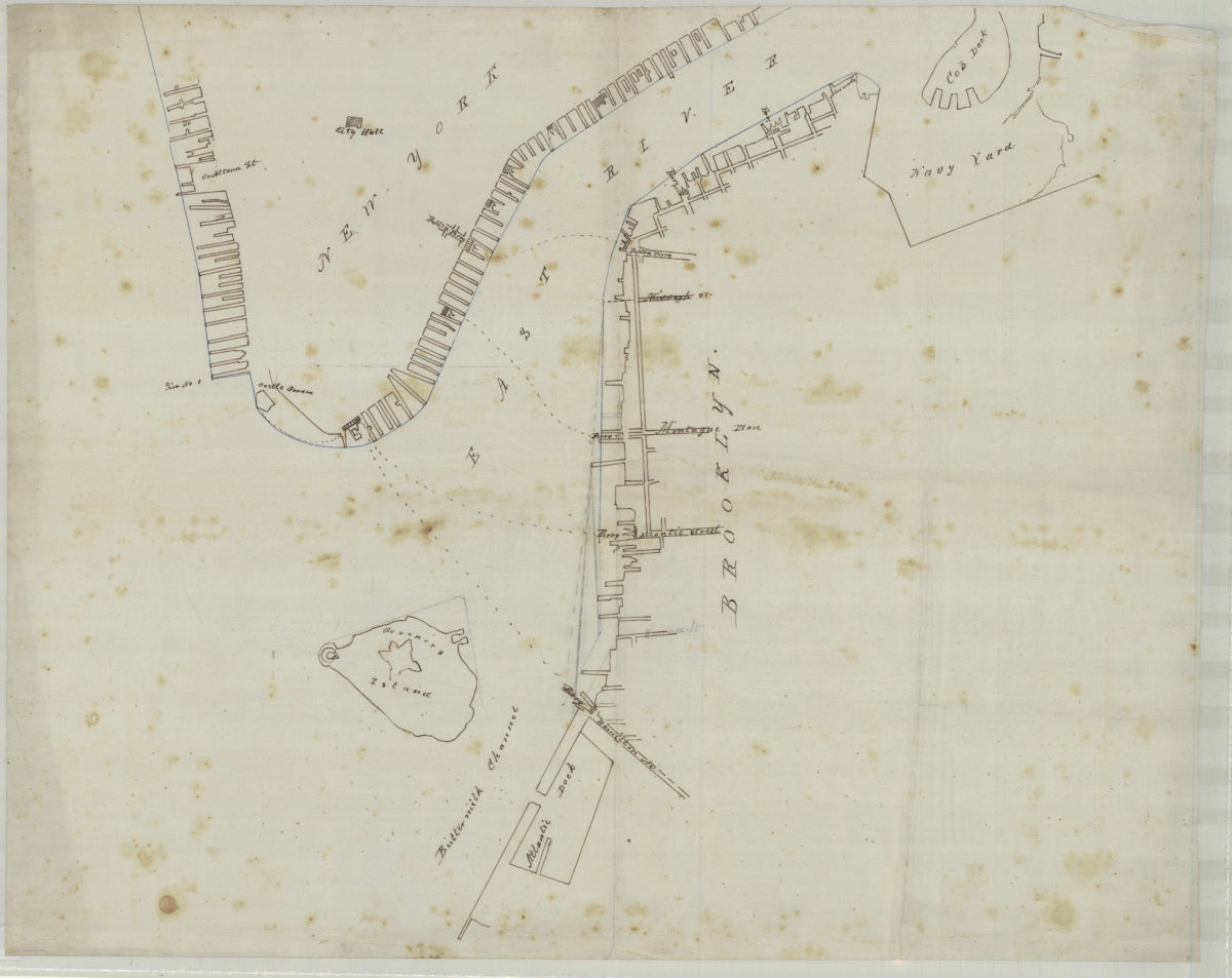
[Map of northwest Brooklyn and Lower Manhattan]
[Map of northwest Brooklyn and Lower Manhattan]
[18??]
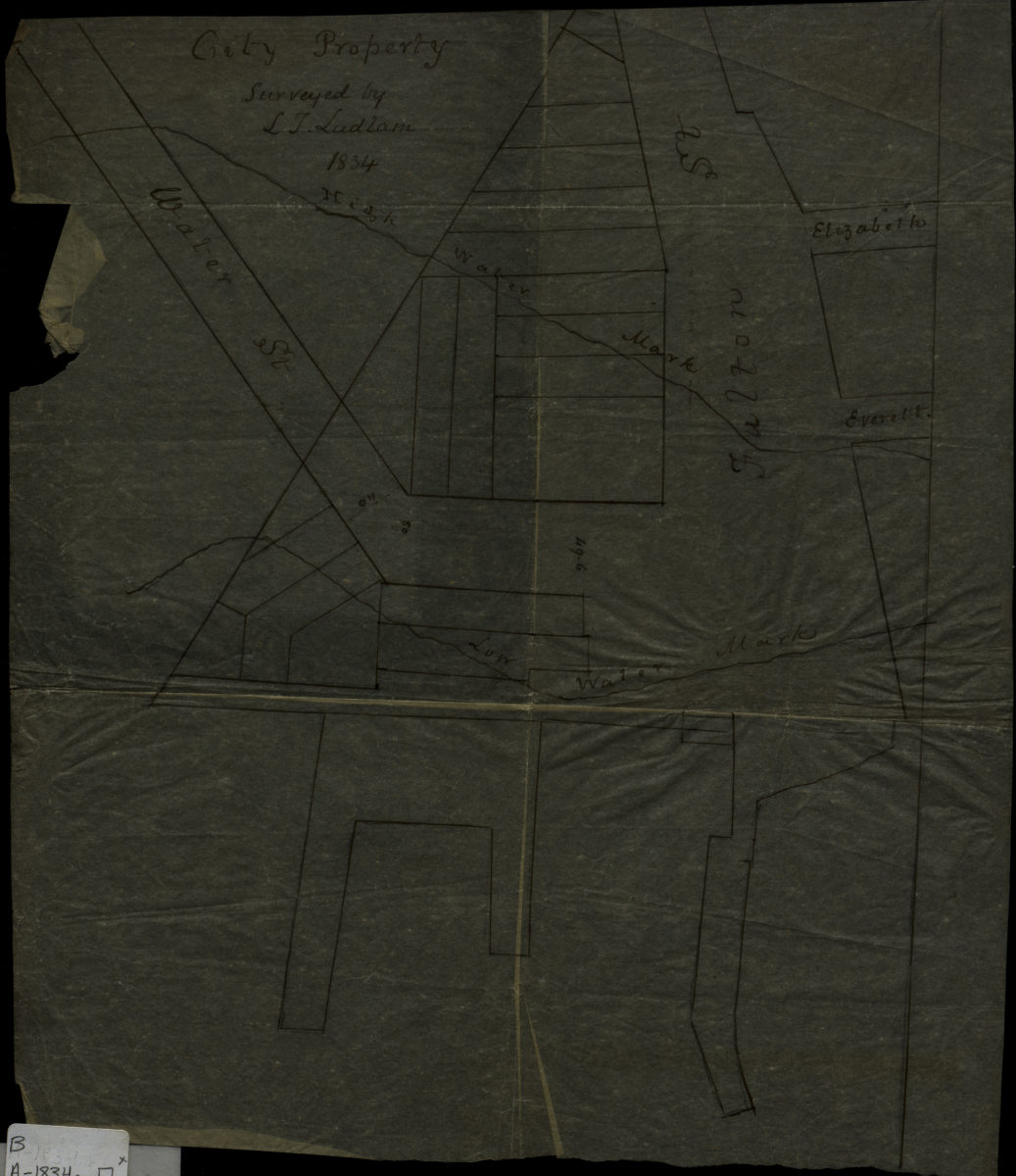
City property: surveyed by I.T. Ludlam
City property: surveyed by I.T. Ludlam
1834
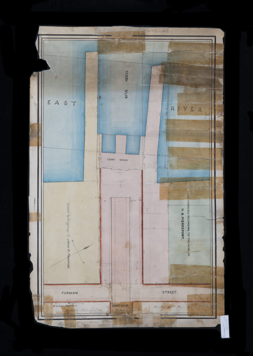
Montague Street Ferry: surveyed by Silas Ludlam ; copied … by Richd. F. Tooms
Montague Street Ferry: surveyed by Silas Ludlam ; copied … by Richd. F. Tooms
September 1854
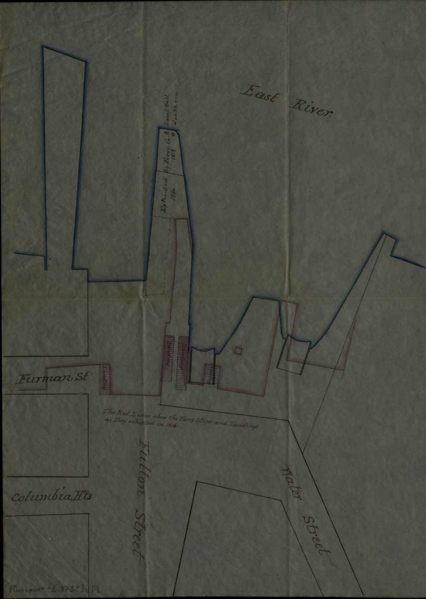
[Ferry slips, landings, and piers at Fulton St.].
[Ferry slips, landings, and piers at Fulton St.].
[1873]
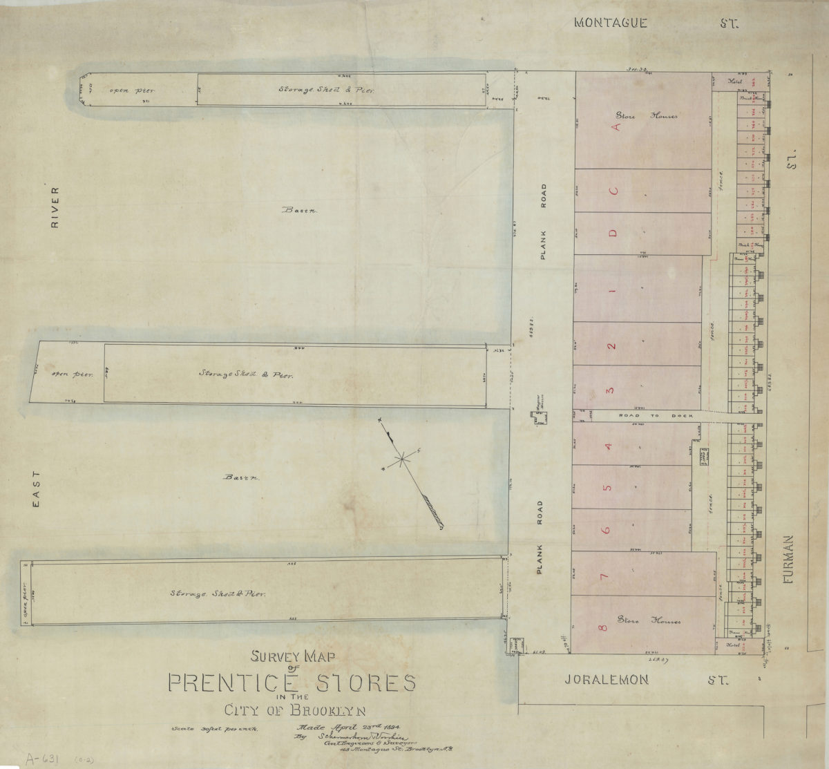
Survey map of Prentice Stores in the city of Brooklyn: by Schermerhorn [and] Voorhies, civil engineers & surveyors
Survey map of Prentice Stores in the city of Brooklyn: by Schermerhorn [and] Voorhies, civil engineers & surveyors
April 23, 1894
[Map of properties at Montague Pl. and Furman St.]: surveyed by Ludlam & Stuchfield, city surveyors
[Map of properties at Montague Pl. and Furman St.]: surveyed by Ludlam & Stuchfield, city surveyors
December 4, 1894