Center for Brooklyn History
Map Collections
Search
About
Othmer Library & Archives
Submit search query
Refine 6 records
Clear filters
3
Location
Bay Ridge (New York, N.Y.)
108
Brooklyn (New York, N.Y.)
891
Coney Island (New York, N.Y.)
22
Crown Heights (New York, N.Y.)
25
Gravesend (New York, N.Y.)
25
Sea Gate (New York, N.Y.)
7
Subject
Grading (Earthwork)
1
Landowners
434
Real property
619
Roads
117
Submerged lands
17
Date
19th Century
945
or enter range:
from
to
Genres
Cadastral maps
597
Early maps
35
Manuscript maps
365
Sort by:
Date (earliest)
Date (most recent)
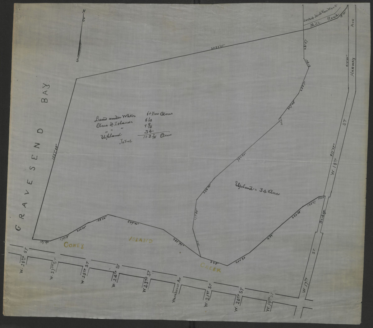
[Survey map of Coney Island and Gravesend]
[Survey map of Coney Island and Gravesend]
[18??]
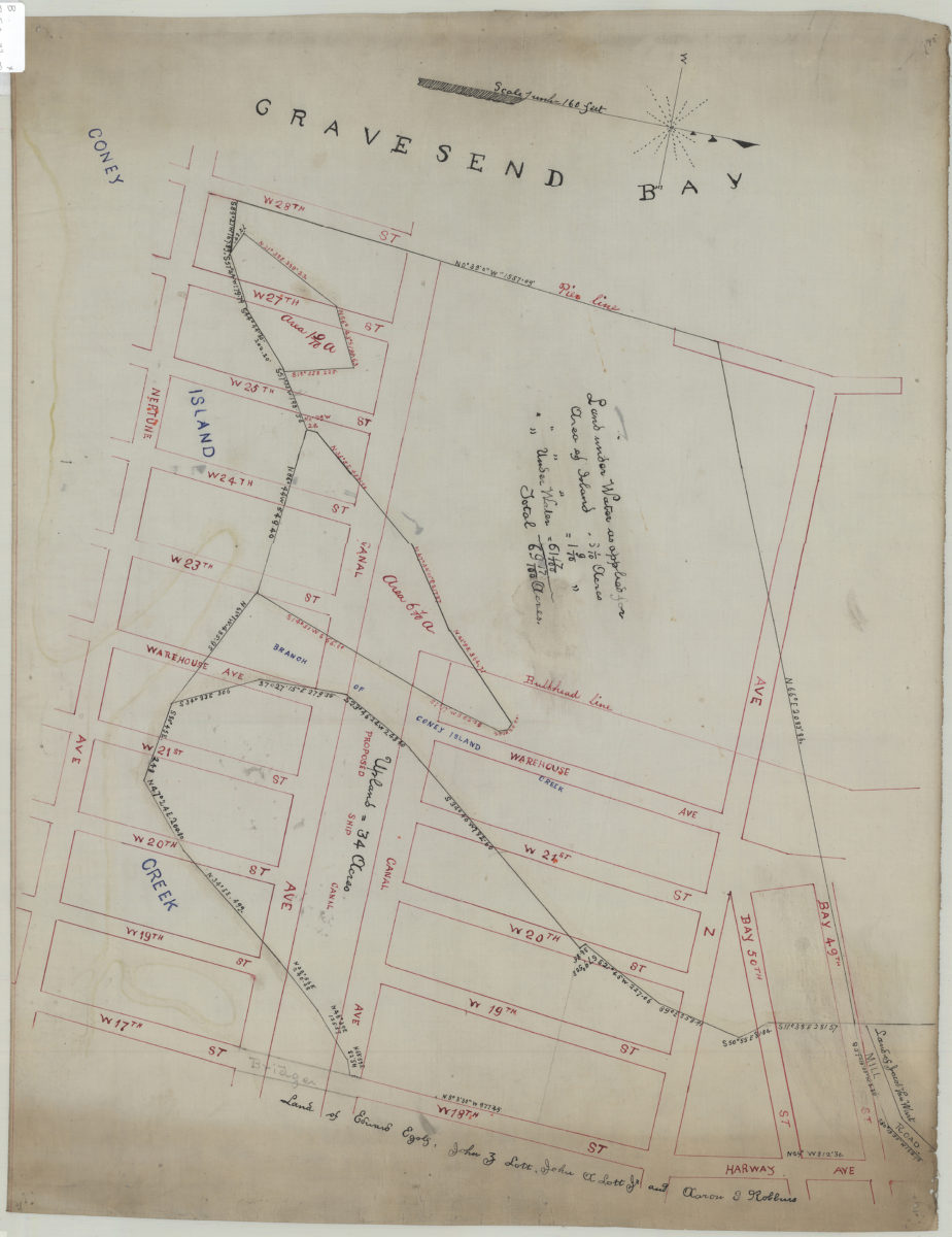
[Map of area bounded by Bay 49th St., W. 28th St., Neptune Ave. and W. 18th St.].
[Map of area bounded by Bay 49th St., W. 28th St., Neptune Ave. and W. 18th St.].
[18??]
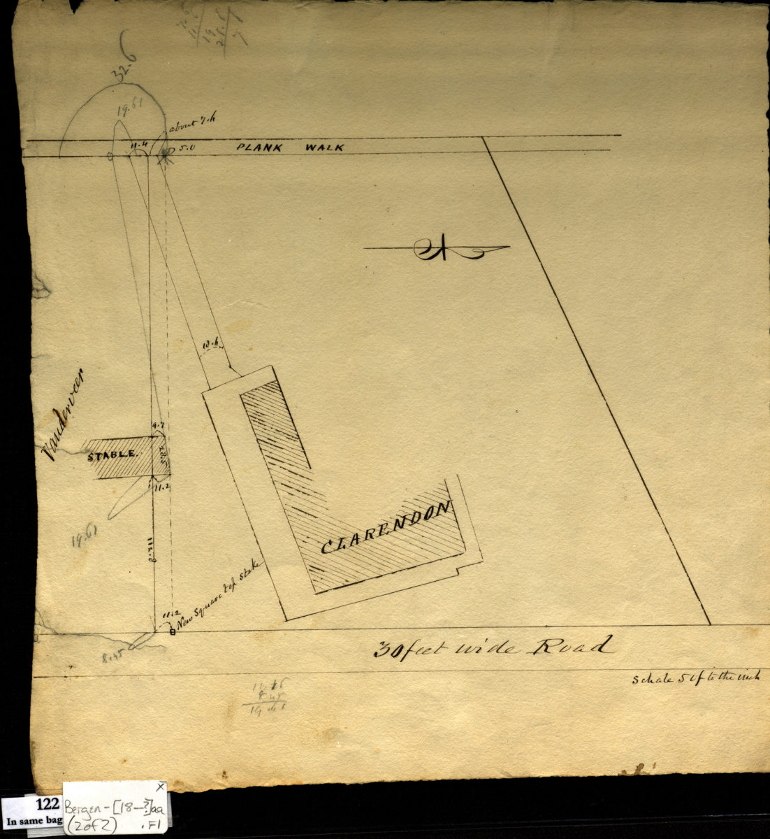
[Survey maps of Kings County Penitentiary Grounds and Vanderveer encroachment onto Clarendon property]
[Survey maps of Kings County Penitentiary Grounds and Vanderveer encroachment onto Clarendon property]
[18??]
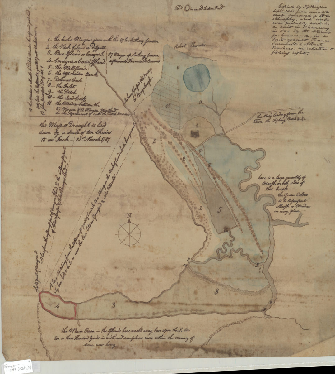
[Map of Gravesend and Coney Island]
[Map of Gravesend and Coney Island]
Sept. 1861
Map of part of Coney Island, as surveyed for the Quarantine Commission
Map of part of Coney Island, as surveyed for the Quarantine Commission
March 1869
[Survey maps of roads in Brooklyn]
[Survey maps of roads in Brooklyn]
[ca.1888]