Center for Brooklyn History
Map Collections
Search
About
Othmer Library & Archives
Submit search query
Refine 11 records
Clear filters
5
Location
Brooklyn (New York, N.Y.)
891
Greenpoint (New York, N.Y.)
38
Williamsburg (New York, N.Y.)
36
Subject
Landowners
434
Real property
619
Date
19th Century
945
20th Century
469
or enter range:
from
to
Genres
Cadastral maps
597
Manuscript maps
365
Sort by:
Date (earliest)
Date (most recent)
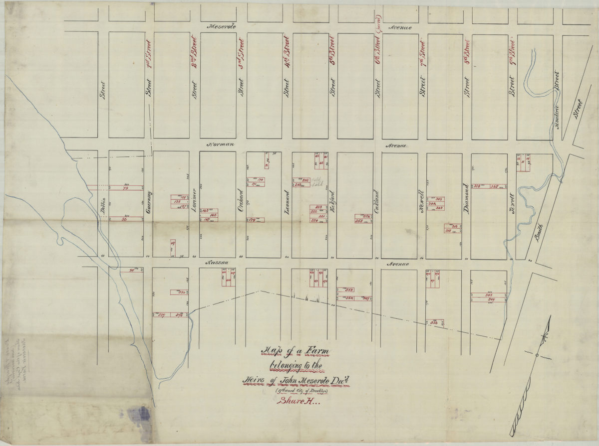
Map of a farm belonging to the heirs of John Meserole, dec’d. (17th Ward, city of Brooklyn), Share H
Map of a farm belonging to the heirs of John Meserole, dec’d. (17th Ward, city of Brooklyn), Share H
[18??]
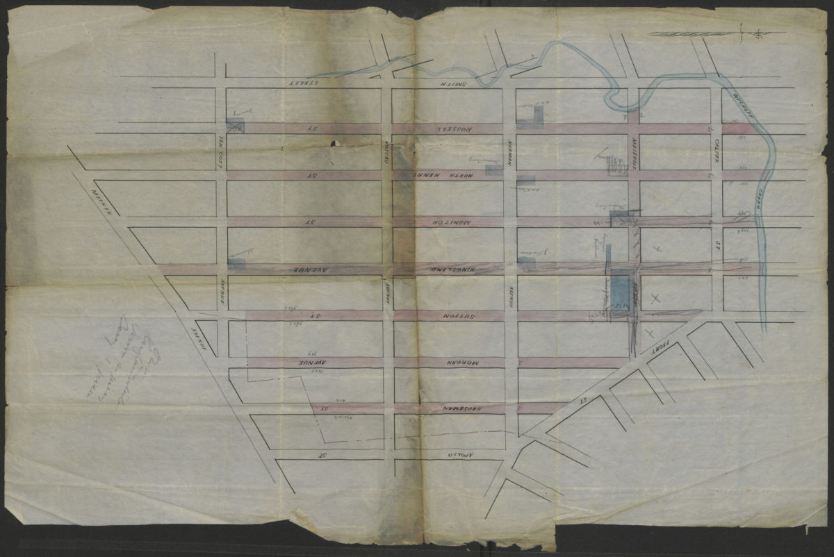
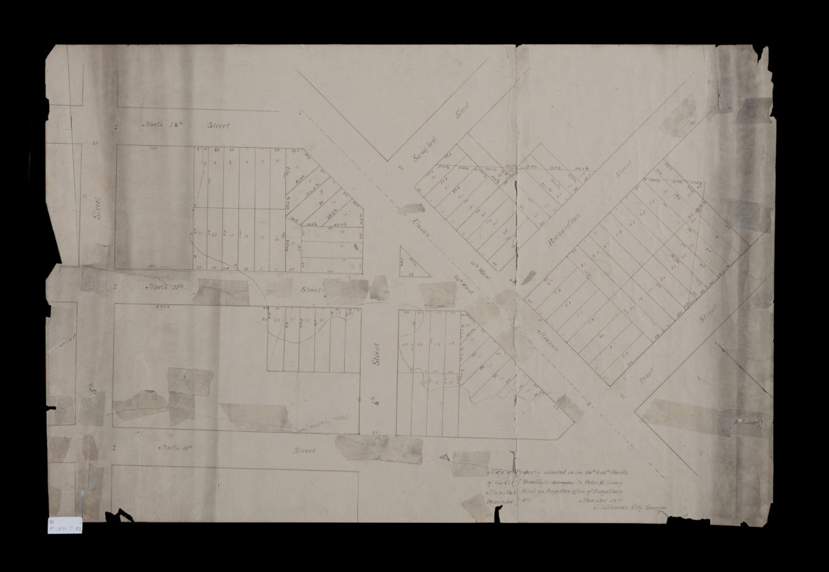
[Map showing street grid, existing buildings, and the course of Wykoff Creek in Greenpoint, Brooklyn]
[Map showing street grid, existing buildings, and the course of Wykoff Creek in Greenpoint, Brooklyn]
[18??]
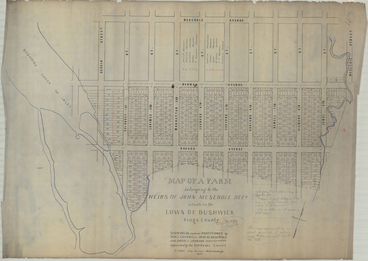
Map of a farm belonging to the heirs of John Meserole, decd., situate[d] in the town of Bushwick, Kings County: showing the same as partitioned by Wm. J. Cogswell, Wm. M. Meserole, and Andw. I. Johnson, commissioners appointed by the Supreme Court
Map of a farm belonging to the heirs of John Meserole, decd., situate[d] in the town of Bushwick, Kings County: showing the same as partitioned by Wm. J. Cogswell, Wm. M. Meserole, and Andw. I. Johnson, commissioners appointed by the Supreme Court
1852
Map of property belonging to N. Bliss, situate[d] at Green Point, Kings Co., N.Y.: recorded in Kings County Registers Office in … [text illegible] April 12th, 1854
Map of property belonging to N. Bliss, situate[d] at Green Point, Kings Co., N.Y.: recorded in Kings County Registers Office in … [text illegible] April 12th, 1854
[1854]
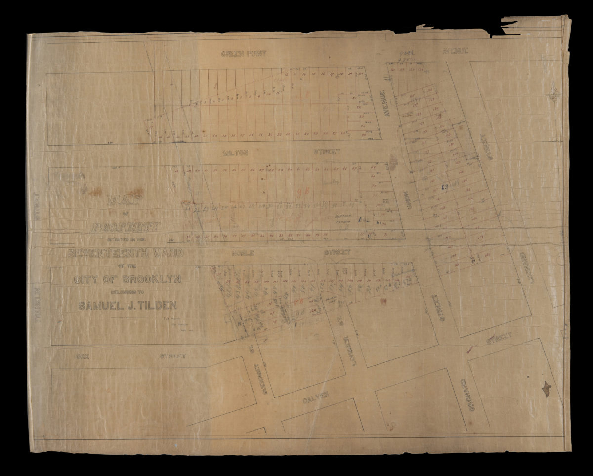
Map of property situated in the Seventeenth Ward of the city of Brooklyn belonging to Samuel J. Tilden: J.V. Meserole, city surveyor
Map of property situated in the Seventeenth Ward of the city of Brooklyn belonging to Samuel J. Tilden: J.V. Meserole, city surveyor
June 1863
Map of property situated in the 14th & 15th Wards of the city of Brooklyn, belonging to Peter B. Amory: J.V. Meserole, city surveyor
Map of property situated in the 14th & 15th Wards of the city of Brooklyn, belonging to Peter B. Amory: J.V. Meserole, city surveyor
November 1871
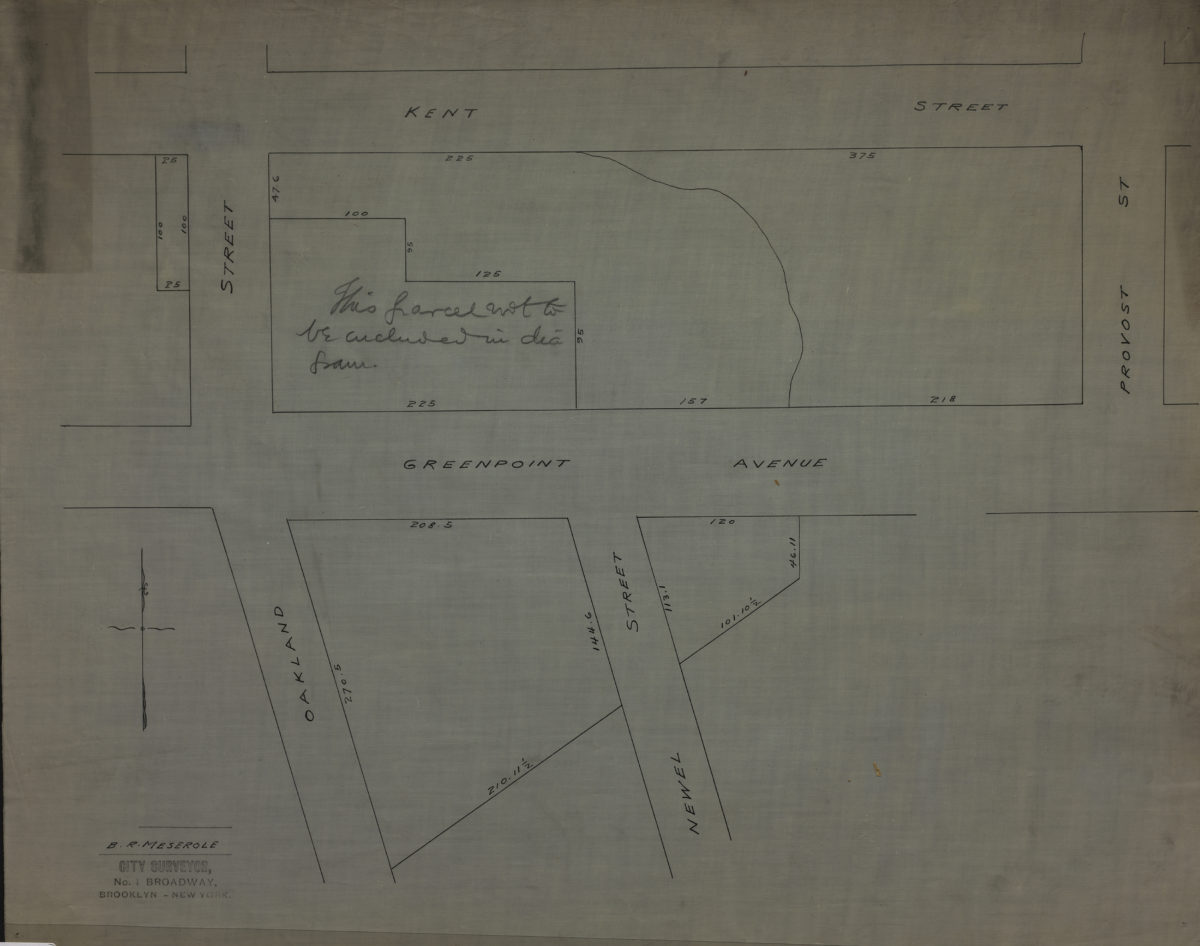
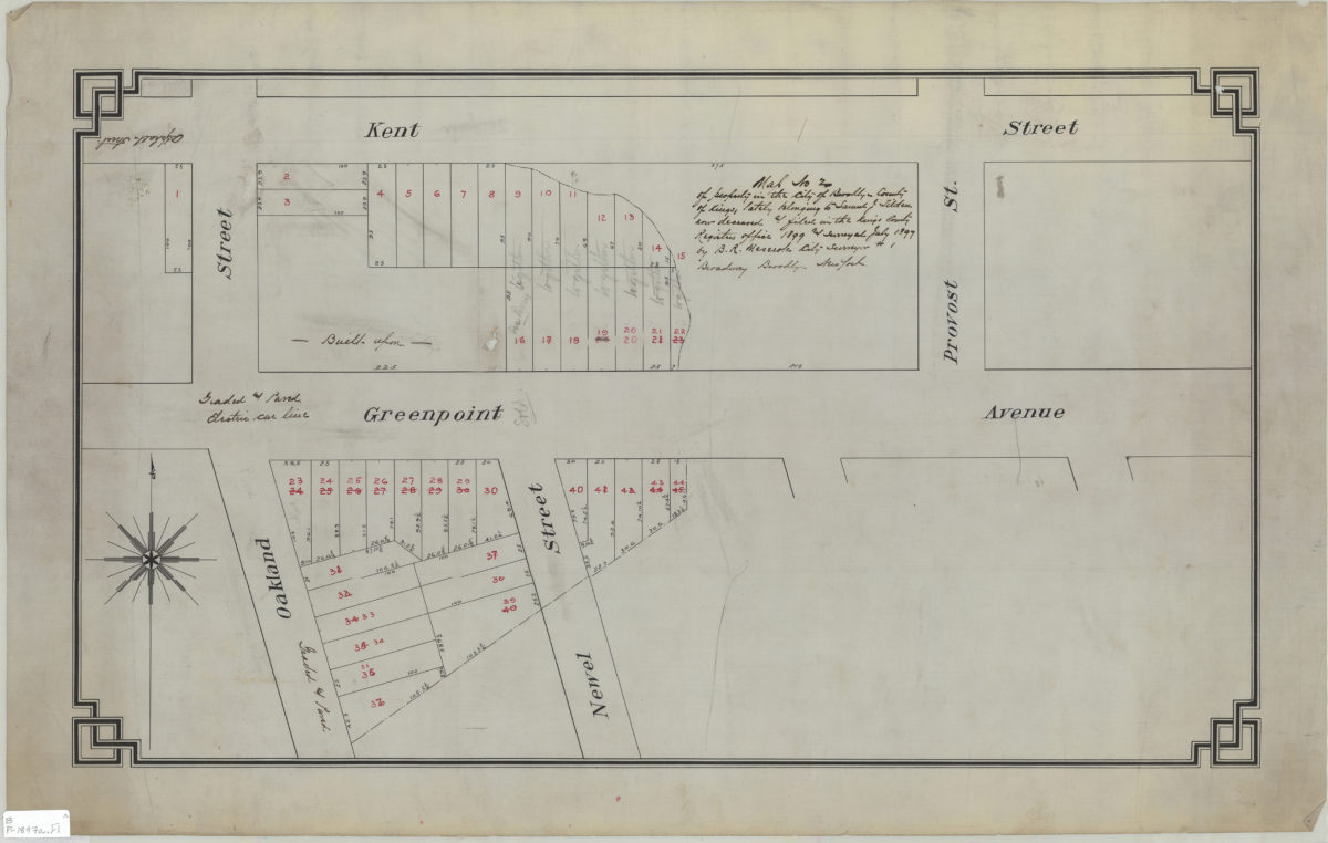
[Map of Kent St. and Greenpoint Ave east from Oakland St. to Provost St.]: B.R. Meserole city surveyor
[Map of Kent St. and Greenpoint Ave east from Oakland St. to Provost St.]: B.R. Meserole city surveyor
[189?]
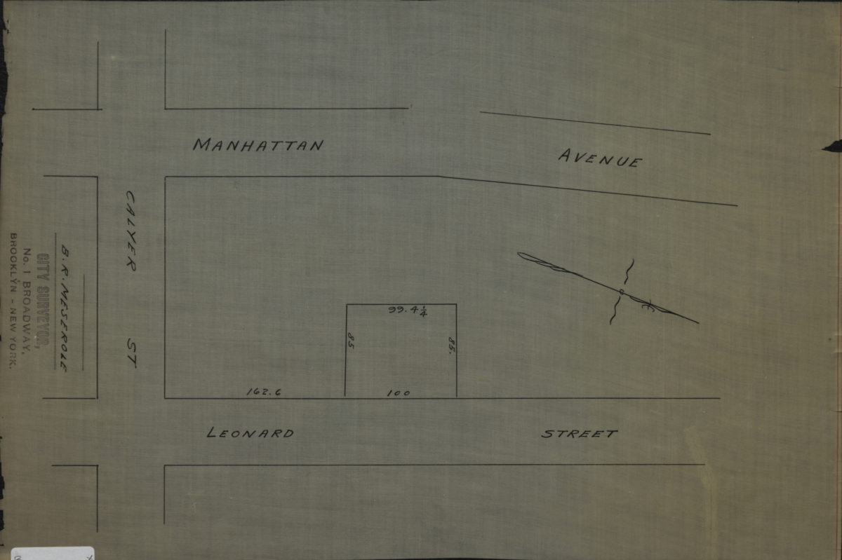
[Map of Manhattan Ave. and Leonard St. at Calyer St.]: B.R. Meserole, city surveyor
[Map of Manhattan Ave. and Leonard St. at Calyer St.]: B.R. Meserole, city surveyor
[189?]
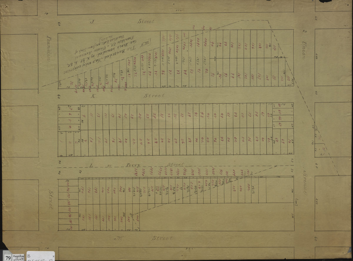
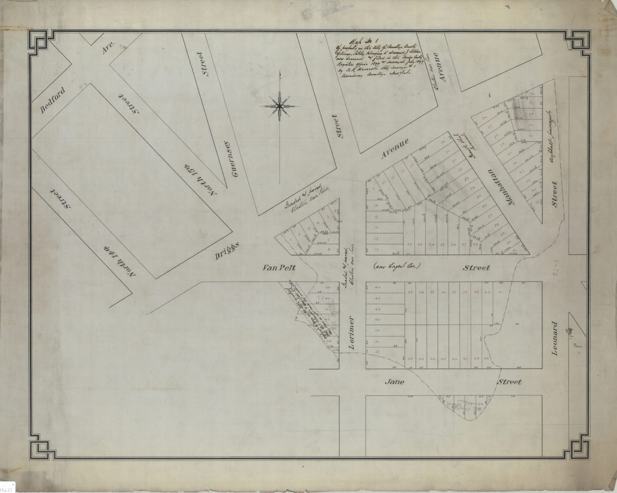
Map no. 1 of property in the city of Brooklyn, county of Kings, lately belonging to Samuel J. Tilden, now deceased, and filed in the Kings County Register’s Office, 1899, and surveyed July 1897: by B.R. Meserole, city surveyor
Map no. 1 of property in the city of Brooklyn, county of Kings, lately belonging to Samuel J. Tilden, now deceased, and filed in the Kings County Register’s Office, 1899, and surveyed July 1897: by B.R. Meserole, city surveyor
July 1897
Map no. 2 of property in the city of Brooklyn, county of Kings, lately belonging to Samuel J. Tilden, now deceased, & filed in the Kings County Register’s Office, 1899, and surveyed July 1897: by B.R. Meserole, city surveyor
Map no. 2 of property in the city of Brooklyn, county of Kings, lately belonging to Samuel J. Tilden, now deceased, & filed in the Kings County Register’s Office, 1899, and surveyed July 1897: by B.R. Meserole, city surveyor
July 1897
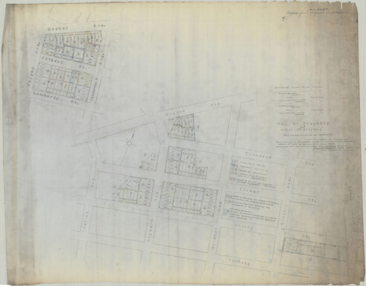
[Copy of] map of property made by J[eremiah] V. Meserole, sole commissioner or referee: showing apportionment thereof made pursuant to the decree of said court, dated and entered March 30th 1896 as amended by its order made of November 25th 1898
[Copy of] map of property made by J[eremiah] V. Meserole, sole commissioner or referee: showing apportionment thereof made pursuant to the decree of said court, dated and entered March 30th 1896 as amended by its order made of November 25th 1898
1918