Center for Brooklyn History
Map Collections
Search
About
Othmer Library & Archives
Submit search query
Refine 15 records
Clear filters
4
Location
Brooklyn (New York, N.Y.)
891
Greenpoint (New York, N.Y.)
38
Williamsburg (New York, N.Y.)
36
Subject
Land tenure
1
Landowners
434
Real property
619
Date
19th Century
945
20th Century
469
or enter range:
from
to
Genres
Cadastral maps
597
Manuscript maps
365
Map
191
Sort by:
Date (earliest)
Date (most recent)
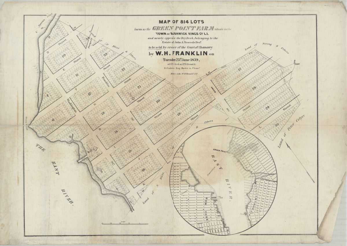
Map of 814 lots known as the Green Point Farm situate[d] in the town of Bushwick, Kings Co., L.I., and nearly opposite the dry dock belonging to the estate of John A. Meserole, decd., to be sold by order of the Court of Chancery by W.H. Franklin
Map of 814 lots known as the Green Point Farm situate[d] in the town of Bushwick, Kings Co., L.I., and nearly opposite the dry dock belonging to the estate of John A. Meserole, decd., to be sold by order of the Court of Chancery by W.H. Franklin
[1839]
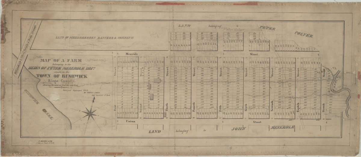
Map of a farm belonging to the heirs of Peter Meserole, decd., situate[d] in the town of Bushwick, Kings County: shewing [sic] the same as laid out into lots: surveyed Septemper [sic], 1845 by Daniel Ewen, city surveyor, N. York
Map of a farm belonging to the heirs of Peter Meserole, decd., situate[d] in the town of Bushwick, Kings County: shewing [sic] the same as laid out into lots: surveyed Septemper [sic], 1845 by Daniel Ewen, city surveyor, N. York
[1845]
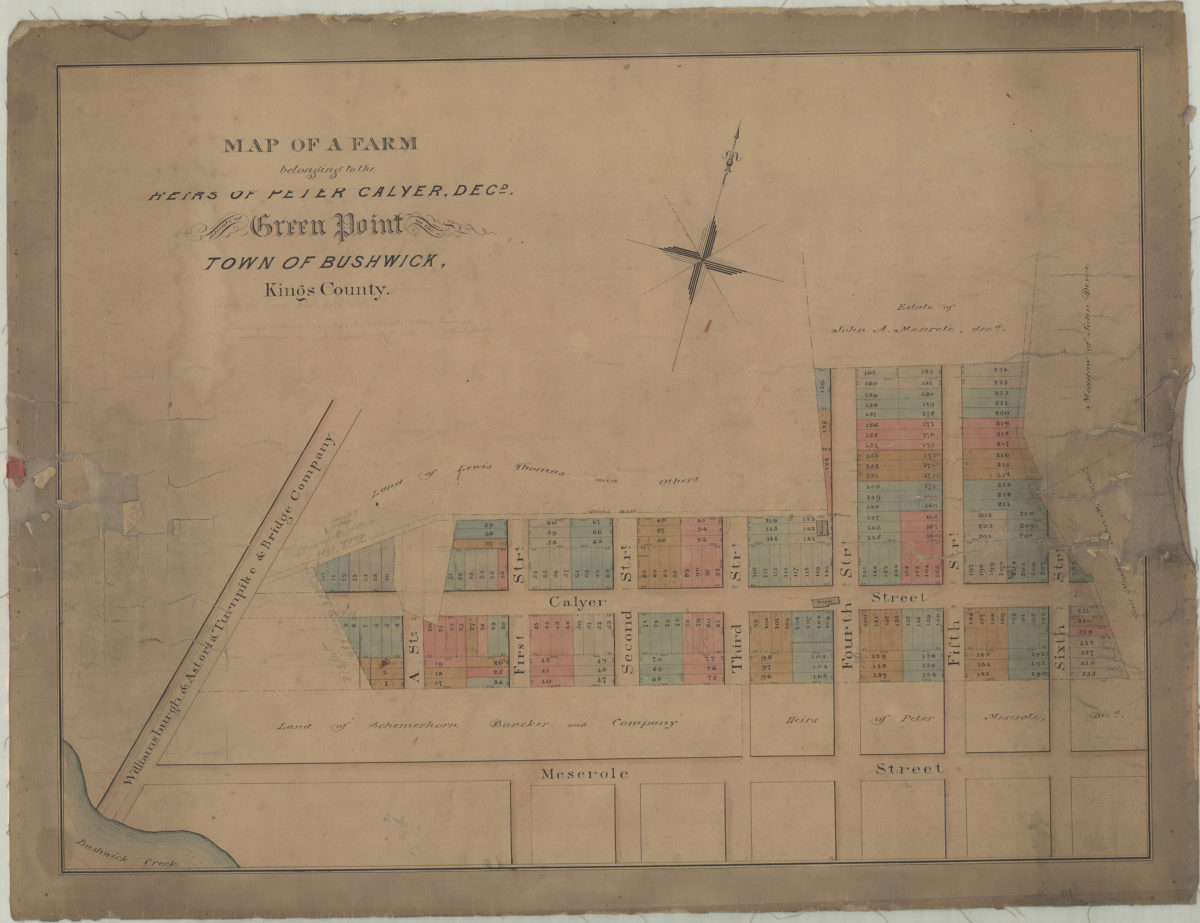
Map of a farm belonging to the heirs of Peter Calyer, decd., situate[d] at Green Point in the town of Bushwick, Kings County
Map of a farm belonging to the heirs of Peter Calyer, decd., situate[d] at Green Point in the town of Bushwick, Kings County
[1848]
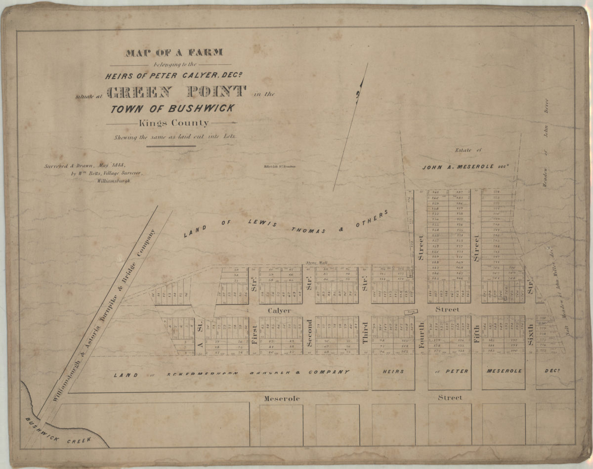
Map of a farm belonging to the heirs of Peter Calyer, decd., situate[d] at Green Point in the town of Bushwick, Kings County, shewing the same as laid out into lots: surveyed & drawn, May 1848 by Wm. Betts, village surveyor, Williamsburgh
Map of a farm belonging to the heirs of Peter Calyer, decd., situate[d] at Green Point in the town of Bushwick, Kings County, shewing the same as laid out into lots: surveyed & drawn, May 1848 by Wm. Betts, village surveyor, Williamsburgh
1848
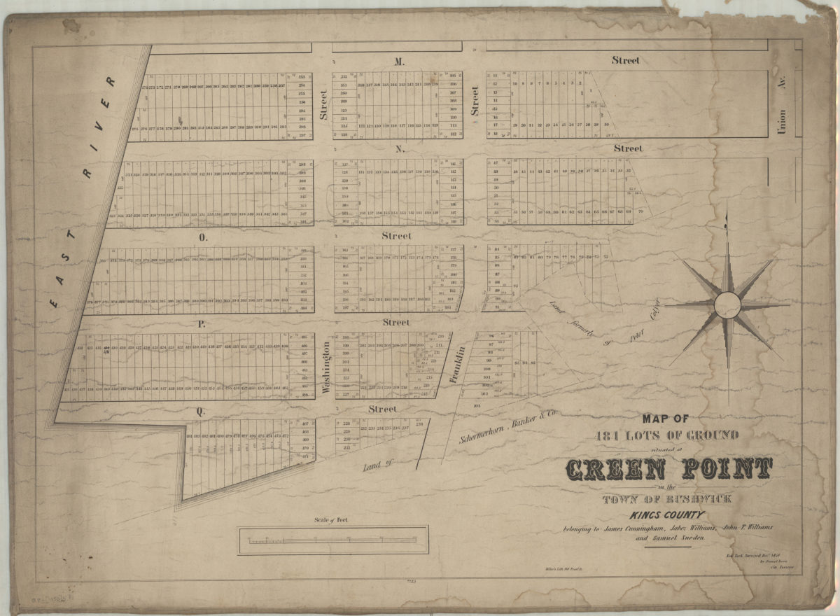
Map of 484 lots of ground situated at Green Point in the town of Bushwick, Kings County, belonging to James Cunningham, Jabez Williams, John T. Williams, and Samuel Sneden: surveyed Decr. 1850 by Daniel Ewen, city surveyor
Map of 484 lots of ground situated at Green Point in the town of Bushwick, Kings County, belonging to James Cunningham, Jabez Williams, John T. Williams, and Samuel Sneden: surveyed Decr. 1850 by Daniel Ewen, city surveyor
1850
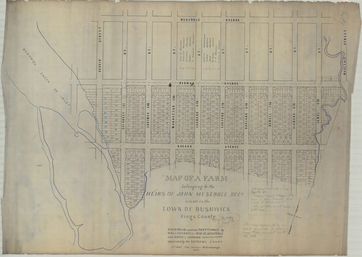
Map of a farm belonging to the heirs of John Meserole, decd., situate[d] in the town of Bushwick, Kings County: showing the same as partitioned by Wm. J. Cogswell, Wm. M. Meserole, and Andw. I. Johnson, commissioners appointed by the Supreme Court
Map of a farm belonging to the heirs of John Meserole, decd., situate[d] in the town of Bushwick, Kings County: showing the same as partitioned by Wm. J. Cogswell, Wm. M. Meserole, and Andw. I. Johnson, commissioners appointed by the Supreme Court
1852
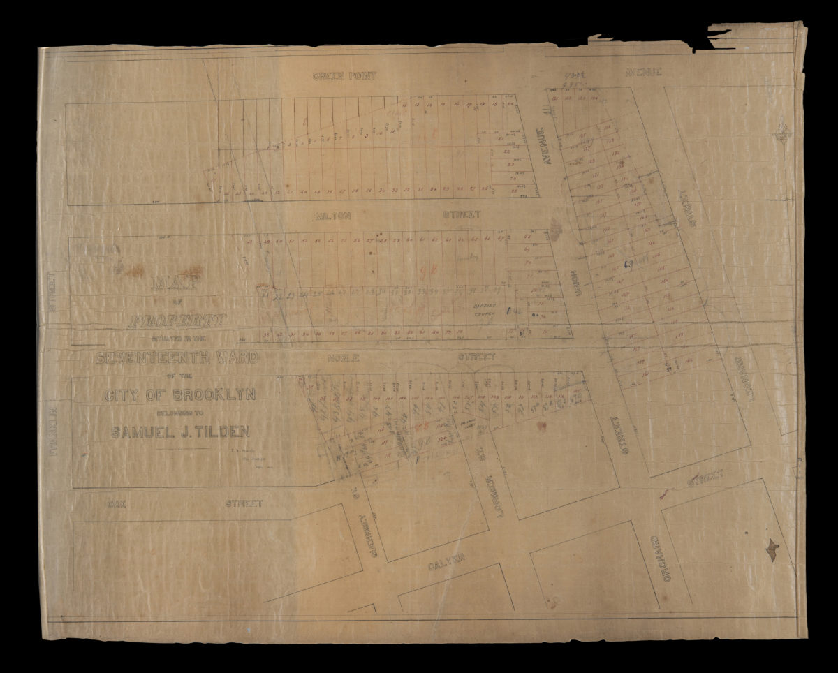
Map of property situated in the Seventeenth Ward of the city of Brooklyn belonging to Samuel J. Tilden: J.V. Meserole, city surveyor
Map of property situated in the Seventeenth Ward of the city of Brooklyn belonging to Samuel J. Tilden: J.V. Meserole, city surveyor
June 1863
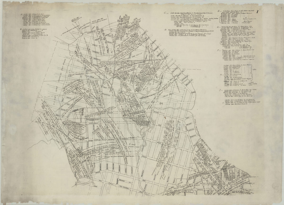
[Map of Greenpoint showing land transfers]
[Map of Greenpoint showing land transfers]
circa 1885
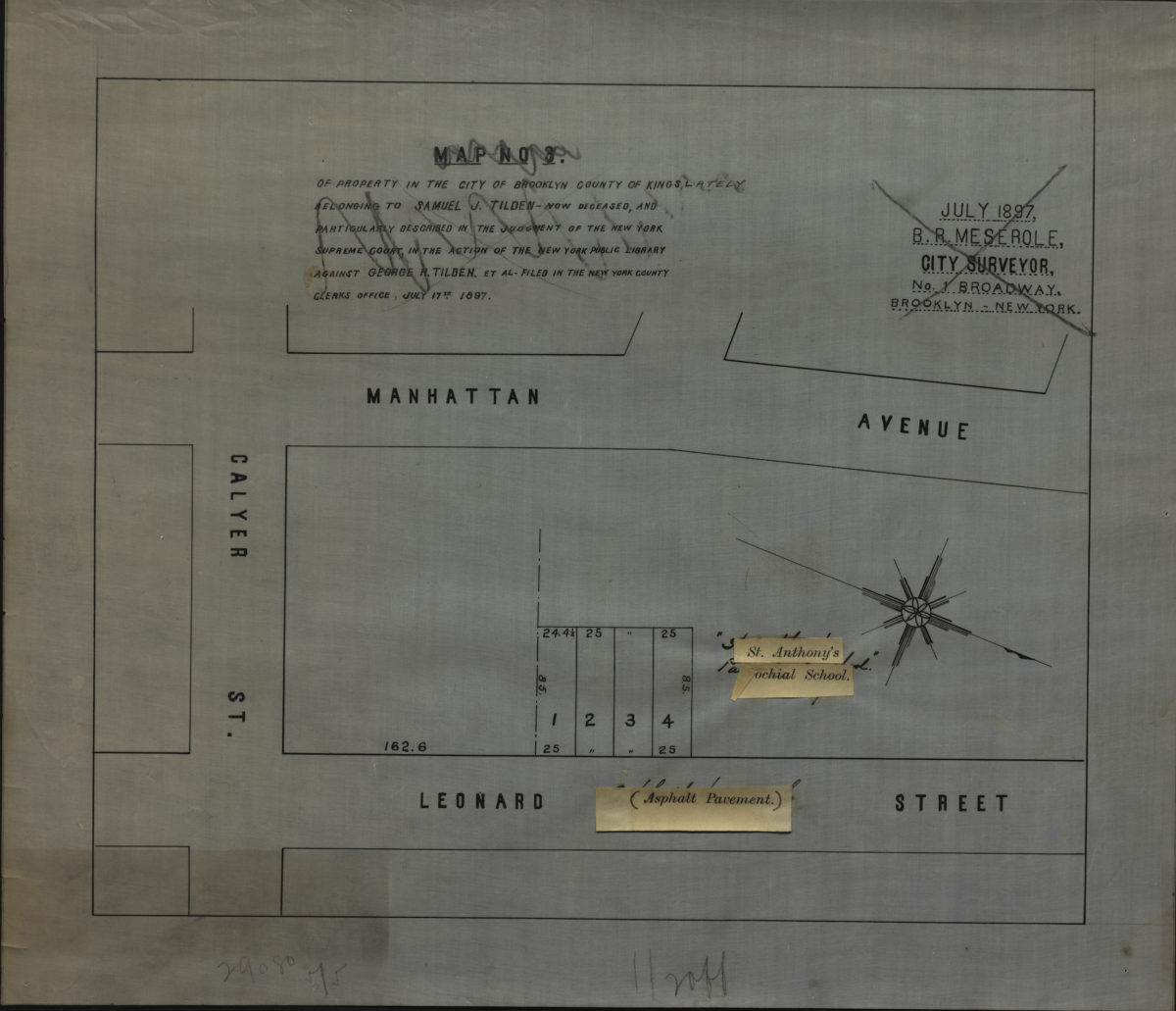
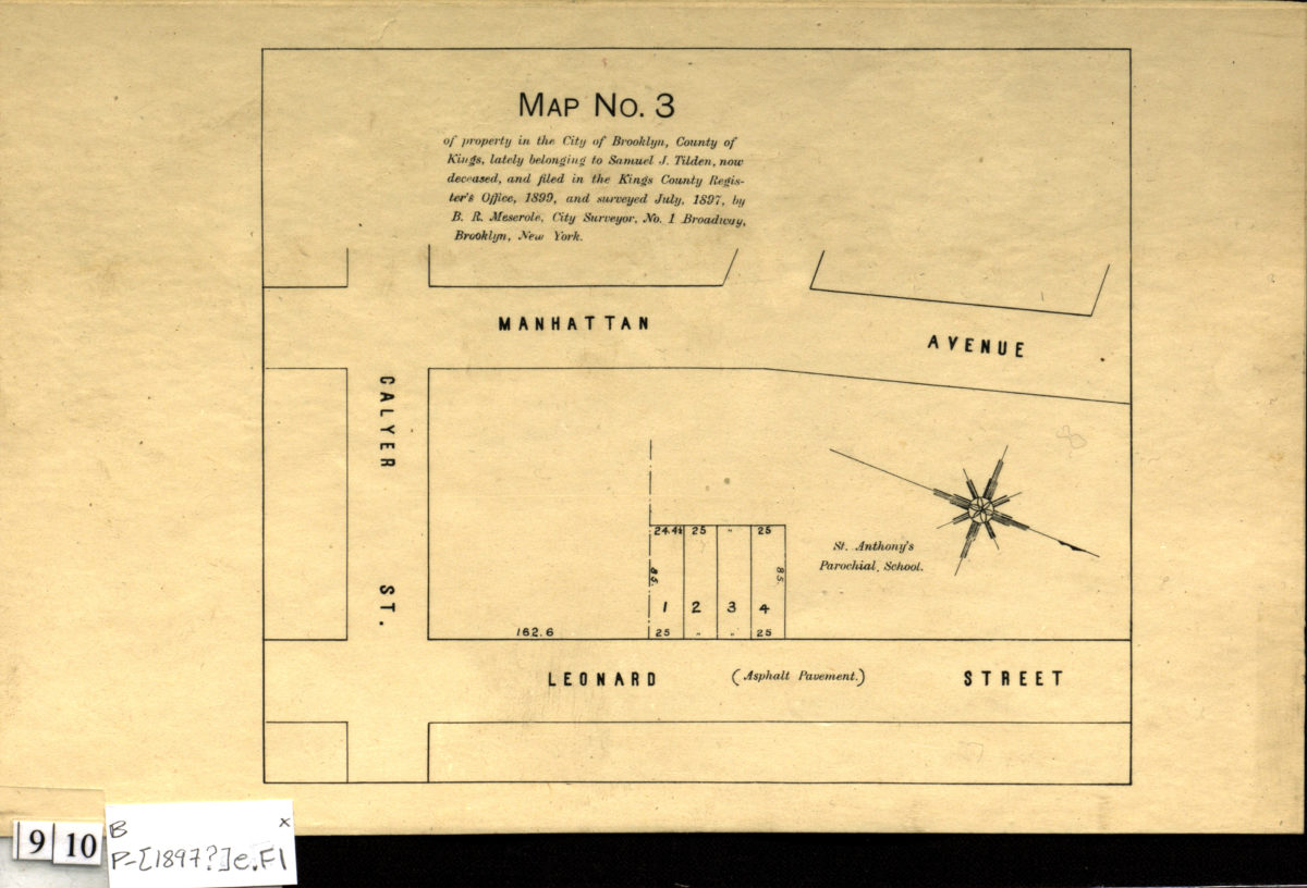
Map no. 3 of property in the city of Brooklyn, county of Kings, lately belonging to Samuel J. Tilden, now deceased, and particularly described in the judgement of the New York Supreme Court, July 17th, 1897
Map no. 3 of property in the city of Brooklyn, county of Kings, lately belonging to Samuel J. Tilden, now deceased, and particularly described in the judgement of the New York Supreme Court, July 17th, 1897
[1897]
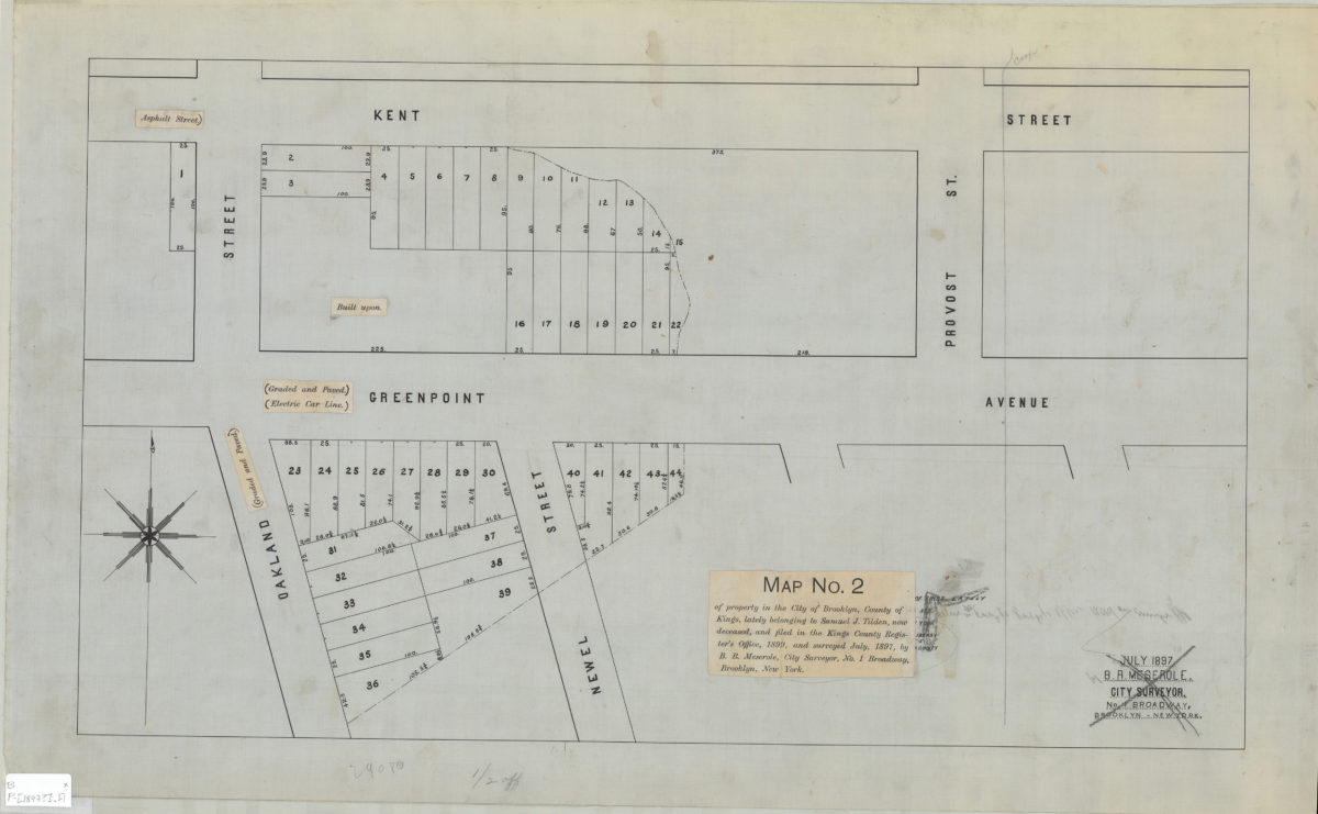
Map no. 2 of property in the city of Brooklyn, county of Kings, lately belonging to Samuel J. Tilden, now deceased, and filed in the Kings County Register’s Office, 1899, and surveyed July 1897: by B.R. Meserole, city surveyor
Map no. 2 of property in the city of Brooklyn, county of Kings, lately belonging to Samuel J. Tilden, now deceased, and filed in the Kings County Register’s Office, 1899, and surveyed July 1897: by B.R. Meserole, city surveyor
[1897]
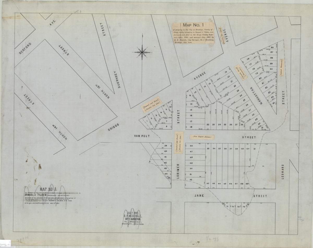
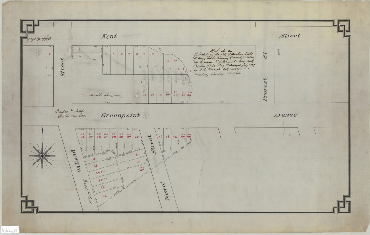
Map no. 1 of property in the city of Brooklyn, county of Kings, lately belonging to Samuel J. Tilden, now deceased, and filed in the Kings County Register’s Office, 1899, and surveyed July 1897: by B.R. Meserole, city surveyor
Map no. 1 of property in the city of Brooklyn, county of Kings, lately belonging to Samuel J. Tilden, now deceased, and filed in the Kings County Register’s Office, 1899, and surveyed July 1897: by B.R. Meserole, city surveyor
[1897]
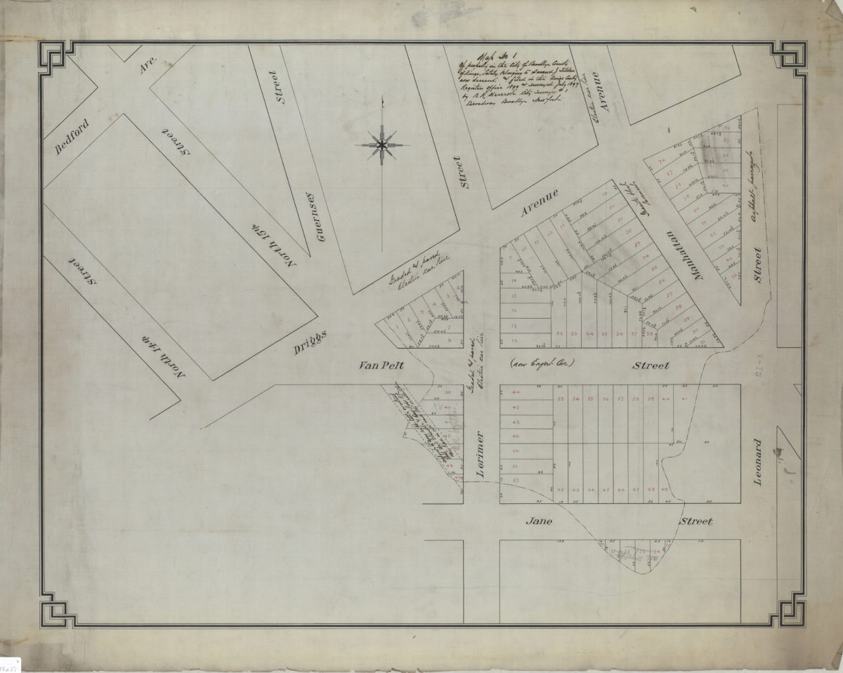
Map no. 1 of property in the city of Brooklyn, county of Kings, lately belonging to Samuel J. Tilden, now deceased, and filed in the Kings County Register’s Office, 1899, and surveyed July 1897: by B.R. Meserole, city surveyor
Map no. 1 of property in the city of Brooklyn, county of Kings, lately belonging to Samuel J. Tilden, now deceased, and filed in the Kings County Register’s Office, 1899, and surveyed July 1897: by B.R. Meserole, city surveyor
July 1897
Map no. 2 of property in the city of Brooklyn, county of Kings, lately belonging to Samuel J. Tilden, now deceased, & filed in the Kings County Register’s Office, 1899, and surveyed July 1897: by B.R. Meserole, city surveyor
Map no. 2 of property in the city of Brooklyn, county of Kings, lately belonging to Samuel J. Tilden, now deceased, & filed in the Kings County Register’s Office, 1899, and surveyed July 1897: by B.R. Meserole, city surveyor
July 1897
Map no. 3 of property in the city of Brooklyn, county of Kings, lately belonging to Samuel J. Tilden, now deceased, and filed in the Kings County Register’s Office, 1899, and surveyed July 1897: by B.R. Meserole, city surveyor
Map no. 3 of property in the city of Brooklyn, county of Kings, lately belonging to Samuel J. Tilden, now deceased, and filed in the Kings County Register’s Office, 1899, and surveyed July 1897: by B.R. Meserole, city surveyor
[1897]
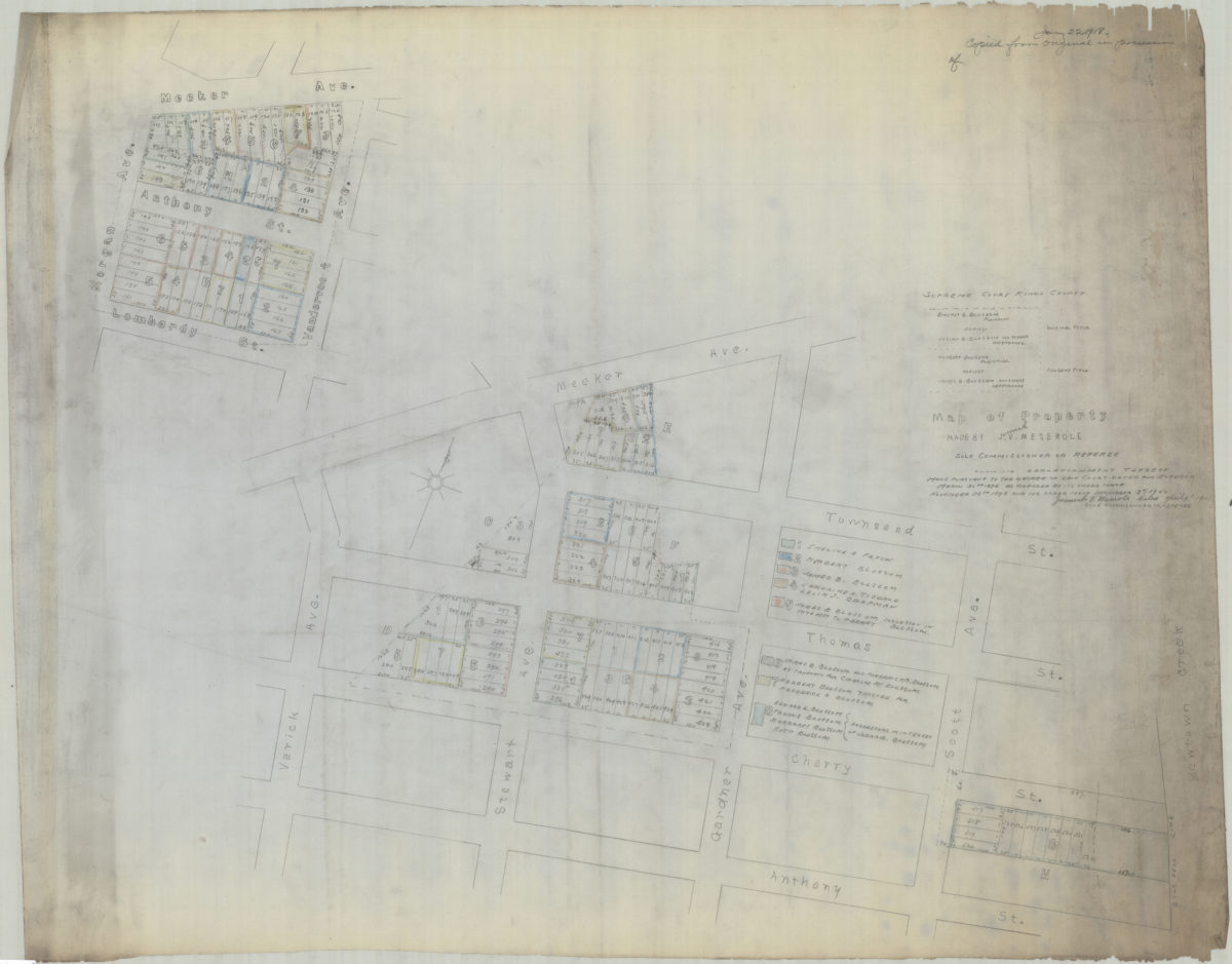
[Copy of] map of property made by J[eremiah] V. Meserole, sole commissioner or referee: showing apportionment thereof made pursuant to the decree of said court, dated and entered March 30th 1896 as amended by its order made of November 25th 1898
[Copy of] map of property made by J[eremiah] V. Meserole, sole commissioner or referee: showing apportionment thereof made pursuant to the decree of said court, dated and entered March 30th 1896 as amended by its order made of November 25th 1898
1918