Center for Brooklyn History
Map Collections
Search
About
Othmer Library & Archives
Submit search query
Refine 14 records
Clear filters
2
Location
Bronx (New York, N.Y.)
10
Brooklyn (New York, N.Y.)
891
Coney Island (New York, N.Y.)
22
Connecticut
7
Long Island (N.Y.)
197
Manhattan (New York, N.Y.)
120
New England
8
New Jersey
27
New York (N.Y.)
164
New York (State)
95
New York Metropolitan Area
40
Pennsylvania
4
Queens (New York, N.Y.)
83
Secaucus (N.J.)
1
Stapleton (New York, N.Y.)
1
Staten Island (N.Y.)
10
Westchester County (N.Y.)
11
Subject
Aeronautical charts
1
Landowners
434
New York Metropolitan Area
1
Roads
117
White Plains, Battle of, White Plains, N.Y., 1776
3
Date
20th Century
469
or enter range:
from
to
Genres
Bathymetric maps
94
Cadastral maps
597
Early maps
35
Historical maps
53
Map
191
Military maps
23
Road maps
83
Topographic maps
70
Sort by:
Date (earliest)
Date (most recent)
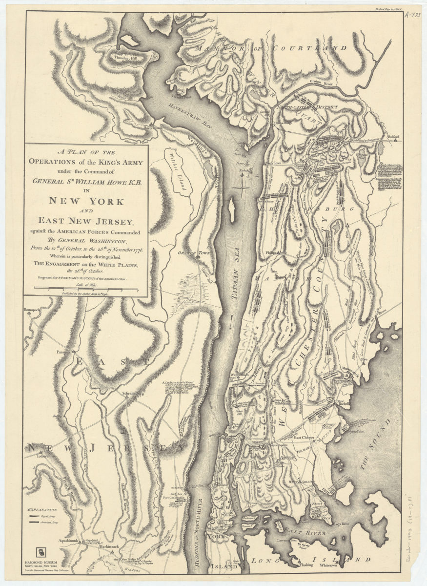
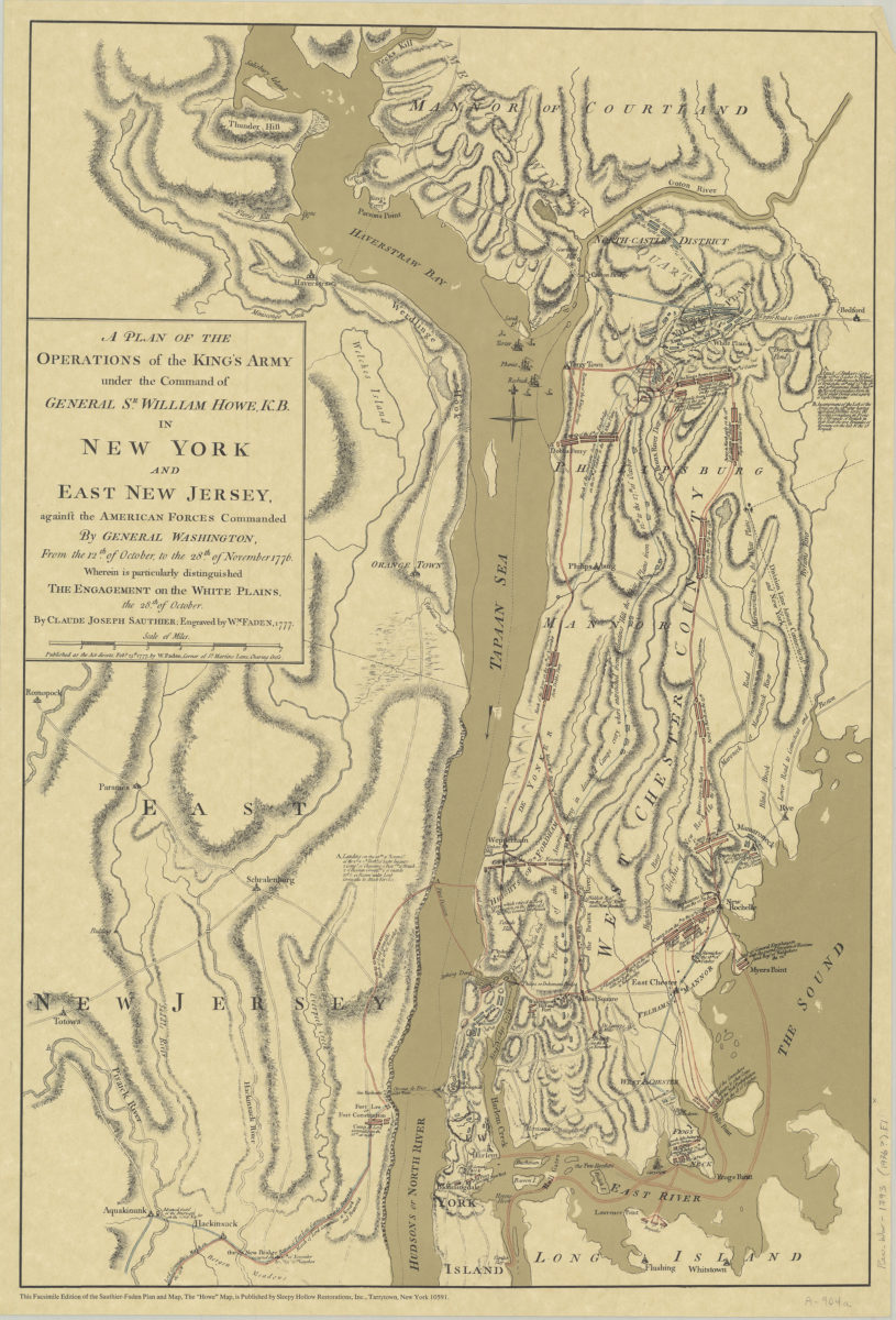
A plan of the operations of the King’s army under the command of General Sr. William Howe, K.B., in New York and East New Jersey against the American forces commanded by General Washington, from the 12th of October, to the 28th of November 1776
A plan of the operations of the King’s army under the command of General Sr. William Howe, K.B., in New York and East New Jersey against the American forces commanded by General Washington, from the 12th of October, to the 28th of November 1776
[19??]
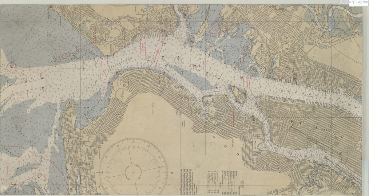
[Map of Mahattan south of Central Park, eastern edge of Brooklyn, southwest edge of New Jersey, and the nothwest edge of Staten Island]
[Map of Mahattan south of Central Park, eastern edge of Brooklyn, southwest edge of New Jersey, and the nothwest edge of Staten Island]
[19??]
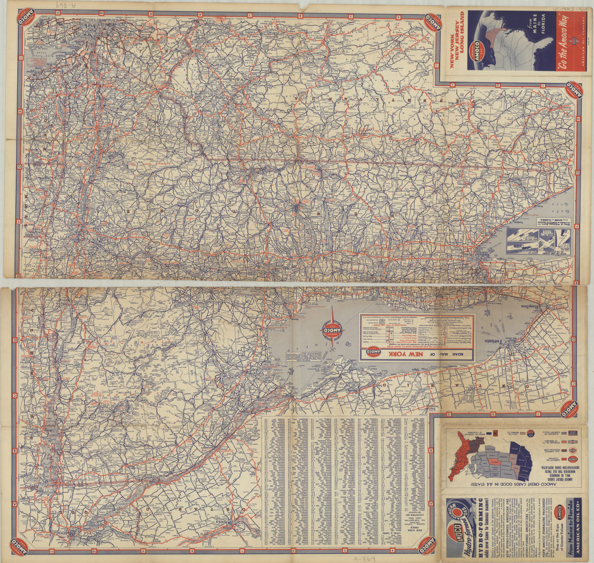
New York, New Jersey, Long Island: [compliments of] Amoco
New York, New Jersey, Long Island: [compliments of] Amoco
[1936]
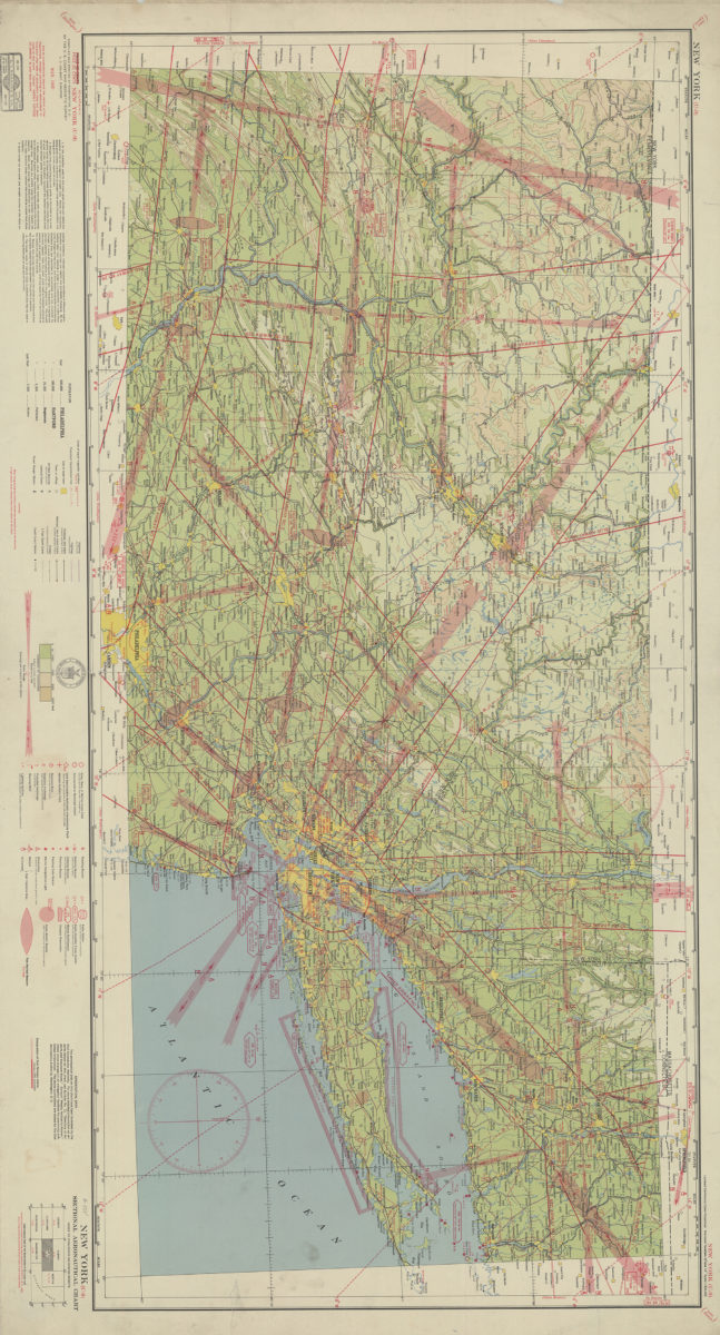
New York (U-9) sectional aeronautical chart: compiled and printed at Washington D.C. by the U.S. Coast and Geodetic Survey
New York (U-9) sectional aeronautical chart: compiled and printed at Washington D.C. by the U.S. Coast and Geodetic Survey
1940
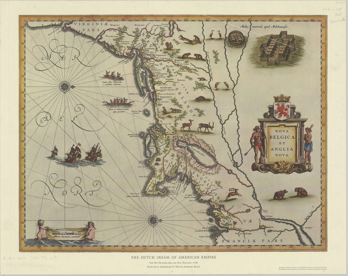
The Dutch dream of American empire: the New Netherlands and New England, 1635: engraved in Amsterdam by Willem Janszoon Blaeu
The Dutch dream of American empire: the New Netherlands and New England, 1635: engraved in Amsterdam by Willem Janszoon Blaeu
[195?]
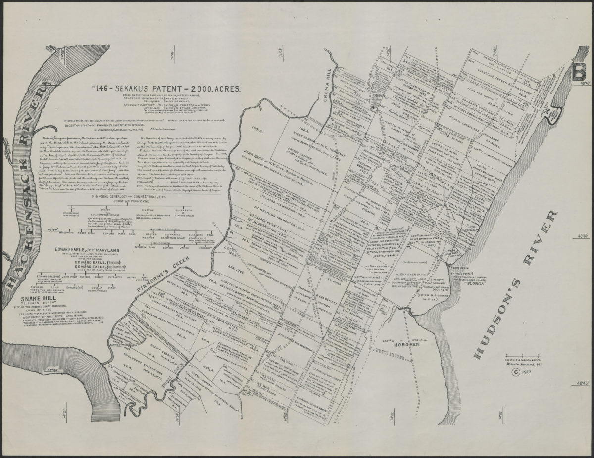
# 146: Sekakus patent: 2000 acres: based on the Indian purchase of Jan. 30, 1658 (Stila Nova)
# 146: Sekakus patent: 2000 acres: based on the Indian purchase of Jan. 30, 1658 (Stila Nova)
[1957; 1957]
Washington’s retreat across New Jersey in Nov. & Dec. 1776
Washington’s retreat across New Jersey in Nov. & Dec. 1776
[1964]
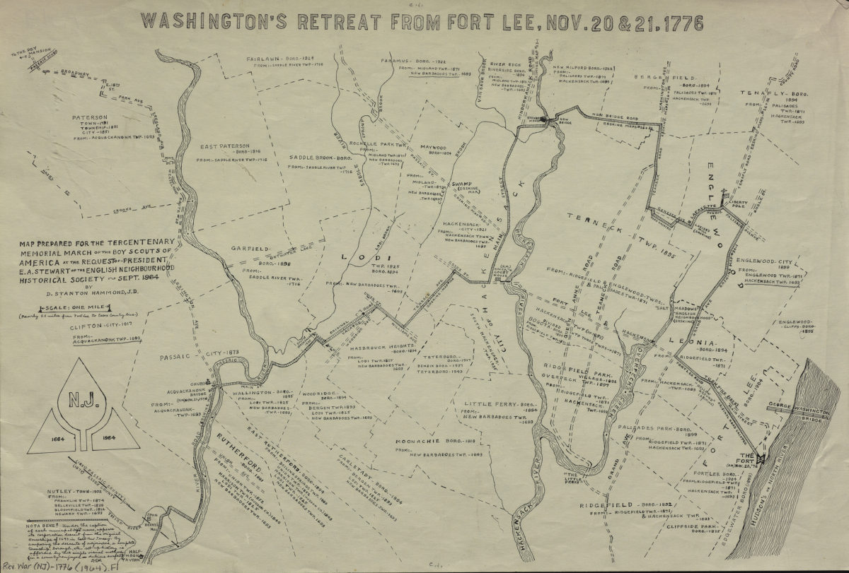
Washington’s retreat from Fort Lee, Nov. 20 & 21, 1776
Washington’s retreat from Fort Lee, Nov. 20 & 21, 1776
[1964]
A sketch of the operations of His Majesty’s fleet and army under the command of Vice Admiral the Rt. Hble Lord Viscount Howe and Gen. Wm. Howe, K.B. in 1776
A sketch of the operations of His Majesty’s fleet and army under the command of Vice Admiral the Rt. Hble Lord Viscount Howe and Gen. Wm. Howe, K.B. in 1776
[ca. 1968]
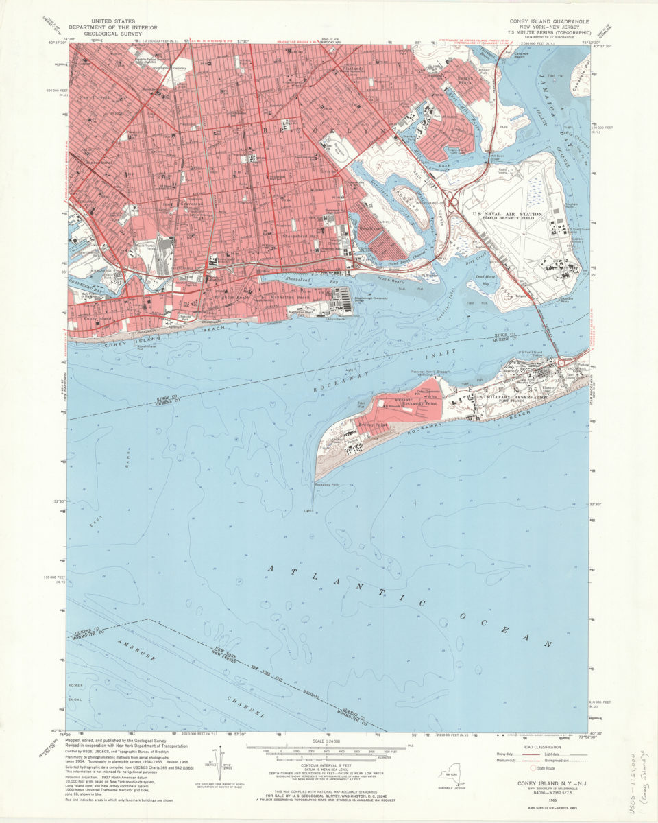
Coney Island quadrangle, New York–New Jersey: 7.5 minute series (topographic): mapped, edited, and published by the Geological Survey ; revised in cooperation with New York Department of Transportation
Coney Island quadrangle, New York–New Jersey: 7.5 minute series (topographic): mapped, edited, and published by the Geological Survey ; revised in cooperation with New York Department of Transportation
1968
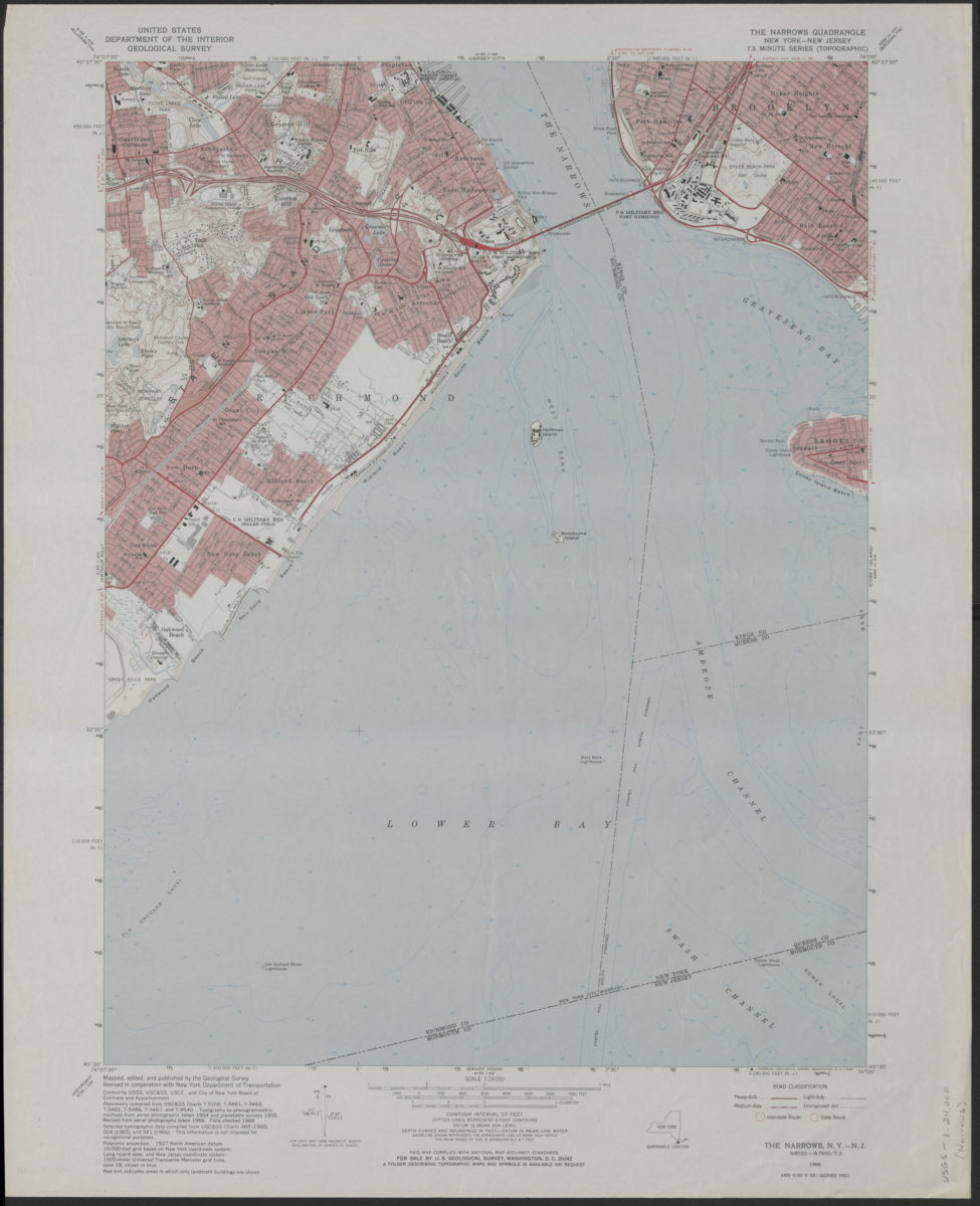
The Narrows quadrangle, New York–New Jersey: 7.5 minute series (topographic): mapped, edited, and published by the Geological Survey ; revised in cooperation with New York Department of Transportation
The Narrows quadrangle, New York–New Jersey: 7.5 minute series (topographic): mapped, edited, and published by the Geological Survey ; revised in cooperation with New York Department of Transportation
1968
Coney Island quadrangle, New York–New Jersey
Coney Island quadrangle, New York–New Jersey
[1969]
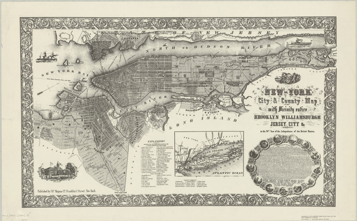
New-York City & County map with vicinity entire: Brooklyn, Williamsburgh, Jersey City &c. in the 79th year of the independence of the United States
New-York City & County map with vicinity entire: Brooklyn, Williamsburgh, Jersey City &c. in the 79th year of the independence of the United States
1974
A plan of the operations of the King’s army under the command of General Sr. William Howe, K.B. in New York and East New Jersey against the American forces commanded by General Washington, from the 12th of October, to the 28th of November 1776
A plan of the operations of the King’s army under the command of General Sr. William Howe, K.B. in New York and East New Jersey against the American forces commanded by General Washington, from the 12th of October, to the 28th of November 1776
[ca. 1976]