Center for Brooklyn History
Map Collections
Search
About
Othmer Library & Archives
Submit search query
Refine 14 records
Clear filters
2
Location
Amityville (N.Y.)
1
Babylon (N.Y. : Town)
2
Babylon (N.Y.)
1
Bay Ridge (New York, N.Y.)
108
Brightwaters (N.Y.)
1
Brooklyn (New York, N.Y.)
891
Fort Hamilton (New York, N.Y.)
31
Gravesend (New York, N.Y.)
25
Islip (N.Y.)
5
Lindenhurst (N.Y.)
1
Long Island (N.Y.)
197
Midwood (New York, N.Y.)
9
Nassau County (N.Y.)
24
New York (N.Y.)
164
New York (State)
95
New York Metropolitan Area
40
Ocean Beach (N.Y.)
1
Queens (New York, N.Y.)
83
Saltaire (N.Y.)
1
Staten Island (N.Y.)
10
Subject
Central business districts
10
Landowners
434
Local transit
63
Postal codes
4
Railroads, Elevated
24
Real property
619
Roads
117
Street addresses
11
Streets
46
Subways
55
Zip codes
4
Date
19th Century
945
20th Century
469
21th Century
66
or enter range:
from
to
Genres
Cadastral maps
597
Manuscript maps
365
Map
191
Road maps
83
Transportation maps
120
Sort by:
Date (earliest)
Date (most recent)
92nd St
92nd St
[18??]
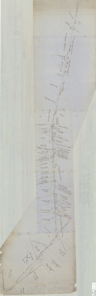
Map of route for a plank road from Coney Island Bridge Road to blacksmith shop, & therein along Wood Road. Patent line d[ivided] to mean: Teunis Bergen
Map of route for a plank road from Coney Island Bridge Road to blacksmith shop, & therein along Wood Road. Patent line d[ivided] to mean: Teunis Bergen
May 1855
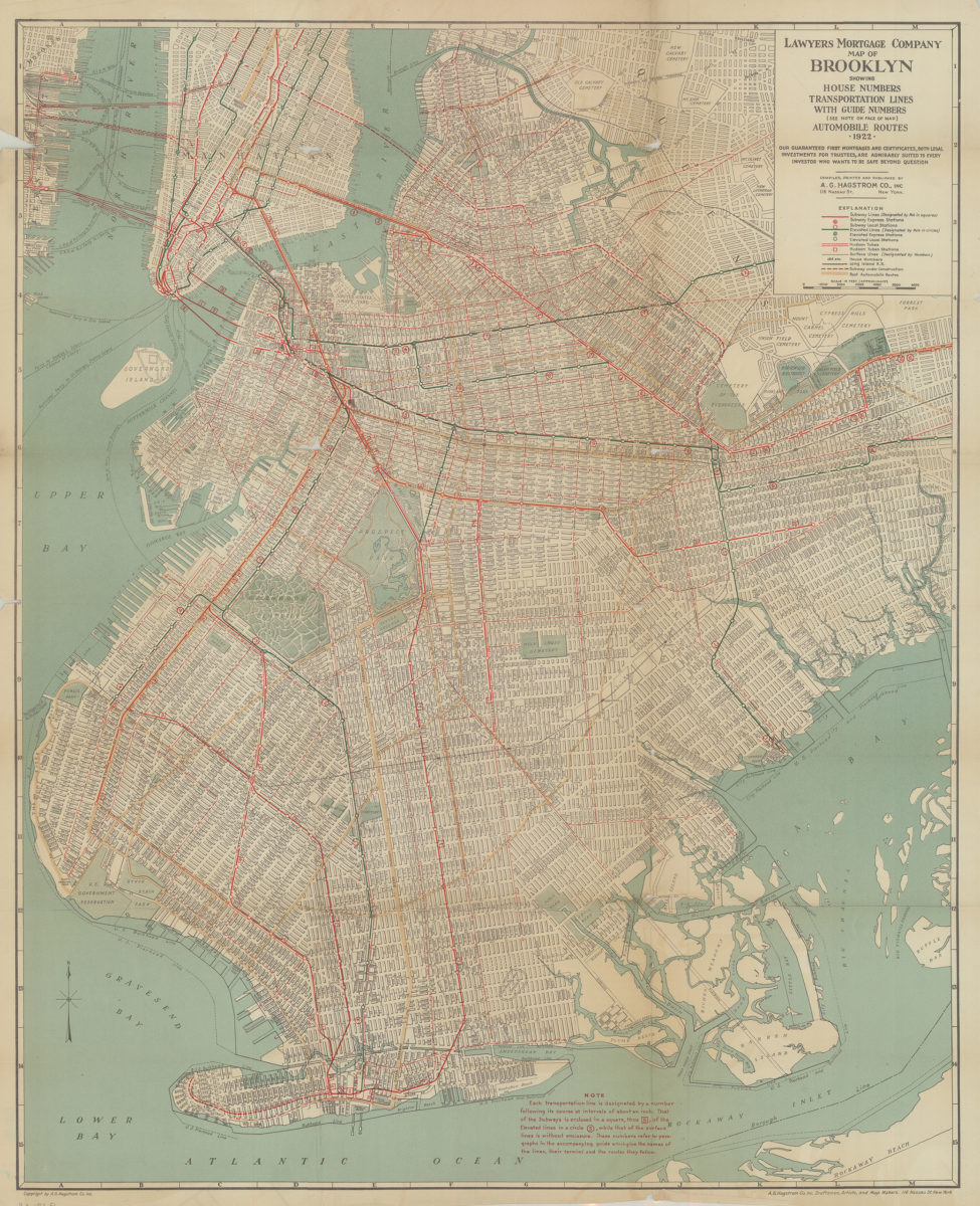
Lawyer’s Mortgage Company map of Brooklyn: showing house-numbers, transportation lines, with guide numbers … automobile routes, 1922: compiled, printed and published A.G. Hagstrom Co., Inc
Lawyer’s Mortgage Company map of Brooklyn: showing house-numbers, transportation lines, with guide numbers … automobile routes, 1922: compiled, printed and published A.G. Hagstrom Co., Inc
1922
Shell street guide and metropolitan map of Brooklyn, Queens and Long Island: the H.M. Gousha Company
Shell street guide and metropolitan map of Brooklyn, Queens and Long Island: the H.M. Gousha Company
[1939]
The complete map of Brooklyn (New York City): featuring house numbers, transit lines, playgrounds, wading pools, etc.: produced under the direction of Alexander Gross
The complete map of Brooklyn (New York City): featuring house numbers, transit lines, playgrounds, wading pools, etc.: produced under the direction of Alexander Gross
[195?]
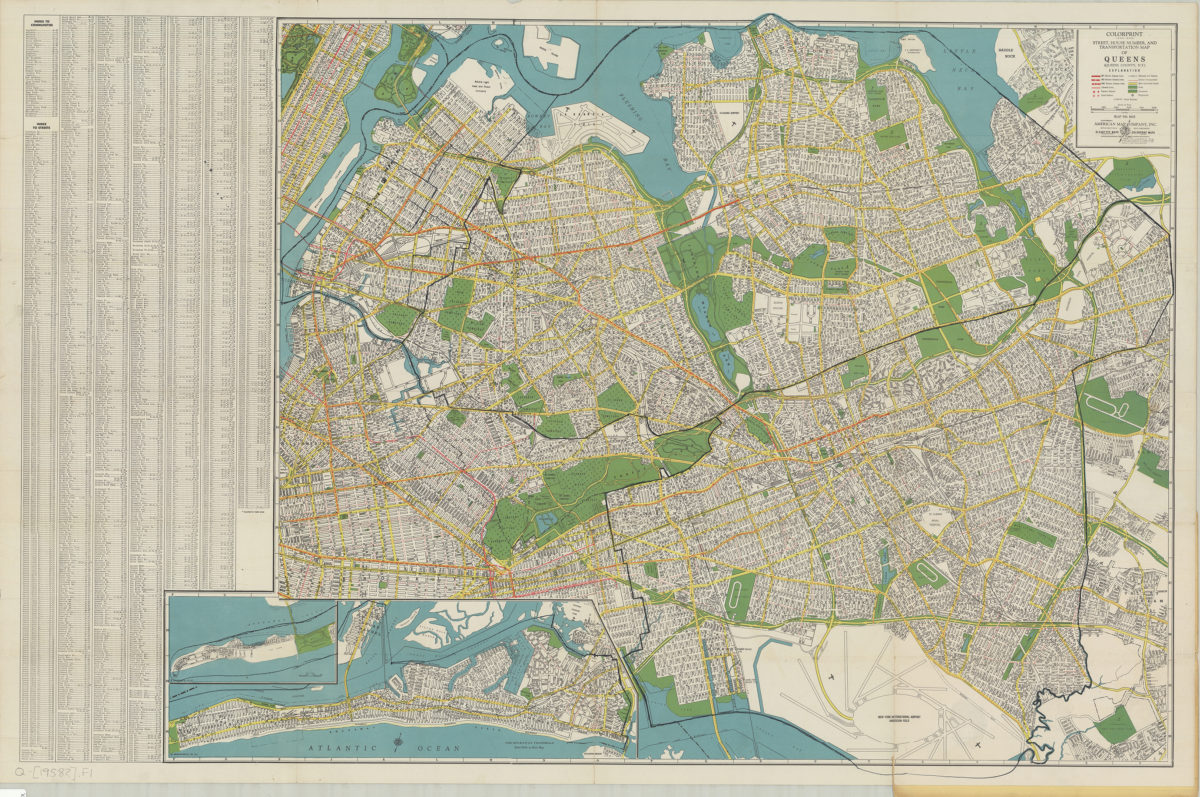
Colorprint street, house number and transportation map of Queens: (Queens County, N.Y.): American Map Company
Colorprint street, house number and transportation map of Queens: (Queens County, N.Y.): American Map Company
[1958]
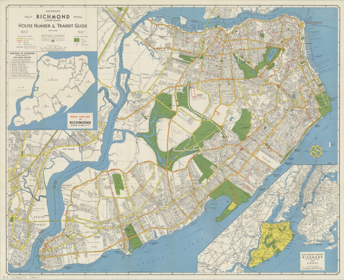
Hagstrom’s map of Richmond (Staten Island), N. Y. City: house number & transit guide: compiled, printed, and published by Hagstrom Company
Hagstrom’s map of Richmond (Staten Island), N. Y. City: house number & transit guide: compiled, printed, and published by Hagstrom Company
[1963]
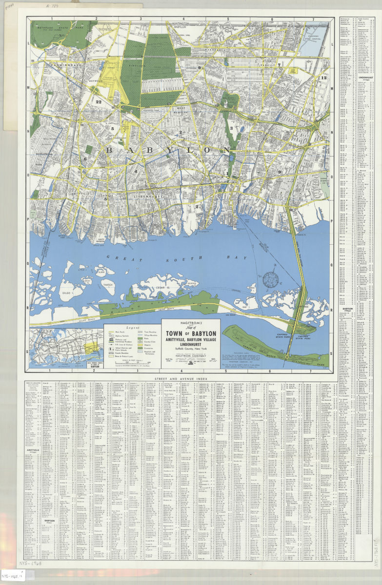
Hagstrom’s street and road map of Town of Babylon: Amityville, Babylon Village, Lindenhurst, Suffolk County, Long Island, N.Y.
Hagstrom’s street and road map of Town of Babylon: Amityville, Babylon Village, Lindenhurst, Suffolk County, Long Island, N.Y.
1968
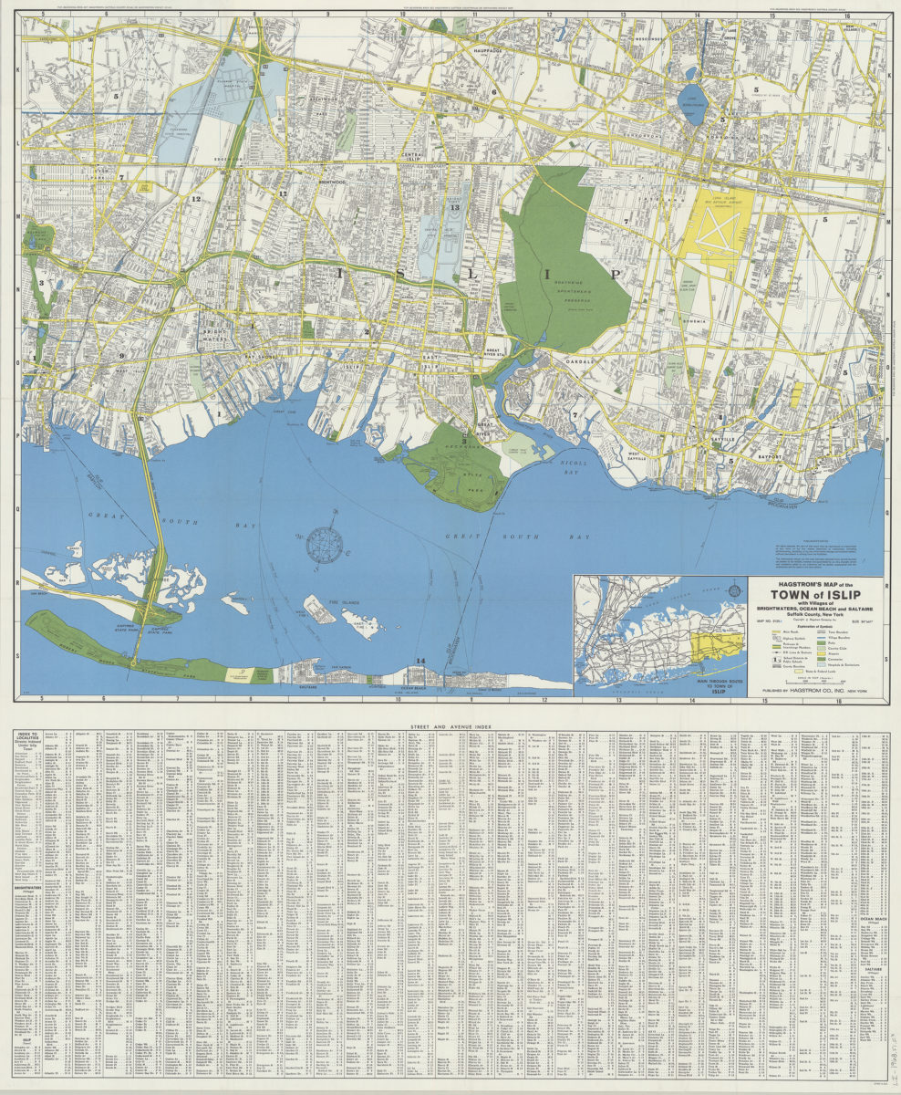
Hagstrom’s map of the Town of Islip: with the villages of Brightwaters, Ocean Beach and Saltaire, Suffolk County, New York
Hagstrom’s map of the Town of Islip: with the villages of Brightwaters, Ocean Beach and Saltaire, Suffolk County, New York
1968
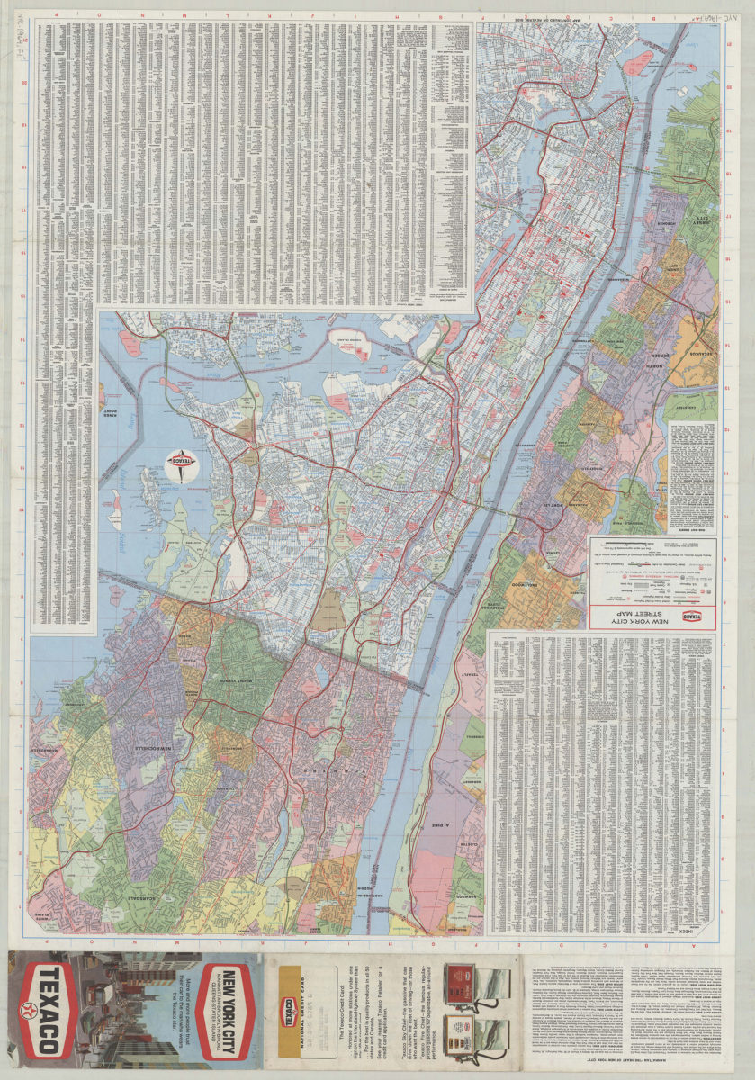
Texaco New York City street map
Texaco New York City street map
[1969; 1969]
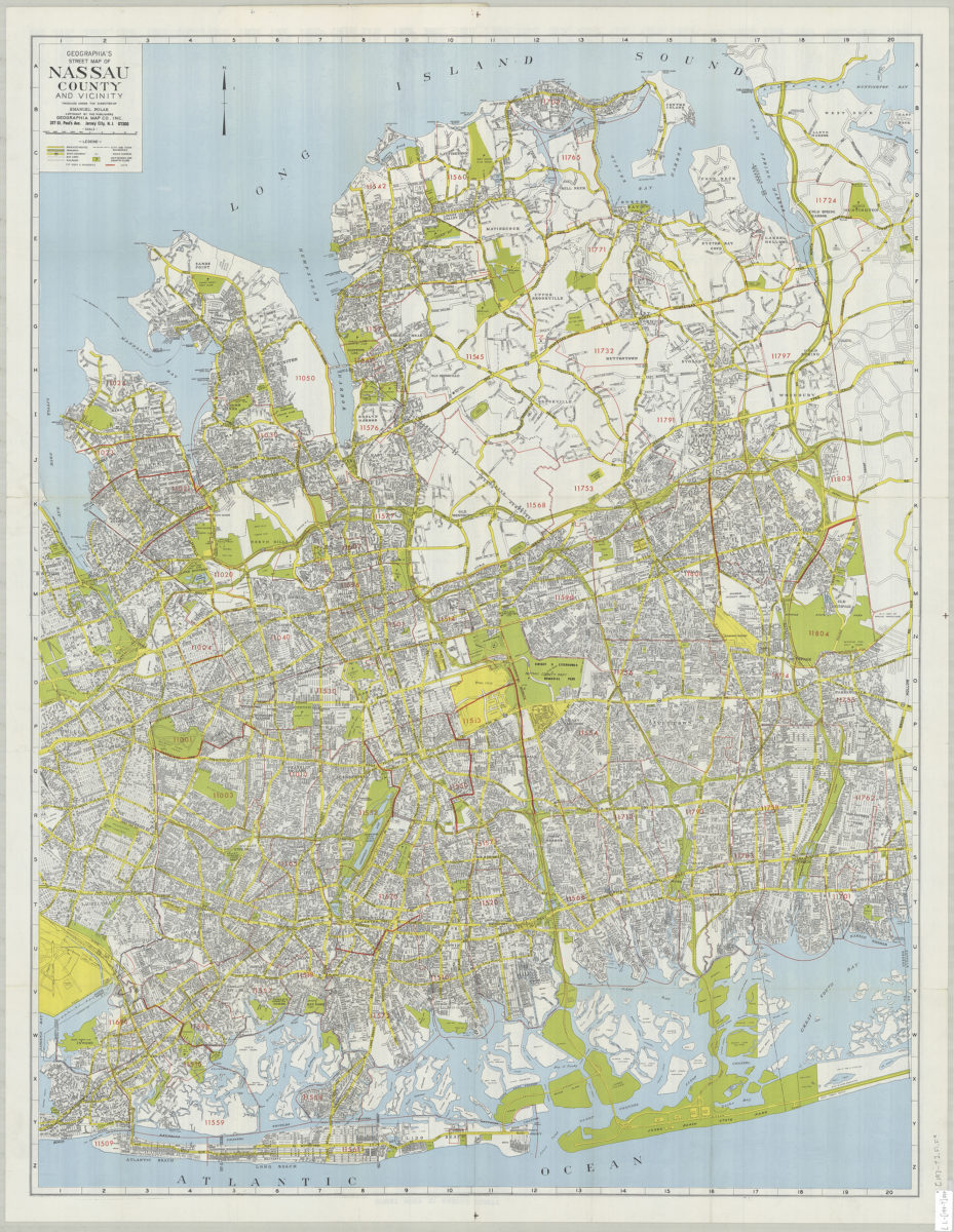
Geographia’s street map of Nassau County and vicinity: produced under the direction of Emanuel Polak
Geographia’s street map of Nassau County and vicinity: produced under the direction of Emanuel Polak
[197?]
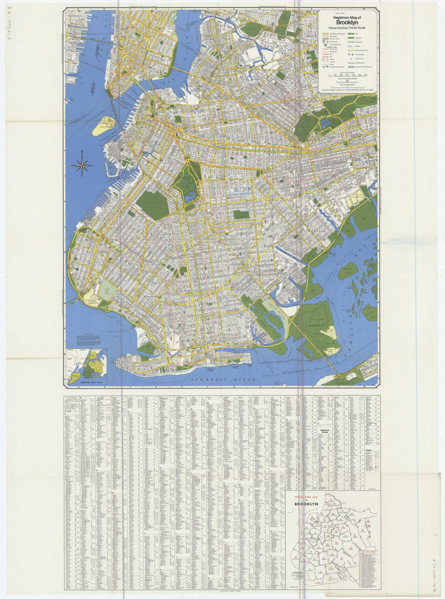
Hagstrom map of Brooklyn: house number, transit guide
Hagstrom map of Brooklyn: house number, transit guide
[1977]
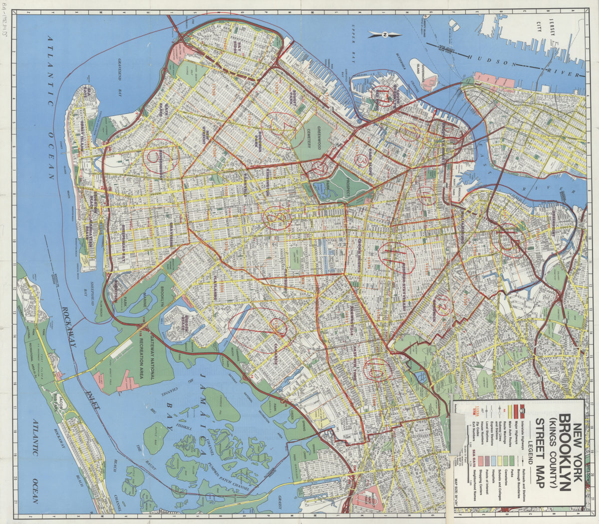
New York, Brooklyn (Kings County), street map: Geographia Map Co., Inc
New York, Brooklyn (Kings County), street map: Geographia Map Co., Inc
[ca. 1982]
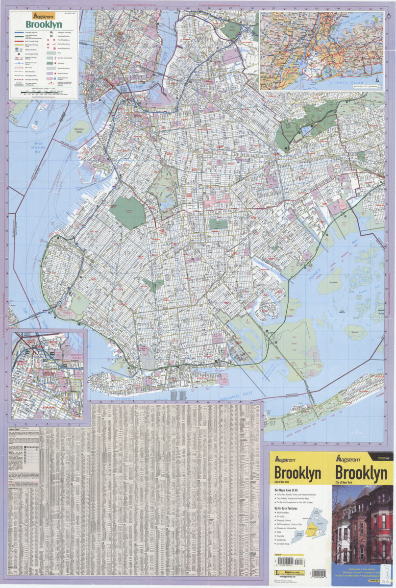
Hagstrom Brooklyn: Hagstrom Map
Hagstrom Brooklyn: Hagstrom Map
[ca. 2009]