Center for Brooklyn History
Map Collections
Search
About
Othmer Library & Archives
Submit search query
Refine 17 records
Clear filters
2
Location
Bath Beach (New York, N.Y.)
8
Bay Ridge (New York, N.Y.)
108
Bensonhurst (New York, N.Y.)
17
Borough Park (New York, N.Y.)
23
Brighton Beach (New York, N.Y.)
4
Brooklyn (New York, N.Y.)
891
Canarsie (New York, N.Y.)
18
Coney Island (New York, N.Y.)
22
Dyker Heights (New York, N.Y.)
23
Fort Hamilton (New York, N.Y.)
31
Gravesend (New York, N.Y.)
25
Lefferts Park (New York, N.Y.)
1
Manhattan Beach (New York, N.Y.)
2
Midwood (New York, N.Y.)
9
New Utrecht (New York, N.Y.)
9
Sea Gate (New York, N.Y.)
7
Sheepshead Bay (New York, N.Y.)
13
Sunset Park (New York, N.Y.)
53
Van Pelt Manor House (Brooklyn, New York, N.Y.)
1
Subject
Election districts
36
Land use
5
Landowners
434
Real property
619
Streets
46
Zoning
2
Date
19th Century
945
20th Century
469
or enter range:
from
to
Genres
Cadastral maps
597
Manuscript maps
365
Pictorial maps
38
Zoning maps
55
Sort by:
Date (earliest)
Date (most recent)
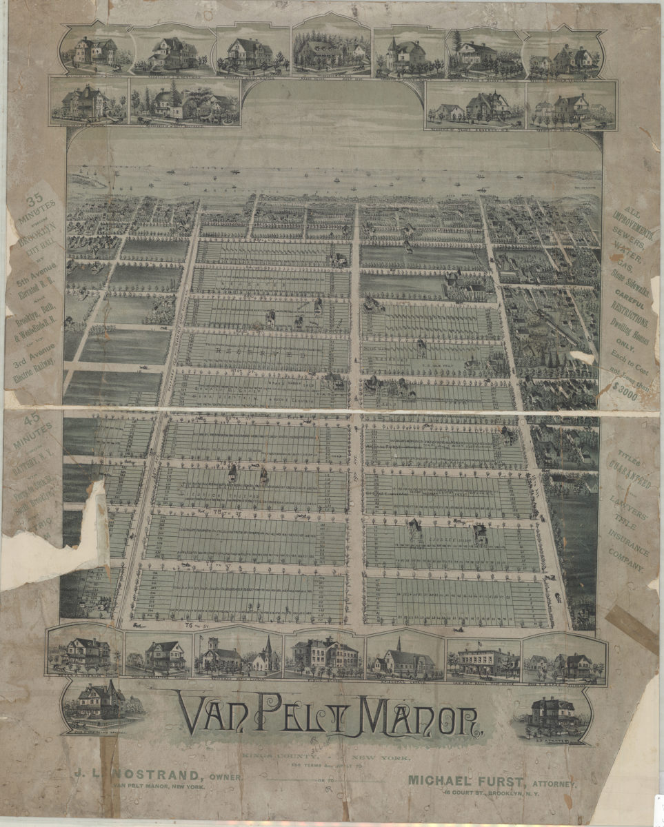
Van Pelt Manor, Kings County, New York
Van Pelt Manor, Kings County, New York
[18??]
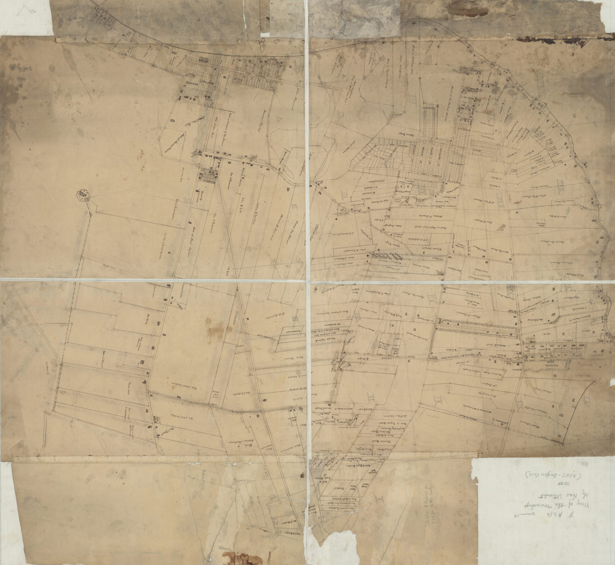
[Map of New Utrecht]
[Map of New Utrecht]
[18??]
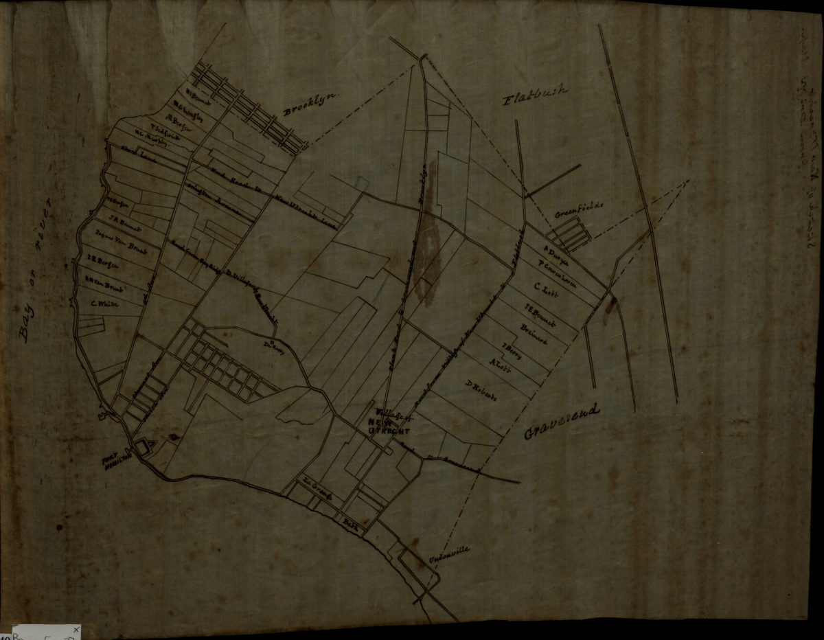
[Map of roads from Gravesend to Flatbush to Flatlands, New Utrecht and Flatbush]
[Map of roads from Gravesend to Flatbush to Flatlands, New Utrecht and Flatbush]
[18??]
Sketch of New Utrecht from Dripps map
Sketch of New Utrecht from Dripps map
[18??]
Opening map and tracing of 22nd Ave
Opening map and tracing of 22nd Ave
[18??]
Map of land sold by John A. Emmans to John Linley situated in the town of New Utrecht, containing 7 [illegible text] acres: as surveyed Oct. 1860 by Teunis G. Bergen
Map of land sold by John A. Emmans to John Linley situated in the town of New Utrecht, containing 7 [illegible text] acres: as surveyed Oct. 1860 by Teunis G. Bergen
1860
Farm & woodland of Robt. B. Lefferts
Farm & woodland of Robt. B. Lefferts
[1862]
Map of land of John James Voorhees situated in the town of New Utrecht and County of Kings: as surveyed and divided into lots by T.G. Bergen
Map of land of John James Voorhees situated in the town of New Utrecht and County of Kings: as surveyed and divided into lots by T.G. Bergen
Sept 1876
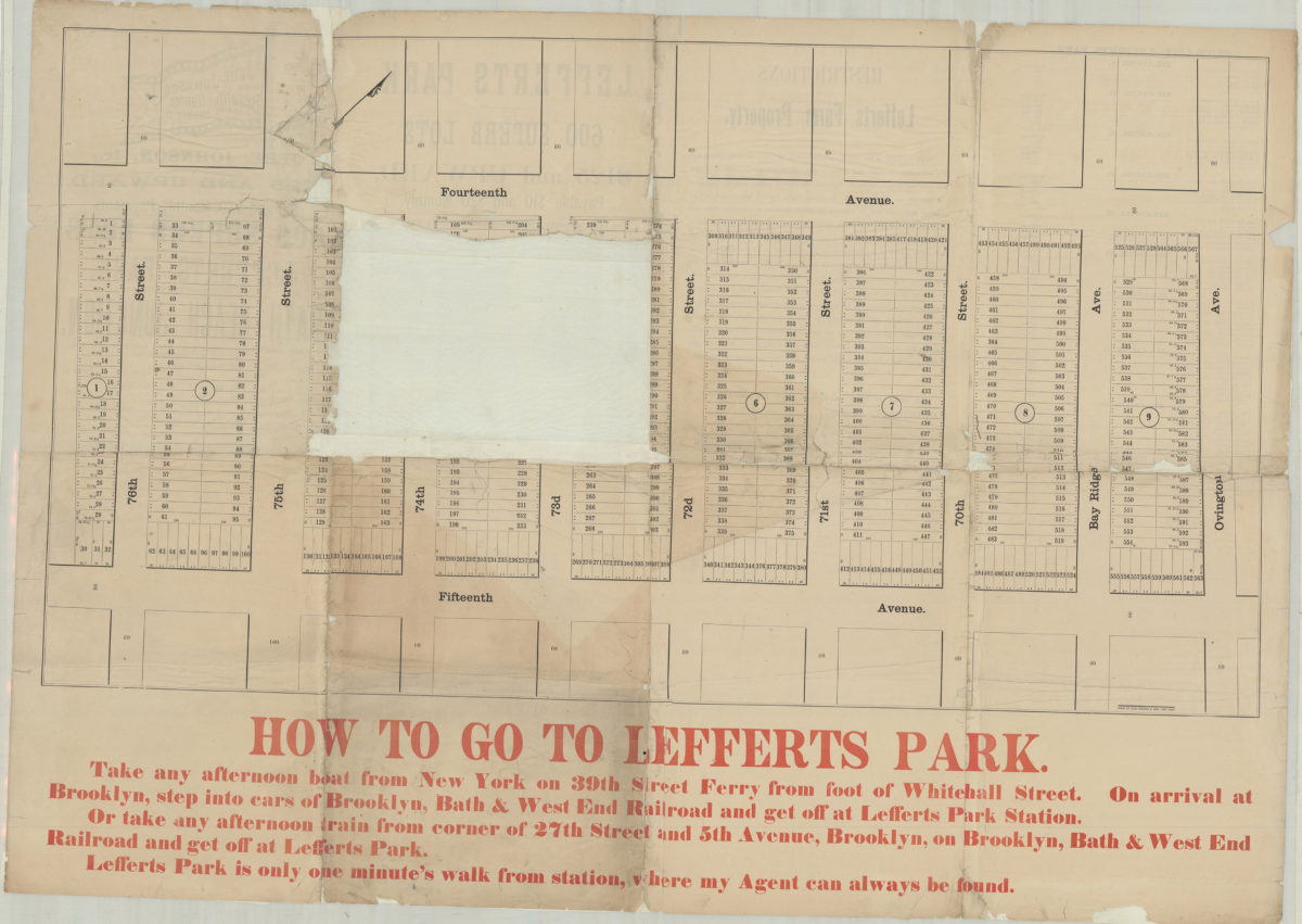
Jere. Johnson, Jr., offers at private sale … 600 superb lots in Lefferts Park, the fourth grand subdivision of Bath Beach Junction, where during the past three years 3,500 lots have been sold and 300 buildings erected
Jere. Johnson, Jr., offers at private sale … 600 superb lots in Lefferts Park, the fourth grand subdivision of Bath Beach Junction, where during the past three years 3,500 lots have been sold and 300 buildings erected
[188?]
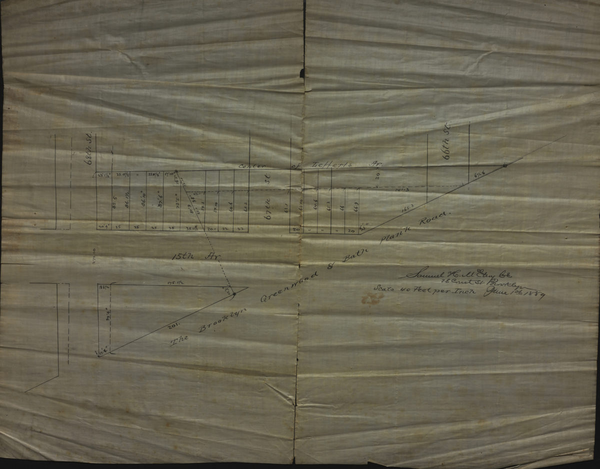
[Map of 15th Ave. between 68th St. and 66th St.]: Samuel H. McElroy
[Map of 15th Ave. between 68th St. and 66th St.]: Samuel H. McElroy
June 1, 1889
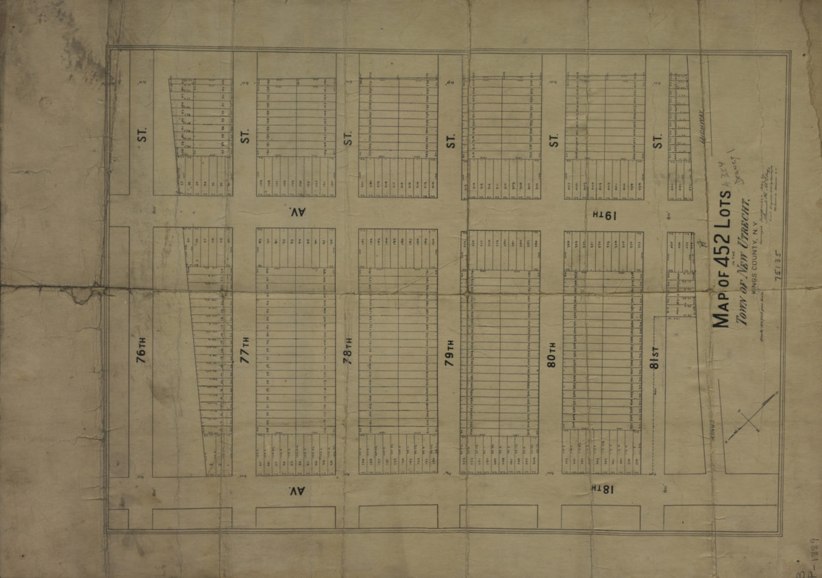
Map of 452 lots in the town of New Utrecht, Kings County, N.Y.: surveyed September 1889 by Samuel H. McElroy, civil engineer & city surveyor
Map of 452 lots in the town of New Utrecht, Kings County, N.Y.: surveyed September 1889 by Samuel H. McElroy, civil engineer & city surveyor
[1889]
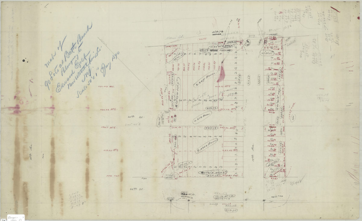
Map of 90 lots at Bath Beach belonging to Edward Egolf, New Utrecht, Kings Co., N.Y.
Map of 90 lots at Bath Beach belonging to Edward Egolf, New Utrecht, Kings Co., N.Y.
January 1890
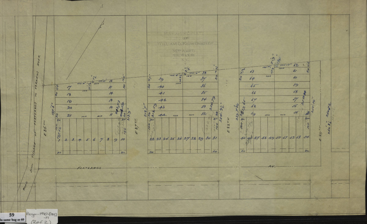
[Maps of land of John Cowenhoven, formerly of Garret Cowenhoven, and of William G. Kouwenhoven]
[Maps of land of John Cowenhoven, formerly of Garret Cowenhoven, and of William G. Kouwenhoven]
1890-[1892]
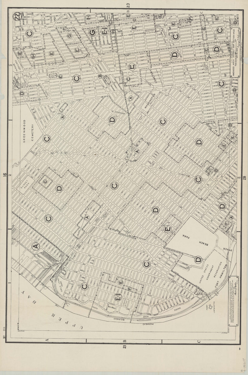
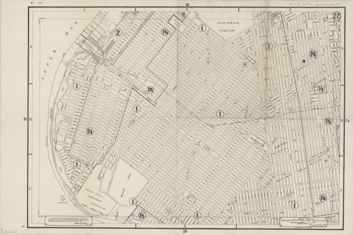
Amended use district map, section no. 22: City of New York, City Planning Commission, Irving F. Ashworth, senior civil engineer
Amended use district map, section no. 22: City of New York, City Planning Commission, Irving F. Ashworth, senior civil engineer
1953
Amended use district map, section no. 22: City of New York, City Planning Commission, Irving F. Ashworth, senior civil engineer
Amended use district map, section no. 22: City of New York, City Planning Commission, Irving F. Ashworth, senior civil engineer
1953
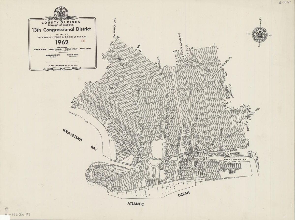
County of Kings, Borough of Brooklyn, 13th Congressional District: issued by the Board of Elections in the City of New York
County of Kings, Borough of Brooklyn, 13th Congressional District: issued by the Board of Elections in the City of New York
1962
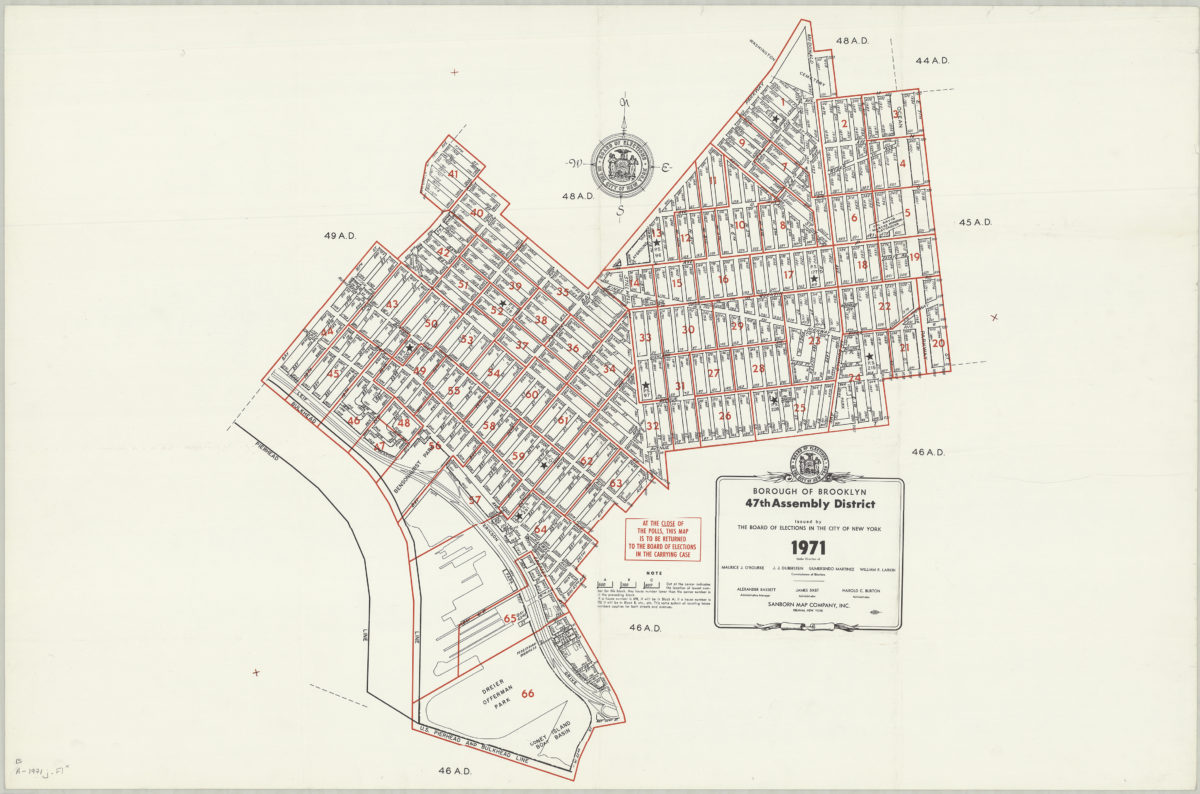
Borough of Brooklyn 47th Assembly District, 1971: issued by the Board of Elections in the City of New York
Borough of Brooklyn 47th Assembly District, 1971: issued by the Board of Elections in the City of New York
1971