Center for Brooklyn History
Map Collections
Search
About
Othmer Library & Archives
Submit search query
Refine 14 records
Clear filters
2
Location
Brooklyn (New York, N.Y.)
891
Hudson County (N.J.)
3
Manhattan (New York, N.Y.)
120
New York (N.Y.)
164
New York Metropolitan Area
40
Subject
Electric railroads
5
Landowners
434
Local transit
63
Piers
25
Postal codes
4
Railroads
72
Railroads, Elevated
24
Real property
619
Roads
117
Street addresses
11
Street railroads
8
Streets
46
Subways
55
Date
19th Century
945
20th Century
469
or enter range:
from
to
Genres
Bathymetric maps
94
Map
191
Road maps
83
Tourist maps
55
Transportation maps
120
Zoning maps
55
Sort by:
Date (earliest)
Date (most recent)
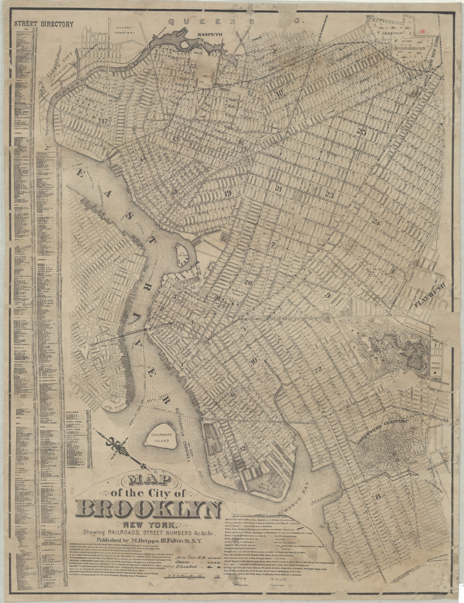
Map of the city of Brooklyn, New York: showing railroads, street numbers &c.&c.&c
Map of the city of Brooklyn, New York: showing railroads, street numbers &c.&c.&c
[18??]
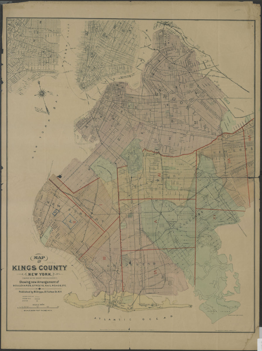
Map of Kings County New York (based on the recent official survey): showing new arrangement of boulevards, streets, railroads, etc
Map of Kings County New York (based on the recent official survey): showing new arrangement of boulevards, streets, railroads, etc
[1879]
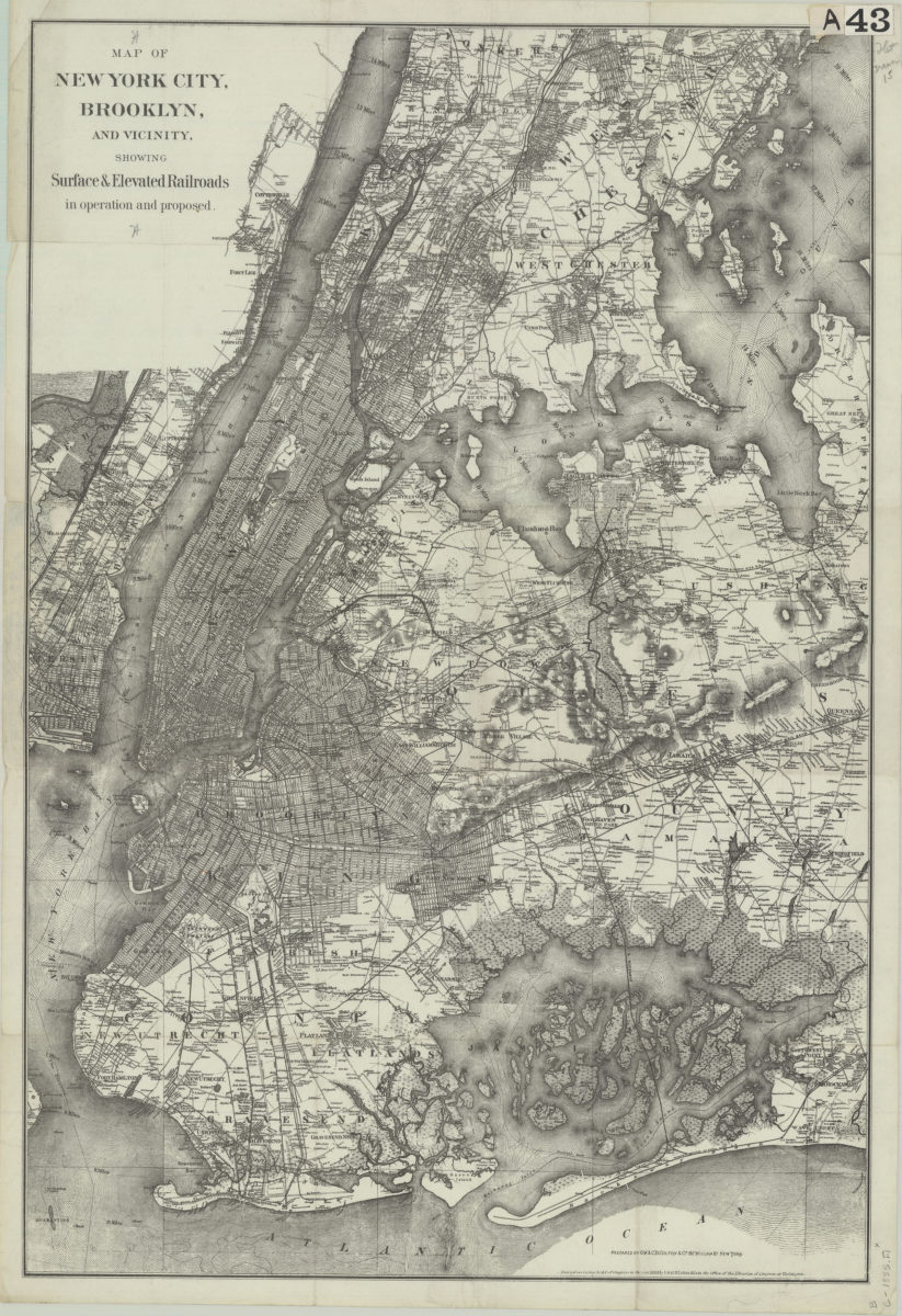
Map of New York City, Brooklyn, and vicinity: showing surface & elevated railroads in operation and proposed
Map of New York City, Brooklyn, and vicinity: showing surface & elevated railroads in operation and proposed
[ca. 1885]
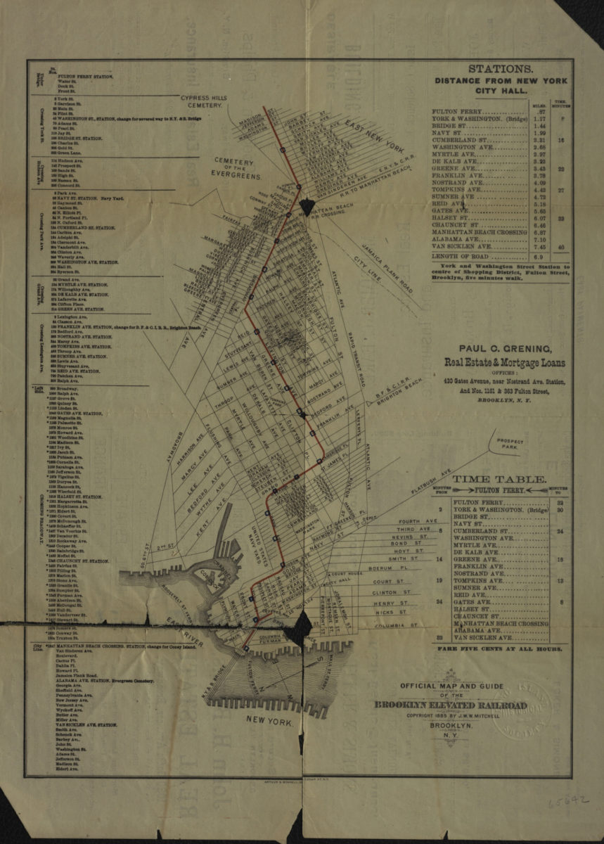
Official map and guide of the Brooklyn Elevated Railroad
Official map and guide of the Brooklyn Elevated Railroad
[ca. 1885]
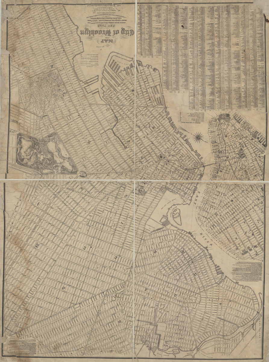
Map of the city of Brooklyn, New York: showing house numbers, churches & public schools, horse-car routes, steam & elevated railroads, police & fire stations, & exit from sewers, and a complete street directory, showing width & location of streets &c
Map of the city of Brooklyn, New York: showing house numbers, churches & public schools, horse-car routes, steam & elevated railroads, police & fire stations, & exit from sewers, and a complete street directory, showing width & location of streets &c
[1886]
Colton’s new indexed map of the city of Brooklyn
1891
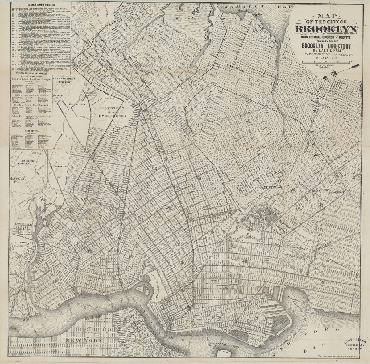
Map of the city of Brooklyn: from official records and surveys
Map of the city of Brooklyn: from official records and surveys
1893
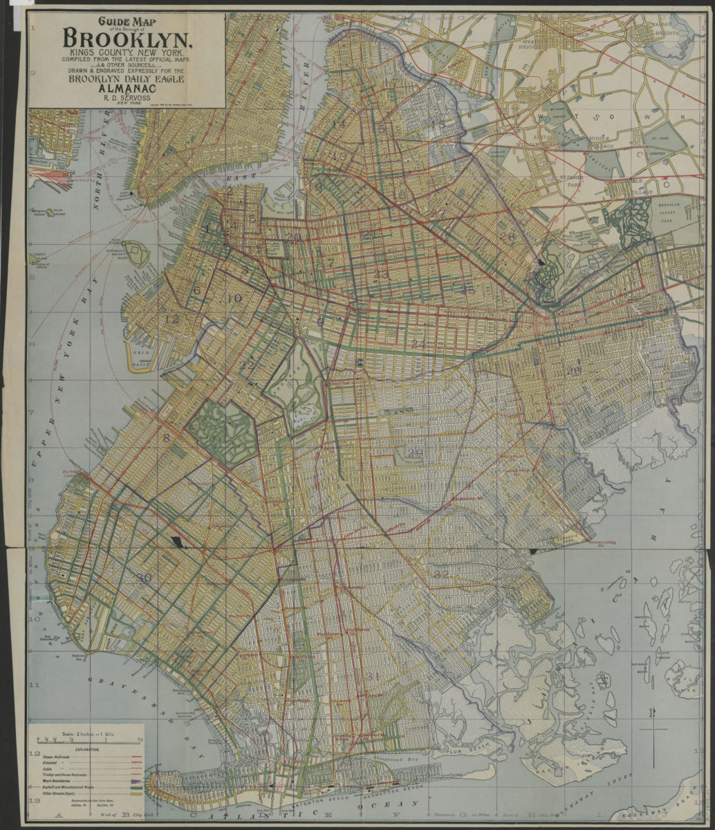
Guide map of the Borough of Brooklyn, Kings County, New York: compiled from the latest official maps & other sources, drawn & engraved expressly for the Brooklyn Daily Eagle Almanac
Guide map of the Borough of Brooklyn, Kings County, New York: compiled from the latest official maps & other sources, drawn & engraved expressly for the Brooklyn Daily Eagle Almanac
[ca. 1898]
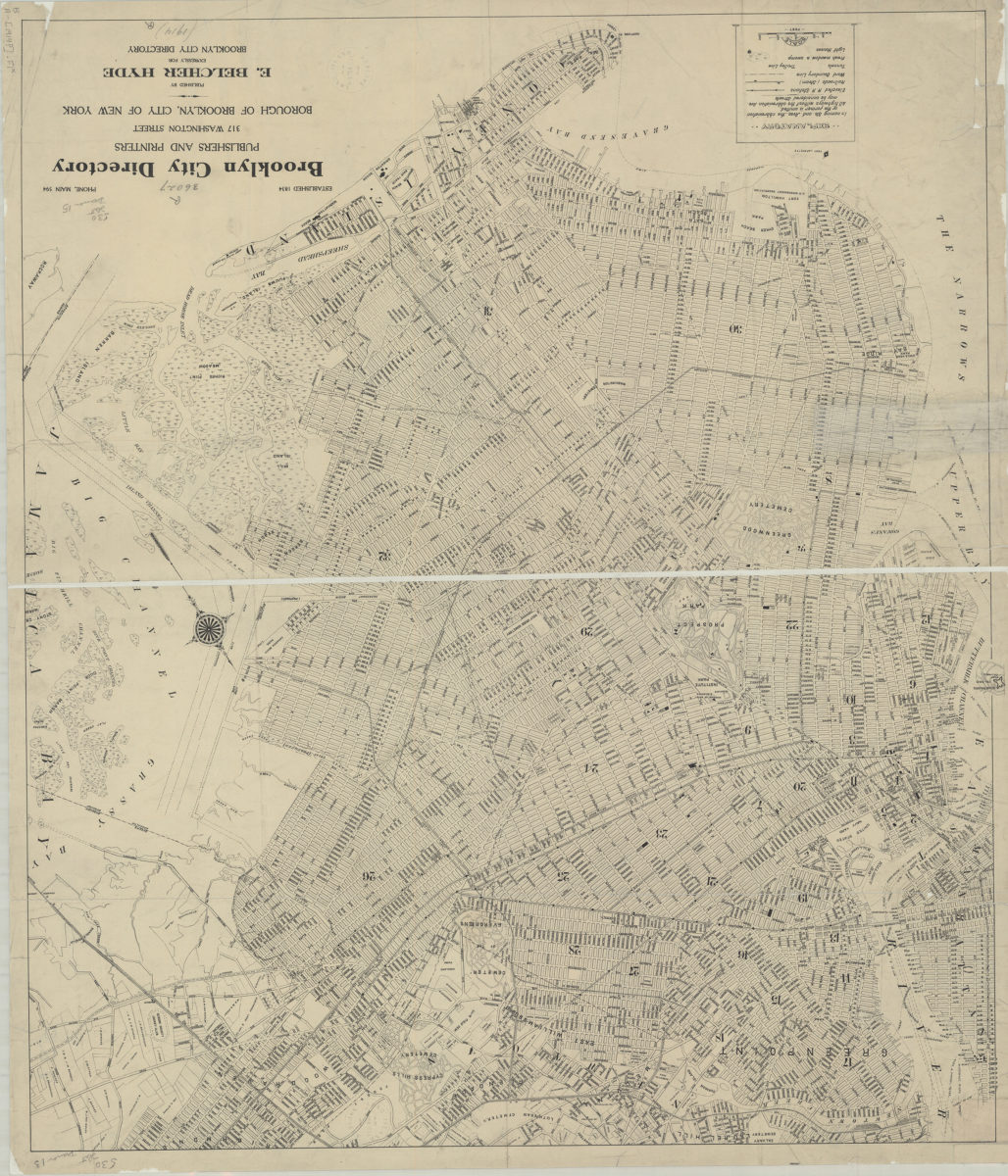
[Map of Brooklyn, circa 1914, from Brooklyn City Directory]
[Map of Brooklyn, circa 1914, from Brooklyn City Directory]
[1914]
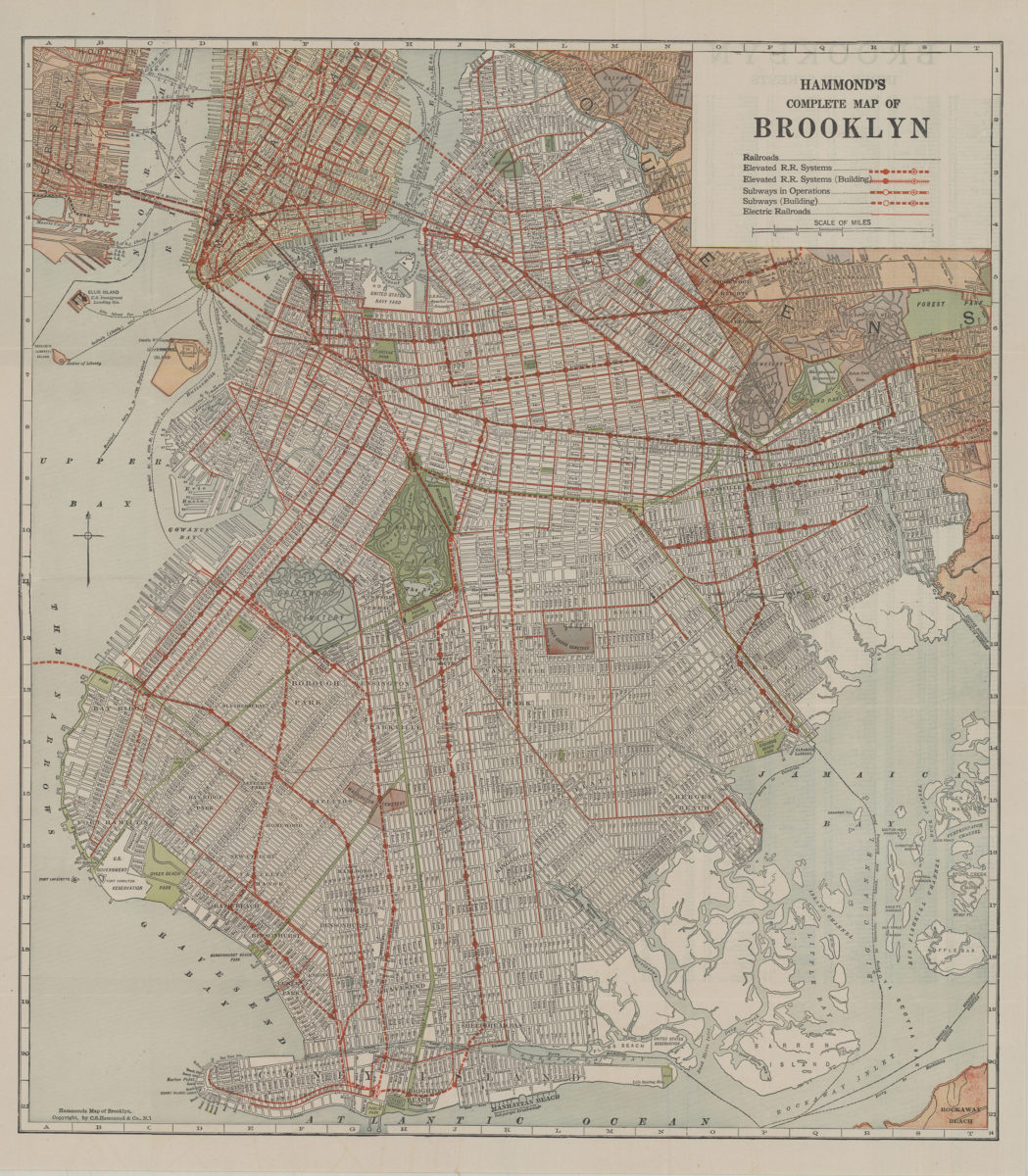
Hammond’s complete map of Brooklyn: copyright by C.S. Hammond Co
Hammond’s complete map of Brooklyn: copyright by C.S. Hammond Co
[192?]
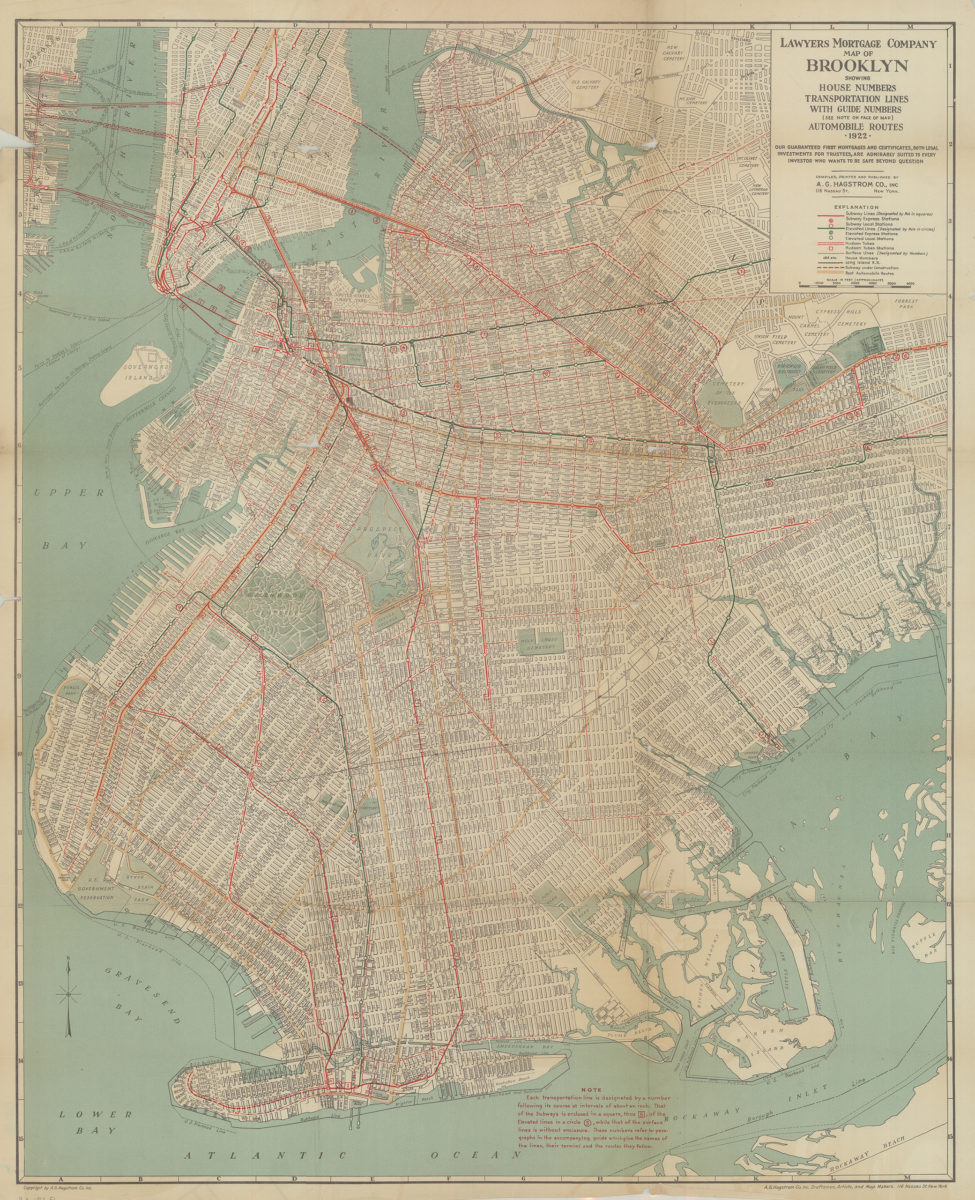
Lawyer’s Mortgage Company map of Brooklyn: showing house-numbers, transportation lines, with guide numbers … automobile routes, 1922: compiled, printed and published A.G. Hagstrom Co., Inc
Lawyer’s Mortgage Company map of Brooklyn: showing house-numbers, transportation lines, with guide numbers … automobile routes, 1922: compiled, printed and published A.G. Hagstrom Co., Inc
1922
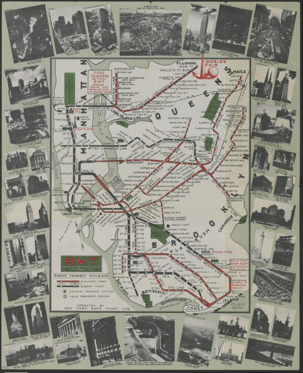
BMT Lines Rapid Transit Division
BMT Lines Rapid Transit Division
[1939]
Hagstrom’s map of Brooklyn, New York City: house number and transit guide: compiled, printed, and published by Hagstrom Company Incorporated
Hagstrom’s map of Brooklyn, New York City: house number and transit guide: compiled, printed, and published by Hagstrom Company Incorporated
[1950; 1947]
The complete map of Brooklyn (New York City): featuring house numbers, transit lines, playgrounds, wading pools, etc.: produced under the direction of Alexander Gross
The complete map of Brooklyn (New York City): featuring house numbers, transit lines, playgrounds, wading pools, etc.: produced under the direction of Alexander Gross
[195?]