Center for Brooklyn History
Map Collections
Search
About
Othmer Library & Archives
Submit search query
Refine 25 records
Clear filters
2
Location
Amityville (N.Y.)
1
Babylon (N.Y. : Town)
2
Babylon (N.Y.)
1
Boerum Hill (New York, N.Y.)
6
Brightwaters (N.Y.)
1
Brooklyn (New York, N.Y.)
891
Brooklyn Heights (New York, N.Y.)
76
Carroll Gardens (New York, N.Y.)
21
Cobble Hill (New York, N.Y.)
7
Downtown Brooklyn (New York, N.Y.)
29
Islip (N.Y.)
5
Lindenhurst (N.Y.)
1
Lloyd Harbor (N.Y.)
1
Long Island (N.Y.)
197
Midwood (New York, N.Y.)
9
Nassau County (N.Y.)
24
New York (N.Y.)
164
New York (State)
95
New York Metropolitan Area
40
Ocean Beach (N.Y.)
1
Patchogue (N.Y.)
2
Queens (New York, N.Y.)
83
Saint Albans (New York, N.Y.)
1
Saltaire (N.Y.)
1
Staten Island (N.Y.)
10
Show 5 more
Subject
Electric railroads
5
Historic sites
3
Local transit
63
Parks
35
Parkways
1
Pavements
3
Postal codes
4
Railroads
72
Railroads, Elevated
24
Roads
117
Street addresses
11
Street railroads
8
Streets
46
Subways
55
Zip codes
4
Date
20th Century
469
or enter range:
from
to
Genres
Cadastral maps
597
Map
191
Road maps
83
Thematic maps
60
Topographic maps
70
Tourist maps
55
Transportation maps
120
Sort by:
Date (earliest)
Date (most recent)
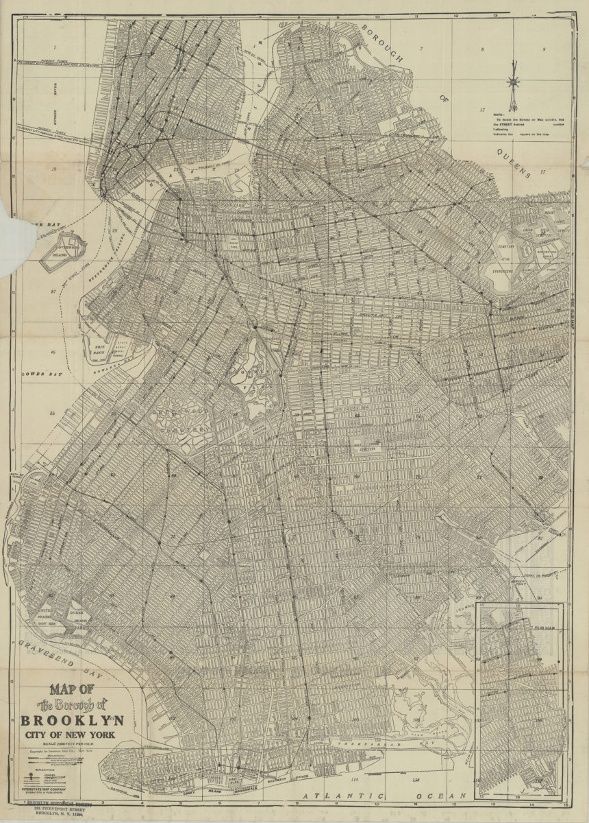
Map of the Borough of Brooklyn, City of New York
Map of the Borough of Brooklyn, City of New York
[19??]
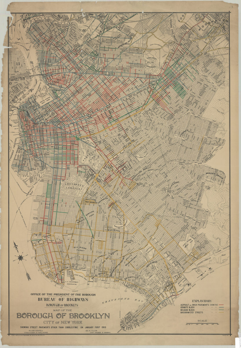
Map of the Borough of Brooklyn, City of New York, showing street pavements other than cobblestone on January first 1903
Map of the Borough of Brooklyn, City of New York, showing street pavements other than cobblestone on January first 1903
1903
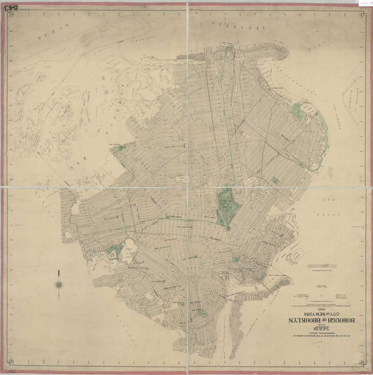
Map of the Borough of Brooklyn, City of New York, 1909: Office of the President of the Borough of Brooklyn, Topographical Bureau
Map of the Borough of Brooklyn, City of New York, 1909: Office of the President of the Borough of Brooklyn, Topographical Bureau
Oct-09
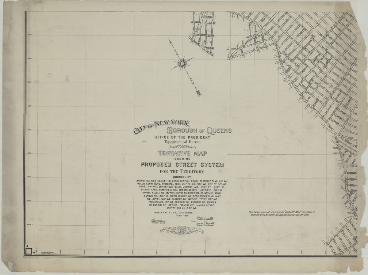
Tentative map showing proposed street system for the territory bounded by Radnor Rd., Avon Rd., Kent Rd. … Jamaica Avenue, 190th St. and Hillside Ave.: City of New York, Borough of Queens, Office of the President, Topographical Bureau
Tentative map showing proposed street system for the territory bounded by Radnor Rd., Avon Rd., Kent Rd. … Jamaica Avenue, 190th St. and Hillside Ave.: City of New York, Borough of Queens, Office of the President, Topographical Bureau
1913
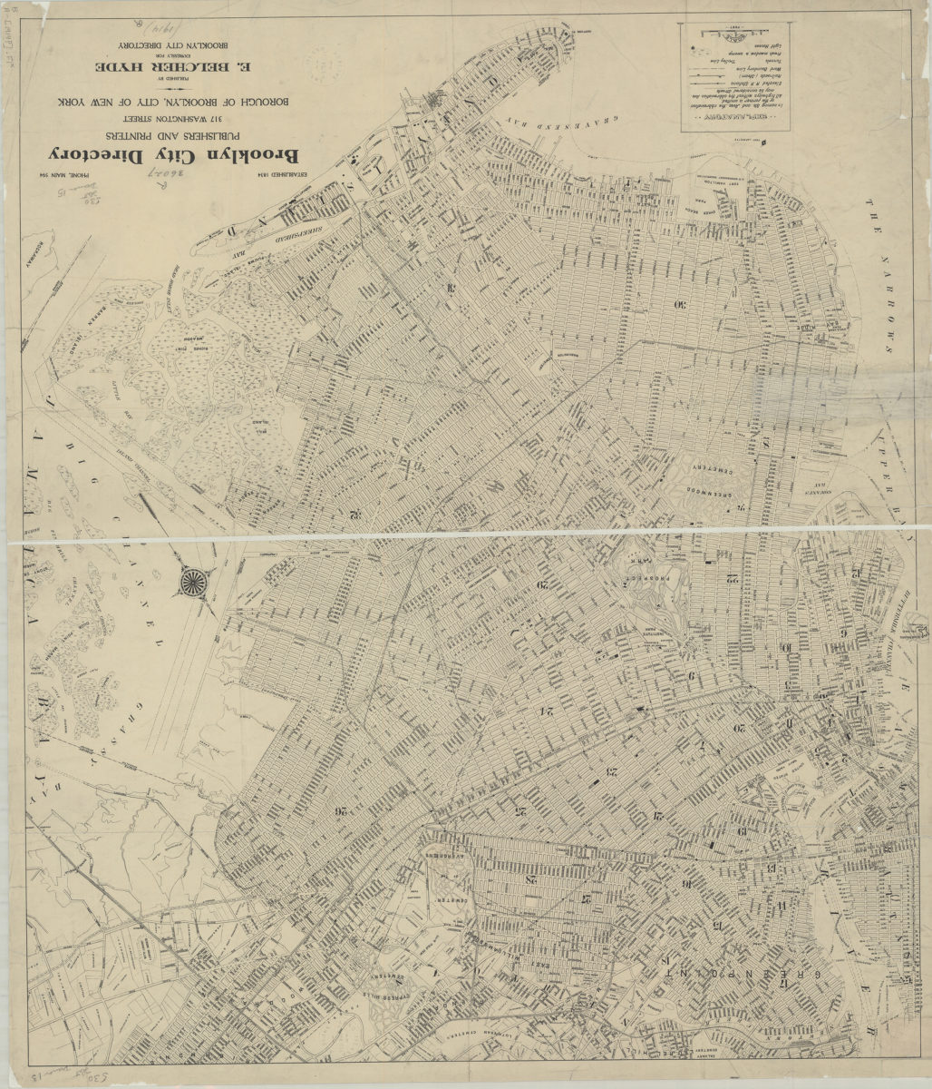
[Map of Brooklyn, circa 1914, from Brooklyn City Directory]
[Map of Brooklyn, circa 1914, from Brooklyn City Directory]
[1914]
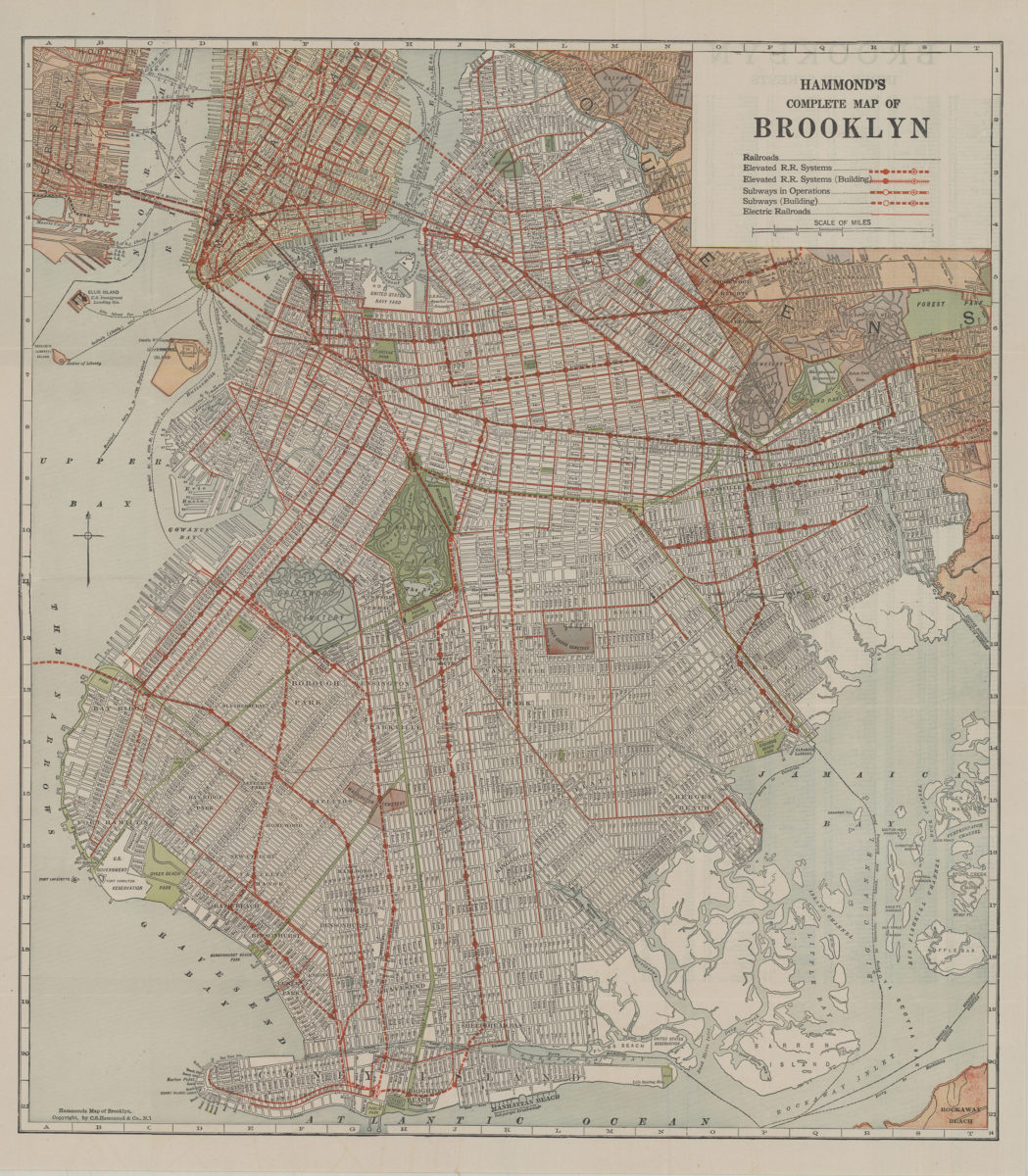
Hammond’s complete map of Brooklyn: copyright by C.S. Hammond Co
Hammond’s complete map of Brooklyn: copyright by C.S. Hammond Co
[192?]
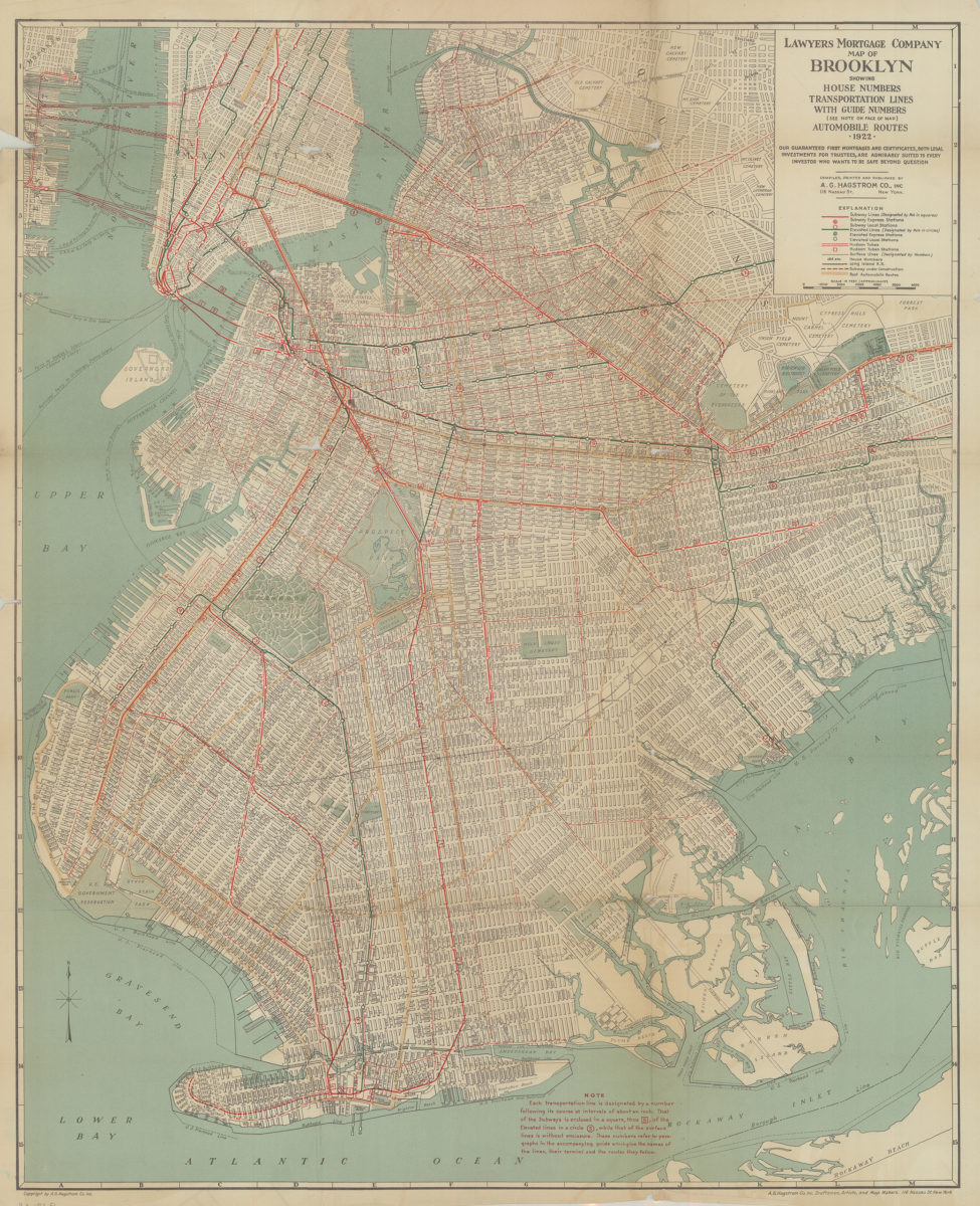
Lawyer’s Mortgage Company map of Brooklyn: showing house-numbers, transportation lines, with guide numbers … automobile routes, 1922: compiled, printed and published A.G. Hagstrom Co., Inc
Lawyer’s Mortgage Company map of Brooklyn: showing house-numbers, transportation lines, with guide numbers … automobile routes, 1922: compiled, printed and published A.G. Hagstrom Co., Inc
1922
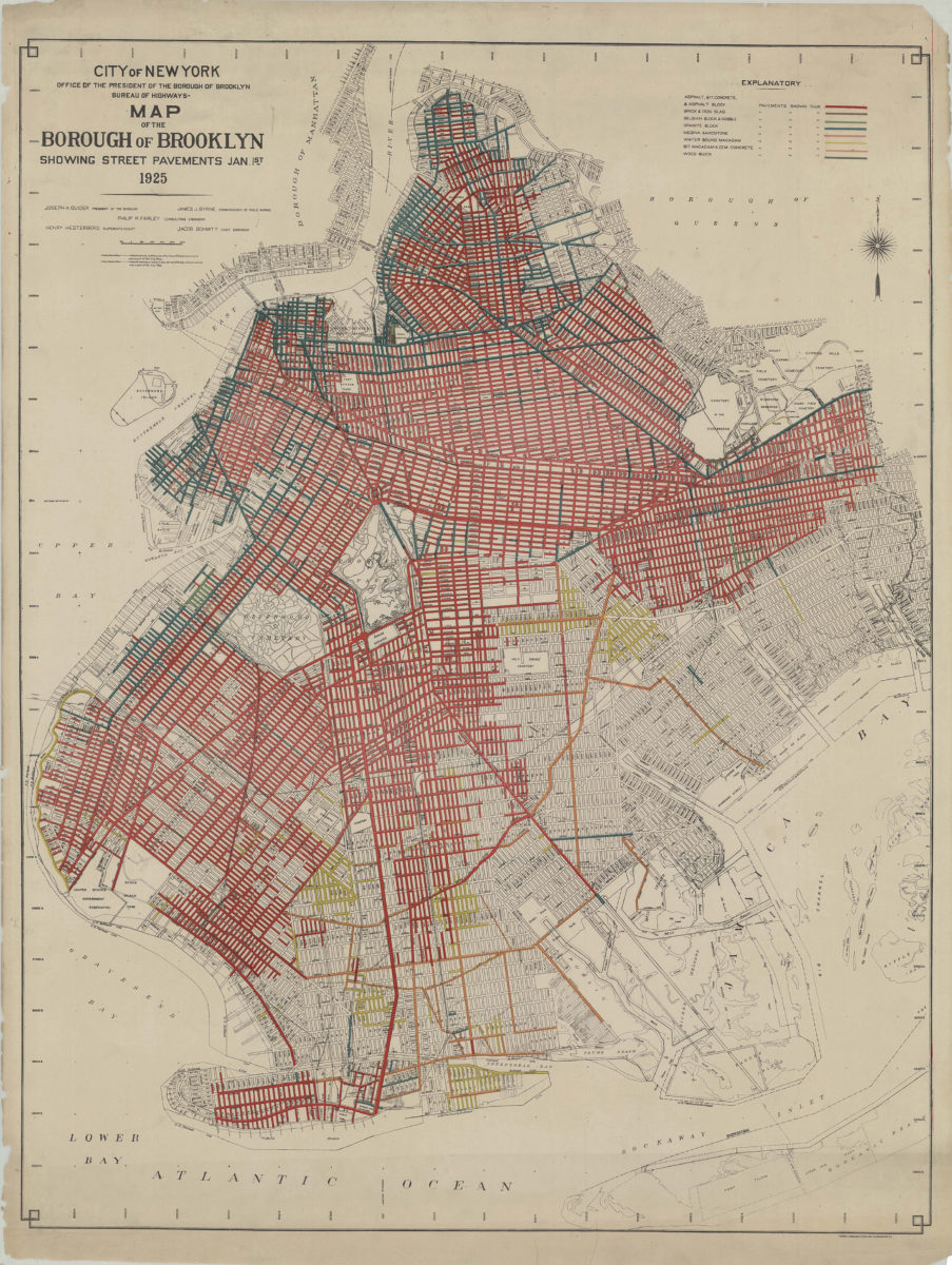
Map of the Borough of Brooklyn showing street pavements Jan. 1st, 1925
Map of the Borough of Brooklyn showing street pavements Jan. 1st, 1925
1925
Shell street guide and metropolitan map of Brooklyn, Queens and Long Island: the H.M. Gousha Company
Shell street guide and metropolitan map of Brooklyn, Queens and Long Island: the H.M. Gousha Company
[1939]
The complete map of Brooklyn (New York City): featuring house numbers, transit lines, playgrounds, wading pools, etc.: produced under the direction of Alexander Gross
The complete map of Brooklyn (New York City): featuring house numbers, transit lines, playgrounds, wading pools, etc.: produced under the direction of Alexander Gross
[195?]
Hagstrom’s map of Brooklyn, New York City: house number and transit guide: compiled, printed, and published by Hagstrom Company Incorporated
Hagstrom’s map of Brooklyn, New York City: house number and transit guide: compiled, printed, and published by Hagstrom Company Incorporated
[1950; 1947]
[Map of village of Patchogue]
[Map of village of Patchogue]
[195?]
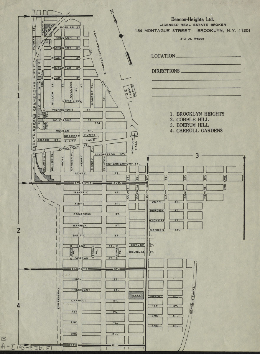
Brooklyn Heights, Cobble Hill, Boerum Hill, Carroll Gardens
Brooklyn Heights, Cobble Hill, Boerum Hill, Carroll Gardens
[195?]
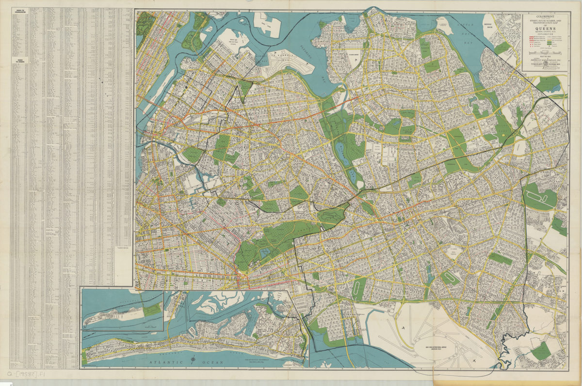
Colorprint street, house number and transportation map of Queens: (Queens County, N.Y.): American Map Company
Colorprint street, house number and transportation map of Queens: (Queens County, N.Y.): American Map Company
[1958]
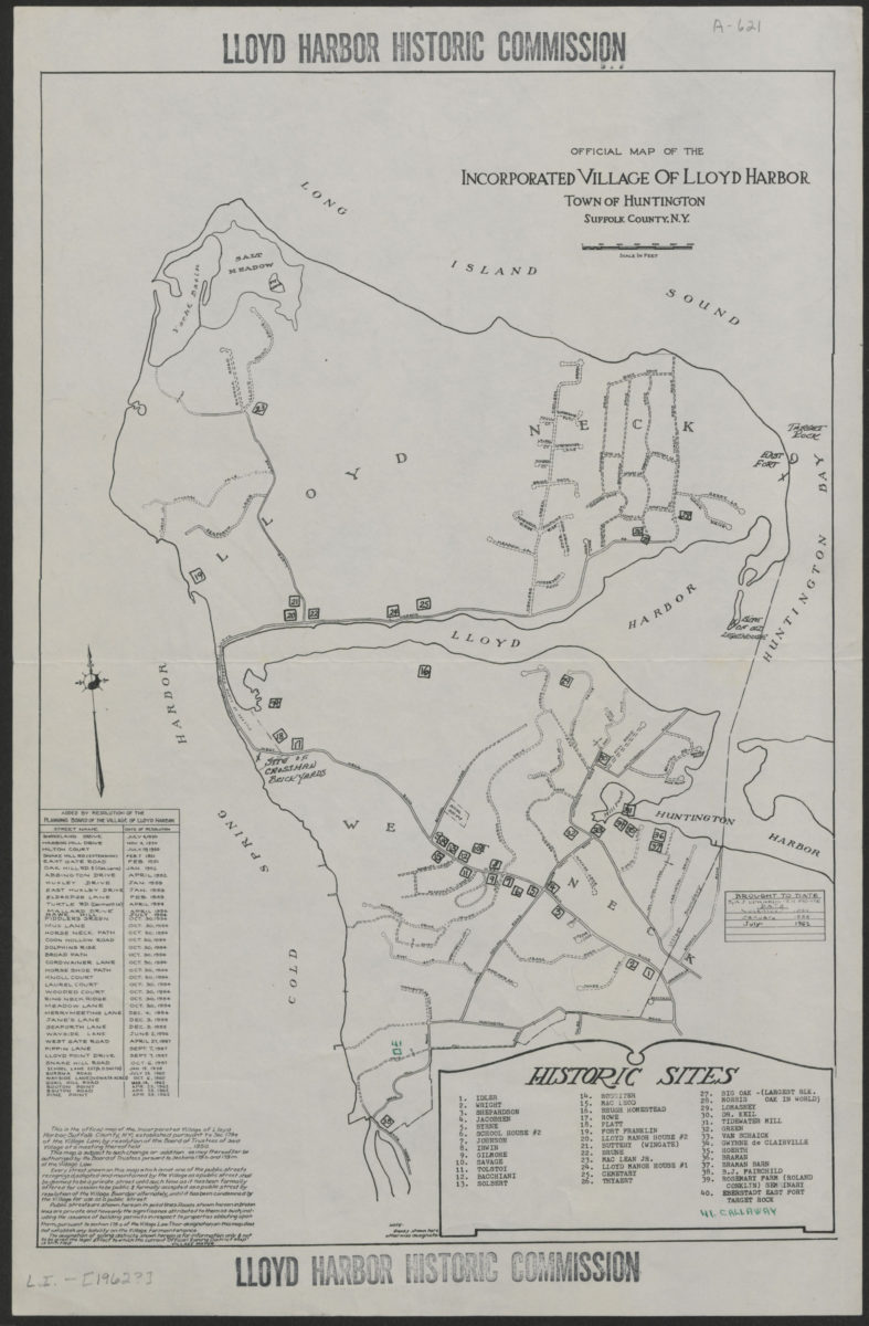
Official map of the Incorporated Village of Lloyd Harbor, Town of Huntington, Suffolk County, N.Y.
Official map of the Incorporated Village of Lloyd Harbor, Town of Huntington, Suffolk County, N.Y.
[1962]
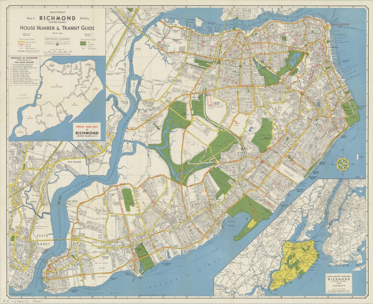
Hagstrom’s map of Richmond (Staten Island), N. Y. City: house number & transit guide: compiled, printed, and published by Hagstrom Company
Hagstrom’s map of Richmond (Staten Island), N. Y. City: house number & transit guide: compiled, printed, and published by Hagstrom Company
[1963]
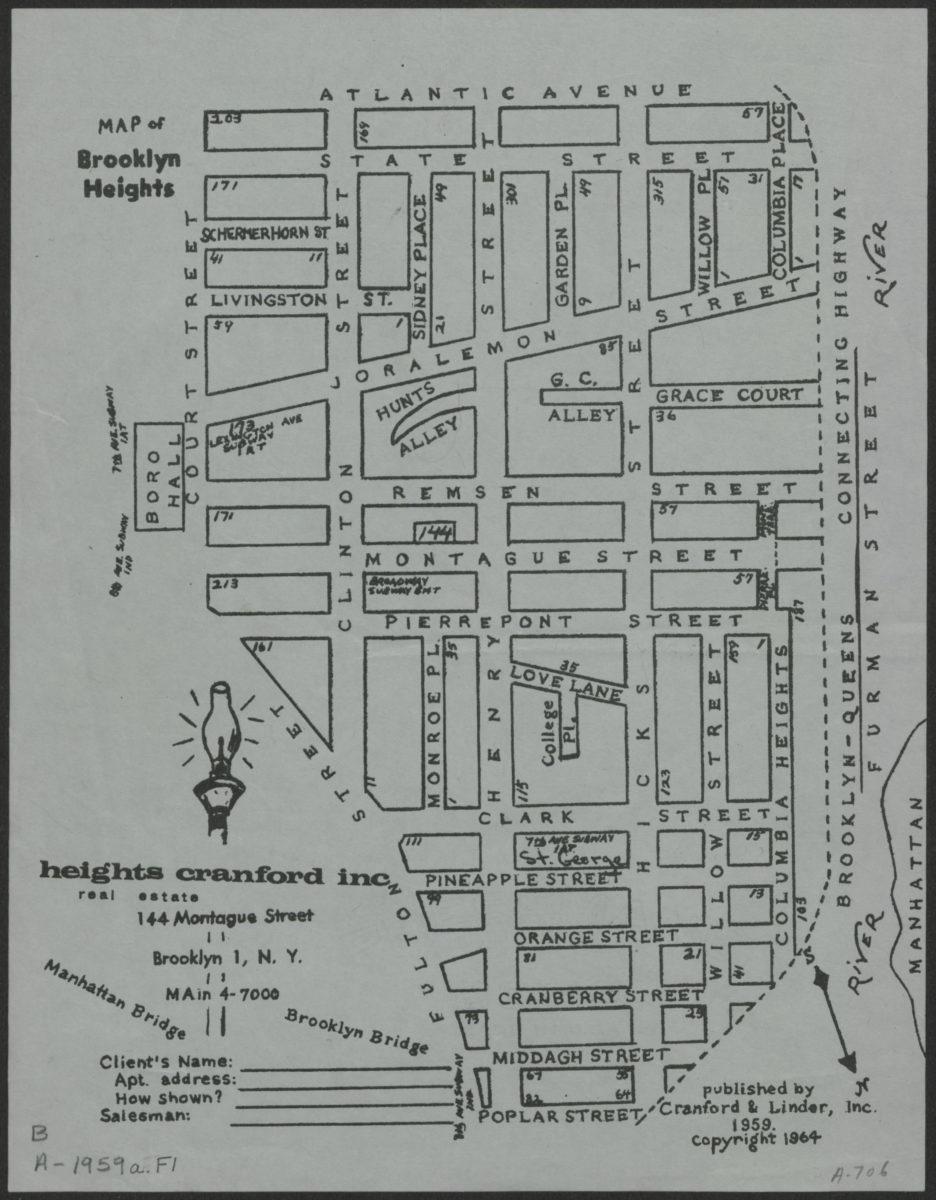
Map of Brooklyn Heights
Map of Brooklyn Heights
[1964; 1964]
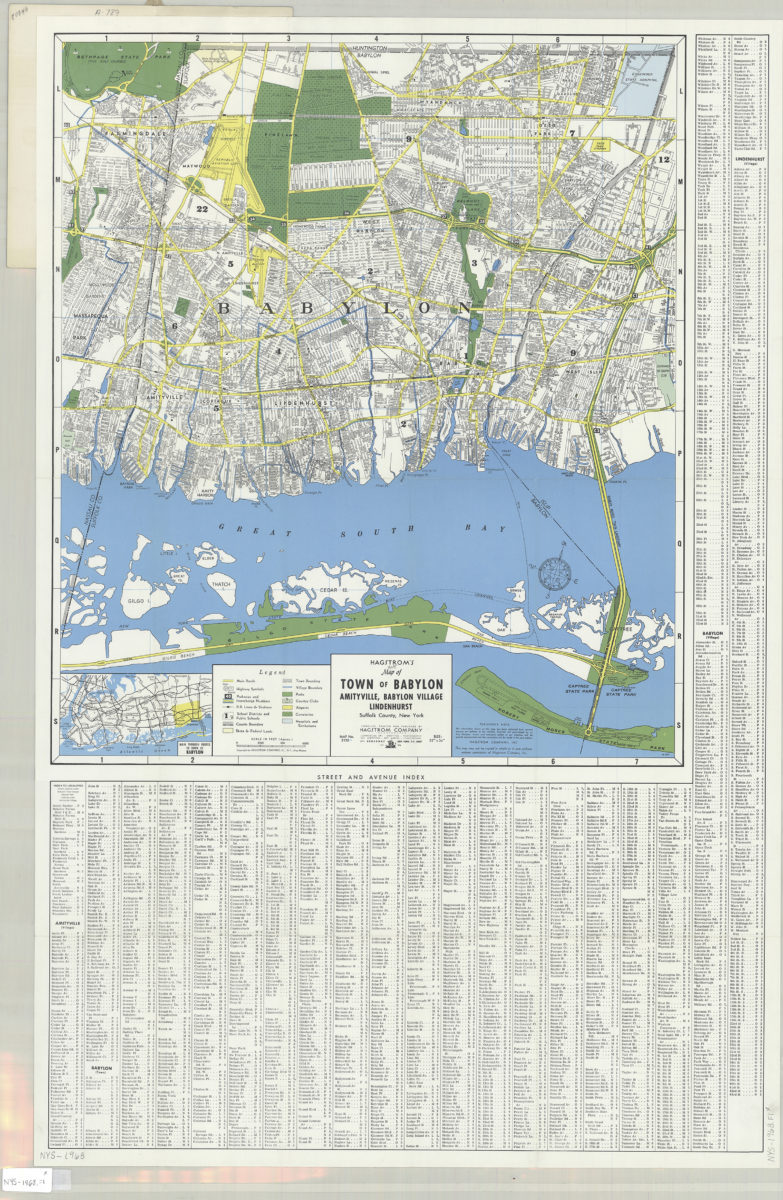
Hagstrom’s street and road map of Town of Babylon: Amityville, Babylon Village, Lindenhurst, Suffolk County, Long Island, N.Y.
Hagstrom’s street and road map of Town of Babylon: Amityville, Babylon Village, Lindenhurst, Suffolk County, Long Island, N.Y.
1968
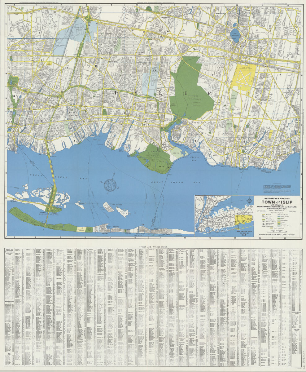
Hagstrom’s map of the Town of Islip: with the villages of Brightwaters, Ocean Beach and Saltaire, Suffolk County, New York
Hagstrom’s map of the Town of Islip: with the villages of Brightwaters, Ocean Beach and Saltaire, Suffolk County, New York
1968
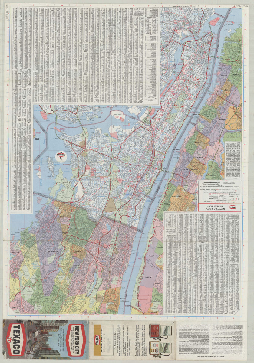
Texaco New York City street map
Texaco New York City street map
[1969; 1969]
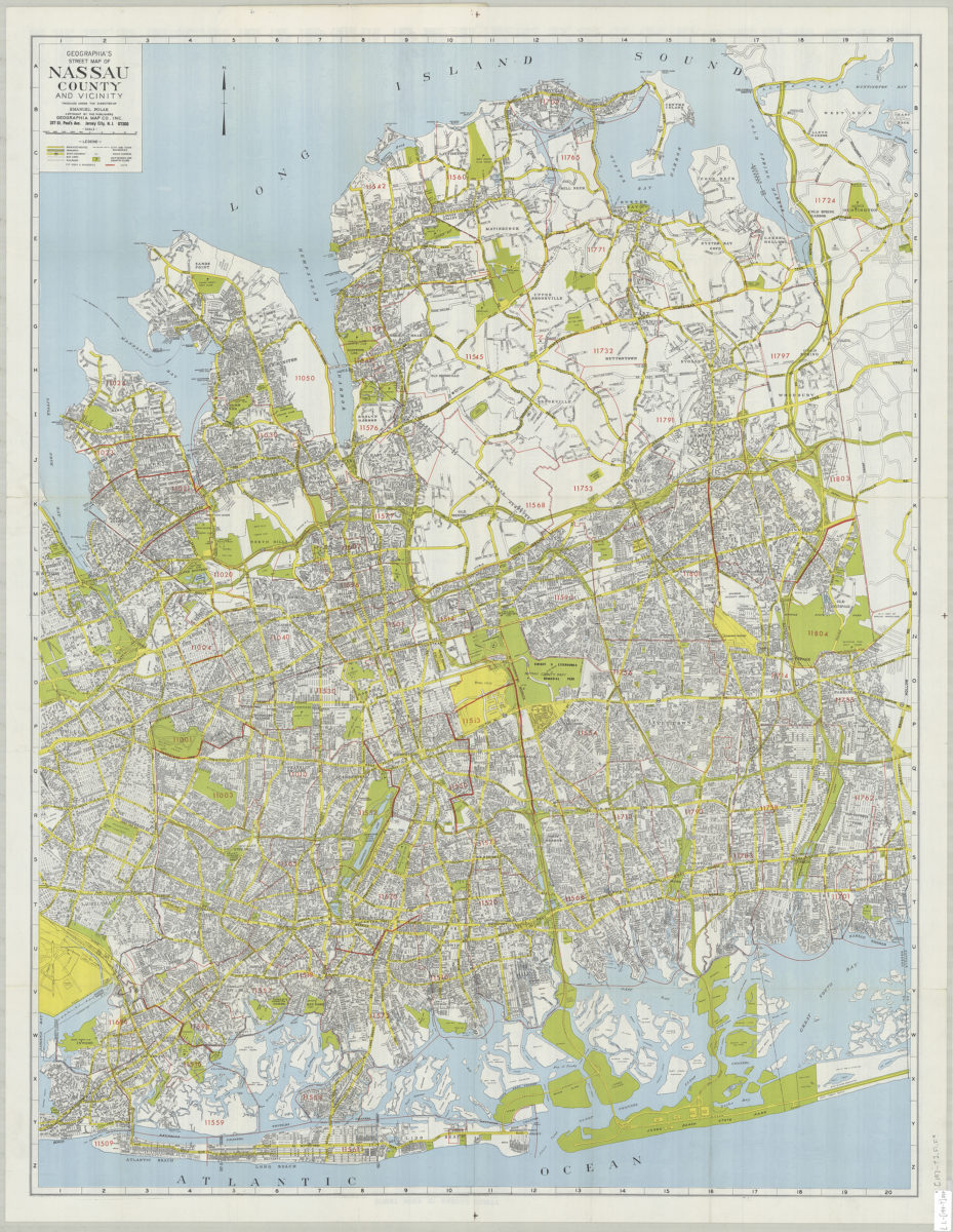
Geographia’s street map of Nassau County and vicinity: produced under the direction of Emanuel Polak
Geographia’s street map of Nassau County and vicinity: produced under the direction of Emanuel Polak
[197?]
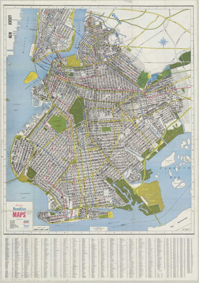
Nester’s Brooklyn maps: produced and designed by Lewis J. Nesterman
Nester’s Brooklyn maps: produced and designed by Lewis J. Nesterman
[1976]
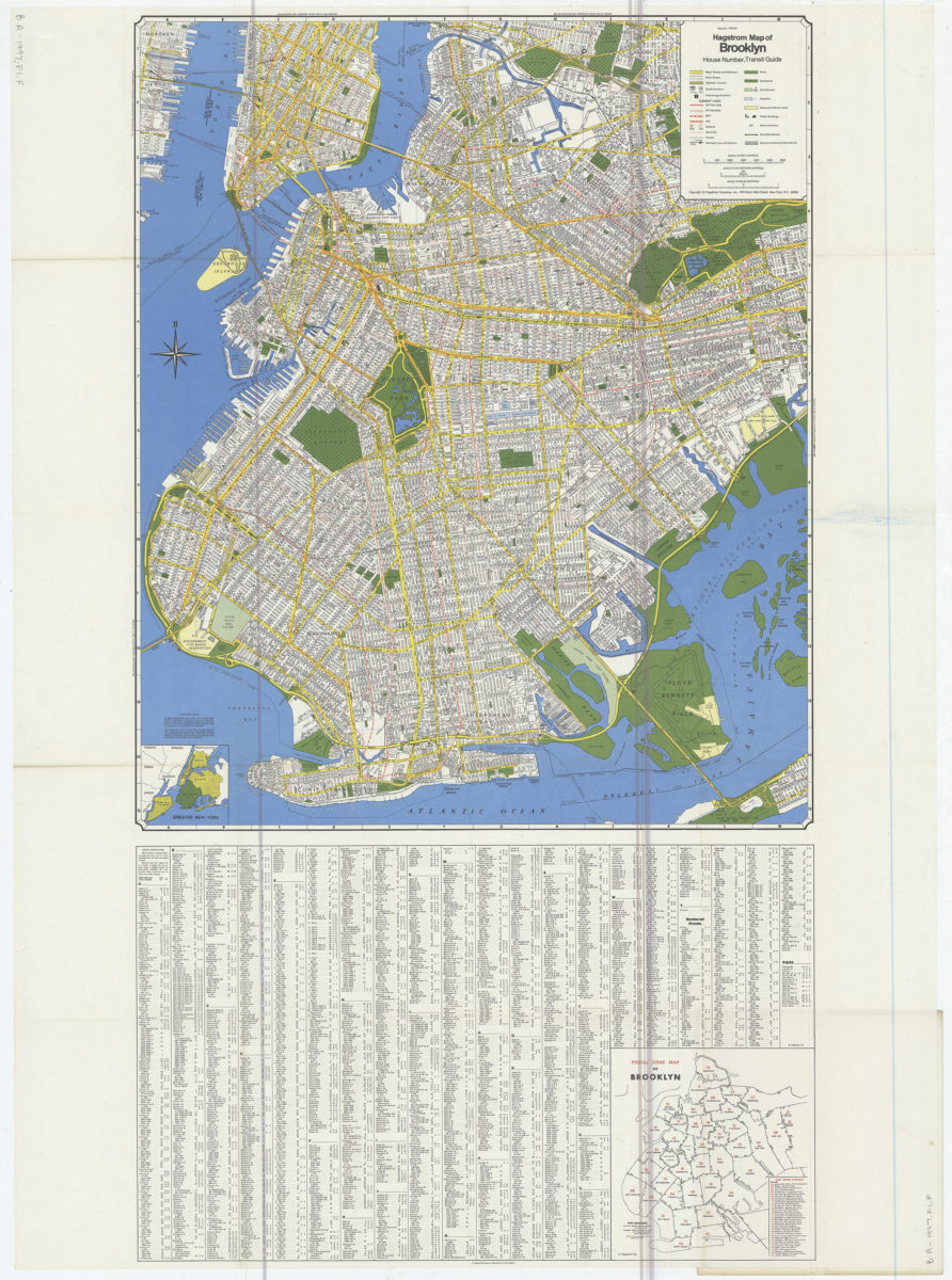
Hagstrom map of Brooklyn: house number, transit guide
Hagstrom map of Brooklyn: house number, transit guide
[1977]
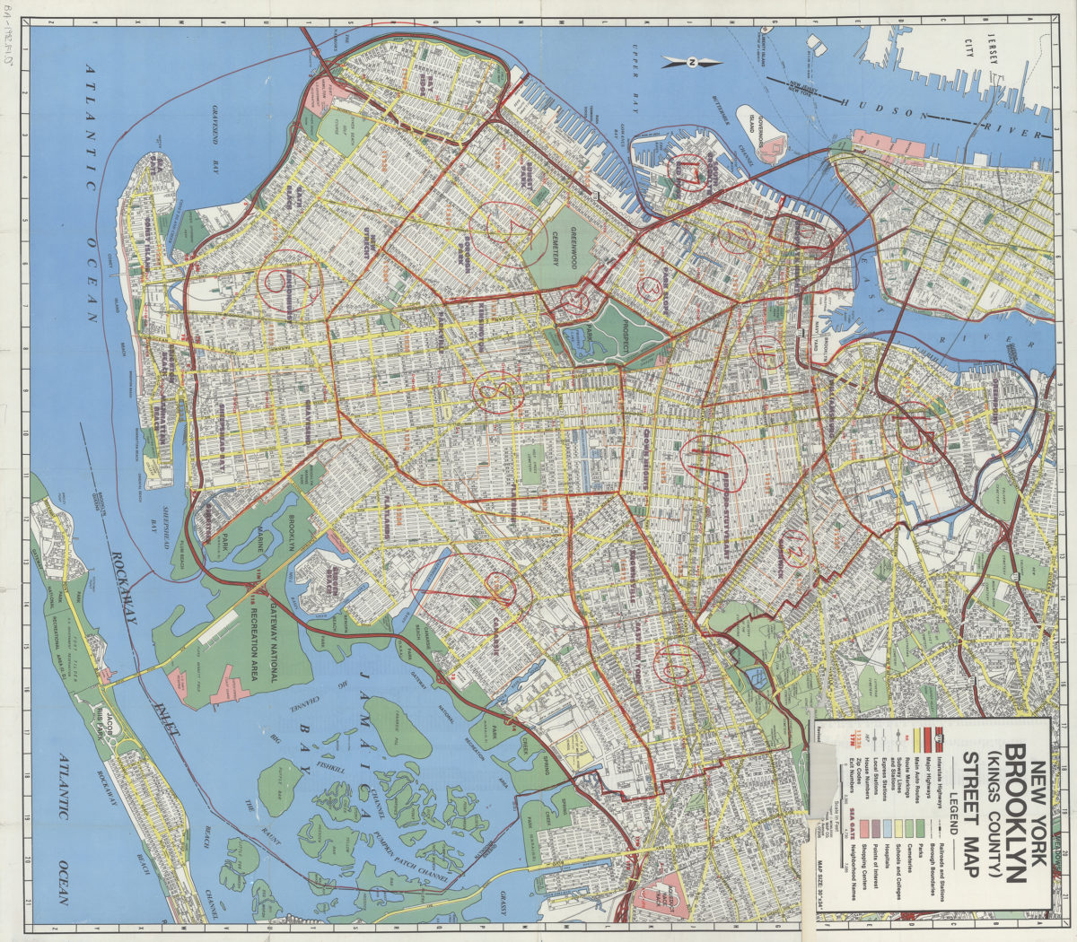
New York, Brooklyn (Kings County), street map: Geographia Map Co., Inc
New York, Brooklyn (Kings County), street map: Geographia Map Co., Inc
[ca. 1982]
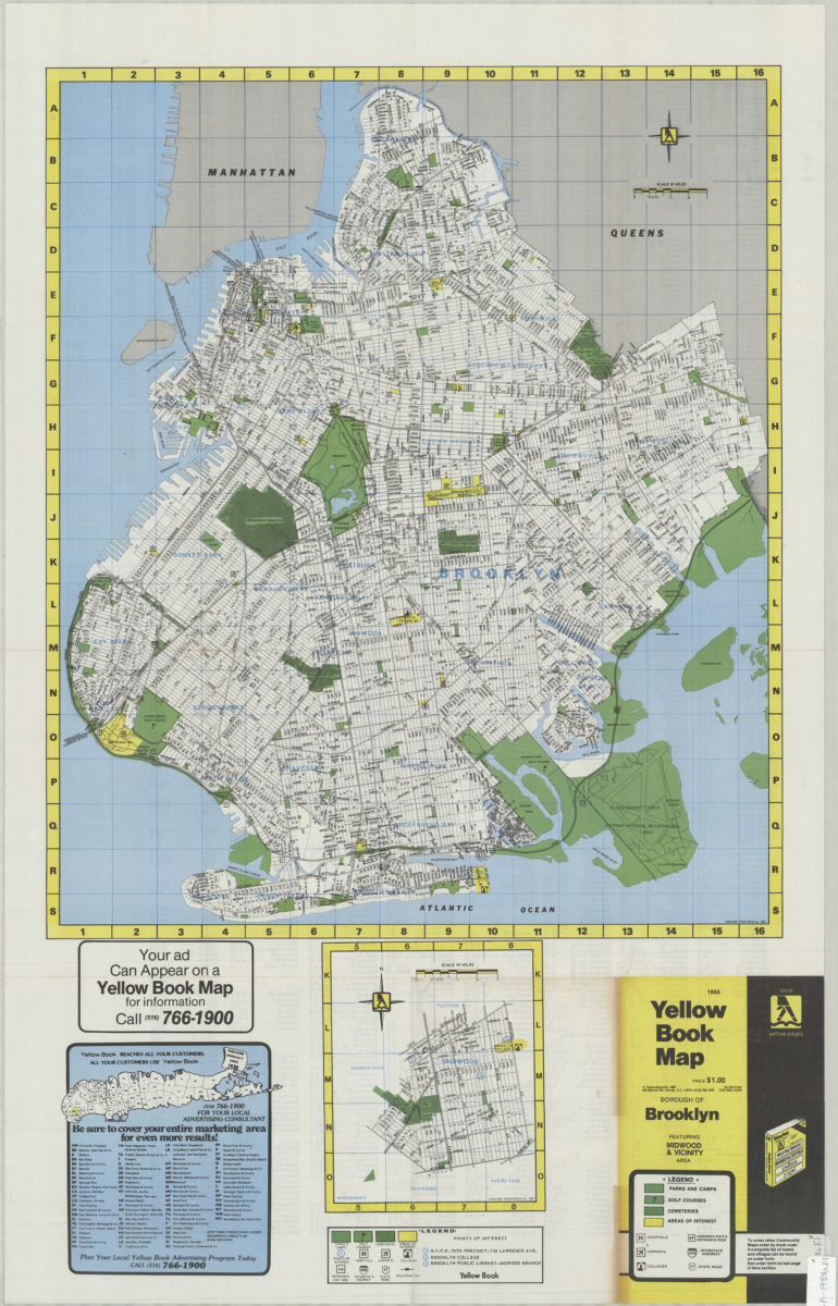
Yellow Book map, Borough of Brooklyn featuring Midwood & vicinity area
Yellow Book map, Borough of Brooklyn featuring Midwood & vicinity area
[1988;1988]