Center for Brooklyn History
Map Collections
Search
About
Othmer Library & Archives
Submit search query
Refine 23 records
Clear filters
2
Location
Bath Beach (New York, N.Y.)
8
Bay Ridge (New York, N.Y.)
108
Bay Ridge Park (New York, N.Y.)
1
Bensonhurst (New York, N.Y.)
17
Borough Park (New York, N.Y.)
23
Brooklyn (New York, N.Y.)
891
Brooklyn Heights (New York, N.Y.)
76
Downtown Brooklyn (New York, N.Y.)
29
Dyker Heights (New York, N.Y.)
23
Fort Hamilton (New York, N.Y.)
31
New Utrecht (New York, N.Y.)
9
Park Slope (New York, N.Y.)
16
Prospect Heights (New York, N.Y.)
16
Sheepshead Bay (New York, N.Y.)
13
Sunset Park (New York, N.Y.)
53
Windsor Terrace (New York, N.Y.)
10
Subject
Auctions
32
Election districts
36
Land use
5
Landowners
434
Real property
619
Salt marshes
2
Zoning
2
Date
19th Century
945
20th Century
469
or enter range:
from
to
Genres
Cadastral maps
597
Manuscript maps
365
Zoning maps
55
Sort by:
Date (earliest)
Date (most recent)
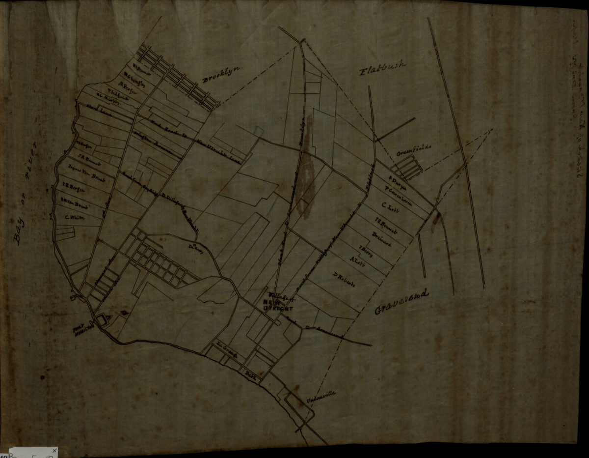
Sketch of New Utrecht from Dripps map
Sketch of New Utrecht from Dripps map
[18??]
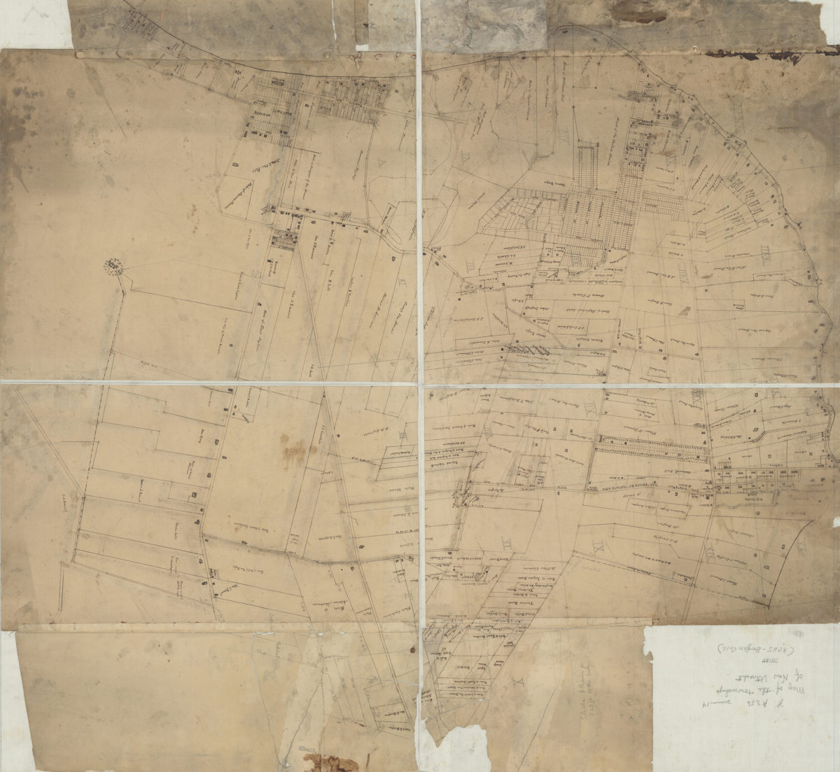
[Map of New Utrecht]
[Map of New Utrecht]
[18??]
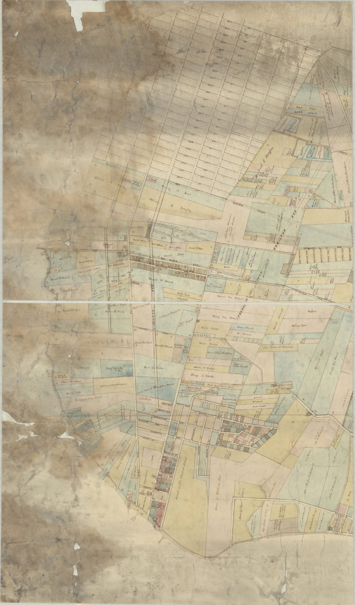
[Map of roads from Gravesend to Flatbush to Flatlands, New Utrecht and Flatbush]
[Map of roads from Gravesend to Flatbush to Flatlands, New Utrecht and Flatbush]
[18??]
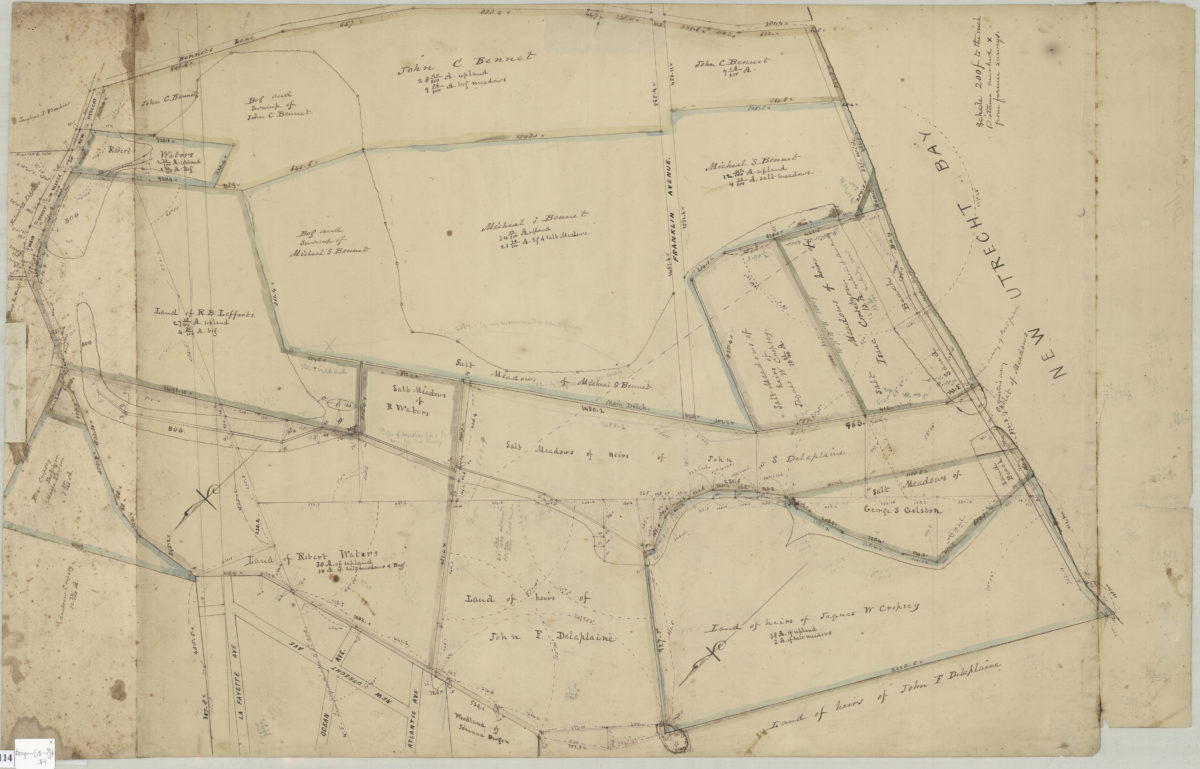
[Map of Dyker Meadows in the town of New Utrecht]
[Map of Dyker Meadows in the town of New Utrecht]
[18??]
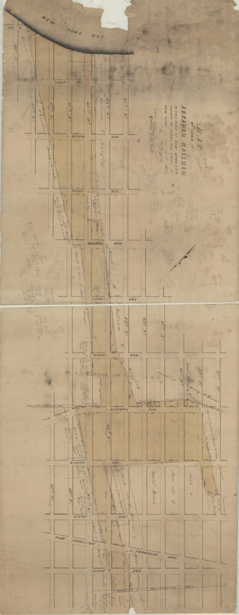
Map of land of Abraham Wakeman, in the town of New Utrecht, county of Kings, and state of New York: as surveyed by T.G. Bergen
Map of land of Abraham Wakeman, in the town of New Utrecht, county of Kings, and state of New York: as surveyed by T.G. Bergen
1873
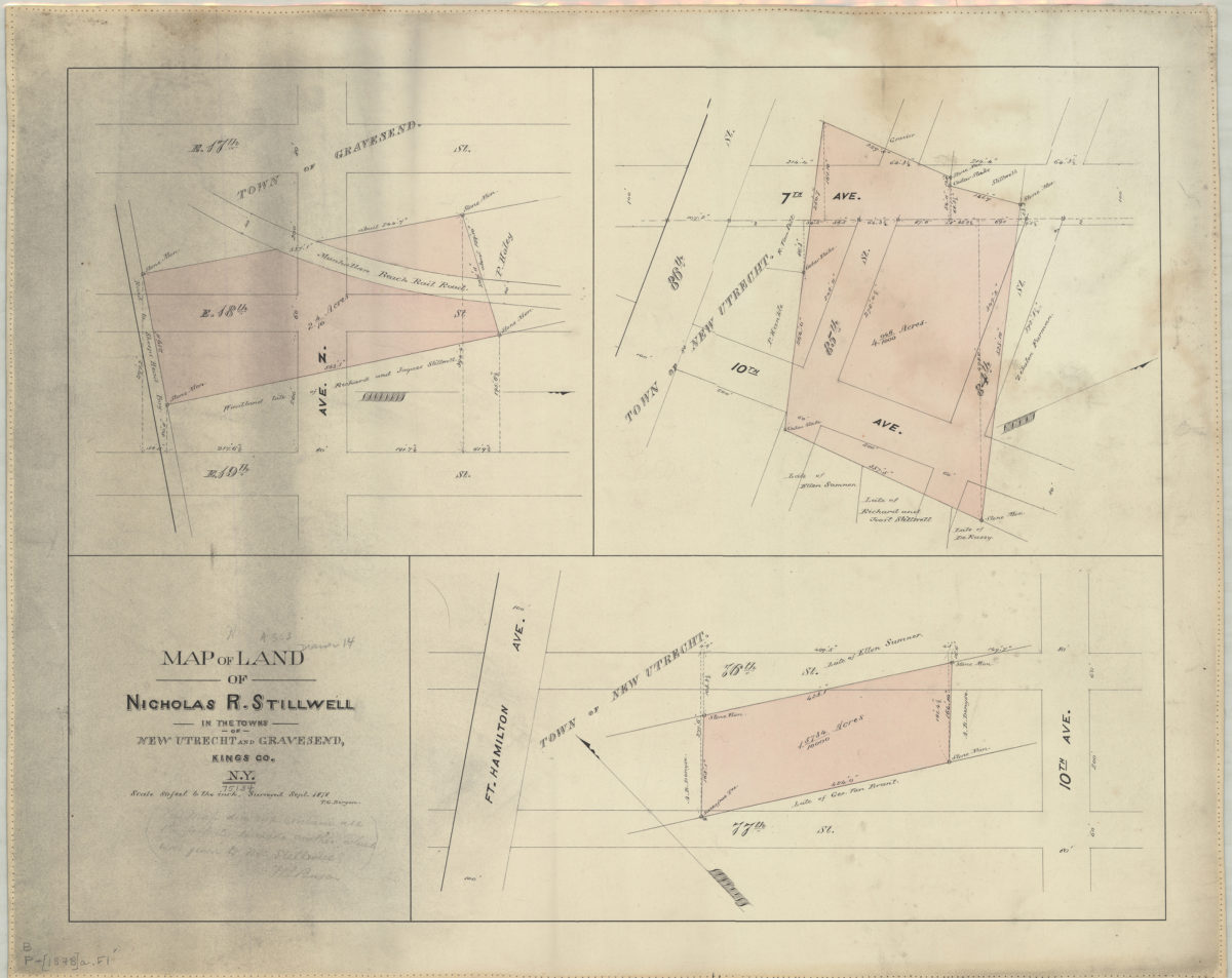
Map of land of Nicholas R. Stillwell in the towns of New Utrecht and Gravesend, Kings Co., N.Y.: surveyed Sept. 1878 [by] T.G. Bergen
Map of land of Nicholas R. Stillwell in the towns of New Utrecht and Gravesend, Kings Co., N.Y.: surveyed Sept. 1878 [by] T.G. Bergen
[1878]
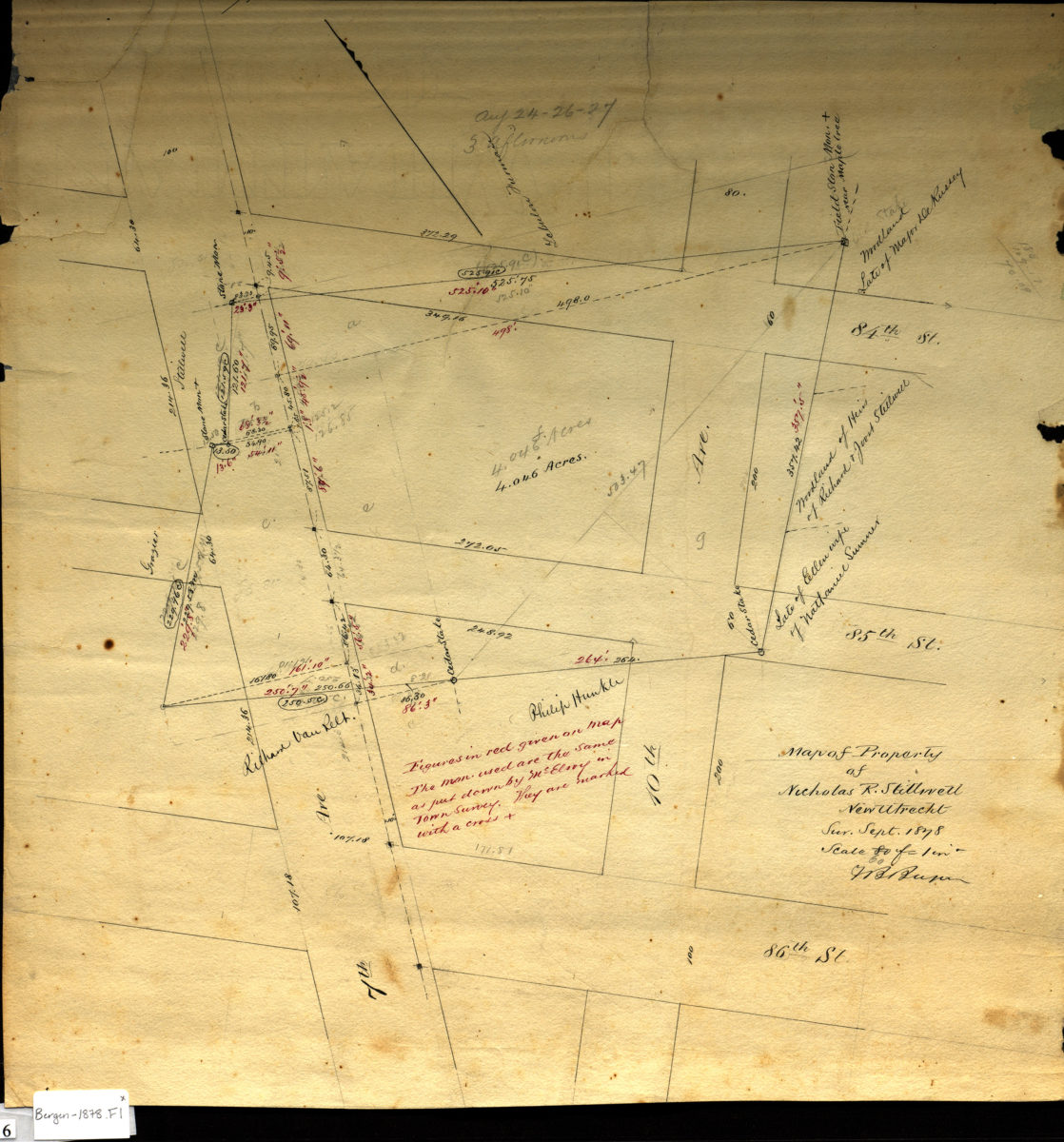
Map of property of Nicholas R. Stillwell, New Utrecht: V.B. Bergen
Map of property of Nicholas R. Stillwell, New Utrecht: V.B. Bergen
Sept. 1878
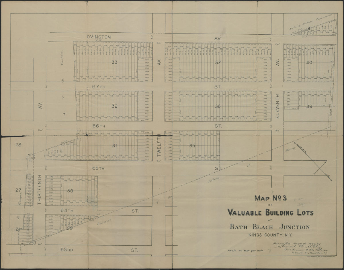
Map no 3 of valuable building lots at Bath Beach Junction, Kings County, N.Y.: surveyed August 1887 by Samuel H McElroy, civil engineer & city surveyor, 16 Court St., Brooklyn, N.Y.
Map no 3 of valuable building lots at Bath Beach Junction, Kings County, N.Y.: surveyed August 1887 by Samuel H McElroy, civil engineer & city surveyor, 16 Court St., Brooklyn, N.Y.
[1887]
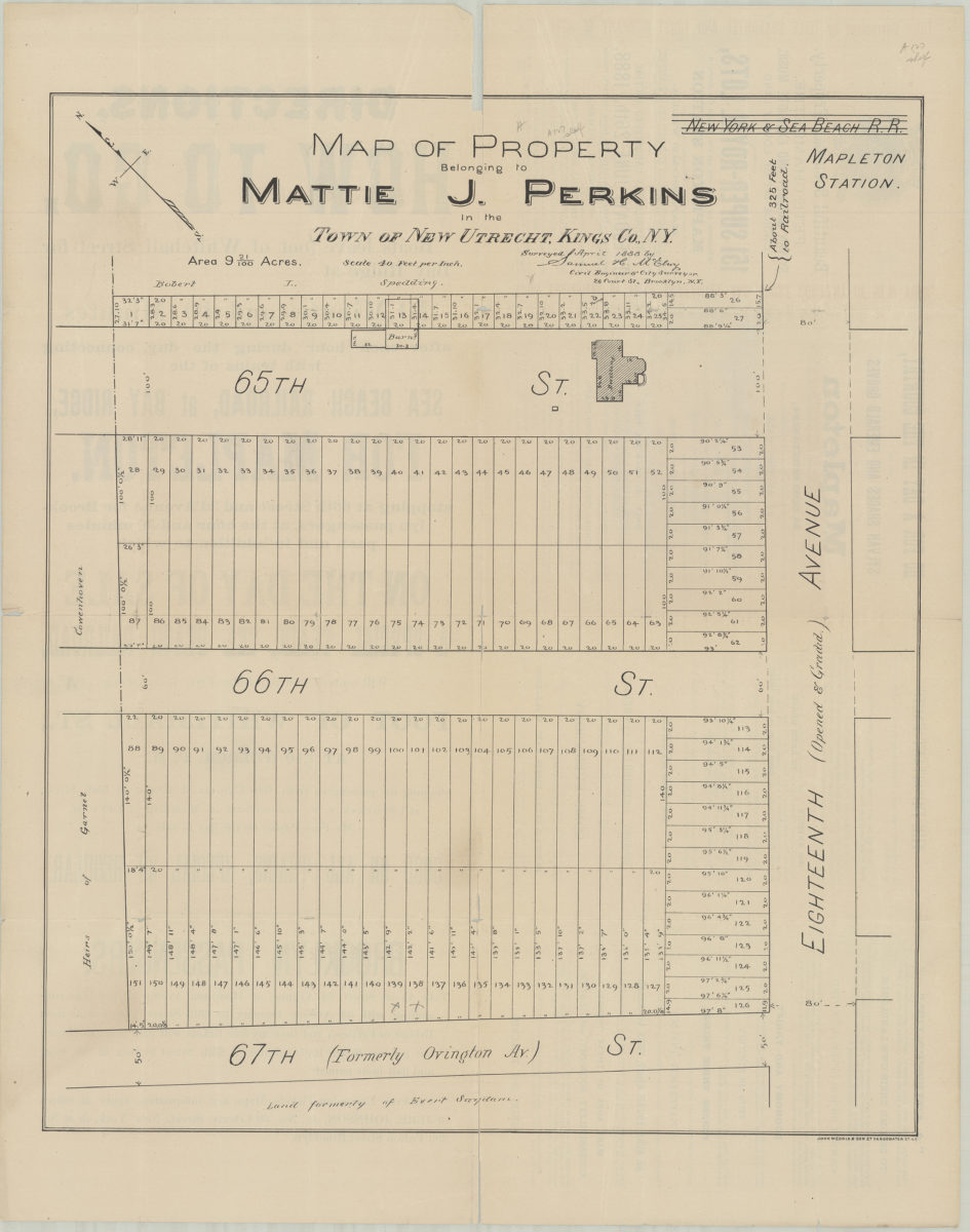
Map of property belonging to Mattie J. Perkins in the town of New Utrecht, Kings Co., N.Y.: surveyed April 1888 by Samuel H. McElroy, city engineer & city surveyor, 26 Court St., Brooklyn, N.Y.
Map of property belonging to Mattie J. Perkins in the town of New Utrecht, Kings Co., N.Y.: surveyed April 1888 by Samuel H. McElroy, city engineer & city surveyor, 26 Court St., Brooklyn, N.Y.
[1888]
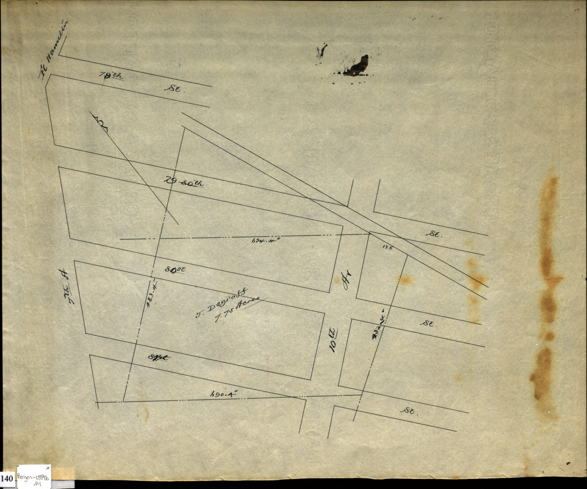
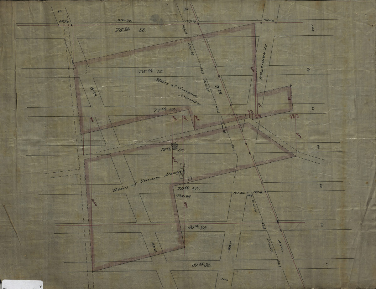
[Survey map of area from 78th Street to 81st Street, between 7th Avenue and 10th Avenue]
[Survey map of area from 78th Street to 81st Street, between 7th Avenue and 10th Avenue]
[ca. 1889]
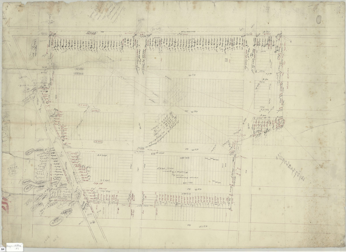
[Survey map of area bounded by 63rd Street, 15th Avenue, Ovington Avenue, and 12th Avenue]
[Survey map of area bounded by 63rd Street, 15th Avenue, Ovington Avenue, and 12th Avenue]
1889
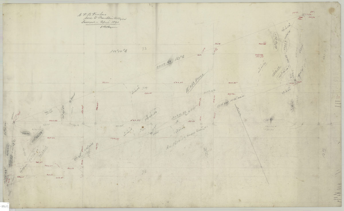
A.V.B. Voorhies, sold to Franklin Allen: VB Bergen
A.V.B. Voorhies, sold to Franklin Allen: VB Bergen
April 1890
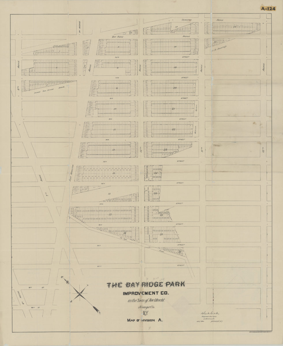
Map of Division A: Charles Crooke, engineer & surveyor
Map of Division A: Charles Crooke, engineer & surveyor
[1890]
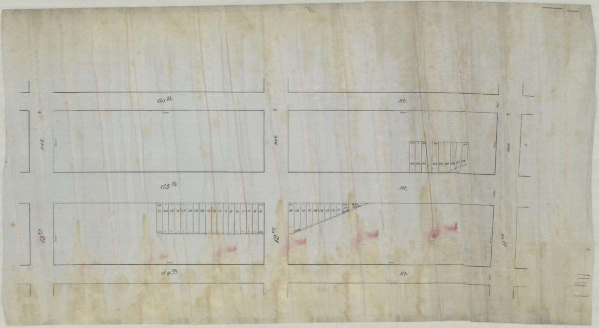
[Map of area bounded by 13th Ave., 64th St., 11th Ave., and 66th St.].
[Map of area bounded by 13th Ave., 64th St., 11th Ave., and 66th St.].
[189?]
[Map of area bounded by 81st St., Fort Hamilton Ave., 75th St., and 6th Ave.].
[Map of area bounded by 81st St., Fort Hamilton Ave., 75th St., and 6th Ave.].
[189?]
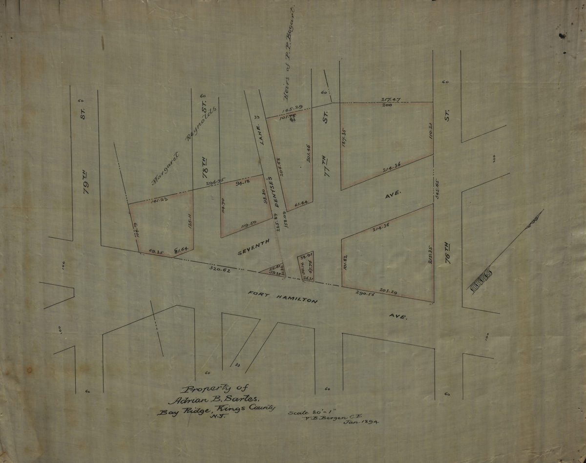
Property of Adrian B. Sartes, Bay Ridge, Kings County, N.Y.: V.B. Bergen, C.E.
Property of Adrian B. Sartes, Bay Ridge, Kings County, N.Y.: V.B. Bergen, C.E.
January 1894
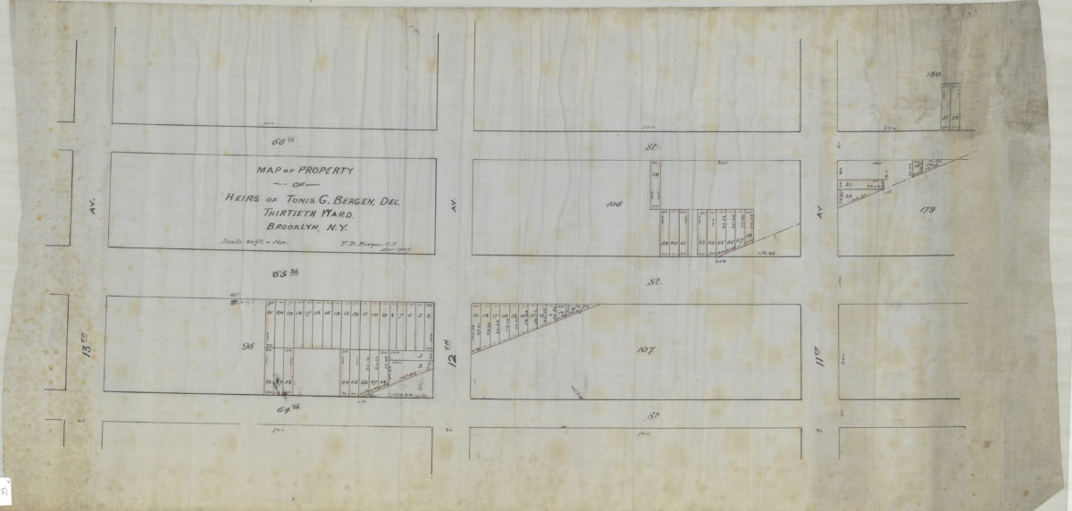
Map of property of heirs of Tunis G. Bergen, dec., Thirtieth Ward, Brooklyn, N.Y.: V.B. Bergen, C.E.
Map of property of heirs of Tunis G. Bergen, dec., Thirtieth Ward, Brooklyn, N.Y.: V.B. Bergen, C.E.
April 1907
Executor’s sale to close estate of Teunis Bergen, deceased, Wednesday, June 19, 1907 at 12 o’clock noon in The Brooklyn Real Estate Exchange 189 Montague St. Brooklyn-New York, 55 valuable lots as the diagram on 65th and 66th Sts
Executor’s sale to close estate of Teunis Bergen, deceased, Wednesday, June 19, 1907 at 12 o’clock noon in The Brooklyn Real Estate Exchange 189 Montague St. Brooklyn-New York, 55 valuable lots as the diagram on 65th and 66th Sts
1907
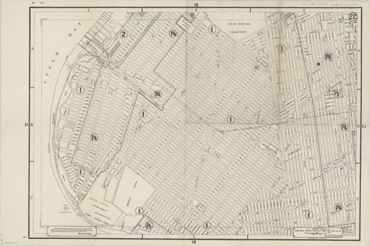
Amended use district map, section no. 22: City of New York, City Planning Commission, Irving F. Ashworth, senior civil engineer
Amended use district map, section no. 22: City of New York, City Planning Commission, Irving F. Ashworth, senior civil engineer
1953
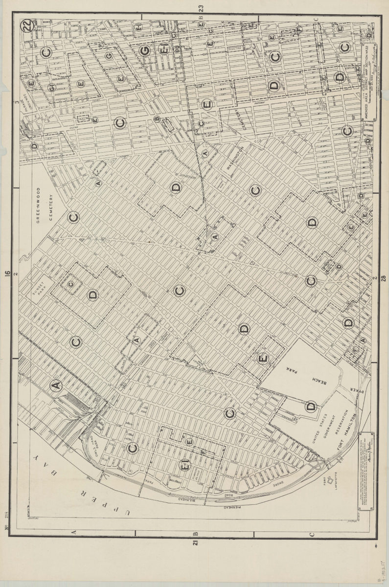
Amended use district map, section no. 22: City of New York, City Planning Commission, Irving F. Ashworth, senior civil engineer
Amended use district map, section no. 22: City of New York, City Planning Commission, Irving F. Ashworth, senior civil engineer
1953
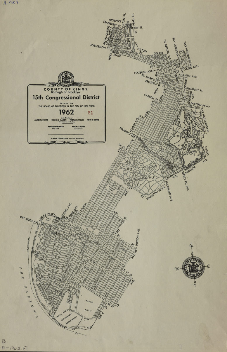
County of Kings, Borough of Brooklyn, 15th Congressional District: issued by the Board of Elections in the City of New York
County of Kings, Borough of Brooklyn, 15th Congressional District: issued by the Board of Elections in the City of New York
1962
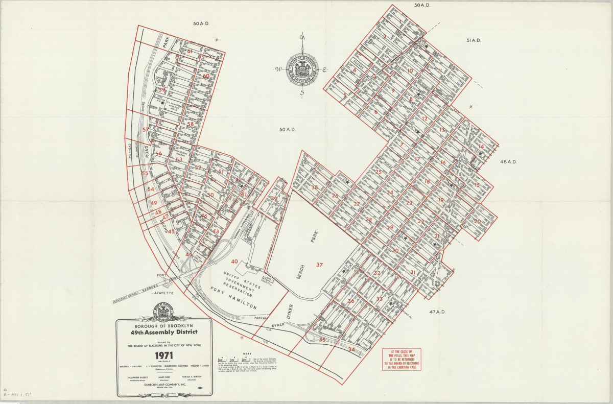
Borough of Brooklyn 49th Assembly District, 1971: issued by the Board of Elections in the City of New York
Borough of Brooklyn 49th Assembly District, 1971: issued by the Board of Elections in the City of New York
1971
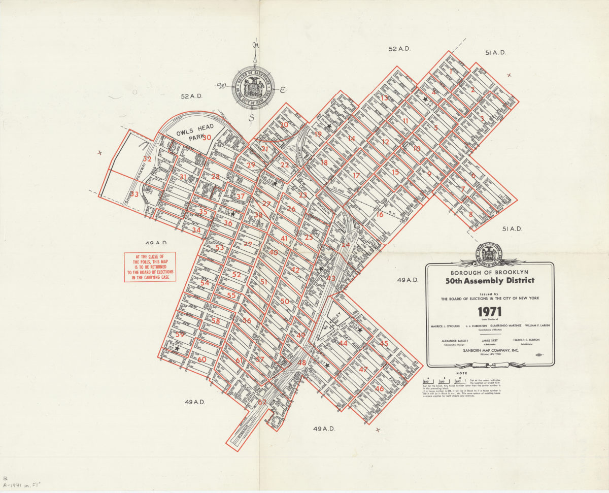
Borough of Brooklyn 50th Assembly District, 1971: issued by the Board of Elections in the City of New York
Borough of Brooklyn 50th Assembly District, 1971: issued by the Board of Elections in the City of New York
1971