Center for Brooklyn History
Map Collections
Search
About
Othmer Library & Archives
Submit search query
Refine 15 records
Clear filters
2
Location
Brooklyn (New York, N.Y.)
891
Connecticut
7
Erie Canal (N.Y.)
3
Genesee River (Pa. and N.Y.)
1
Hudson River (N.Y. and N.J.)
7
Long Island (N.Y.)
197
New York (N.Y.)
164
New York (State)
95
New York Metropolitan Area
40
Pennsylvania
4
Rhode Island
2
Saint Lawrence River
2
Subject
Canals
15
Counties
1
Forest reserves
1
Historic sites
3
Indians of North America
6
Natural areas
1
Outdoor recreation
1
Road maps
2
Roads
117
Date
19th Century
945
20th Century
469
21th Century
66
or enter range:
from
to
Genres
Map
191
Sort by:
Date (earliest)
Date (most recent)
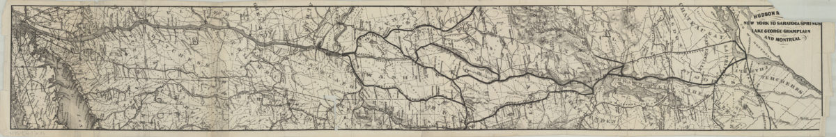
Hudon R[iver?], New York to Saratoga Springs, Lake George-Champlain, and Montreal
Hudon R[iver?], New York to Saratoga Springs, Lake George-Champlain, and Montreal
[18??]
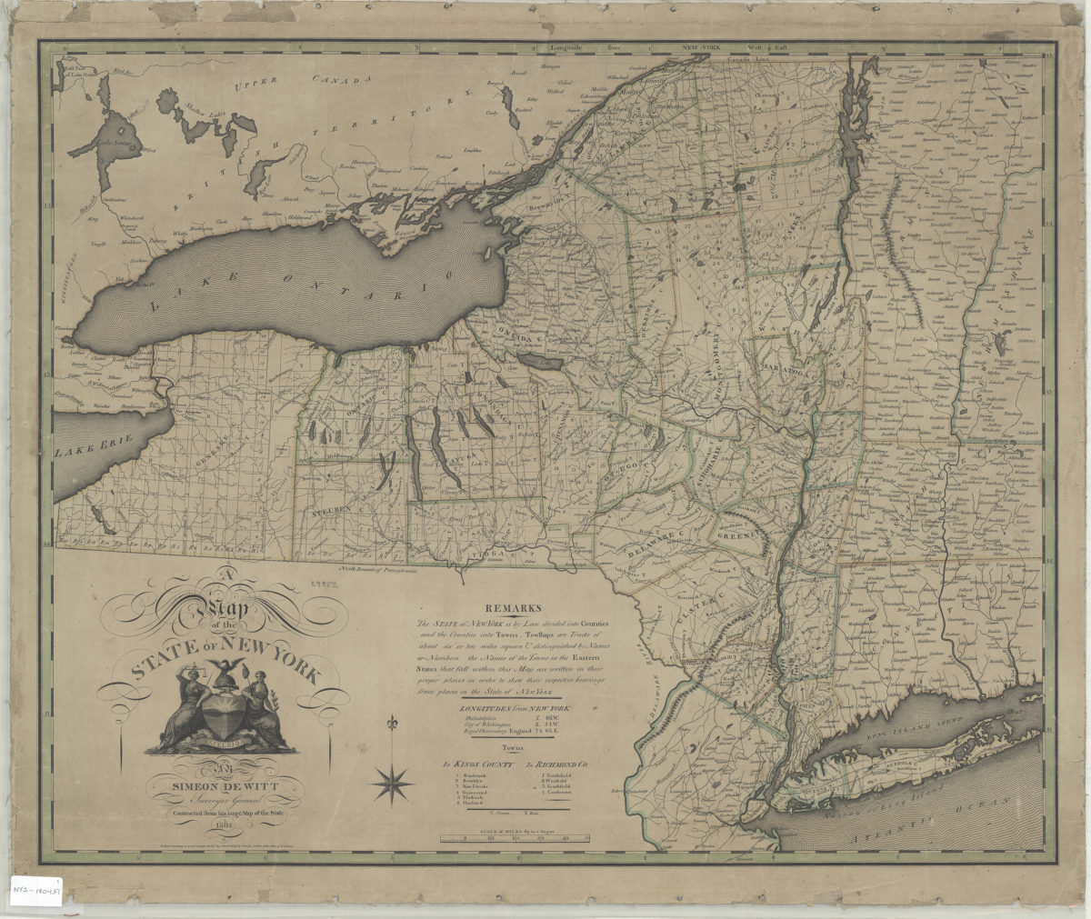
A map of the state of New York: Simeon DeWitt, surveyor general
A map of the state of New York: Simeon DeWitt, surveyor general
1804
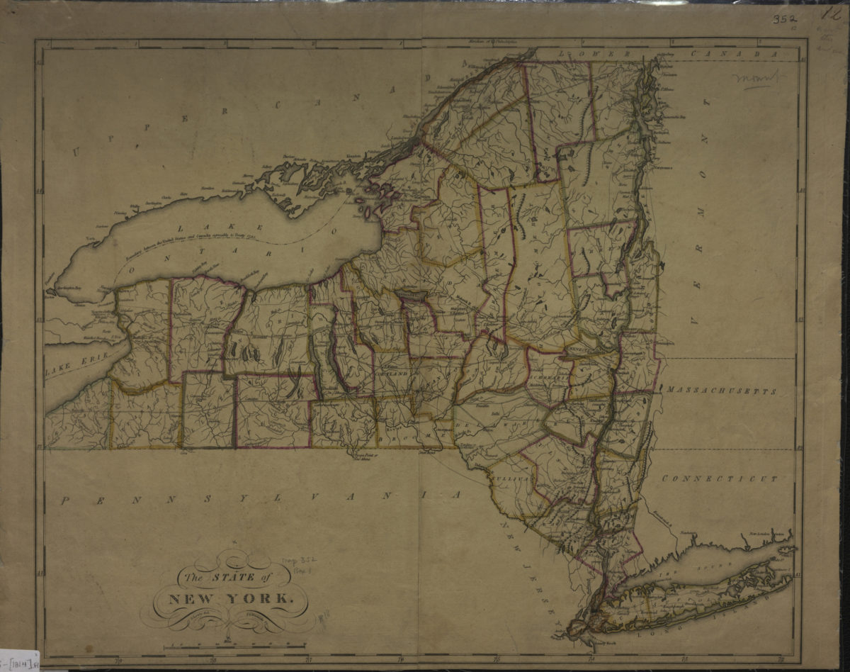
The state of New York: S. Lewis, del
The state of New York: S. Lewis, del
[1814]
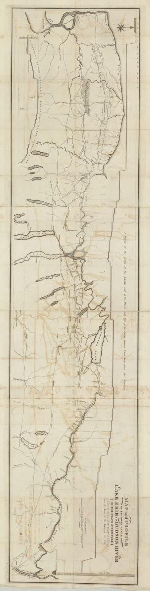
Map and profile of the proposed canal from Lake Erie to Hudson River in the State of New York: contracted by direction of the Canal Commissioners from the maps of the engineers in 1817
Map and profile of the proposed canal from Lake Erie to Hudson River in the State of New York: contracted by direction of the Canal Commissioners from the maps of the engineers in 1817
[1817]
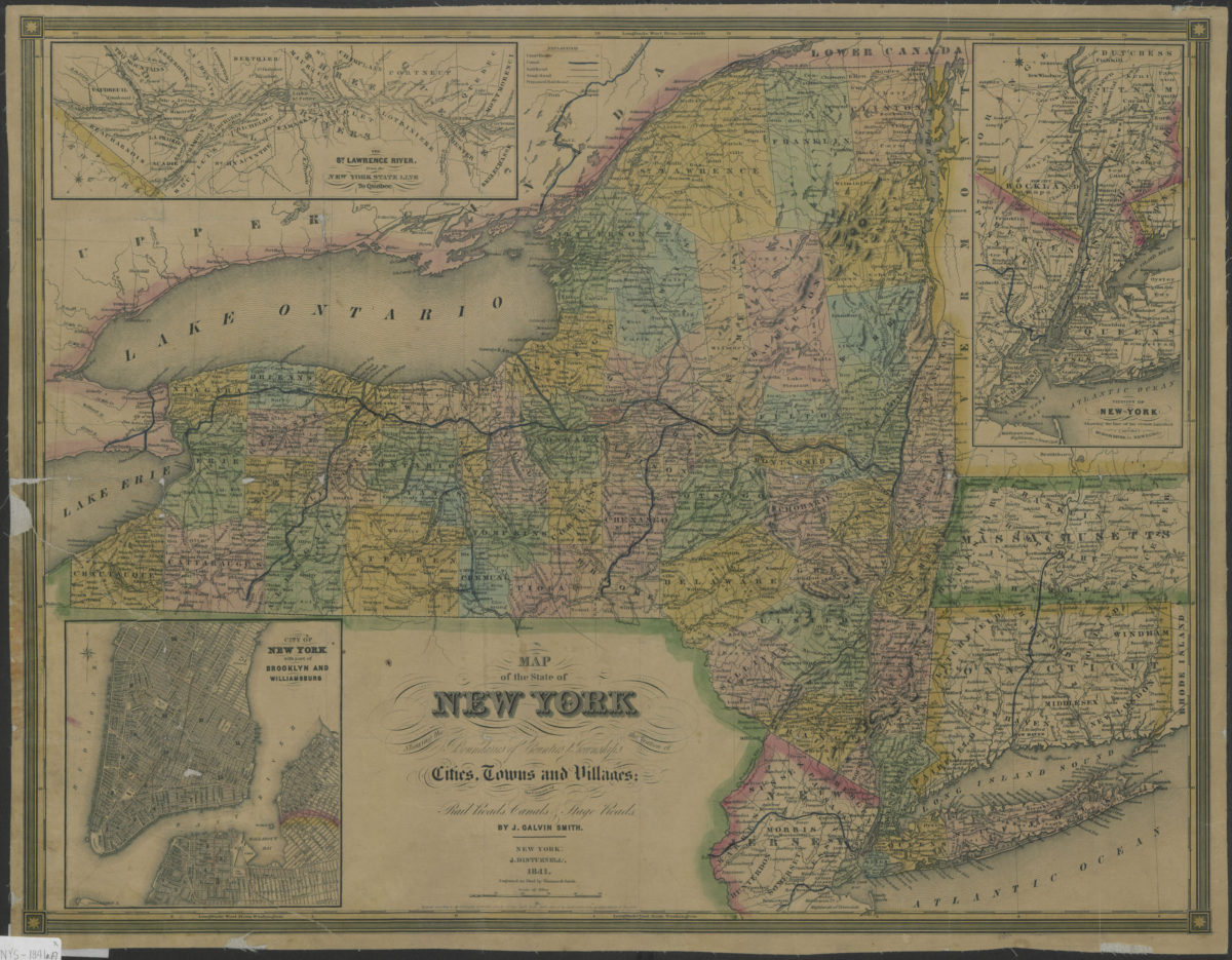
Map of the state of New York: showing the boundaries of counties & townships, the location of cities, towns and villages, the courses of rail roads, canals & stage roads: by J. Calvin Smith
Map of the state of New York: showing the boundaries of counties & townships, the location of cities, towns and villages, the courses of rail roads, canals & stage roads: by J. Calvin Smith
1841
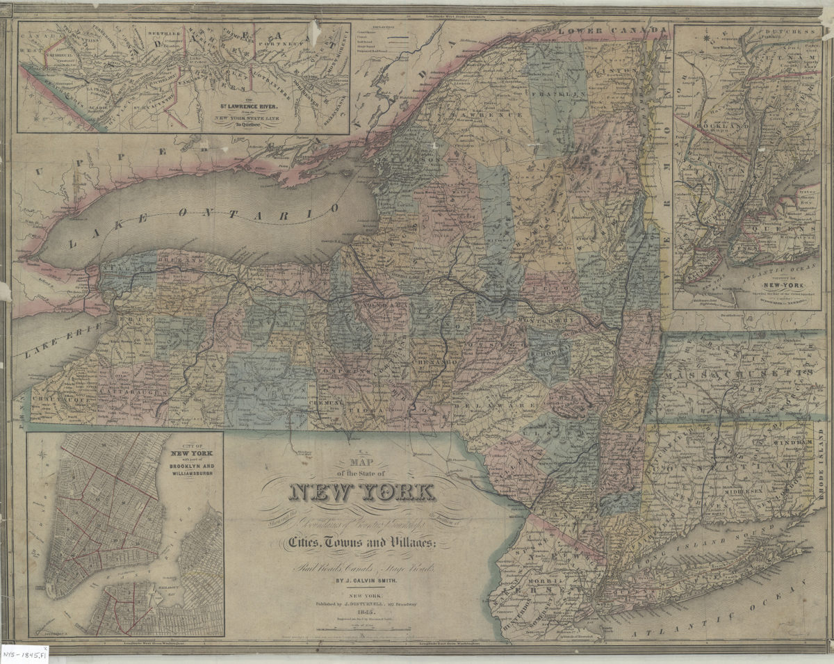
Map of the state of New York: showing the boundaries of counties & townships, the location of cities, towns and villages, the courses of rail roads, canals & stage roads: by J. Calvin Smith
Map of the state of New York: showing the boundaries of counties & townships, the location of cities, towns and villages, the courses of rail roads, canals & stage roads: by J. Calvin Smith
1845; [ca. 1842]
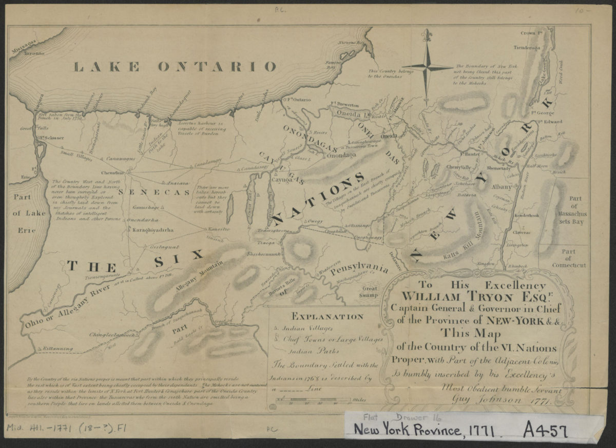
To his excellency William Tryon Esqr., captain general & governor in chief of the province of New-York & &: this map of the country of the VI. nations proper, with part of the adjacent colonies is humbly inscribed:
To his excellency William Tryon Esqr., captain general & governor in chief of the province of New-York & &: this map of the country of the VI. nations proper, with part of the adjacent colonies is humbly inscribed:
[1851]
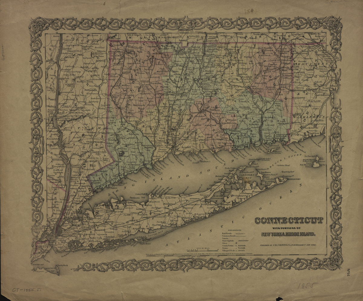
Connecticut: with portions of New York & Rhode Island
Connecticut: with portions of New York & Rhode Island
[1855]
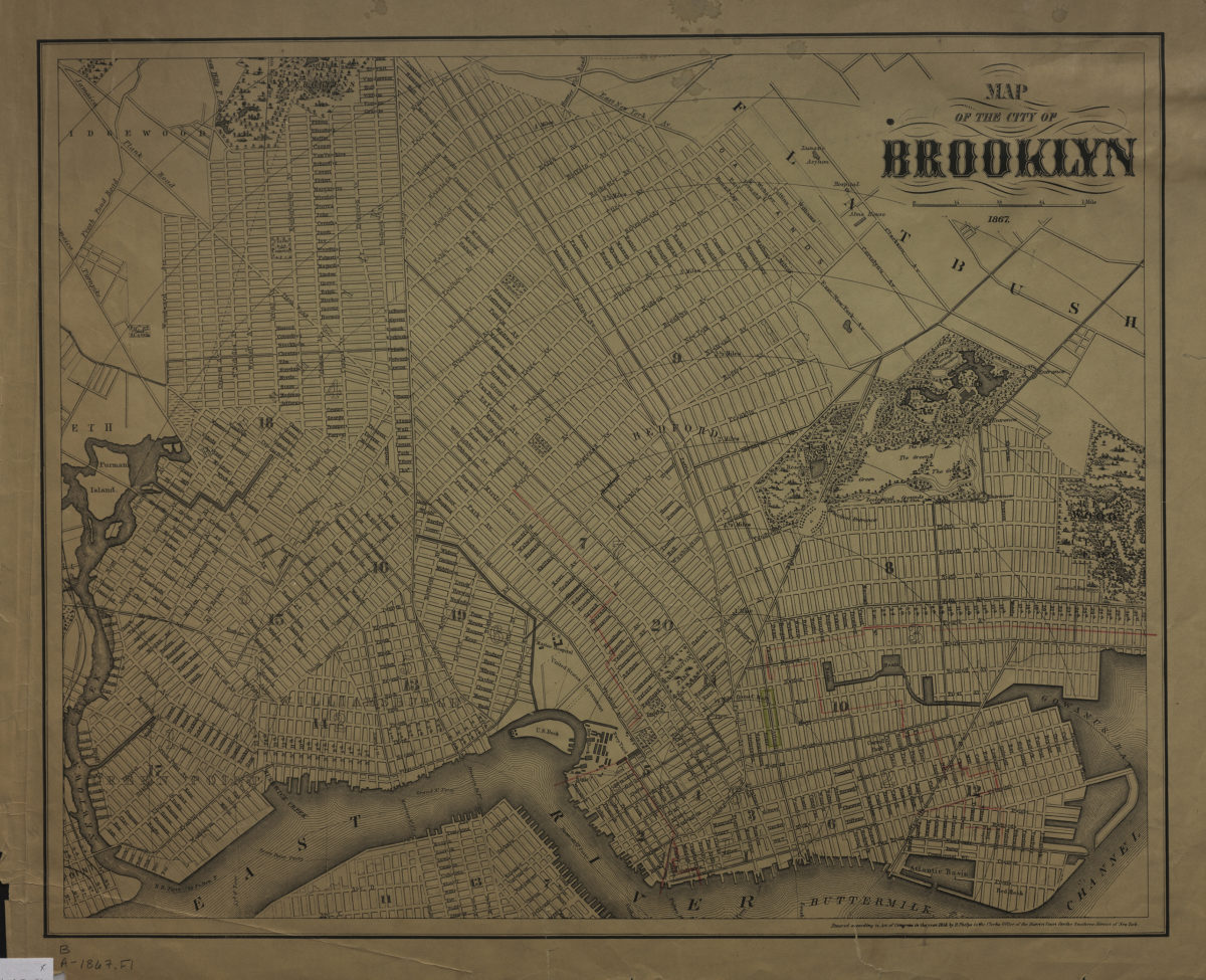
Map of the city of Brooklyn 1867
Map of the city of Brooklyn 1867
1867; [ca. 1858]
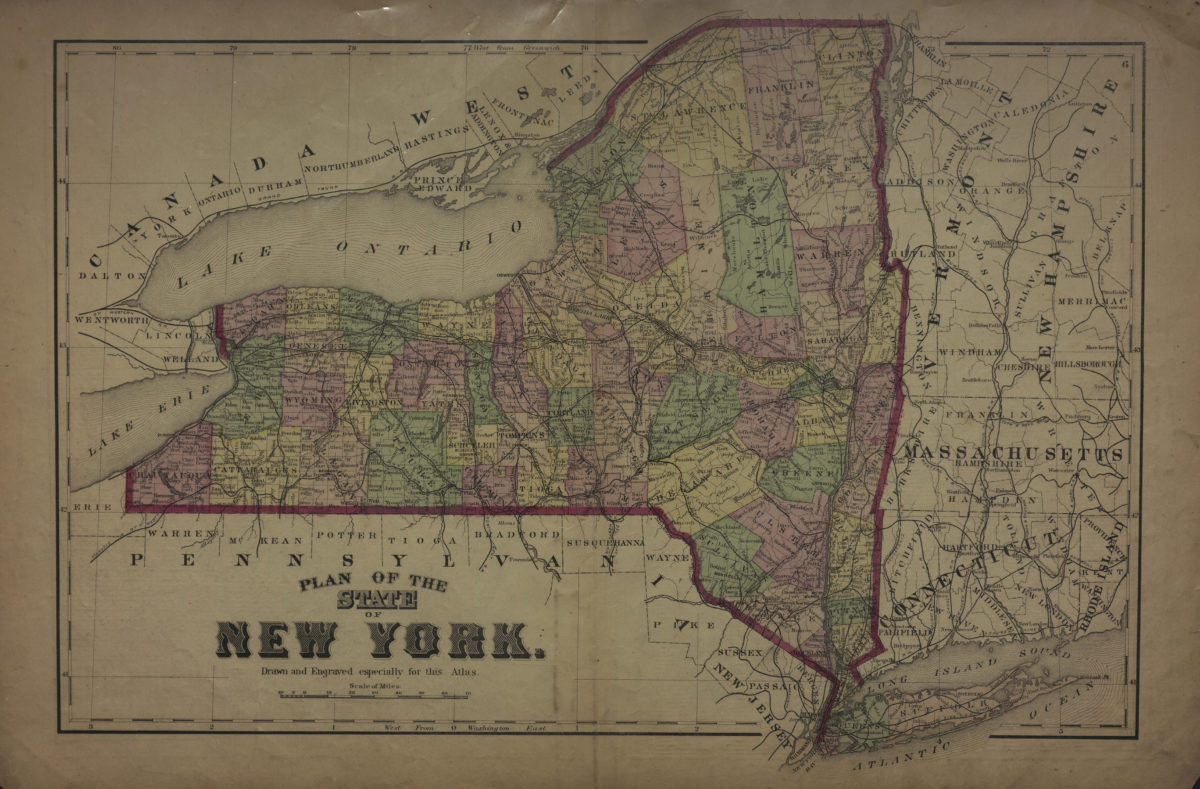
Plan of the state of New York: drawn and engraved especially for this atlas
Plan of the state of New York: drawn and engraved especially for this atlas
[1873]
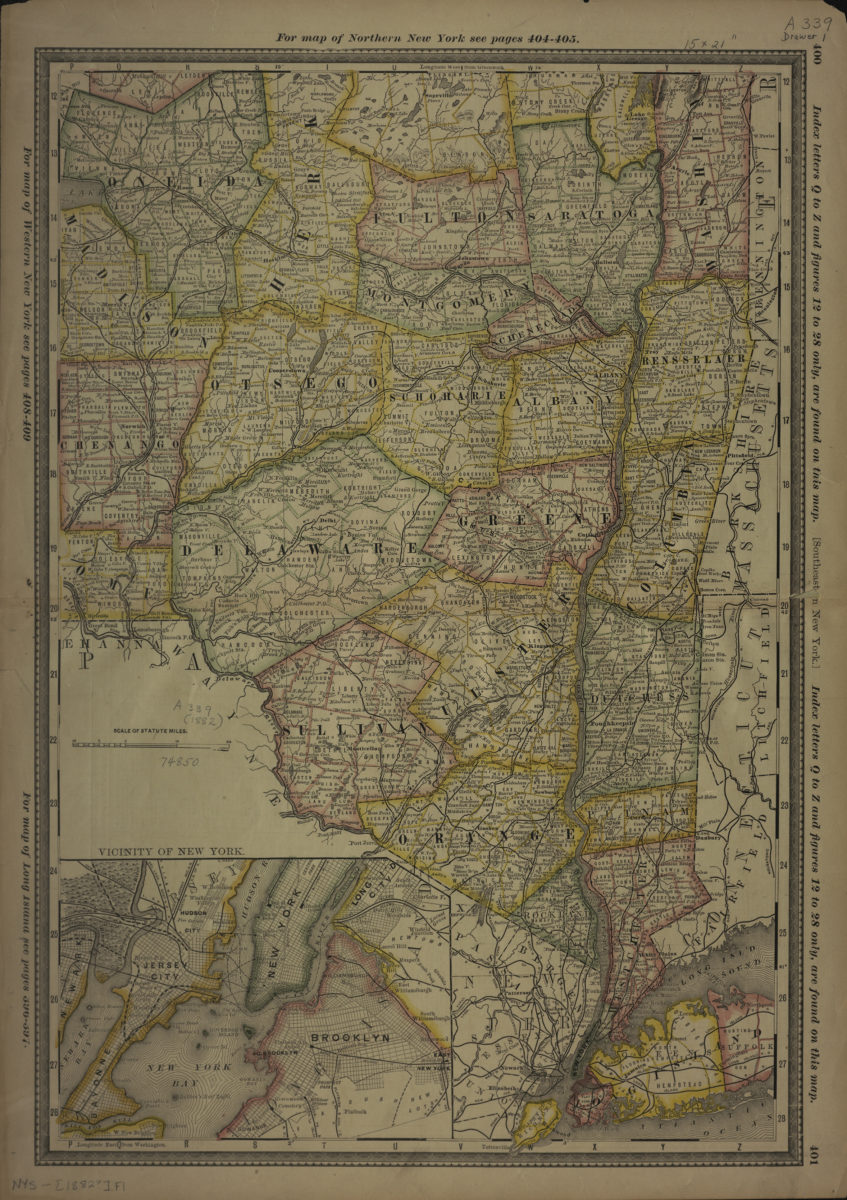
Southeastern New York
Southeastern New York
[1882]
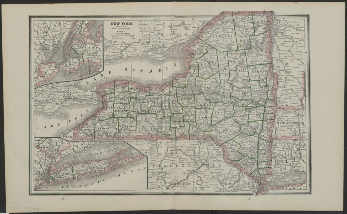
New York
New York
[19??]
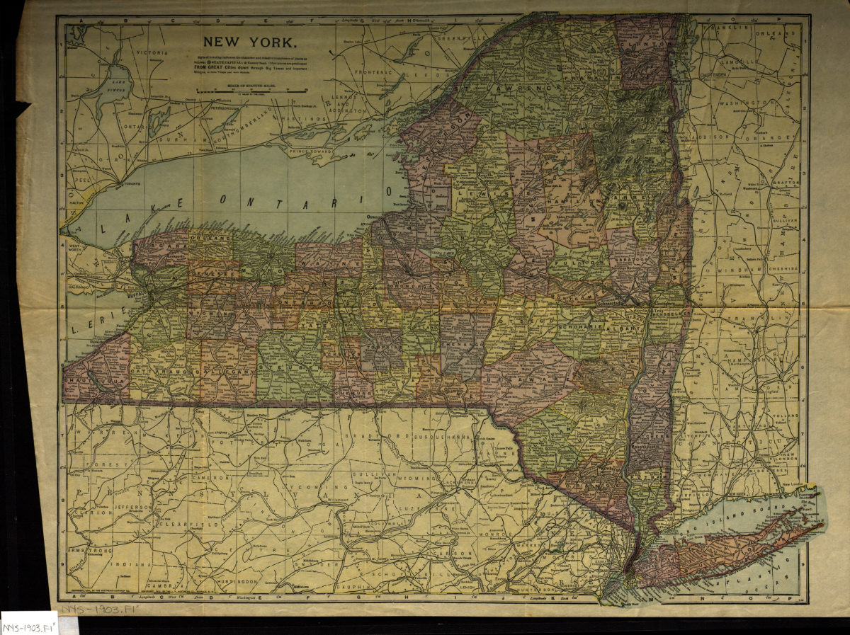
New York
New York
[1903; 1903]
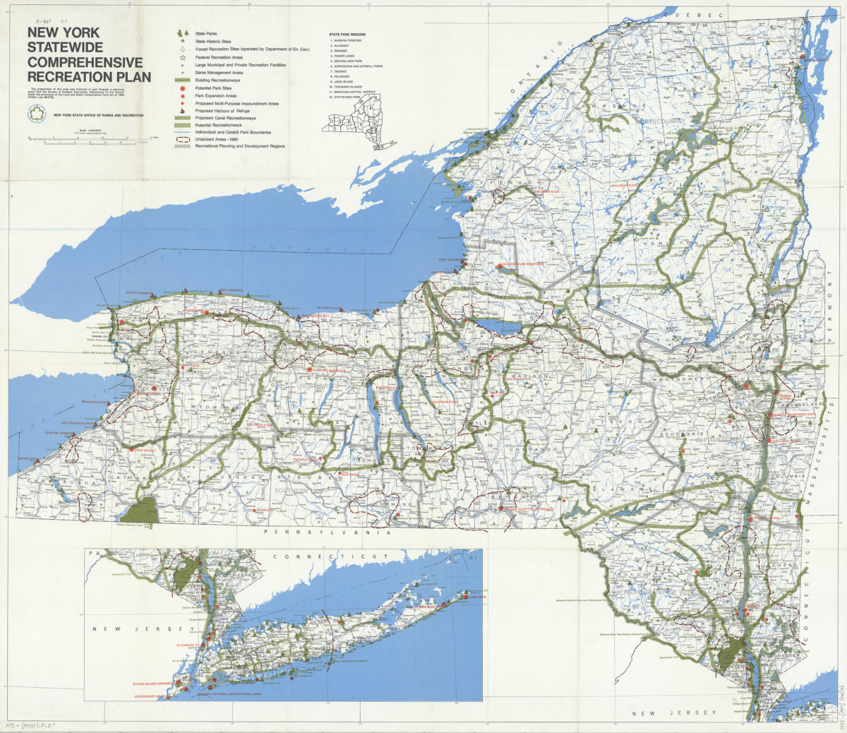
New York statewide comprehensive recreation plan
New York statewide comprehensive recreation plan
[1990]
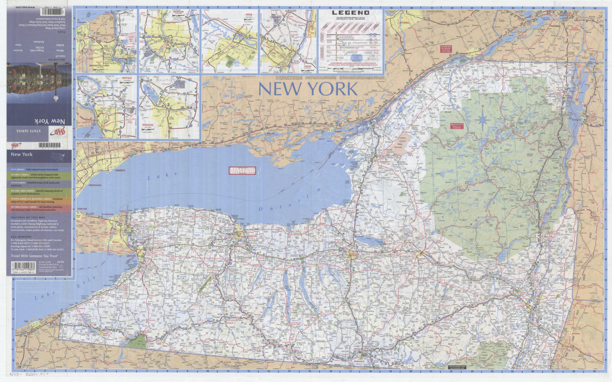
New York: including insets of Albany, Buffalo, Niagara Falls NY-ON, Rochester, Syracuse, Utica, plus Long Island map … toll & ferry information: AAA
New York: including insets of Albany, Buffalo, Niagara Falls NY-ON, Rochester, Syracuse, Utica, plus Long Island map … toll & ferry information: AAA
[2004]