Center for Brooklyn History
Map Collections
Search
About
Othmer Library & Archives
Submit search query
Refine 22 records
Clear filters
2
Location
Bay Ridge (New York, N.Y.)
108
Brooklyn (New York, N.Y.)
891
Fort Hamilton (New York, N.Y.)
31
Hudson County (N.J.)
3
Jersey City (N.J.)
4
Manhattan (New York, N.Y.)
120
Nassau County (N.Y.)
24
New Utrecht (New York, N.Y.)
9
New York (N.Y.)
164
New York Metropolitan Area
40
Queens (New York, N.Y.)
83
Sunset Park (New York, N.Y.)
53
Subject
Aqueducts
3
Buildings
12
Canals
15
Drainage
1
Electric railroads
5
ferries
32
Fills (Earthwork)
4
Fire alarms
4
Fire protection districts
2
Landowners
434
Local transit
63
Piers
25
Ponds
6
Railroads
72
Railroads, Elevated
24
Real property
619
Reservoirs
2
Rivers
16
Roads
117
School districts
4
Shorelines
3
Storm sewers
2
Street railroads
8
Streets
46
Subways
55
Wetlands
6
Show 6 more
Date
19th Century
945
20th Century
469
or enter range:
from
to
Genres
Cadastral maps
597
Manuscript maps
365
Map
191
Physical maps
4
Public utility maps
15
Road maps
83
Thematic maps
60
Tourist maps
55
Transportation maps
120
Sort by:
Date (earliest)
Date (most recent)
Map of Brooklyn City Railroad in New Utrecht
Map of Brooklyn City Railroad in New Utrecht
[18??]
Map of the city of Brooklyn, New York: showing railroads, street numbers &c.&c.&c
Map of the city of Brooklyn, New York: showing railroads, street numbers &c.&c.&c
[18??]
City & County map of New-York, Brooklyn, Williamsburgh, Jersey City and the adjacent waters: by J.H. Colton
City & County map of New-York, Brooklyn, Williamsburgh, Jersey City and the adjacent waters: by J.H. Colton
1852; [ca. 1845]
Sketch of a part of Long Island shewing the line of its water works and the position of the cities and towns that may be supplied with water from the distributing reservoirs: surveyed by Daniel Marsh … under the direction of Ward B. Burnett
Sketch of a part of Long Island shewing the line of its water works and the position of the cities and towns that may be supplied with water from the distributing reservoirs: surveyed by Daniel Marsh … under the direction of Ward B. Burnett
January 1853
Map of the consolidated City of Brooklyn: comprising the City of Brooklyn, City of Williamsburgh and Town of Bushwick, Kings County, Long Island: compiled from the Commissioners maps by George Hayward
Map of the consolidated City of Brooklyn: comprising the City of Brooklyn, City of Williamsburgh and Town of Bushwick, Kings County, Long Island: compiled from the Commissioners maps by George Hayward
1854
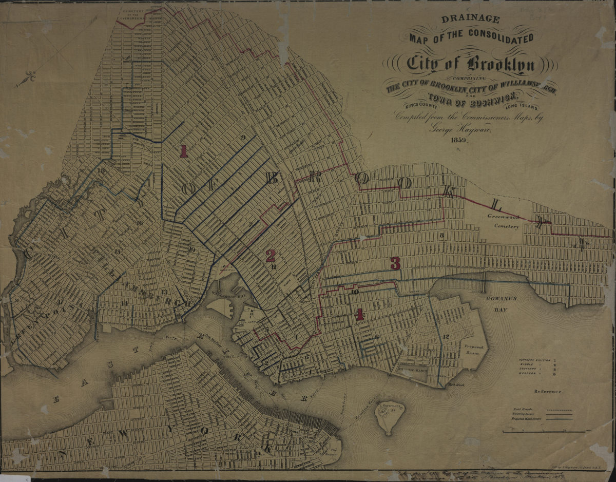
Drainage map of the consolidated city of Brooklyn: comprising the city of Brooklyn, city of Williamsburgh and town of Bushwick, Kings County, Long Island: compiled from the commissioners maps by George Hayward ; lith. by G. Hayward
Drainage map of the consolidated city of Brooklyn: comprising the city of Brooklyn, city of Williamsburgh and town of Bushwick, Kings County, Long Island: compiled from the commissioners maps by George Hayward ; lith. by G. Hayward
1859
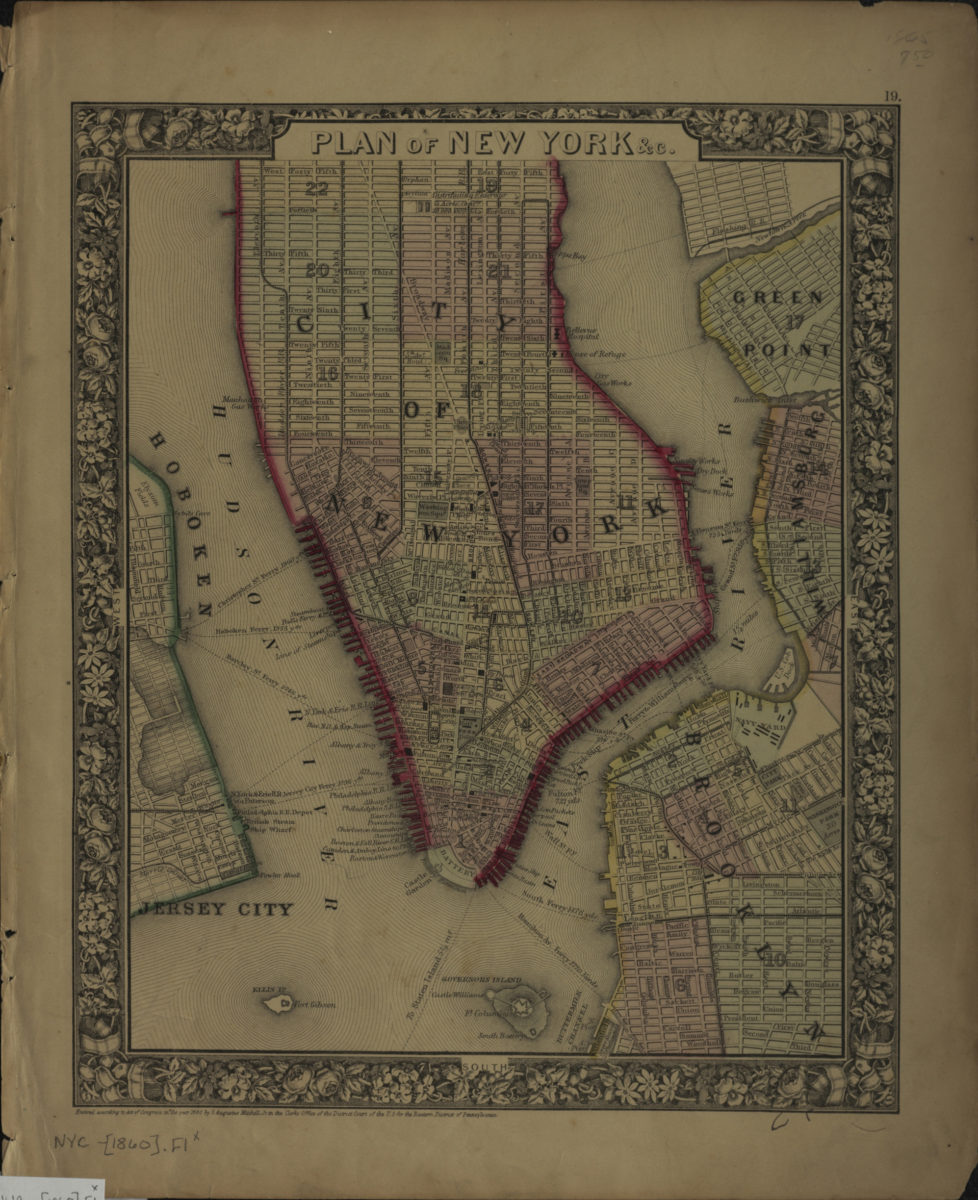
Plan of New York &c
Plan of New York &c
[ca. 1860]
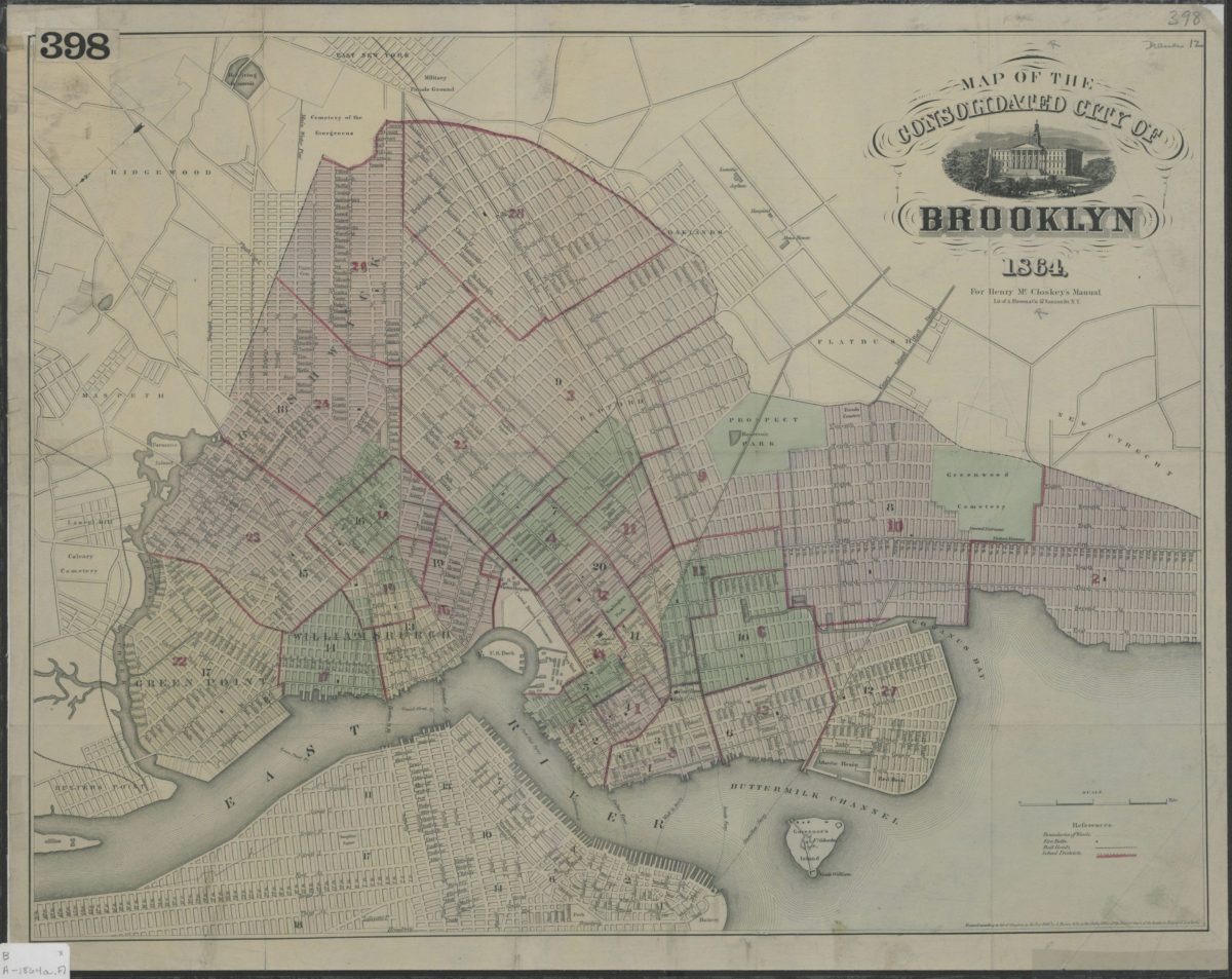
Map of the consolidated City of Brooklyn
Map of the consolidated City of Brooklyn
1864
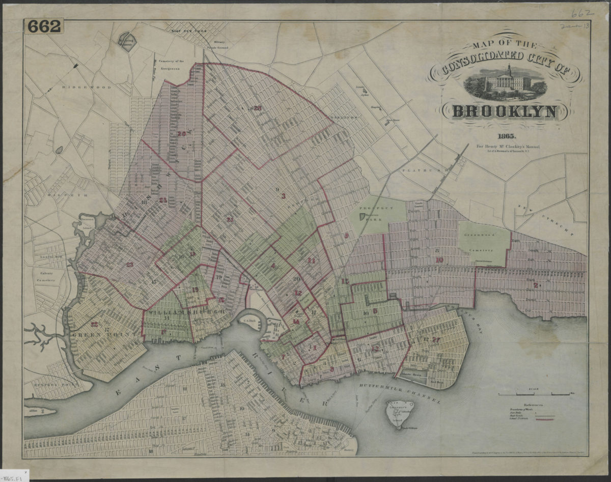
Map of the consolidated City of Brooklyn
Map of the consolidated City of Brooklyn
1865
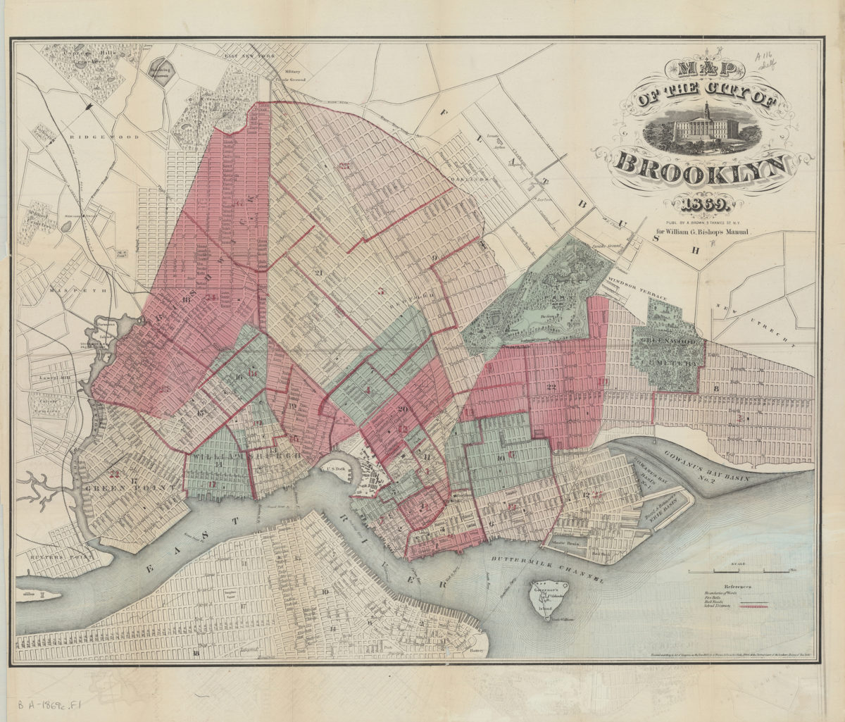
Map of the City of Brooklyn
Map of the City of Brooklyn
1869
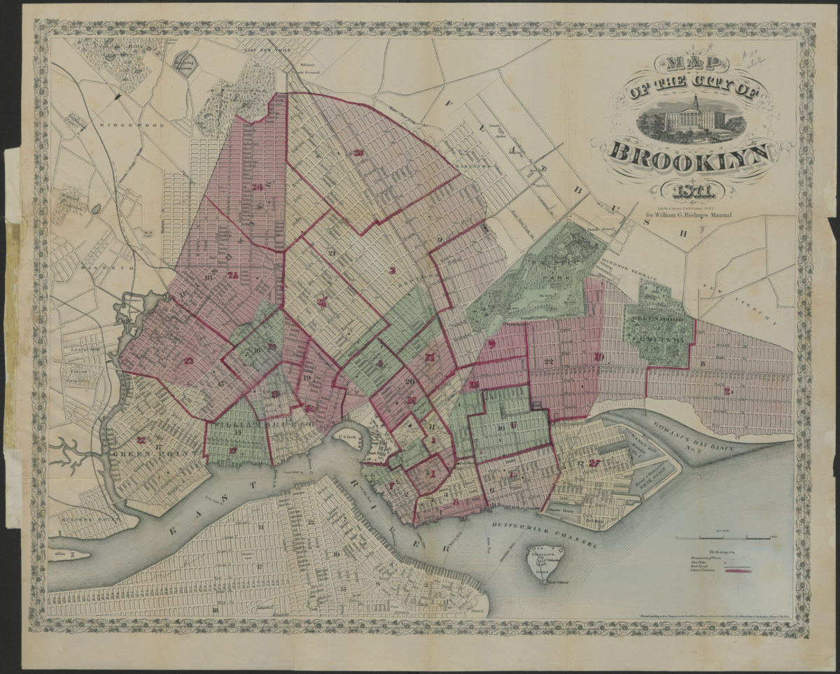
Map of the City of Brooklyn
Map of the City of Brooklyn
1871
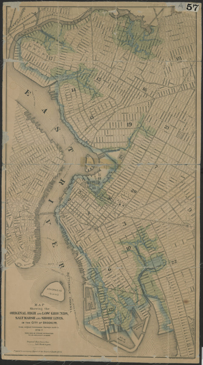
Map showing the original high and low grounds, salt marsh and shore lines in the city of Brooklyn: from original government surveys made in 1776-7
Map showing the original high and low grounds, salt marsh and shore lines in the city of Brooklyn: from original government surveys made in 1776-7
[1876]
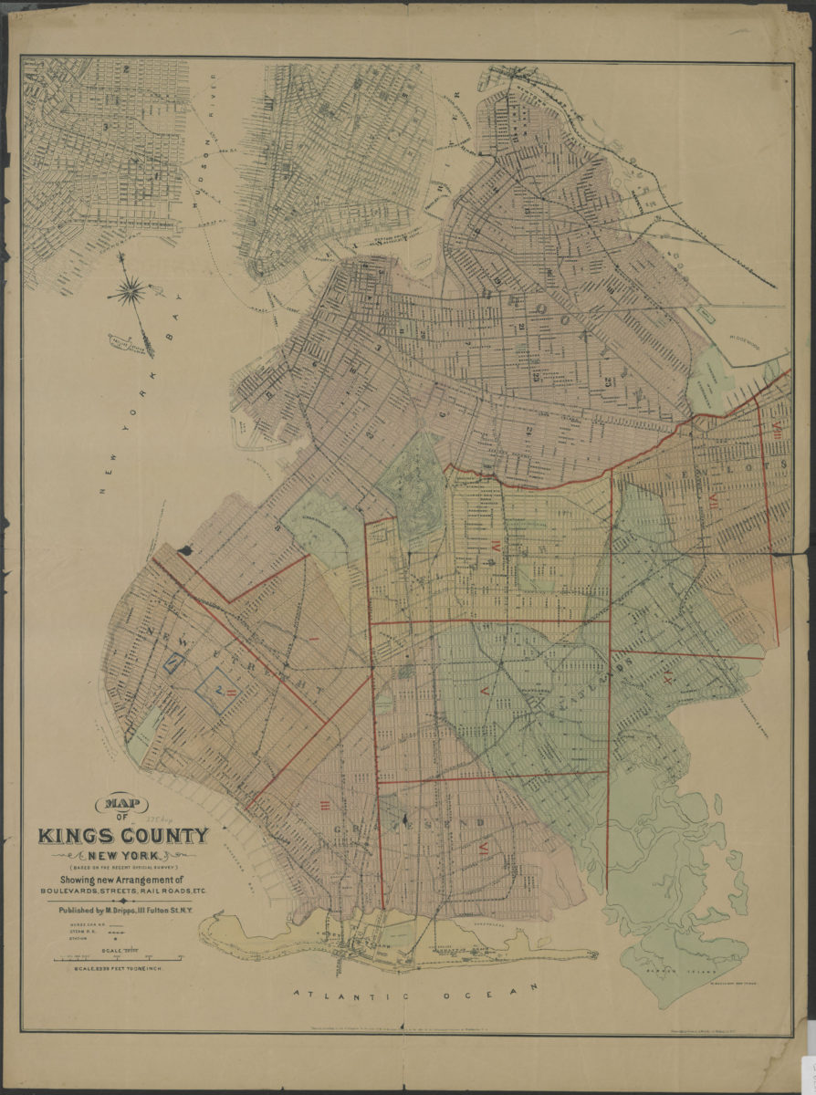
Map of Kings County New York (based on the recent official survey): showing new arrangement of boulevards, streets, railroads, etc
Map of Kings County New York (based on the recent official survey): showing new arrangement of boulevards, streets, railroads, etc
[1879]
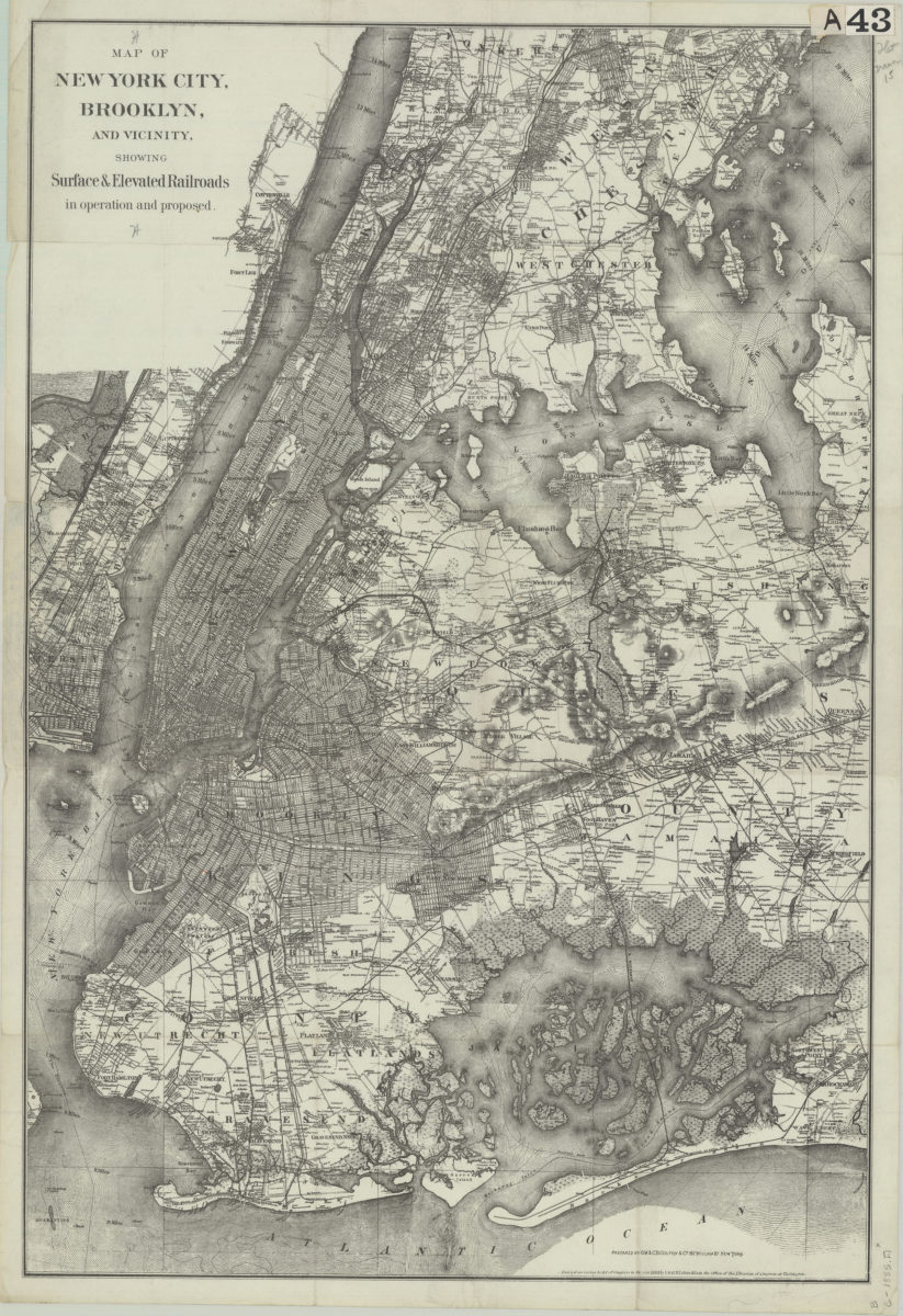
Map of New York City, Brooklyn, and vicinity: showing surface & elevated railroads in operation and proposed
Map of New York City, Brooklyn, and vicinity: showing surface & elevated railroads in operation and proposed
[ca. 1885]
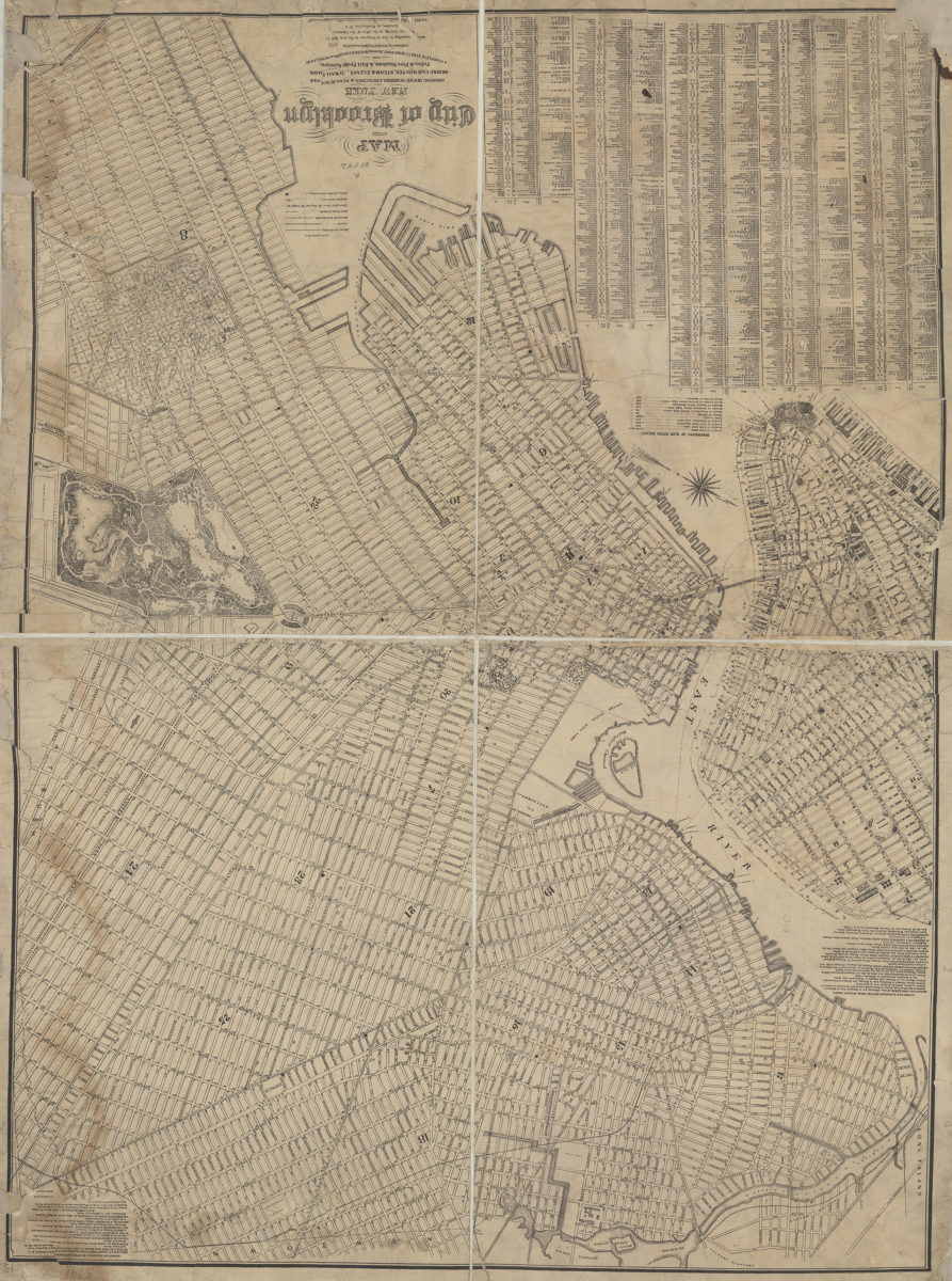
Map of the city of Brooklyn, New York: showing house numbers, churches & public schools, horse-car routes, steam & elevated railroads, police & fire stations, & exit from sewers, and a complete street directory, showing width & location of streets &c
Map of the city of Brooklyn, New York: showing house numbers, churches & public schools, horse-car routes, steam & elevated railroads, police & fire stations, & exit from sewers, and a complete street directory, showing width & location of streets &c
[1886]
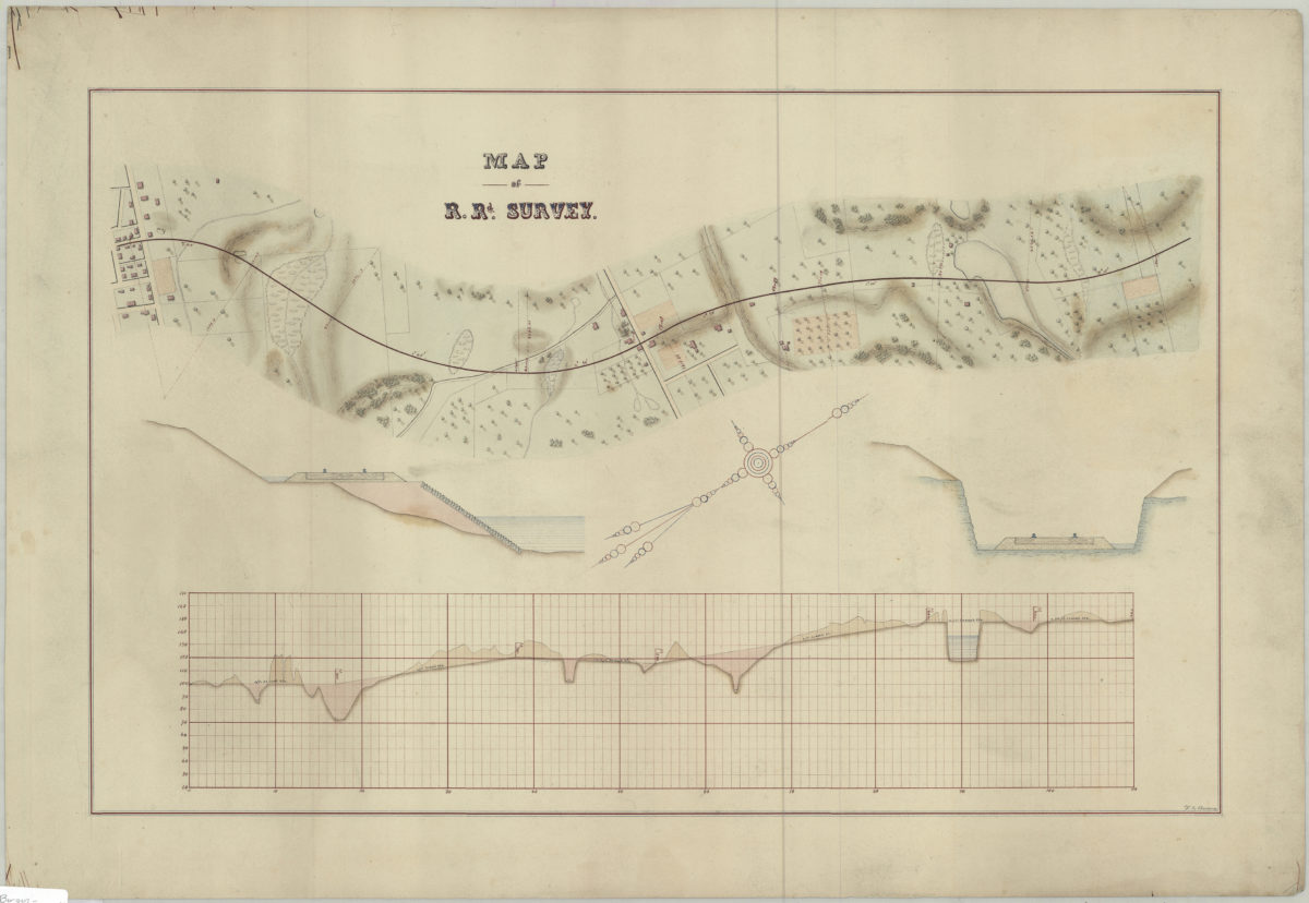
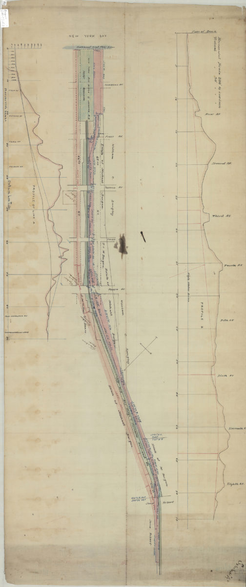
Map of r.rd. survey: V.B. Bergen
Map of r.rd. survey: V.B. Bergen
[189?]
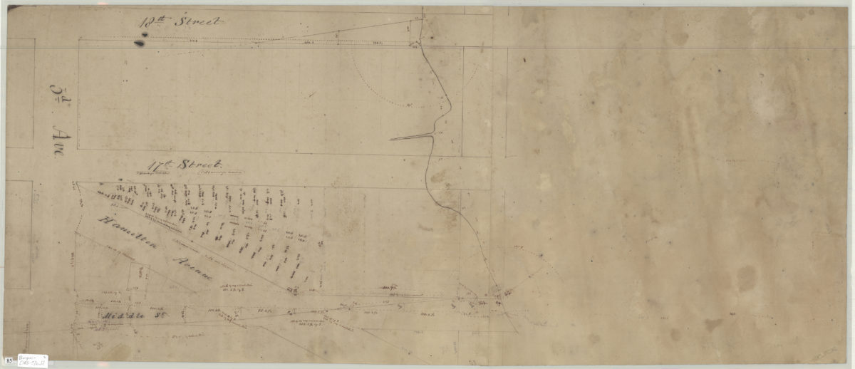
Map of r.rd. survey
Map of r.rd. survey
[189?]
[Map showing line of New York, Bay Ridge & Jamaica Railroad Co. in Bay Ridge, Brooklyn]
[Map showing line of New York, Bay Ridge & Jamaica Railroad Co. in Bay Ridge, Brooklyn]
[189?]
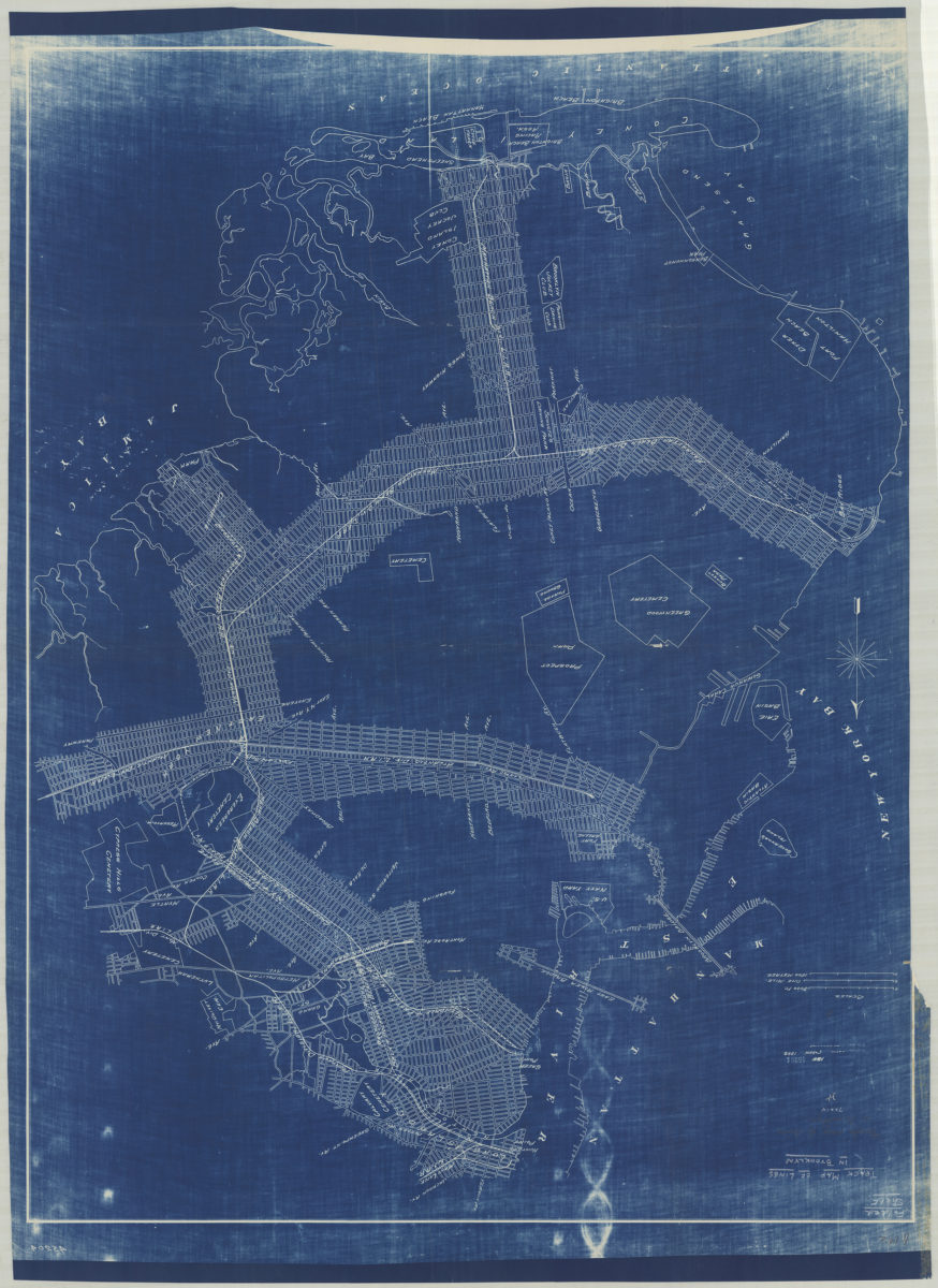
Track map of lines in Brooklyn
Track map of lines in Brooklyn
1898
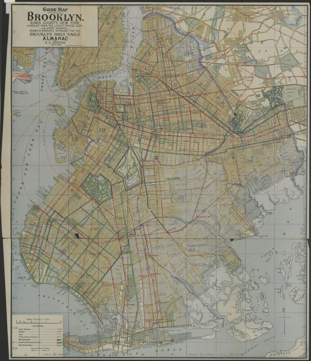
Guide map of the Borough of Brooklyn, Kings County, New York: compiled from the latest official maps & other sources, drawn & engraved expressly for the Brooklyn Daily Eagle Almanac
Guide map of the Borough of Brooklyn, Kings County, New York: compiled from the latest official maps & other sources, drawn & engraved expressly for the Brooklyn Daily Eagle Almanac
[ca. 1898]
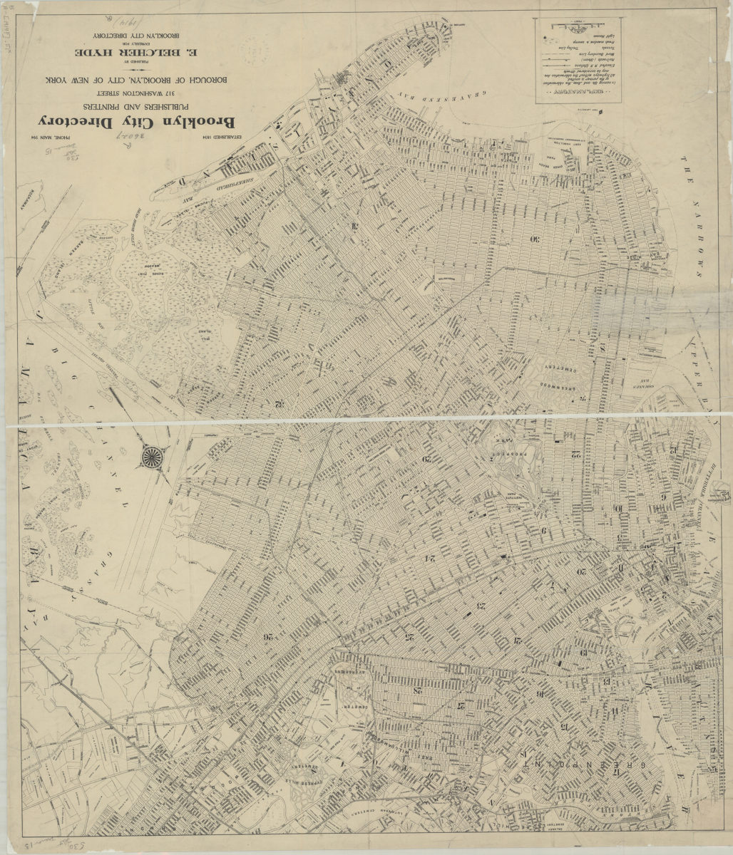
[Map of Brooklyn, circa 1914, from Brooklyn City Directory]
[Map of Brooklyn, circa 1914, from Brooklyn City Directory]
[1914]
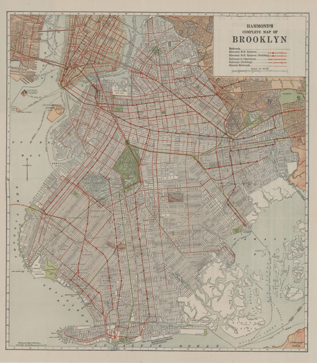
Hammond’s complete map of Brooklyn: copyright by C.S. Hammond Co
Hammond’s complete map of Brooklyn: copyright by C.S. Hammond Co
[192?]