Center for Brooklyn History
Map Collections
Search
About
Othmer Library & Archives
Submit search query
Refine 83 records
Clear filter
1
Location
Astoria (New York, N.Y.)
4
Bellerose (New York, N.Y.)
1
Bergen County (N.J.)
6
Bronx (New York, N.Y.)
10
Brooklyn (New York, N.Y.)
891
Bushwick (New York, N.Y.)
20
College Point (New York, N.Y.)
2
Corona (New York, N.Y.)
2
Cypress Hills (New York, N.Y.)
8
Douglaston (New York, N.Y.)
1
Downtown Brooklyn (New York, N.Y.)
29
East Elmhurst (New York, N.Y.)
2
Elmhurst (New York, N.Y.)
1
Far Rockaway (New York, N.Y.)
2
Flushing (New York, N.Y.)
13
Flushing Meadows-Corona Park (New York, N.Y.)
1
Forest Hills Gardens (New York, N.Y.)
1
Freeport (N.Y.)
1
Hempstead (N.Y.)
13
Hinsdale (New York, N.Y.)
1
Hunters Point (New York, N.Y.)
2
Jamaica (New York, N.Y.)
8
Jamaica Bay (N.Y.)
5
Jersey City (N.J.)
4
Kings County (New York, N.Y.)
8
Long Island (N.Y.)
197
Long Island City (New York, N.Y.)
8
Malba (New York, N.Y.)
1
Manhattan (New York, N.Y.)
120
Maspeth (New York, N.Y.)
2
Nassau County (N.Y.)
24
New Jersey
27
New York (N.Y.)
164
New York (State)
95
New York Metropolitan Area
40
Newtown (New York, N.Y.)
1
Newtown (Queens County, N.Y.)
4
Queens (New York, N.Y.)
83
Ravenswood (New York, N.Y.)
4
Richmond Hill (New York, N.Y.)
2
Ridgewood (New York, N.Y.)
2
Rockaway (New York, N.Y.)
1
Rockaway Beach (New York, N.Y.)
1
Saint Albans (New York, N.Y.)
1
Stapleton (New York, N.Y.)
1
Staten Island (N.Y.)
10
Suffolk County (N.Y.)
43
Sunnyside (New York, N.Y.)
1
United States
10
Whitestone (New York, N.Y.)
3
Woodhaven (New York, N.Y.)
1
Woodside (New York, N.Y.)
3
Show 32 more
Subject
Aqueducts
3
Auctions
32
Buildings
12
Bus lines
20
Bus travel
22
Canals
15
Cemeteries
17
Coasts
4
Exhibitions
5
Fills (Earthwork)
4
Housing
4
Landowners
434
Local transit
63
Market surveys
4
Marshes
1
New York (State)
1
Piers
25
Ponds
6
Postal codes
4
Railroads
72
Railroads, Elevated
24
Real estate development
1
Real property
619
Rent
4
Reservoirs
2
Rivers
16
Roads
117
Street addresses
11
Street railroads
8
Streets
46
Subways
55
Transportation
3
Wetlands
6
Show 13 more
Date
19th Century
945
20th Century
469
21th Century
66
or enter range:
from
to
Genres
Aerial views
15
Bathymetric maps
94
Broadsides
33
Cadastral maps
597
Index maps
1
Manuscript maps
365
Map
191
Nautical charts
30
Physical maps
4
Pictorial maps
38
Population maps
6
Road maps
83
Thematic maps
60
Topographic maps
70
Tourist maps
55
Transportation maps
120
Zoning maps
55
Sort by:
Date (earliest)
Date (most recent)
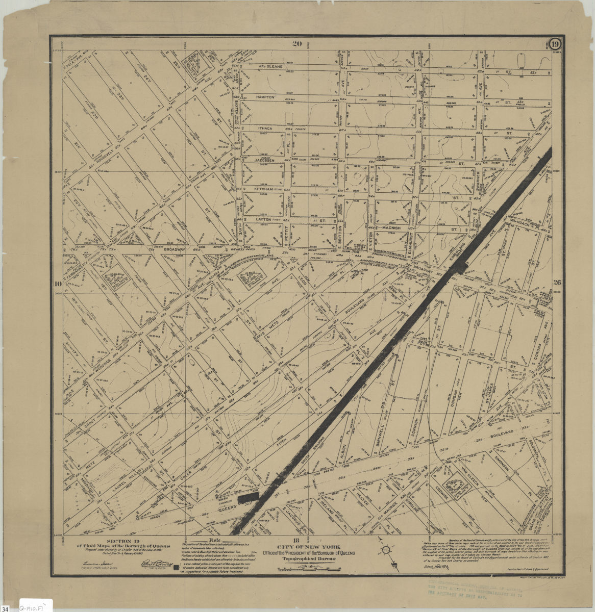
Section 19 of Final maps of the Borough of Queens: City of New York, Borough of Queens, Office of the President, Topographical Bureau
Section 19 of Final maps of the Borough of Queens: City of New York, Borough of Queens, Office of the President, Topographical Bureau
1910
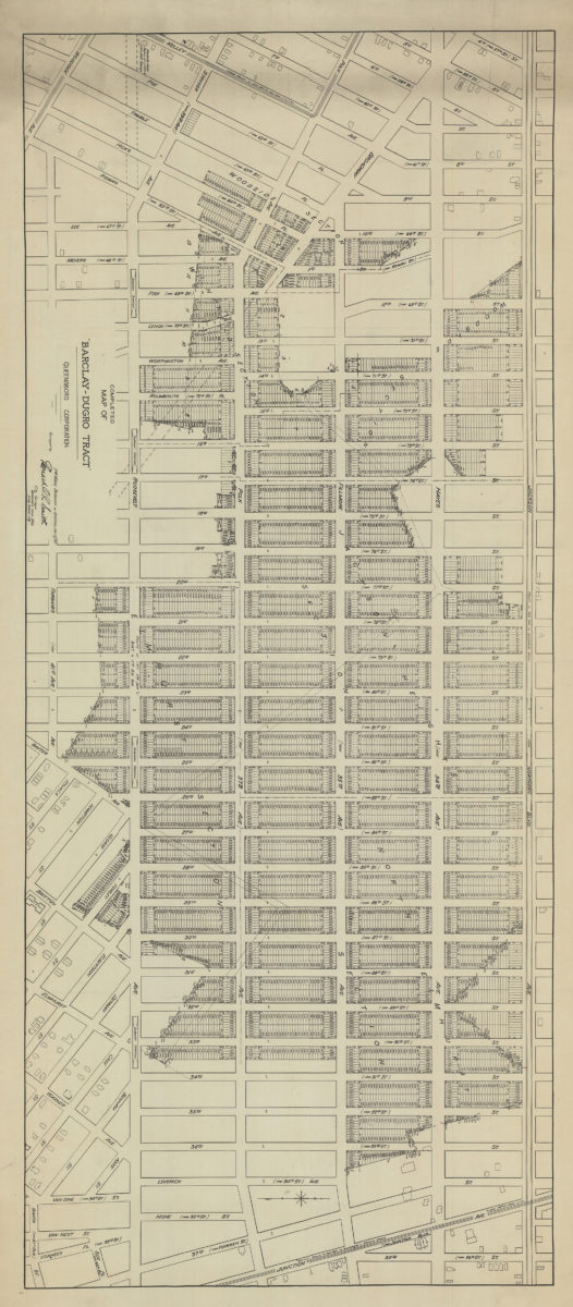
Completed map of the Barclay-Dugro tract
Completed map of the Barclay-Dugro tract
1911
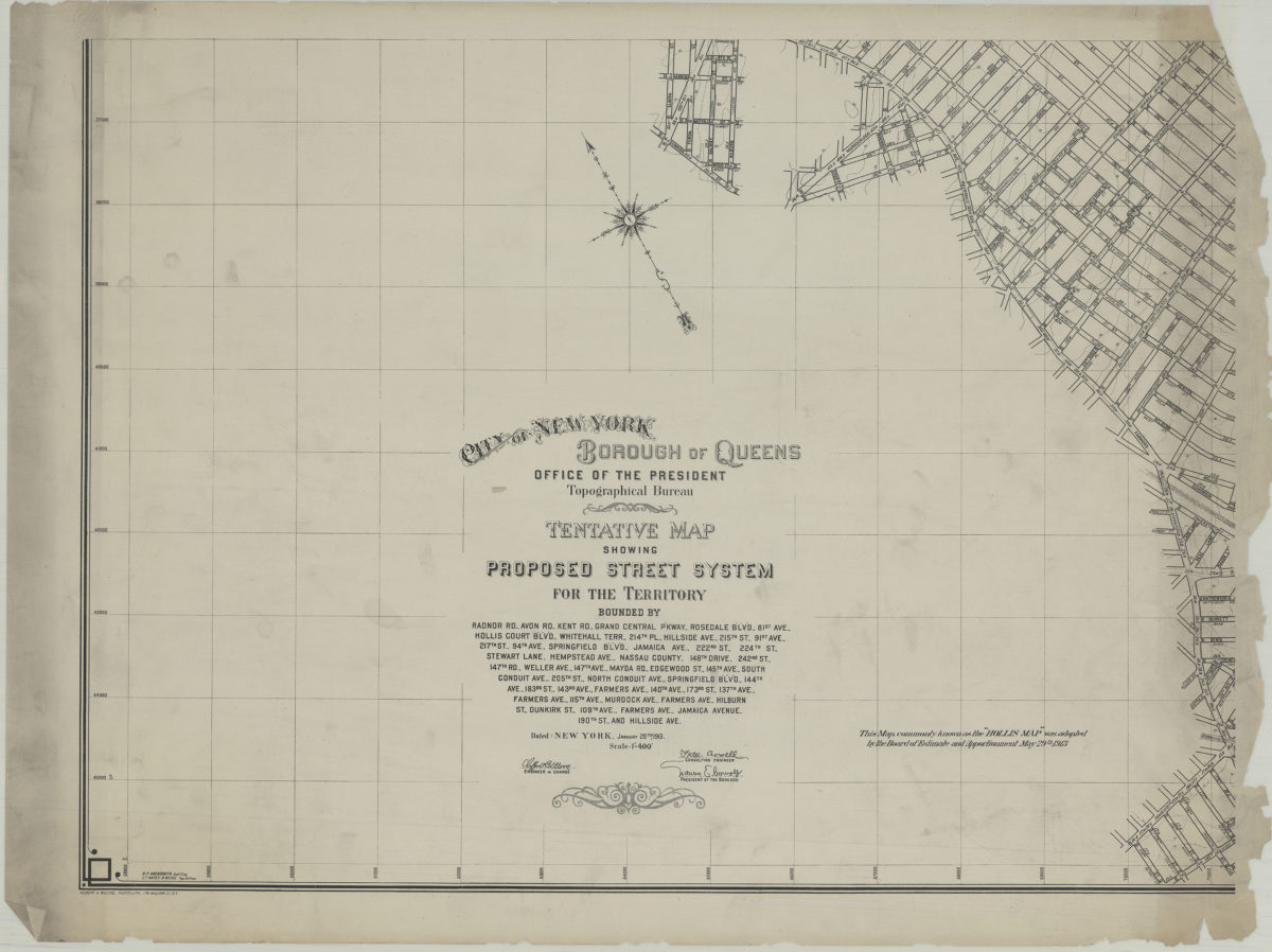
Tentative map showing proposed street system for the territory bounded by Radnor Rd., Avon Rd., Kent Rd. … Jamaica Avenue, 190th St. and Hillside Ave.: City of New York, Borough of Queens, Office of the President, Topographical Bureau
Tentative map showing proposed street system for the territory bounded by Radnor Rd., Avon Rd., Kent Rd. … Jamaica Avenue, 190th St. and Hillside Ave.: City of New York, Borough of Queens, Office of the President, Topographical Bureau
1913
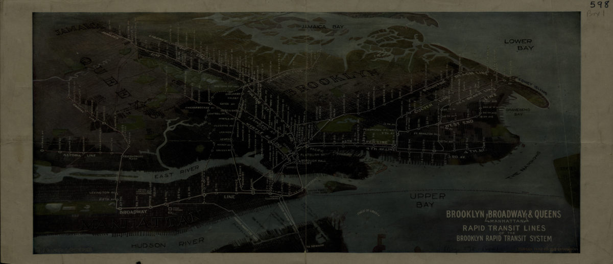
Brooklyn, Broadway (Manhattan), Queens rapid transit lines of the Brooklyn Rapid Transit System: Harry A. Chandler
Brooklyn, Broadway (Manhattan), Queens rapid transit lines of the Brooklyn Rapid Transit System: Harry A. Chandler
[1916-1924]
Map showing Brooklyn automobile routes and car lines approved by the Borough President, July 1919
Map showing Brooklyn automobile routes and car lines approved by the Borough President, July 1919
[1919]
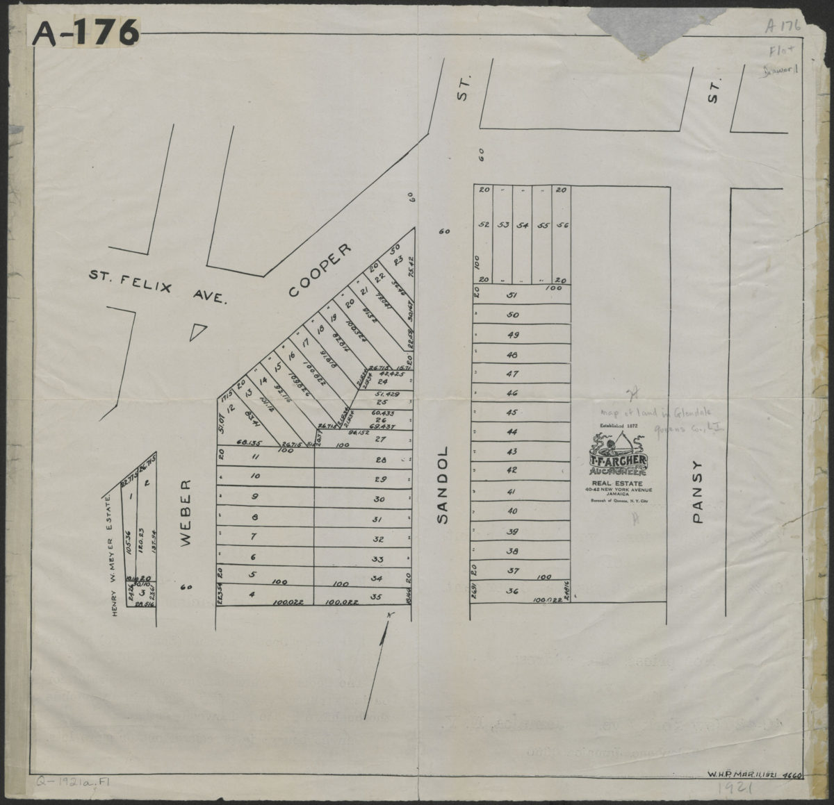
[Map of 53 building lots in Ridgewood, Glendale section, Queens County]
[Map of 53 building lots in Ridgewood, Glendale section, Queens County]
1921
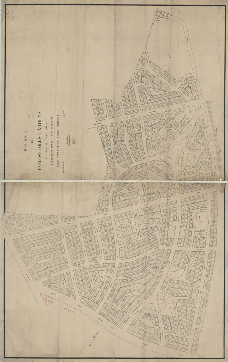
Map no. 6 of Forest Hills Gardens: situated at Forest Hills, Borough of Queens, City of New York : [surveyed for] Sage Foundation Homes Company: C.B. Fancy, civil engineer
Map no. 6 of Forest Hills Gardens: situated at Forest Hills, Borough of Queens, City of New York : [surveyed for] Sage Foundation Homes Company: C.B. Fancy, civil engineer
1921
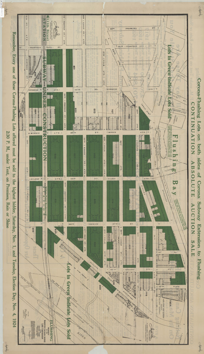
Property of the Roosevelt-Jackson Avenue Land Corporation in the Second Ward Borough of Queens City of New York
Property of the Roosevelt-Jackson Avenue Land Corporation in the Second Ward Borough of Queens City of New York
1923
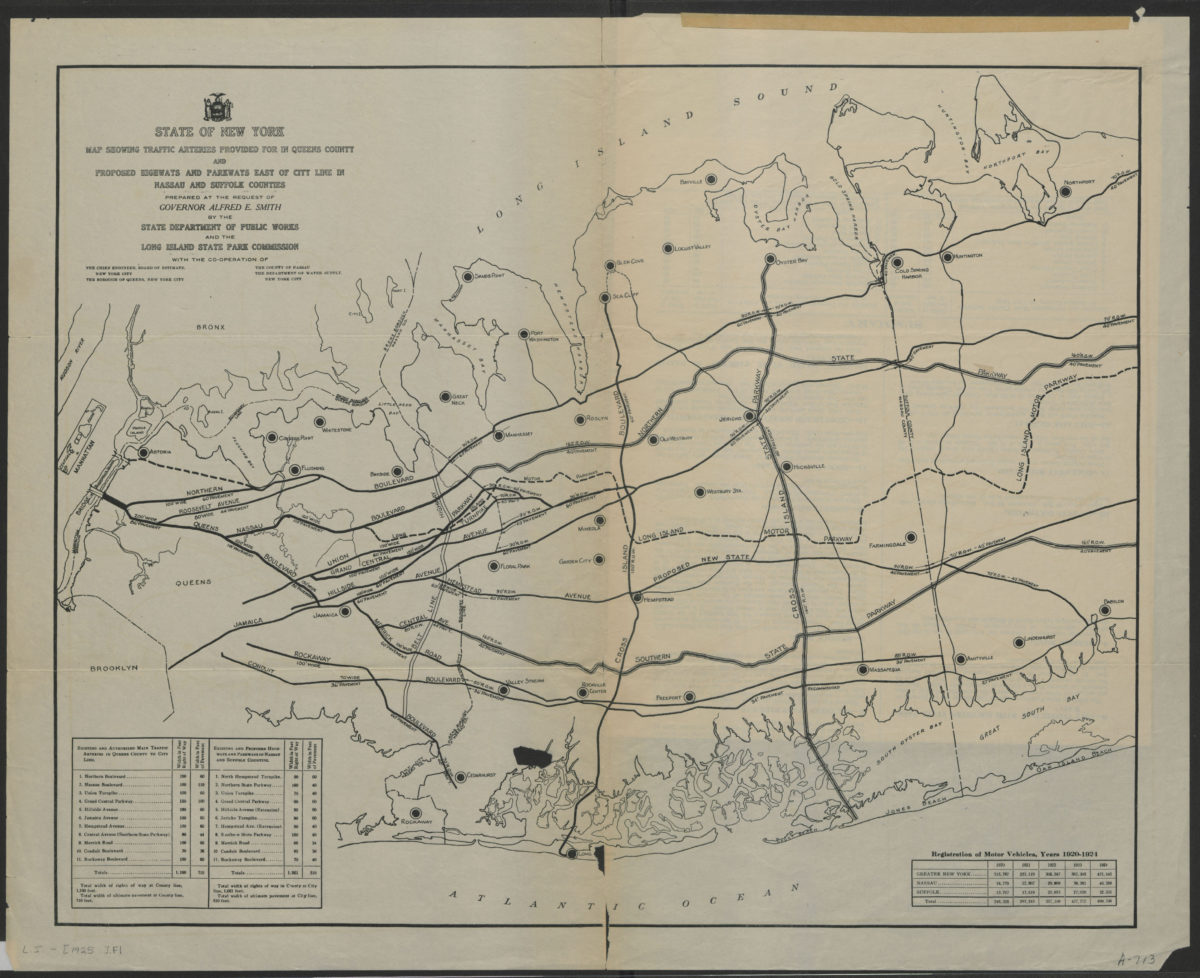
State of New York map showing traffic arteries provided for in Queens County and proposed highways and parkways east of city line in Nassau and Suffolk Counties: prepared at the request of Governor Alfred E. Smith
State of New York map showing traffic arteries provided for in Queens County and proposed highways and parkways east of city line in Nassau and Suffolk Counties: prepared at the request of Governor Alfred E. Smith
[1925]
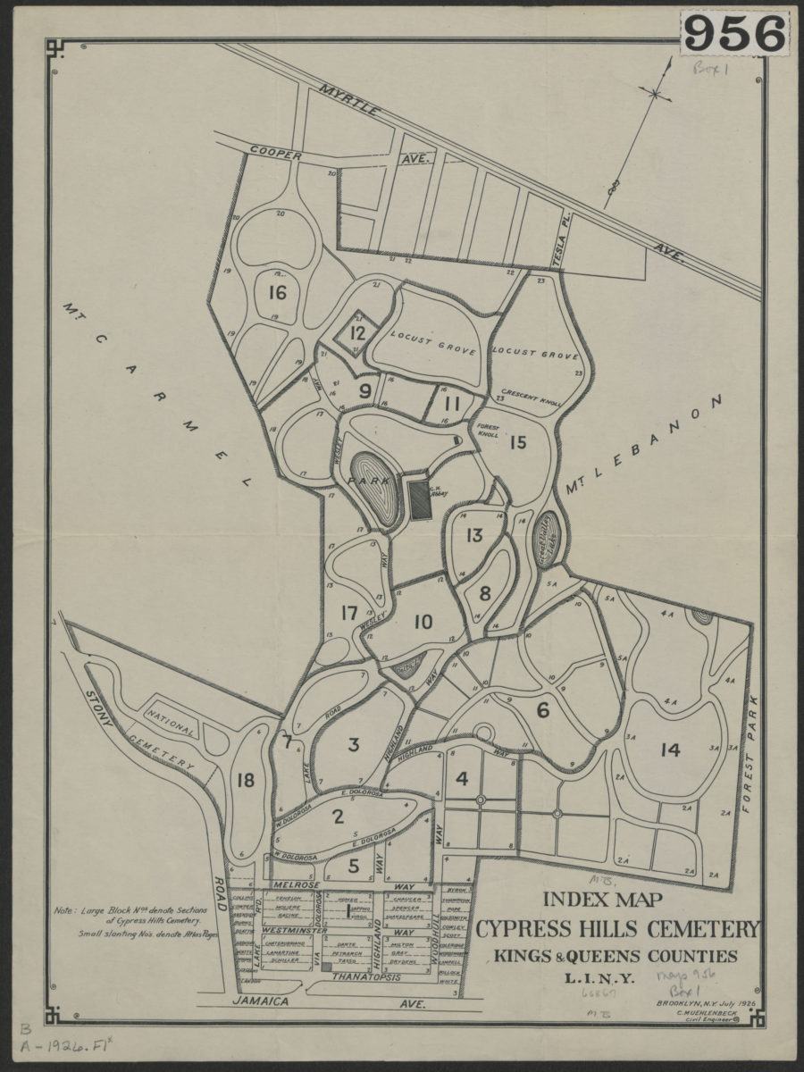
Index map, Cypress Hills Cemetery: Kings & Queens Counties, L.I., N.Y.
Index map, Cypress Hills Cemetery: Kings & Queens Counties, L.I., N.Y.
Jul-26
Hagstrom’s map of Queens (New York City): house-number and subway guide: compiled, printed, and published by Hagstrom Map Company, map makers and publishers
Hagstrom’s map of Queens (New York City): house-number and subway guide: compiled, printed, and published by Hagstrom Map Company, map makers and publishers
[1928]
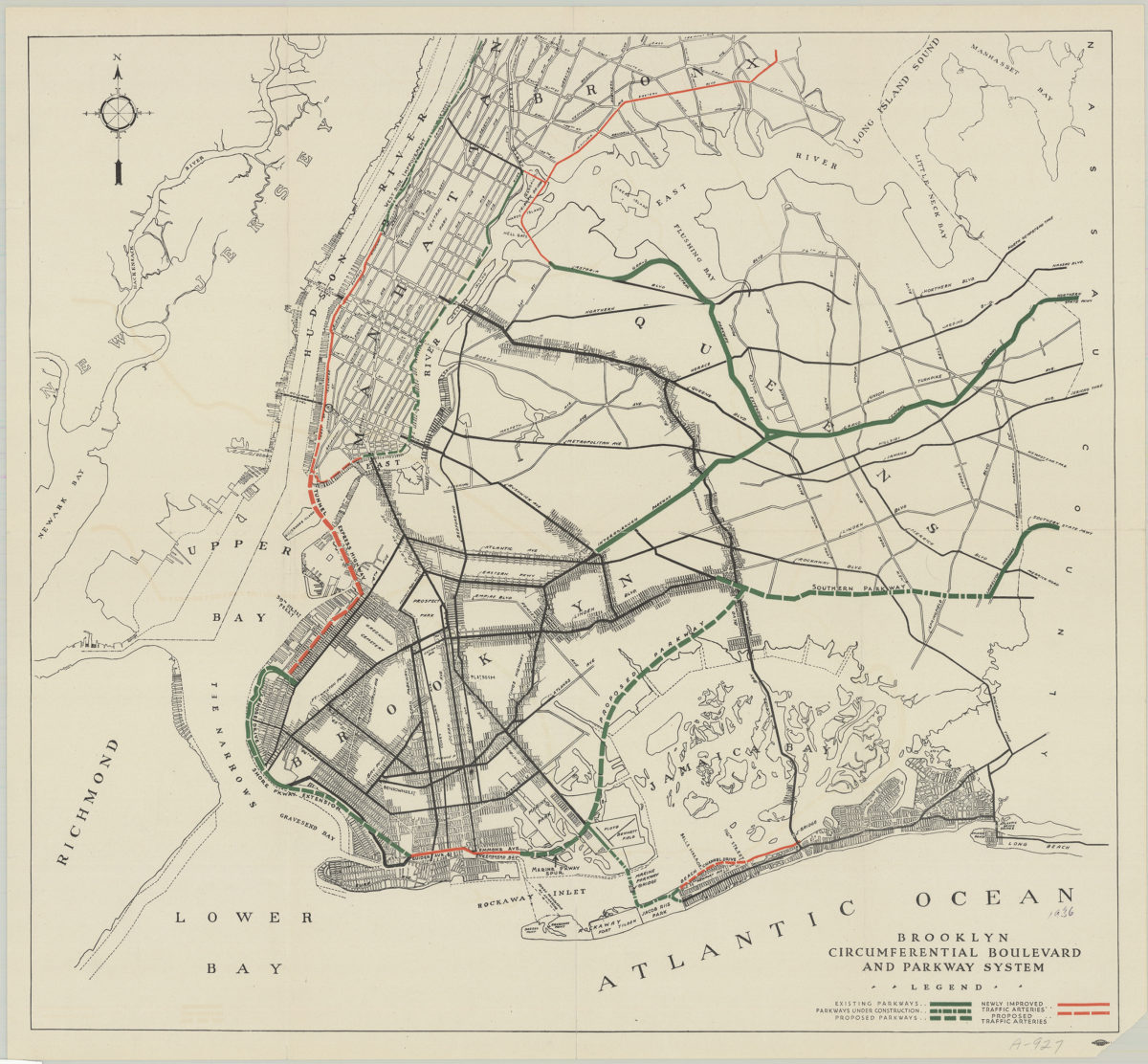
Brooklyn circumferential boulevard and parkway system
Brooklyn circumferential boulevard and parkway system
[193?]
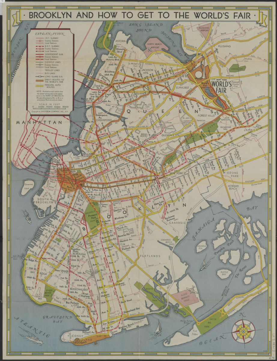
How to get to the New York World’s Fair, and The heart of Brooklyn: issued by the Downtown Brooklyn Association, Inc
How to get to the New York World’s Fair, and The heart of Brooklyn: issued by the Downtown Brooklyn Association, Inc
[1939]
Shell street guide and metropolitan map of Brooklyn, Queens and Long Island: the H.M. Gousha Company
Shell street guide and metropolitan map of Brooklyn, Queens and Long Island: the H.M. Gousha Company
[1939]
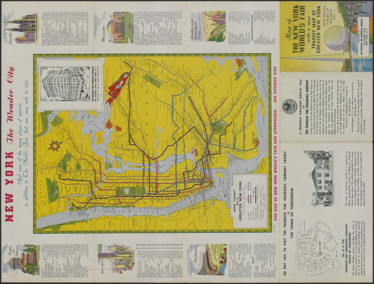
Map of the New York World’s Fair with a new transit map of Greater New York: auto routes, places of interest
Map of the New York World’s Fair with a new transit map of Greater New York: auto routes, places of interest
[1939]
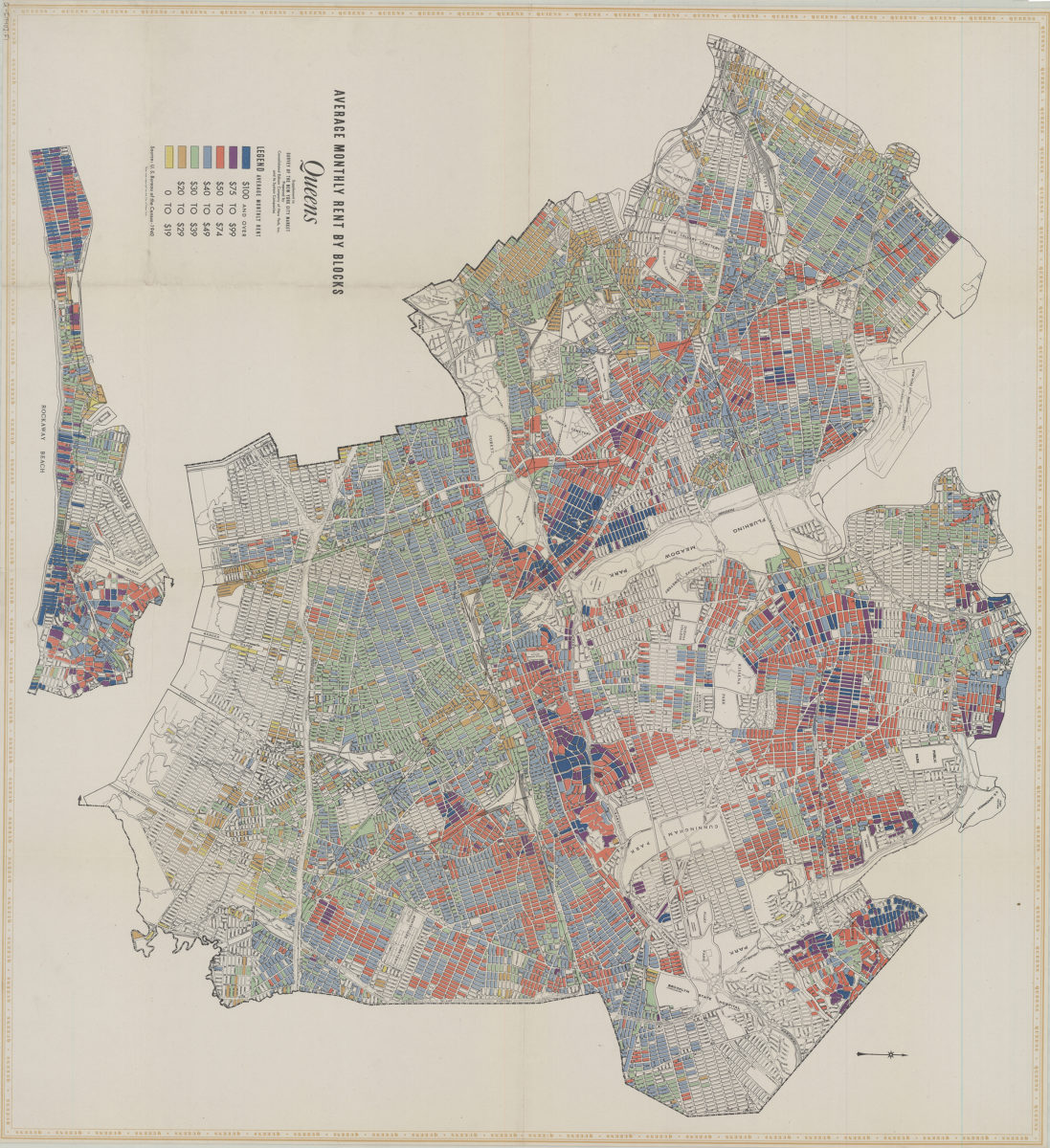
Average monthly rent by blocks, Queens: supplement to Survey of the New York City market: prepared by Consolidated Edison Company of New York, Inc. and its system companies
Average monthly rent by blocks, Queens: supplement to Survey of the New York City market: prepared by Consolidated Edison Company of New York, Inc. and its system companies
[1940]
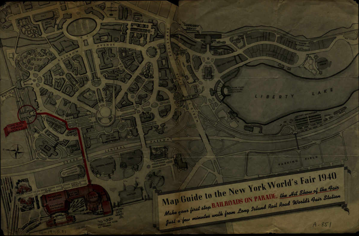
Map guide to the New York World’s Fair 1940
Map guide to the New York World’s Fair 1940
[1940]
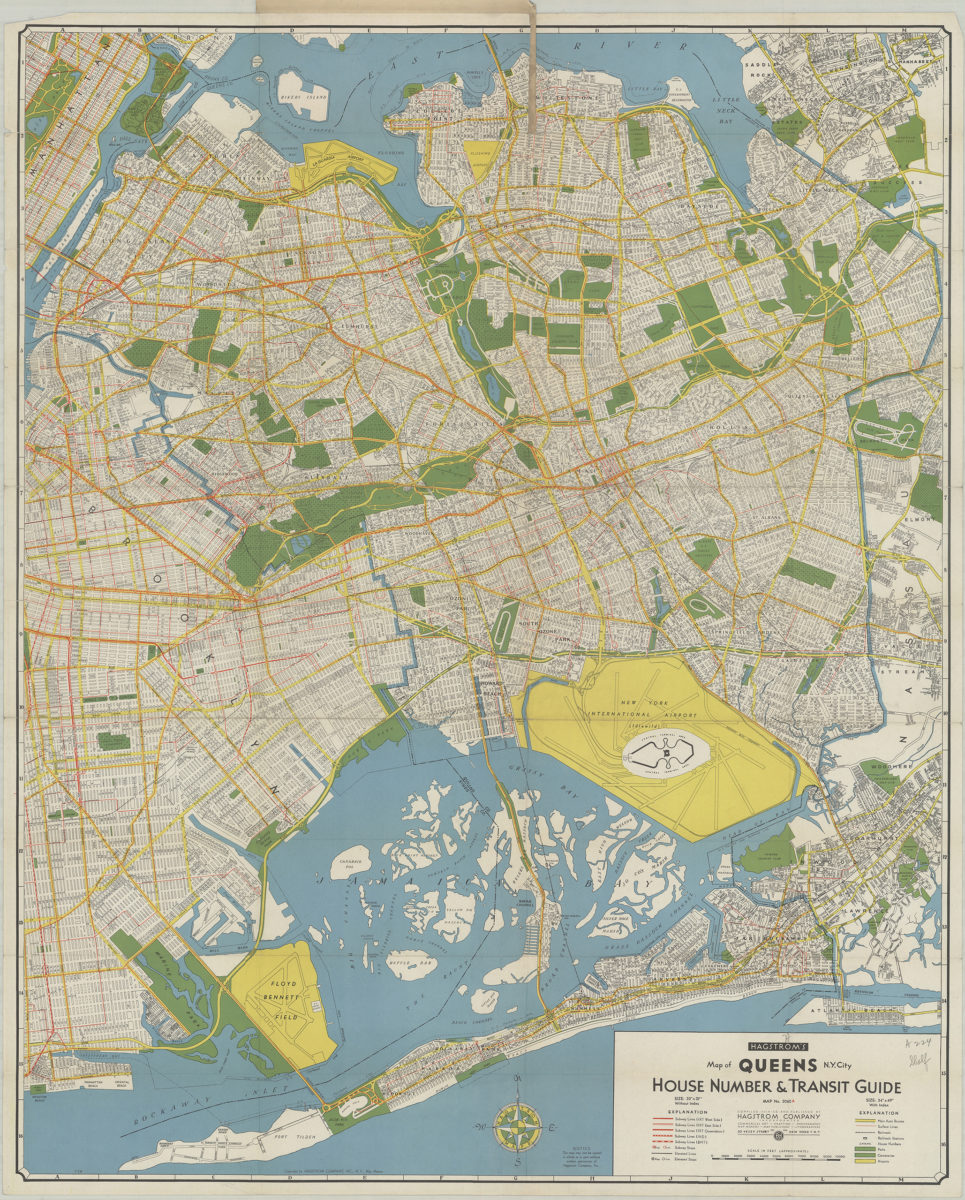
Hagstrom’s map of Queens N.Y. City: house number & transit guide: compiled, printed, and published by Hagstrom Company Incorporated
Hagstrom’s map of Queens N.Y. City: house number & transit guide: compiled, printed, and published by Hagstrom Company Incorporated
[1948]
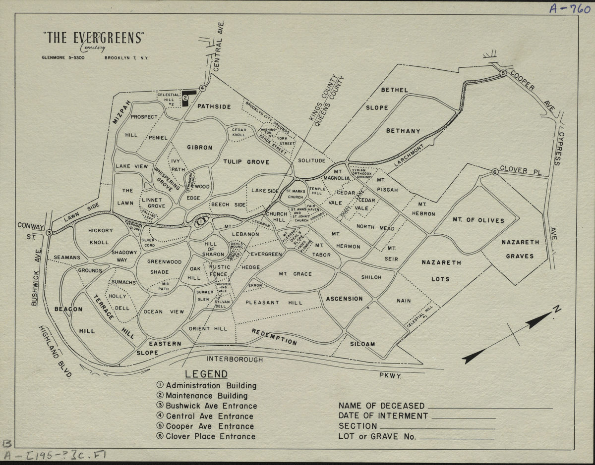
“The Evergreens” cemetery, Brooklyn-New York
“The Evergreens” cemetery, Brooklyn-New York
[195?]
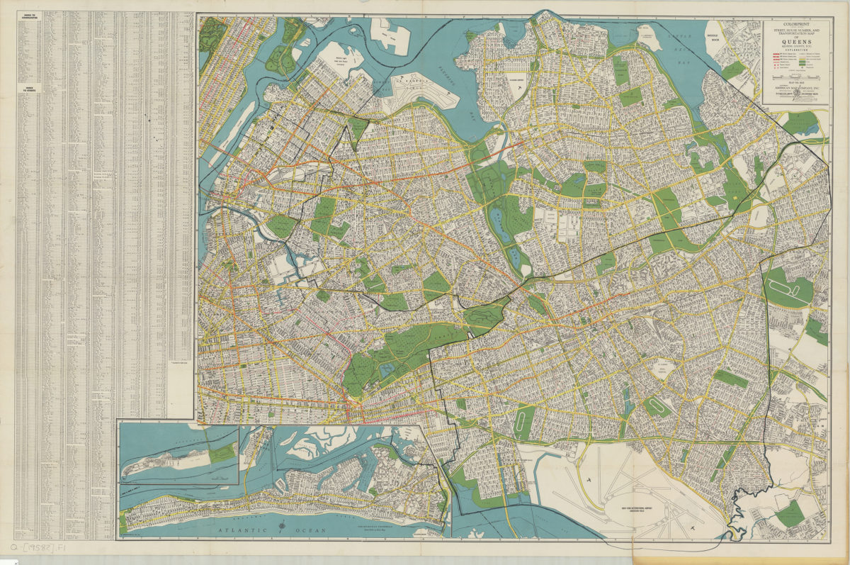
Colorprint street, house number and transportation map of Queens: (Queens County, N.Y.): American Map Company
Colorprint street, house number and transportation map of Queens: (Queens County, N.Y.): American Map Company
[1958]
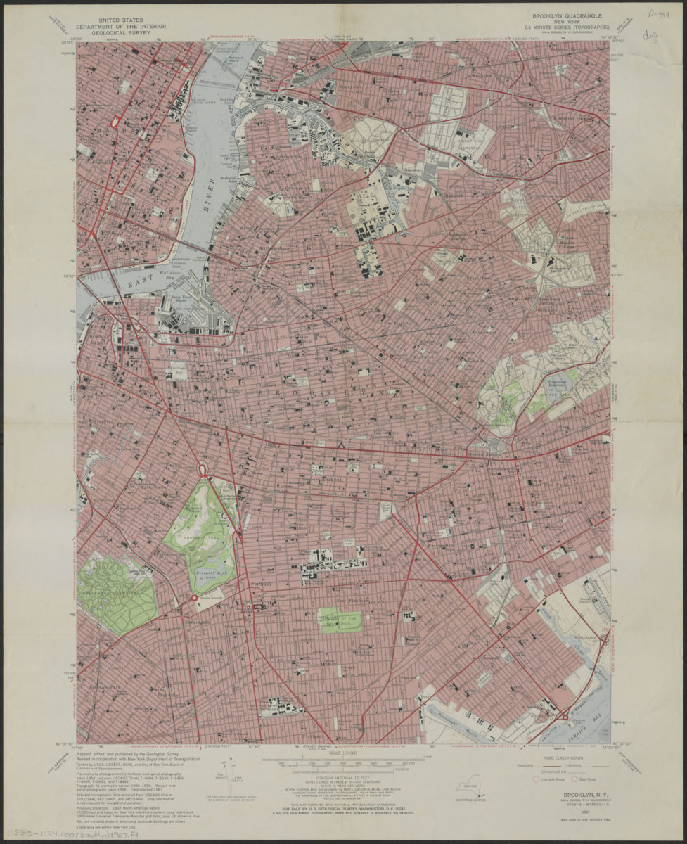
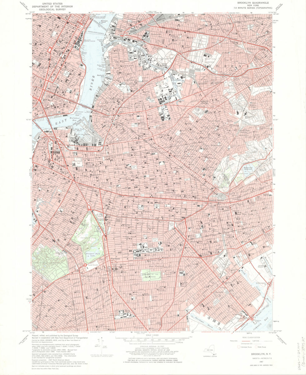
Brooklyn quadrangle, New York
Brooklyn quadrangle, New York
1967
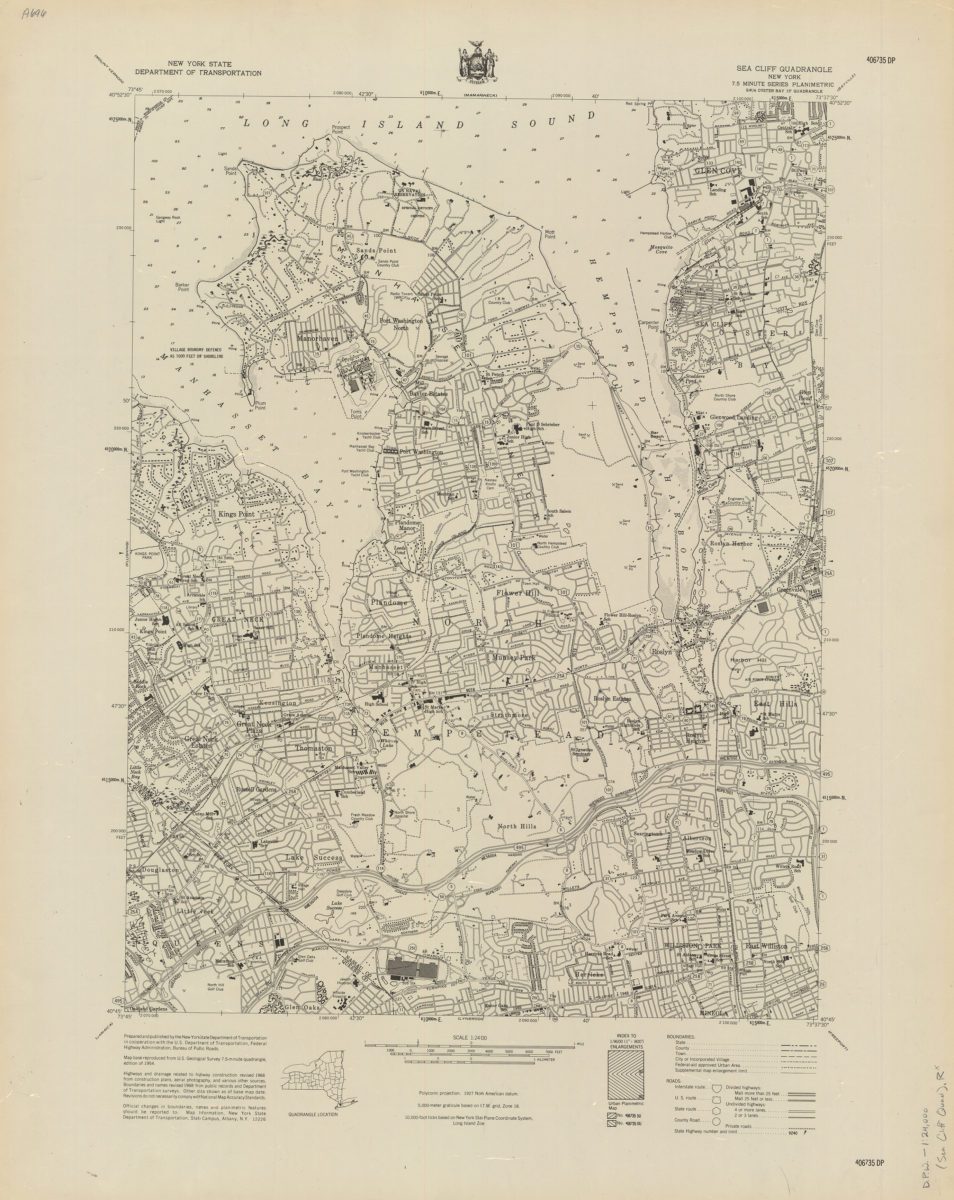
Sea Cliff quadrangle, New York
Sea Cliff quadrangle, New York
[1968]
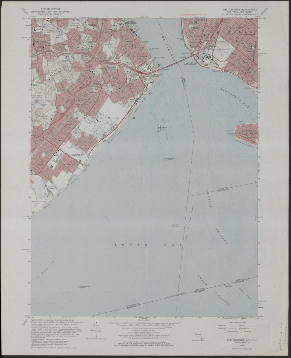
The Narrows quadrangle, New York–New Jersey: 7.5 minute series (topographic): mapped, edited, and published by the Geological Survey ; revised in cooperation with New York Department of Transportation
The Narrows quadrangle, New York–New Jersey: 7.5 minute series (topographic): mapped, edited, and published by the Geological Survey ; revised in cooperation with New York Department of Transportation
1968
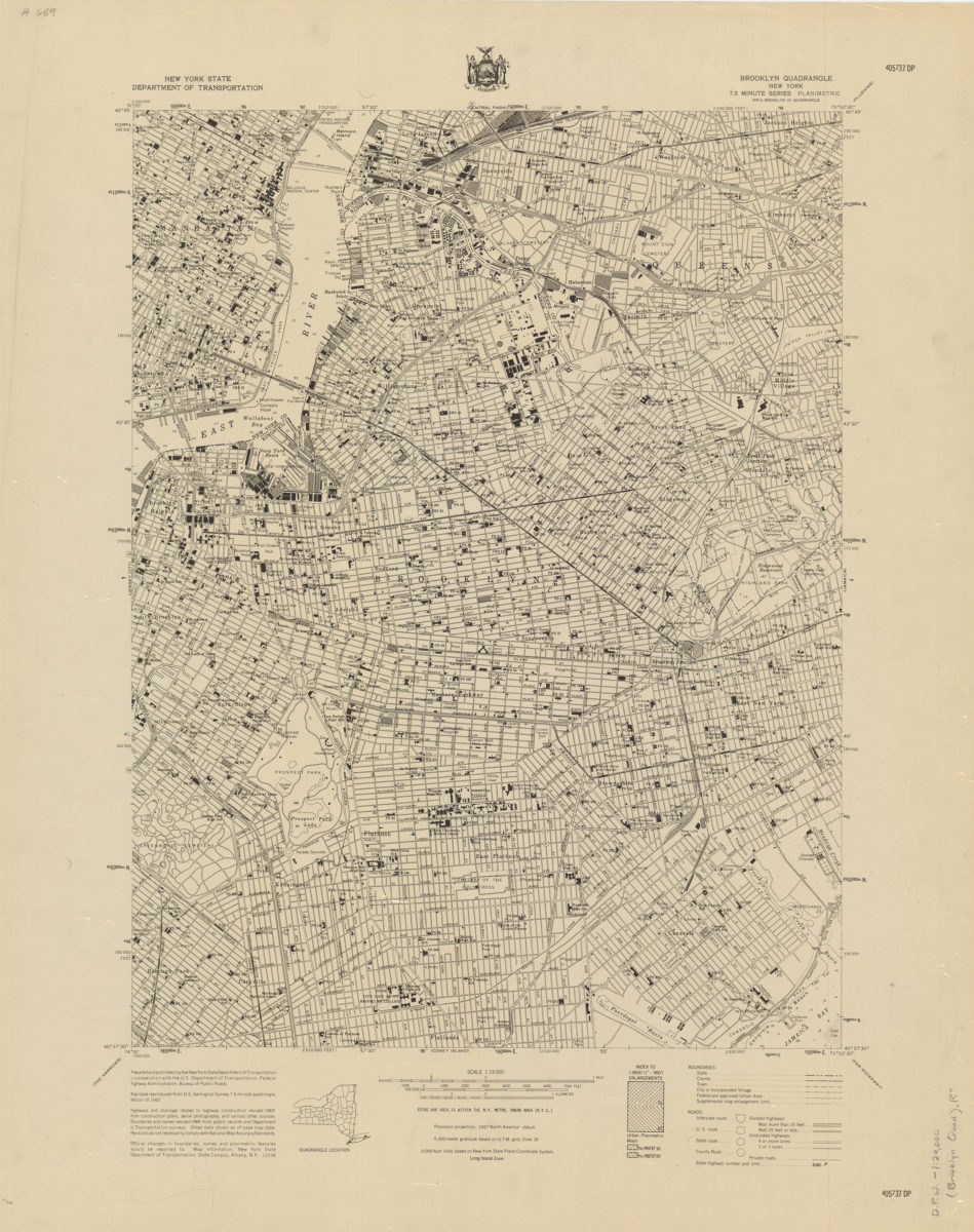
Brooklyn quadrangle, New York
Brooklyn quadrangle, New York
[1969]
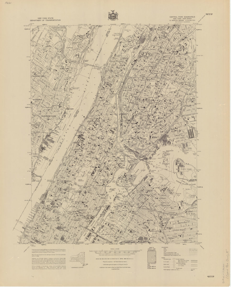
Central Park quadrangle, New York
Central Park quadrangle, New York
[1969]
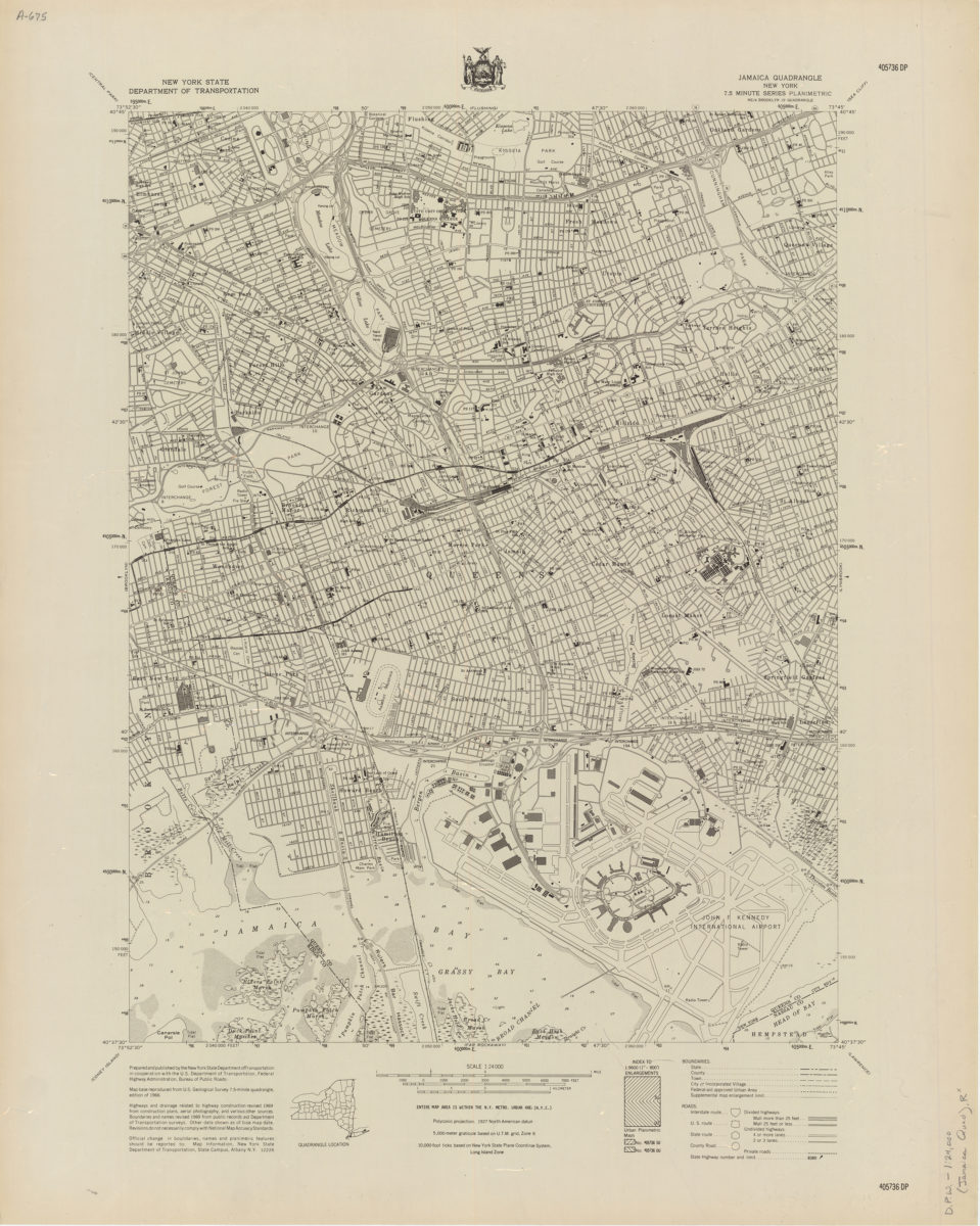
Jamaica quadrangle, New York
Jamaica quadrangle, New York
[1969]
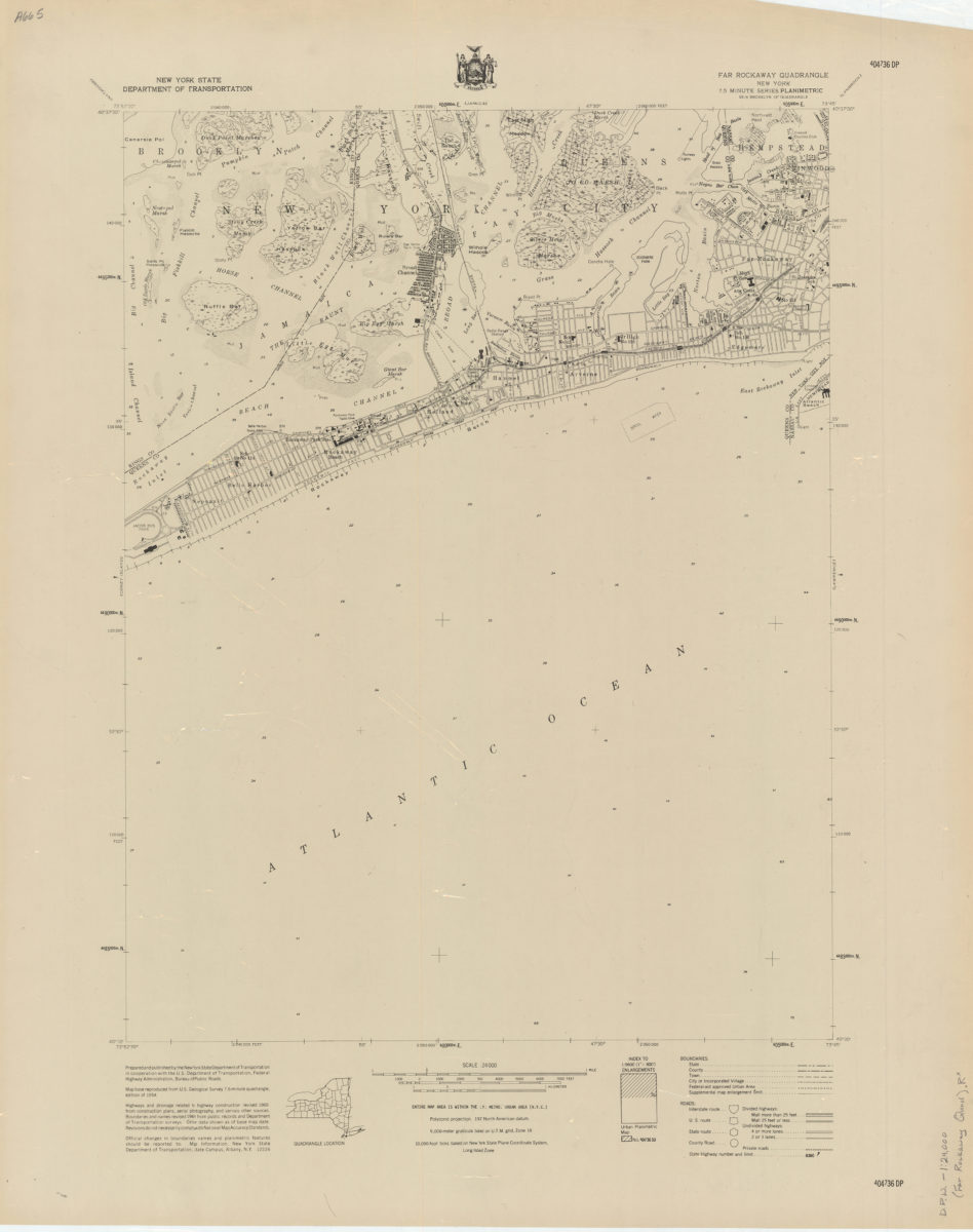
Far Rockaway quadrangle, New York
Far Rockaway quadrangle, New York
[1969]
Flushing quadrangle, New York
Flushing quadrangle, New York
[1969]
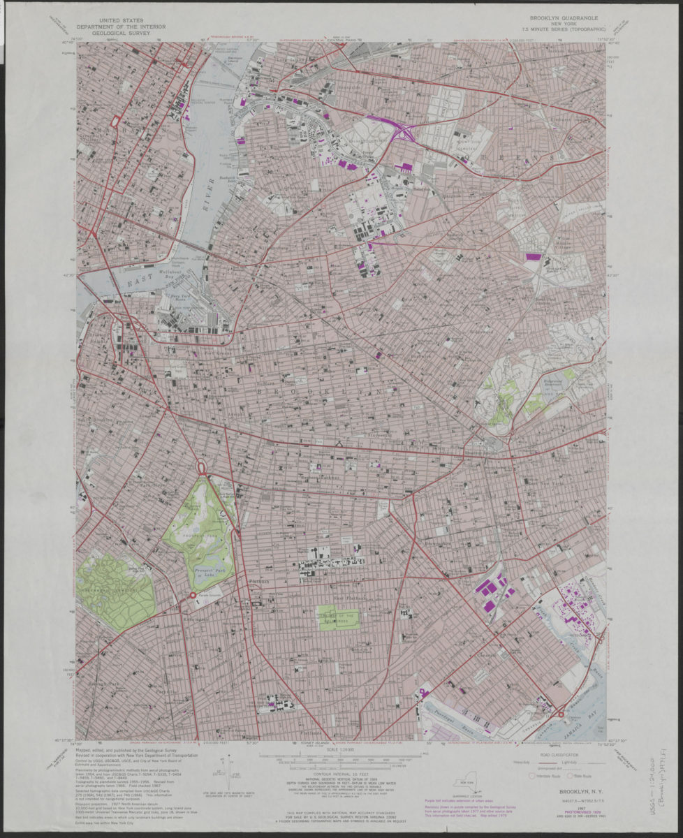
Brooklyn quadrangle, New York: mapped, edited, and published by the Geological Survey ; revised in cooperation with New York Department of Transportation
Brooklyn quadrangle, New York: mapped, edited, and published by the Geological Survey ; revised in cooperation with New York Department of Transportation
1975
Brooklyn quadrangle, New York: mapped, edited, and published by the Geological Survey ; revised in cooperation with New York Department of Transportation
Brooklyn quadrangle, New York: mapped, edited, and published by the Geological Survey ; revised in cooperation with New York Department of Transportation
1979
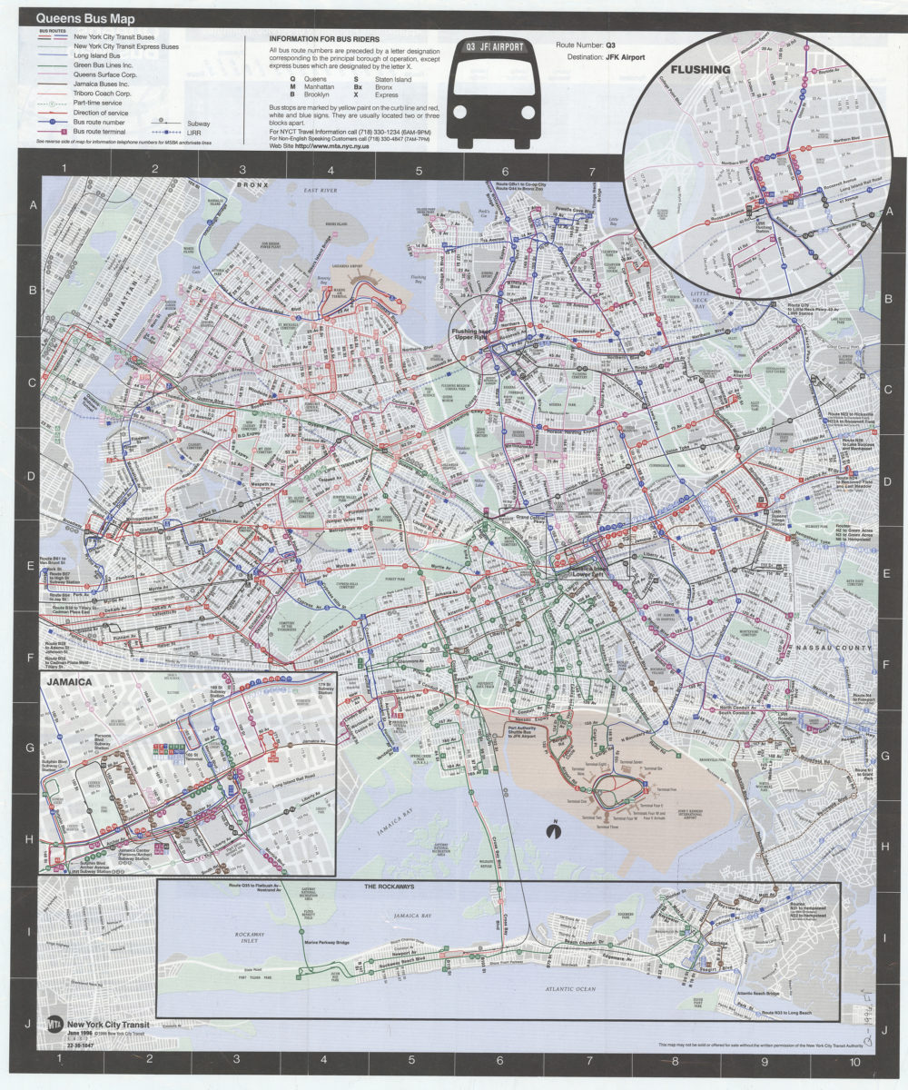
Queens bus map: MTA, New York City Transit
Queens bus map: MTA, New York City Transit
[ca. 1996]
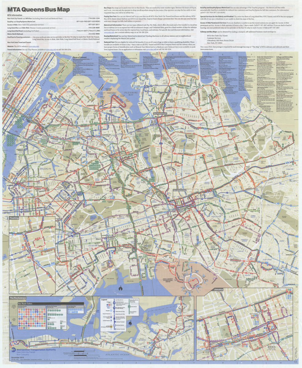
Queens bus map: November 2010: MTA Metropolitan Transportation Authority, New York City Transit Bus Company
Queens bus map: November 2010: MTA Metropolitan Transportation Authority, New York City Transit Bus Company
[2010; 2010]
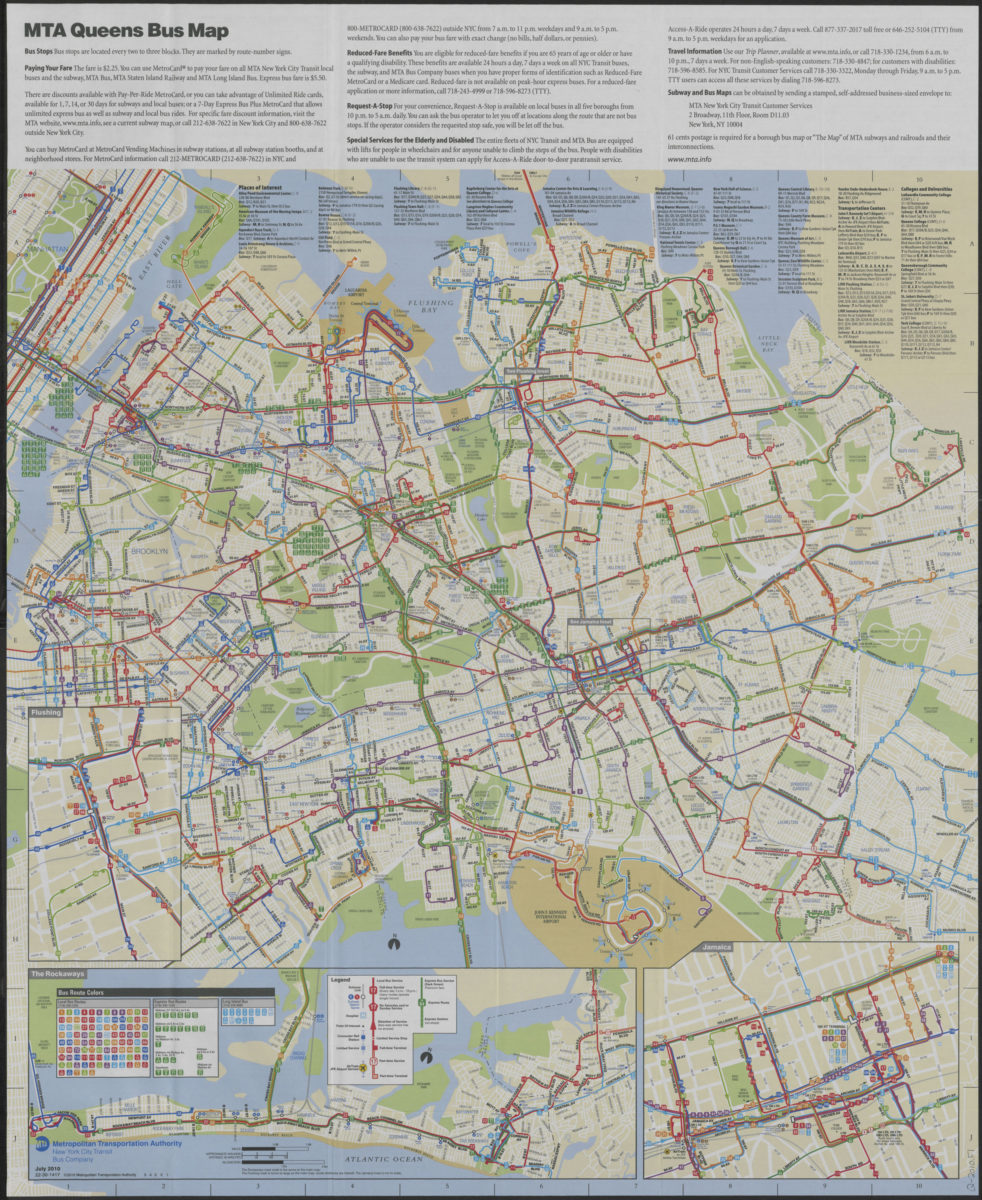
Queens bus map: free, July 2010: MTA Metropolitan Transportation Authority, New York City Transit Bus Company
Queens bus map: free, July 2010: MTA Metropolitan Transportation Authority, New York City Transit Bus Company
[ca. 2010]
Previous
1
2