Center for Brooklyn History
Map Collections
Search
About
Othmer Library & Archives
Submit search query
Refine 13 records
Clear filters
3
Location
Brooklyn (New York, N.Y.)
891
Brooklyn Heights (New York, N.Y.)
76
DUMBO Historic District (New York, N.Y.)
7
Fulton Ferry Historic District (New York, N.Y.)
5
Hoboken (N.J.)
1
Jersey City (N.J.)
4
Long Island (N.Y.)
197
Long Island, Battle of, New York, N.Y., 1776
4
Manhattan (New York, N.Y.)
120
New Jersey
27
New York (N.Y.)
164
New York (State)
95
Wallabout Bay (New York, N.Y.)
6
Subject
Bays
5
Buildings
12
Landforms
15
Landowners
434
Long Island, Battle of, New York, N.Y. , 1776
7
Piers
25
Real property
619
Rivers
16
Swamps
2
Wetlands
6
Date
19th Century
945
or enter range:
from
to
Genres
Bathymetric maps
94
Cadastral maps
597
Historical maps
53
Manuscript maps
365
Military maps
23
Pictorial maps
38
Topographic maps
70
Sort by:
Date (earliest)
Date (most recent)
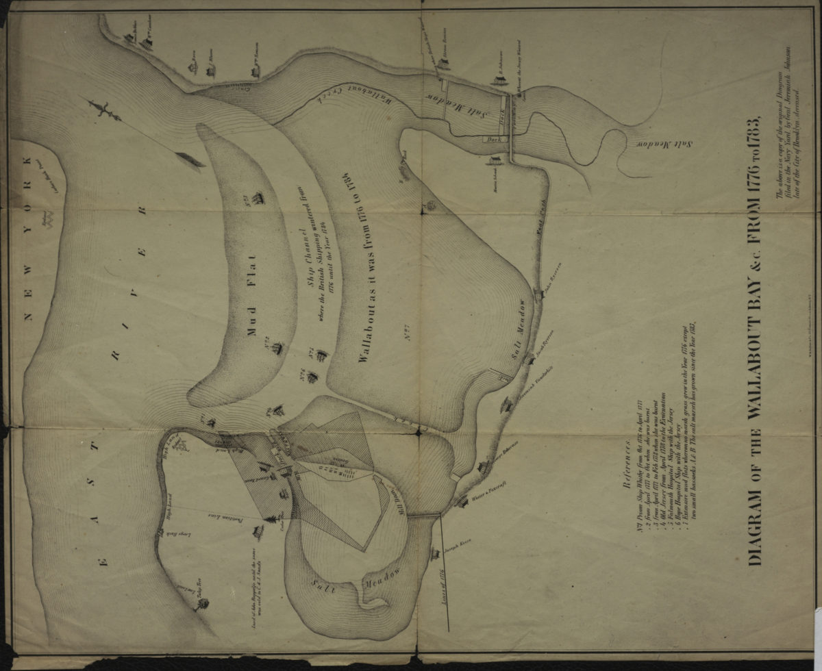
Diagram of the Wallabout Bay &c. from 1776 to 1783
Diagram of the Wallabout Bay &c. from 1776 to 1783
[18??]
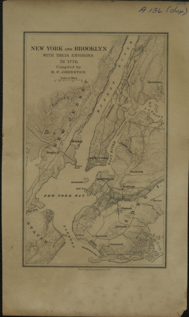
New York and Brooklyn with their environs in 1776: compiled by H.P. Johnston
New York and Brooklyn with their environs in 1776: compiled by H.P. Johnston
[18??]
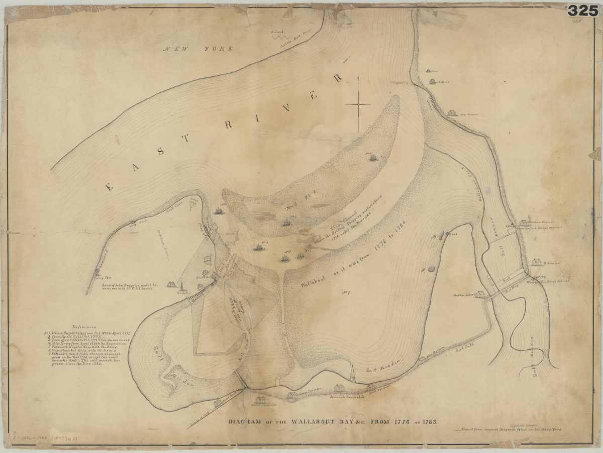
Diagram of the Wallabout Bay &c. from 1776 to 1783
Diagram of the Wallabout Bay &c. from 1776 to 1783
[18??]
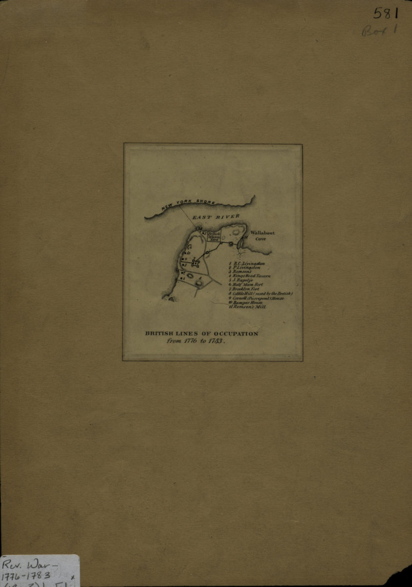
British lines of occupation from 1776 to 1783
British lines of occupation from 1776 to 1783
[18??]
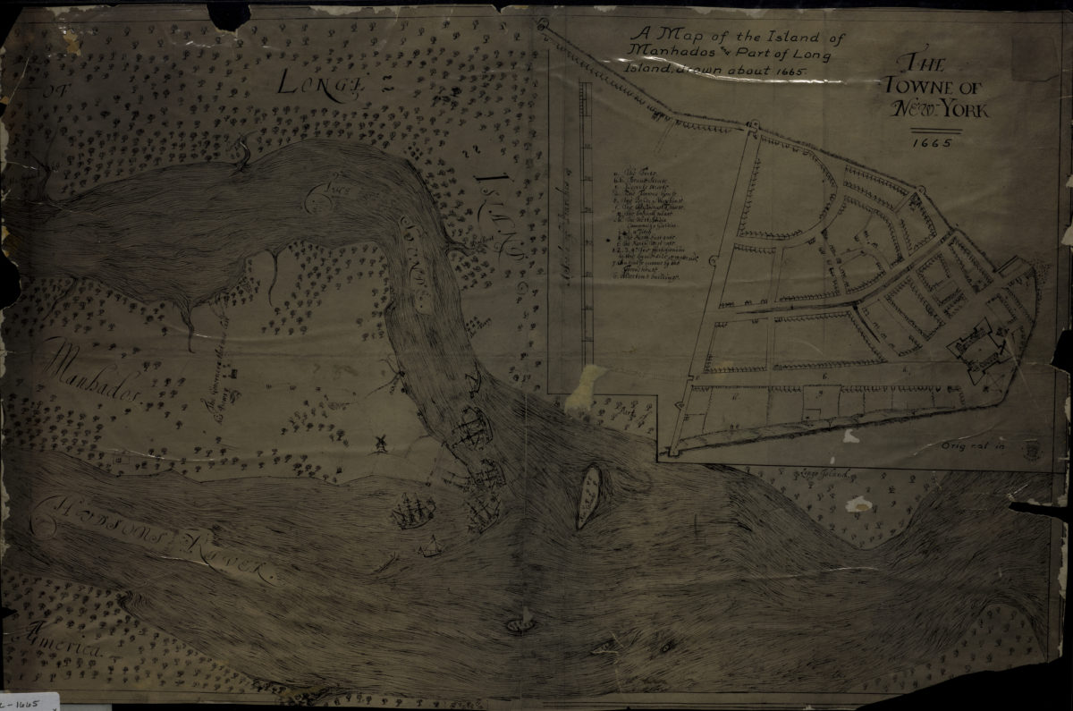
A map of the island of Manhados and part of Long Island, drawn about 1665
A map of the island of Manhados and part of Long Island, drawn about 1665
[18??]
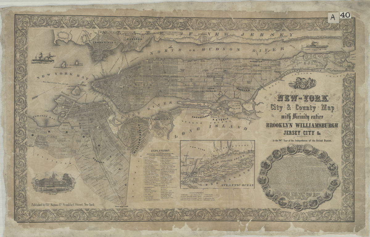
New-York City & County map: with vicinity entire, Brooklyn, Williamsburgh, Jersey City &c. in the 79th year of the independence of the United States
New-York City & County map: with vicinity entire, Brooklyn, Williamsburgh, Jersey City &c. in the 79th year of the independence of the United States
[1855]
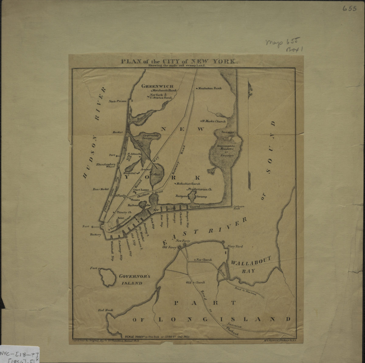
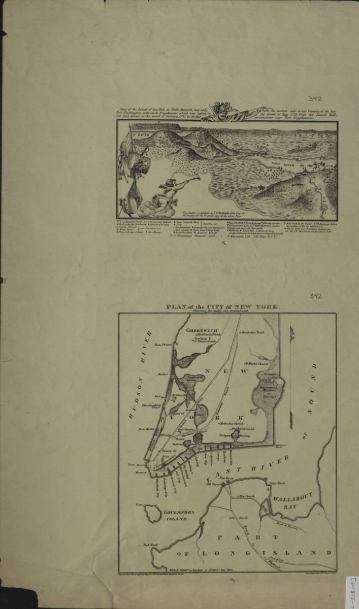
Plan of the city of New York: showing the made and swamp land: copied from the original map … by G. Hayward, 120 Water St. N.Y.
Plan of the city of New York: showing the made and swamp land: copied from the original map … by G. Hayward, 120 Water St. N.Y.
[1856]
Plan of the island of New York in North America, but only Fort Washington, afterwards Knypausen, which was taken in but first drawn in the month of January 1781 in the hut from the eastern side in the vicinity of the late the month of May 1779
Plan of the island of New York in North America, but only Fort Washington, afterwards Knypausen, which was taken in but first drawn in the month of January 1781 in the hut from the eastern side in the vicinity of the late the month of May 1779
[1856]
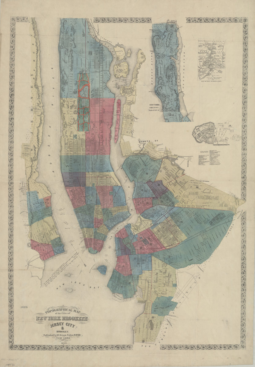
Topographical map of the cities of New York, Brooklyn, Jersey City & Hoboken
Topographical map of the cities of New York, Brooklyn, Jersey City & Hoboken
1858
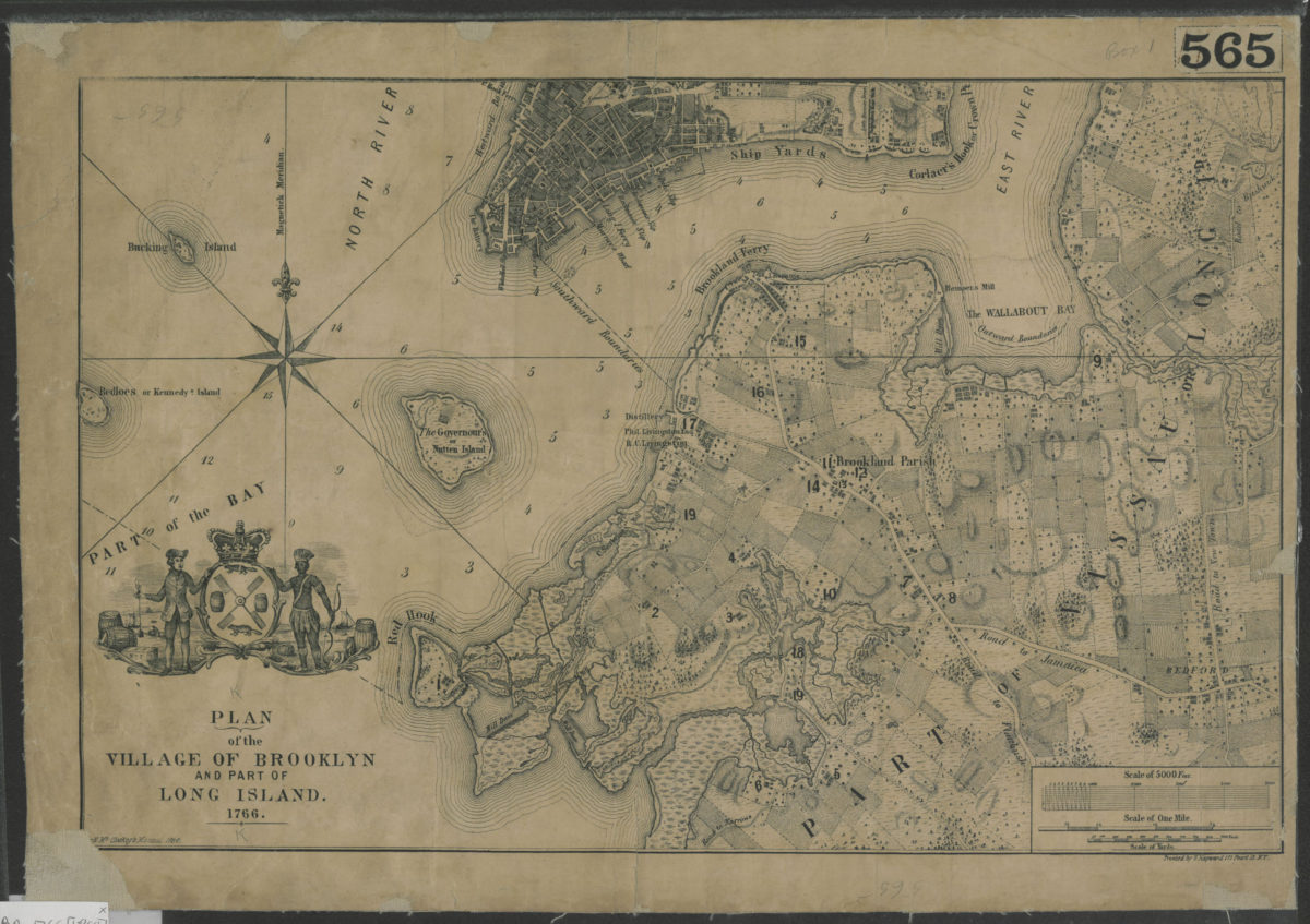
Plan of the village of Brooklyn and part of Long Island 1766
Plan of the village of Brooklyn and part of Long Island 1766
[1864]
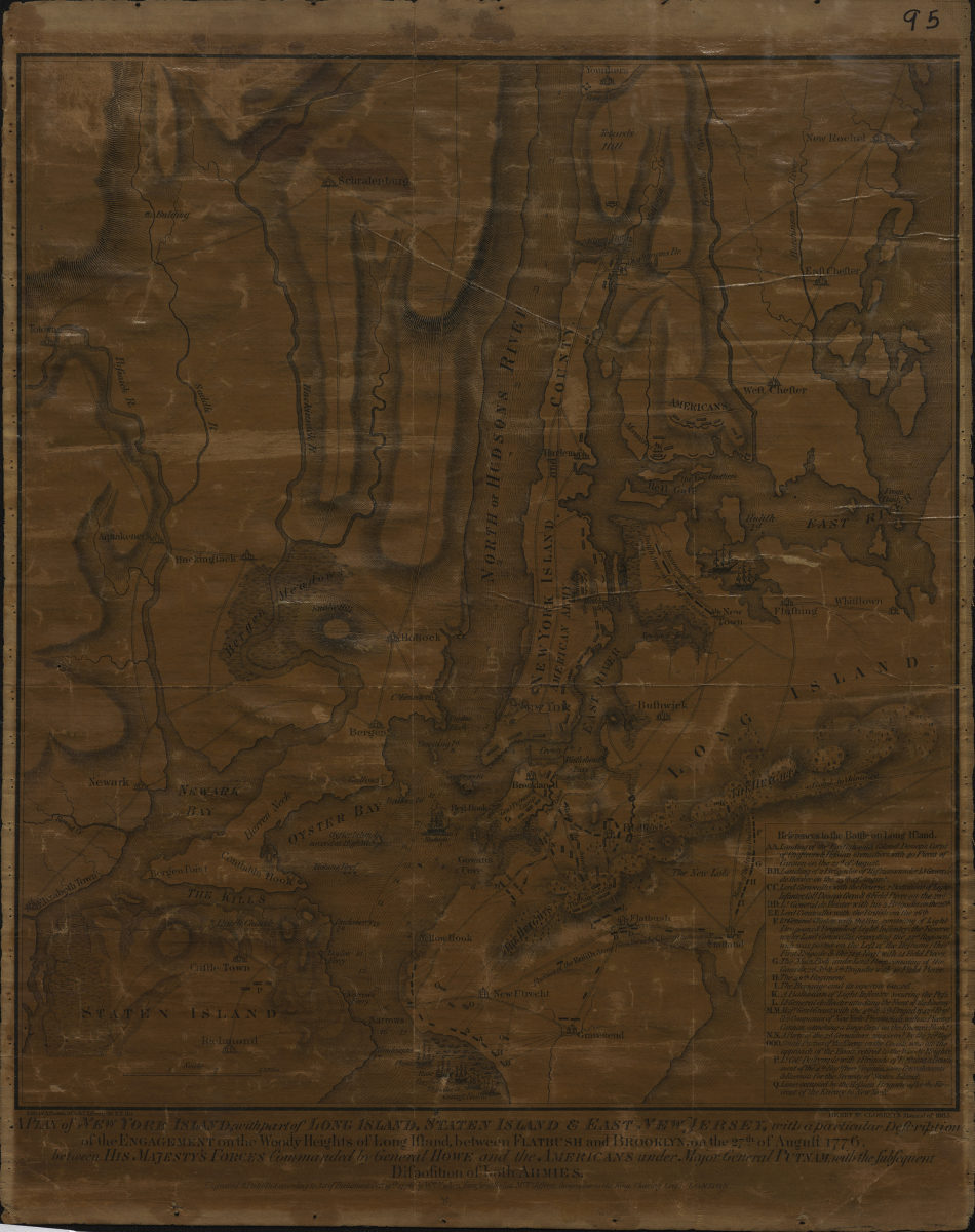
A plan of New York Island, with part of Long Island, Staten Island & East New Jersey: with a particular description of the Engagement on the Woody Heights of Long Island, between Flatbush and Brooklyn, on the 27th of August 1776
A plan of New York Island, with part of Long Island, Staten Island & East New Jersey: with a particular description of the Engagement on the Woody Heights of Long Island, between Flatbush and Brooklyn, on the 27th of August 1776
[1865]
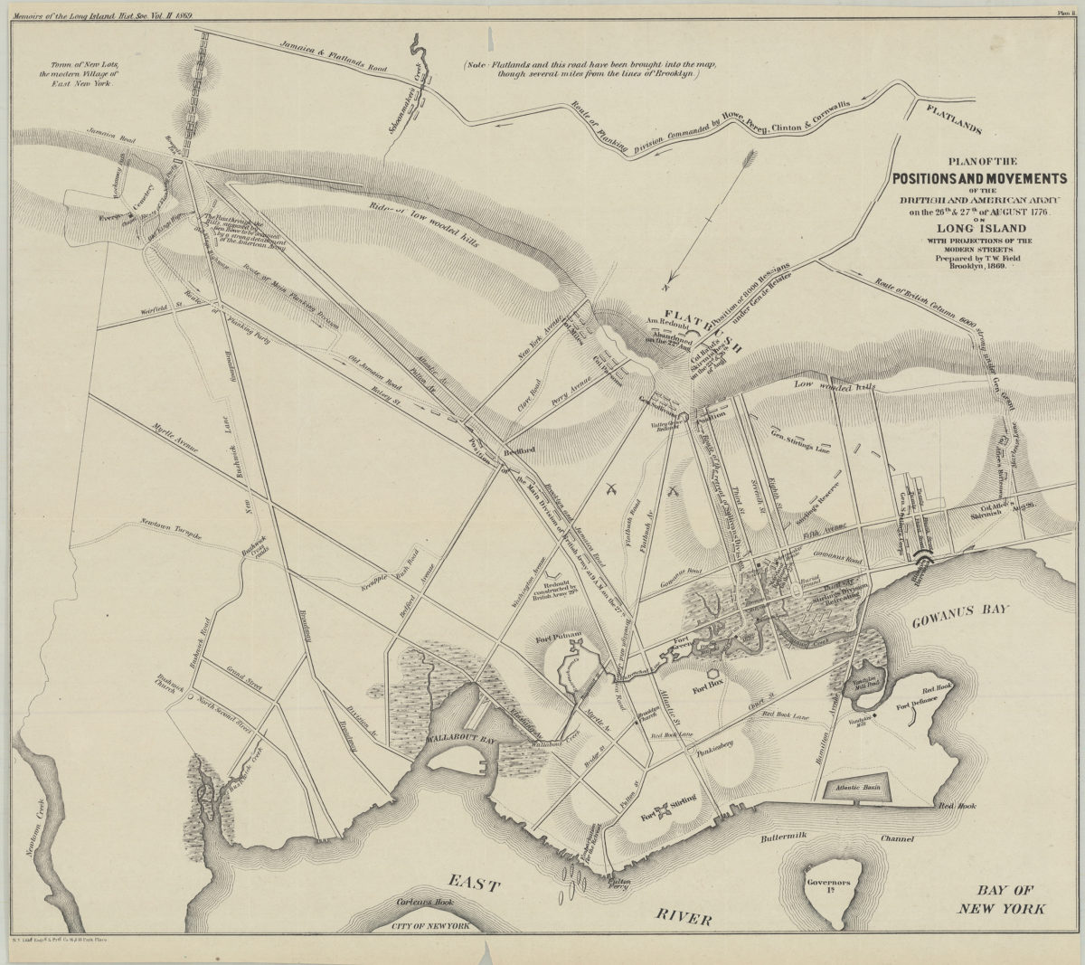
Plan of the positions and movements of the British and American army on the 26th & 27th of August 1776, on Long Island, with projects of the modern streets: prepared by T.W. Field
Plan of the positions and movements of the British and American army on the 26th & 27th of August 1776, on Long Island, with projects of the modern streets: prepared by T.W. Field
1869
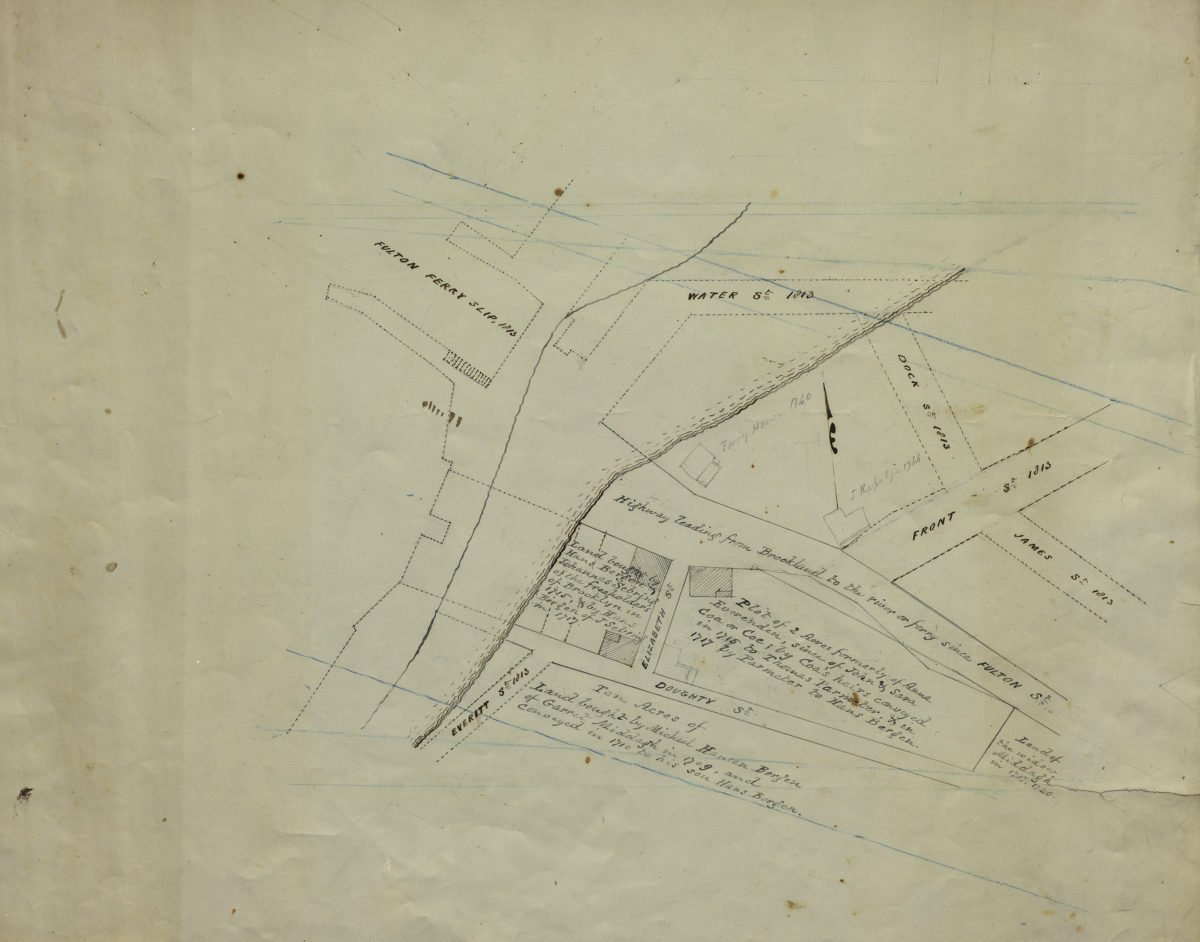
[Map of Hans Bergen’s land at Brooklyn Ferry]
[Map of Hans Bergen’s land at Brooklyn Ferry]
[ca. 1876]