Center for Brooklyn History
Map Collections
Search
About
Othmer Library & Archives
Submit search query
Refine 73 records
Clear filters
2
Location
Battery Park (New York, N.Y.)
3
Belt Parkway (New York, N.Y.)
1
Bergen County (N.J.)
6
Bronx (New York, N.Y.)
10
Brooklyn (New York, N.Y.)
891
Brooklyn-Battery Bridge (New York, N.Y.)
1
Coney Island (New York, N.Y.)
22
ferries
1
Greenwich Village (New York, N.Y.)
1
Harlem (New York, N.Y.)
1
Hudson County (N.J.)
3
Inwood (New York, N.Y.)
1
Jamaica Bay (N.Y.)
5
Jersey City (N.J.)
4
Long Island (N.Y.)
197
Manhattan (New York, N.Y.)
120
New Jersey
27
New York (N.Y.)
164
New York (State)
95
New York Harbor (N.Y. and N.J.)
16
New York Metropolitan Area
40
New York Region
5
Queens (New York, N.Y.)
83
Stapleton (New York, N.Y.)
1
Staten Island (N.Y.)
10
Suffolk County (N.Y.)
43
Upper East Side (New York, N.Y.)
1
Upper West Side (New York, N.Y.)
2
Washington Heights (New York, N.Y.)
2
Show 9 more
Subject
Baseball teams
1
Bays
5
Bridges
13
Canals
15
Ethnology
3
Exhibitions
5
ferries
32
Highway planning
2
Historic districts
4
Landowners
434
Local transit
63
Long Island, Battle of, New York, N.Y. , 1776
7
Postal codes
4
Railroad terminals
2
Railroads
72
Railroads, Elevated
24
Remote sensing
1
Roads
117
Street addresses
11
Street railroads
8
Streets
46
Subways
55
Traffic engineering
1
Tunnels
16
Waterfronts
5
Show 5 more
Date
20th Century
469
or enter range:
from
to
Genres
Aerial views
15
Bathymetric maps
94
Historical maps
53
Manuscript maps
365
Map
191
Military maps
23
Physical maps
4
Pictorial maps
38
Remote-sensing maps
1
Road maps
83
Thematic maps
60
Topographic maps
70
Tourist maps
55
Transportation maps
120
Sort by:
Date (earliest)
Date (most recent)
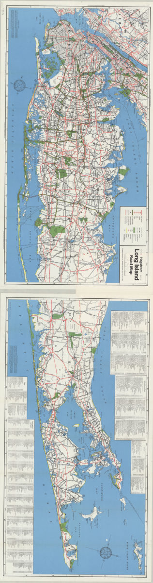
Hagstrom Long Island road map
Hagstrom Long Island road map
[1971]
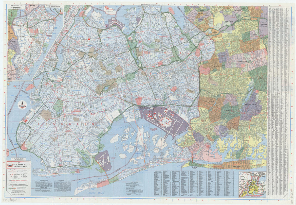
New York City street map: [prepared for] Texaco
New York City street map: [prepared for] Texaco
[1972]
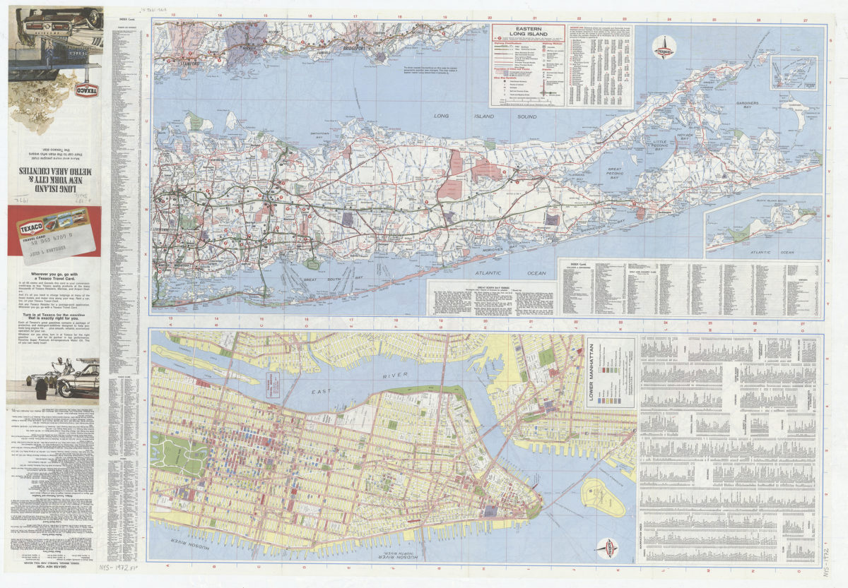
Long Island, New York City & metro area counties
Long Island, New York City & metro area counties
[1972]
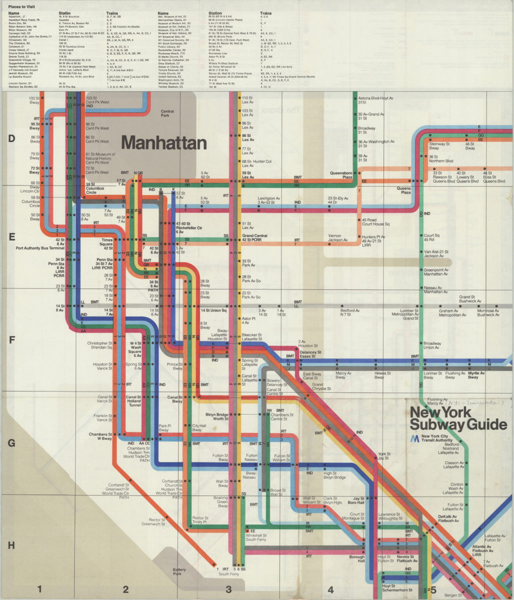
The Metropolitan Transportation Authority revised map of rapid transit facilities of New York City Transit Authority: New York City Transit Authority
The Metropolitan Transportation Authority revised map of rapid transit facilities of New York City Transit Authority: New York City Transit Authority
[ca. 1972]
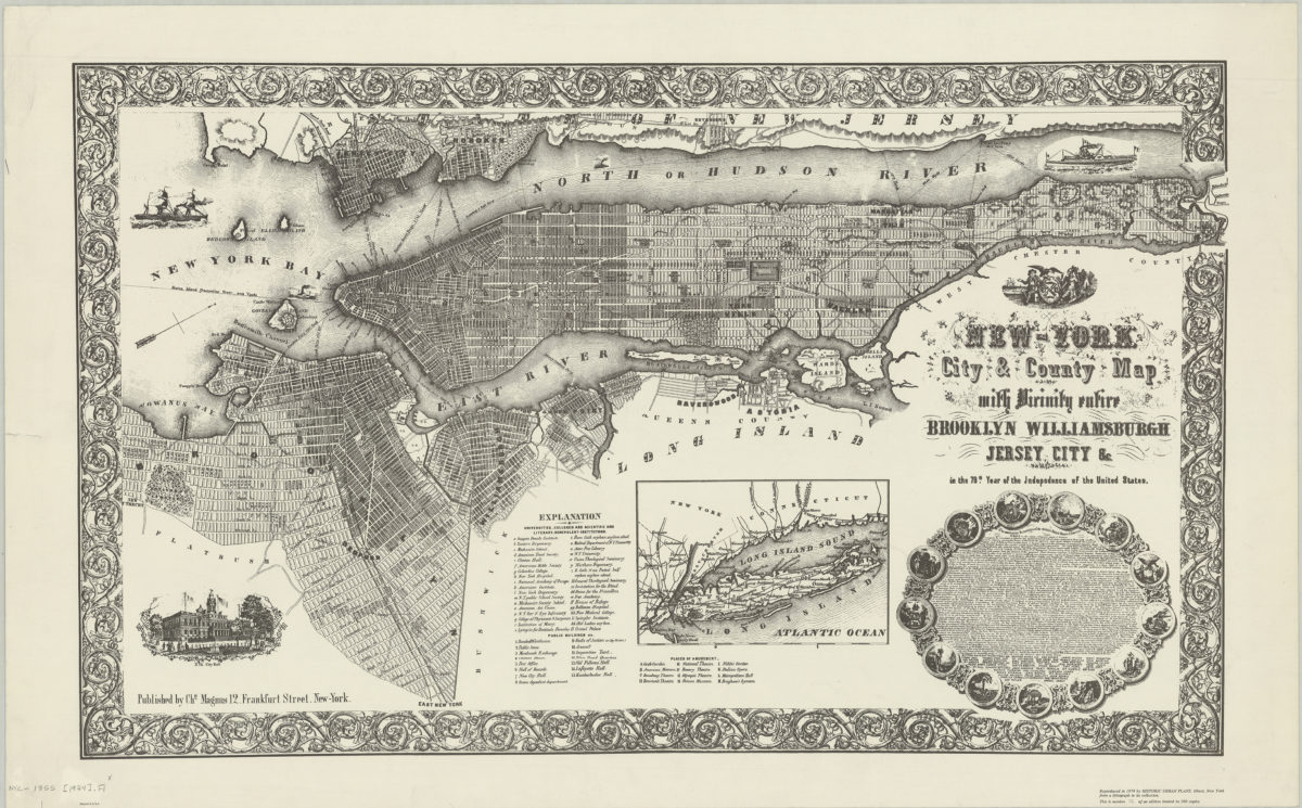
New-York City & County map with vicinity entire: Brooklyn, Williamsburgh, Jersey City &c. in the 79th year of the independence of the United States
New-York City & County map with vicinity entire: Brooklyn, Williamsburgh, Jersey City &c. in the 79th year of the independence of the United States
1974
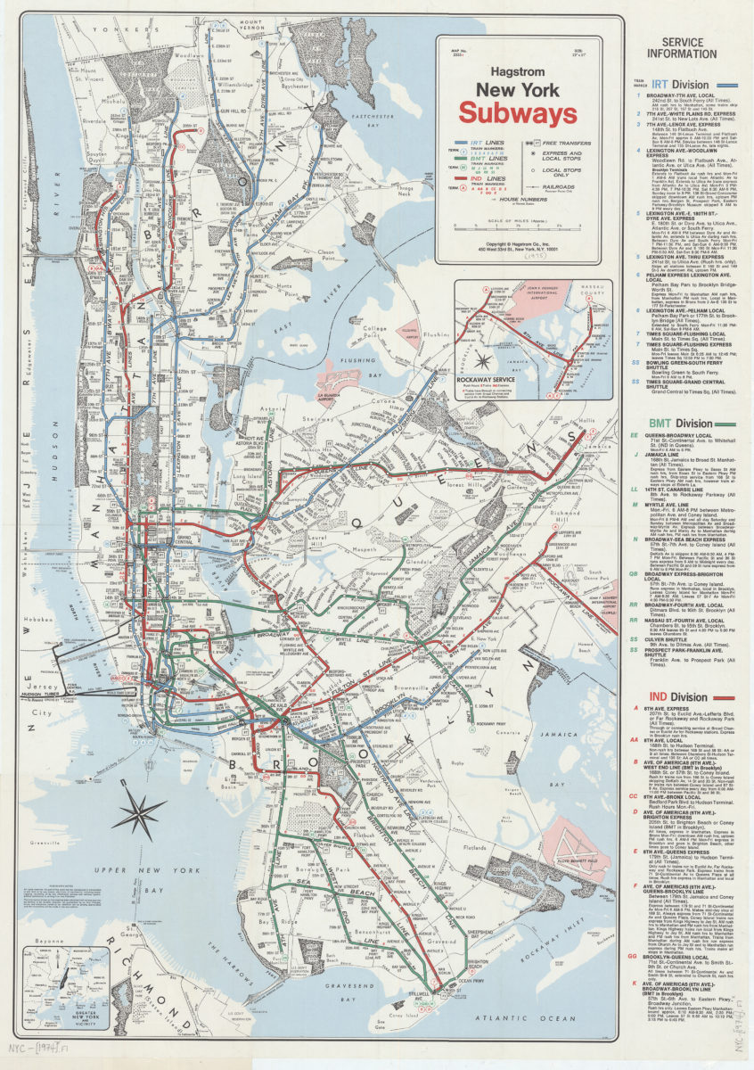
New York subways: Hagstrom
New York subways: Hagstrom
[1974]
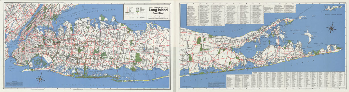
Hagstrom Long Island road map
Hagstrom Long Island road map
[1974]
The Metropolitan Transportation Authority revised map of rapid transit facilities of New York City Transit Authority: New York City Transit Authority
The Metropolitan Transportation Authority revised map of rapid transit facilities of New York City Transit Authority: New York City Transit Authority
[ca. 1974]
Long Island, New York City & metro area counties: [prepared for] Texaco
Long Island, New York City & metro area counties: [prepared for] Texaco
1975
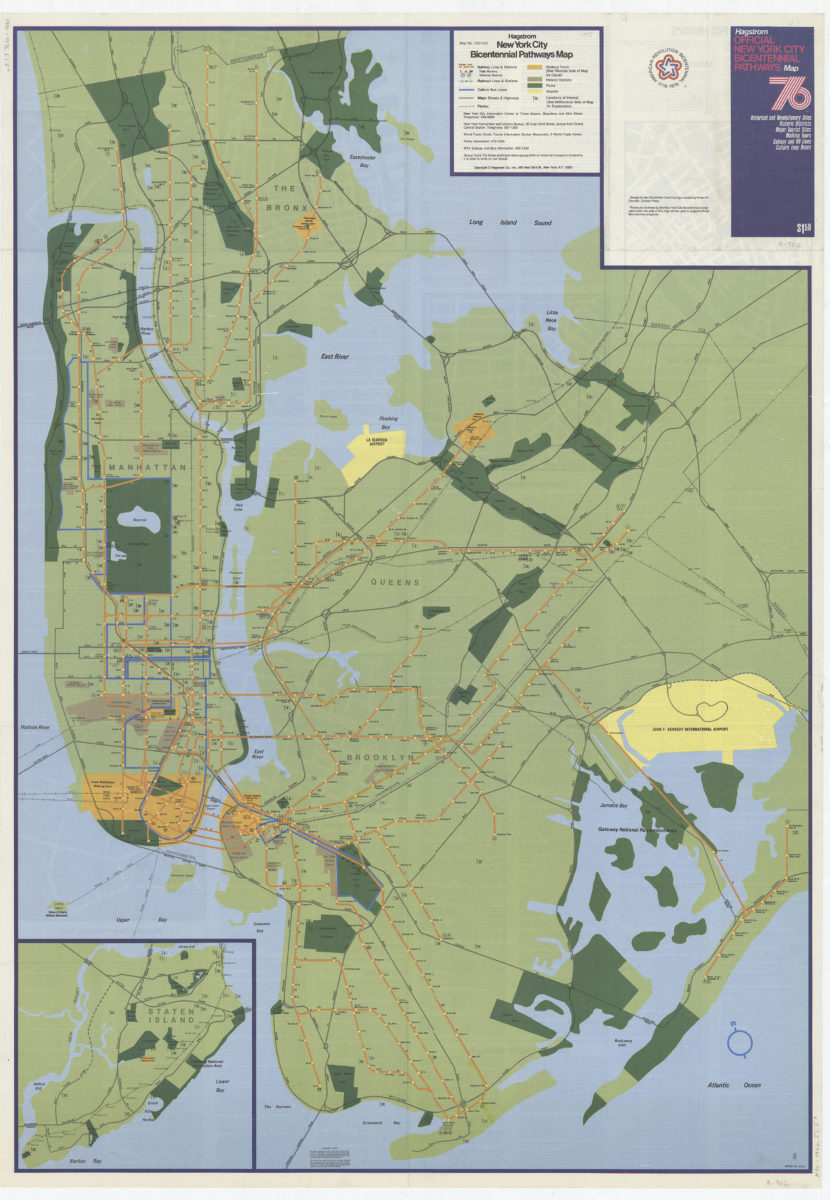
Hagstrom New York City Bicentennial pathways map
Hagstrom New York City Bicentennial pathways map
[1975]
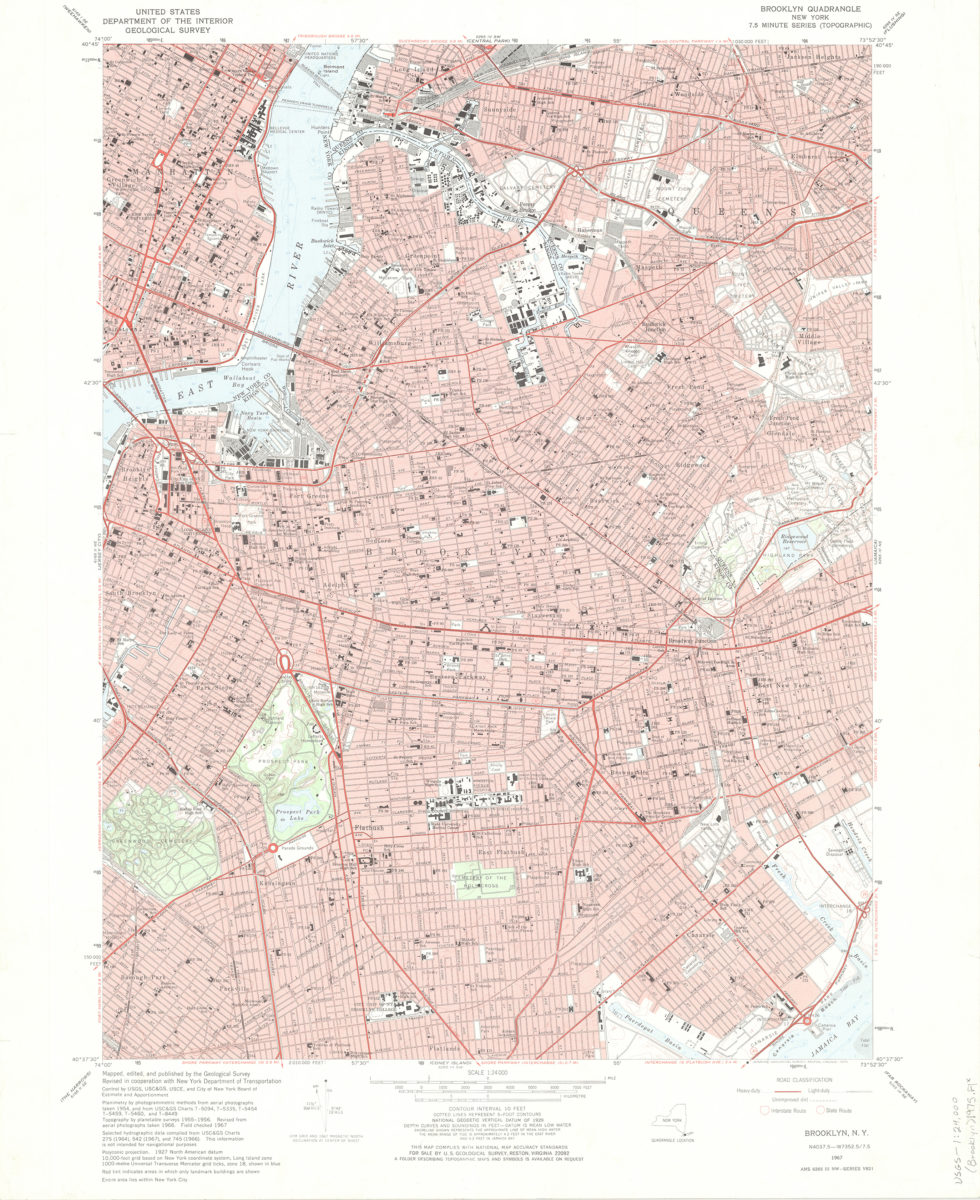
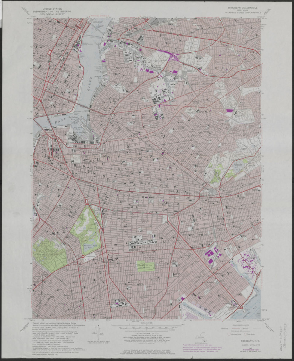
Brooklyn quadrangle, New York: mapped, edited, and published by the Geological Survey ; revised in cooperation with New York Department of Transportation
Brooklyn quadrangle, New York: mapped, edited, and published by the Geological Survey ; revised in cooperation with New York Department of Transportation
1975
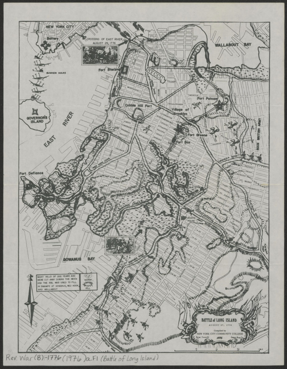
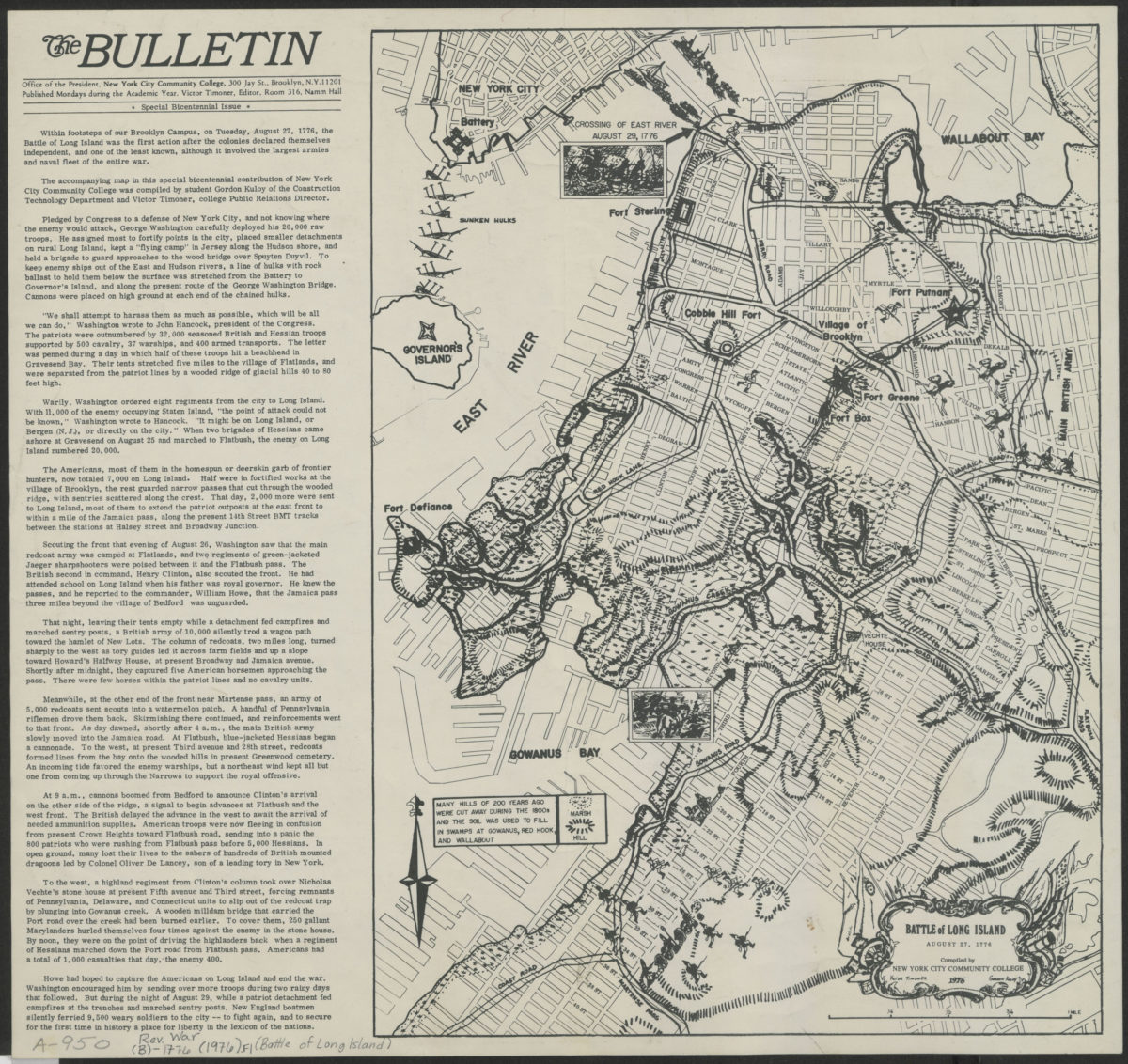
Battle of Long Island, August 27, 1776: compiled by New York City Community College
Battle of Long Island, August 27, 1776: compiled by New York City Community College
[1976]
Battle of Long Island, August 27, 1776: compiled by New York City Community College
Battle of Long Island, August 27, 1776: compiled by New York City Community College
1976
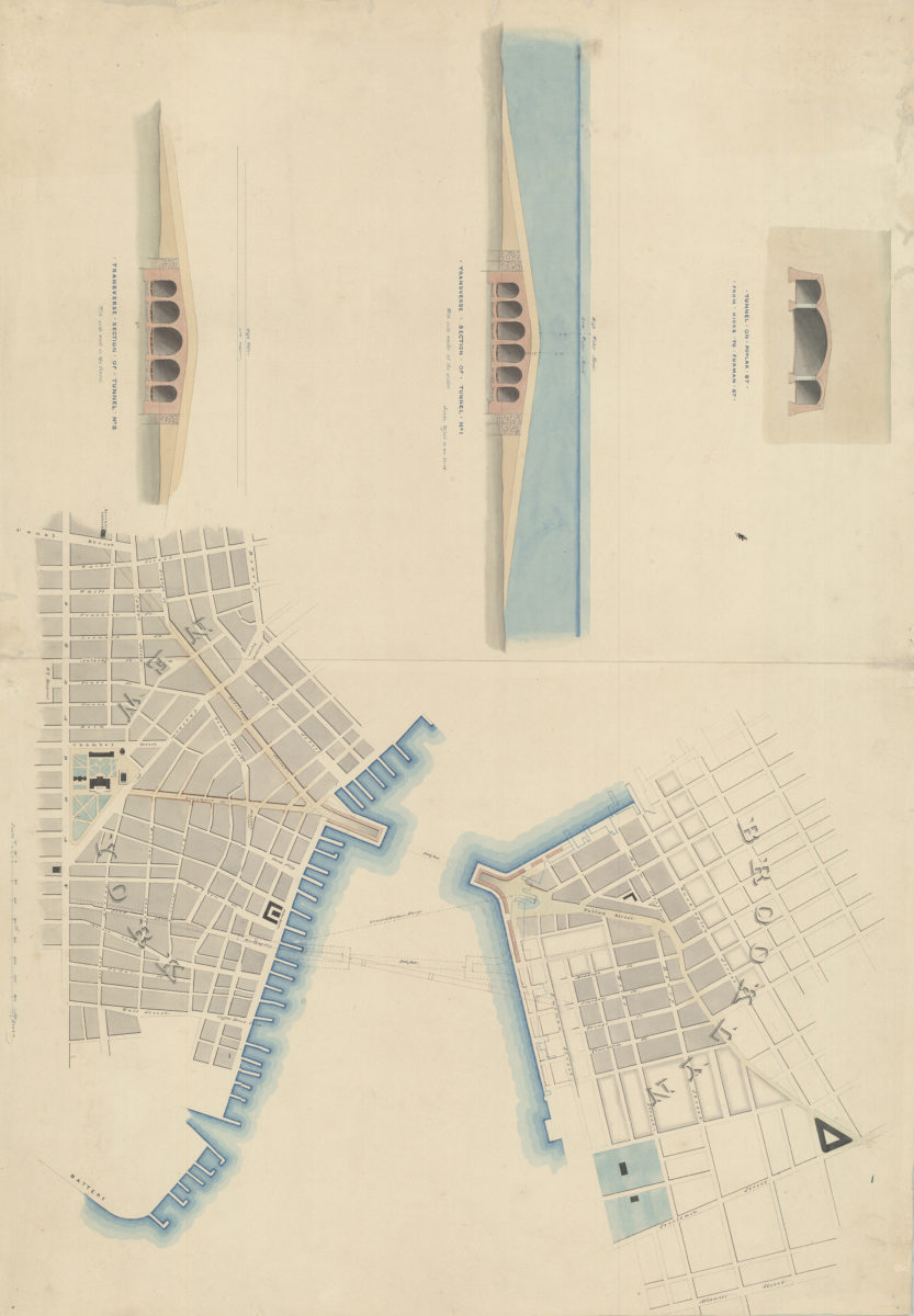
[Watercolor plan for proposed tunnel between Manhattan and Brooklyn on Poplar Street connecting Hicks Street and Furman Street]
[Watercolor plan for proposed tunnel between Manhattan and Brooklyn on Poplar Street connecting Hicks Street and Furman Street]
1978
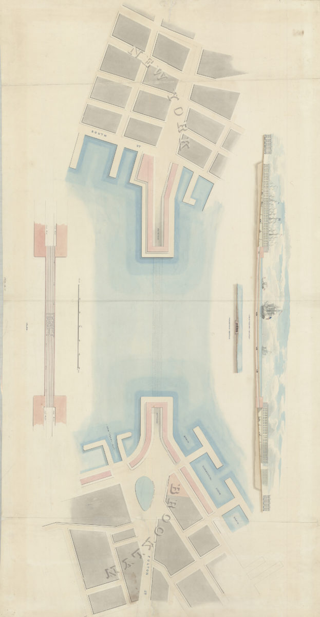
[Watercolor plan for proposed tunnel between Brooklyn and Manhattan connecting Fulton Street in Brooklyn and South Street in Manhattan]
[Watercolor plan for proposed tunnel between Brooklyn and Manhattan connecting Fulton Street in Brooklyn and South Street in Manhattan]
1978
Brooklyn quadrangle, New York: mapped, edited, and published by the Geological Survey ; revised in cooperation with New York Department of Transportation
Brooklyn quadrangle, New York: mapped, edited, and published by the Geological Survey ; revised in cooperation with New York Department of Transportation
1979
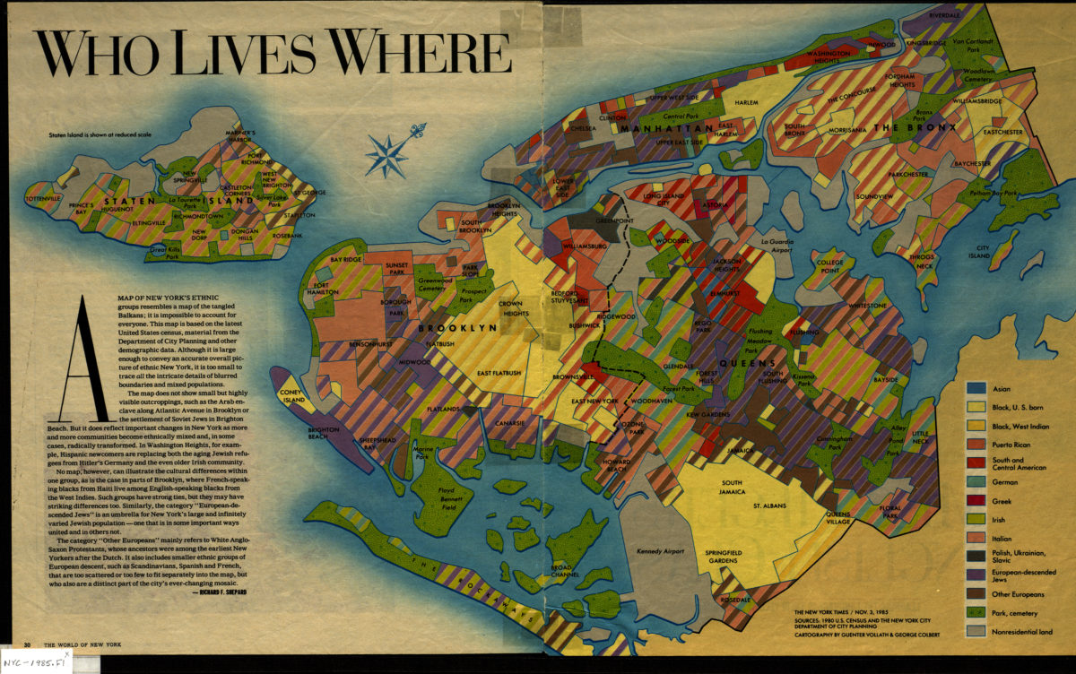
Who lives where: cartography by Guenter Vollath & George Colbert ; [text by] Richard F. Shepard
Who lives where: cartography by Guenter Vollath & George Colbert ; [text by] Richard F. Shepard
1985
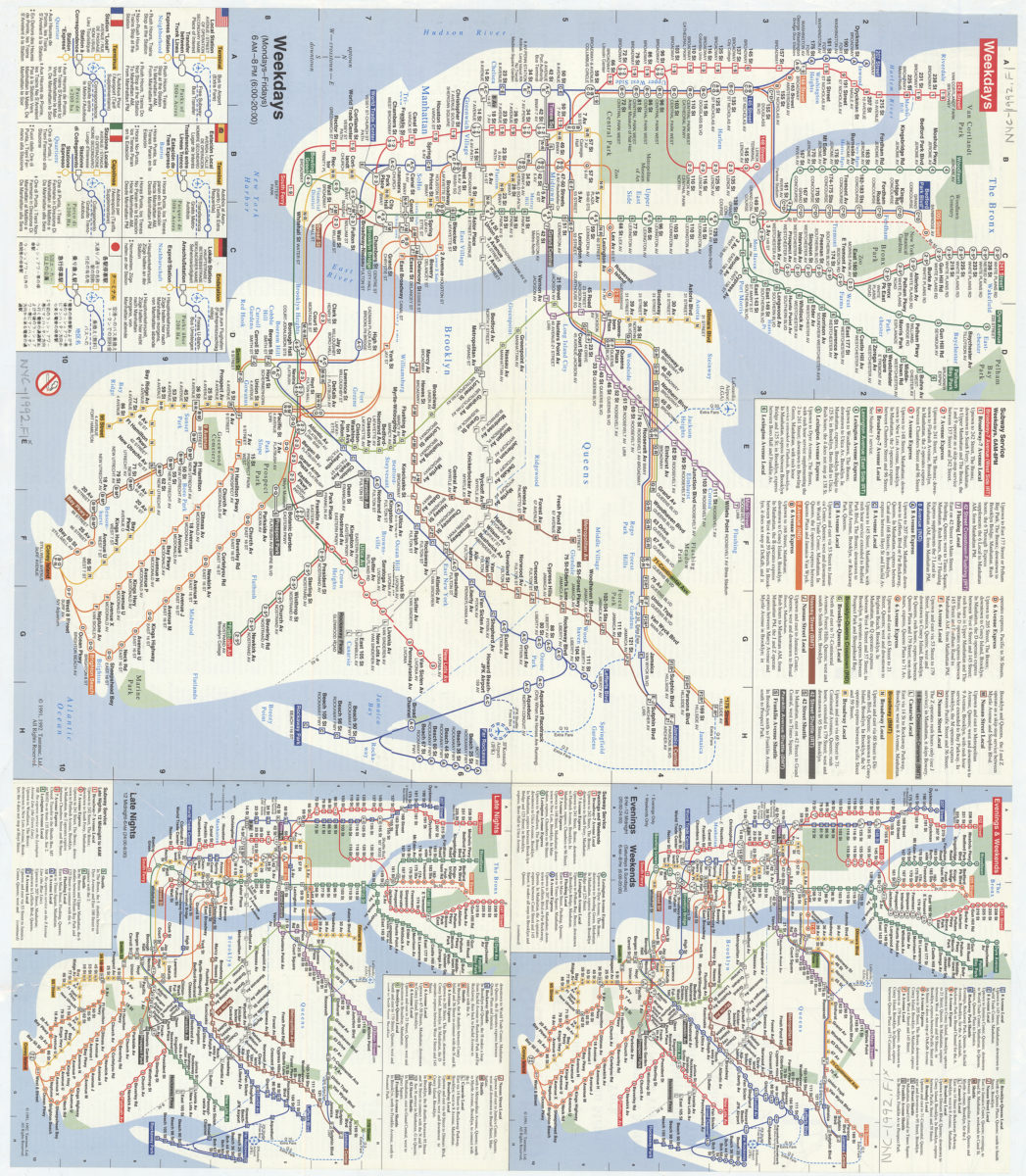
Subway map: the New York subway map = Le plan du métro de New York: the New York subway map is a Tauranac map
Subway map: the New York subway map = Le plan du métro de New York: the New York subway map is a Tauranac map
[1992]
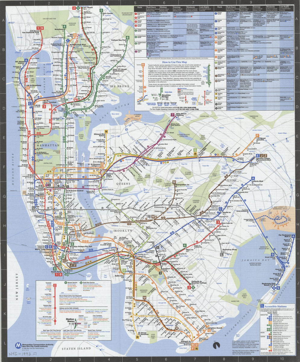
NYC subway map: June 1993, Français, Español, Deutsch, Italiano, English, Nihongo, Chung wen: New York City Transit Authority, Metropolitan Transportation Authority
NYC subway map: June 1993, Français, Español, Deutsch, Italiano, English, Nihongo, Chung wen: New York City Transit Authority, Metropolitan Transportation Authority
[ca. 1993]
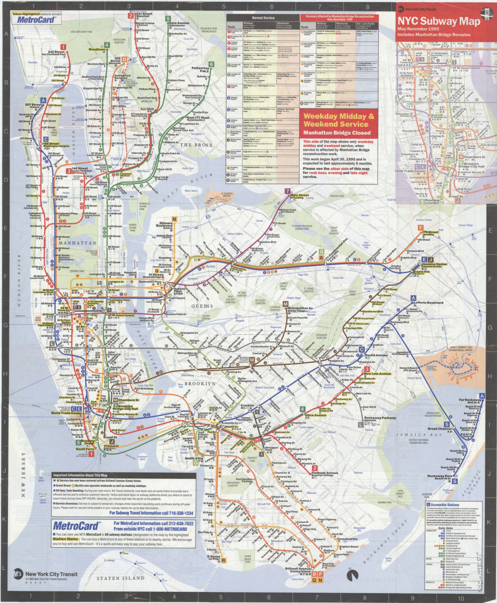
NYC subway map, May-November 1995: includes Manhattan Bridge reroutes: MTA New York City Transit Authority
NYC subway map, May-November 1995: includes Manhattan Bridge reroutes: MTA New York City Transit Authority
[ca. 1995]
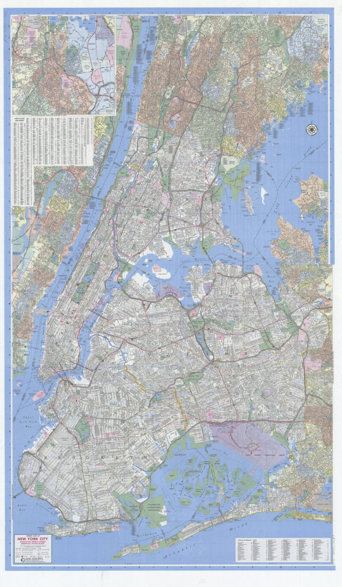
Gousha New York City citymap: including Bogota, Englewood, Fairview, Floral Park, Fort Lee … and adjoining communities, plus index to selective places of interest: H.M. Gousha
Gousha New York City citymap: including Bogota, Englewood, Fairview, Floral Park, Fort Lee … and adjoining communities, plus index to selective places of interest: H.M. Gousha
[1995; ca. 1991]
New York City Transit subway map: multilingual : English, Français, Español, Deutsch, Italiano, Nihongo, Chung wen/: MTA-New York City Transit
New York City Transit subway map: multilingual : English, Français, Español, Deutsch, Italiano, Nihongo, Chung wen/: MTA-New York City Transit
[ca. 1996]
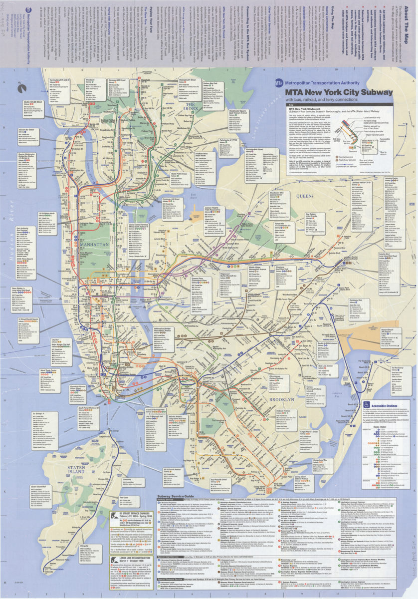
The map, MTA subways and railroads and their interconnections: connections between MTA subway, rail, and bus services, selected connections to other regional transit services: MTA Metropolitan Transportation Authority
The map, MTA subways and railroads and their interconnections: connections between MTA subway, rail, and bus services, selected connections to other regional transit services: MTA Metropolitan Transportation Authority
[ca. 1998]
Previous
1
2