Center for Brooklyn History
Map Collections
Search
About
Othmer Library & Archives
Submit search query
Refine 75 records
Clear filters
2
Location
Abingdon Square (New York, N.Y.)
1
Battery Park (New York, N.Y.)
3
Brooklyn (New York, N.Y.)
891
Brooklyn Heights (New York, N.Y.)
76
Buffalo (N.Y.)
3
Central Park (New York, N.Y.)
3
City Hall Park (New York, N.Y.)
1
Columbus Park (New York, N.Y.)
1
Croton Aqueduct (N.Y.)
3
Duane Street Park (New York, N.Y.)
1
East Harlem (New York, N.Y.)
1
Fort Washington (New York, N.Y.)
2
Gramercy Park (New York, N.Y.)
1
Hudson County (N.J.)
3
Jersey City (N.J.)
4
Long Island (N.Y.)
197
Madison Square Park (New York, N.Y.)
1
Manhattan (New York, N.Y.)
120
New York (N.Y.)
164
New York (State)
95
New York Metropolitan Area
40
Queens (New York, N.Y.)
83
Stuyvesant Square (New York, N.Y.)
1
Tompkins Square (New York, N.Y.)
1
Union Square (New York, N.Y.)
1
United States
10
Upper West Side (New York, N.Y.)
2
Washington Heights (New York, N.Y.)
2
Washington Square (New York, N.Y.)
1
Williamsburg (New York, N.Y.)
36
Show 10 more
Subject
Aqueducts
3
Buildings
12
Canals
15
ferries
32
Fills (Earthwork)
4
Fire protection districts
2
Fires
1
Fortification
7
Harlem Heights, Battle of, N.Y.
1
Landforms
15
Landowners
434
Manuscript Maps
2
Parks
35
Piers
25
Ponds
6
Railroads
72
Railroads, Elevated
24
Real property
619
Reservoirs
2
Rivers
16
Shorelines
3
Streets
46
Swamps
2
Wetlands
6
Show 4 more
Date
19th Century
945
or enter range:
from
to
Genres
Bathymetric maps
94
Cadastral maps
597
Early maps
35
Early works
3
Facsimiles
1
Historical maps
53
Manuscript maps
365
Map
191
Military maps
23
Pictorial maps
38
Pictorial works
1
Thematic maps
60
Tourist maps
55
Transportation maps
120
Zoning maps
55
Sort by:
Date (earliest)
Date (most recent)
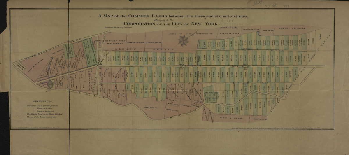
A map of the common lands between the three and six mile stones, belonging to the corporation of the city of New York: Casimer Th. Goerck, city surveyor
A map of the common lands between the three and six mile stones, belonging to the corporation of the city of New York: Casimer Th. Goerck, city surveyor
[1861]
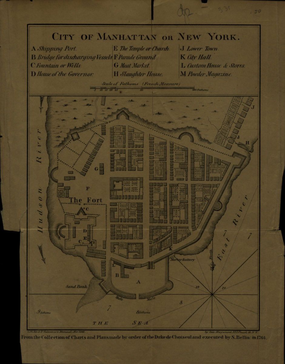
City of Manhattan or New York
City of Manhattan or New York
[1861]
New map of that part of the city of New York south from 20th Street on the Hudson & 35th Street on the East River: showing the position of Greenwich, Washington and West Streets on the Hudson River, and Pearl, Water, Front, Cherry & Tompkins Sts
New map of that part of the city of New York south from 20th Street on the Hudson & 35th Street on the East River: showing the position of Greenwich, Washington and West Streets on the Hudson River, and Pearl, Water, Front, Cherry & Tompkins Sts
[1862]
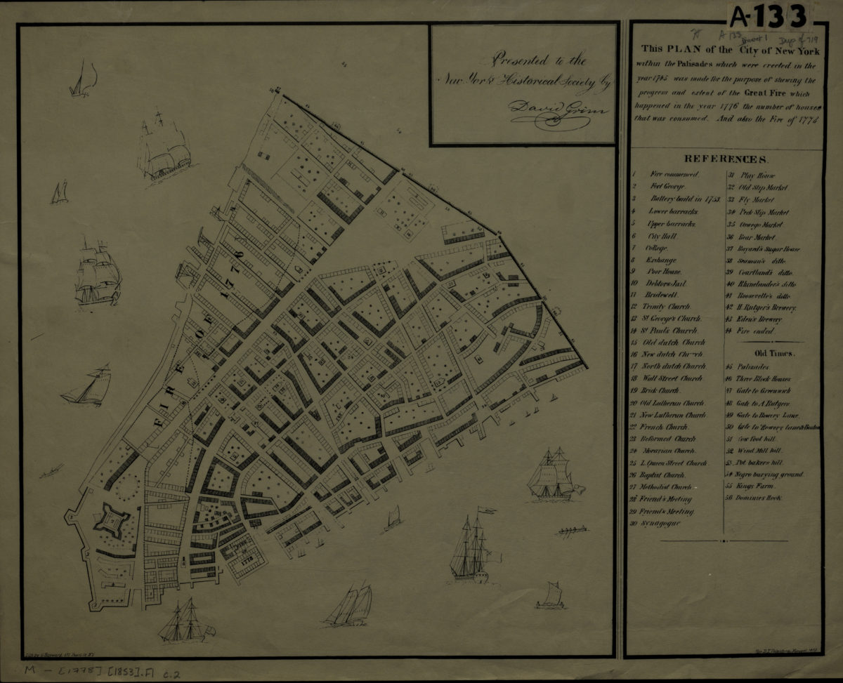
This plan of the city of New York within the Palisades which were erected in the year 1745 was made for the purpose of shewing the progress and extent of the Great Fire which happened in the year 1776, the number of houses that was consumed
This plan of the city of New York within the Palisades which were erected in the year 1745 was made for the purpose of shewing the progress and extent of the Great Fire which happened in the year 1776, the number of houses that was consumed
[1863]
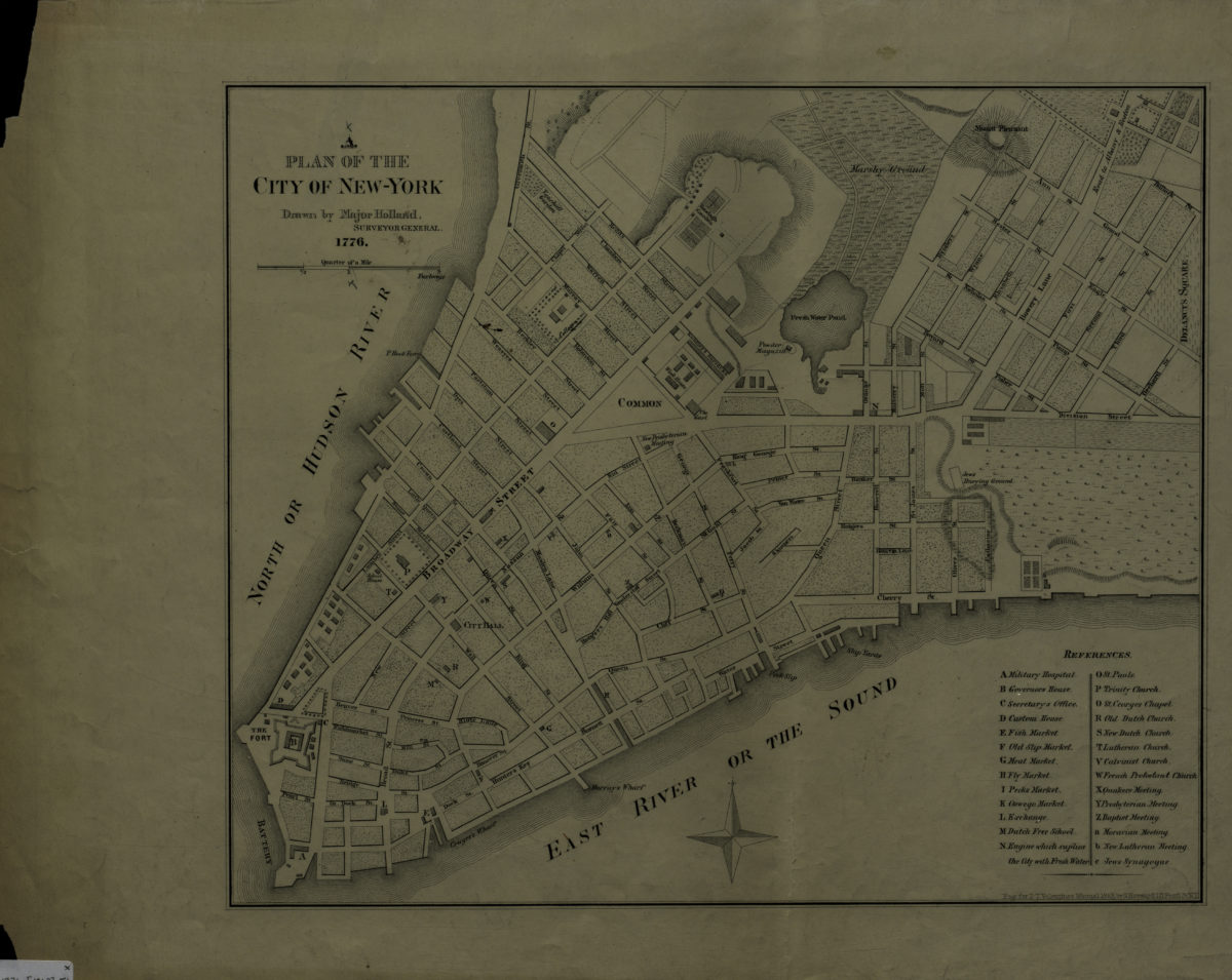
A plan of the city of New-York: drawn by Major Holland, surveyor general
A plan of the city of New-York: drawn by Major Holland, surveyor general
[1863]
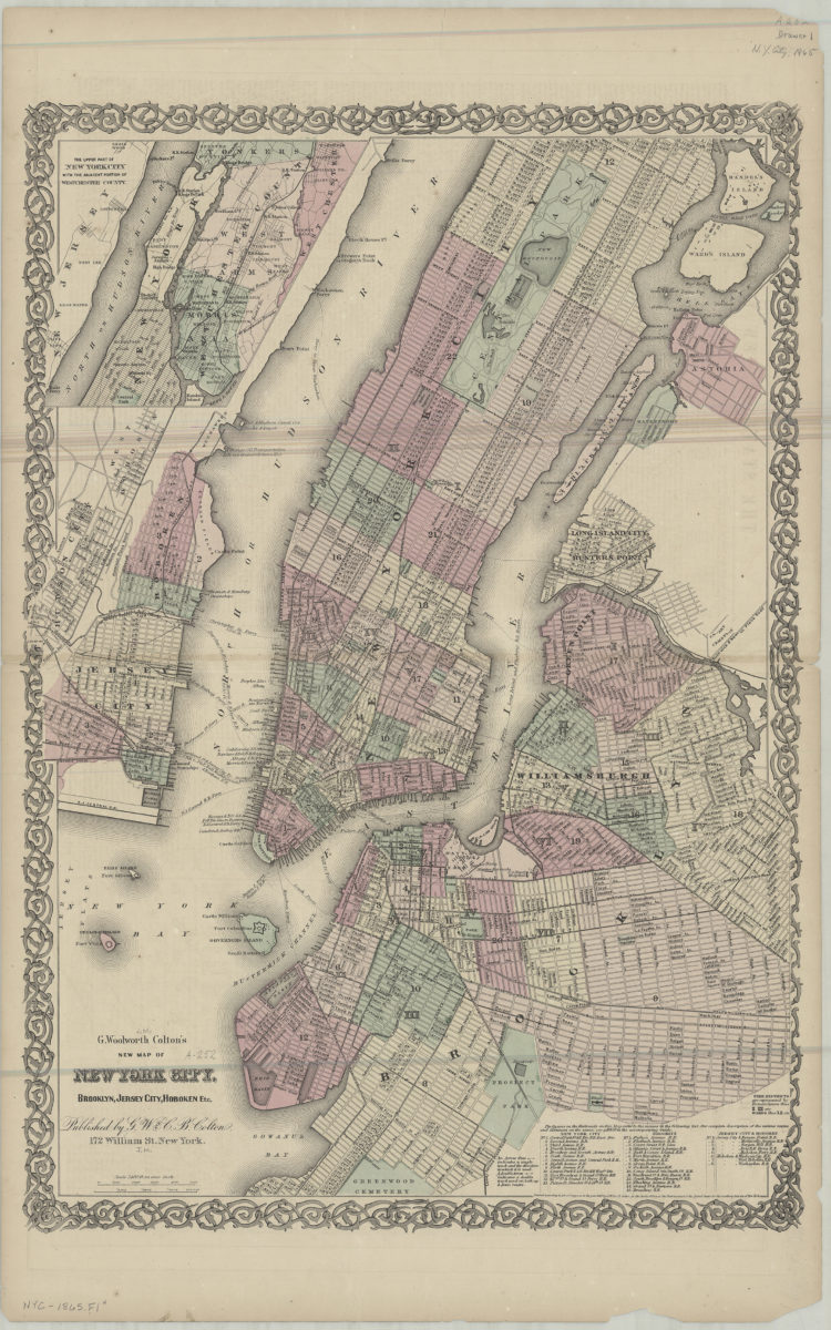
G. Woolworth Colton’s new map of York City, Brooklyn, Jersey City, Hoboken etc
G. Woolworth Colton’s new map of York City, Brooklyn, Jersey City, Hoboken etc
[ca. 1865]
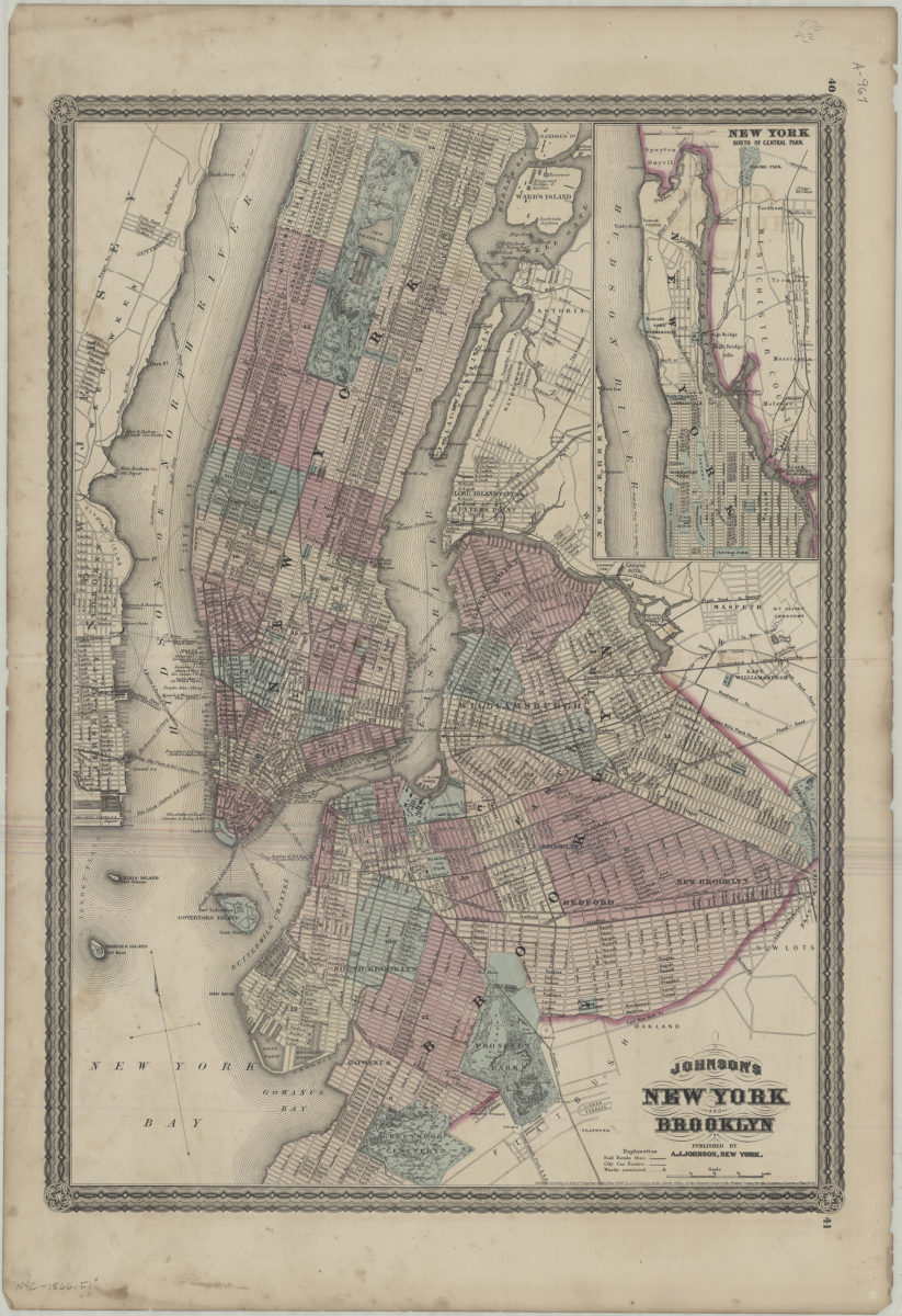
Johnson’s New York and Brooklyn
Johnson’s New York and Brooklyn
[1866]
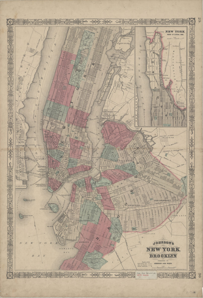
Johnson’s New York and Brooklyn
Johnson’s New York and Brooklyn
[ca. 1866]
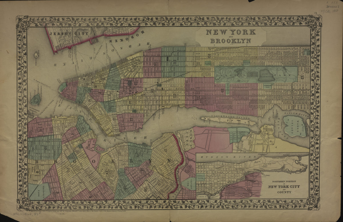
New York and Brooklyn
New York and Brooklyn
[ca. 1867]
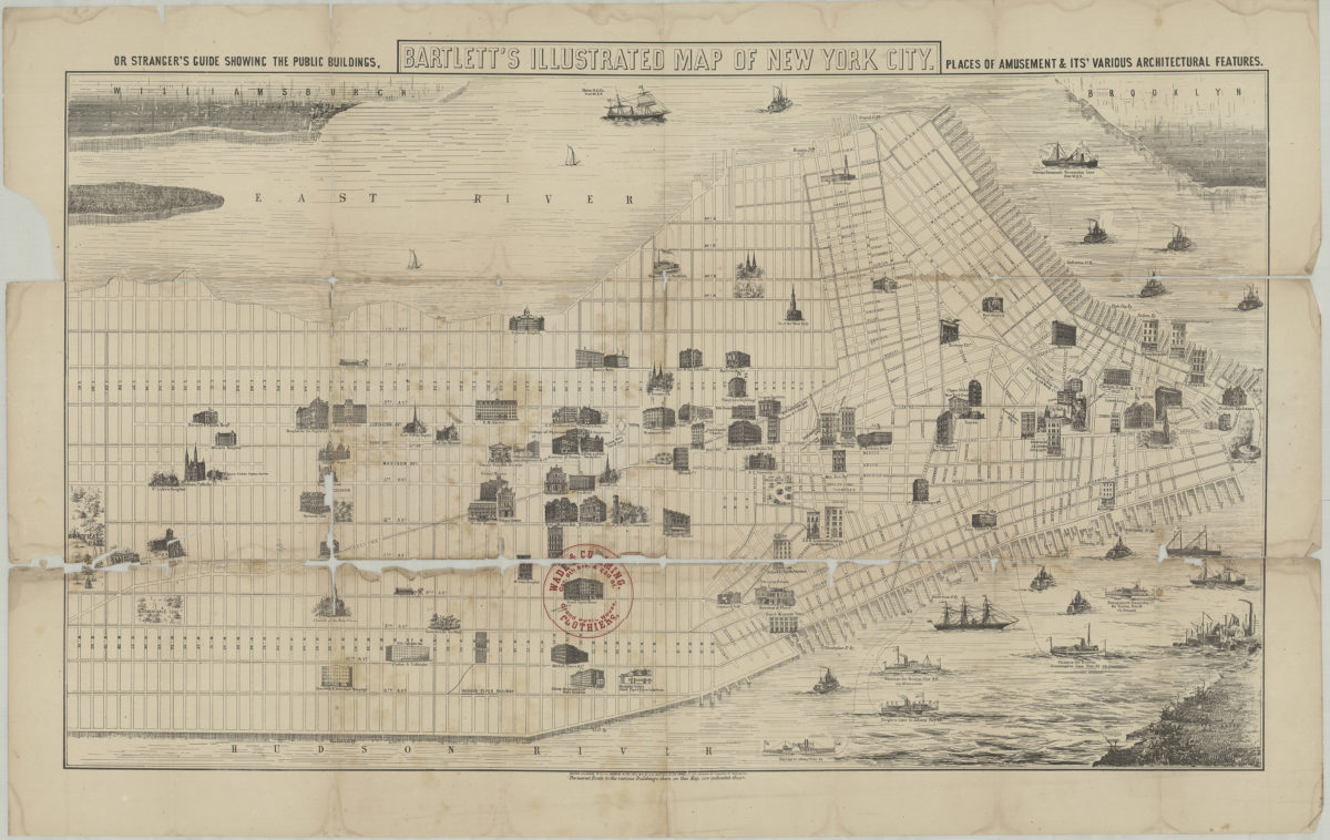
Bartlett’s illustrated map of New York City, or stranger’s guide showing the public buildings, places of amusement and its various architectural features
Bartlett’s illustrated map of New York City, or stranger’s guide showing the public buildings, places of amusement and its various architectural features
[1870]
New York City, Brooklyn, Jersey City, Hoboken etc
New York City, Brooklyn, Jersey City, Hoboken etc
[187?]
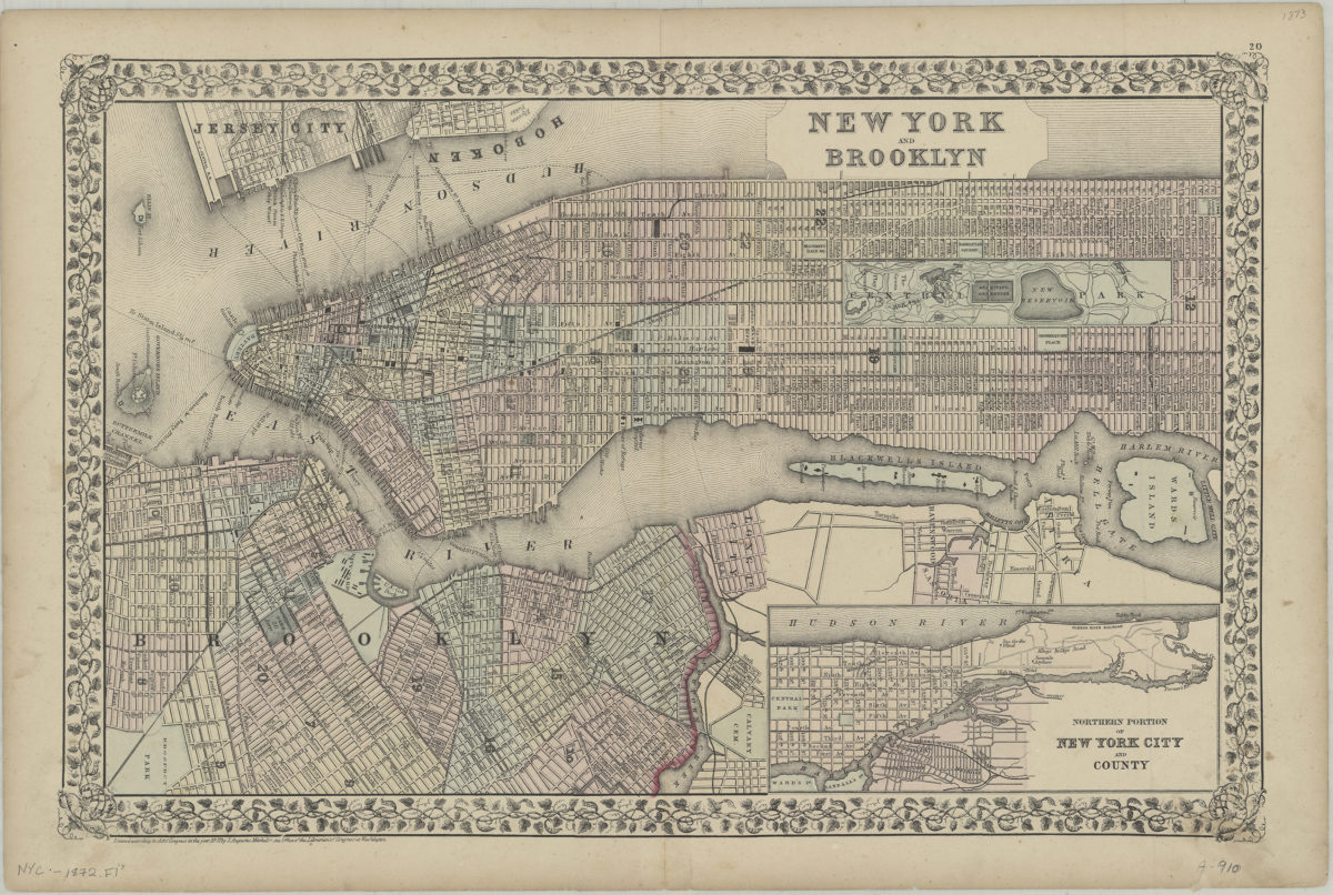
New York and Brooklyn
New York and Brooklyn
[ca. 1872]
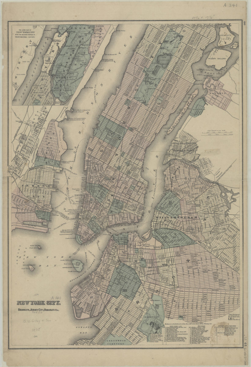
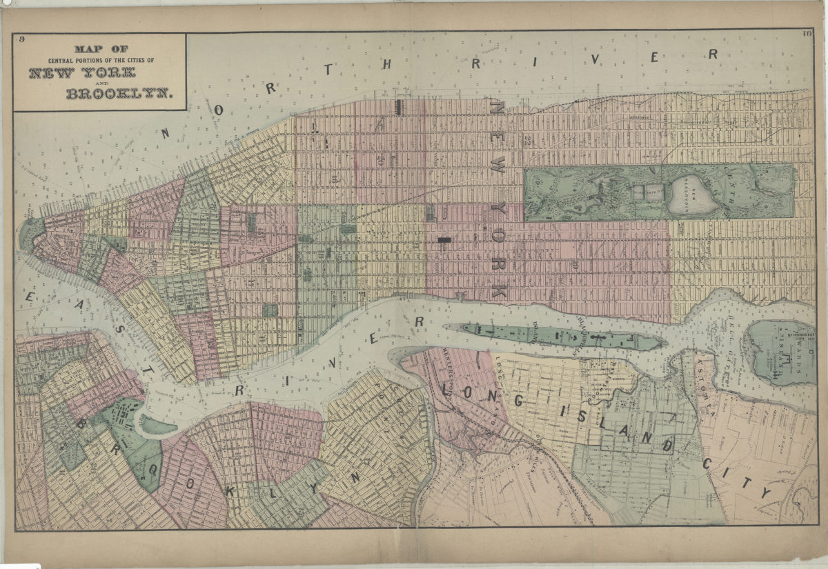
Map of central portions of the cities of New York and Brooklyn
Map of central portions of the cities of New York and Brooklyn
[1873]
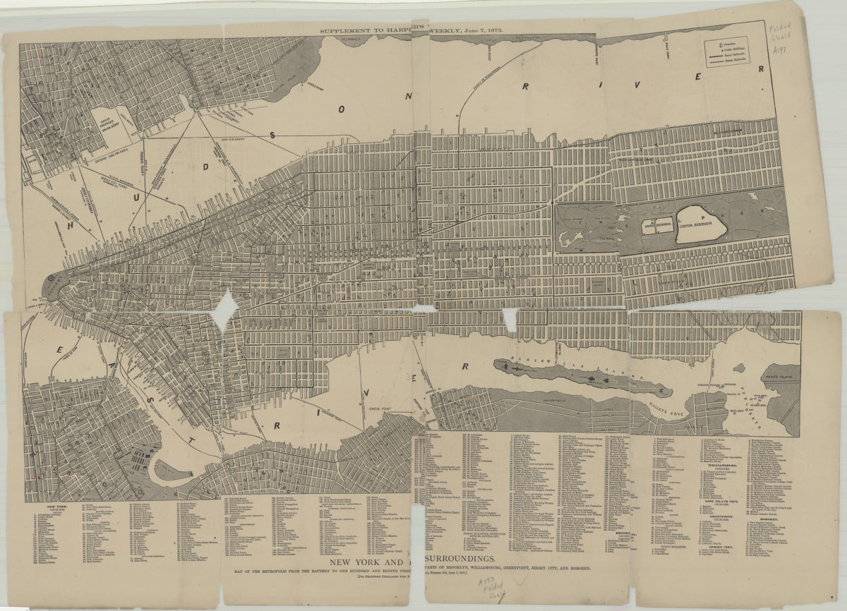
New York and its surroundings: map of the metropolis from the Battery to One Hundred and Eighth Street, and parts of Brooklyn, Williamsburg, Greenpoint, Jersey City, and Hoboken
New York and its surroundings: map of the metropolis from the Battery to One Hundred and Eighth Street, and parts of Brooklyn, Williamsburg, Greenpoint, Jersey City, and Hoboken
1873
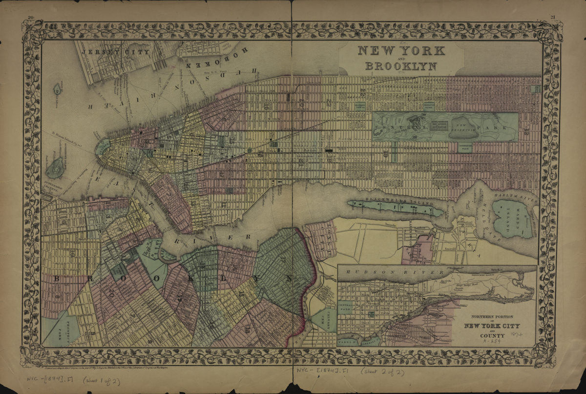
New York and Brooklyn
New York and Brooklyn
[ca. 1874]
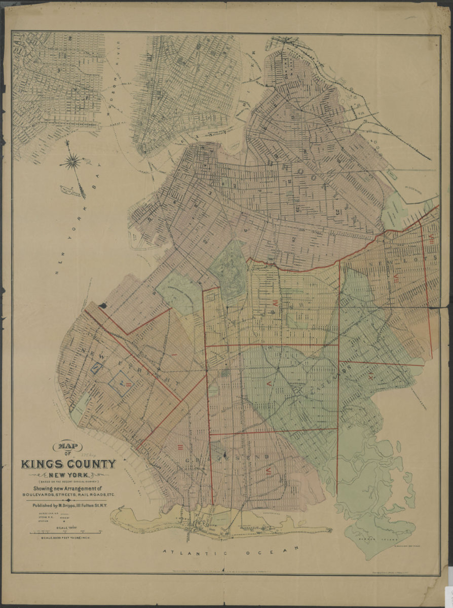
Map of Kings County New York (based on the recent official survey): showing new arrangement of boulevards, streets, railroads, etc
Map of Kings County New York (based on the recent official survey): showing new arrangement of boulevards, streets, railroads, etc
[1879]
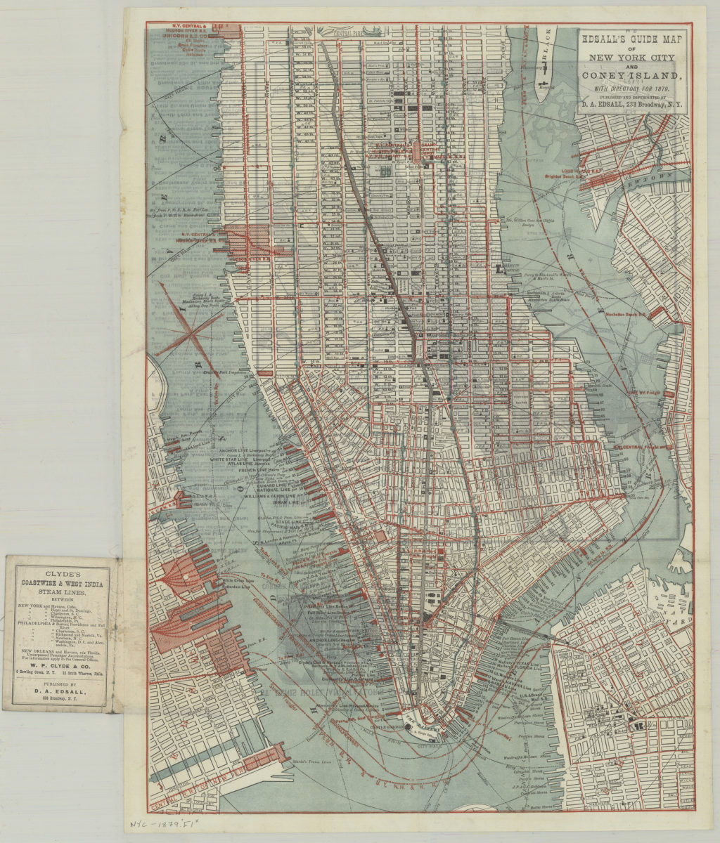
Edsall’s guide map of New York City and Coney Island: with directory for 1879
Edsall’s guide map of New York City and Coney Island: with directory for 1879
1879
New York and Brooklyn
New York and Brooklyn
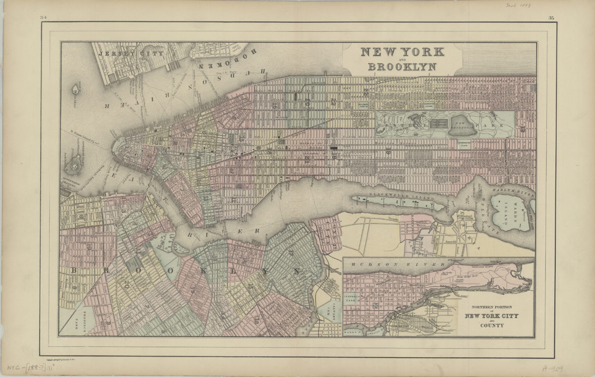
[188?]
New York and Brooklyn
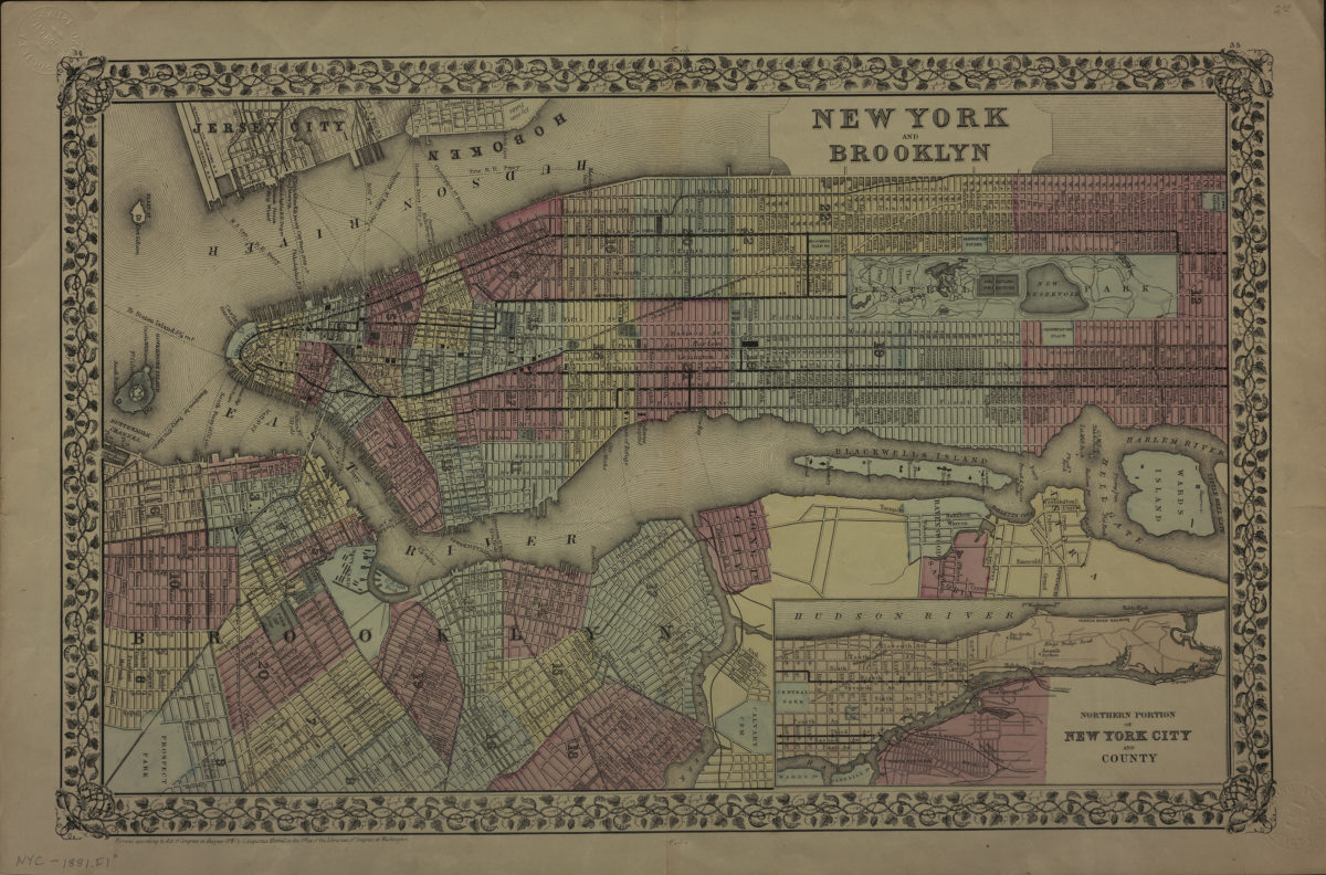
New York and Brooklyn
[ca. 1881]
Map of New York and vicinity
Map of New York and vicinity
[1886-1894]
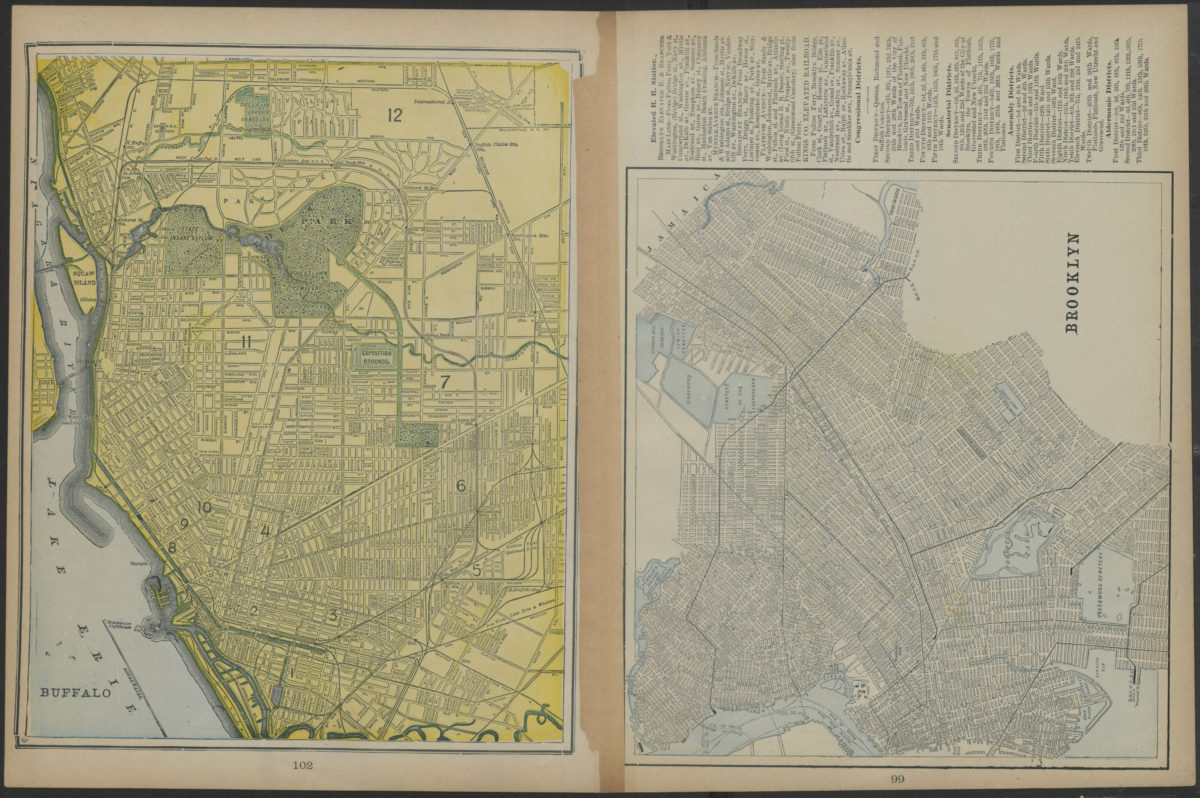
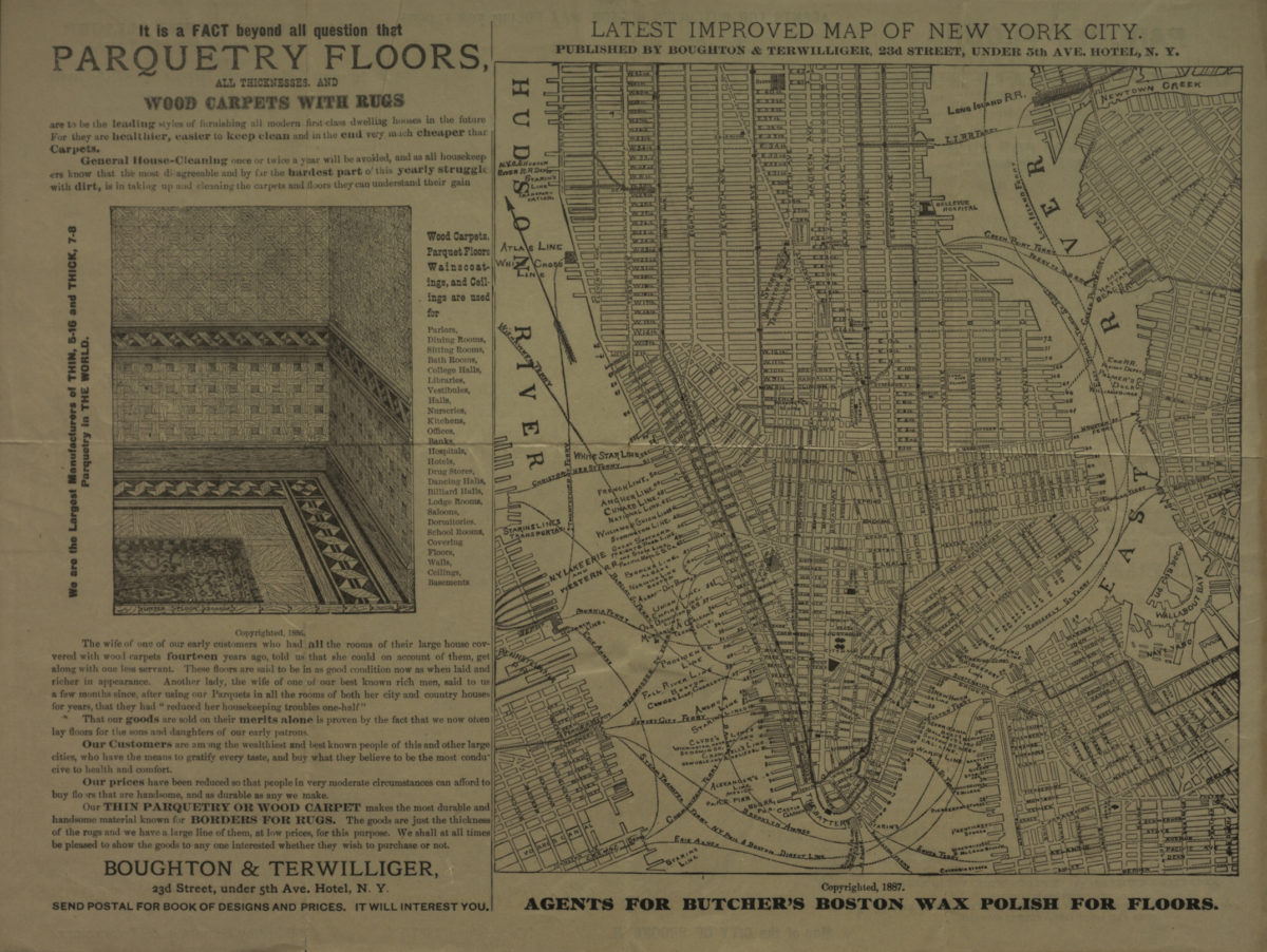
Map of the city of Brooklyn ; Latest improved map of New York City
Map of the city of Brooklyn ; Latest improved map of New York City
[ca. 1887]
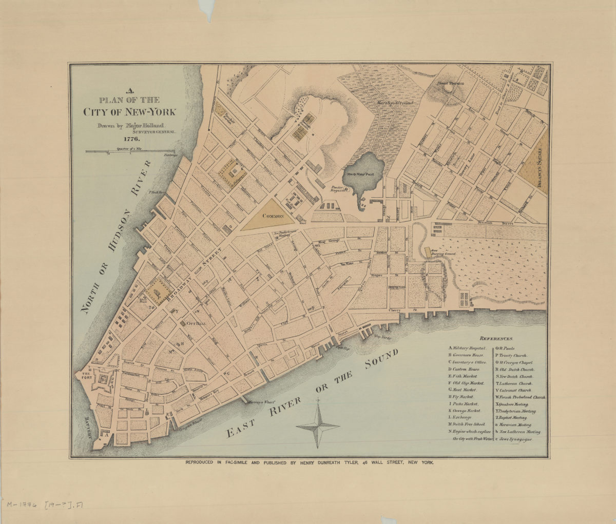
A plan of the city of New York: drawn by Major Holland, surveyor general
A plan of the city of New York: drawn by Major Holland, surveyor general
[189?]
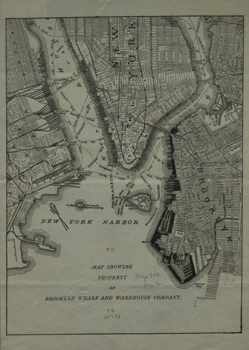
Map showing property of Brooklyn Wharf and Warehouse Company
Map showing property of Brooklyn Wharf and Warehouse Company
[189?]
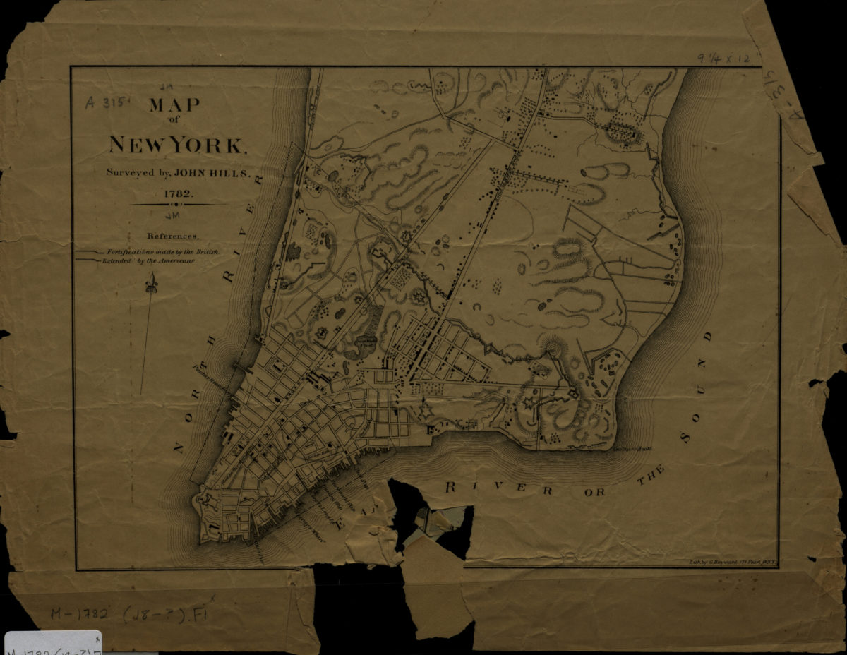
Map of New York: surveyed by John Hills
Map of New York: surveyed by John Hills
[1890]
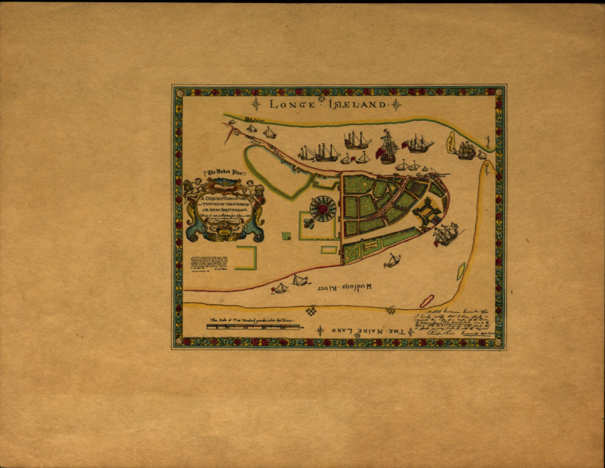
A description of the towne of Mannados or New Amsterdam: as it was in September 1661 lying in latitude 40 de. and 40 m. anno Domini 1664
A description of the towne of Mannados or New Amsterdam: as it was in September 1661 lying in latitude 40 de. and 40 m. anno Domini 1664
[1897]
Previous
1
2