Center for Brooklyn History
Map Collections
Search
About
Othmer Library & Archives
Submit search query
Refine 31 records
Clear filters
2
Location
Bath Beach (New York, N.Y.)
8
Bay Ridge (New York, N.Y.)
108
Bay Ridge Park (New York, N.Y.)
1
Bensonhurst (New York, N.Y.)
17
Borough Park (New York, N.Y.)
23
Brooklyn (New York, N.Y.)
891
Brooklyn Heights (New York, N.Y.)
76
Downtown Brooklyn (New York, N.Y.)
29
Dyker Heights (New York, N.Y.)
23
East New York (New York, N.Y.)
16
Fort Hamilton (New York, N.Y.)
31
Gravesend (New York, N.Y.)
25
New Utrecht (New York, N.Y.)
9
Park Slope (New York, N.Y.)
16
Prospect Heights (New York, N.Y.)
16
Sunset Park (New York, N.Y.)
53
Windsor Terrace (New York, N.Y.)
10
Subject
Election districts
36
Land use
5
Landforms
15
Landowners
434
Railroads
72
Real property
619
Riparian rights
13
Roads
117
Salt marshes
2
Streets
46
Submerged lands
17
Zoning
2
Date
19th Century
945
20th Century
469
or enter range:
from
to
Genres
Cadastral maps
597
Manuscript maps
365
Pictorial maps
38
Transportation maps
120
Zoning maps
55
Sort by:
Date (earliest)
Date (most recent)
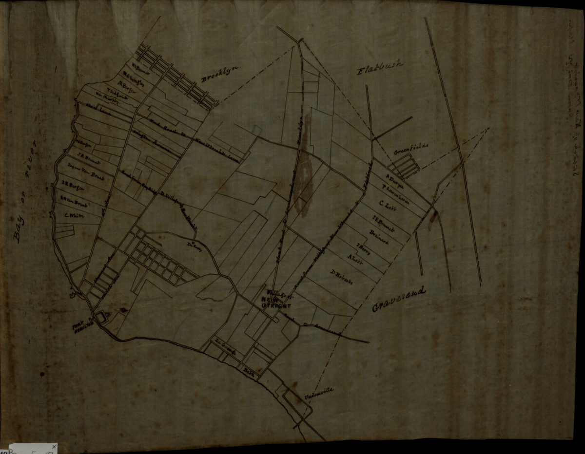
Sketch of New Utrecht from Dripps map
Sketch of New Utrecht from Dripps map
[18??]
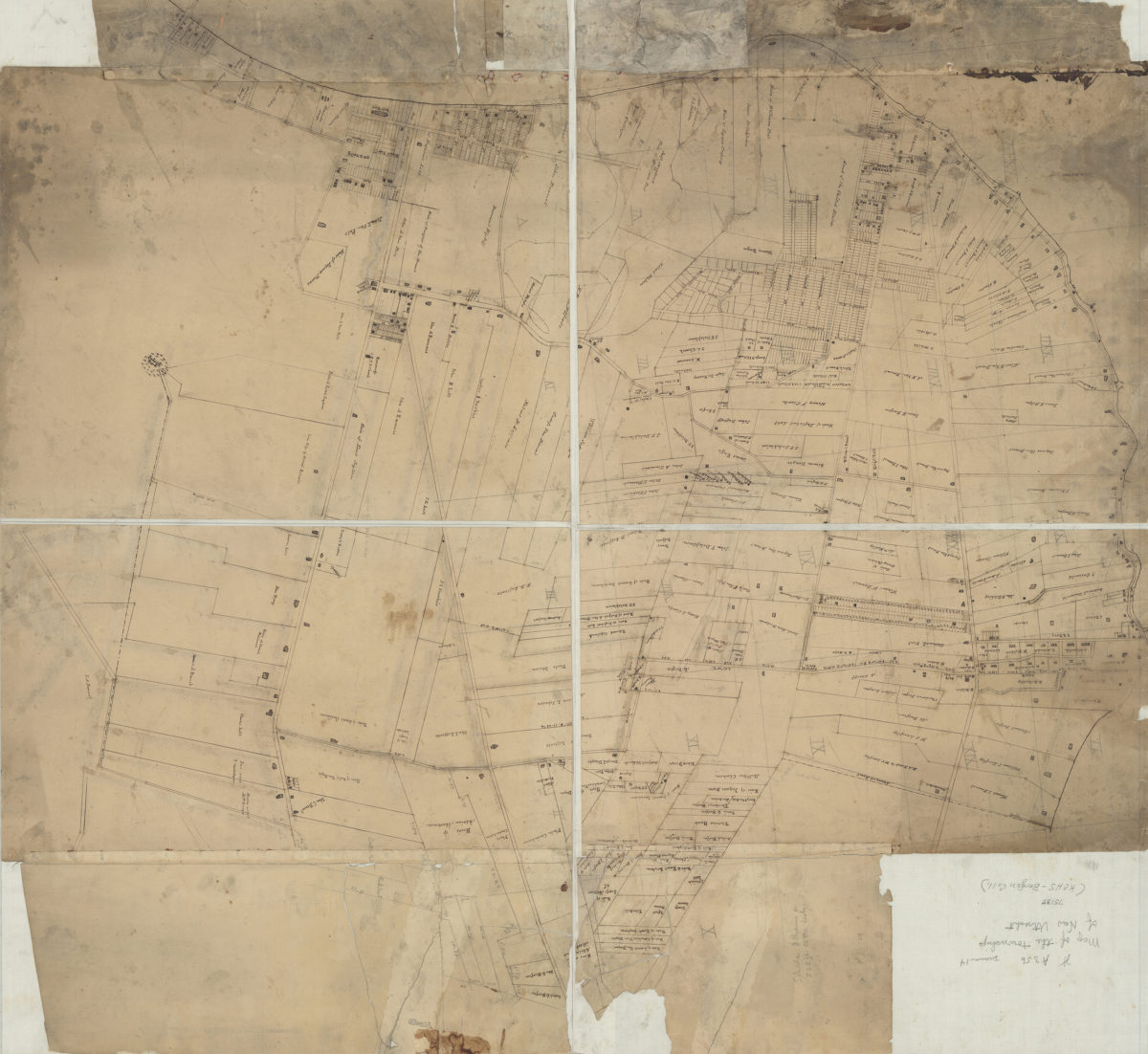
[Map of New Utrecht]
[Map of New Utrecht]
[18??]
[Map of roads from Gravesend to Flatbush to Flatlands, New Utrecht and Flatbush]
[Map of roads from Gravesend to Flatbush to Flatlands, New Utrecht and Flatbush]
[18??]
Map of Brooklyn City Railroad in New Utrecht
Map of Brooklyn City Railroad in New Utrecht
[18??]
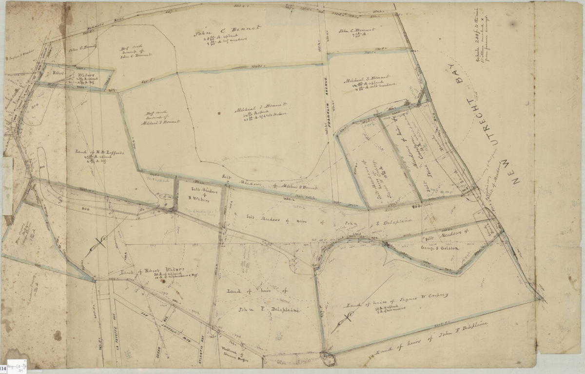
[Map of Dyker Meadows in the town of New Utrecht]
[Map of Dyker Meadows in the town of New Utrecht]
[18??]
92nd St
92nd St
[18??]
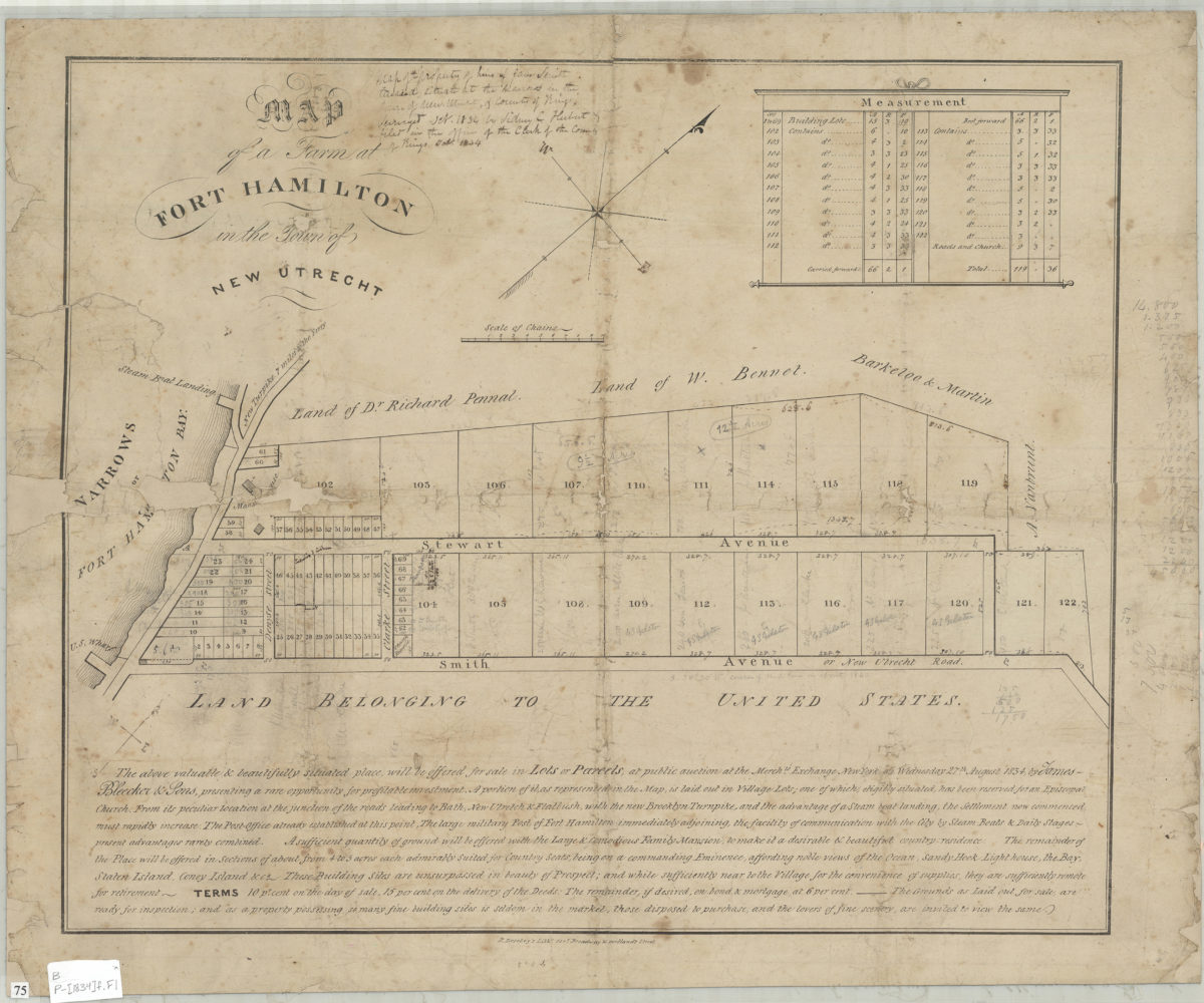
Map of a farm at Fort Hamilton in the town of New Utrecht
Map of a farm at Fort Hamilton in the town of New Utrecht
[1834]
[Survey map of 2 proposed routes north from Dyker Meadow in the town of New Utrecht]
[Survey map of 2 proposed routes north from Dyker Meadow in the town of New Utrecht]
[1839]
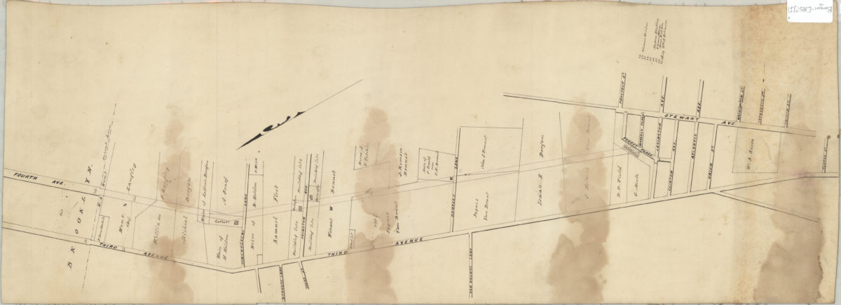
[Property map covering 3rd and 4th Aves. between Clarke St. and Cowenhovens Ln.].
[Property map covering 3rd and 4th Aves. between Clarke St. and Cowenhovens Ln.].
[185?]
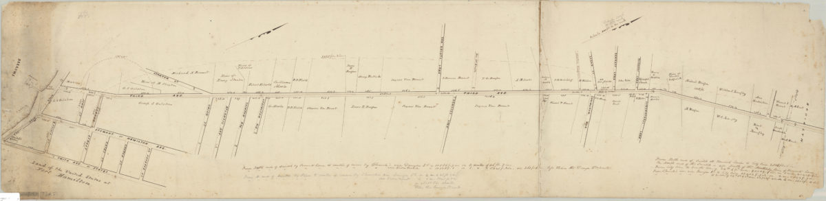
Extension of 3rd Ave. to Ft. Hamilton
Extension of 3rd Ave. to Ft. Hamilton
1851
Extension of 3d. Ave., New Utrecht, preliminary survey, 1852
Extension of 3d. Ave., New Utrecht, preliminary survey, 1852
January 1852
Sectional map no. 4 of the village of Fort Hamilton, Hamilton Grove in the town of New Utrecht and state of New York, 1853: surveyed by R. Henwood, October 18th, 1853
Sectional map no. 4 of the village of Fort Hamilton, Hamilton Grove in the town of New Utrecht and state of New York, 1853: surveyed by R. Henwood, October 18th, 1853
[1853]
[Maps of land in Fort Hamilton bought and sold by Richard R. Bennet]
[Maps of land in Fort Hamilton bought and sold by Richard R. Bennet]
1853-1854
Map of 3d Ave. of Brooklyn, as extended to Fort Hamilton, New Utrecht, by order of commissioners in 1853
Map of 3d Ave. of Brooklyn, as extended to Fort Hamilton, New Utrecht, by order of commissioners in 1853
[1853]
[Profile maps of grade of 3rd Avenue from Brooklyn to Fort Hamilton]
[Profile maps of grade of 3rd Avenue from Brooklyn to Fort Hamilton]
Map of the property of heirs of Jane Smith, deceased, situate[d] at the Narrows in the town of New Utrecht: surveyed Oct. 1836 by Sidney C. Herbert and filed in the Office of the Clerk of the county of Kings, Oct. 1836 ; [copied by T.G. Bergen?]
Map of the property of heirs of Jane Smith, deceased, situate[d] at the Narrows in the town of New Utrecht: surveyed Oct. 1836 by Sidney C. Herbert and filed in the Office of the Clerk of the county of Kings, Oct. 1836 ; [copied by T.G. Bergen?]
[1858]
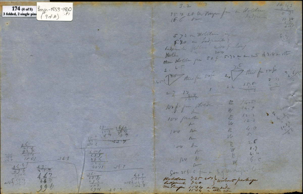
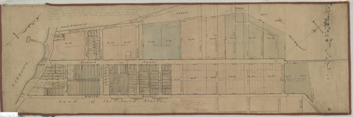
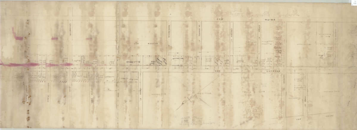
Opening map of Stewart Avenue, Denyse Street, Clarke Street, & John Street: as surveyed by T.G. Bergen
Opening map of Stewart Avenue, Denyse Street, Clarke Street, & John Street: as surveyed by T.G. Bergen
June 1861
Village of Ft. Hamilton
Village of Ft. Hamilton
[1867-1891]
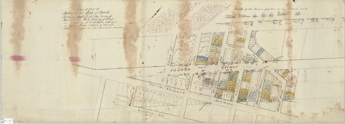
Copy of part of assessment map of Fourth Avenue grading in the town of New Utrecht and County of Kings: as made by T.G. Bergen, surveyor
Copy of part of assessment map of Fourth Avenue grading in the town of New Utrecht and County of Kings: as made by T.G. Bergen, surveyor
1870
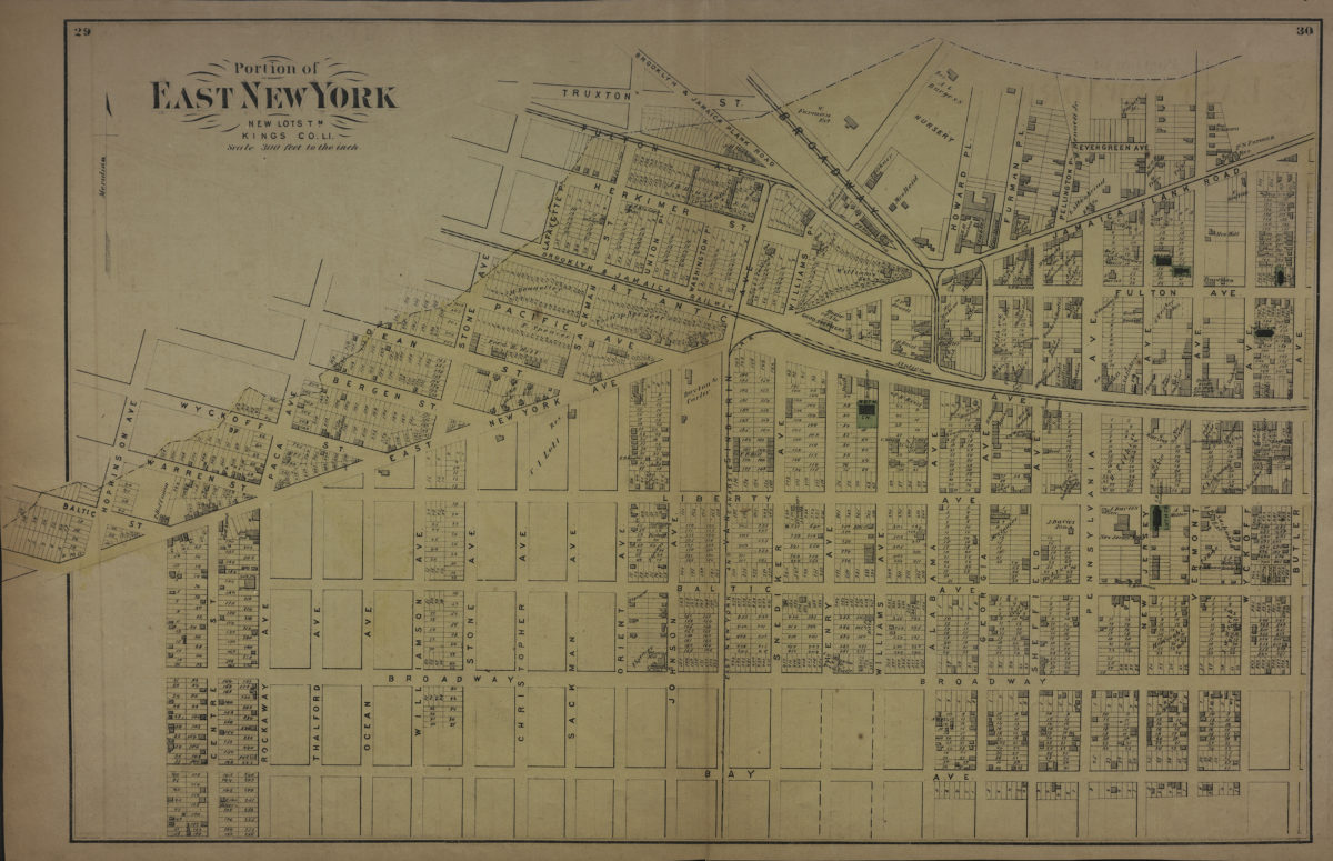
Portion of East New York, New Lots Tn., Kings Co., L.I.
Portion of East New York, New Lots Tn., Kings Co., L.I.
[1873]
[Maps of land of Inebriates Home near Fort Hamilton in the county of Kings, and the state of New York]
[Maps of land of Inebriates Home near Fort Hamilton in the county of Kings, and the state of New York]
1873
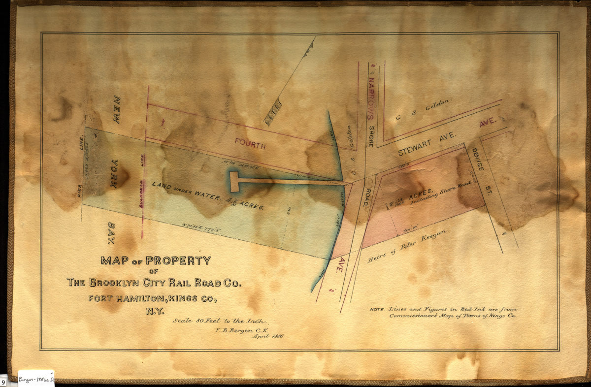
Map of property of the Brooklyn City Rail Road Co., Fort Hamilton, Kings Co., N.Y.: V.B. Bergen, C.E.
Map of property of the Brooklyn City Rail Road Co., Fort Hamilton, Kings Co., N.Y.: V.B. Bergen, C.E.
April 1886
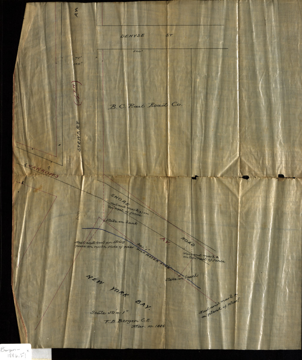
[Map of Stewart Ave. at Narrows Ave. and Shore Rd.]: V.B. Bergen, C.E.
[Map of Stewart Ave. at Narrows Ave. and Shore Rd.]: V.B. Bergen, C.E.
March 10, 1886
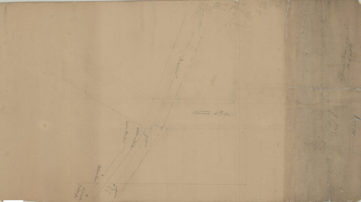
[Survey of Brooklyn City Rail Road Company land grant at the intersection of Narrows Shore Road and Stewart Avenue where it coincides with 4th Avenue]
[Survey of Brooklyn City Rail Road Company land grant at the intersection of Narrows Shore Road and Stewart Avenue where it coincides with 4th Avenue]
[1886]
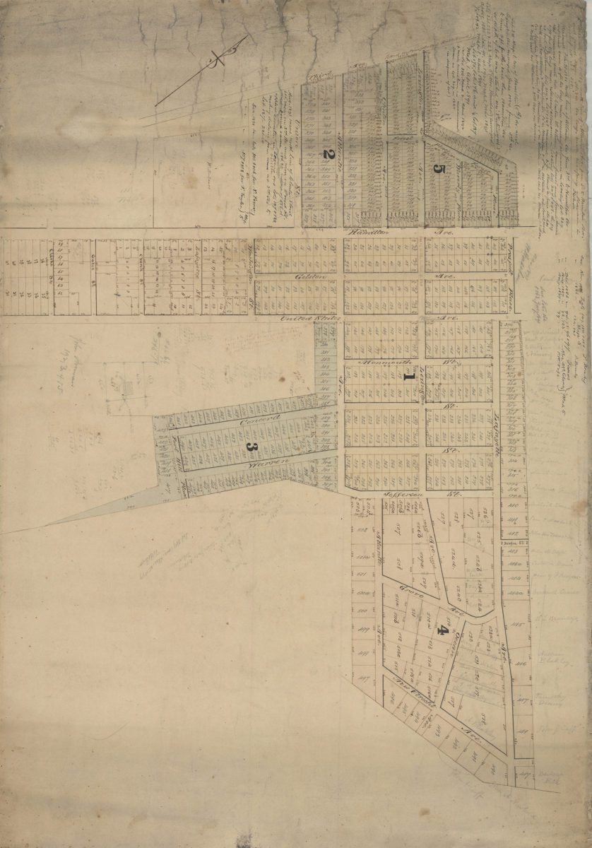
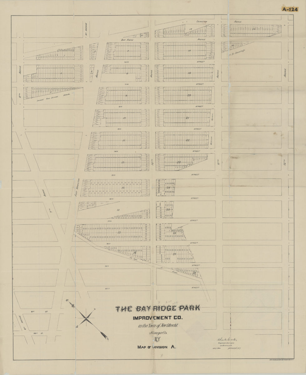
Map of Division A: Charles Crooke, engineer & surveyor
Map of Division A: Charles Crooke, engineer & surveyor
[1890]
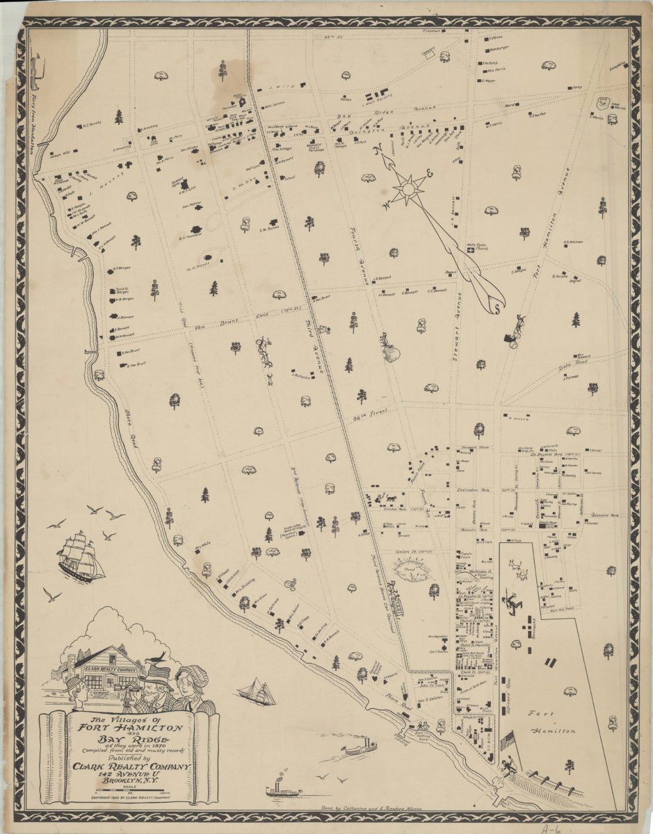
The villages of Fort Hamilton and Bay Ridge as they were in 1870: compiled from old and musty records: done by Catherine and E. Theodore Nelson
The villages of Fort Hamilton and Bay Ridge as they were in 1870: compiled from old and musty records: done by Catherine and E. Theodore Nelson
[ca. 1942]
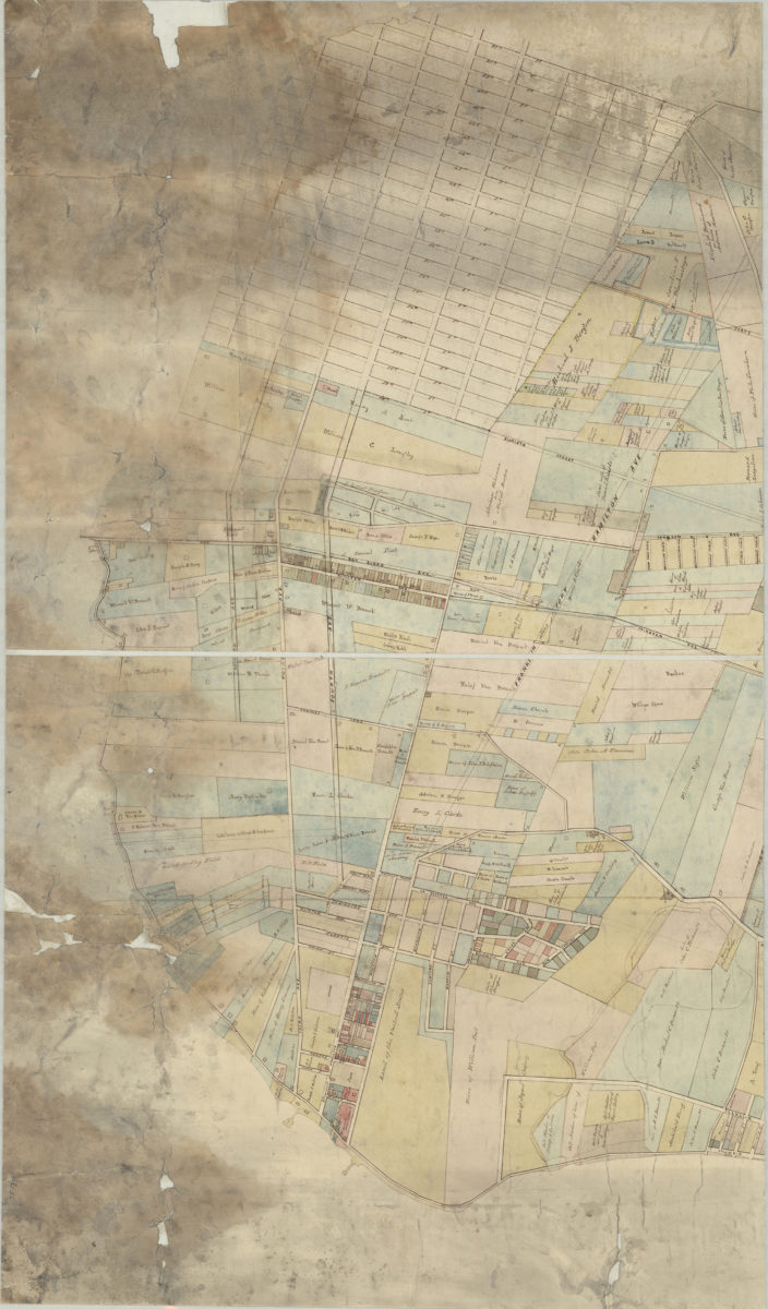
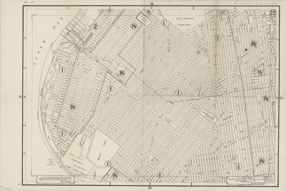
Amended use district map, section no. 22: City of New York, City Planning Commission, Irving F. Ashworth, senior civil engineer
Amended use district map, section no. 22: City of New York, City Planning Commission, Irving F. Ashworth, senior civil engineer
1953
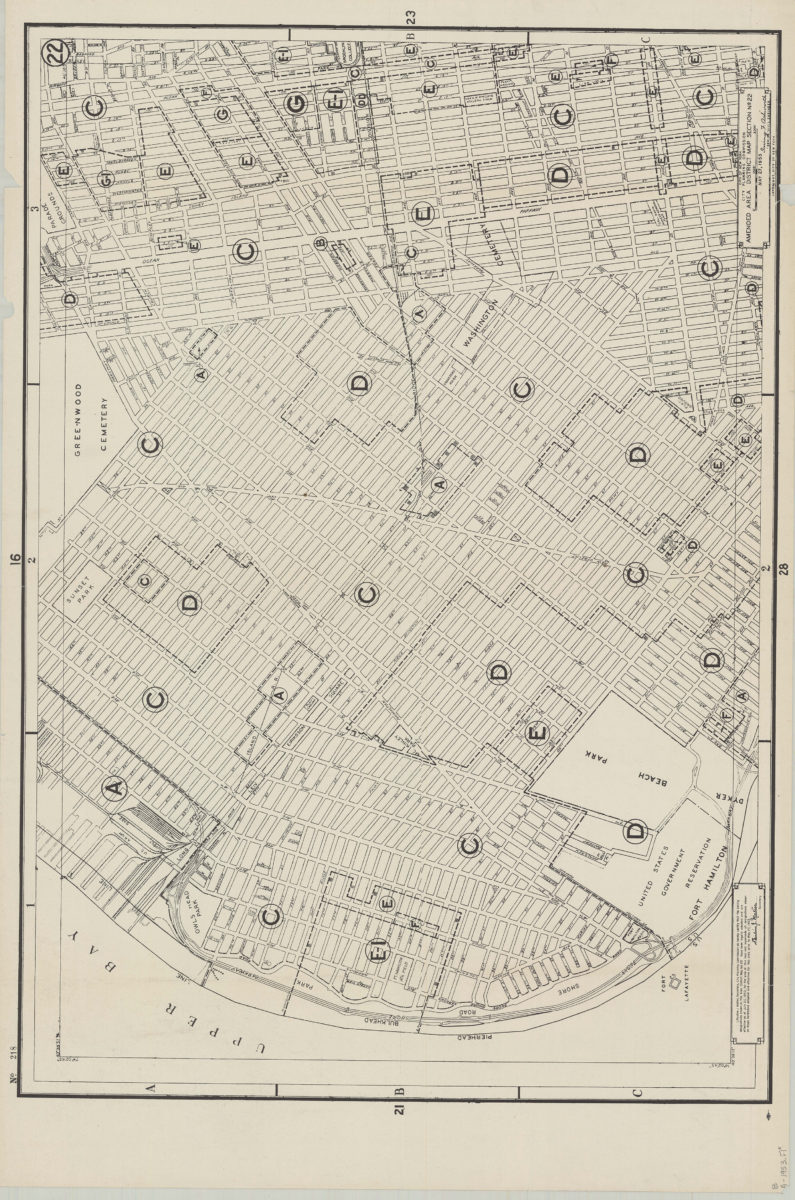
Amended use district map, section no. 22: City of New York, City Planning Commission, Irving F. Ashworth, senior civil engineer
Amended use district map, section no. 22: City of New York, City Planning Commission, Irving F. Ashworth, senior civil engineer
1953
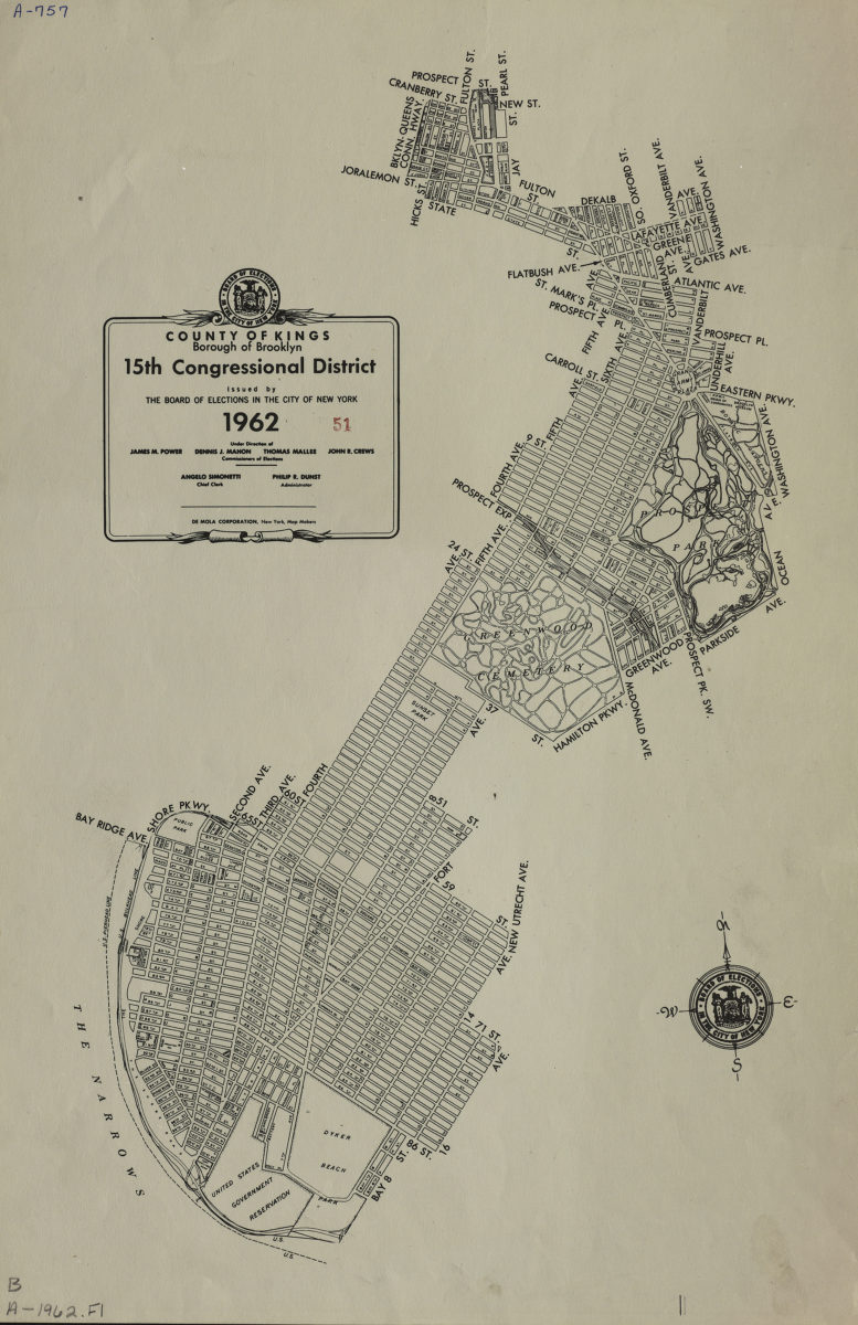
County of Kings, Borough of Brooklyn, 15th Congressional District: issued by the Board of Elections in the City of New York
County of Kings, Borough of Brooklyn, 15th Congressional District: issued by the Board of Elections in the City of New York
1962
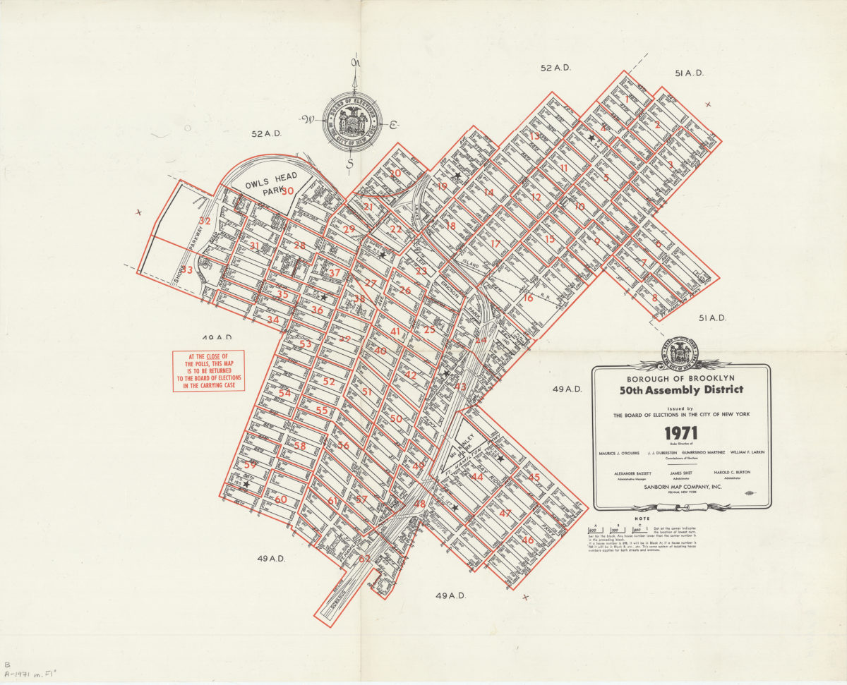
Borough of Brooklyn 50th Assembly District, 1971: issued by the Board of Elections in the City of New York
Borough of Brooklyn 50th Assembly District, 1971: issued by the Board of Elections in the City of New York
1971
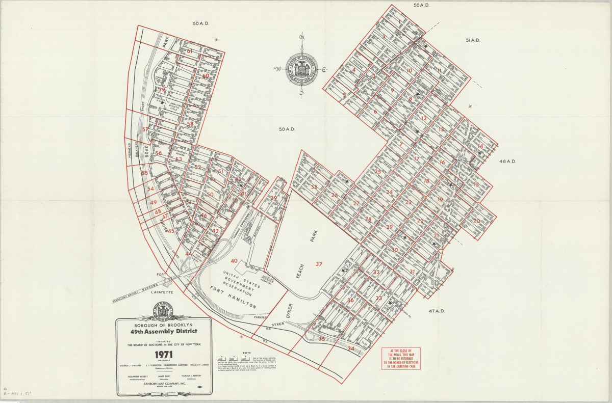
Borough of Brooklyn 49th Assembly District, 1971: issued by the Board of Elections in the City of New York
Borough of Brooklyn 49th Assembly District, 1971: issued by the Board of Elections in the City of New York
1971