Center for Brooklyn History
Map Collections
Search
About
Othmer Library & Archives
Submit search query
Refine 117 records
Clear filter
1
Location
Albany (N.Y.)
3
Amityville (N.Y.)
1
Babylon (N.Y. : Town)
2
Babylon (N.Y.)
1
Bay Ridge (New York, N.Y.)
108
Brightwaters (N.Y.)
1
Brooklyn (New York, N.Y.)
891
Brooklyn Heights (New York, N.Y.)
76
Brownsville (New York, N.Y.)
10
Buffalo (N.Y.)
3
Bushwick (New York, N.Y.)
20
Columbia County (N.Y.)
1
Coney Island (New York, N.Y.)
22
Crown Heights (New York, N.Y.)
25
Downtown Brooklyn (New York, N.Y.)
29
Dutchess County (N.Y.)
2
East Flatbush (New York, N.Y.)
23
Flatbush (New York, N.Y.)
35
Flatlands (New York, N.Y.)
19
Flushing (New York, N.Y.)
13
Fort Hamilton (New York, N.Y.)
31
Fulton Ferry Historic District (New York, N.Y.)
5
Gowanus (New York, N.Y.)
12
Gravesend (New York, N.Y.)
25
Greene County (N.Y.)
3
Greenpoint (New York, N.Y.)
38
Holland Tunnel (Jersey City, N.J., and New York, N.Y.)
1
Islip (N.Y.)
5
Kings Highway (New York, N.Y.)
1
Lindenhurst (N.Y.)
1
Long Island (N.Y.)
197
Manhattan (New York, N.Y.)
120
Midwood (New York, N.Y.)
9
Nassau County (N.Y.)
24
New England
8
New Jersey
27
New Utrecht (New York, N.Y.)
9
New York (N.Y.)
164
New York (State)
95
New York Harbor (N.Y. and N.J.)
16
New York Metropolitan Area
40
Ocean Beach (N.Y.)
1
Park Slope (New York, N.Y.)
16
Pennsylvania
4
Queens (New York, N.Y.)
83
Ridgewood (New York, N.Y.)
2
Saltaire (N.Y.)
1
Sheepshead Bay (New York, N.Y.)
13
Smithtown (N.Y. : Town)
4
Southampton (N.Y.)
5
Staten Island (N.Y.)
10
Suffolk County (N.Y.)
43
Sunset Park (New York, N.Y.)
53
Westchester County (N.Y.)
11
Williamsburg (New York, N.Y.)
36
Show 35 more
Subject
Airports
2
Airways
2
Aqueducts
3
Automobile racing
1
Bicycle trails
17
Buildings
12
Canals
15
Central business districts
10
Country clubs
1
Electric railroads
5
Exhibitions
5
Federal aid to transportation
1
ferries
32
Ferry routes
3
Fills (Earthwork)
4
Fortification
7
Golf courses
2
Golf resorts
1
Grading (Earthwork)
1
Highway planning
2
Landforms
15
Landowners
434
Local transit
63
Piers
25
Plank roads
1
Ponds
6
Postal codes
4
Railroads
72
Railroads, Elevated
24
Real property
619
Recreation
5
Reservoirs
2
River channels
1
Rivers
16
Road maps
2
Roads
117
Steamboat lines
4
Street addresses
11
Street railroads
8
Streets
46
Submerged lands
17
Subways
55
Tourism
1
Traffic engineering
1
Transportation
3
Wetlands
6
Yacht clubs
1
Zip codes
4
Show 28 more
Date
18th Century
12
19th Century
945
20th Century
469
21th Century
66
or enter range:
from
to
Genres
Aerial views
15
Cadastral maps
597
Early maps
35
Historical maps
53
Manuscript maps
365
Map
191
Pictorial maps
38
Road
1
Road maps
83
Statistical maps
8
Thematic maps
60
Tourist maps
55
Transportation maps
120
Sort by:
Date (earliest)
Date (most recent)
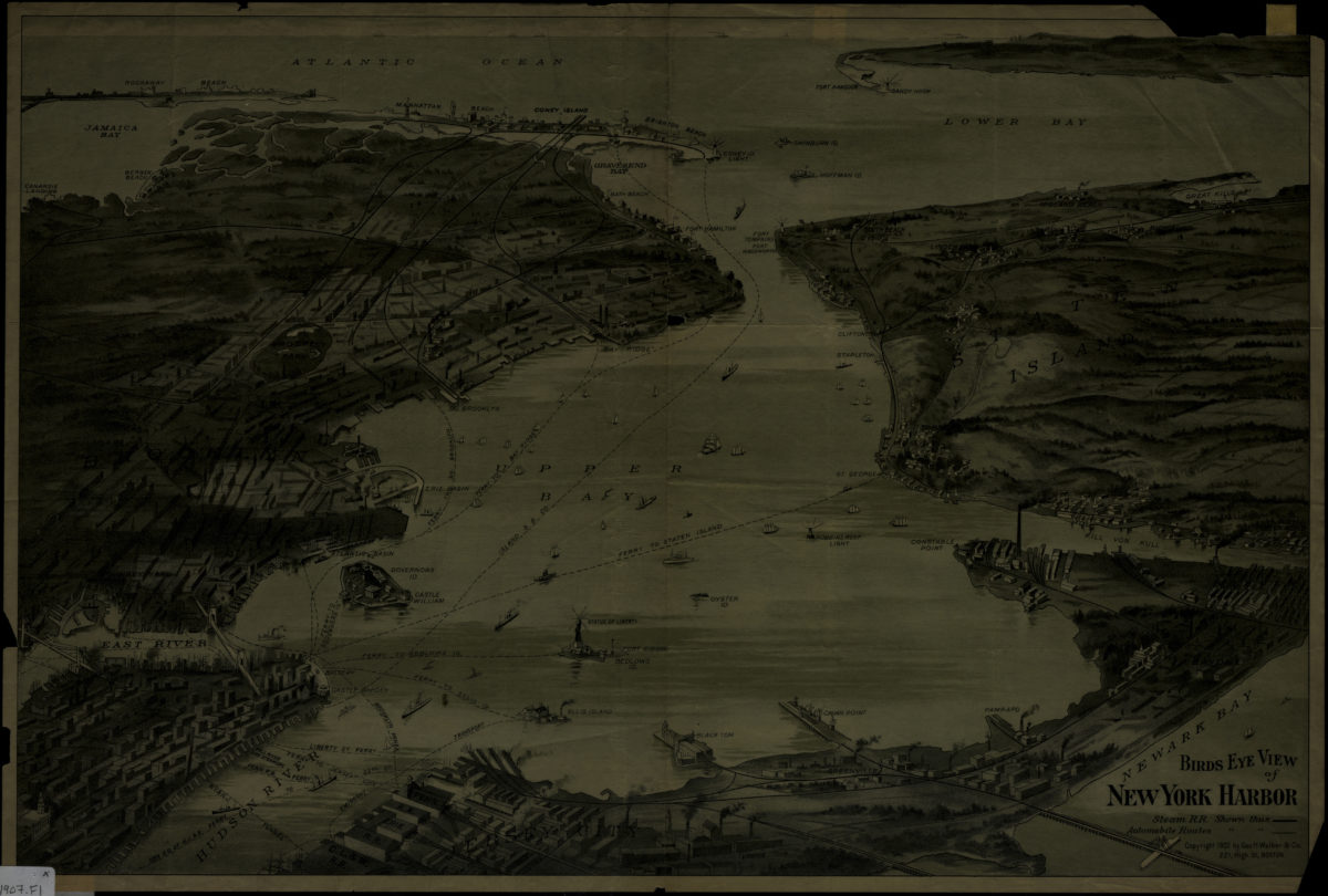
Birds eye view of New York Harbor
Birds eye view of New York Harbor
[1907]
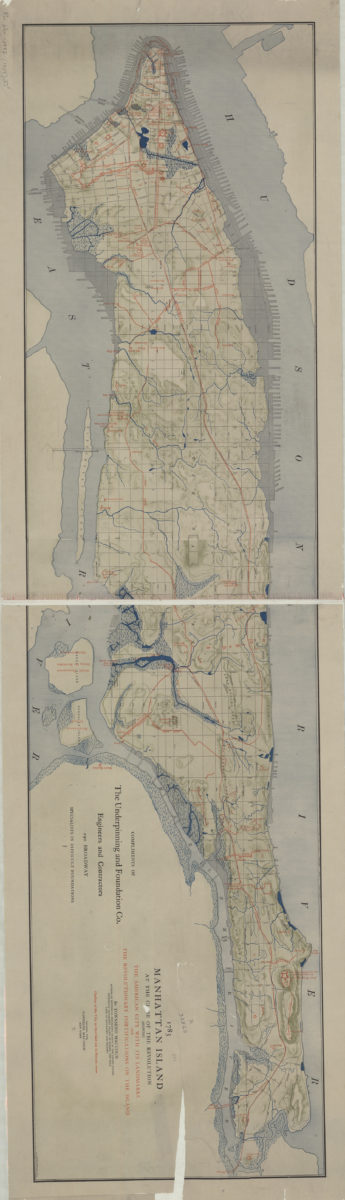
1783 Manhattan Island at the close of the Revolution: showing the American city with its landmarks and the Revolutionary fortifictions on the island: by Townsend Mac Coun
1783 Manhattan Island at the close of the Revolution: showing the American city with its landmarks and the Revolutionary fortifictions on the island: by Townsend Mac Coun
[ca. 1909]
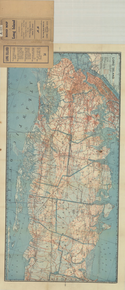
Road map of Long Island
Road map of Long Island
[1910; 1906]
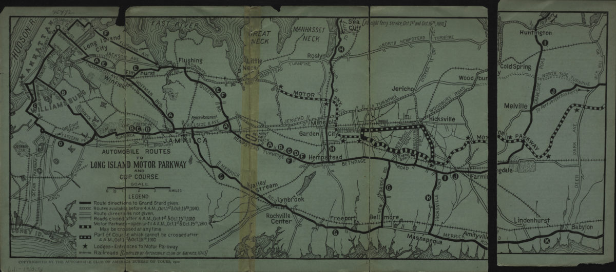
Automobile routes to Long Island Motor Parkway and Cup course
Automobile routes to Long Island Motor Parkway and Cup course
[1910; 1910]
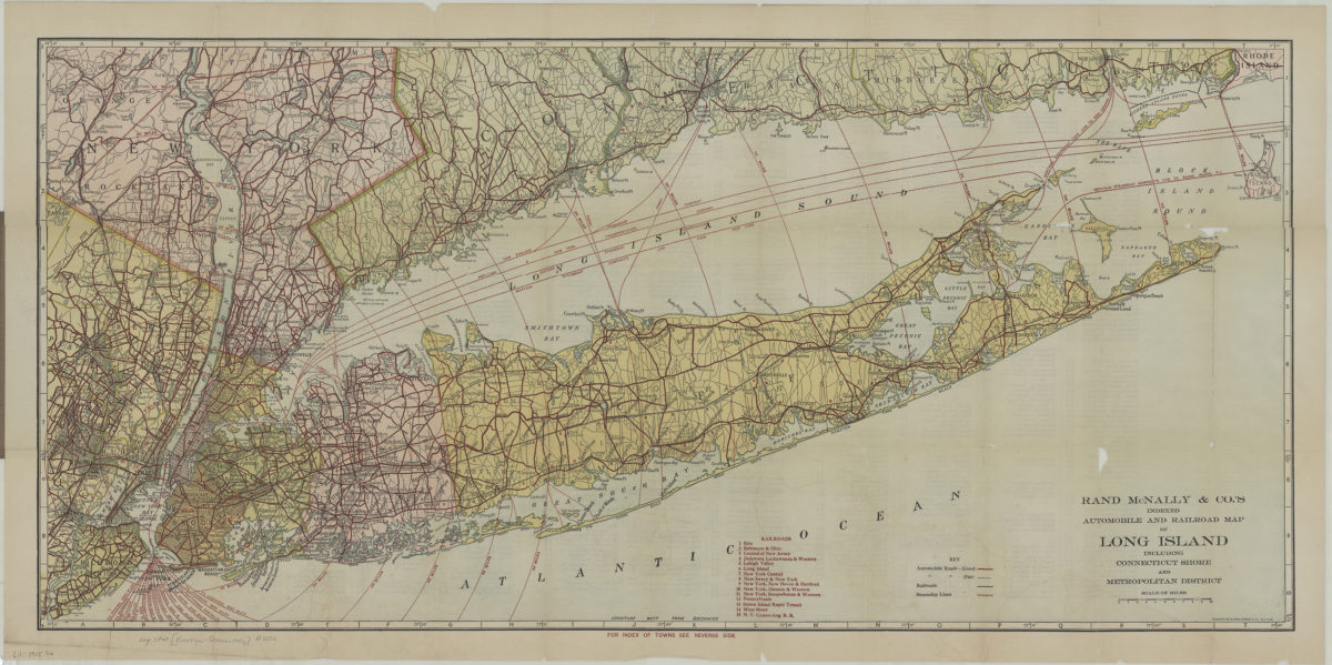
Rand McNally indexed automobile and railroad pocket map of Long Island including Connecticut shore and Metropolitan district
Rand McNally indexed automobile and railroad pocket map of Long Island including Connecticut shore and Metropolitan district
[1915; 1915]
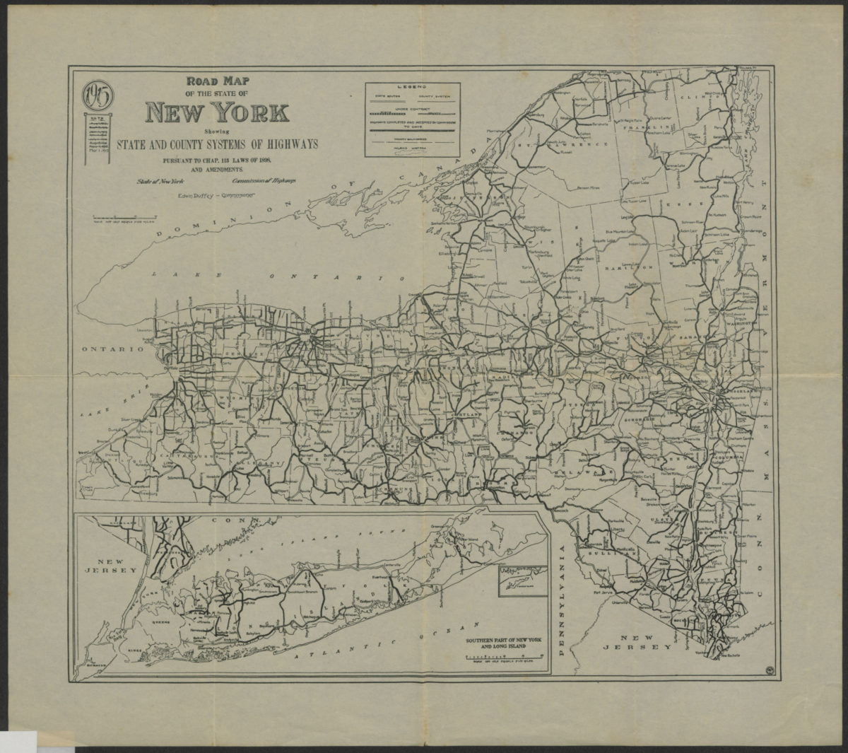
Road map of the state of New York: showing state and county systems of highways: pursuant to Chap. 115 Laws of 1898 and amendments, State of New York, Department of Highways
Road map of the state of New York: showing state and county systems of highways: pursuant to Chap. 115 Laws of 1898 and amendments, State of New York, Department of Highways
1915
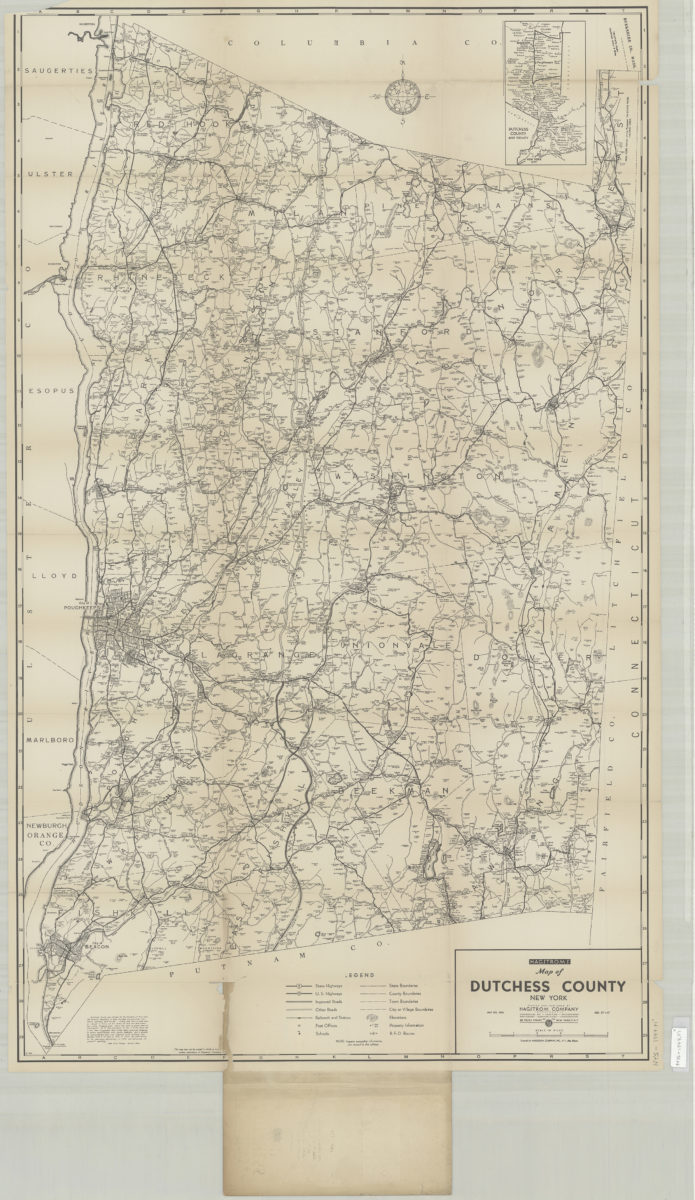
Hagstrom’s street and road map of Dutchess County, New York: contents Beacon, Millbrook, Millerton, Pawling, Poughkeepsie, Red Hook, Rhinebeck, Wappingers Falls, etc
Hagstrom’s street and road map of Dutchess County, New York: contents Beacon, Millbrook, Millerton, Pawling, Poughkeepsie, Red Hook, Rhinebeck, Wappingers Falls, etc
[1916-1924]
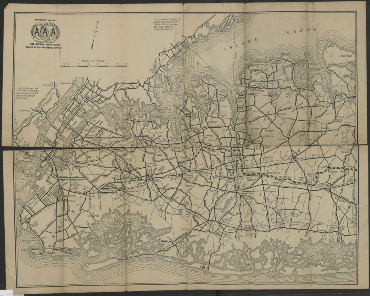
Suburban Long Island: detail of routes in a heavily-traveled and complicated section of the metropolitan district, showing bridges and ferries to and from Manhattan, the Bronx, lower Westchester County and suburban New Jersey
Suburban Long Island: detail of routes in a heavily-traveled and complicated section of the metropolitan district, showing bridges and ferries to and from Manhattan, the Bronx, lower Westchester County and suburban New Jersey
[ca. 1916]
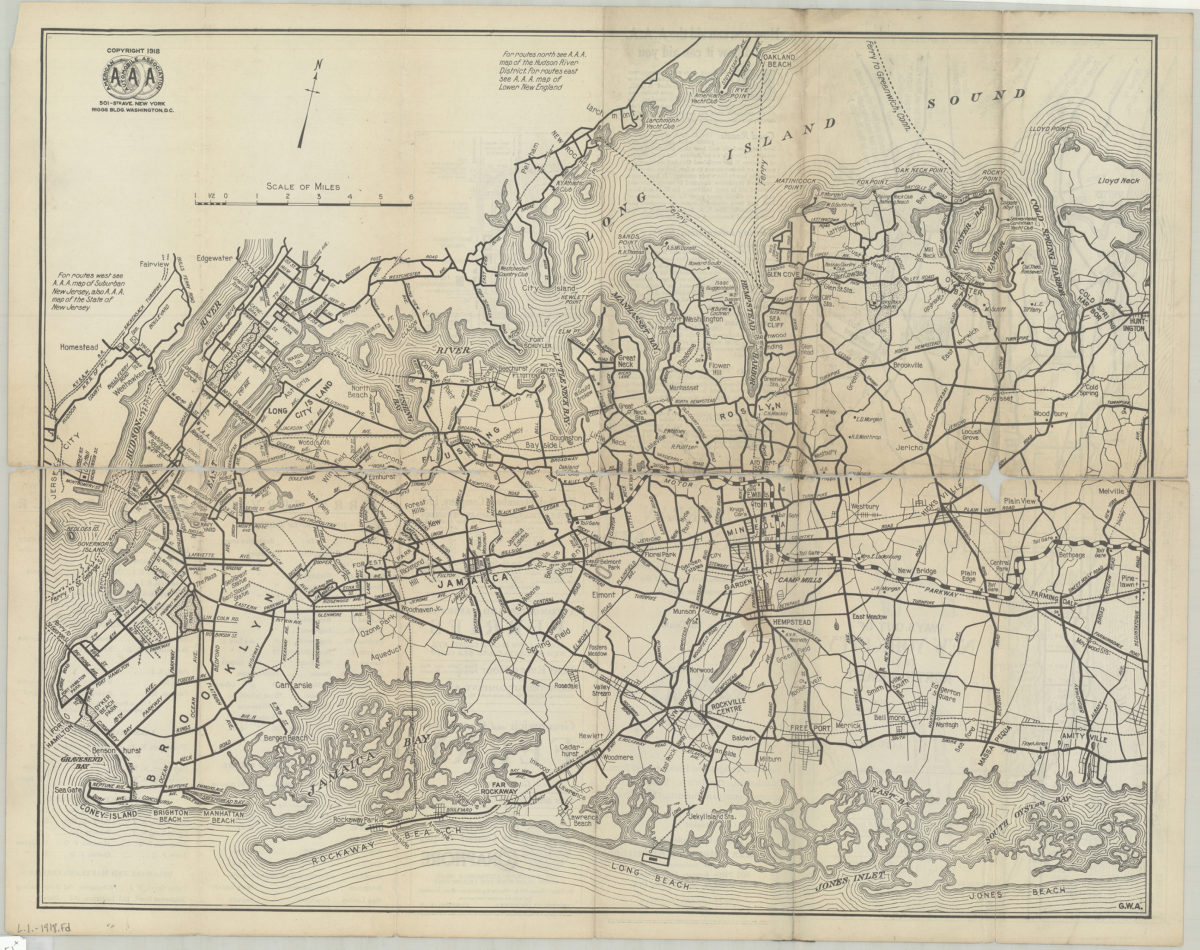
Suburban Long Island: detail of routes in a heavily-traveled and complicated section of the metropolitan district, showing bridges and ferries to and from Manhattan, the Bronx, Lower Westchester County and Suburban New Jersey
Suburban Long Island: detail of routes in a heavily-traveled and complicated section of the metropolitan district, showing bridges and ferries to and from Manhattan, the Bronx, Lower Westchester County and Suburban New Jersey
[ca. 1918]
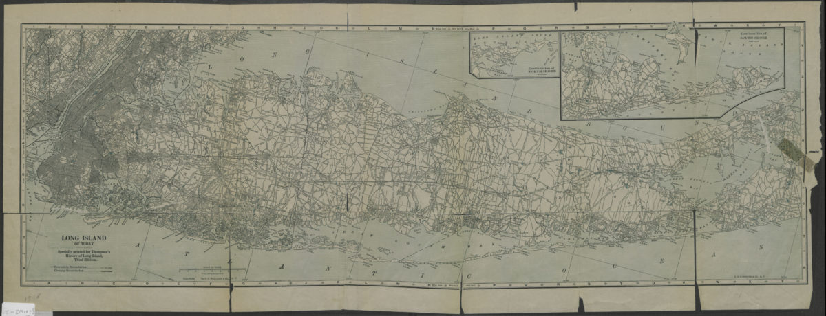
Long Island of today: C.S. Hammond & Co
Long Island of today: C.S. Hammond & Co
[1918]
Map showing Brooklyn automobile routes and car lines approved by the Borough President, July 1919
Map showing Brooklyn automobile routes and car lines approved by the Borough President, July 1919
[1919]
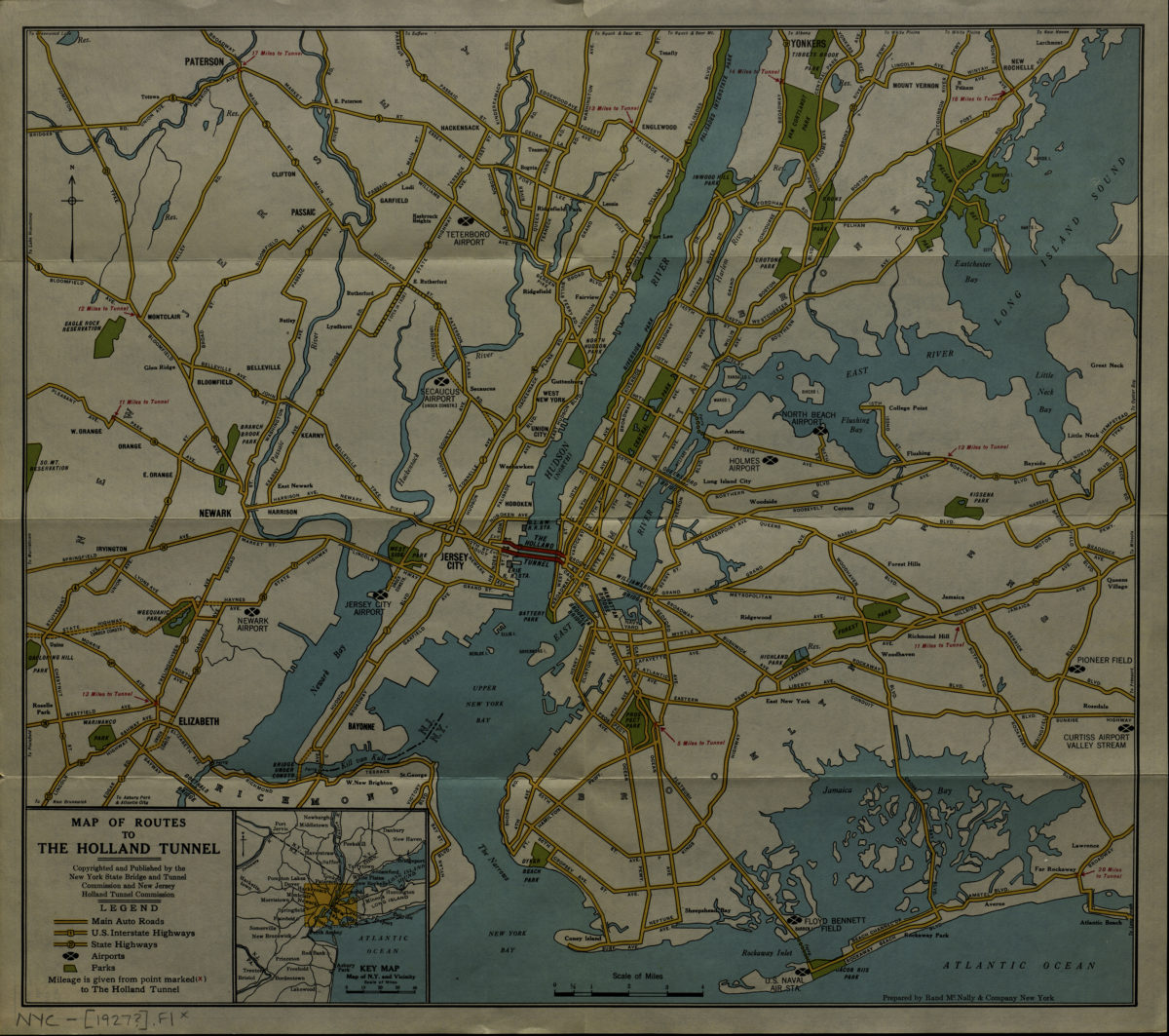
Map of routes to the Holland Tunnel: prepared by Rand McNally & Company, New York
Map of routes to the Holland Tunnel: prepared by Rand McNally & Company, New York
[192?]
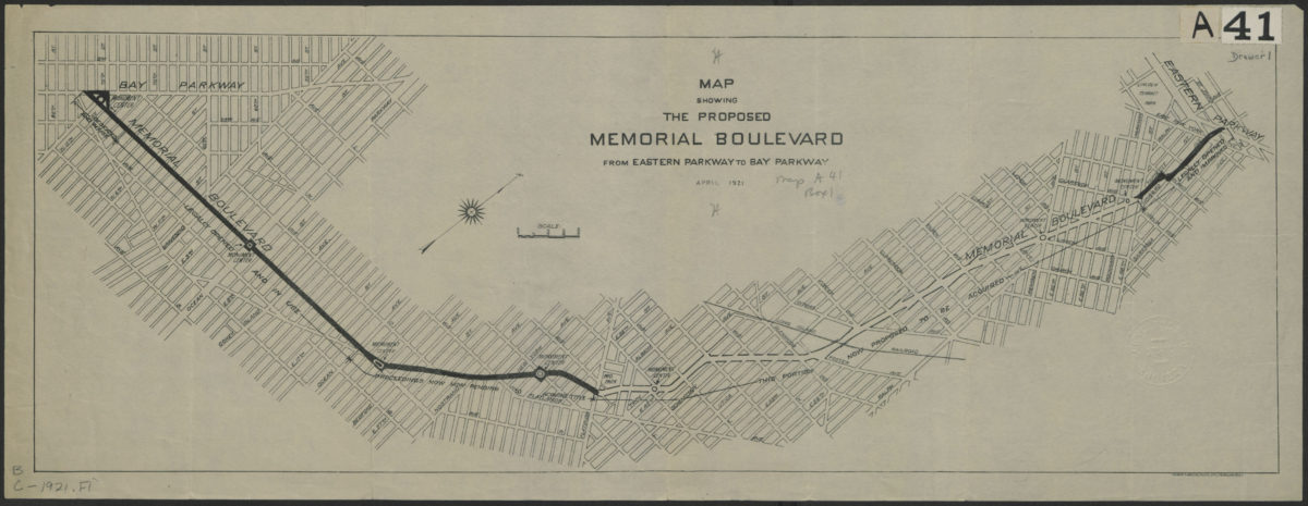
Map showing the proposed Memorial Boulevard from Eastern Parkway to Bay Parkway, April 1921
Map showing the proposed Memorial Boulevard from Eastern Parkway to Bay Parkway, April 1921
[1921]
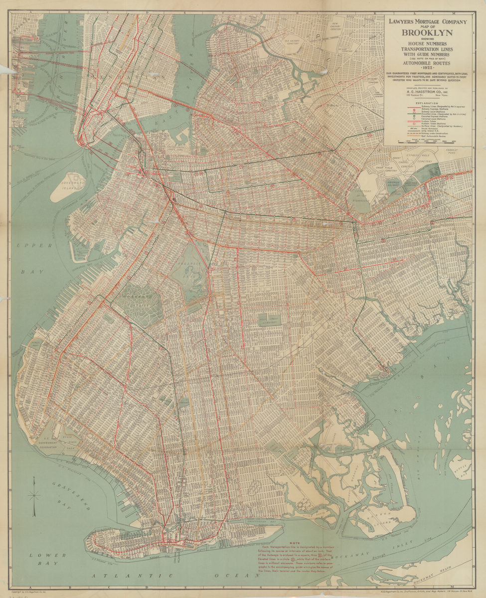
Lawyer’s Mortgage Company map of Brooklyn: showing house-numbers, transportation lines, with guide numbers … automobile routes, 1922: compiled, printed and published A.G. Hagstrom Co., Inc
Lawyer’s Mortgage Company map of Brooklyn: showing house-numbers, transportation lines, with guide numbers … automobile routes, 1922: compiled, printed and published A.G. Hagstrom Co., Inc
1922
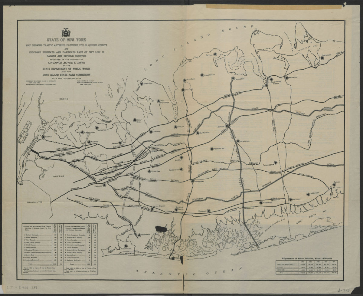
State of New York map showing traffic arteries provided for in Queens County and proposed highways and parkways east of city line in Nassau and Suffolk Counties: prepared at the request of Governor Alfred E. Smith
State of New York map showing traffic arteries provided for in Queens County and proposed highways and parkways east of city line in Nassau and Suffolk Counties: prepared at the request of Governor Alfred E. Smith
[1925]
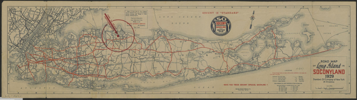
Road map of Long Island in Soconyland, 1929: copyright General Drafting Co., Inc
Road map of Long Island in Soconyland, 1929: copyright General Drafting Co., Inc
[1929]
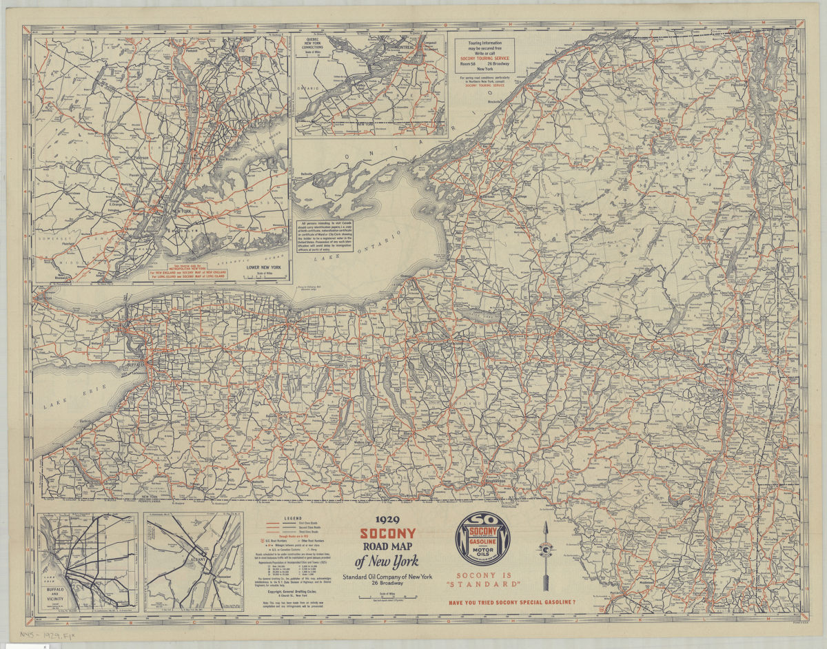
1929 Socony Road map of New York: copyright General Drafting Co., Inc
1929 Socony Road map of New York: copyright General Drafting Co., Inc
[1929]
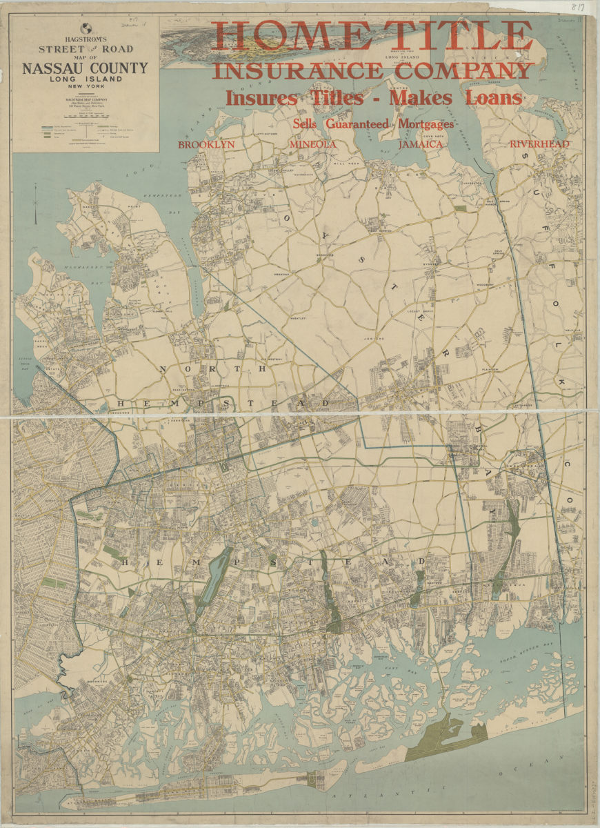
Hagstrom’s street and road map of Nassau County, Long Island, New York: compiled, printed and published by Hagstrom Map Company
Hagstrom’s street and road map of Nassau County, Long Island, New York: compiled, printed and published by Hagstrom Map Company
[1930]
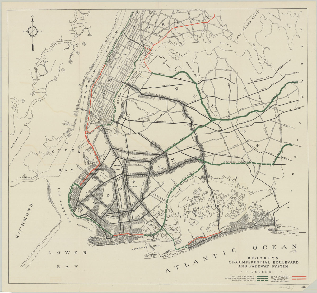
Brooklyn circumferential boulevard and parkway system
Brooklyn circumferential boulevard and parkway system
[193?]
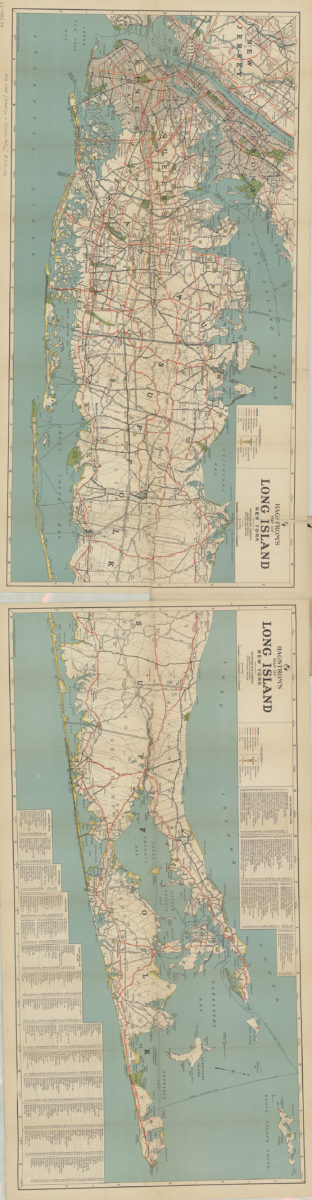
Hagstrom’s map of Long Island, New York
Hagstrom’s map of Long Island, New York
1932
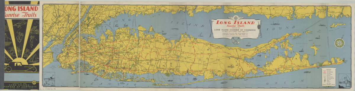
Long Island sunrise trails: issued by the Long Island Chamber of commerce, compiled … by Hagstrom Map Company
Long Island sunrise trails: issued by the Long Island Chamber of commerce, compiled … by Hagstrom Map Company
[1932]
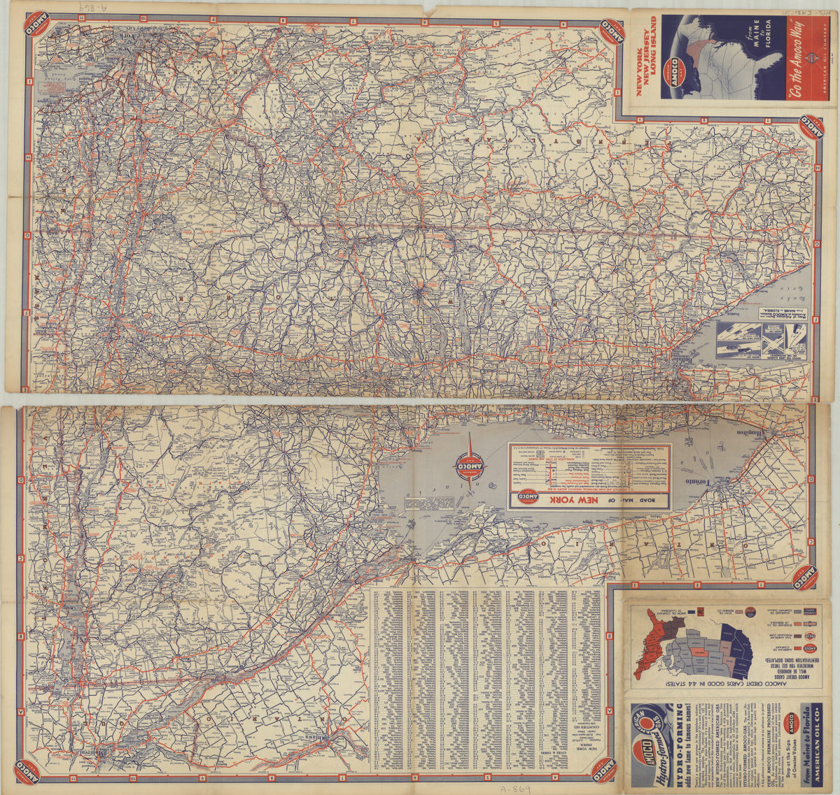
New York, New Jersey, Long Island: [compliments of] Amoco
New York, New Jersey, Long Island: [compliments of] Amoco
[1936]
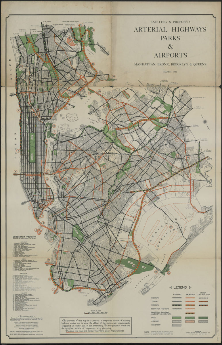
Existing & proposed arterial highways, parks & airports, Manhattan, Bronx, Brooklyn & Queens: prepared by Consolidated Edison Co. of N.Y., inc
Existing & proposed arterial highways, parks & airports, Manhattan, Bronx, Brooklyn & Queens: prepared by Consolidated Edison Co. of N.Y., inc
1937
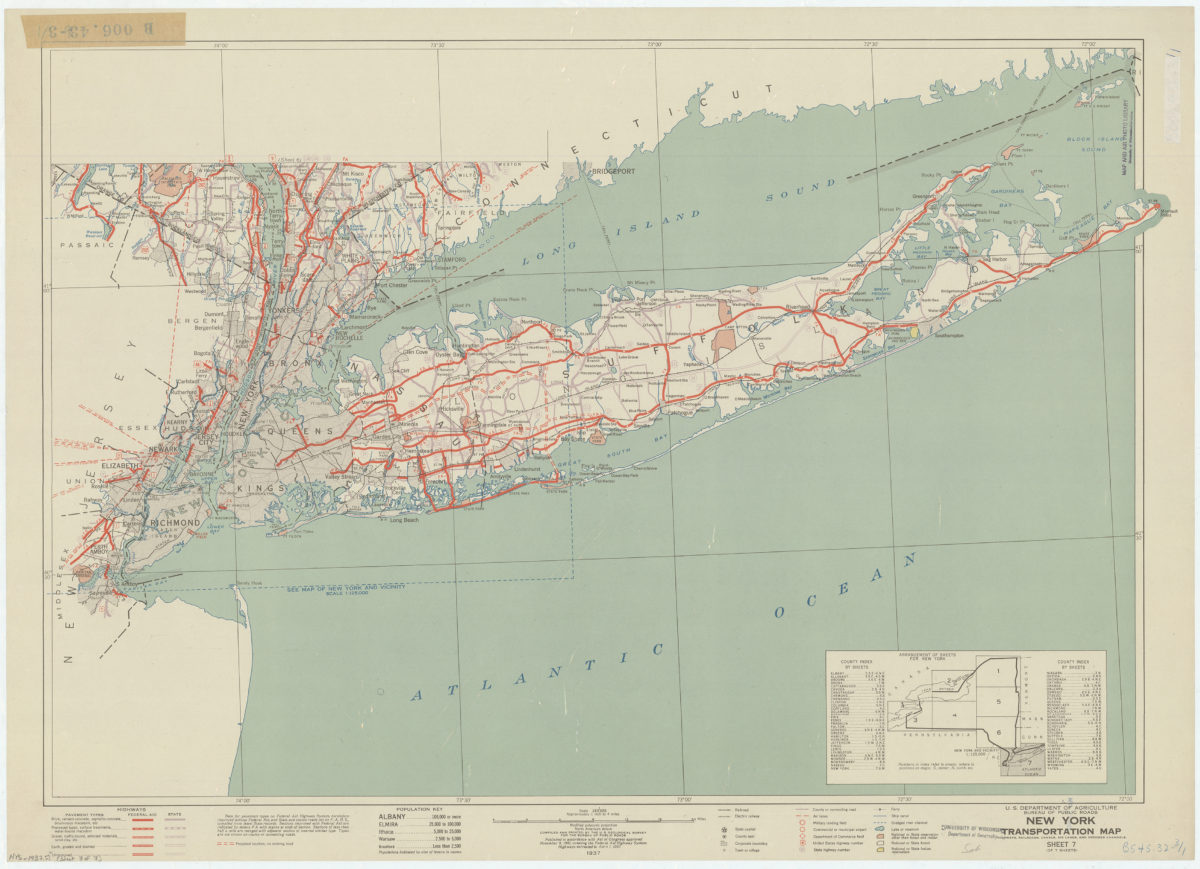
New York transportation map: highways, railroads, canals, air lanes, and dredged channels: compiled and printed by the U.S. Geological Survey for the Bureau of Public Roads
New York transportation map: highways, railroads, canals, air lanes, and dredged channels: compiled and printed by the U.S. Geological Survey for the Bureau of Public Roads
1937
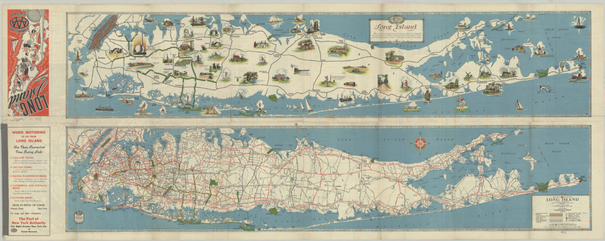
Long Island: AAA ; Automobile Club of New York
Long Island: AAA ; Automobile Club of New York
[1939]
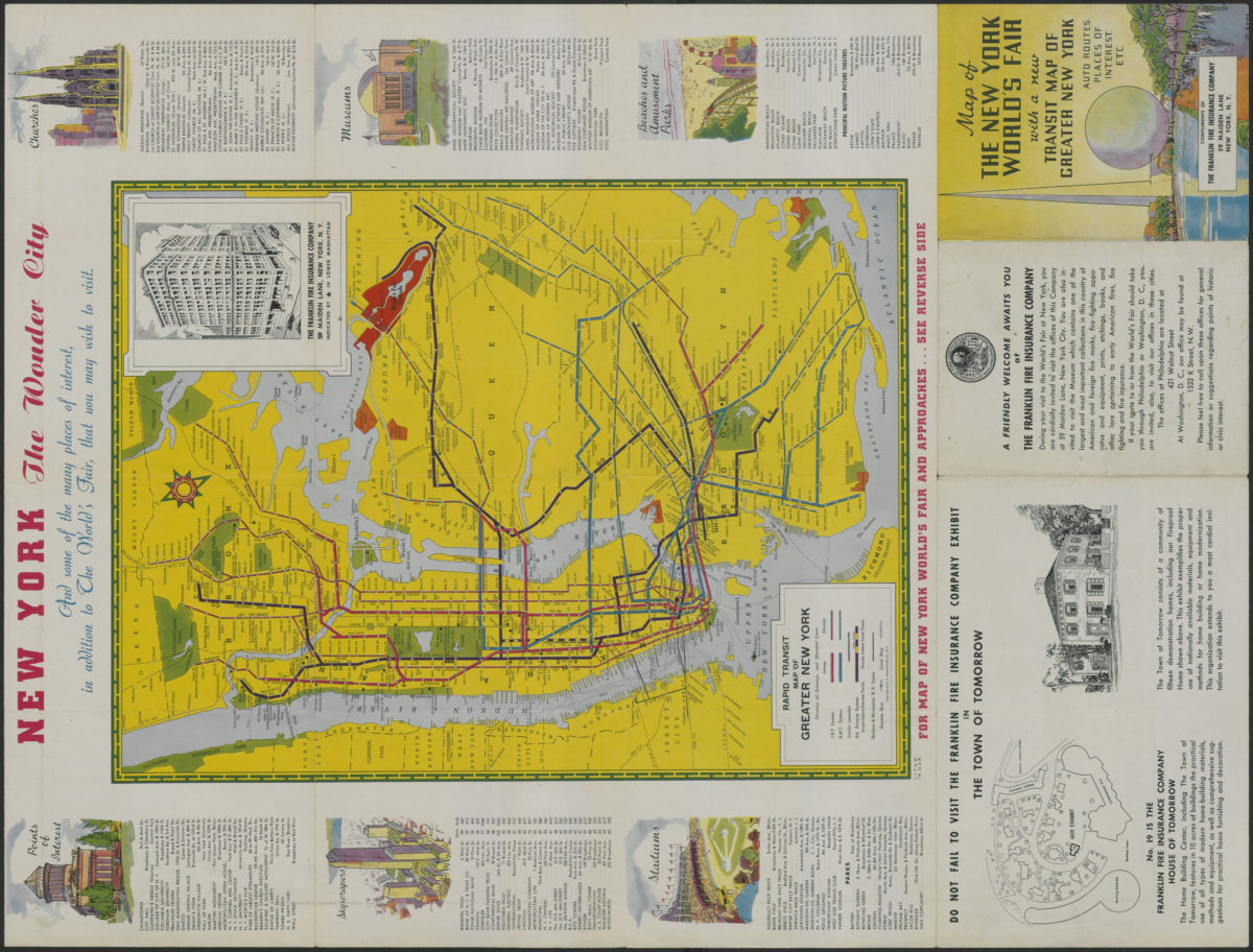
Map of the New York World’s Fair with a new transit map of Greater New York: auto routes, places of interest
Map of the New York World’s Fair with a new transit map of Greater New York: auto routes, places of interest
[1939]
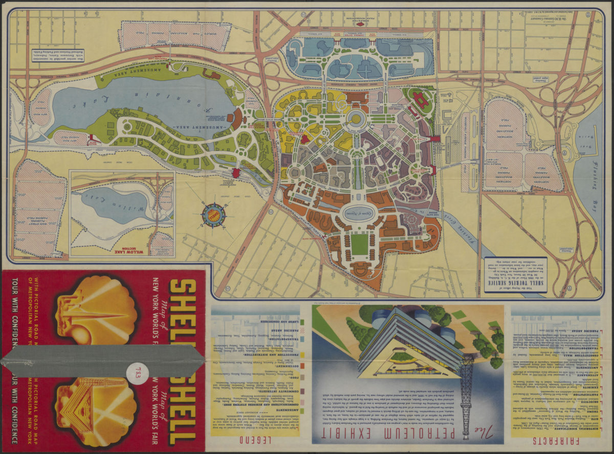
Shell street guide and metropolitan map of Brooklyn, Queens and Long Island: the H.M. Gousha Company
Shell street guide and metropolitan map of Brooklyn, Queens and Long Island: the H.M. Gousha Company
[1939]
The locale of the New York World’s Fair: H.M. Gousha Company
The locale of the New York World’s Fair: H.M. Gousha Company
1939
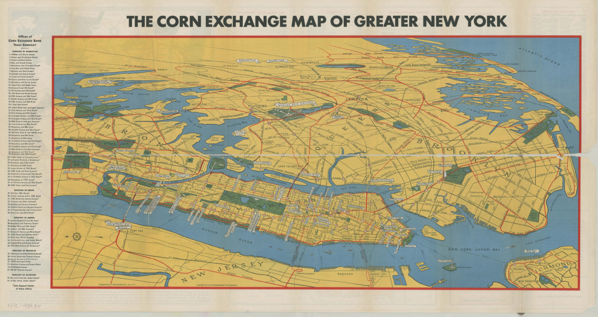
Map of greater New York: New York World’s Fair, 1939: prepared by C.S. Hammond & Co., inc ; copyright by Corn Exchange Bank Trust Company
Map of greater New York: New York World’s Fair, 1939: prepared by C.S. Hammond & Co., inc ; copyright by Corn Exchange Bank Trust Company
[1939]
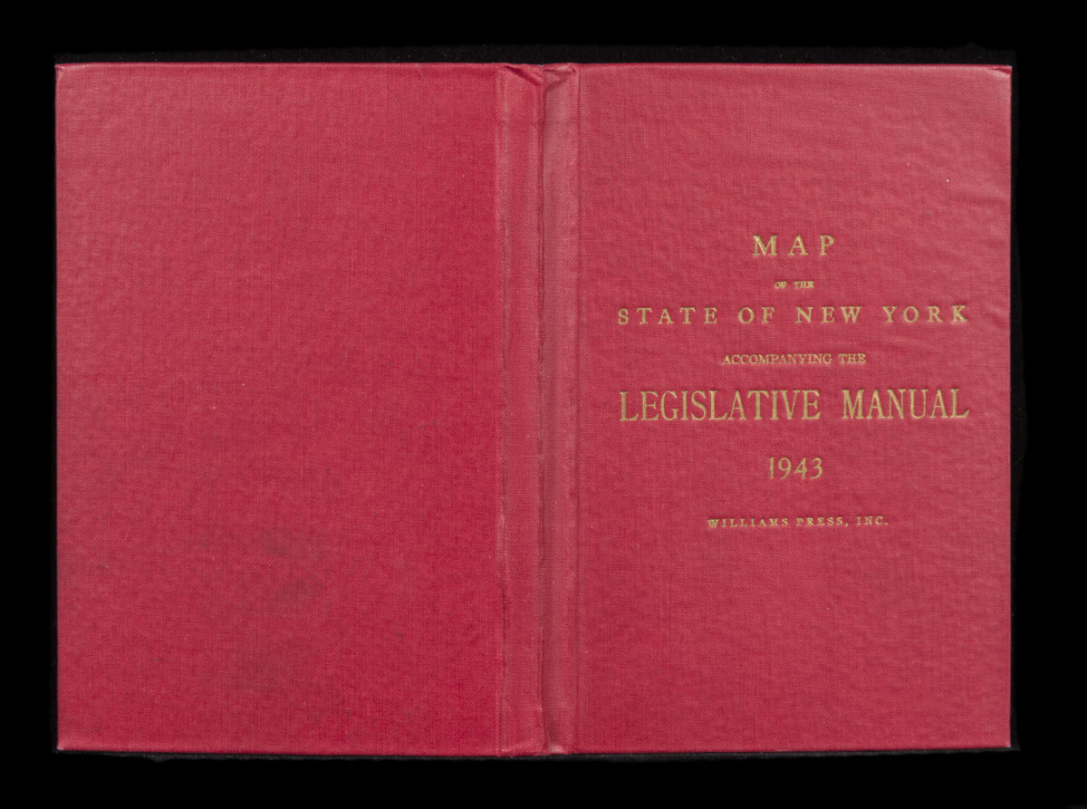
Canal and railroad map of the State of New York: to accompany the Legislative Manual
Canal and railroad map of the State of New York: to accompany the Legislative Manual
1943
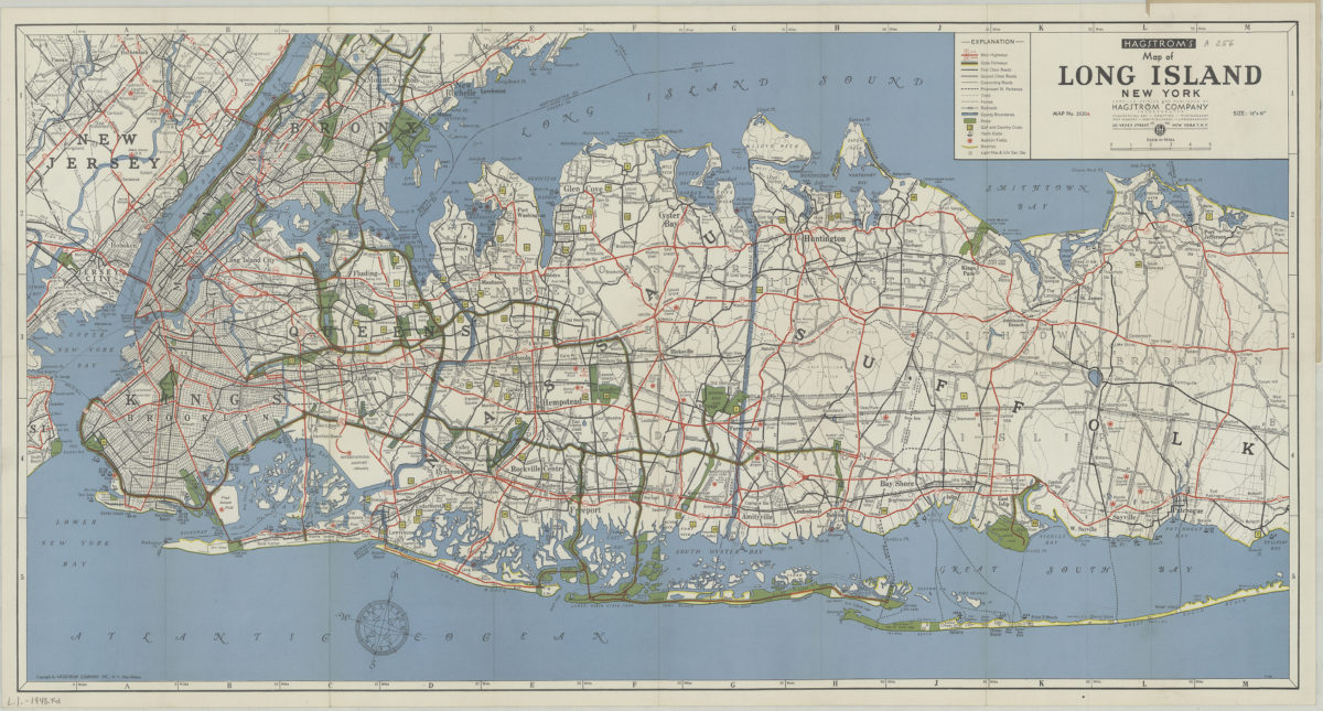
Hagstrom’s map of Long Island, New York
Hagstrom’s map of Long Island, New York
[1948]
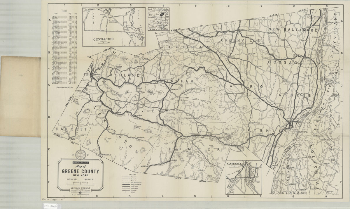
Hagstrom’s map of Greene County, New York: Hagstrom Company
Hagstrom’s map of Greene County, New York: Hagstrom Company
[1950]
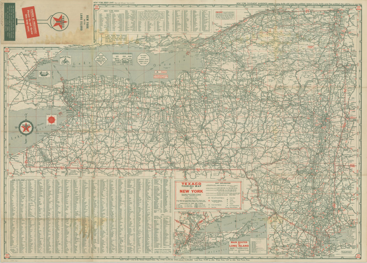
Texaco touring map of Long Island and Metropolitan New York
Texaco touring map of Long Island and Metropolitan New York
[1950]
The complete map of Brooklyn (New York City): featuring house numbers, transit lines, playgrounds, wading pools, etc.: produced under the direction of Alexander Gross
The complete map of Brooklyn (New York City): featuring house numbers, transit lines, playgrounds, wading pools, etc.: produced under the direction of Alexander Gross
[195?]
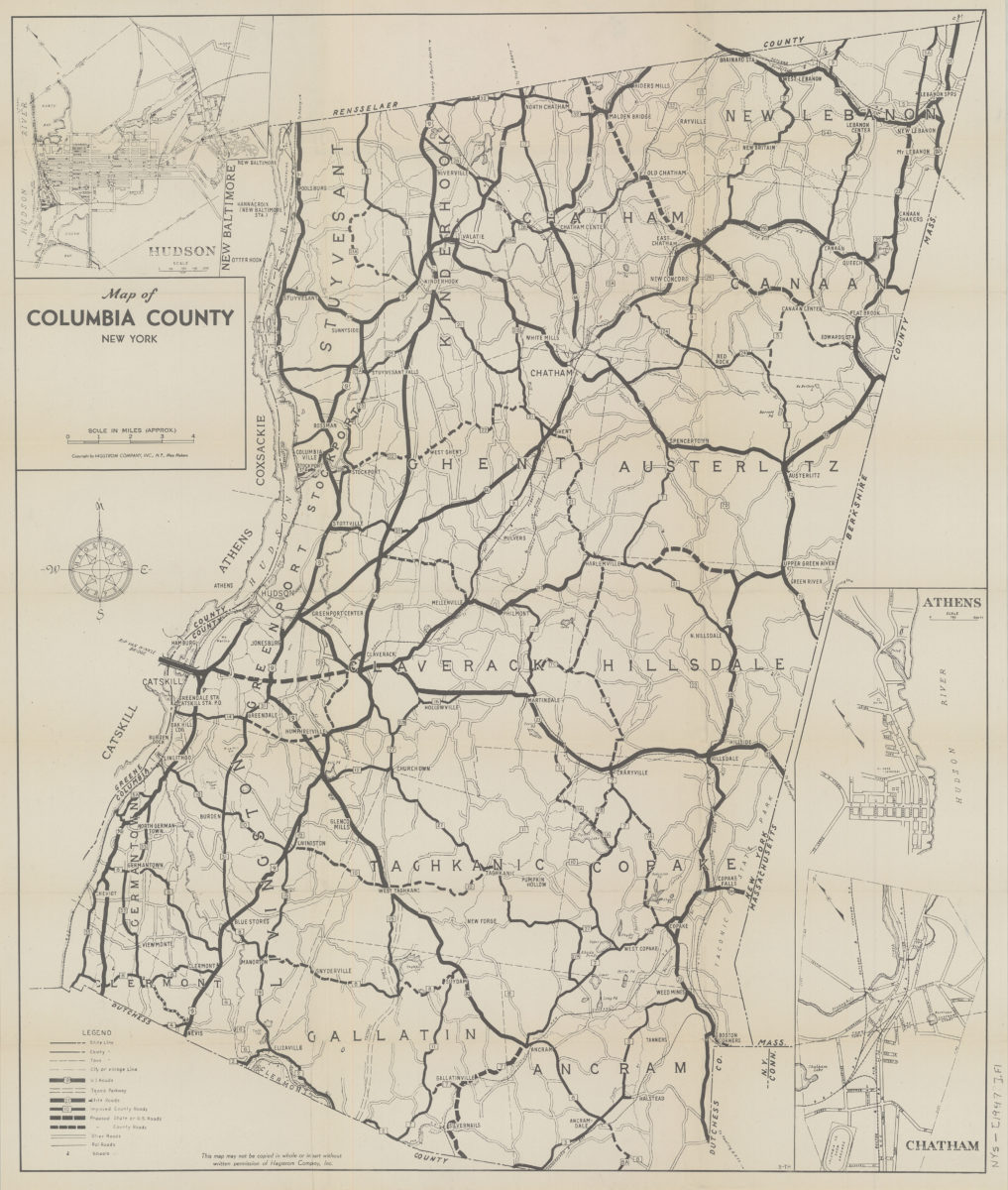
Map of Columbia County, New York
Map of Columbia County, New York
1951
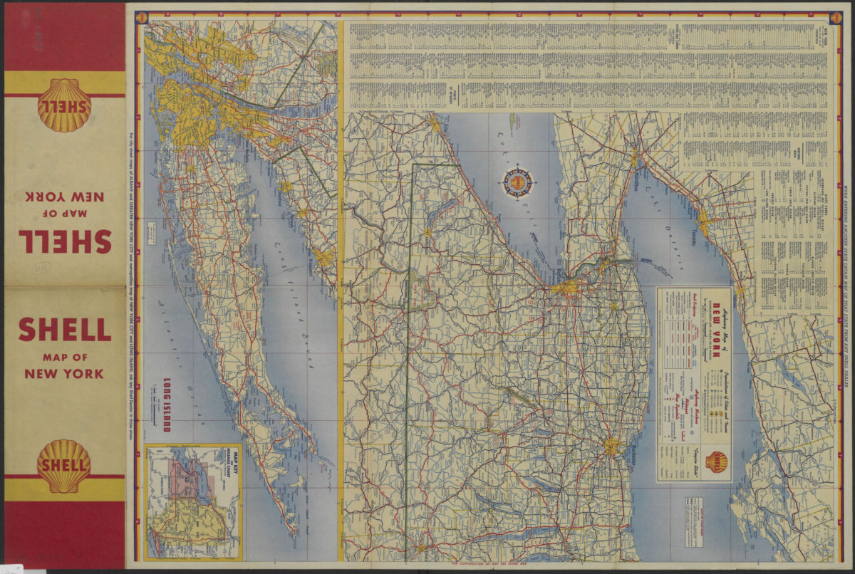
Highway map of New York
Highway map of New York
[1953]
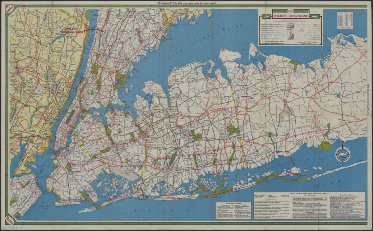
Long Island, Metropolitan New York, Westchester County
Long Island, Metropolitan New York, Westchester County
[1957]
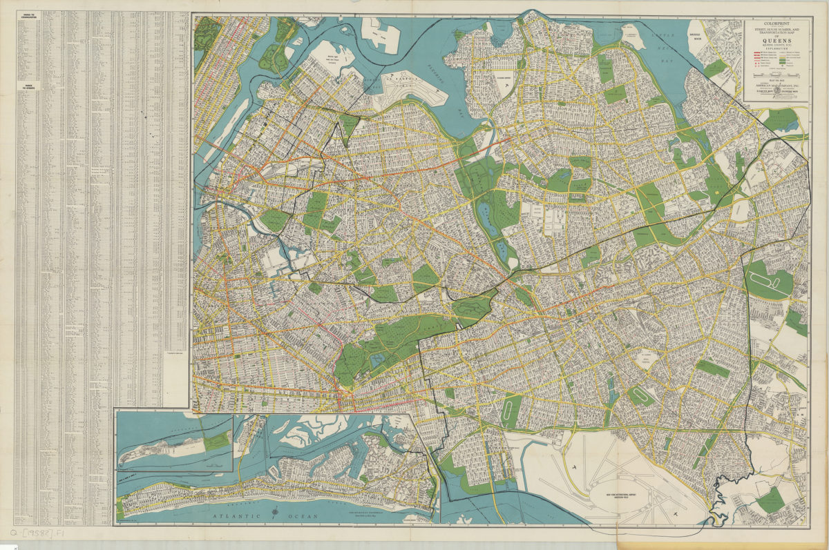
Colorprint street, house number and transportation map of Queens: (Queens County, N.Y.): American Map Company
Colorprint street, house number and transportation map of Queens: (Queens County, N.Y.): American Map Company
[1958]
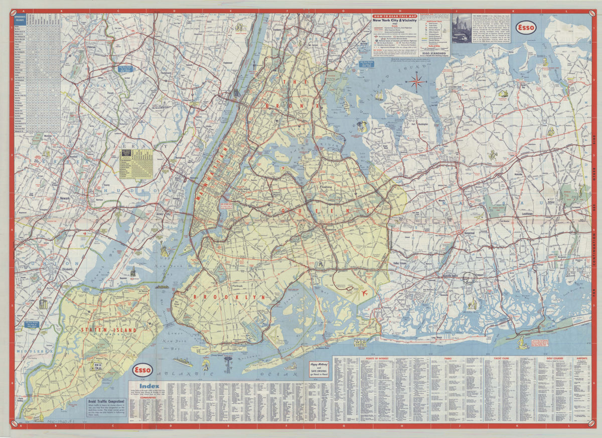
New York City & vicinity,1960: General Drafting Company ; [prepared for] Esso Standard
New York City & vicinity,1960: General Drafting Company ; [prepared for] Esso Standard
1960
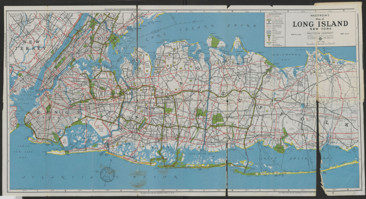
Hagstrom’s map of Long Island, New York
Hagstrom’s map of Long Island, New York
[1962]
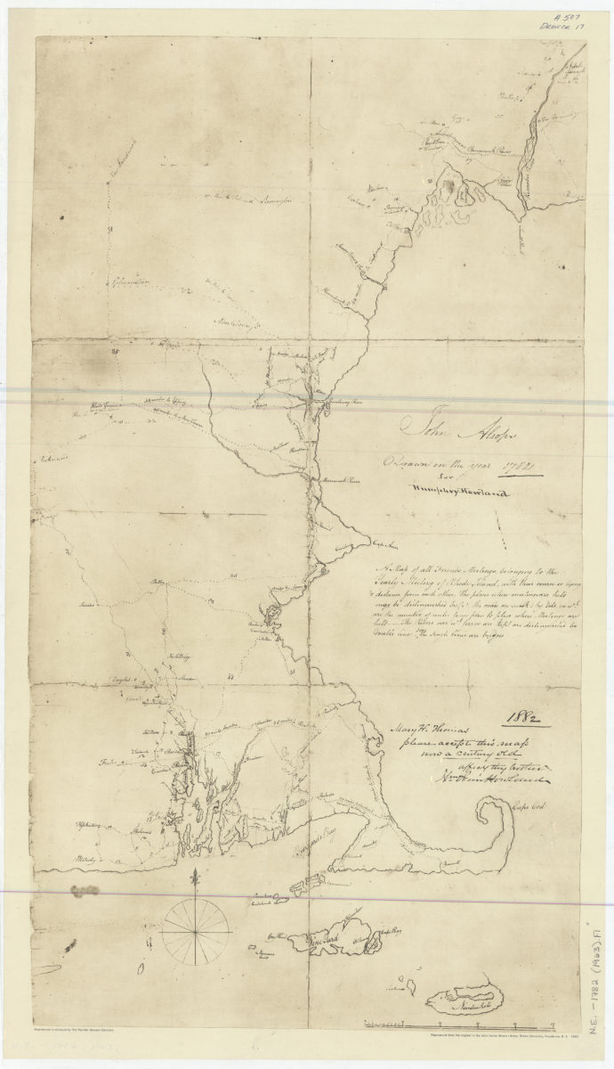
A map of all Friends Meetings belonging to the Yearly Meeting of Rhode Island: with their course or lying & distance from each other …: John Alsops ; drawn in the year 1782 for Humphrey Howland
A map of all Friends Meetings belonging to the Yearly Meeting of Rhode Island: with their course or lying & distance from each other …: John Alsops ; drawn in the year 1782 for Humphrey Howland
1963
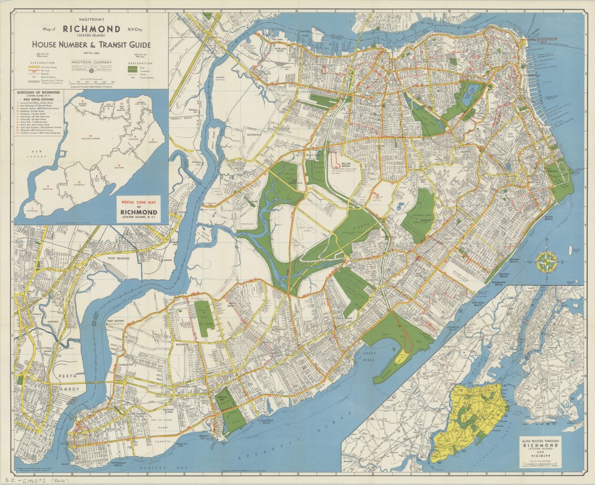
Hagstrom’s map of Richmond (Staten Island), N. Y. City: house number & transit guide: compiled, printed, and published by Hagstrom Company
Hagstrom’s map of Richmond (Staten Island), N. Y. City: house number & transit guide: compiled, printed, and published by Hagstrom Company
[1963]
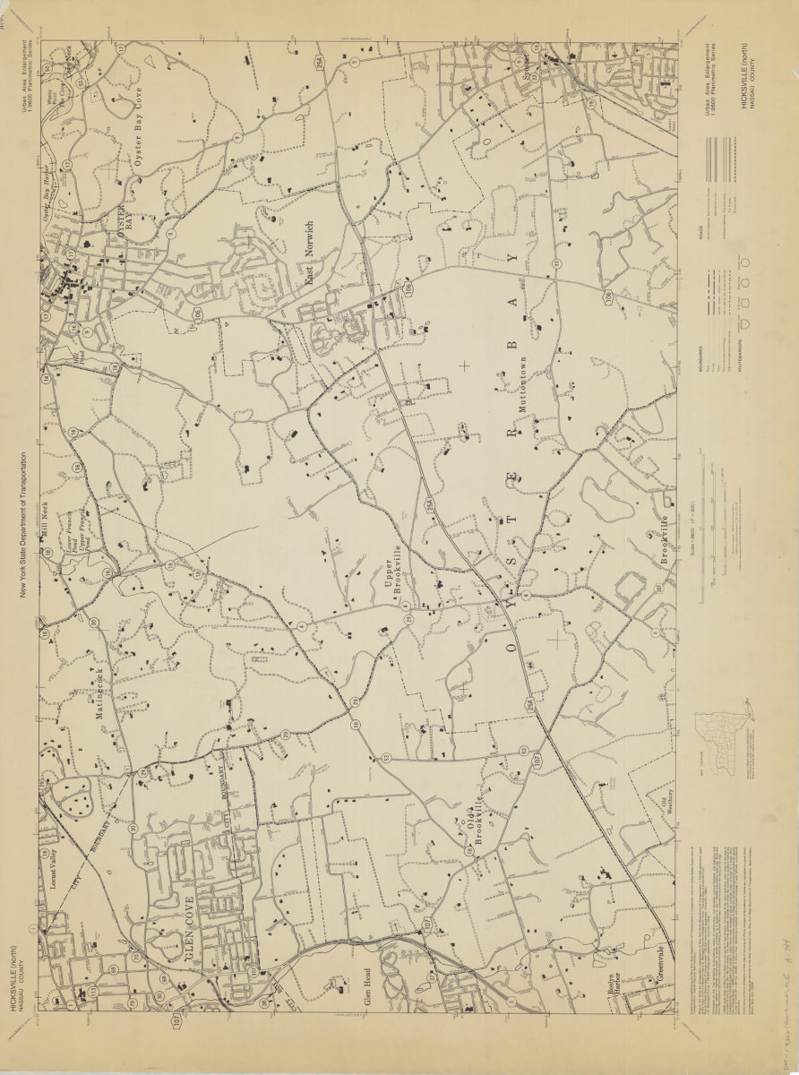
Hicksville (north)-Nassau County: New York State Department of Transportation
Hicksville (north)-Nassau County: New York State Department of Transportation
[1966]
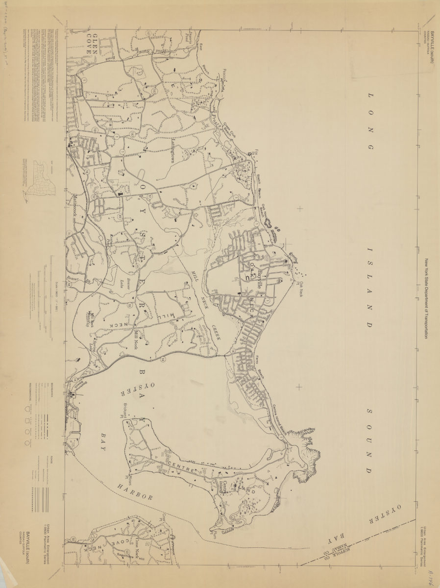
Bayville (south)-Nassau-Suffolk Counties: New York State Department of Transportation
Bayville (south)-Nassau-Suffolk Counties: New York State Department of Transportation
[1966]
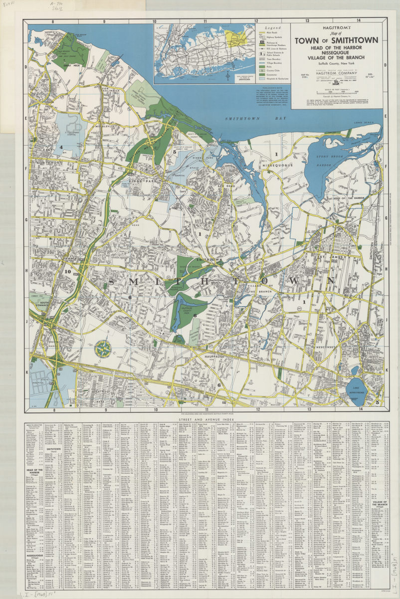
Hagstrom’s map of town of Smithtown, Head of the Harbor, Nissequgue [sic], Village of the Branch, Suffolk County, New York: compiled, printed, and published by Hagstrom Company Incorporated
Hagstrom’s map of town of Smithtown, Head of the Harbor, Nissequgue [sic], Village of the Branch, Suffolk County, New York: compiled, printed, and published by Hagstrom Company Incorporated
[1968]
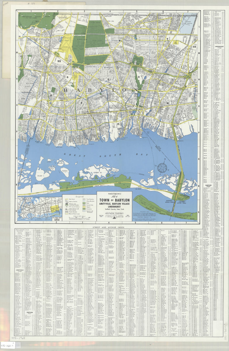
Hagstrom’s street and road map of Town of Babylon: Amityville, Babylon Village, Lindenhurst, Suffolk County, Long Island, N.Y.
Hagstrom’s street and road map of Town of Babylon: Amityville, Babylon Village, Lindenhurst, Suffolk County, Long Island, N.Y.
1968
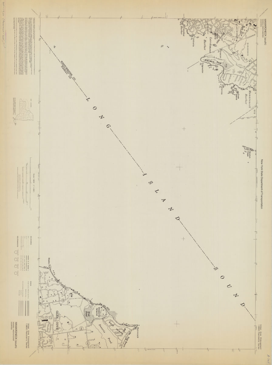
Mamaroneck (south)-Nassau/Westchester Counties: New York State Department of Transportation
Mamaroneck (south)-Nassau/Westchester Counties: New York State Department of Transportation
[1968]
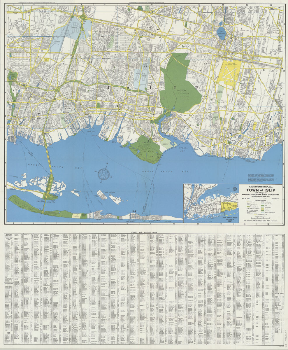
Hagstrom’s map of the Town of Islip: with the villages of Brightwaters, Ocean Beach and Saltaire, Suffolk County, New York
Hagstrom’s map of the Town of Islip: with the villages of Brightwaters, Ocean Beach and Saltaire, Suffolk County, New York
1968
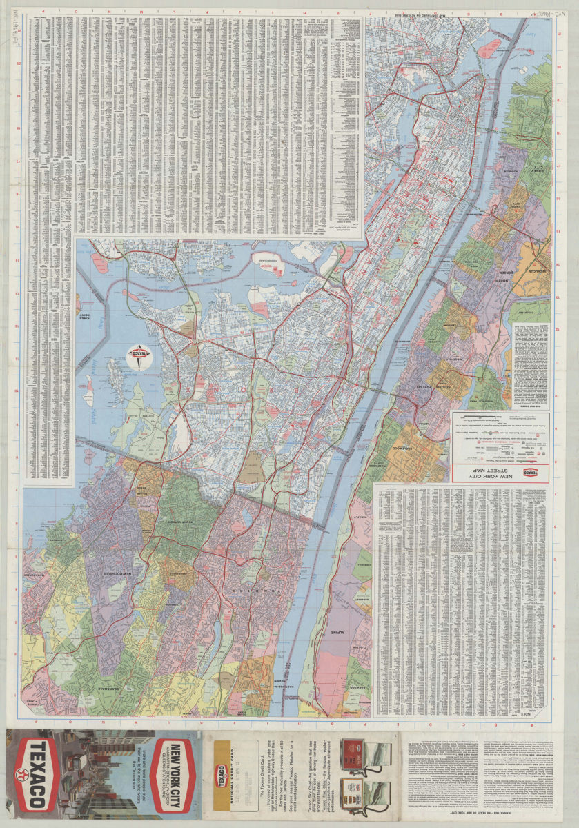
Texaco New York City street map
Texaco New York City street map
[1969; 1969]
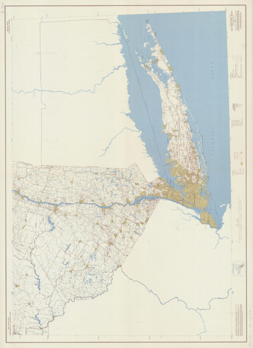
Transportation/planning map, New York State–South: prepared and published by the New York State Department of Transportation in cooperation with the Federal Highway Administration, U.S. Department of Transportation
Transportation/planning map, New York State–South: prepared and published by the New York State Department of Transportation in cooperation with the Federal Highway Administration, U.S. Department of Transportation
[1970; 1970]
Previous
1
2
3
Next