[Maps of land of John Cowenhoven, formerly of Garret Cowenhoven, and of William G. Kouwenhoven]
1890-[1892]
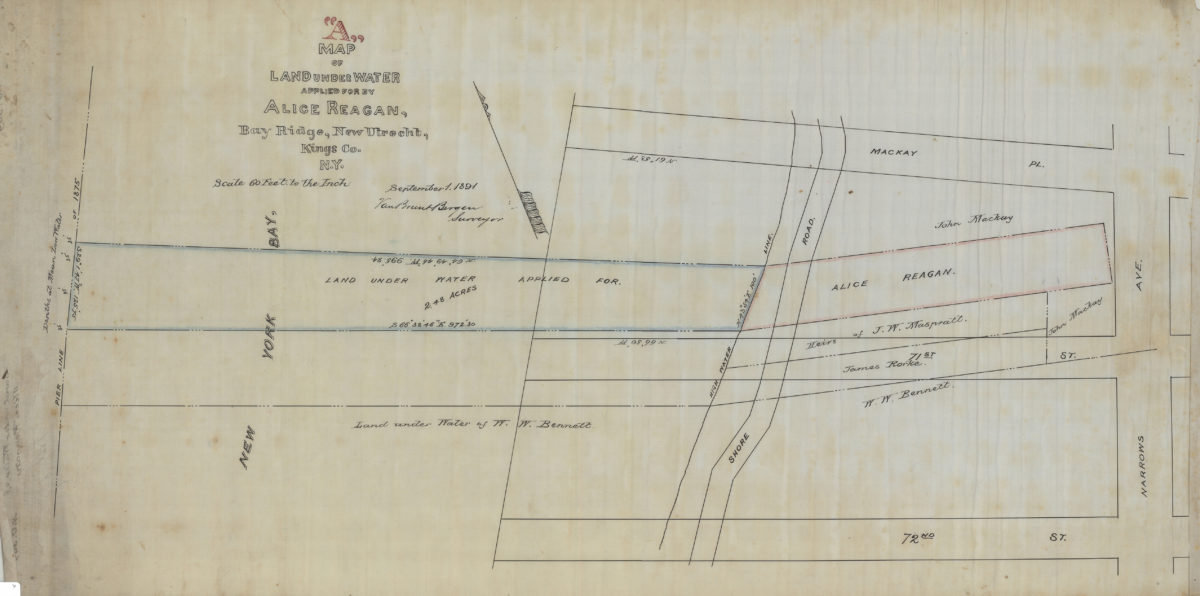
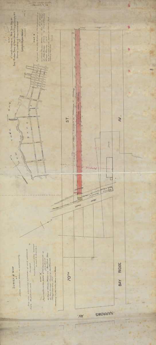
Map “A” of land under water applied for by Alice Reagan, Bay Ridge, New Utrecht, Kings Co., N.Y.: Van Brunt Bergen, surveyor
September 1, 1891
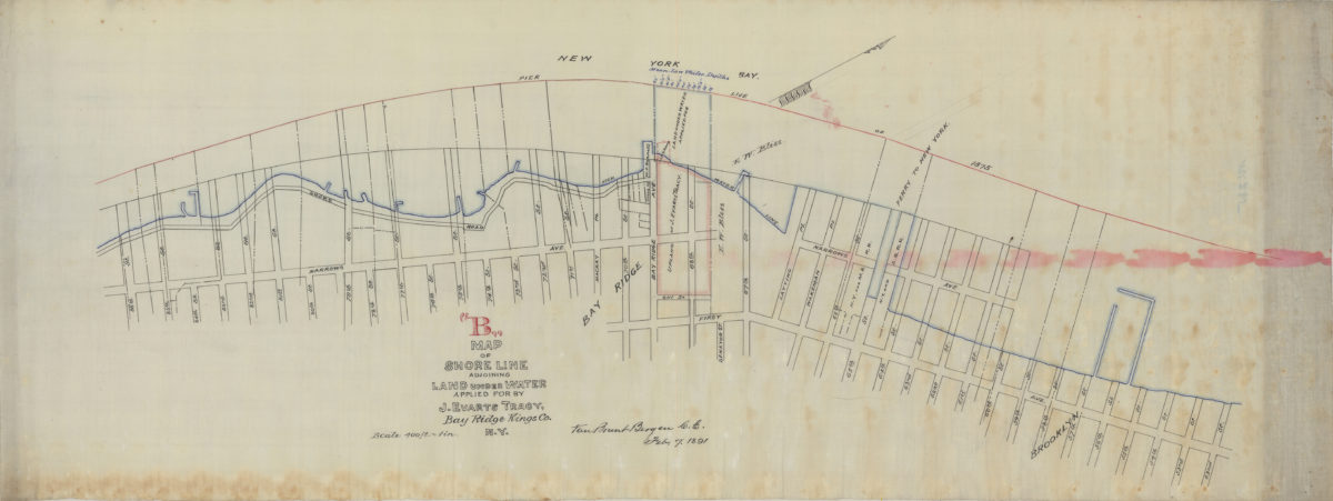
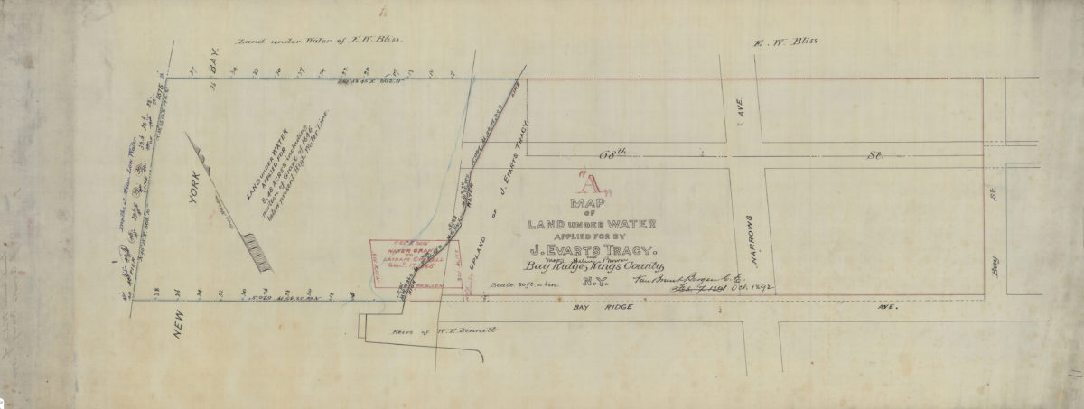
Map “B” of shore line adjoining land under water applied for by J. Evarts Tracy, Bay Ridge, Kings Co., N.Y.: Van Brunt Bergen, C.E.
February 7, 1891
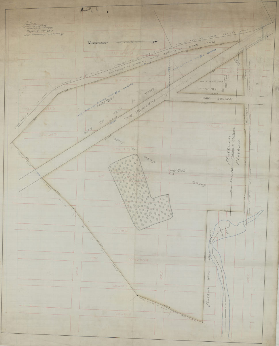
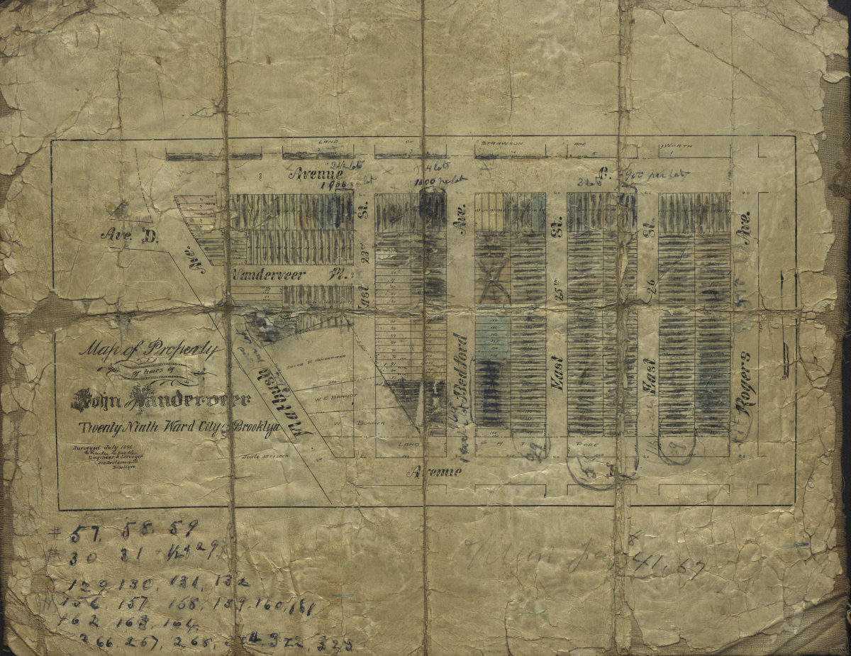
[Map of area bounded by E. 25th St., Ave. G, E. 35th St., and Ave. E.]: Charles Crooke, engineer & surveyor
January 1891
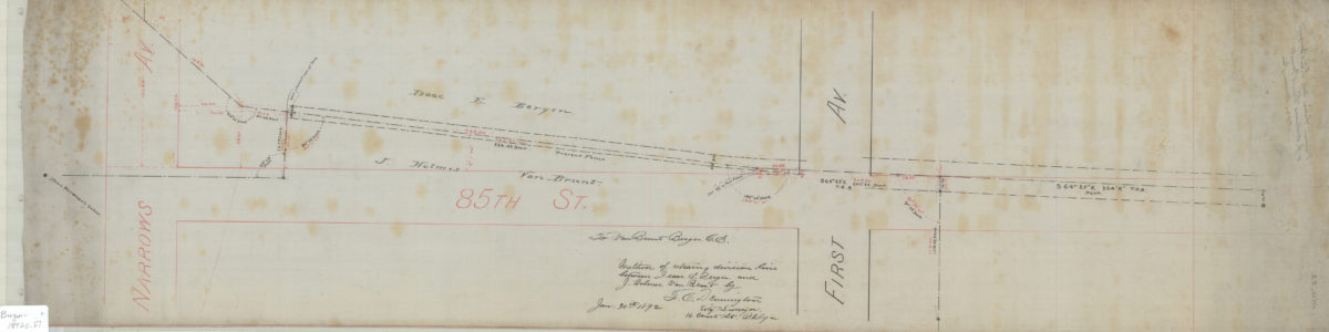
Method of retracing division line between Isaac E. Bergen and J. Holmes Van Brunt: by F.C. Dennington, city surveyor
January 30, 1892
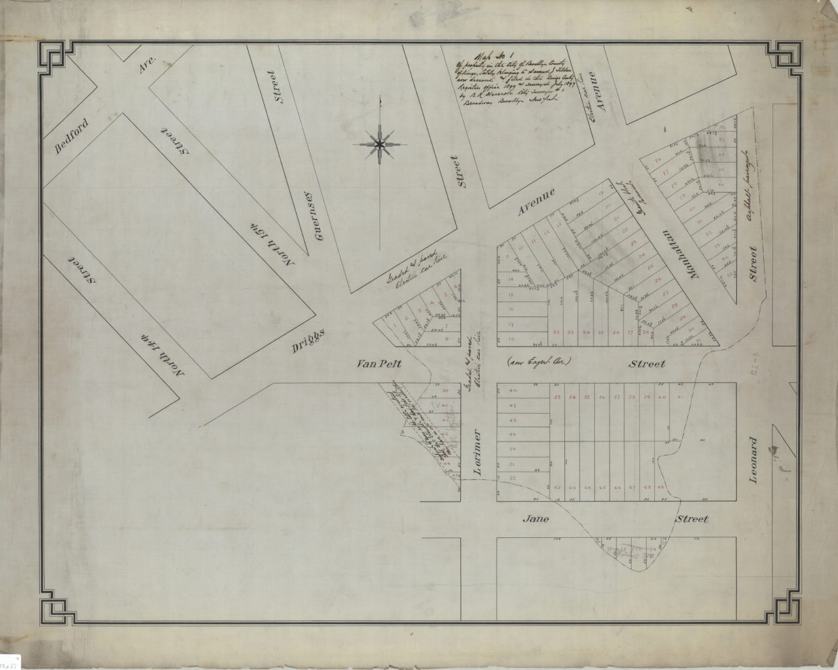
[Map of properties at Montague Pl. and Furman St.]: surveyed by Ludlam & Stuchfield, city surveyors
December 4, 1894
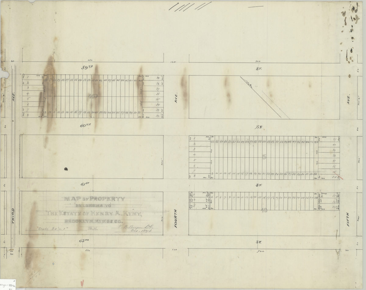
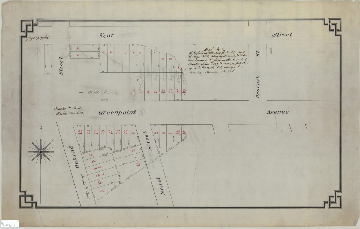
Map of property belonging to Henry A. Kent, Brooklyn, Kings Co., N.Y.: V.B. Bergen, C.E.
October 1894
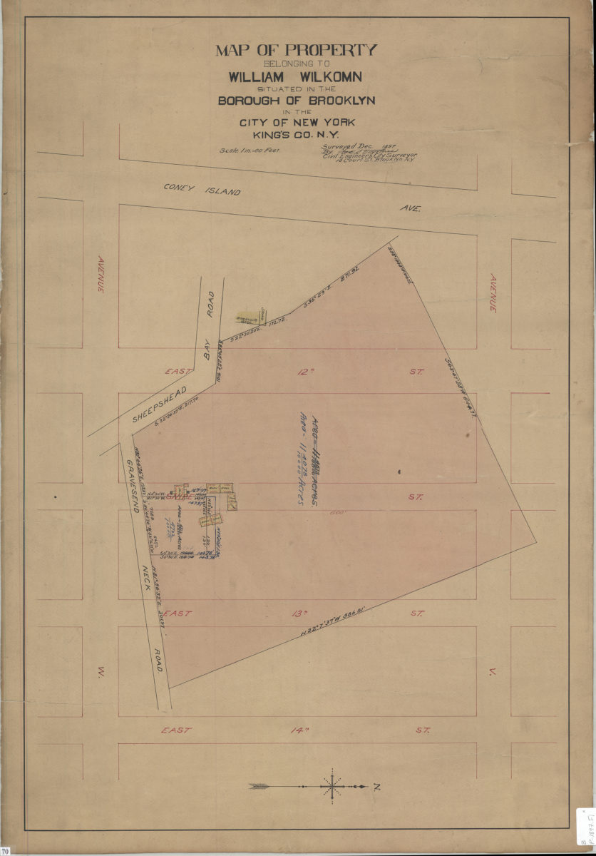
[Map of Ave. U between E. 4th St. and E. 5th St.]: surveyed … by Chas. S. Voorhies, civil eng. & city surveyor
September 1898