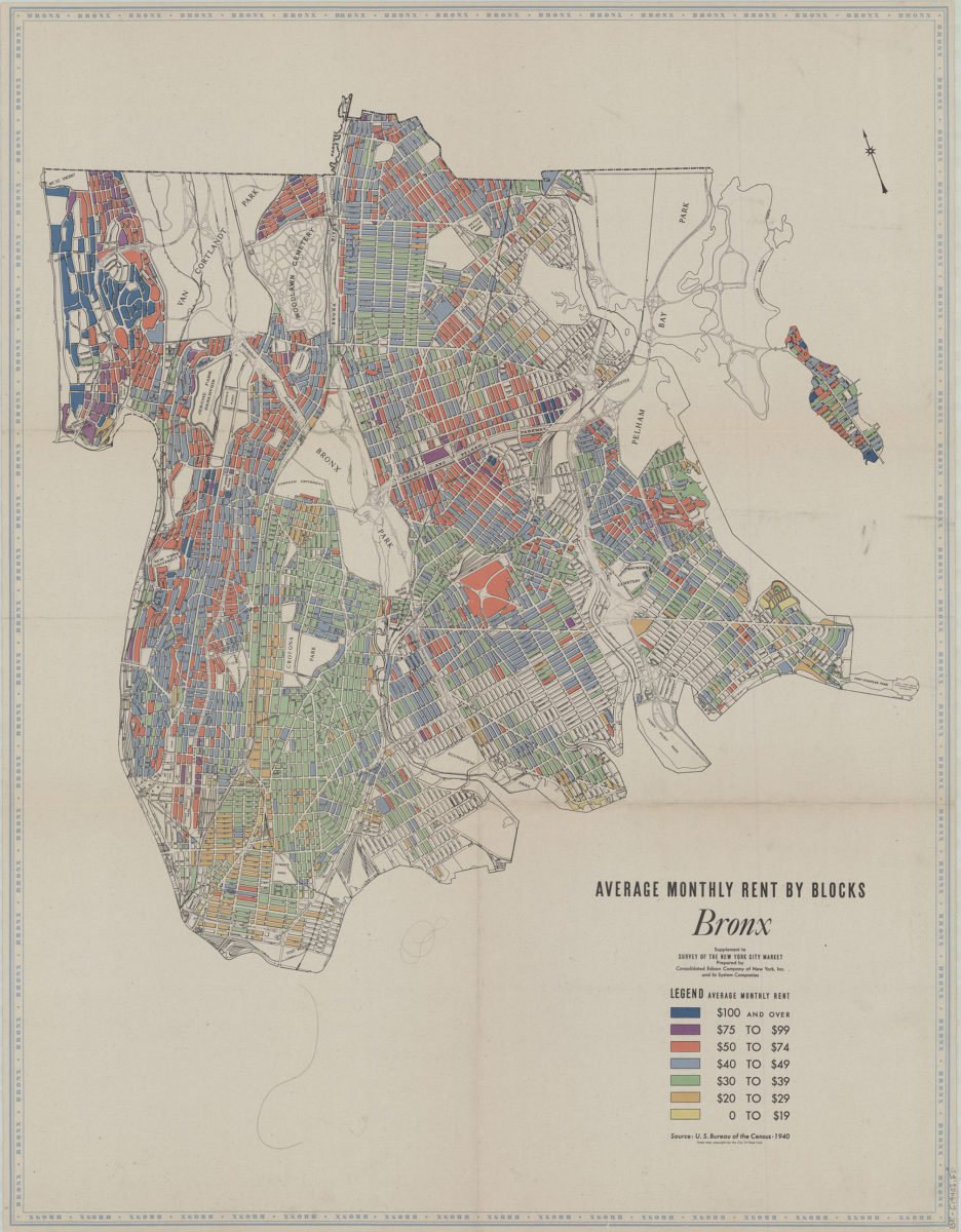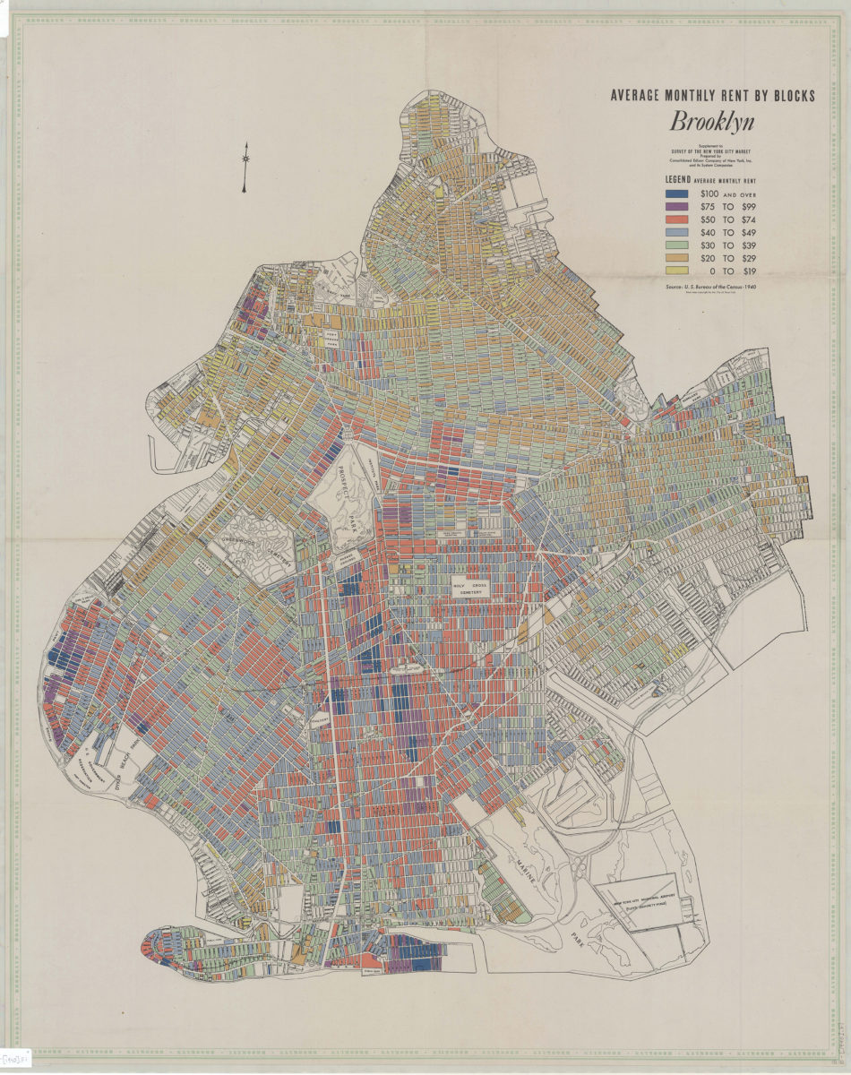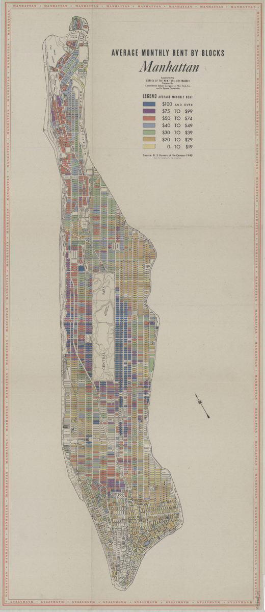
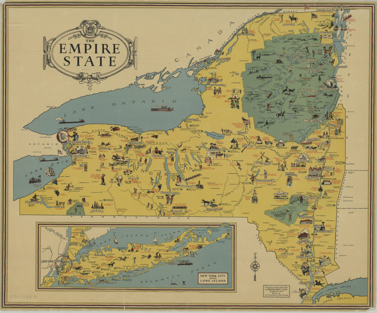
The Empire State: compiled and copyrighted 1932 by Bertrand T. Fay ; drawn by Everard A. McAvoy
[1932;1932]
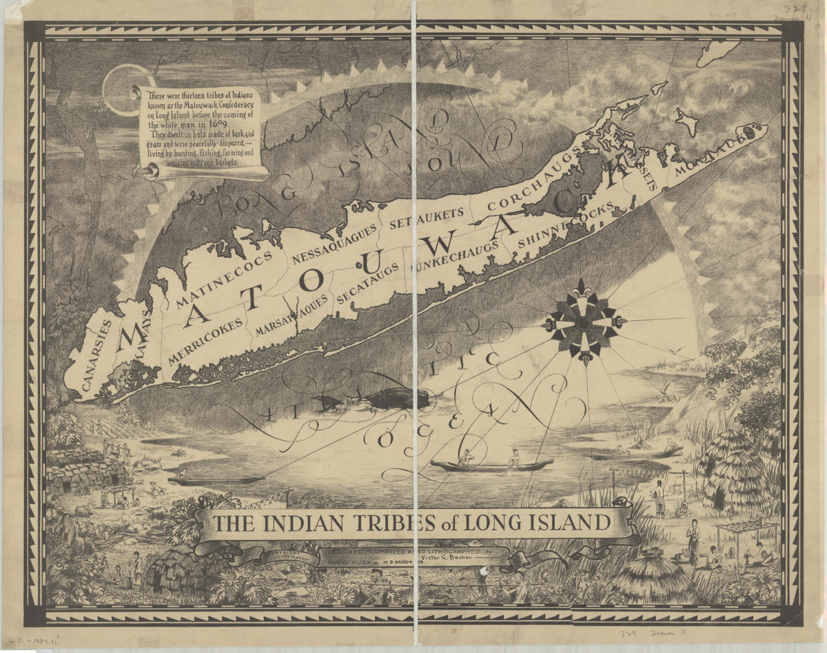
The Indian tribes of Long Island: designed, compiled and lithographed by Victor G. Becker
[ca. 1934]
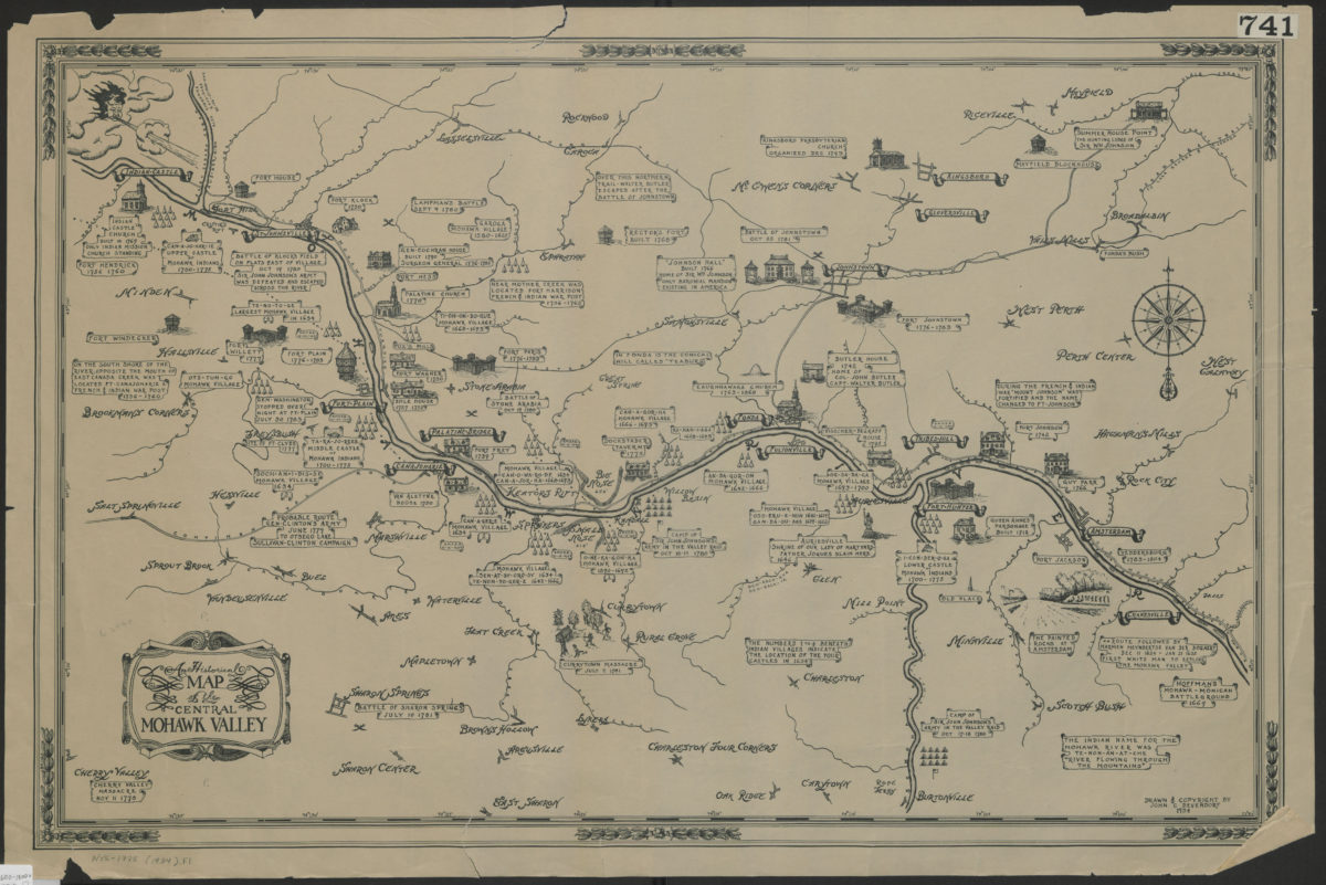
An historical map of the central Mohawk Valley: drawn and copyright[ed] by John C. Devendorf
[ca. 1934]

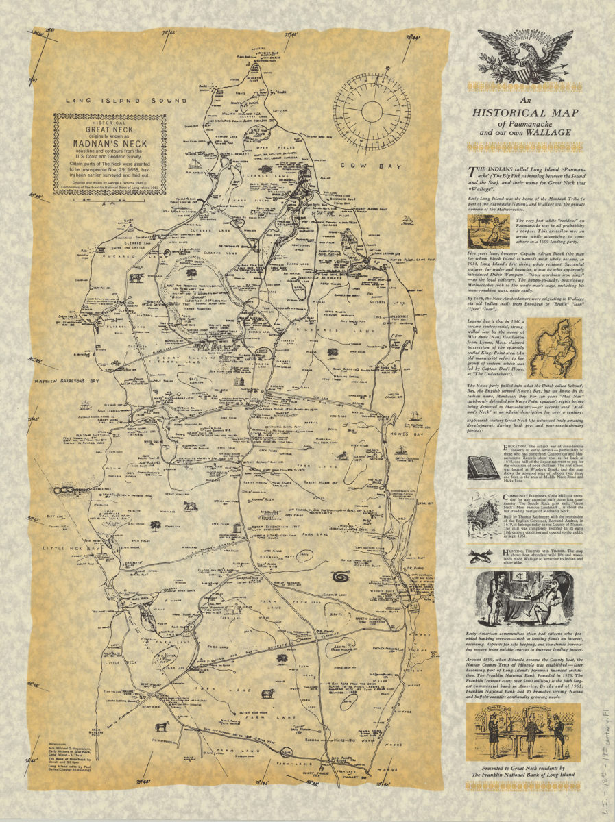
An historical map of Paumanacke and our own Wallage: compiled and drawn by George L. Whittle
[ca. 1940, 1961]