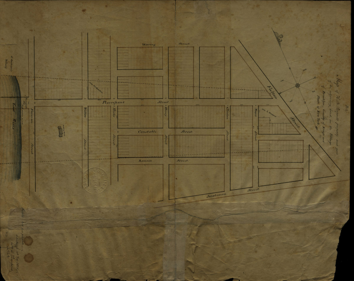
Map of H.B. Pierpont’s property and part of the adjoining land in the village of Brooklyn, county of Kings, and state of New York: Wm. C. Pierrepont
February 12, 1825
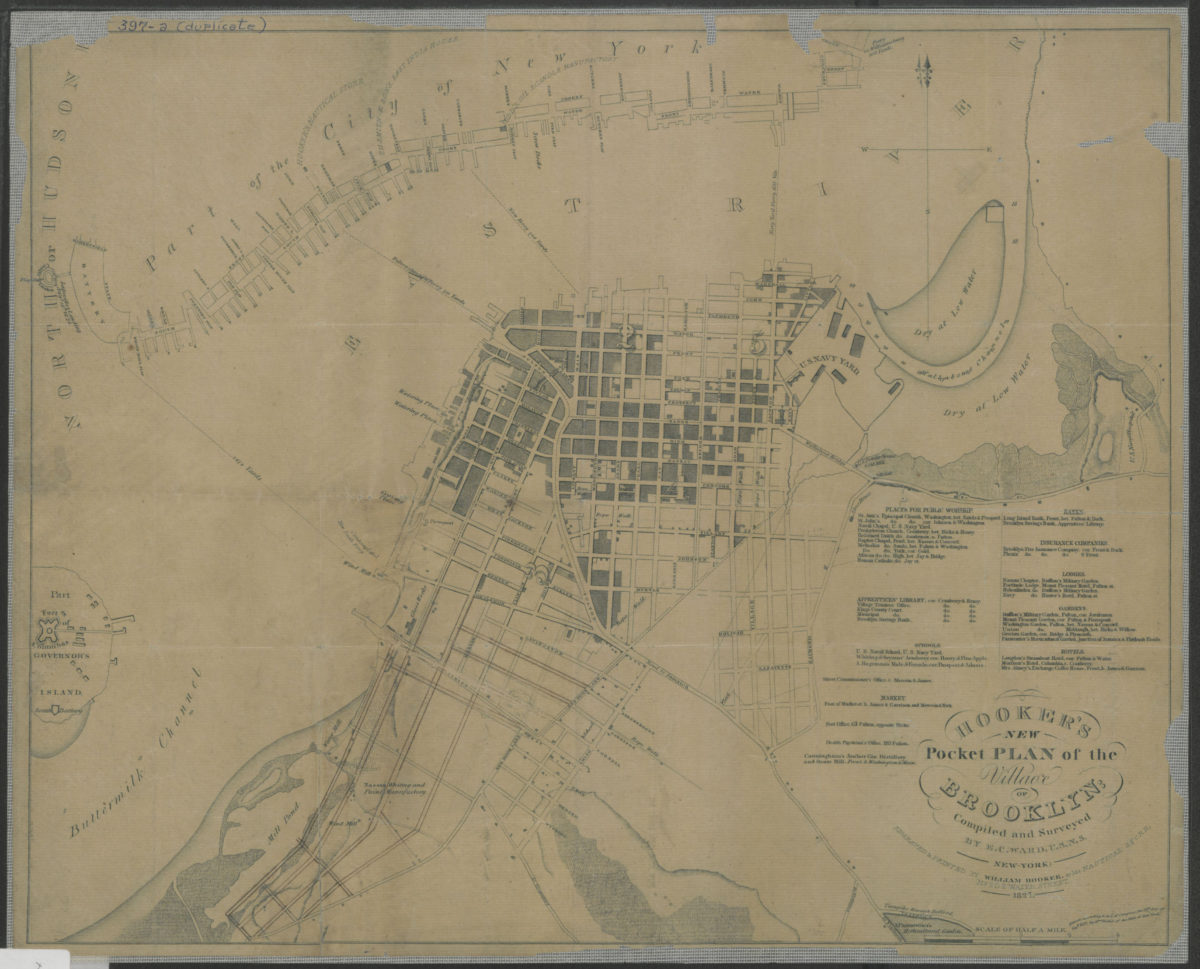
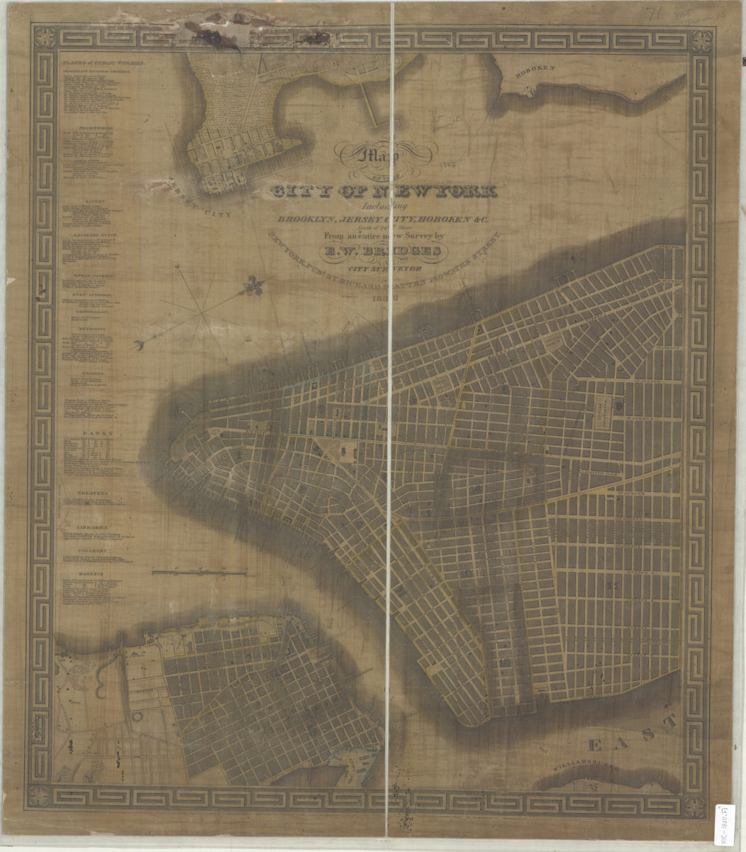
Hooker’s new pocket plan of the village of Brooklyn: compiled and surveyed by E.C. Ward, U.S.N.S.
1827
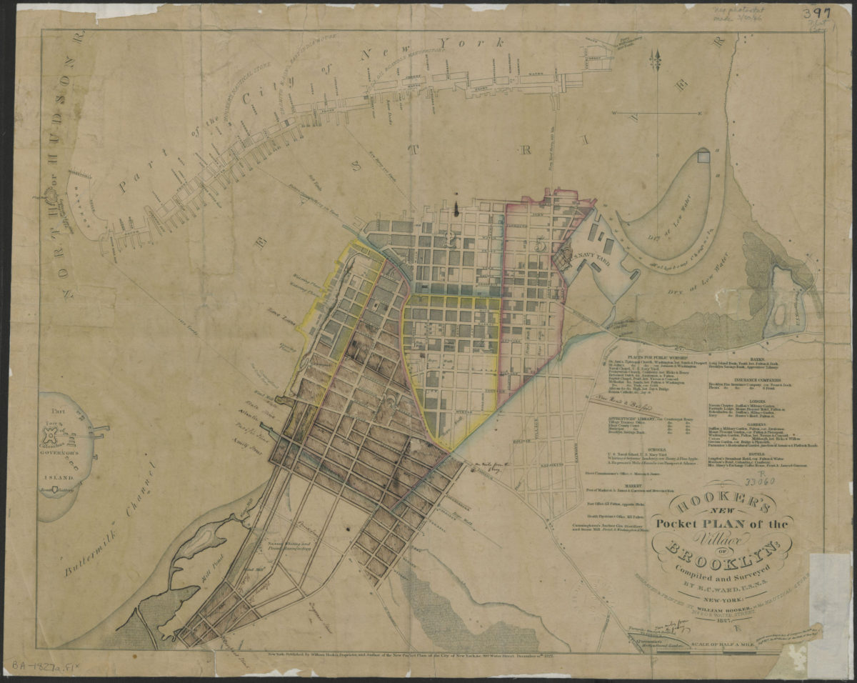
Hooker’s new pocket plan of the village of Brooklyn: compiled and surveyed by E.C. Ward, U.S.N.S.
1827
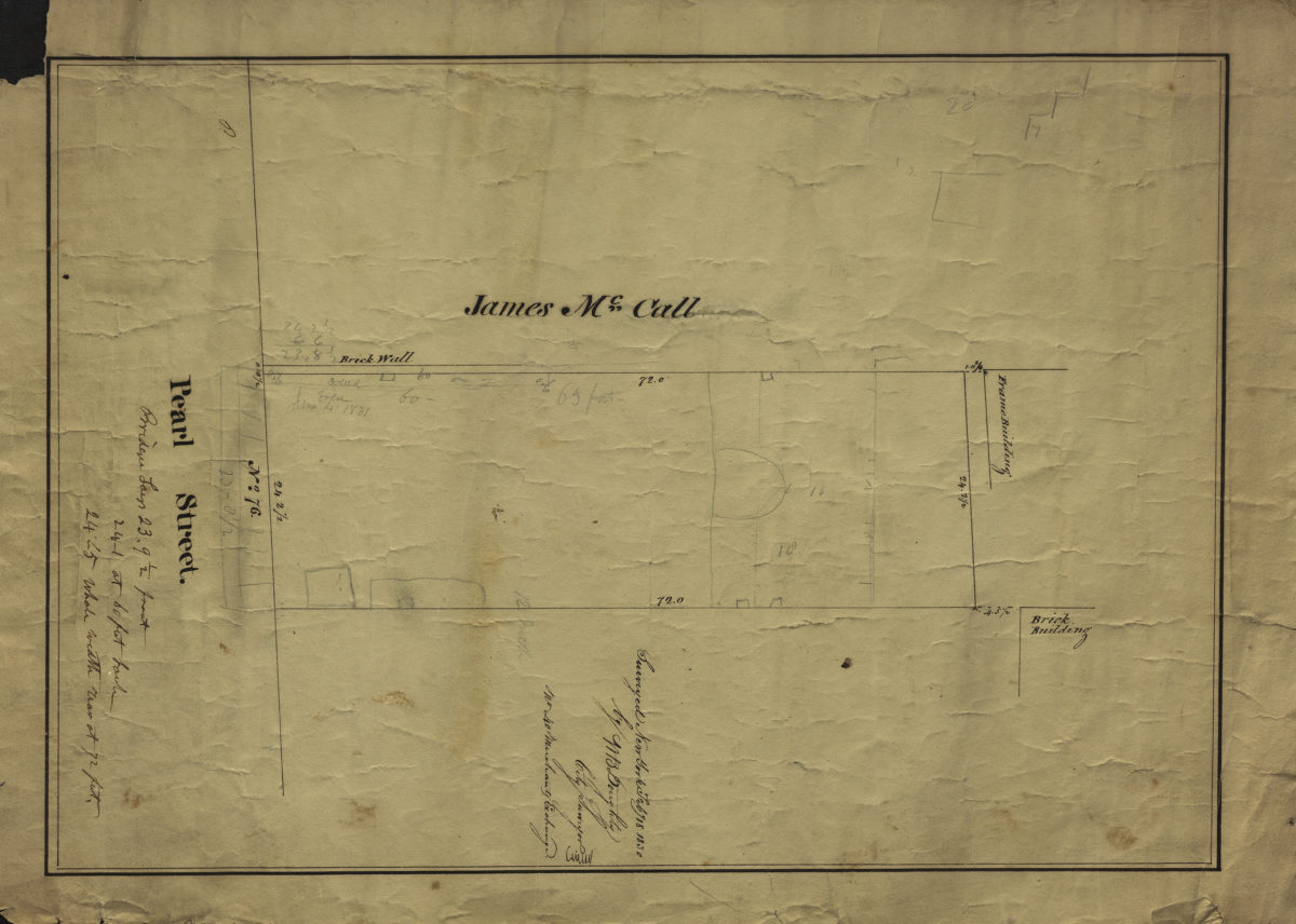
[Map of No. 76 Pearl St.]: surveyed … by M.B. Doughty, city surveyor
February 18, 1830
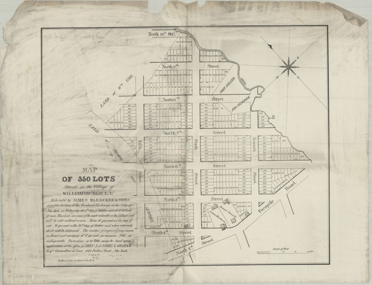
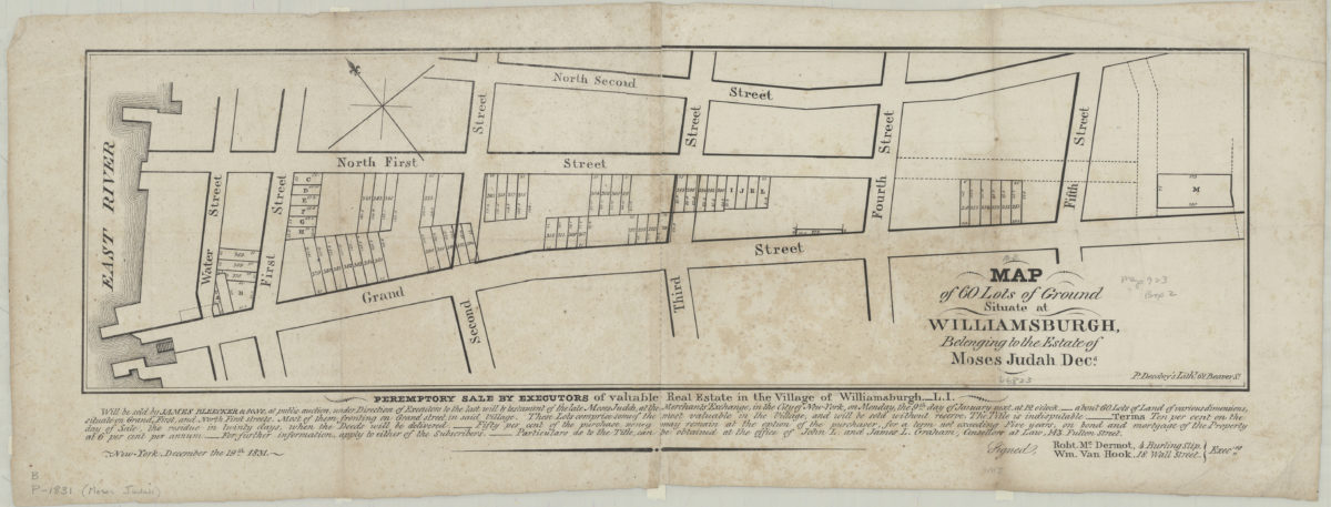
Map of 60 lots of ground situate[d] at Williamsburgh, belonging to the estate of Moses Judah, decd
1831
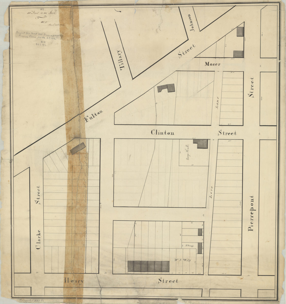
[Map of area bounded by Henry St., Clarke St., Fulton St., and Pierrepont St.]: H.E.P. [Henry Evelyn Pierrepont]
March 20, 1832
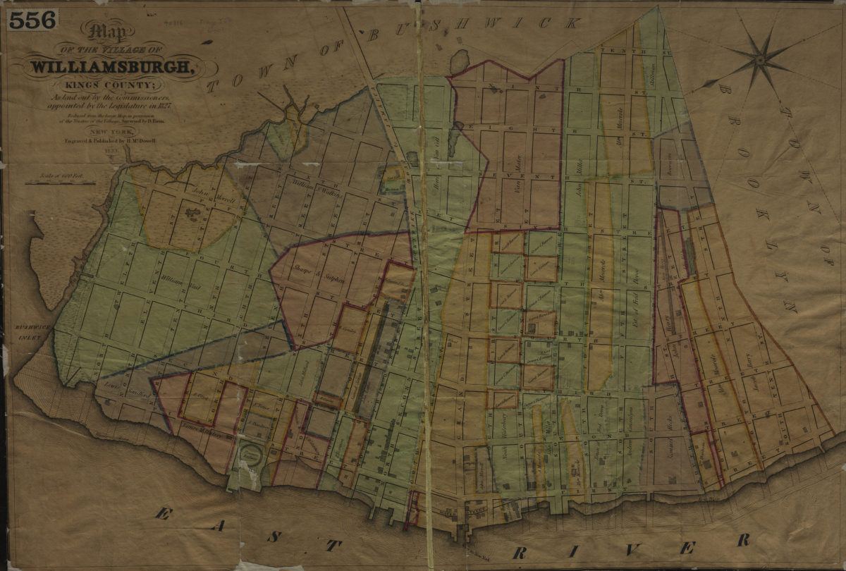
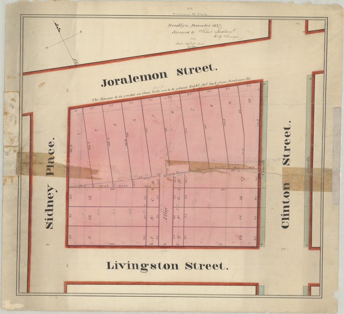
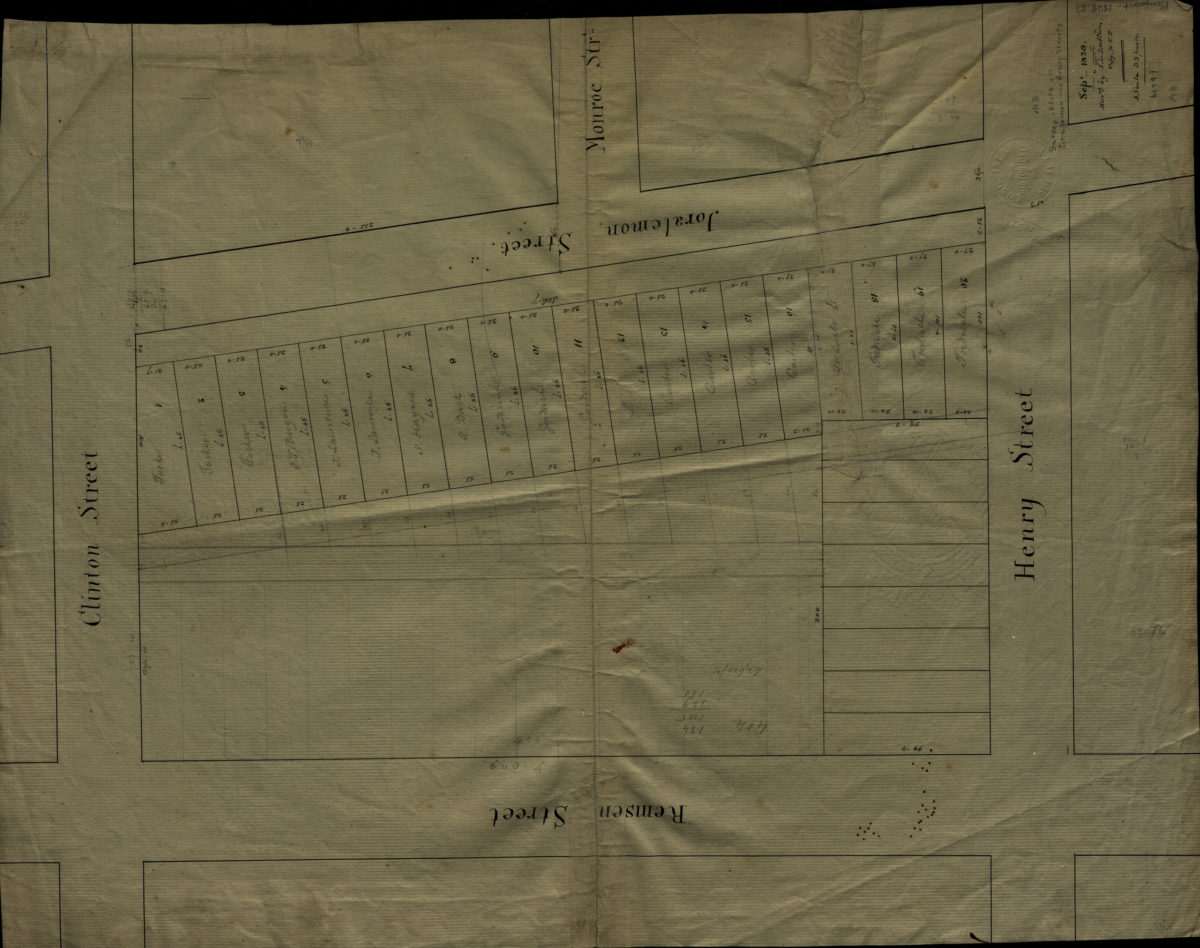
[Map of area bounded by Joralemon St., Clinton St., Livingston St., and Sidney Pl.]: surveyed by Silas Ludlam, city surveyor
December 1837