Center for Brooklyn History
Map Collections
Search
About
Othmer Library & Archives
Submit search query
Refine 191 records
Clear filter
1
Location
Adirondack Mountains (N.Y.)
2
Adirondack Park (N.Y.)
1
Albany (N.Y.)
3
Auburn (N.Y.)
1
Bay Ridge (New York, N.Y.)
108
Bedford-Stuyvesant (New York, N.Y.)
67
Boerum Hill (New York, N.Y.)
6
Brooklyn (New York, N.Y.)
891
Brooklyn Heights (New York, N.Y.)
76
Buttermilk Channel (New York, N.Y.)
1
Canarsie (New York, N.Y.)
18
Carroll Gardens (New York, N.Y.)
21
Carroll Park (New York, N.Y.)
1
Clinton Hill (New York, N.Y.)
10
Cobble Hill (New York, N.Y.)
7
Commodore Barry Park (New York, N.Y.)
1
Connecticut
7
Crown Heights (New York, N.Y.)
25
Downtown Brooklyn (New York, N.Y.)
29
Dutchess County (N.Y.)
2
East New York (New York, N.Y.)
16
East River (N.Y.)
3
Erie Basin (New York, N.Y.)
2
Erie Canal (N.Y.)
3
Flatbush (New York, N.Y.)
35
Fort Greene (New York, N.Y.)
22
Genesee County (N.Y.)
2
Genesee River (Pa. and N.Y.)
1
Gowanus (New York, N.Y.)
12
Gowanus Bay (New York, N.Y.)
1
Grand Army Plaza (Brooklyn, New York, N.Y.)
1
Greenpoint (New York, N.Y.)
38
Hempstead (N.Y.)
13
Holland Tunnel (Jersey City, N.J., and New York, N.Y.)
1
Hudson County (N.J.)
3
Hudson River (N.Y. and N.J.)
7
Ithaca, N.Y.
1
Jamaica Bay (N.Y.)
5
Jersey City (N.J.)
4
Kings County (New York, N.Y.)
8
Lloyd Harbor (N.Y.)
1
Long Island (N.Y.)
197
Manhattan (New York, N.Y.)
120
Maritime Provinces
1
Middle Atlantic States
2
Morningside Heights (New York, N.Y.)
1
New England
8
New Jersey
27
New York (N.Y.)
164
New York (State)
95
New York Metropolitan Area
40
Oswego (N.Y.)
1
Oyster Bay (N.Y.)
9
Park Slope (New York, N.Y.)
16
Patchogue (N.Y.)
2
Pennsylvania
4
Prospect Heights (New York, N.Y.)
16
Prospect Park (New York, N.Y.)
25
Putnam County (N.Y.)
1
Queens (New York, N.Y.)
83
Red Hook (New York, N.Y.)
19
Rhode Island
2
Richmond Hill (New York, N.Y.)
2
Saint Lawrence River
2
Saratoga Springs (N.Y.)
1
Sea Gate (New York, N.Y.)
7
Sleepy Hollow (N.Y.)
1
Staten Island (N.Y.)
10
Suffolk County (N.Y.)
43
Sunset Park (New York, N.Y.)
53
Syracuse (N.Y.)
1
U.S.
1
United States
10
Upper Bay (N.Y. and N.J.)
4
Williamsburg (New York, N.Y.)
36
Windsor Terrace (New York, N.Y.)
10
Show 56 more
Subject
Academic libraries
1
Advertising
4
Aeronautical charts
1
Apartment houses
1
Bays
5
Buildings
12
Canals
15
Cemeteries
17
Central business districts
10
Church property
1
City planning
7
Counties
1
Election districts
36
ferries
32
Fills (Earthwork)
4
Fire alarms
4
Fire protection districts
2
Forest reserves
1
Fortification
7
Geology
2
Harbors
11
Historic buildings
3
Historic sites
3
Indians of North America
6
Land tenure
1
Landforms
15
Landowners
434
Marine terminals
2
Names, Geographical
1
Natural areas
1
Neighborhoods
3
Nonsmoking areas
1
Outdoor recreation
1
Parks
35
Parkways
1
Piers
25
Ponds
6
Post roads
1
Railroads
72
Railroads, Elevated
24
Real property
619
Rivers
16
Road maps
2
Roads
117
School districts
4
Schools
1
Shorelines
3
Smoking cessation
1
Streets
46
Subways
55
Tenement houses
1
Topographic maps
1
Trees
1
Trials
1
Universities and colleges
1
Urban renewal
3
Waterworks
5
Wells
2
Wetlands
6
Show 39 more
Date
19th Century
945
20th Century
469
21th Century
66
or enter range:
from
to
Genres
Map
191
Sort by:
Date (earliest)
Date (most recent)
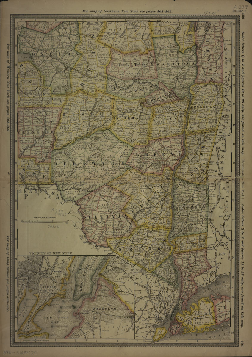
Southeastern New York
Southeastern New York
[1882]
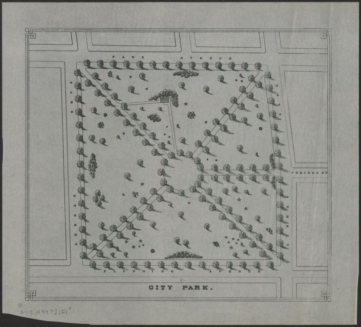
City Park
City Park
[1884]
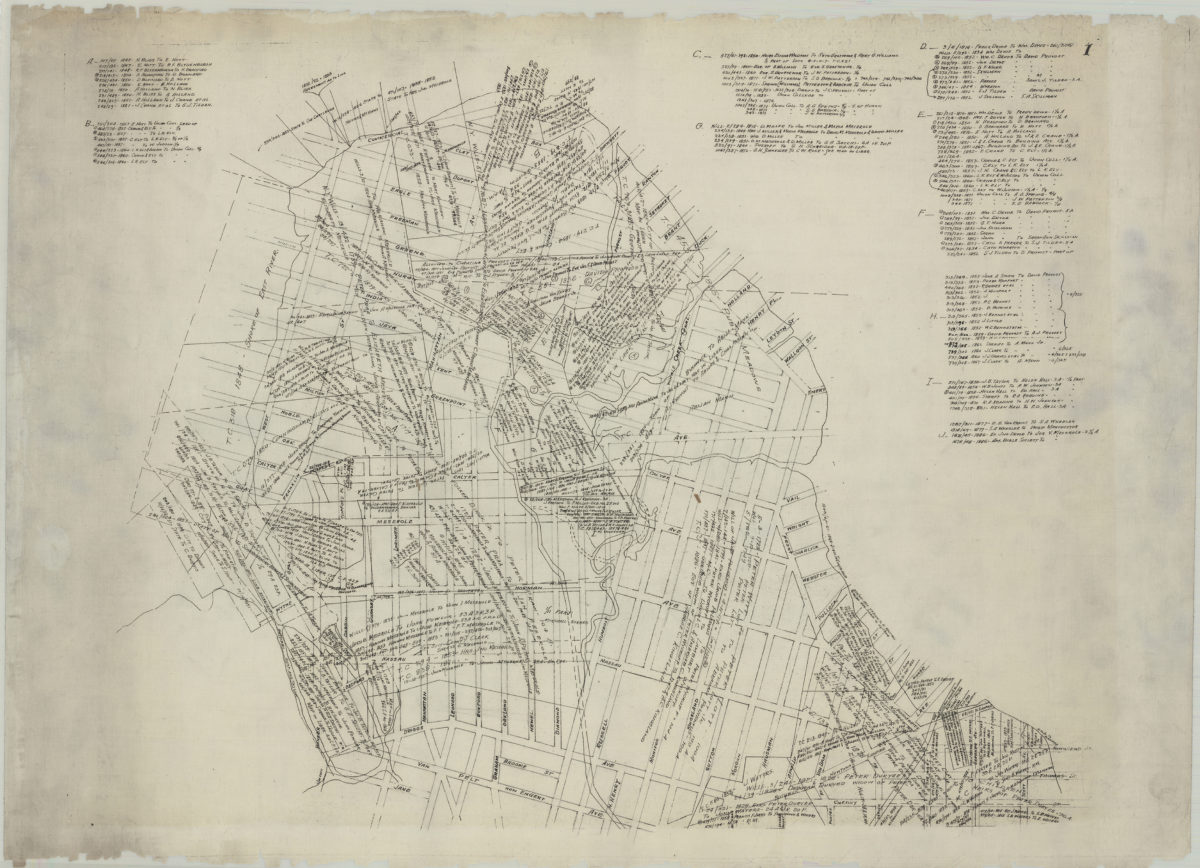
[Map of Greenpoint showing land transfers]
[Map of Greenpoint showing land transfers]
circa 1885
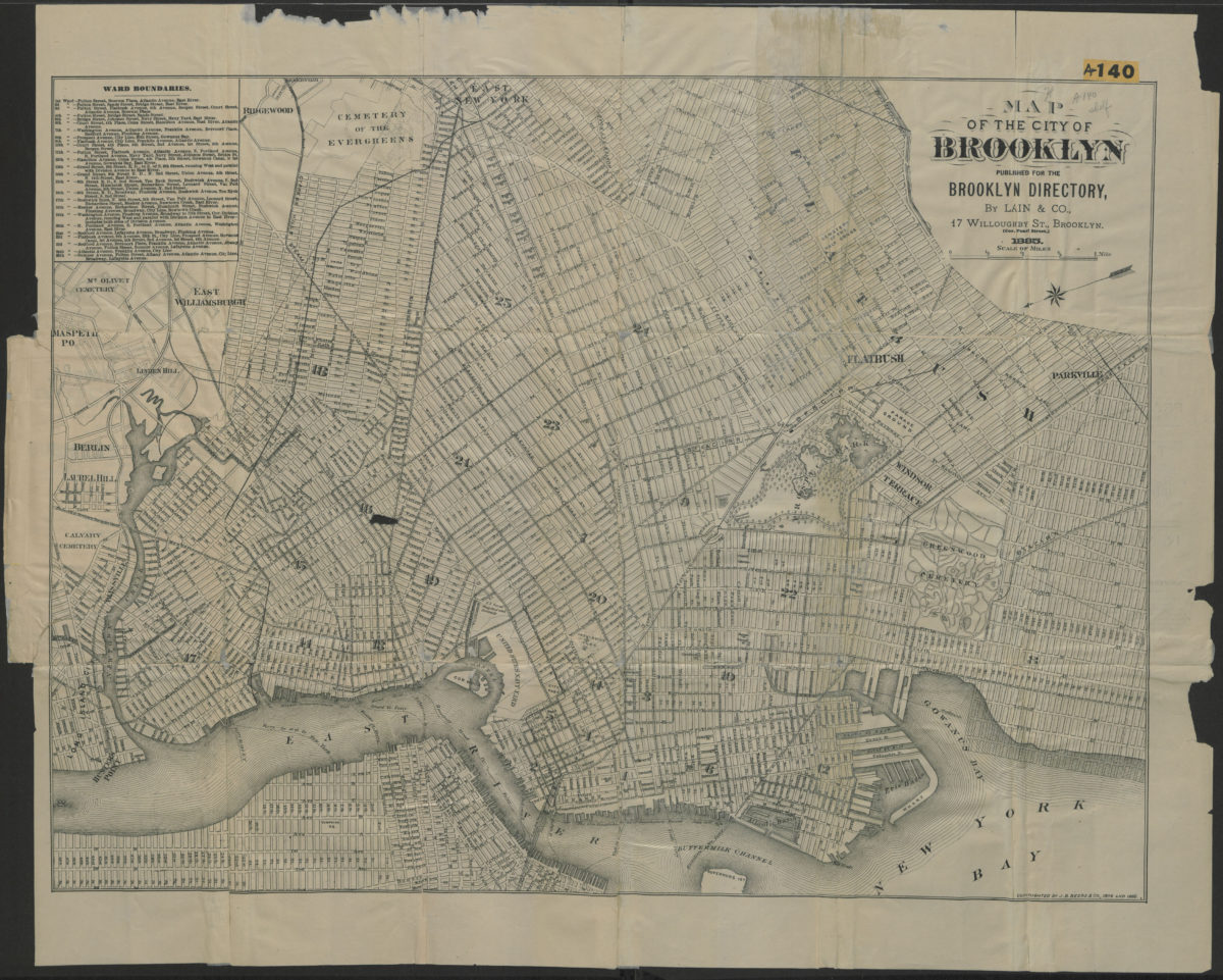
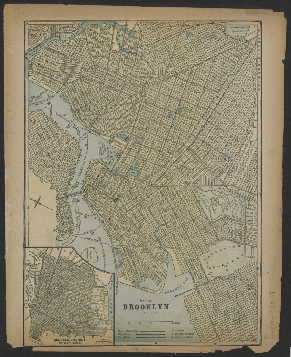
Map of the city of Brooklyn
Map of the city of Brooklyn
1885
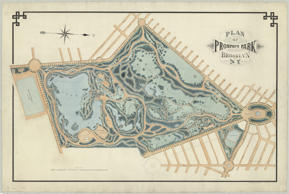
Plan of Prospect Park, Brooklyn, N.Y.: Jos. Strachan, N.Y.U. ’83
Plan of Prospect Park, Brooklyn, N.Y.: Jos. Strachan, N.Y.U. ’83
[1886]
Map of Brooklyn
Map of Brooklyn
[1886]
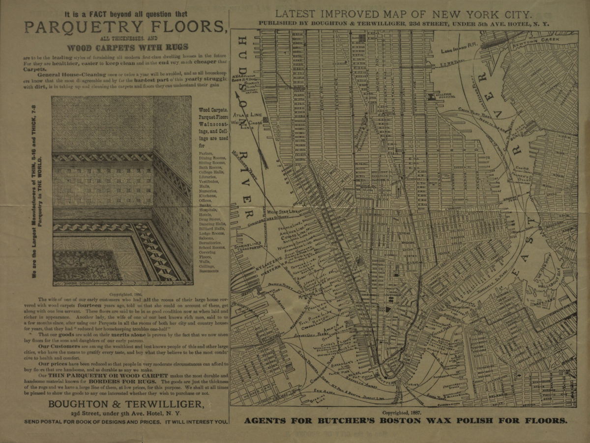
Map of the city of Brooklyn ; Latest improved map of New York City
Map of the city of Brooklyn ; Latest improved map of New York City
[ca. 1887]
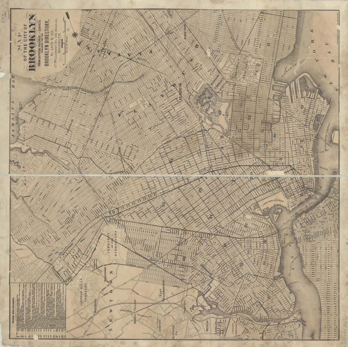
Map of the city of Brooklyn: from official records and surveys
Map of the city of Brooklyn: from official records and surveys
1888
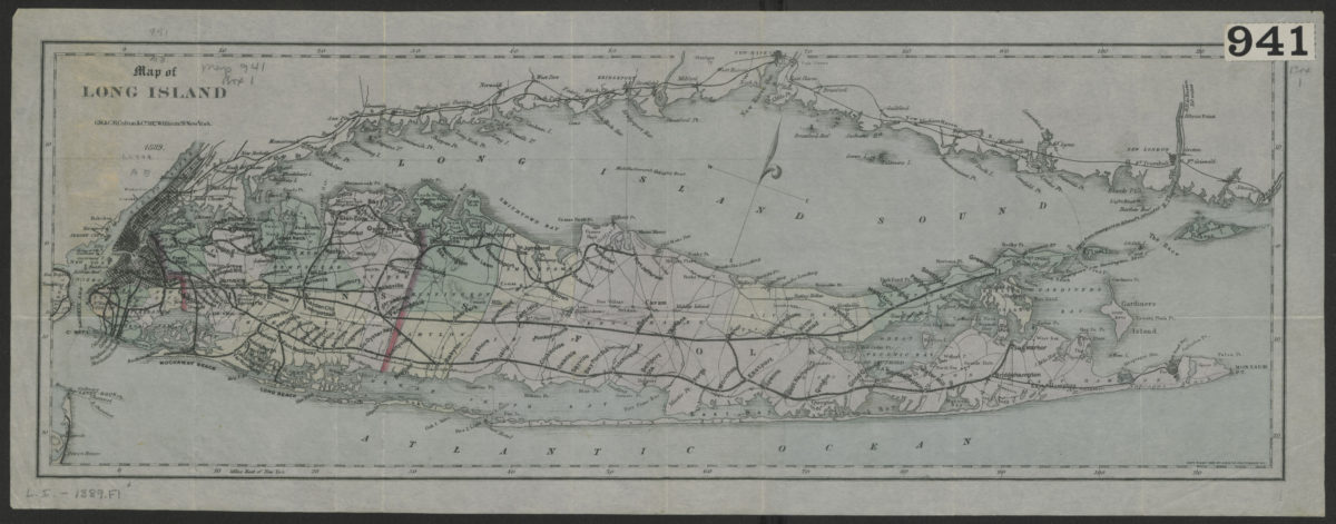
Map of Long Island
Map of Long Island
1889; [ca. 1882]
Indexed commercial map of Brooklyn and Kings County, New York: from latest official surveys: drawn by Ch. Bruegel
Indexed commercial map of Brooklyn and Kings County, New York: from latest official surveys: drawn by Ch. Bruegel
1889
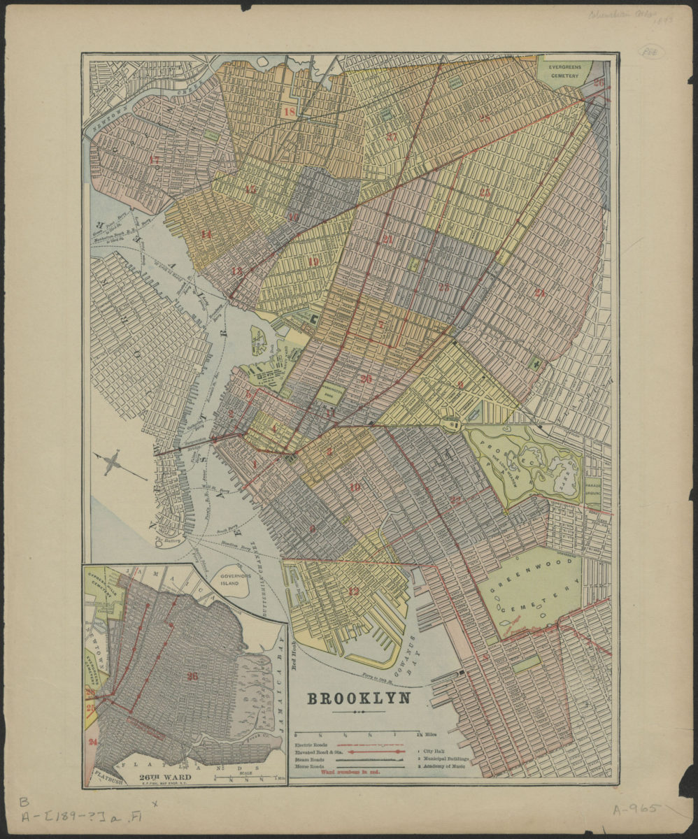
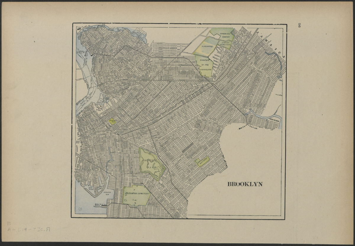
Brooklyn
Brooklyn
[189?]
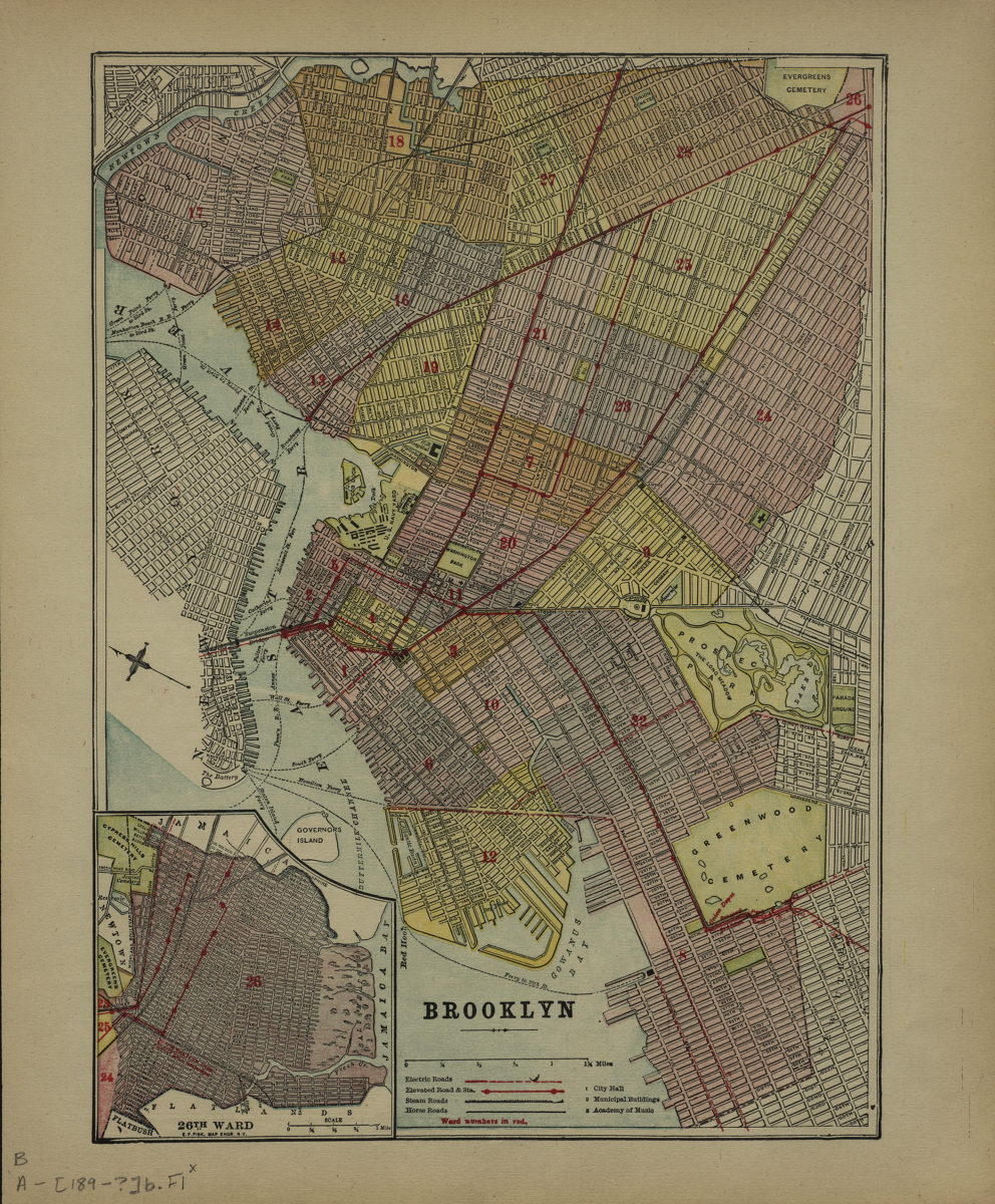
Brooklyn
Brooklyn
[189?]
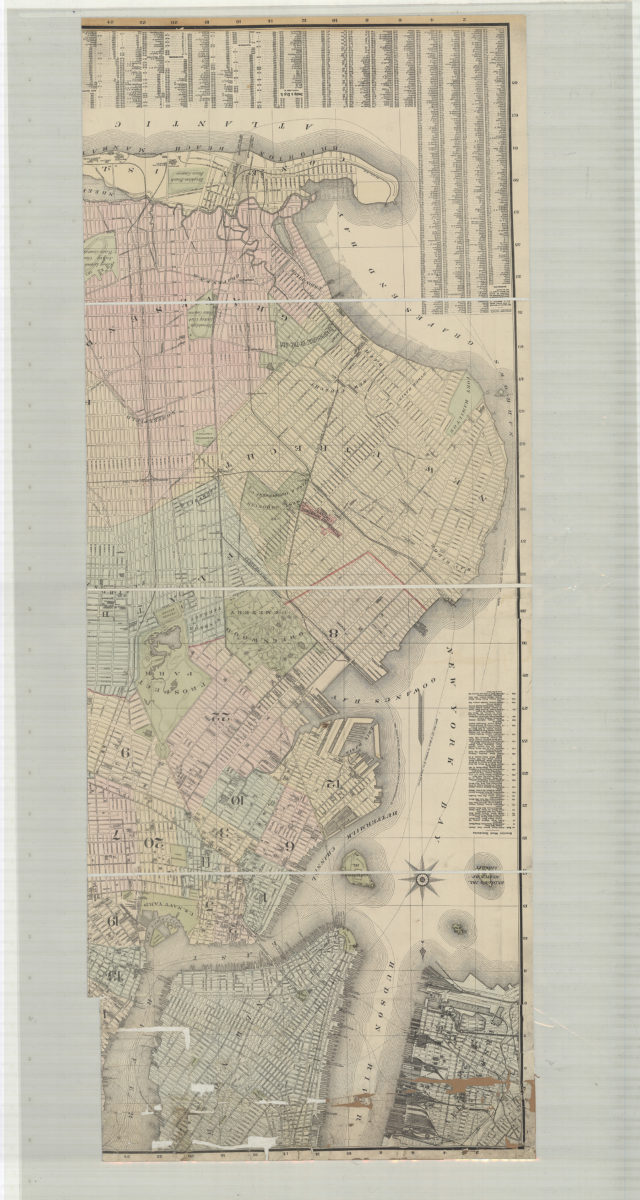
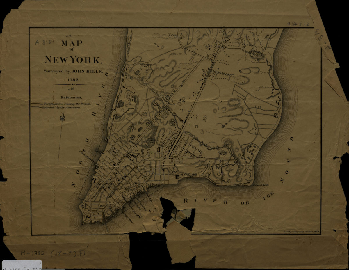
Map of New York: surveyed by John Hills
Map of New York: surveyed by John Hills
[1890]
[Map of New York metropolitan area]
[Map of New York metropolitan area]
[189?]
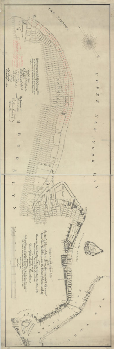
Pierhead and bulkhead lines for the easterly shore of East River, Buttermilk Channel, Upper New York Bay, and the shores of Gowanus Bay, from Broadway Ferry Brooklyn, E.D., to the northern boundary of the government land at Fort Hamilton
Pierhead and bulkhead lines for the easterly shore of East River, Buttermilk Channel, Upper New York Bay, and the shores of Gowanus Bay, from Broadway Ferry Brooklyn, E.D., to the northern boundary of the government land at Fort Hamilton
February 1890
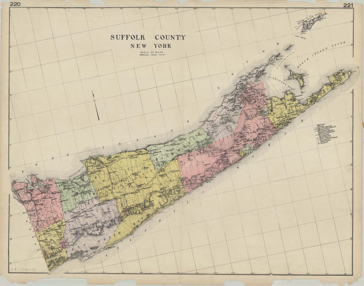
Suffolk County, New York
Suffolk County, New York
[189?]
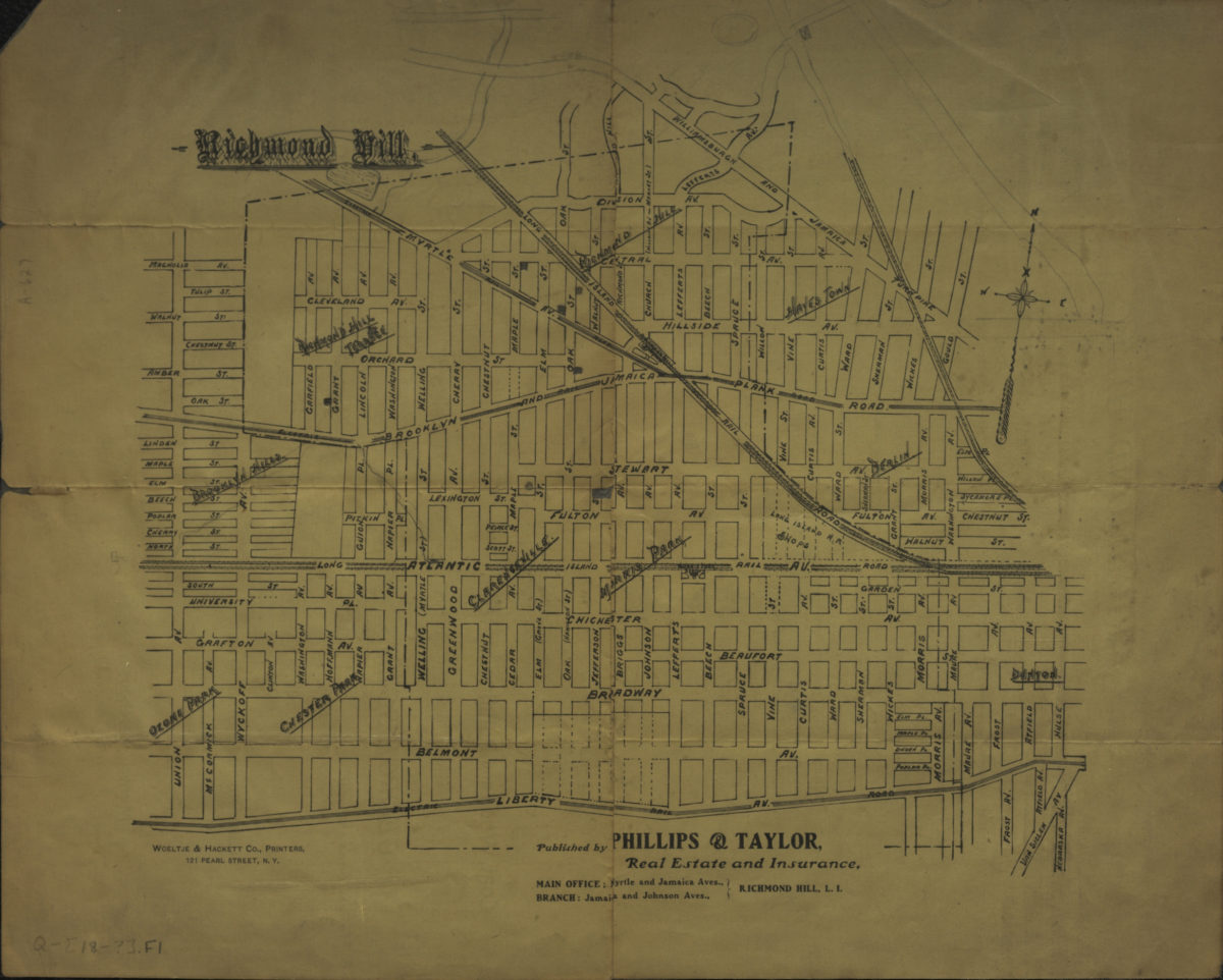
Richmond Hill
Richmond Hill
[189?]
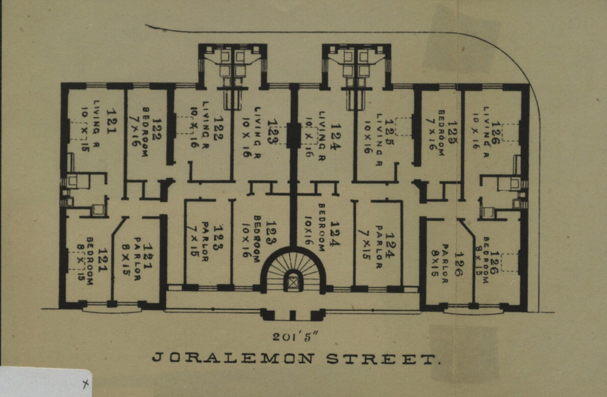
201’5” Joralemon Street
201’5” Joralemon Street
[189?]
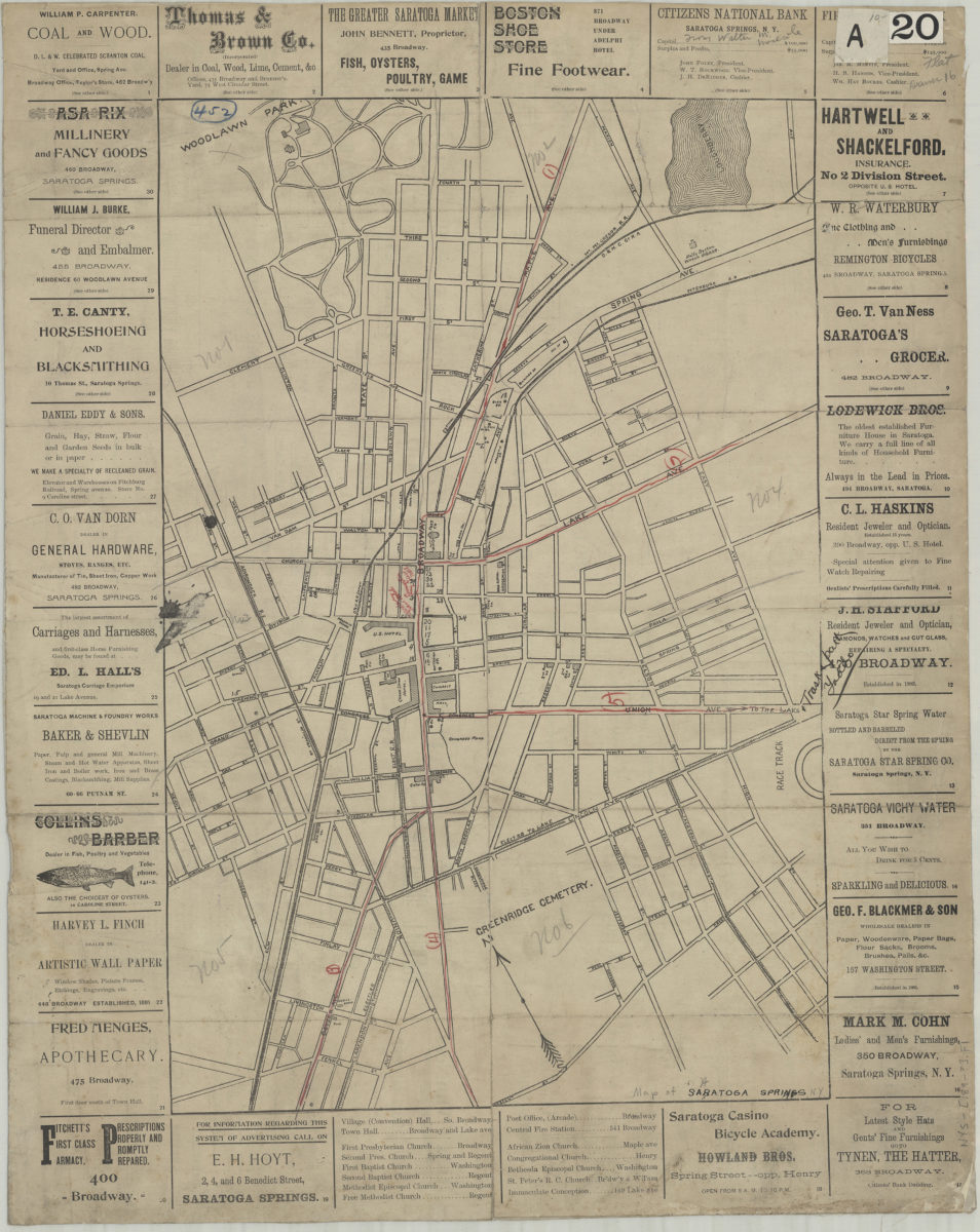
Saratoga Springs
Saratoga Springs
[189?]
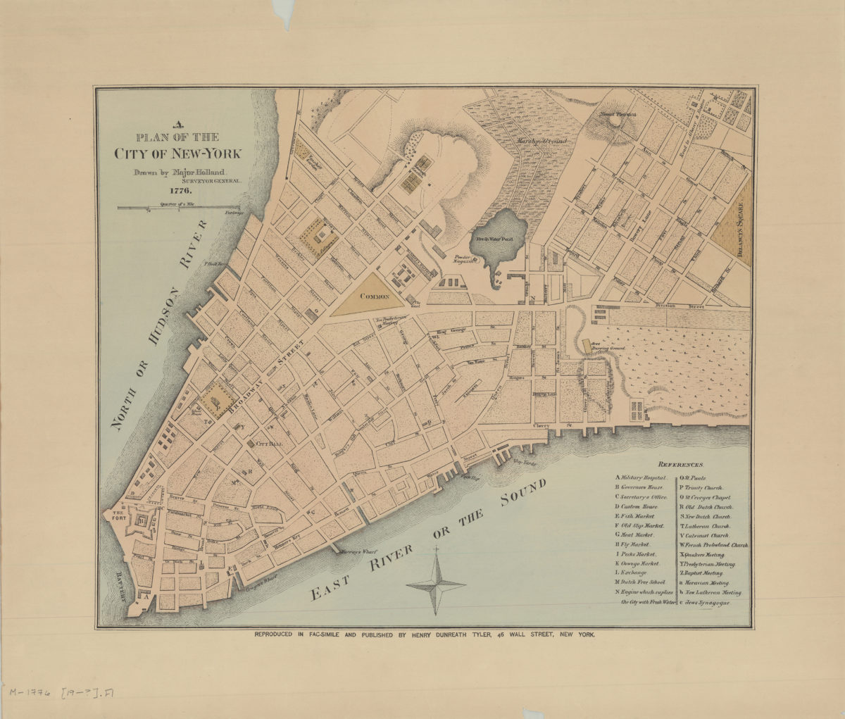
A plan of the city of New York: drawn by Major Holland, surveyor general
A plan of the city of New York: drawn by Major Holland, surveyor general
[189?]
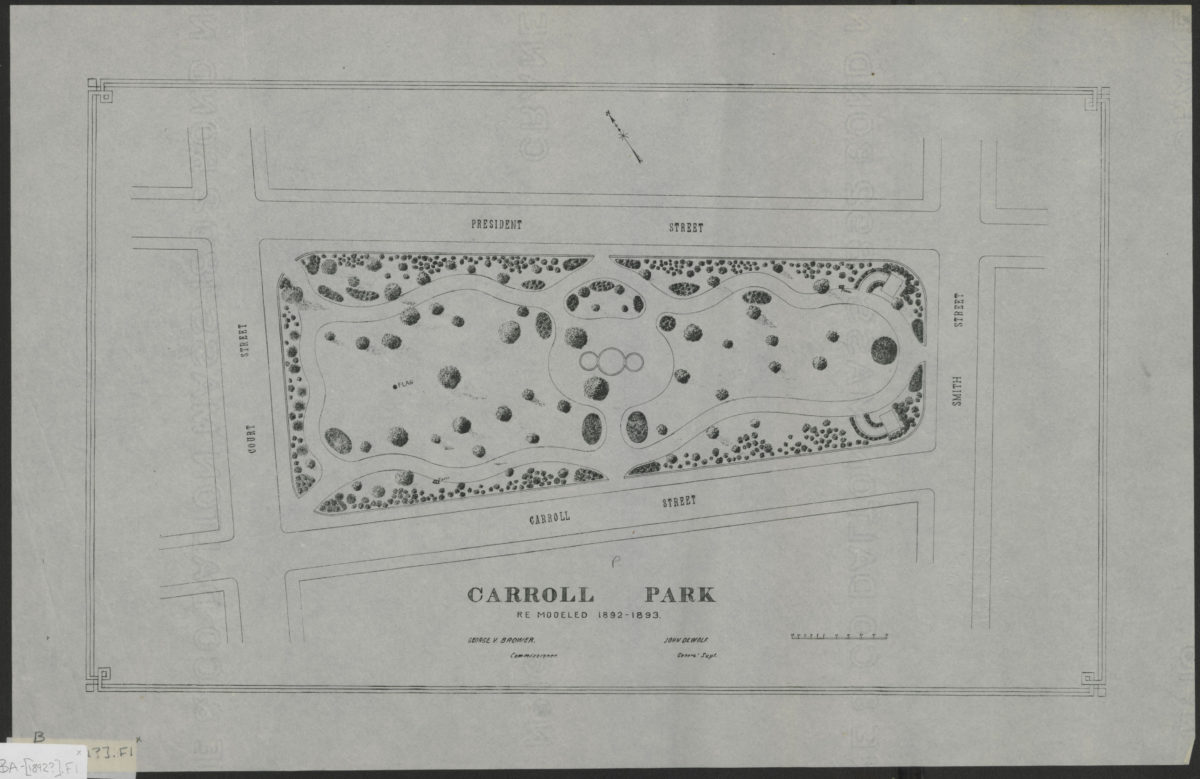
Carroll Park: re-modeled 1892-1893
Carroll Park: re-modeled 1892-1893
[1892]
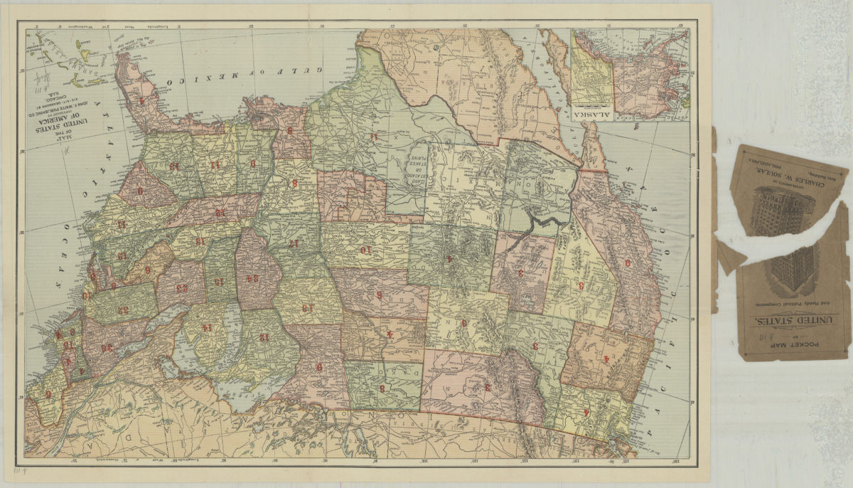
Map of the United States of America
Map of the United States of America
[1892]
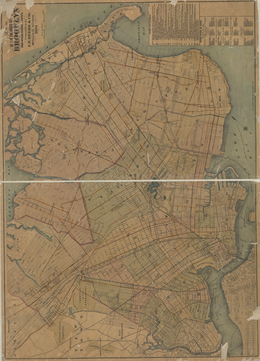
Map of the enlarged city of Brooklyn: from official records and surveys
Map of the enlarged city of Brooklyn: from official records and surveys
1894
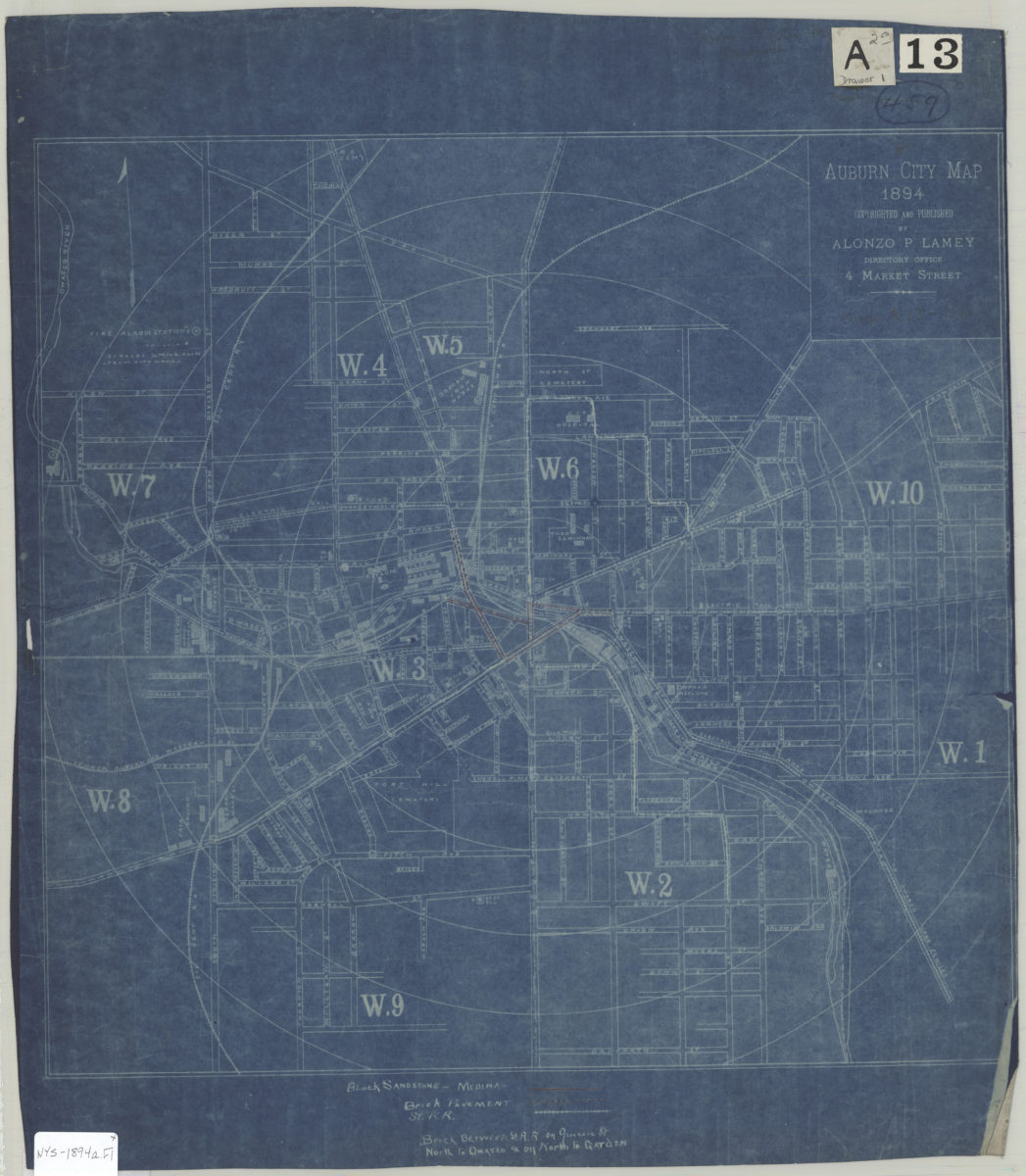
Auburn city map
Auburn city map
1894
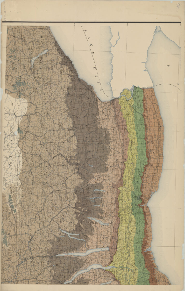
Preliminary geologic map of New York, exhibiting the structure of the state so far as known: Geological Survey of the State of New York ; prepared under the direction of James Hall by W.J. McGee
Preliminary geologic map of New York, exhibiting the structure of the state so far as known: Geological Survey of the State of New York ; prepared under the direction of James Hall by W.J. McGee
1894
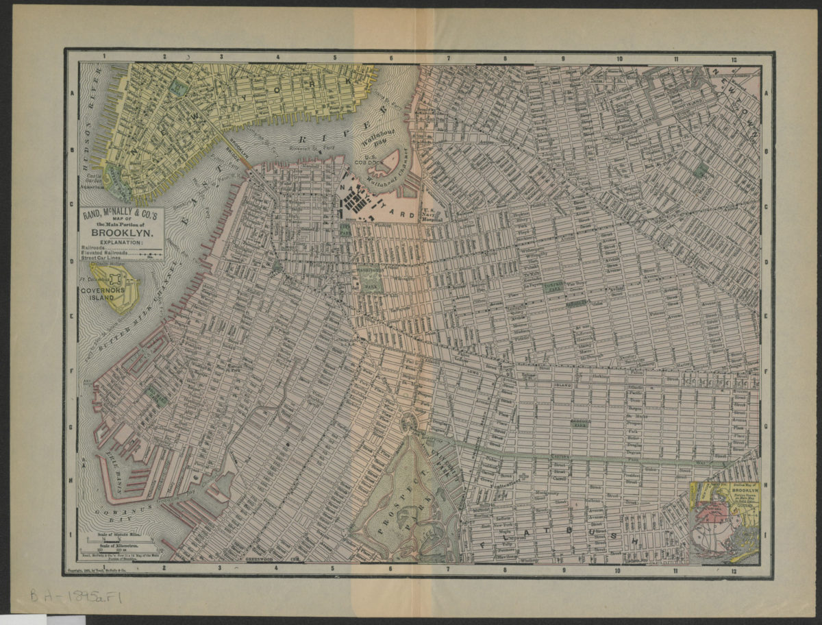
Rand, McNally & Co.’s map of the main portion of Brooklyn
Rand, McNally & Co.’s map of the main portion of Brooklyn
[1895; 1895]
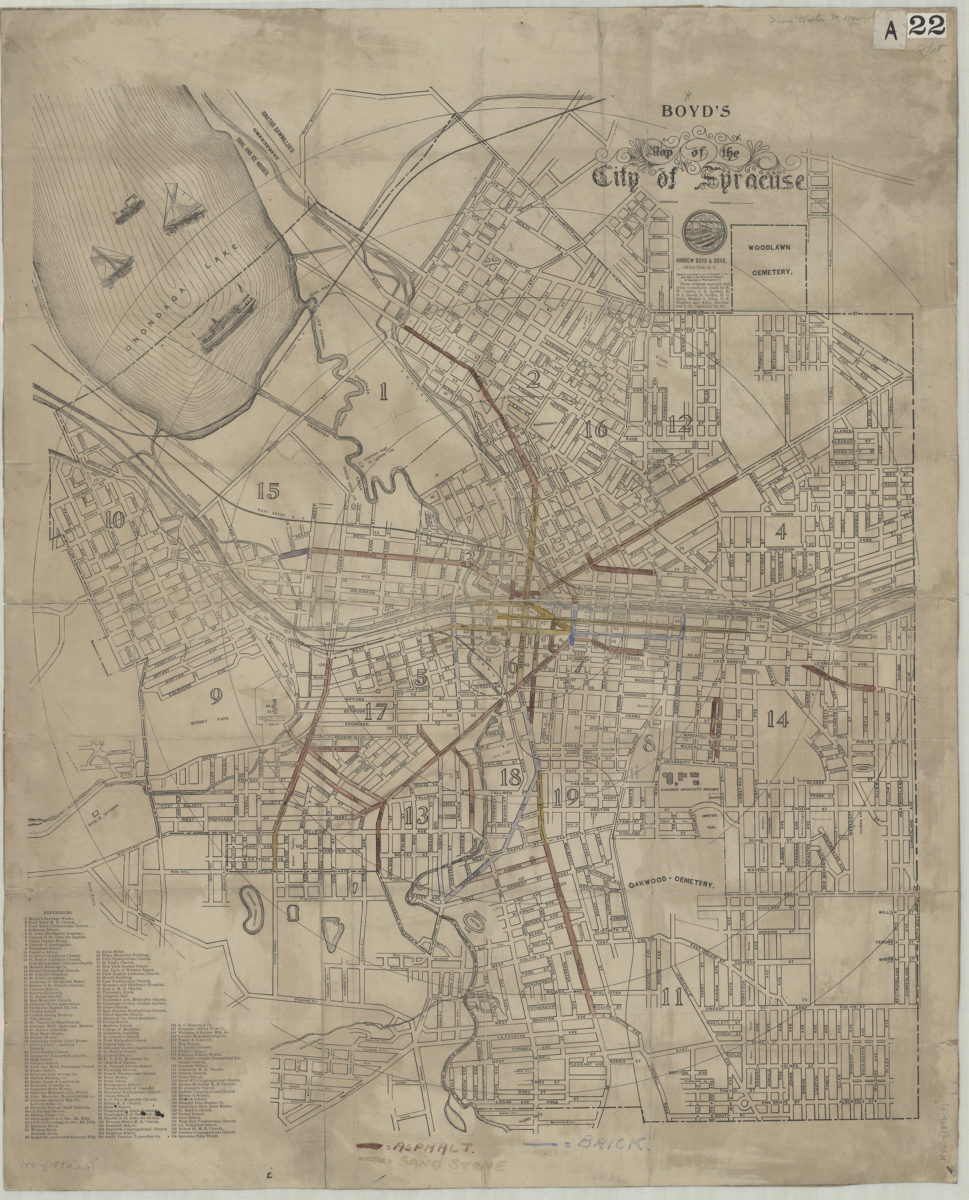
Boyd’s map of the city of Syracuse: from original surveys and from corrections: by H.W. Clarke, J.B. Borden, H.D.L. Sweet … [et al.].
Boyd’s map of the city of Syracuse: from original surveys and from corrections: by H.W. Clarke, J.B. Borden, H.D.L. Sweet … [et al.].
[1896]
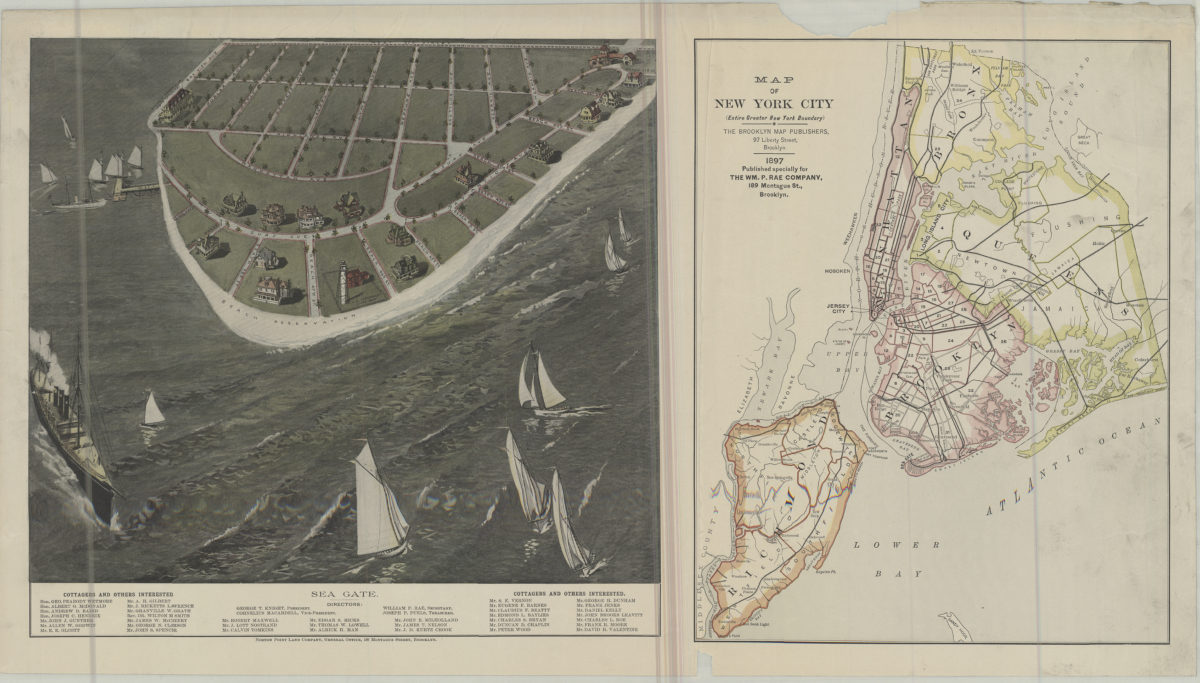
Map of New York City (entire greater New York boundary) ; Sea Gate
Map of New York City (entire greater New York boundary) ; Sea Gate
1897
Brooklyn
Brooklyn
[1897]
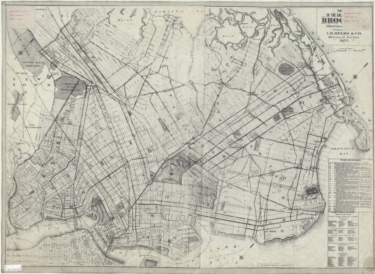
Map of the enlarged city of Brooklyn from official records and surveys: published by J.B. Beers & Co
Map of the enlarged city of Brooklyn from official records and surveys: published by J.B. Beers & Co
1897
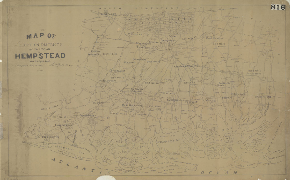
Map of election districts in the town of Hempstead: Thos. V. Smith, civ. eng., Hempstead, July 19, 1899
Map of election districts in the town of Hempstead: Thos. V. Smith, civ. eng., Hempstead, July 19, 1899
[1899]
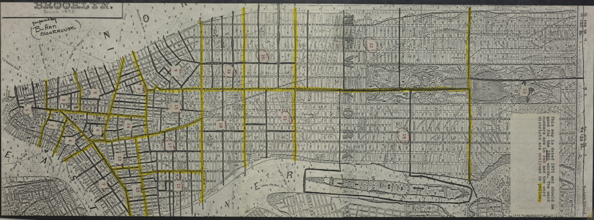
Map of the borough of Brooklyn, city of New York: based upon maps on file in the various city offices ; new system of street pavements, council district and ward boundary lines
Map of the borough of Brooklyn, city of New York: based upon maps on file in the various city offices ; new system of street pavements, council district and ward boundary lines
1899
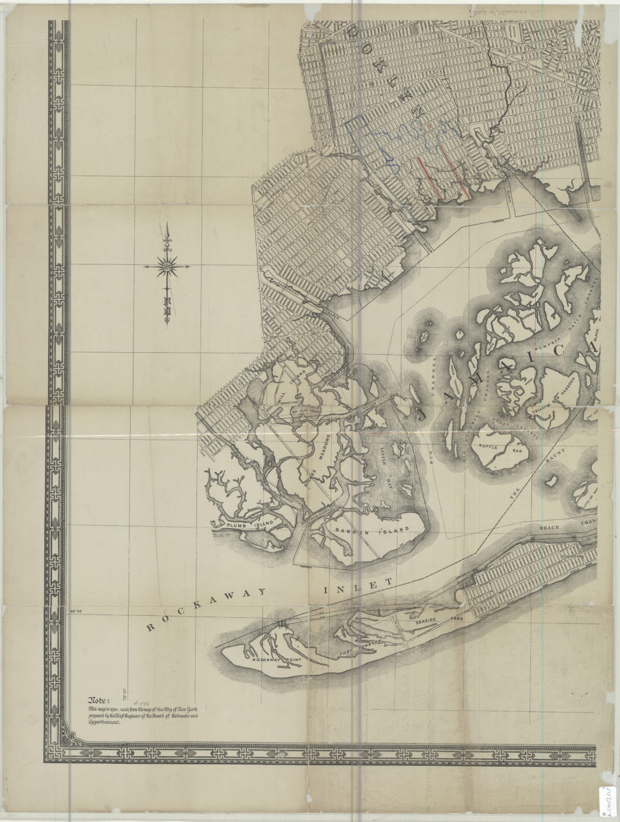
[Map of Jamaica Bay]
[Map of Jamaica Bay]
[19??]
Map of Brooklyn, Kings County, Long Island: from an entire new survey: by Alexr. Martin
Map of Brooklyn, Kings County, Long Island: from an entire new survey: by Alexr. Martin
[19??]
[Map of Manhattan, from the Battery to 114th St.].
[Map of Manhattan, from the Battery to 114th St.].
[19??]
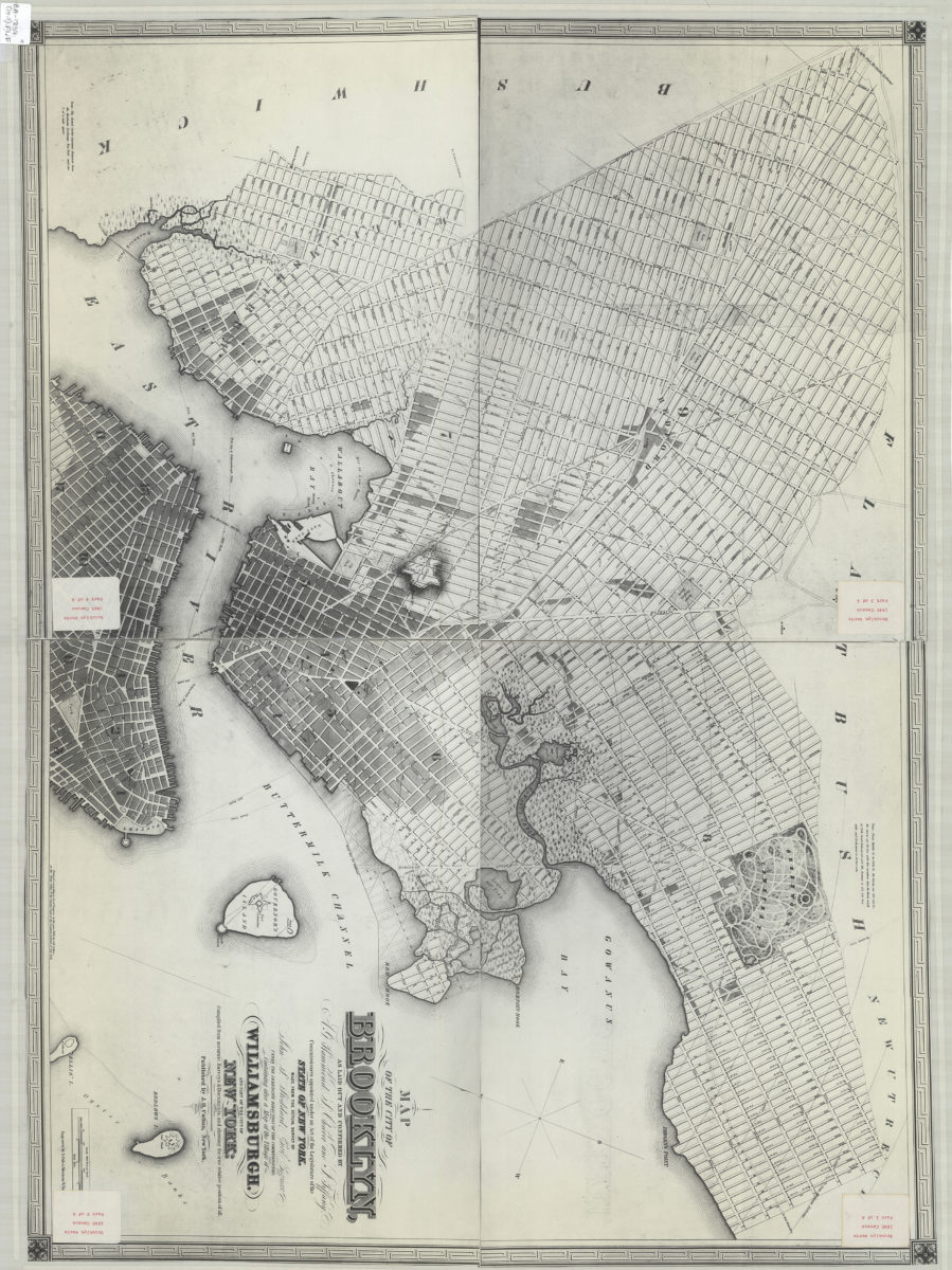
Map of the city of Brooklyn: as laid out and confirmed by A.G. Hammond, S. Cheever and J. Tiffany, commissioners appointed under an Act of the Legislature of the state of New York ; containing also a map of the village of Williamsburgh
Map of the city of Brooklyn: as laid out and confirmed by A.G. Hammond, S. Cheever and J. Tiffany, commissioners appointed under an Act of the Legislature of the state of New York ; containing also a map of the village of Williamsburgh
[19??]
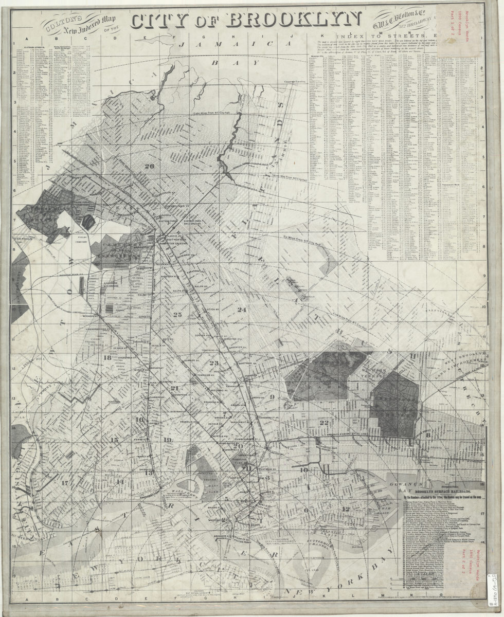
Colton’s new indexed map of the city of Brooklyn
Colton’s new indexed map of the city of Brooklyn
[19??]
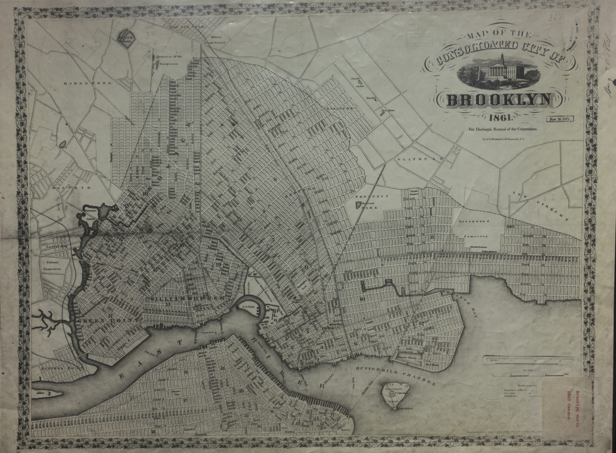
Map of the consolidated city of Brooklyn: for Bishop’s Manual of the Corporation
Map of the consolidated city of Brooklyn: for Bishop’s Manual of the Corporation
[19??]
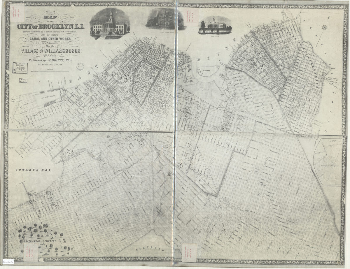
Map of the city of Brooklyn, L.I. : shewing the streets as at present existing, with the buildings, and the intended canal and other works … ; also the village of Williamsburgh
Map of the city of Brooklyn, L.I. : shewing the streets as at present existing, with the buildings, and the intended canal and other works … ; also the village of Williamsburgh
[19??]
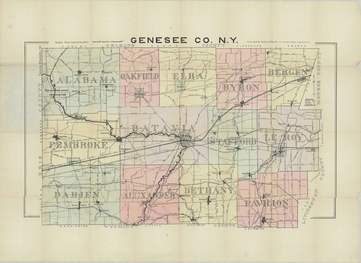
Genesee Co., N.Y.
Genesee Co., N.Y.
[19??]
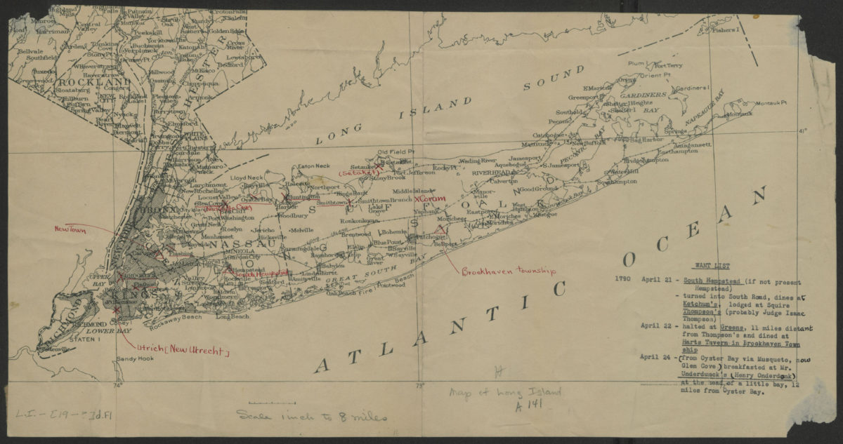
[Map of Long Island]
[Map of Long Island]
[19??]
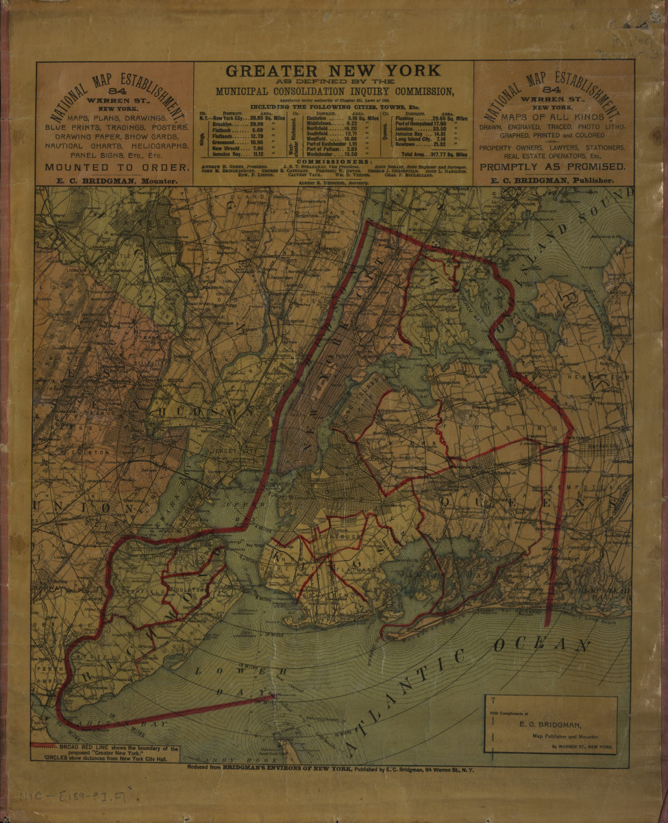
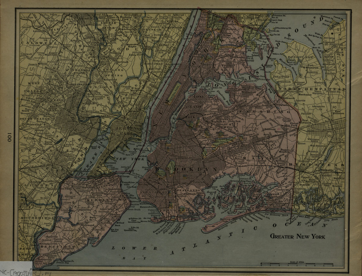
Greater New York
Greater New York
[1900]
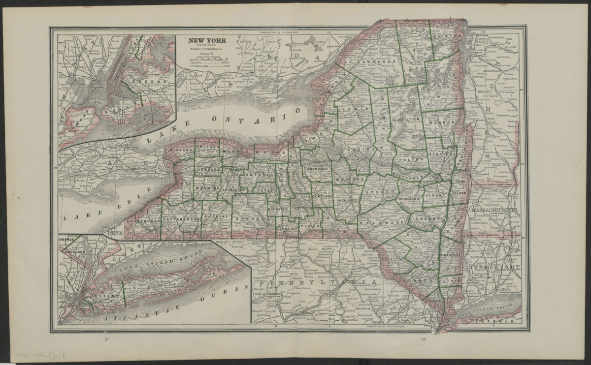
New York
New York
[19??]
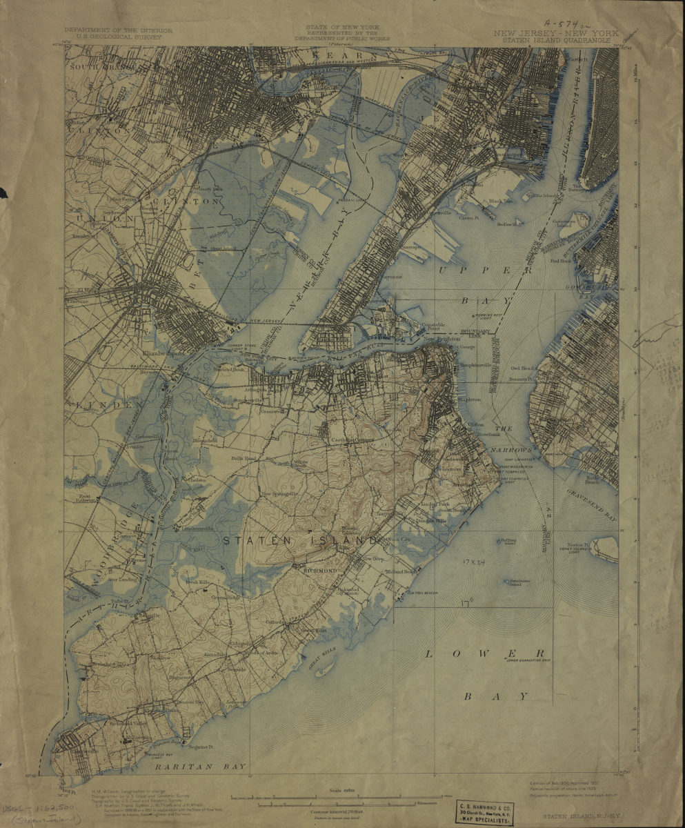
New Jersey- New York: Staten Island Quadrangle
New Jersey- New York: Staten Island Quadrangle
1900
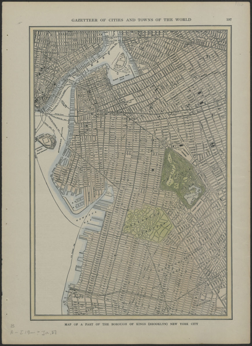
Map of a part of the borough of Kings (Brooklyn) New York City
Map of a part of the borough of Kings (Brooklyn) New York City
[1903-1909]
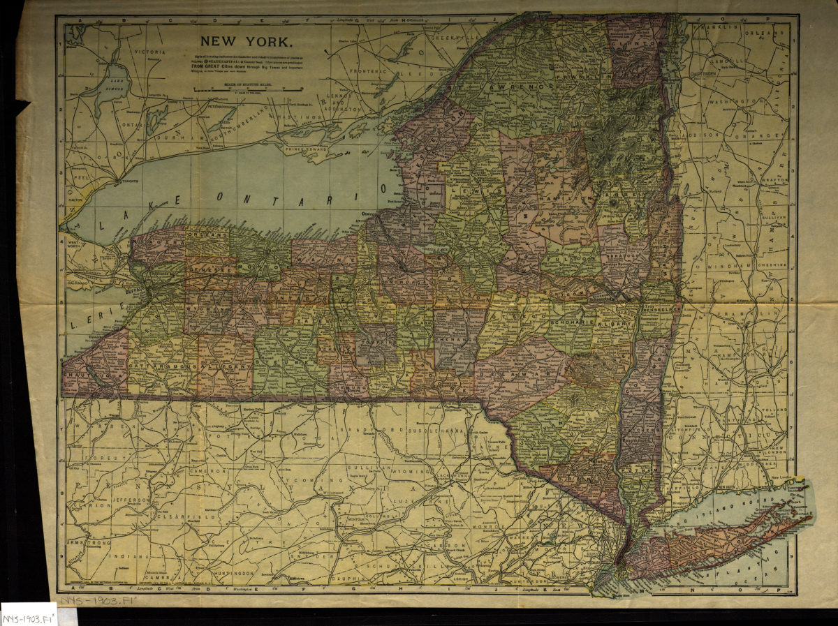
New York
New York
[1903; 1903]
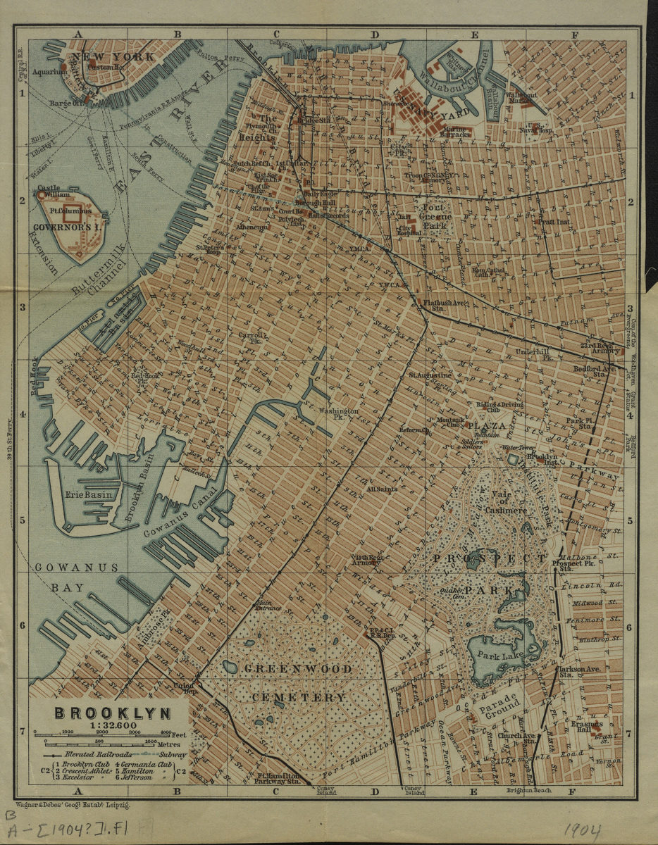
Brooklyn
Brooklyn
[1904]
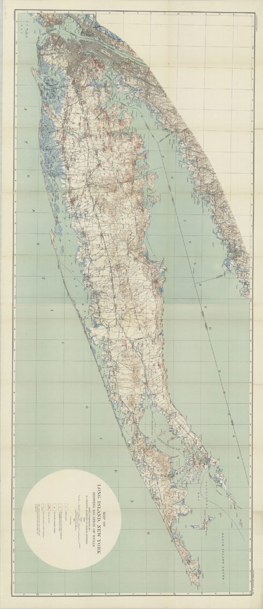
Map of Long Island, New York: showing location of wells: data compiled by A.C. Veatch, assisted by Isaiah Bowman
Map of Long Island, New York: showing location of wells: data compiled by A.C. Veatch, assisted by Isaiah Bowman
1904
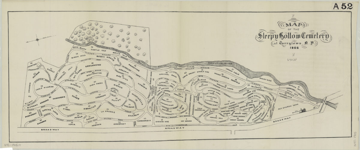
Map of the Sleepy Hollow Cemetery at Tarrytown, N.Y., 1905
Map of the Sleepy Hollow Cemetery at Tarrytown, N.Y., 1905
[ca. 1905]
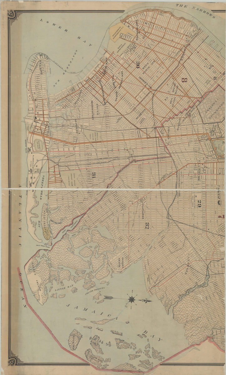
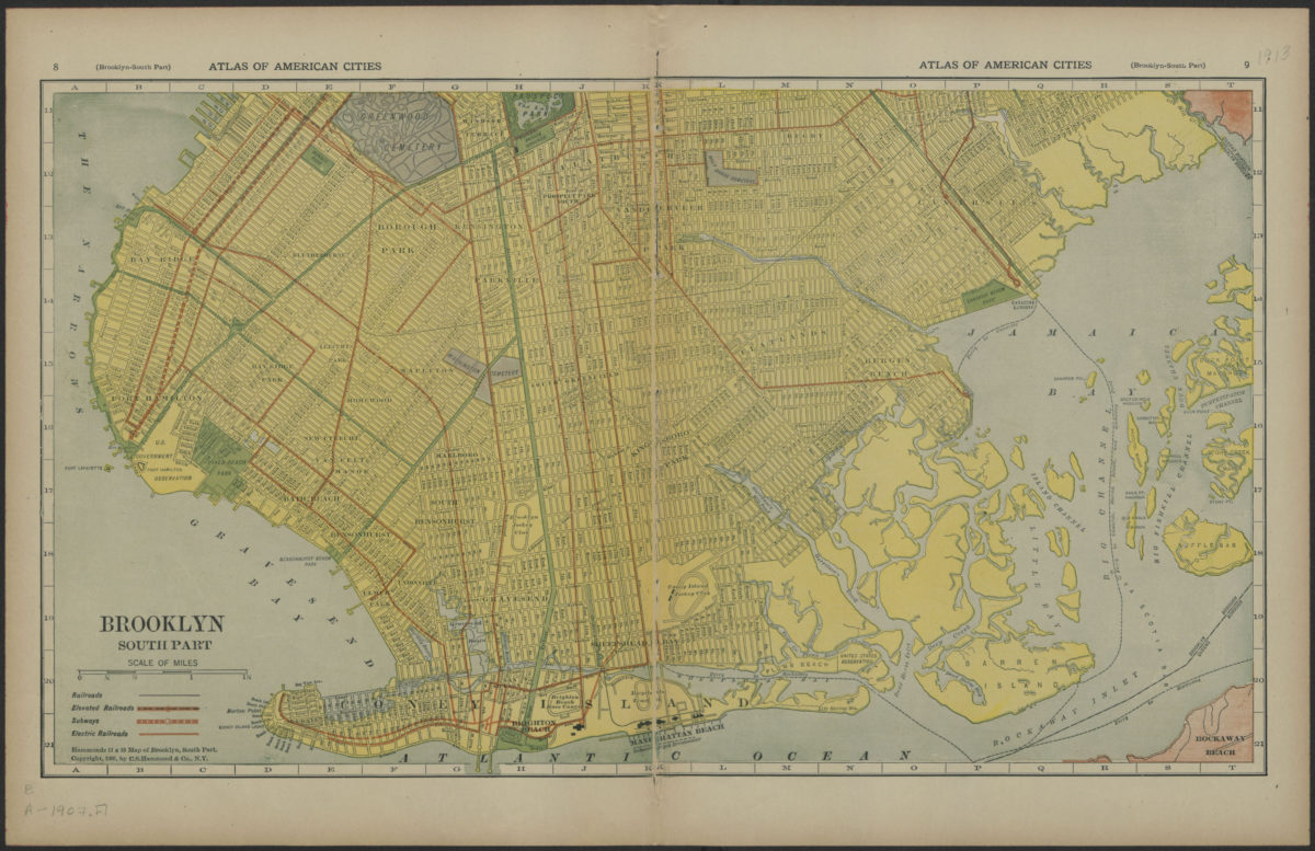
Brooklyn, south part
Brooklyn, south part
[1907]
Previous
1
2
3
4
Next