Center for Brooklyn History
Map Collections
Search
About
Othmer Library & Archives
Leisure
69 records
To further explore these maps, visit the
Search
page, and use the filters.
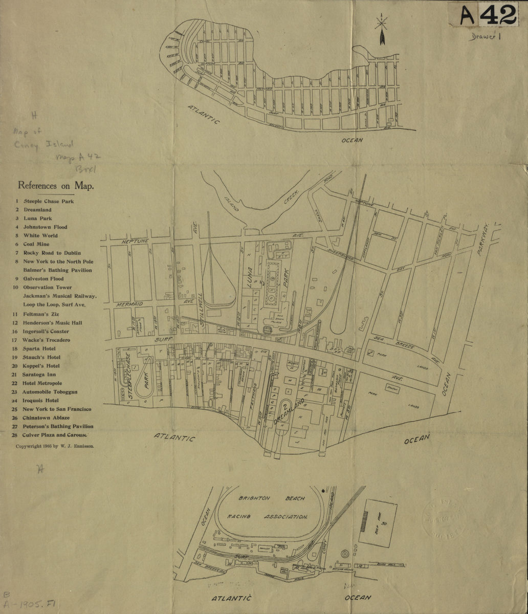
[Maps of Coney Island, 1905]
[Maps of Coney Island, 1905]
[1905; 1905]
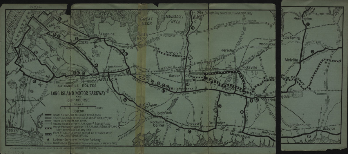
Automobile routes to Long Island Motor Parkway and Cup course
Automobile routes to Long Island Motor Parkway and Cup course
[1910; 1910]
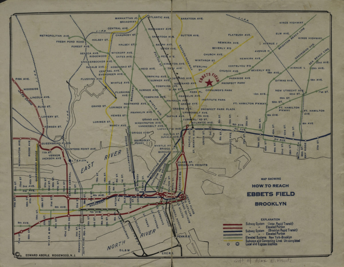
Map showing how to reach Ebbets Field, Brooklyn
Map showing how to reach Ebbets Field, Brooklyn
[1919]
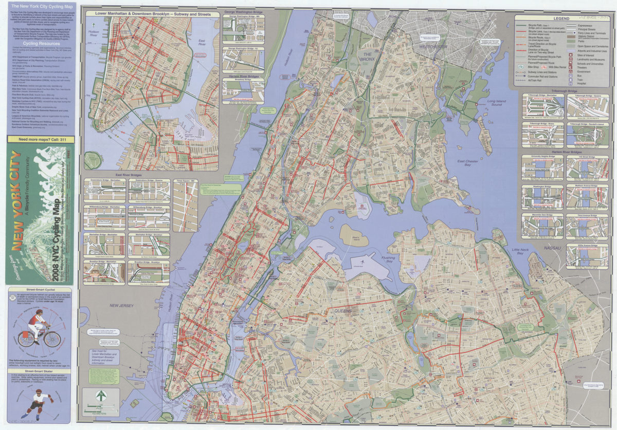
2008 NYC cycling map: 70 new miles of bicycle routes — historic districts — updated bike rental and safety info: the New York Cycling Map was designed by in-agency staff at the New York City Department of City Planning
2008 NYC cycling map: 70 new miles of bicycle routes — historic districts — updated bike rental and safety info: the New York Cycling Map was designed by in-agency staff at the New York City Department of City Planning
[ca. 2008]
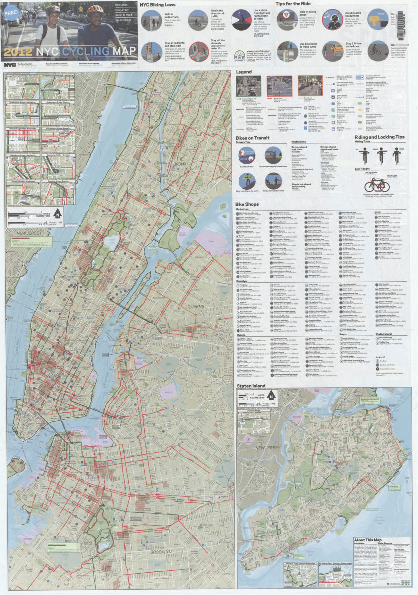
2012 NYC cycling map: new lanes, new layout, easier to read, nyc.gov/bikes: NYC, the City of New York, Department of Transportation, Department of City Planning, Department of Parks & Recreation
2012 NYC cycling map: new lanes, new layout, easier to read, nyc.gov/bikes: NYC, the City of New York, Department of Transportation, Department of City Planning, Department of Parks & Recreation
[2012]
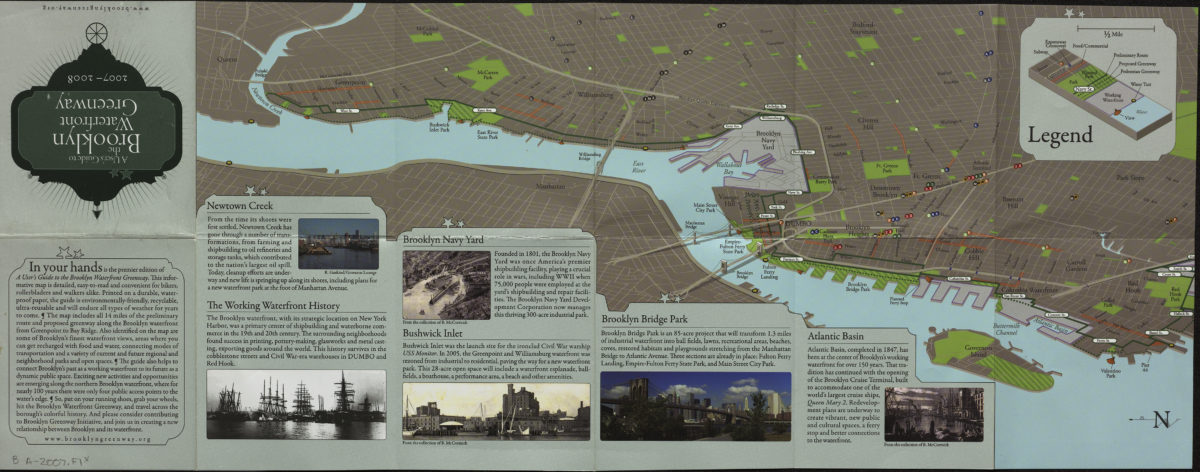
A user’s guide to the Brooklyn waterfront greenway: 2007-2008
A user’s guide to the Brooklyn waterfront greenway: 2007-2008
[2007; 2007]
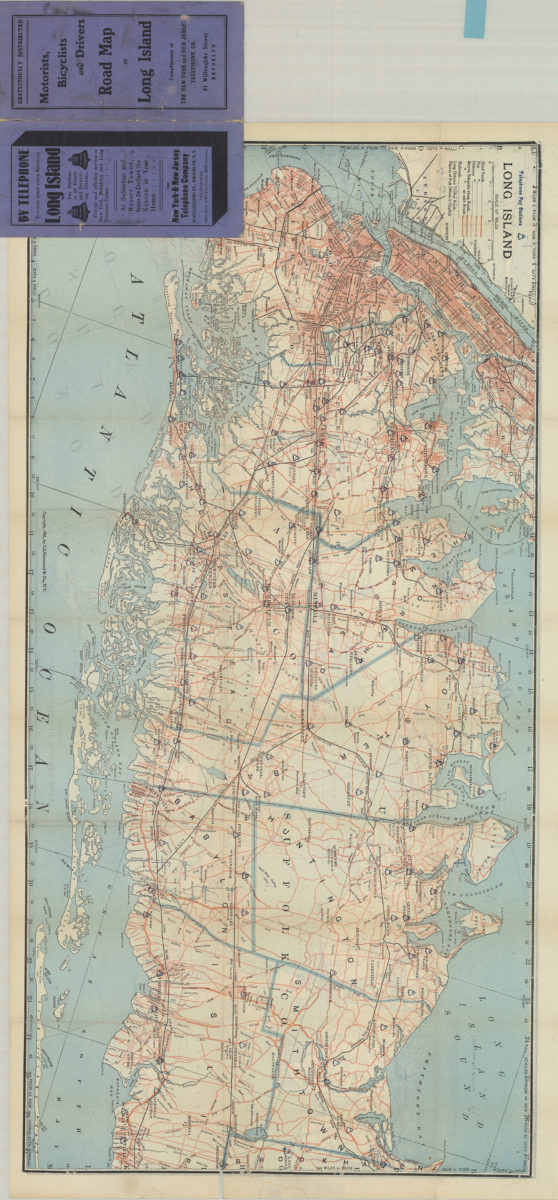
Motorists, bicyclists and drivers road map of Long Island: compliments of The New York and New Jersey Telephone Co
Motorists, bicyclists and drivers road map of Long Island: compliments of The New York and New Jersey Telephone Co
[1905; 1905]
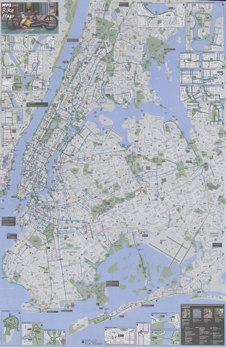
NYC 2015 bike map, free: nyc.gov/bikes
NYC 2015 bike map, free: nyc.gov/bikes
[2015]
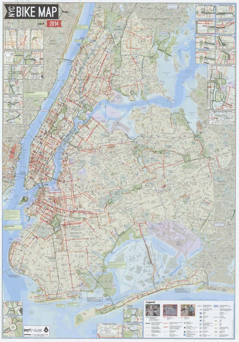
NYC bike map 2014: NYC Department of Transportation, Department of Parks & Recreation, Department of City Planning
NYC bike map 2014: NYC Department of Transportation, Department of Parks & Recreation, Department of City Planning
[2014]
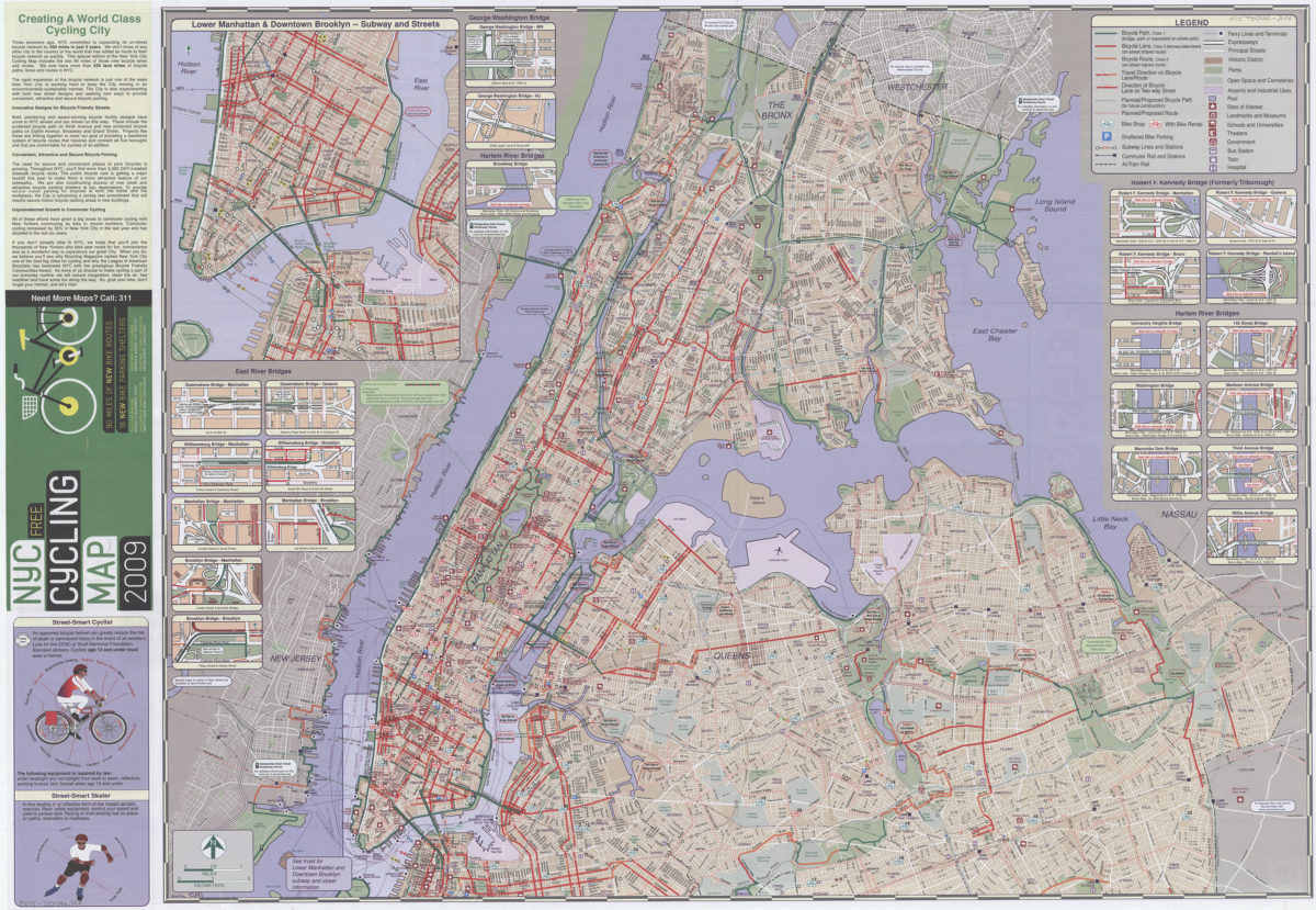
NYC cycling map 2009: 90 miles of new bike routes, 16 new bike parking shelters: the City of New York, Department of City Planning, Department of Transportation, Department of Parks & Recreation
NYC cycling map 2009: 90 miles of new bike routes, 16 new bike parking shelters: the City of New York, Department of City Planning, Department of Transportation, Department of Parks & Recreation
[ca. 2009]
NYC cycling map, 2006: the Bronx, Brooklyn, Manhattan, Queens, Staten Island : timeless fun! : five boroughs, one map!: the New York Cycling Map was designed by in-agency staff at the New York City Department of City Planning
NYC cycling map, 2006: the Bronx, Brooklyn, Manhattan, Queens, Staten Island : timeless fun! : five boroughs, one map!: the New York Cycling Map was designed by in-agency staff at the New York City Department of City Planning
[ca. 2006]
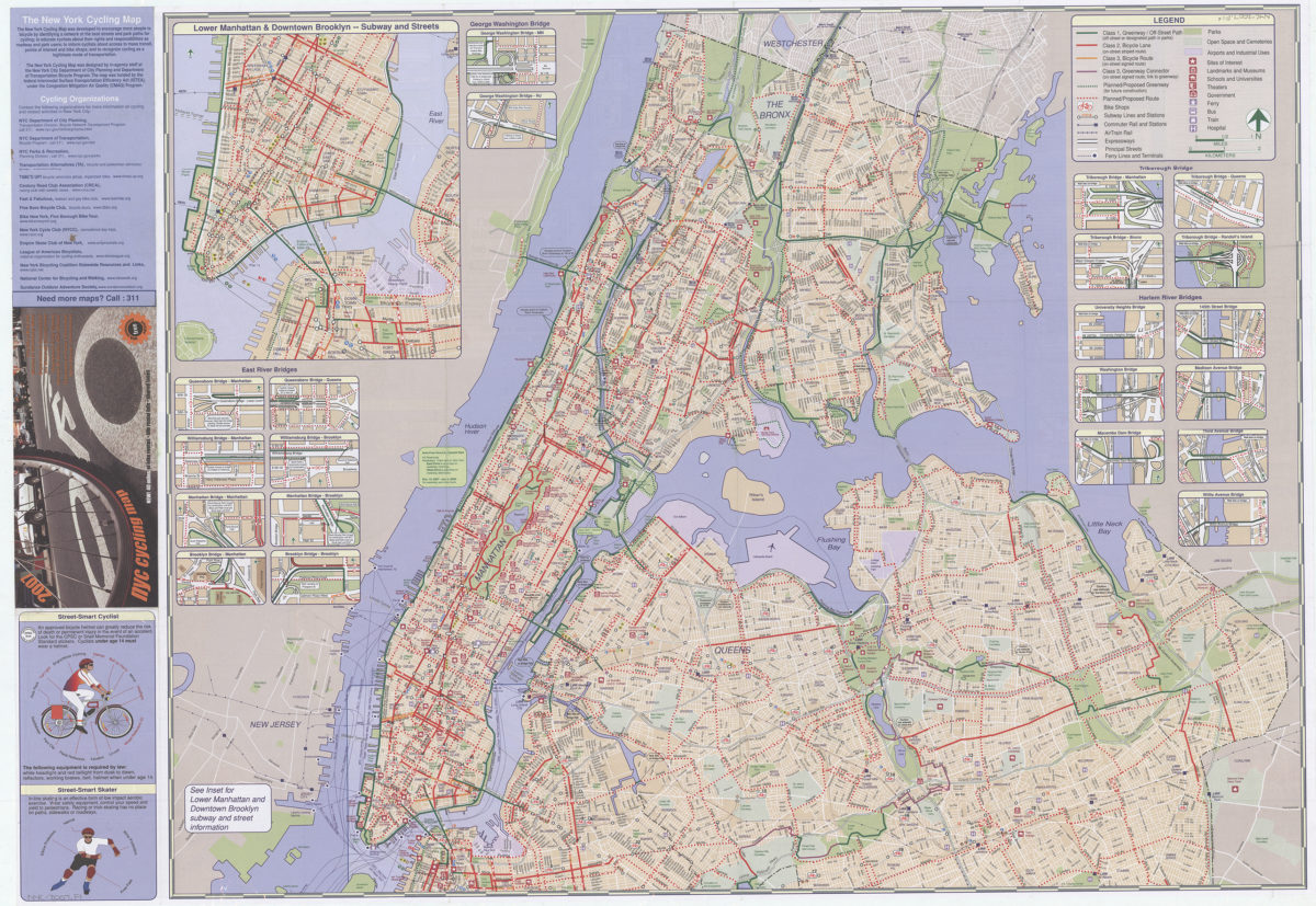
NYC cycling map, 2007: New! 40 miles of bike routes, bike rental info, and shared lanes: New York City Department of Transportation, Department of City Planning and Department of Parks and Recreation
NYC cycling map, 2007: New! 40 miles of bike routes, bike rental info, and shared lanes: New York City Department of Transportation, Department of City Planning and Department of Parks and Recreation
[2007; 2007]
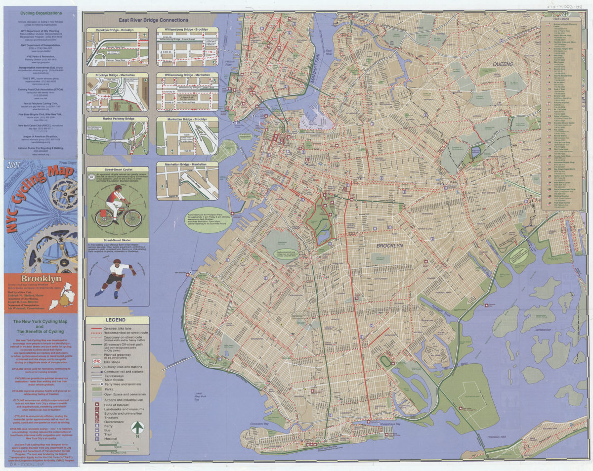
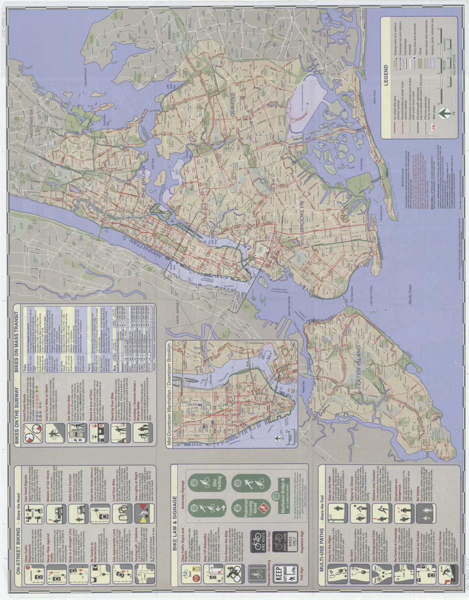
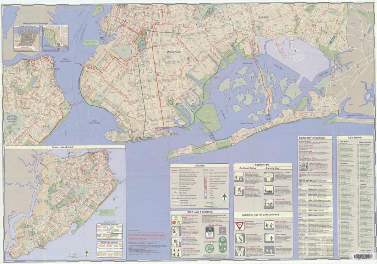
NYC cycling map, Brooklyn, 2001: double-sided map featuring Brooklyn bicycle routes and major citywide bicycle routes: … designed by in-agency staff at the New York City Department of City Planning and Department of Transportation Bicycle Program
NYC cycling map, Brooklyn, 2001: double-sided map featuring Brooklyn bicycle routes and major citywide bicycle routes: … designed by in-agency staff at the New York City Department of City Planning and Department of Transportation Bicycle Program
[2001]
NYC cycling map, Manhattan, 2001: double-sided map featuring Manhattan bicycle routes and major citywide bicycle routes: … designed by in-agency staff at the New York City Department of City Planning and Department of Transportation Bicycle Program
NYC cycling map, Manhattan, 2001: double-sided map featuring Manhattan bicycle routes and major citywide bicycle routes: … designed by in-agency staff at the New York City Department of City Planning and Department of Transportation Bicycle Program
[2001]
NYC cycling map: the Bronx, Brooklyn, Manhattan, Queens, Staten Island : New York City : updated! all five boros in one map! : 2002: … designed by in-agency staff at the New York City Department of City Planning
NYC cycling map: the Bronx, Brooklyn, Manhattan, Queens, Staten Island : New York City : updated! all five boros in one map! : 2002: … designed by in-agency staff at the New York City Department of City Planning
[ca. 2002]
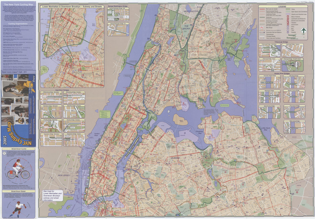
NYC cycling map: the Bronx, Brooklyn, Manhattan, Queens, Staten Island : 2005: five boroughs, one map!: … designed by in-agency staff at the New York City Department of City Planning and Department of Transportation Bicycle Program
NYC cycling map: the Bronx, Brooklyn, Manhattan, Queens, Staten Island : 2005: five boroughs, one map!: … designed by in-agency staff at the New York City Department of City Planning and Department of Transportation Bicycle Program
[ca. 2005]
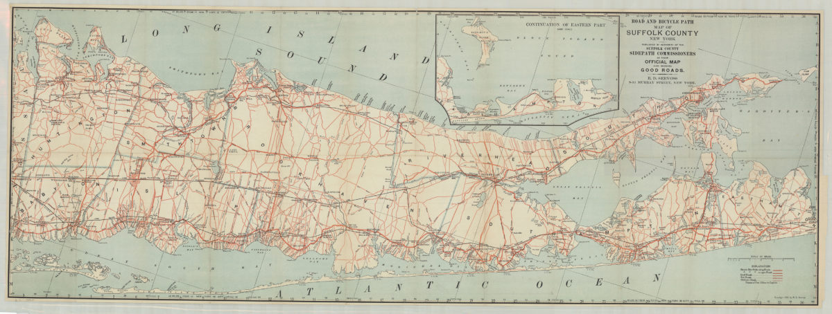
Road and bicycle path map of Suffolk County, New York: R.D. Servoss
Road and bicycle path map of Suffolk County, New York: R.D. Servoss
[ca. 1900]
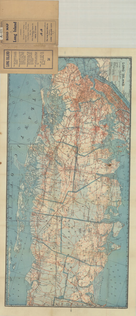
Road map of Long Island
Road map of Long Island
[1910; 1906]
Section 1, cyclists’ road map of New Jersey
Section 1, cyclists’ road map of New Jersey
[ca. 1890]
Reading hot spots in New York City
Reading hot spots in New York City
[2008]
New York state parks: C. Koetzner
New York state parks: C. Koetzner
[195?]
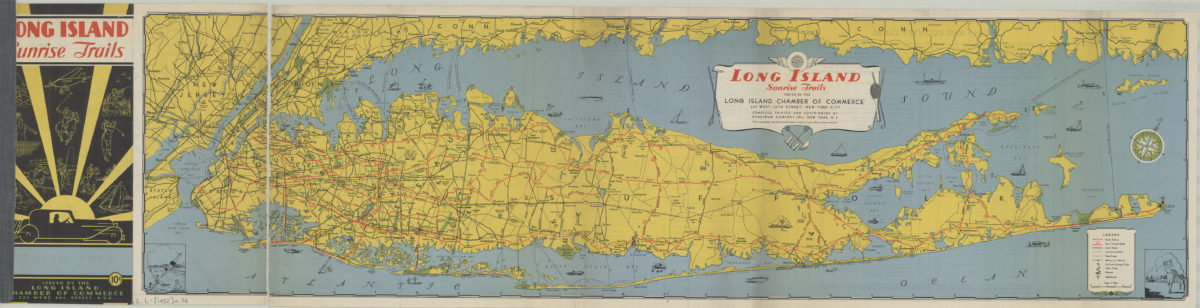
Long Island sunrise trails: issued by the Long Island Chamber of commerce, compiled … by Hagstrom Map Company
Long Island sunrise trails: issued by the Long Island Chamber of commerce, compiled … by Hagstrom Map Company
[1932]
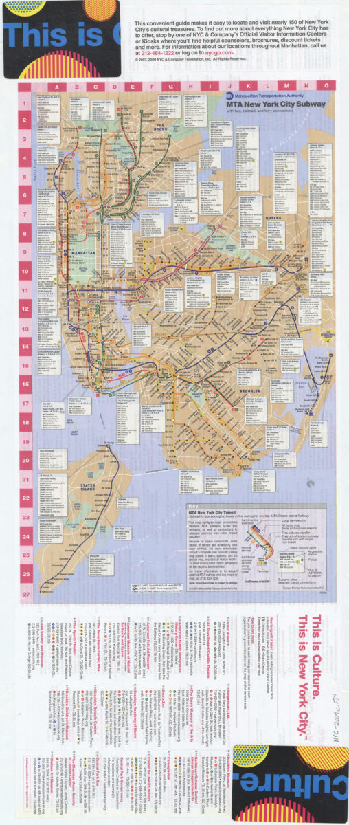
MTA New York City subway with bus, railroad and ferry connections
MTA New York City subway with bus, railroad and ferry connections
[2009; ca. 2009]
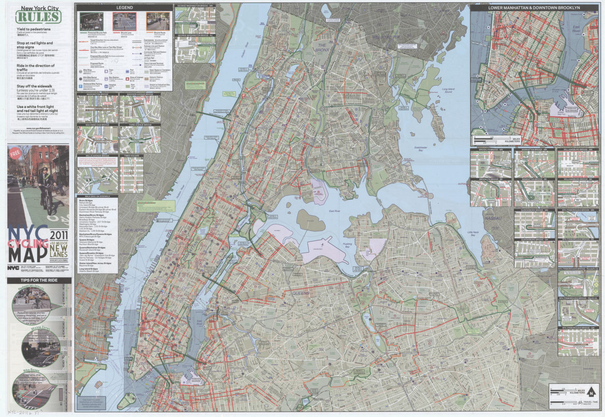
#ERROR!
#ERROR!
[ca. 2011]
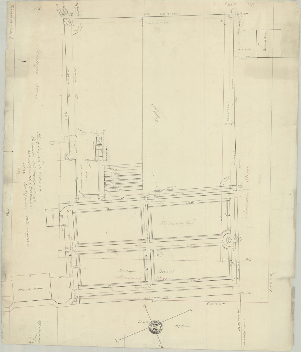
Plan of large & small gardens at the Pierrepont Homestead, Brooklyn: as surveyed … by W.C. Pierrepont
Plan of large & small gardens at the Pierrepont Homestead, Brooklyn: as surveyed … by W.C. Pierrepont
March 31 & Apr. 2, 1821
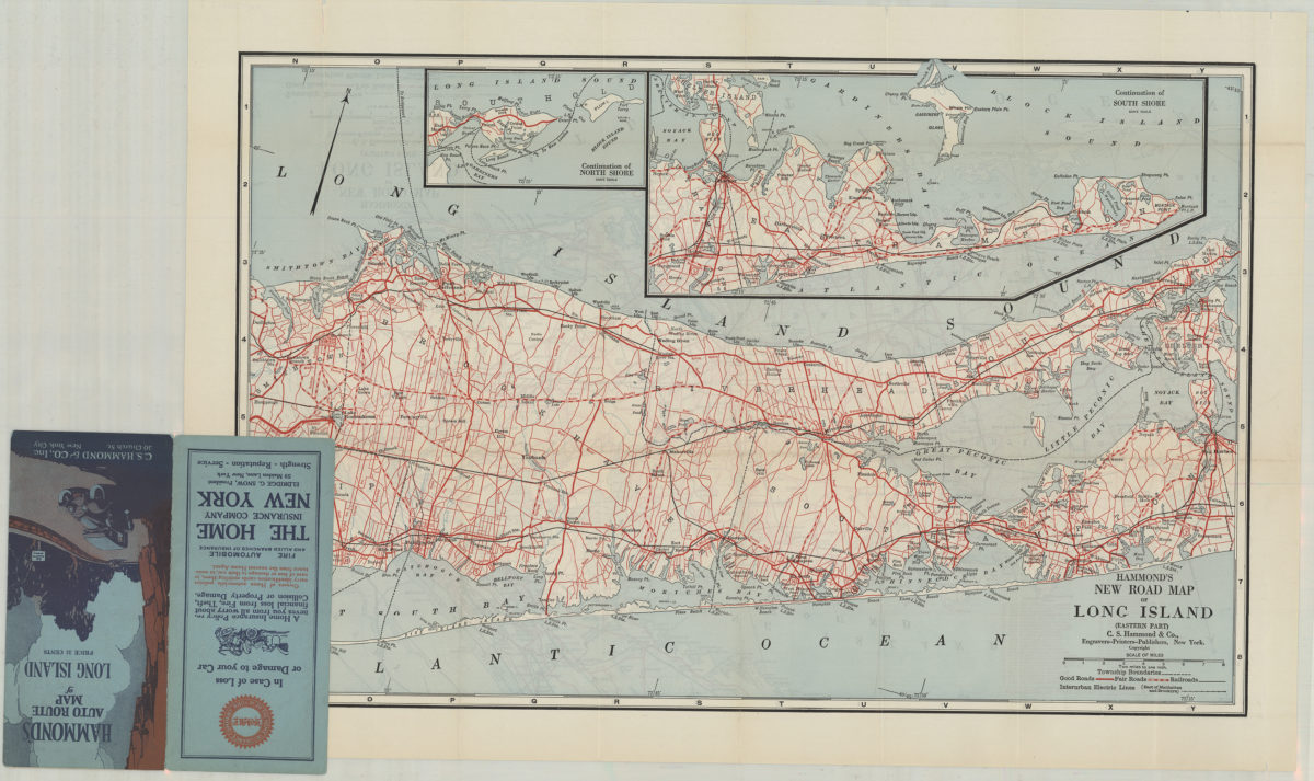
Hammond’s new road map of Long Island: C.S. Hammond & Co
Hammond’s new road map of Long Island: C.S. Hammond & Co
[19??]
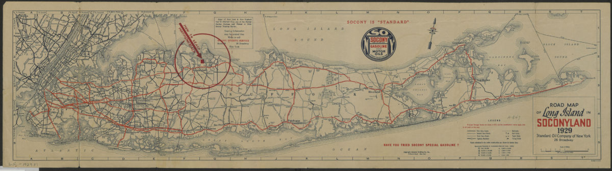
Road map of Long Island in Soconyland, 1929: copyright General Drafting Co., Inc
Road map of Long Island in Soconyland, 1929: copyright General Drafting Co., Inc
[1929]
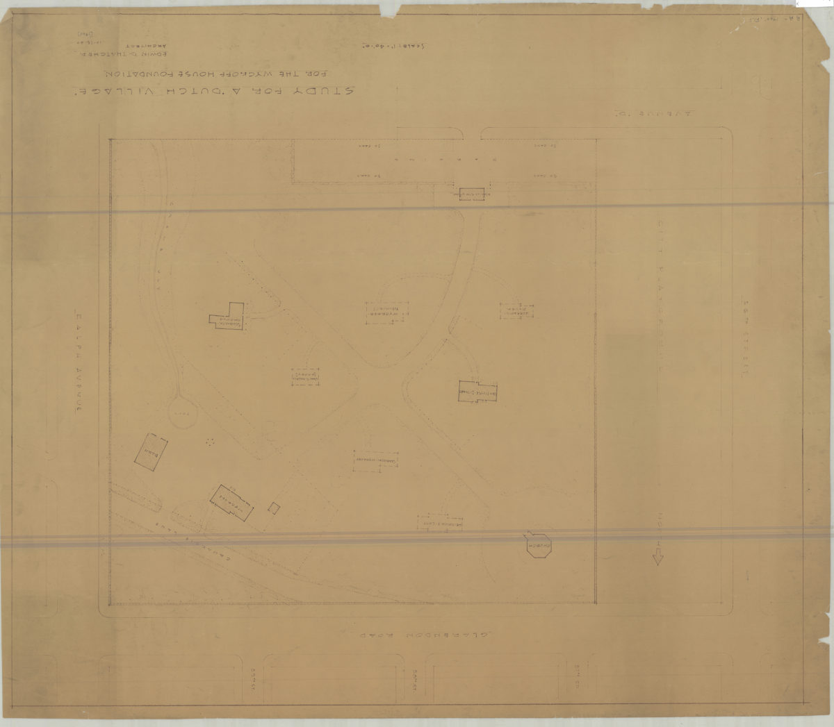
Study for a ‘Dutch village’ for the Wykoff House Foundation: Edwin D. Thatcher, architect
Study for a ‘Dutch village’ for the Wykoff House Foundation: Edwin D. Thatcher, architect
Oct-60
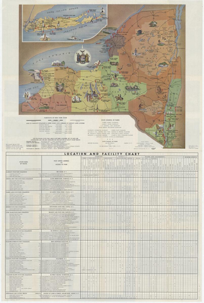
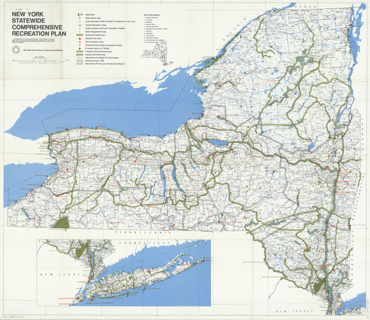
New York statewide comprehensive recreation plan
New York statewide comprehensive recreation plan
[1990]
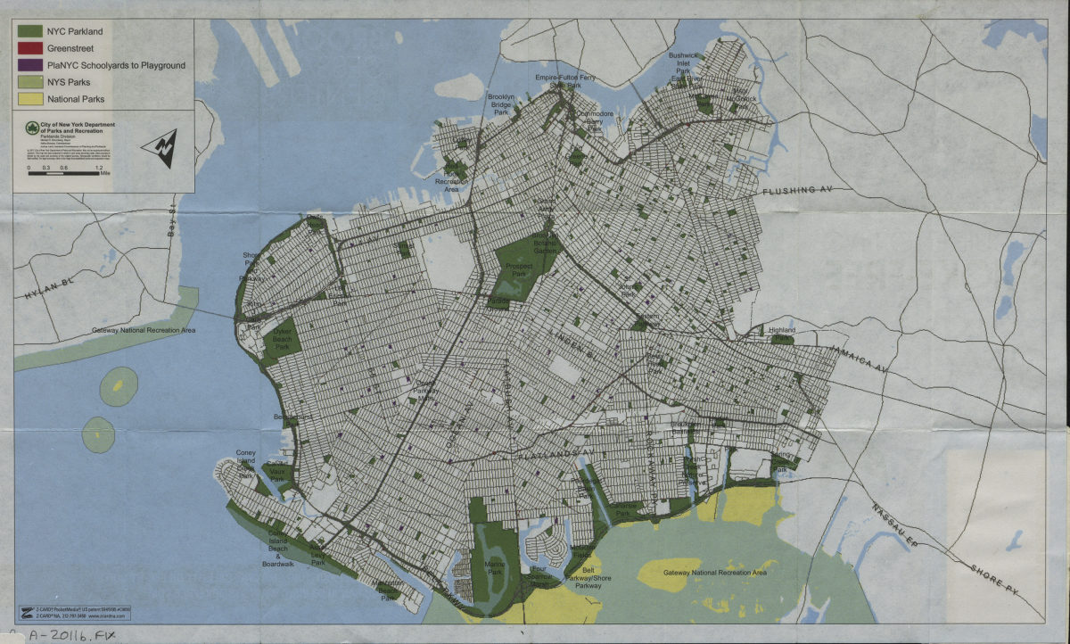
A guide to smoke-fee parks and beaches in Brooklyn
A guide to smoke-fee parks and beaches in Brooklyn
[2011; 2011]
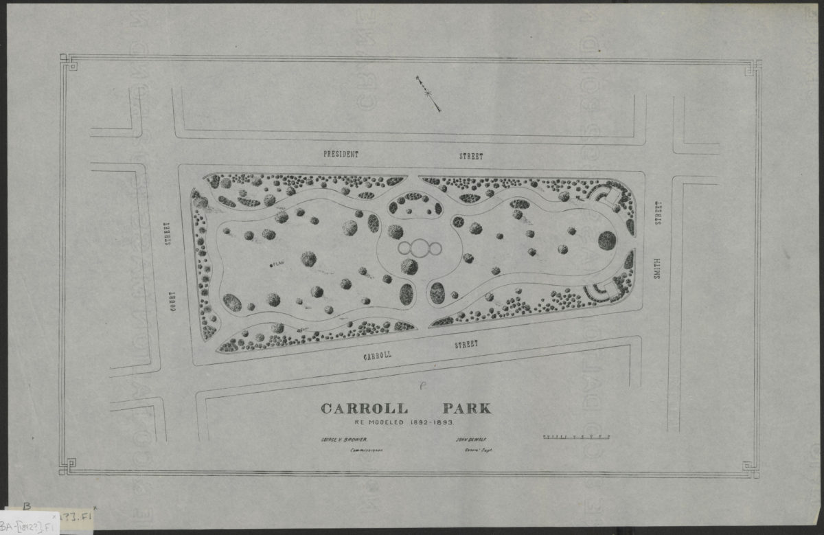
Carroll Park: re-modeled 1892-1893
Carroll Park: re-modeled 1892-1893
[1892]
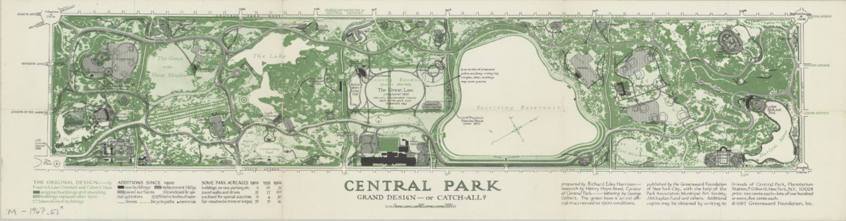
Central Park, grand design–or catch-all?: prepared by Richard Edes Harrison ; research by Henry Hope Reed, curator of Central Park ; lettering by George Colbert
Central Park, grand design–or catch-all?: prepared by Richard Edes Harrison ; research by Henry Hope Reed, curator of Central Park ; lettering by George Colbert
[ca. 1967]
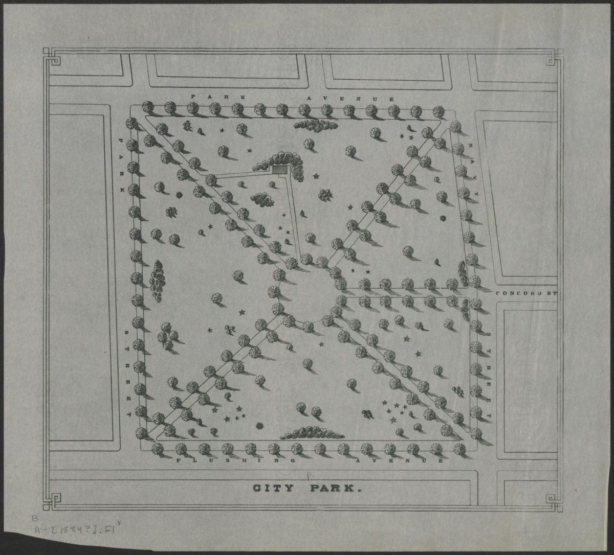
City Park
City Park
[1884]
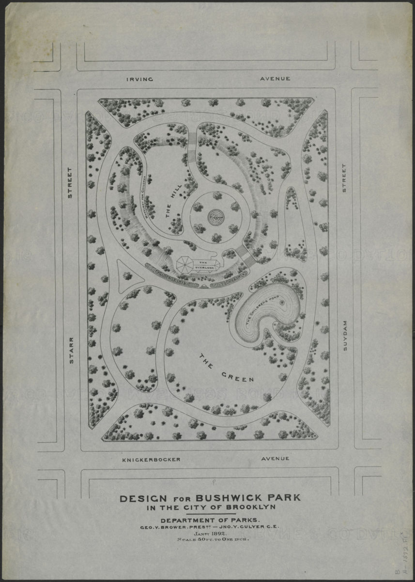
Design for Bushwick Park in the city of Brooklyn
Design for Bushwick Park in the city of Brooklyn
January 1892
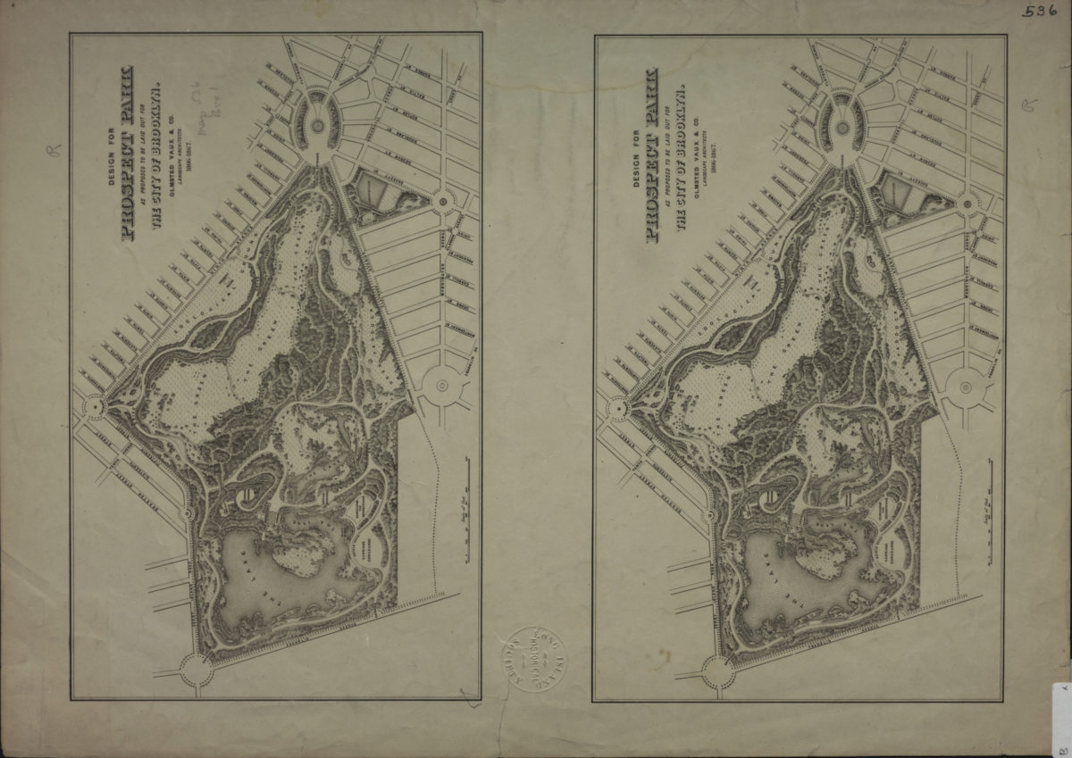
Design for Prospect Park as proposed to be laid out for the city of Brooklyn: Olmsted, Vaux & Co., landscape architects
Design for Prospect Park as proposed to be laid out for the city of Brooklyn: Olmsted, Vaux & Co., landscape architects
[1867]
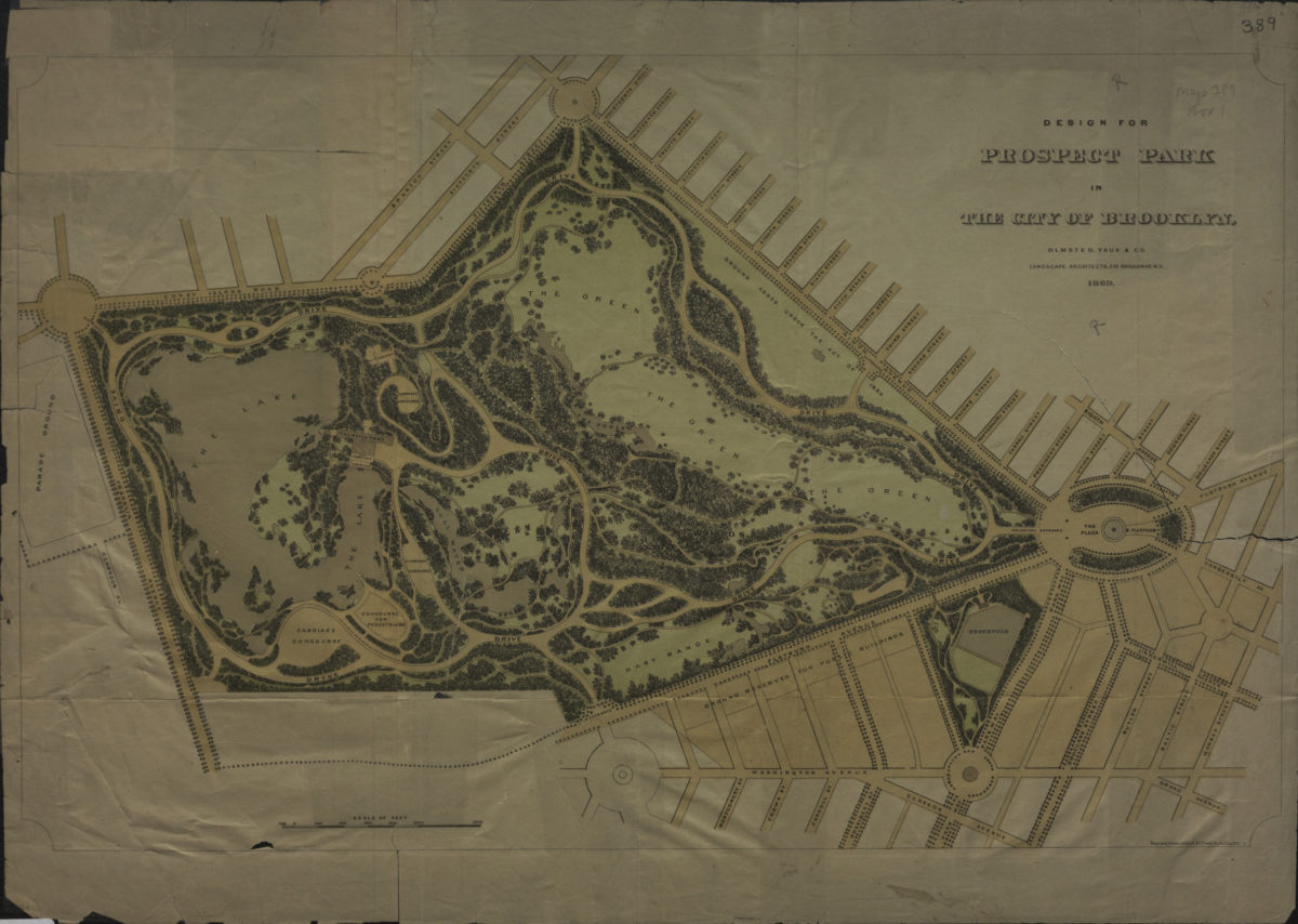
Design for Prospect Park in the city of Brooklyn: Olmsted, Vaux & Co., landscape architects
Design for Prospect Park in the city of Brooklyn: Olmsted, Vaux & Co., landscape architects
1869
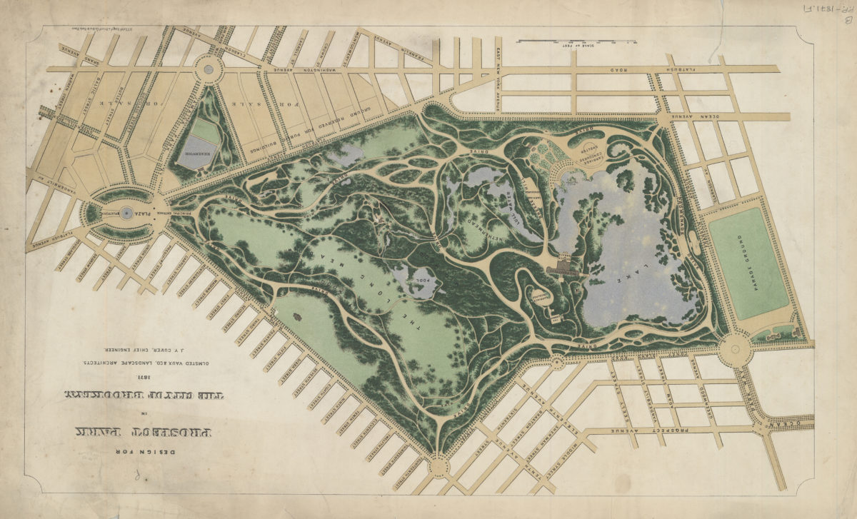
Design for Prospect Park in the City of Brooklyn: Olmsted, Vaux & Co., landscape architects ; J.Y. Culyer, chief engineer
Design for Prospect Park in the City of Brooklyn: Olmsted, Vaux & Co., landscape architects ; J.Y. Culyer, chief engineer
1871
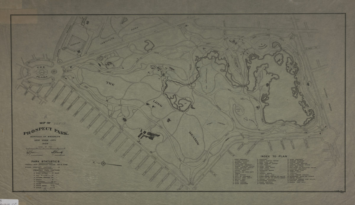
Map of Prospect Park, Borough of Brooklyn, New York City, 1909
Map of Prospect Park, Borough of Brooklyn, New York City, 1909
1909
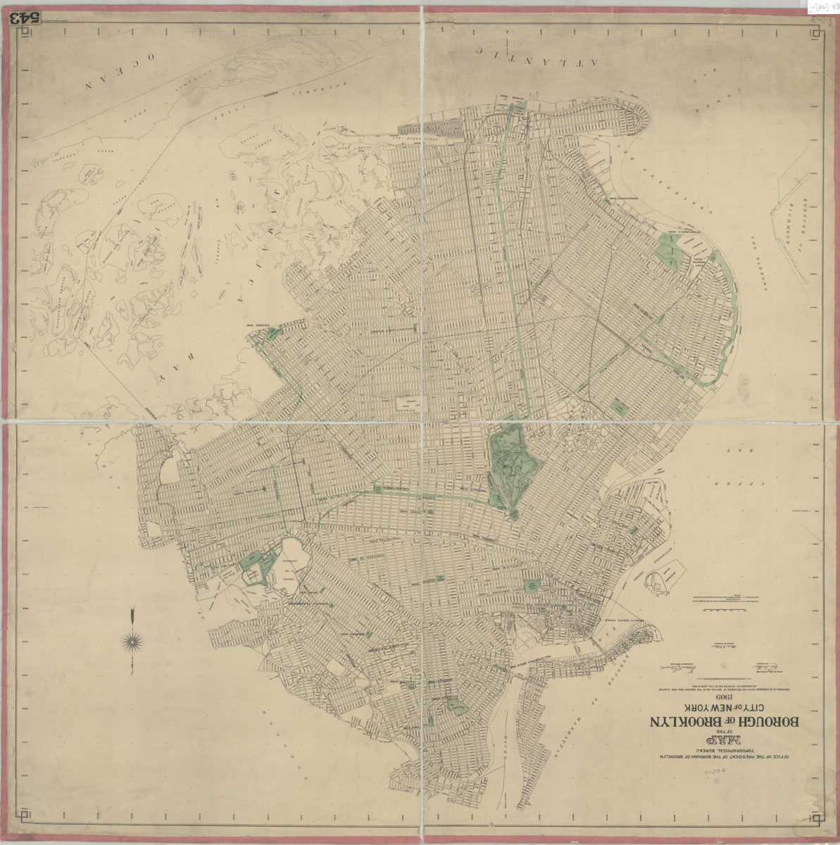
Map of the Borough of Brooklyn, City of New York, 1909: Office of the President of the Borough of Brooklyn, Topographical Bureau
Map of the Borough of Brooklyn, City of New York, 1909: Office of the President of the Borough of Brooklyn, Topographical Bureau
Oct-09
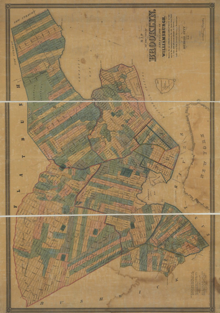
Map of the city of Brooklyn and village of Williamsburgh: showing the size of blocks and width of streets as laid out by the commissioners, the old farm lines, water line, and all recent changes in streets
Map of the city of Brooklyn and village of Williamsburgh: showing the size of blocks and width of streets as laid out by the commissioners, the old farm lines, water line, and all recent changes in streets
1846
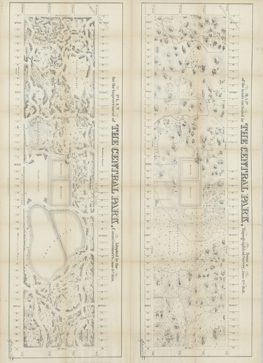
Map of the lands included in the Central Park, from a topographical survey, June 17th, 1856 ; Plan for the improvement of the Central Park, adopted by the Commissioners, June 3rd, 1856
Map of the lands included in the Central Park, from a topographical survey, June 17th, 1856 ; Plan for the improvement of the Central Park, adopted by the Commissioners, June 3rd, 1856
[1856]
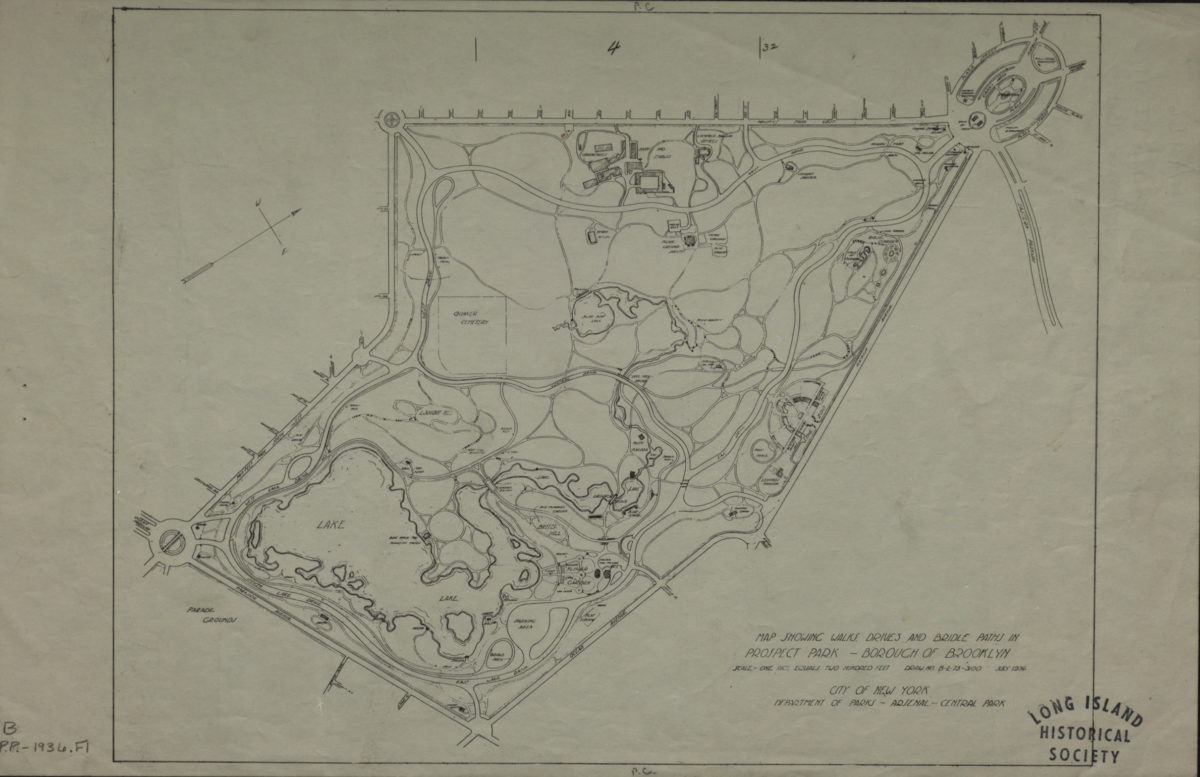
Map showing walks, drives and bridle paths in Prospect Park, Borough of Brooklyn
Map showing walks, drives and bridle paths in Prospect Park, Borough of Brooklyn
1936
Marine Park, Brooklyn, New York City: copied from drawing of Charles Downing Lay, landscape architect, 101 Park Ave., New York City
Marine Park, Brooklyn, New York City: copied from drawing of Charles Downing Lay, landscape architect, 101 Park Ave., New York City
[1932]
Plan for the improvement of Prospect Park, Brooklyn: Egbert L. Viele, topg. engineer
Plan for the improvement of Prospect Park, Brooklyn: Egbert L. Viele, topg. engineer
1861
Plan for the Parade Ground: proposed to be laid out for Kings Co., L.I.
Plan for the Parade Ground: proposed to be laid out for Kings Co., L.I.
[186?]
Plan of Central Park, New York City
Plan of Central Park, New York City
[186?]
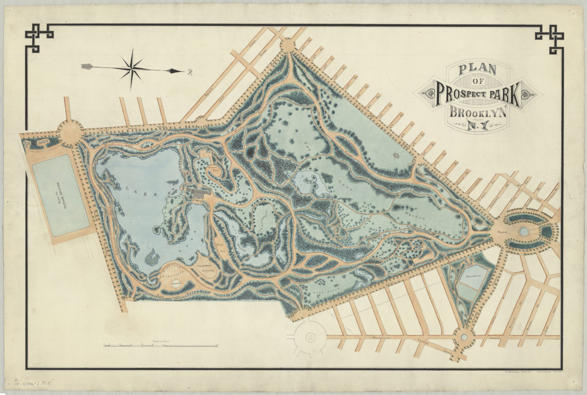
Plan of Prospect Park (comprising 630 acres), Brooklyn
Plan of Prospect Park (comprising 630 acres), Brooklyn
[186?]
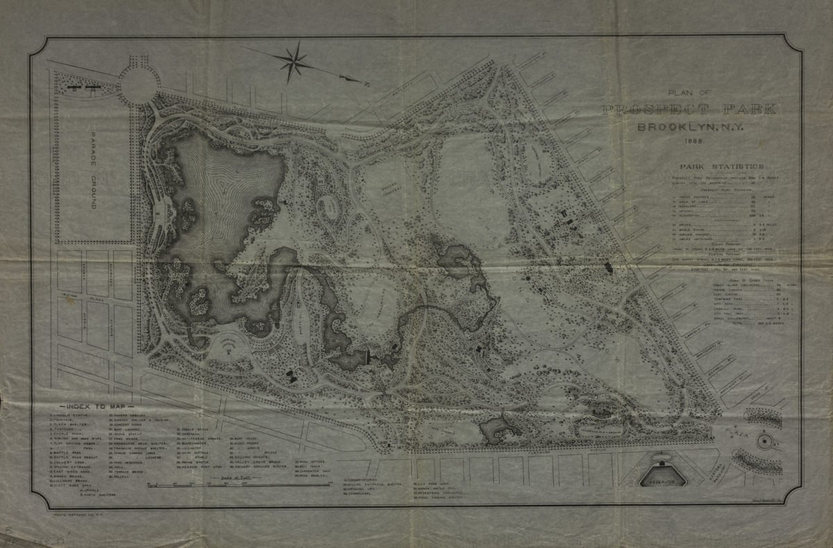
Plan of Prospect Park, Brooklyn, N.Y.: Chas. P. Woodruff, del
Plan of Prospect Park, Brooklyn, N.Y.: Chas. P. Woodruff, del
1888
Plan of Prospect Park, Brooklyn, N.Y.: Jos. Strachan, N.Y.U. ’83
Plan of Prospect Park, Brooklyn, N.Y.: Jos. Strachan, N.Y.U. ’83
[1886]
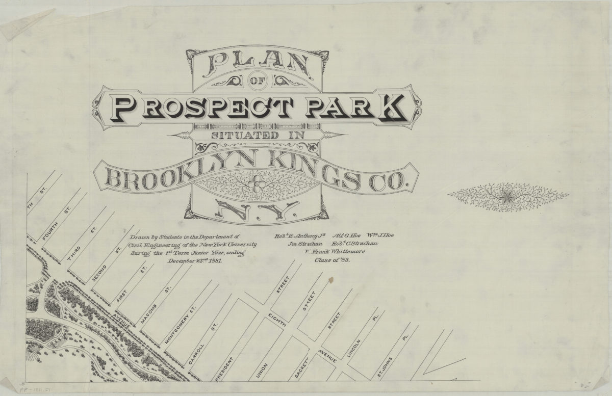
Plan of Prospect Park, situated in Brooklyn, Kings Co., N.Y.: drawn by students in the Department of Civil Engineering of the New York University during the 1st term junior year, ending December 23rd 1881
Plan of Prospect Park, situated in Brooklyn, Kings Co., N.Y.: drawn by students in the Department of Civil Engineering of the New York University during the 1st term junior year, ending December 23rd 1881
[1881]
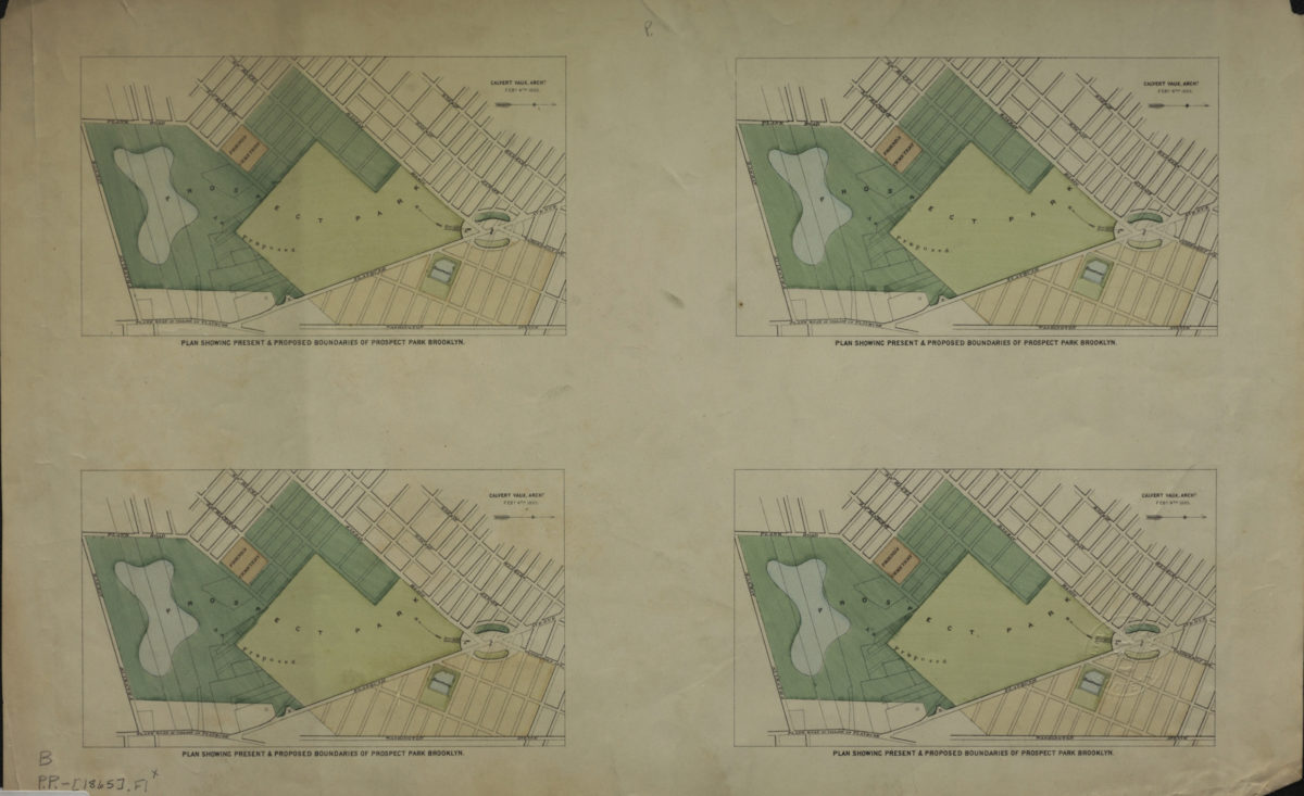
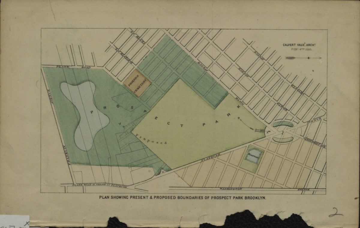
Plan showing present & proposed boundaries of Prospect Park Brooklyn: Calvert Vaux, archt
Plan showing present & proposed boundaries of Prospect Park Brooklyn: Calvert Vaux, archt
[1865]
Plan showing present & proposed boundaries of Prospect Park Brooklyn: Calvert Vaux, archt
Plan showing present & proposed boundaries of Prospect Park Brooklyn: Calvert Vaux, archt
[1866]
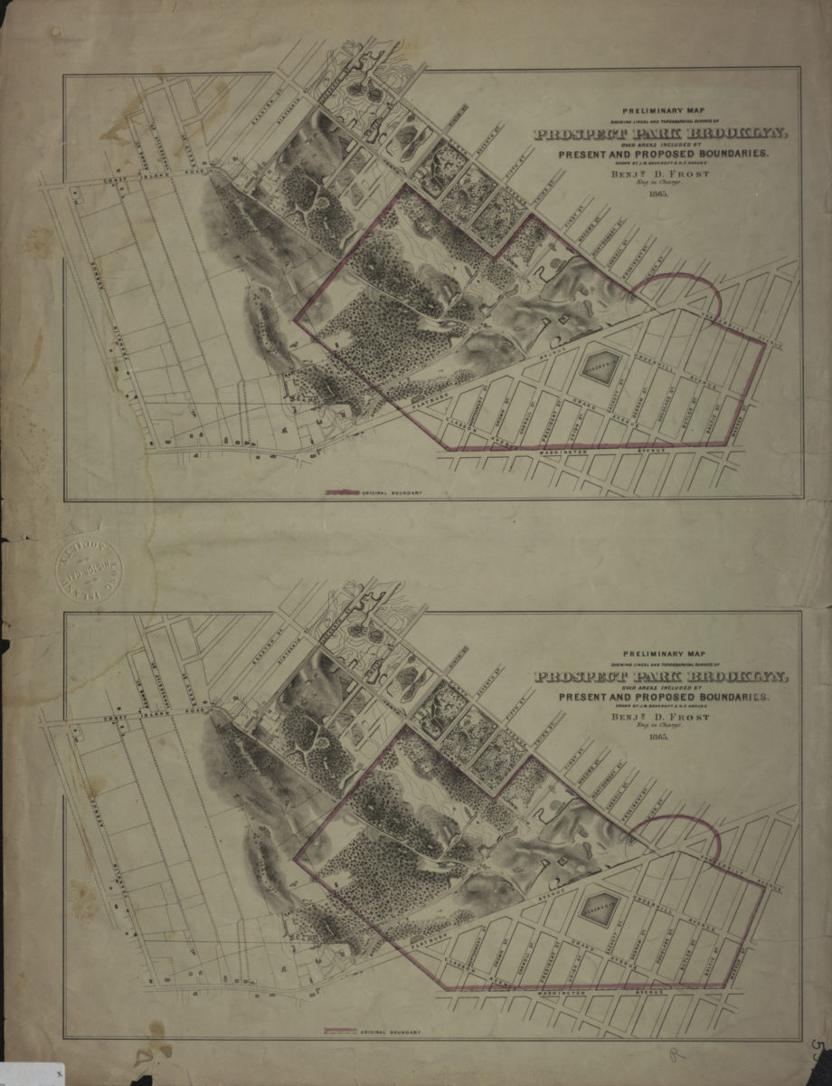
Preliminary map showing lineal and topographical surveys of Prospect Park Brooklyn, over areas included by present and proposed boundaries: drawn by J.M. Bancroft & H.F. Krause
Preliminary map showing lineal and topographical surveys of Prospect Park Brooklyn, over areas included by present and proposed boundaries: drawn by J.M. Bancroft & H.F. Krause
1865
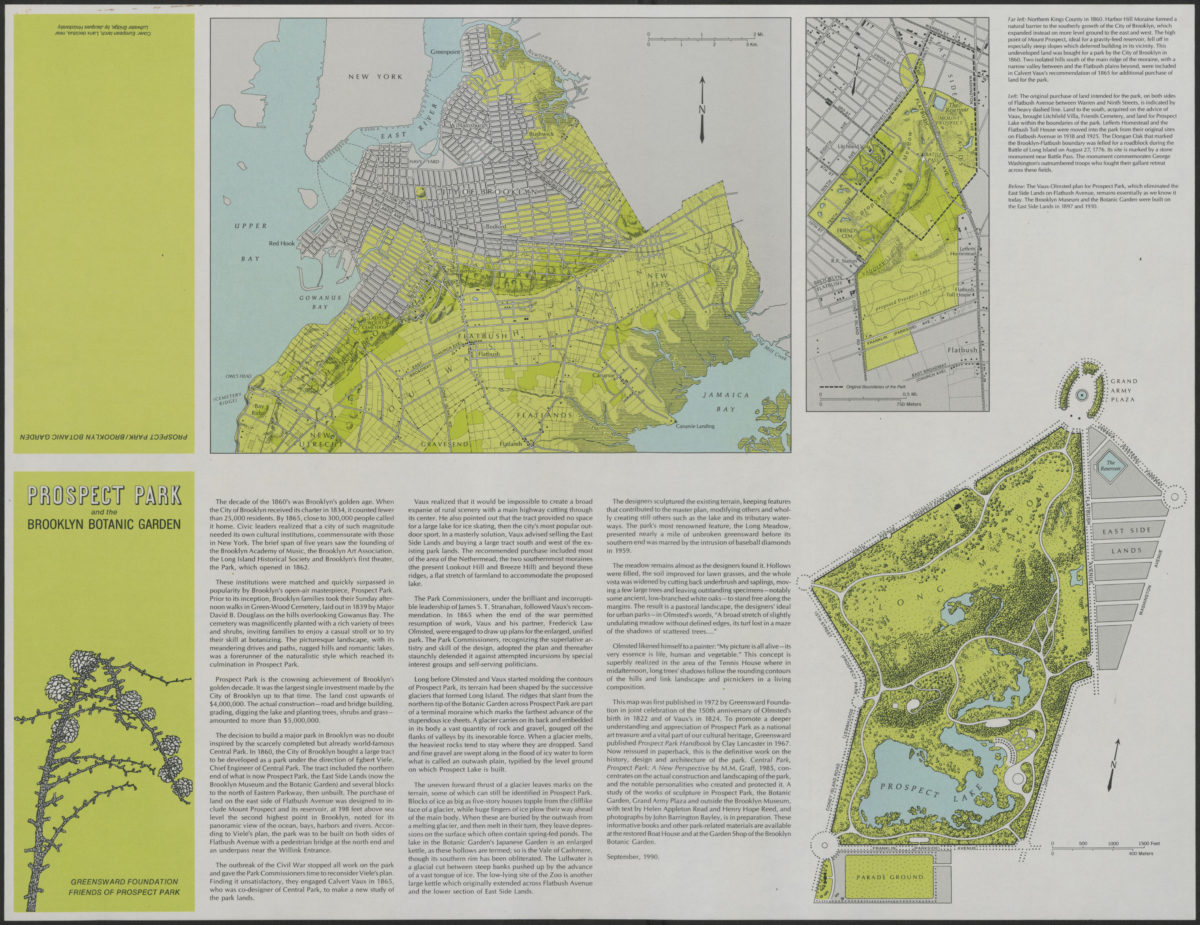
Prospect Park and the Brooklyn Botanic Garden
Prospect Park and the Brooklyn Botanic Garden
[1990; 1990]
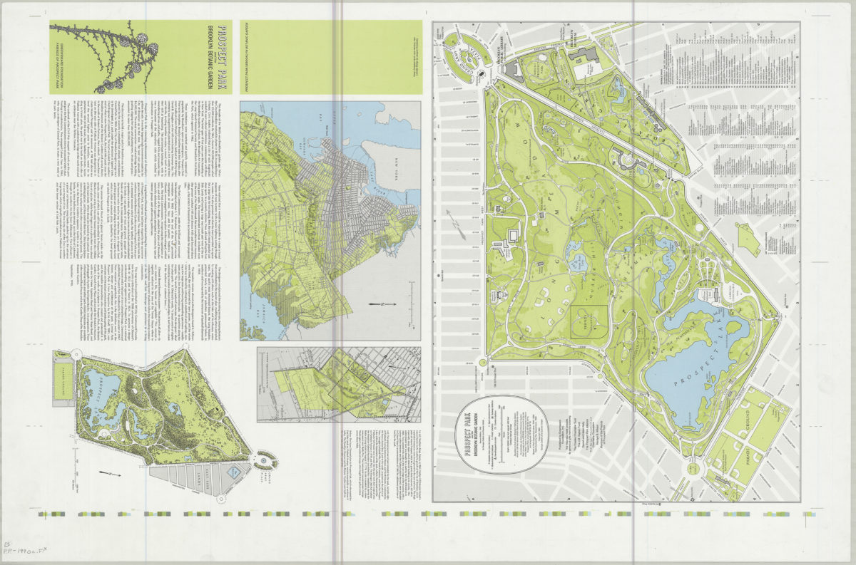
Prospect Park and the Brooklyn Botanic Garden: by George Colbert and Guenther Vollath
Prospect Park and the Brooklyn Botanic Garden: by George Colbert and Guenther Vollath
[ca. 1972]
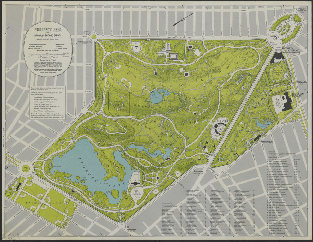
Prospect Park and the Brooklyn Botanic Garden: by George Corbert and Guenter Vollath
Prospect Park and the Brooklyn Botanic Garden: by George Corbert and Guenter Vollath
[ca. 1990]
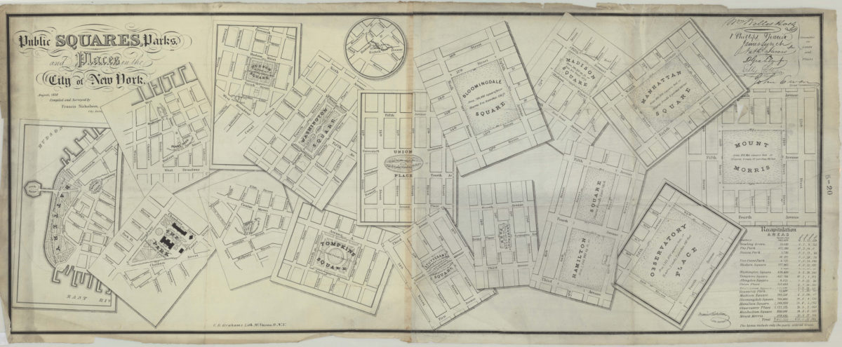
Public squares, parks, and places in the city of New York: compiled and surveyed by Francis Nicholson
Public squares, parks, and places in the city of New York: compiled and surveyed by Francis Nicholson
August 1838
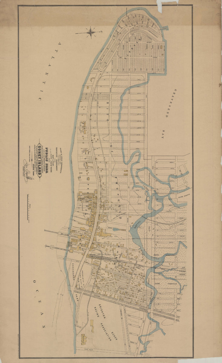
Tentative amendment to the Map or plan of the city of New York, showing a public park in that part of the borough of Brooklyn formerly known as the town of Gravesend and designated Coney Island, from W. 37th St. (Seagate)
Tentative amendment to the Map or plan of the city of New York, showing a public park in that part of the borough of Brooklyn formerly known as the town of Gravesend and designated Coney Island, from W. 37th St. (Seagate)
[1899]
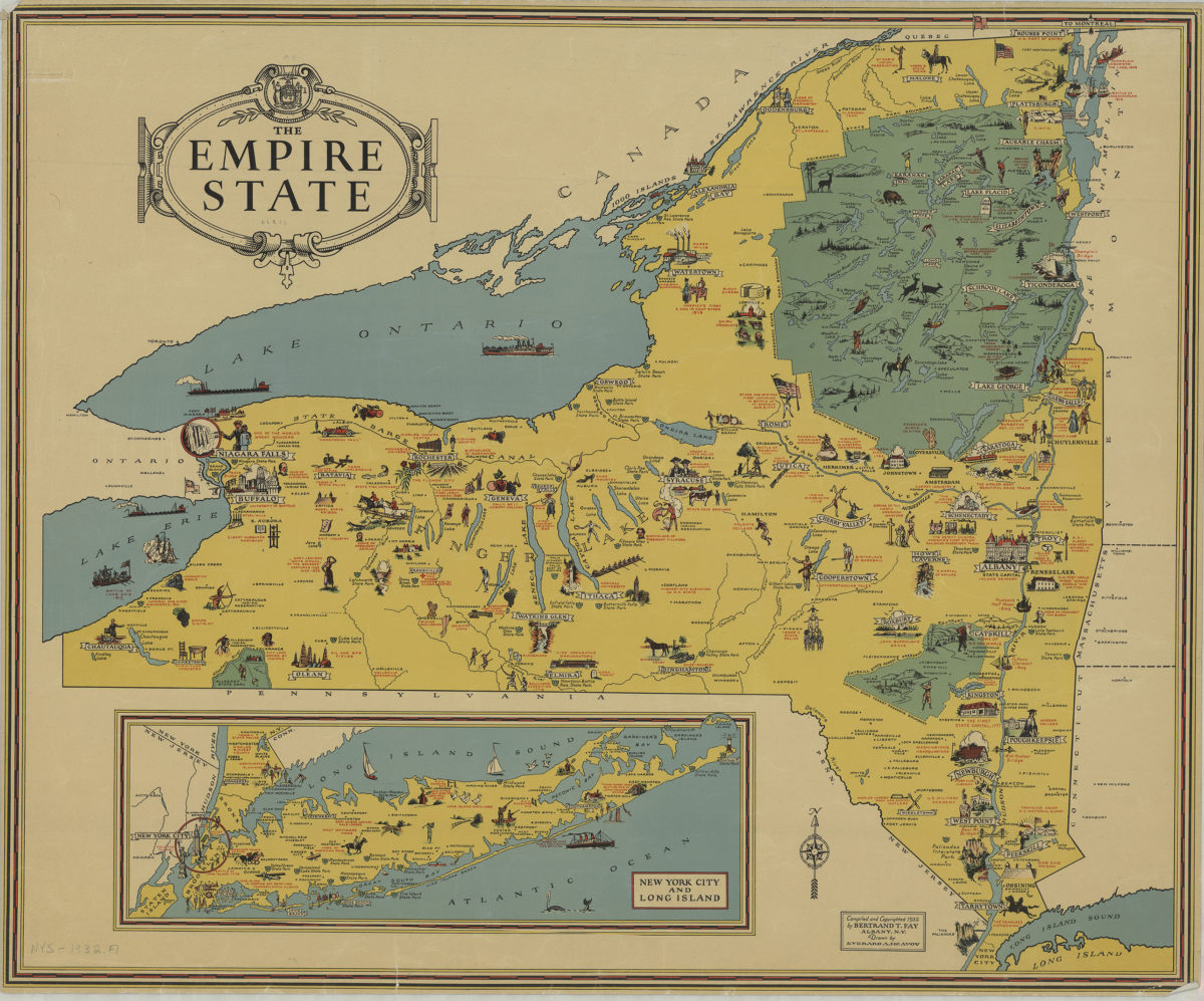
The Empire State: compiled and copyrighted 1932 by Bertrand T. Fay ; drawn by Everard A. McAvoy
The Empire State: compiled and copyrighted 1932 by Bertrand T. Fay ; drawn by Everard A. McAvoy
[1932;1932]
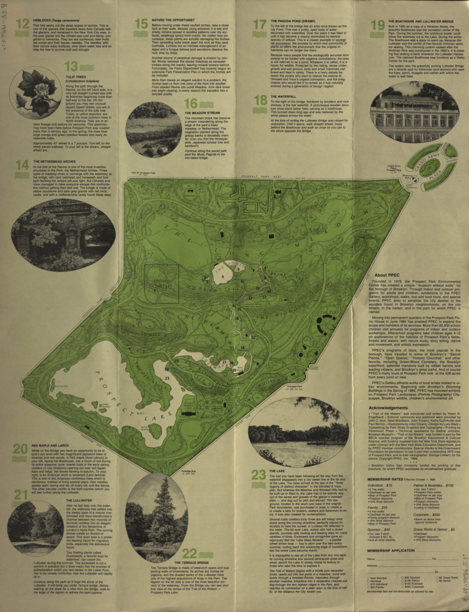
Trail of the waters: a guided walking tour along the watercourse of Prospect Park, Brooklyn
Trail of the waters: a guided walking tour along the watercourse of Prospect Park, Brooklyn
[1986; 1986]
Tompkins Park
Tompkins Park
[1893]
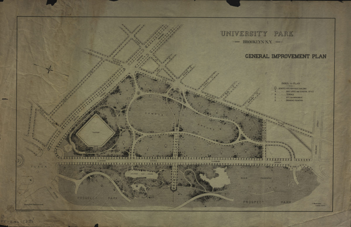
University Park, Brooklyn, N.Y.: general improvement plan: J. Weidenmann, landscape architect
University Park, Brooklyn, N.Y.: general improvement plan: J. Weidenmann, landscape architect
[186?]
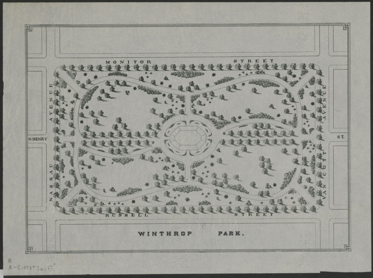
Winthrop Park
Winthrop Park
[1893]
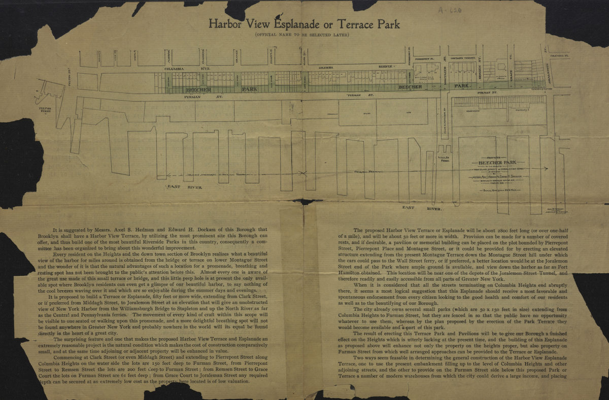
Proposed Beecher Park on the Heights from Clark Street to Joralemon Street: as designed by Messrs. Axel S. Hedman and Edward H. Dockam, Borough of Brooklyn, City of N.Y., February 1903
Proposed Beecher Park on the Heights from Clark Street to Joralemon Street: as designed by Messrs. Axel S. Hedman and Edward H. Dockam, Borough of Brooklyn, City of N.Y., February 1903
1903
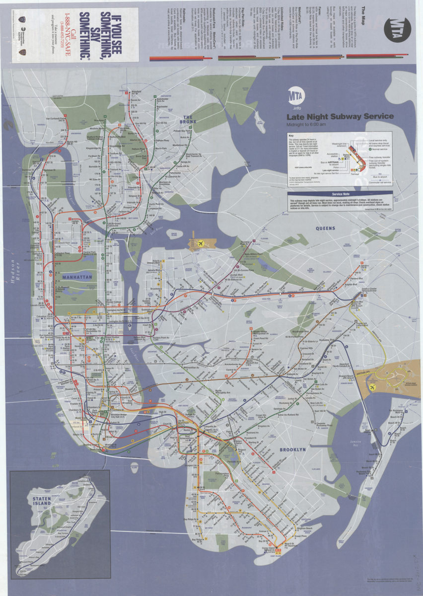
Late night subway service, midnight to 6: 12:00 AM: MTA.info
Late night subway service, midnight to 6: 12:00 AM: MTA.info
[ca. 2012]
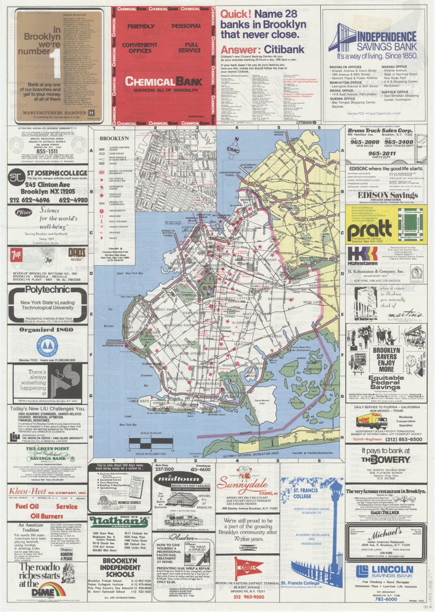
Brooklyn
Brooklyn
1977
Brooklyn, Flatbush and Coney Island guide map to Brighton Beach, 1881
[ca. 1880]
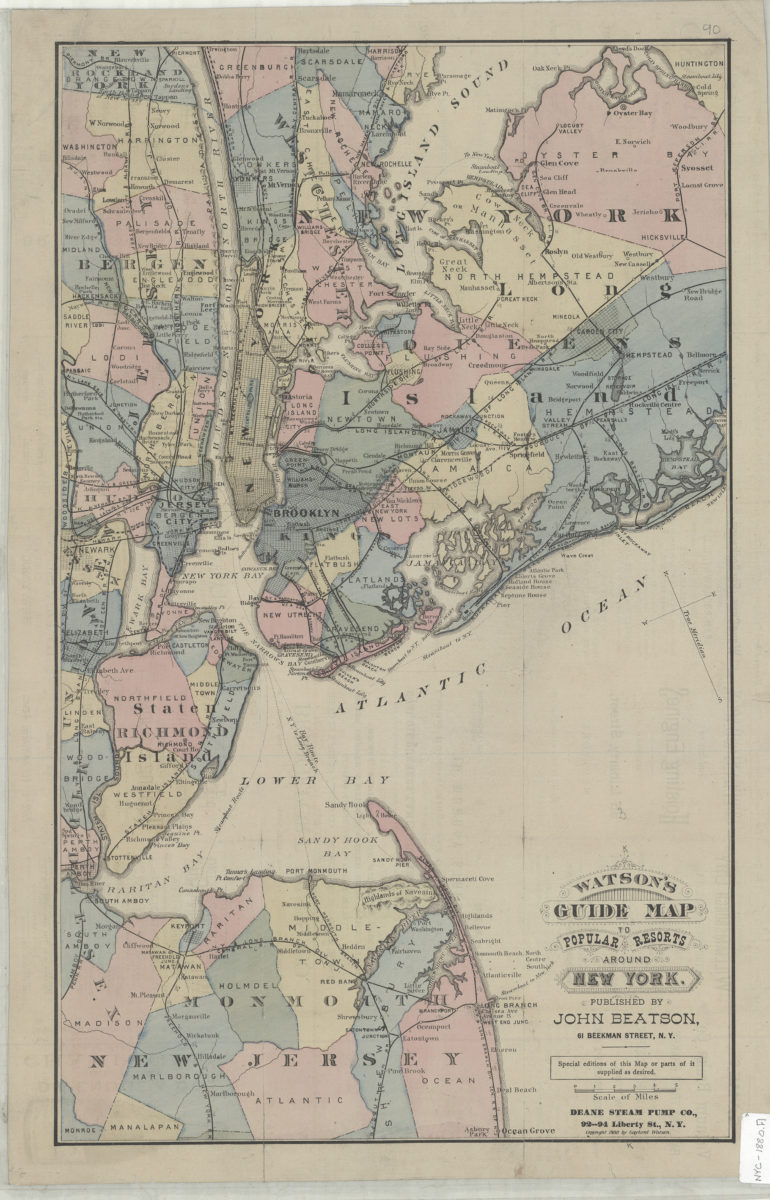
Watson’s guide map to popular resorts around New York
Watson’s guide map to popular resorts around New York
[ca. 1880]
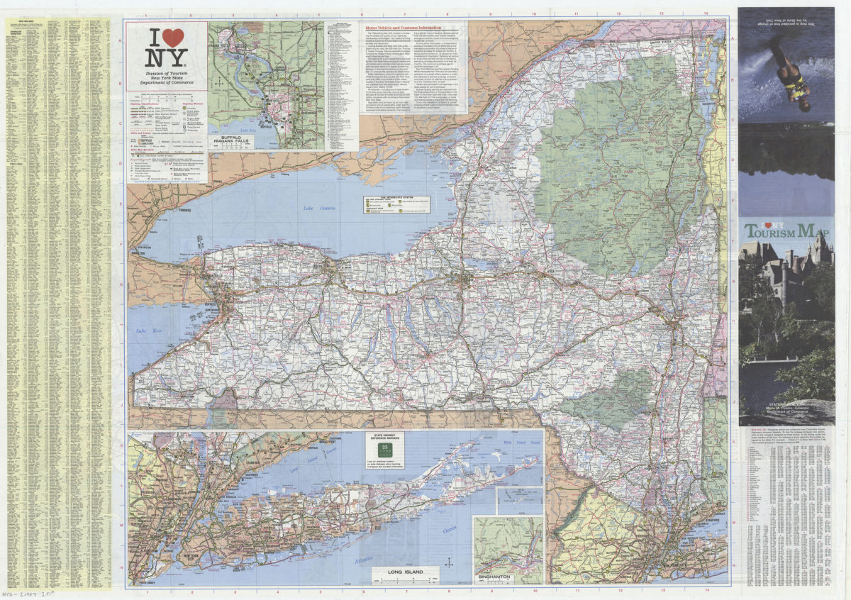
I [heart symbol] NY: Division of Tourism, New York State Department of Commerce
I [heart symbol] NY: Division of Tourism, New York State Department of Commerce
[1987]