Center for Brooklyn History
Map Collections
Search
About
Othmer Library & Archives
Public Transit
111 records
To further explore these maps, visit the
Search
page, and use the filters.
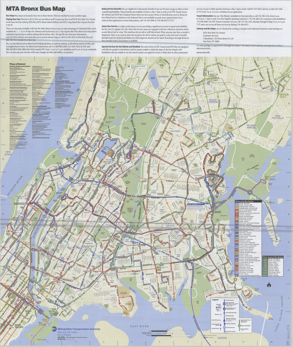
Bronx bus map: July 2010: MTA Metropolitan Transportation Authority, New York City Transit Bus Company
Bronx bus map: July 2010: MTA Metropolitan Transportation Authority, New York City Transit Bus Company
[ca. 2010]
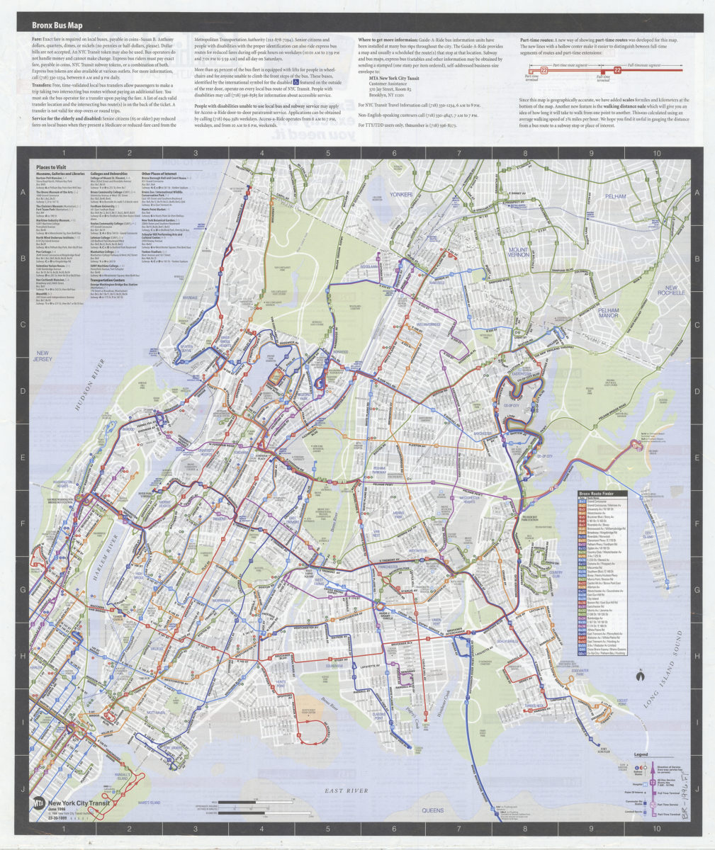
Bronx bus map: MTA, New York City Transit
Bronx bus map: MTA, New York City Transit
[ca. 1996]
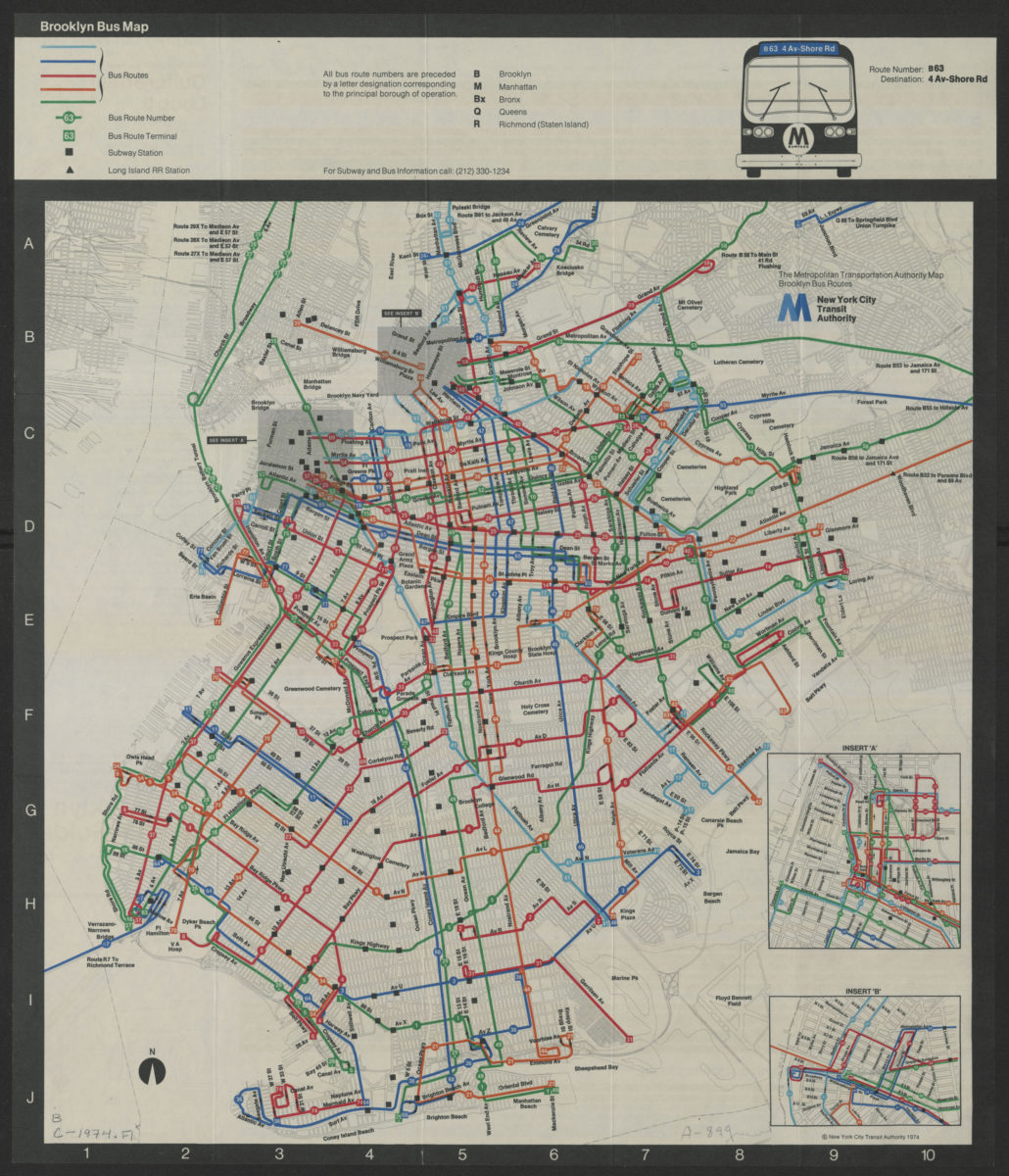
Brooklyn bus map
Brooklyn bus map
[ca. 1974]
Brooklyn bus map: August 2001, free: MTA New York City Transit
Brooklyn bus map: August 2001, free: MTA New York City Transit
[ca. 2001]
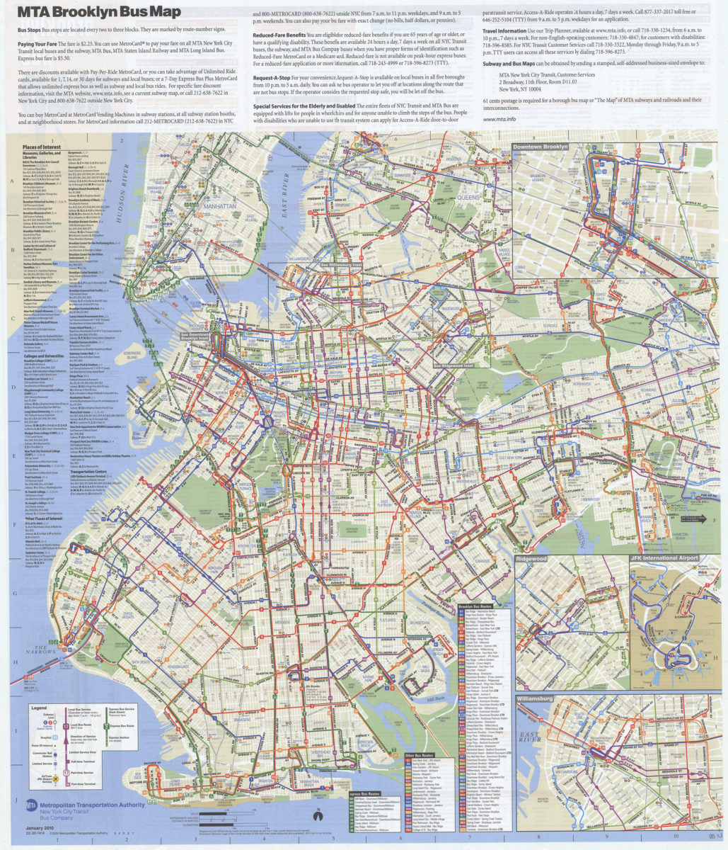
Brooklyn bus map: free, January 2010: MTA Metropolitan Transportation Authority, New York City Transit Bus Company
Brooklyn bus map: free, January 2010: MTA Metropolitan Transportation Authority, New York City Transit Bus Company
[2010; 2010]
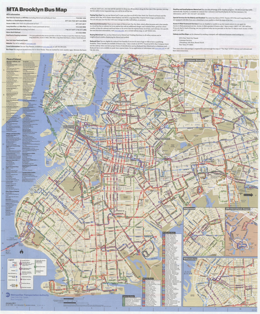
Brooklyn bus map: free, January 2011: MTA Metropolitan Transportation Authority, New York City Transit Bus Company
Brooklyn bus map: free, January 2011: MTA Metropolitan Transportation Authority, New York City Transit Bus Company
[2011; 2011]
Brooklyn bus map: updated for fall service changes: MTA, New York City Transit
Brooklyn bus map: updated for fall service changes: MTA, New York City Transit
[ca. 1995]
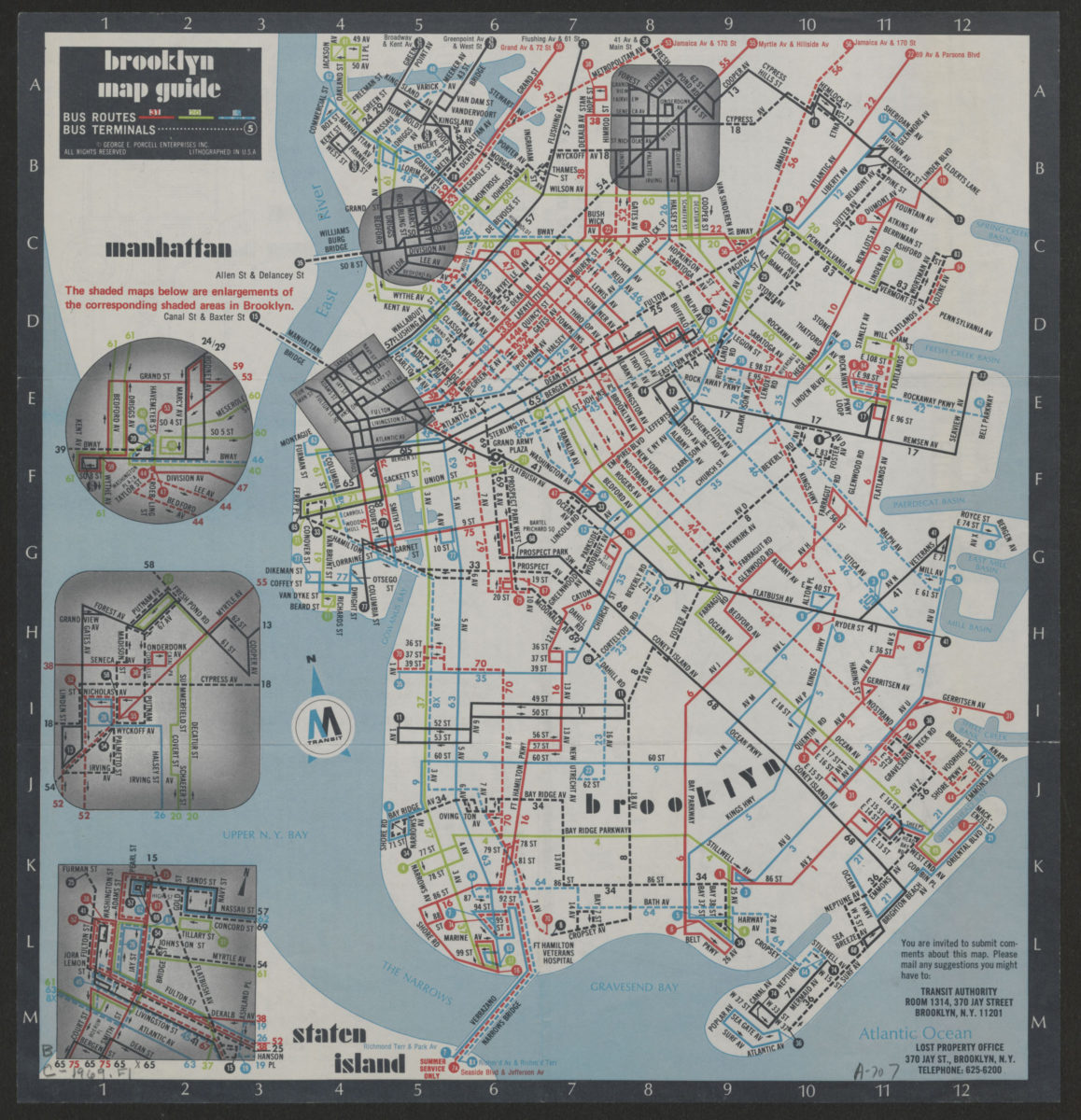
Brooklyn Staten Island bus map: M Transit
Brooklyn Staten Island bus map: M Transit
[ca. 1969]
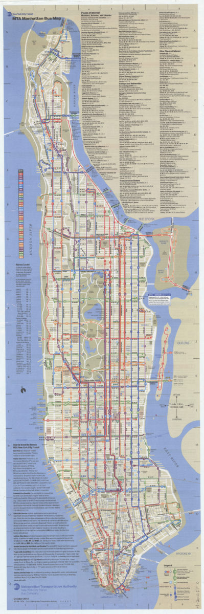
Manhattan bus map: October 2010: MTA
Manhattan bus map: October 2010: MTA
[2010; 2010]
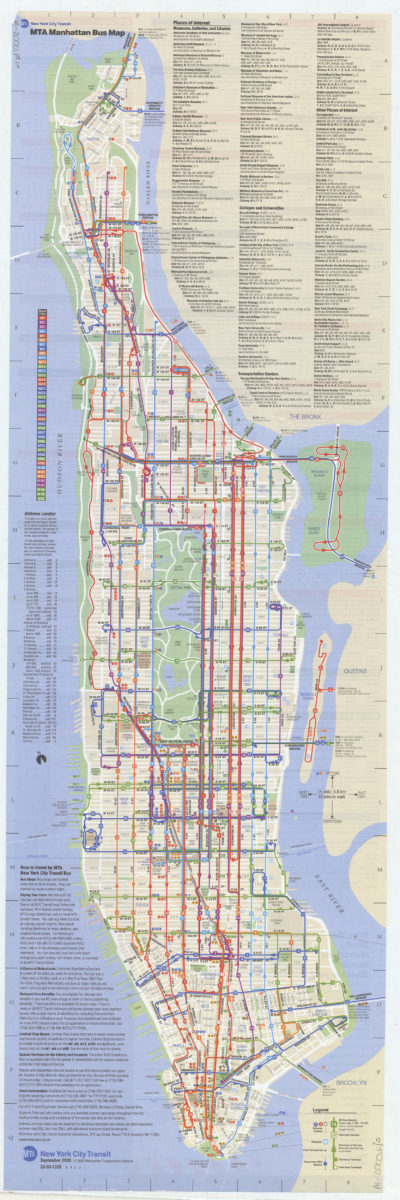
Manhattan bus map: September 2000, free: MTA New York City Transit
Manhattan bus map: September 2000, free: MTA New York City Transit
[ca. 2000]
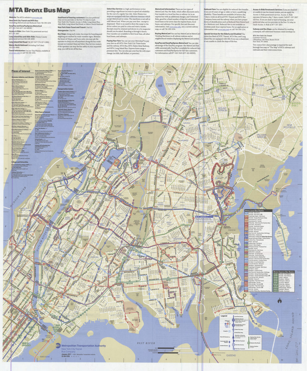
MTA Bronx bus map: MTA Metropolitan Transportation Authority, New York City Transit Bus Company
MTA Bronx bus map: MTA Metropolitan Transportation Authority, New York City Transit Bus Company
[2011; 2011]
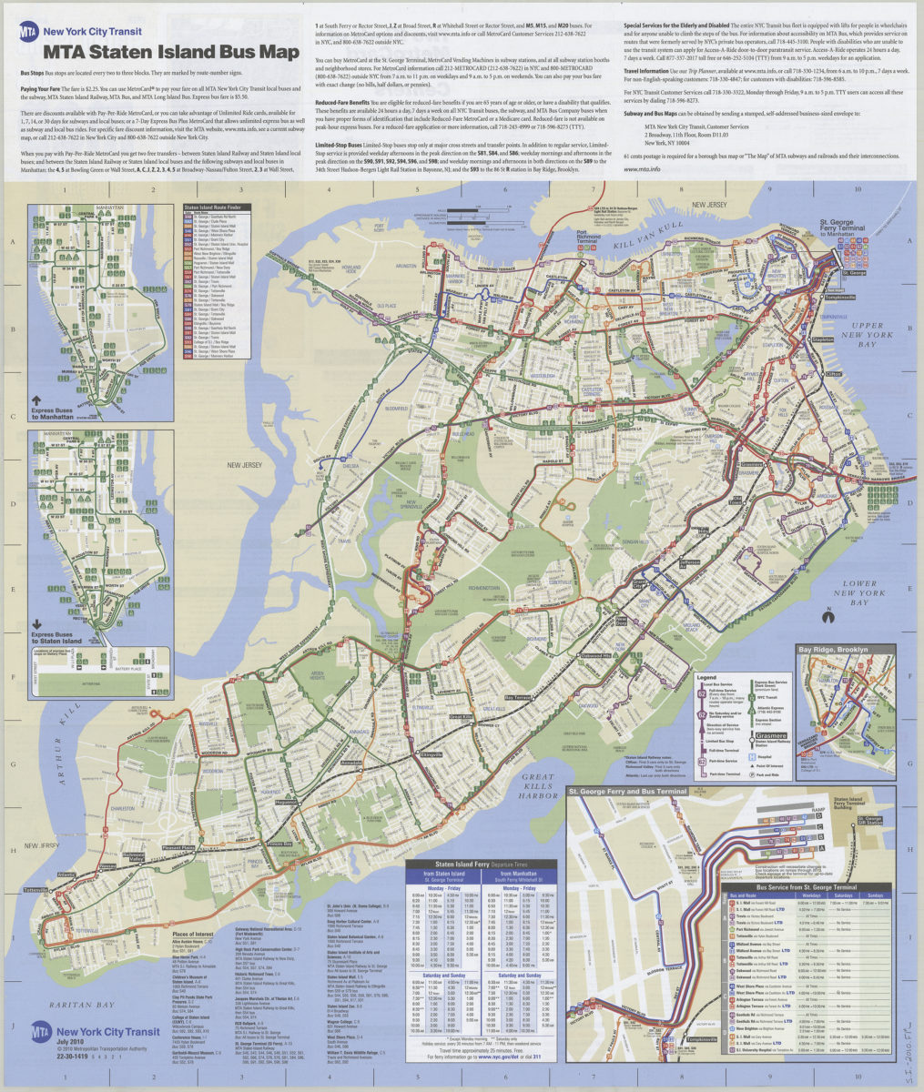
MTA Staten Island bus map: November, 2010
MTA Staten Island bus map: November, 2010
[2010; 2010]
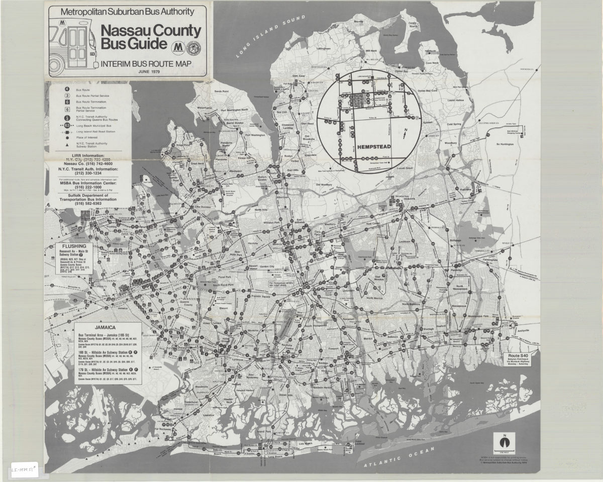
Nassau County bus guide: interim bus route map: Metropolitan Suburban Bus Authority
Nassau County bus guide: interim bus route map: Metropolitan Suburban Bus Authority
1979;c1979
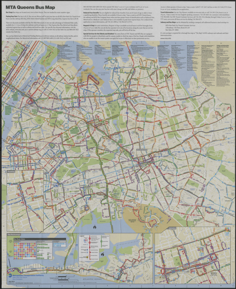
Queens bus map: free, July 2010: MTA Metropolitan Transportation Authority, New York City Transit Bus Company
Queens bus map: free, July 2010: MTA Metropolitan Transportation Authority, New York City Transit Bus Company
[ca. 2010]
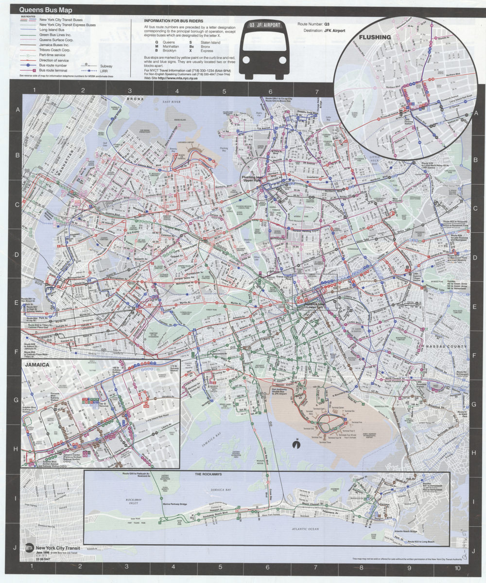
Queens bus map: MTA, New York City Transit
Queens bus map: MTA, New York City Transit
[ca. 1996]
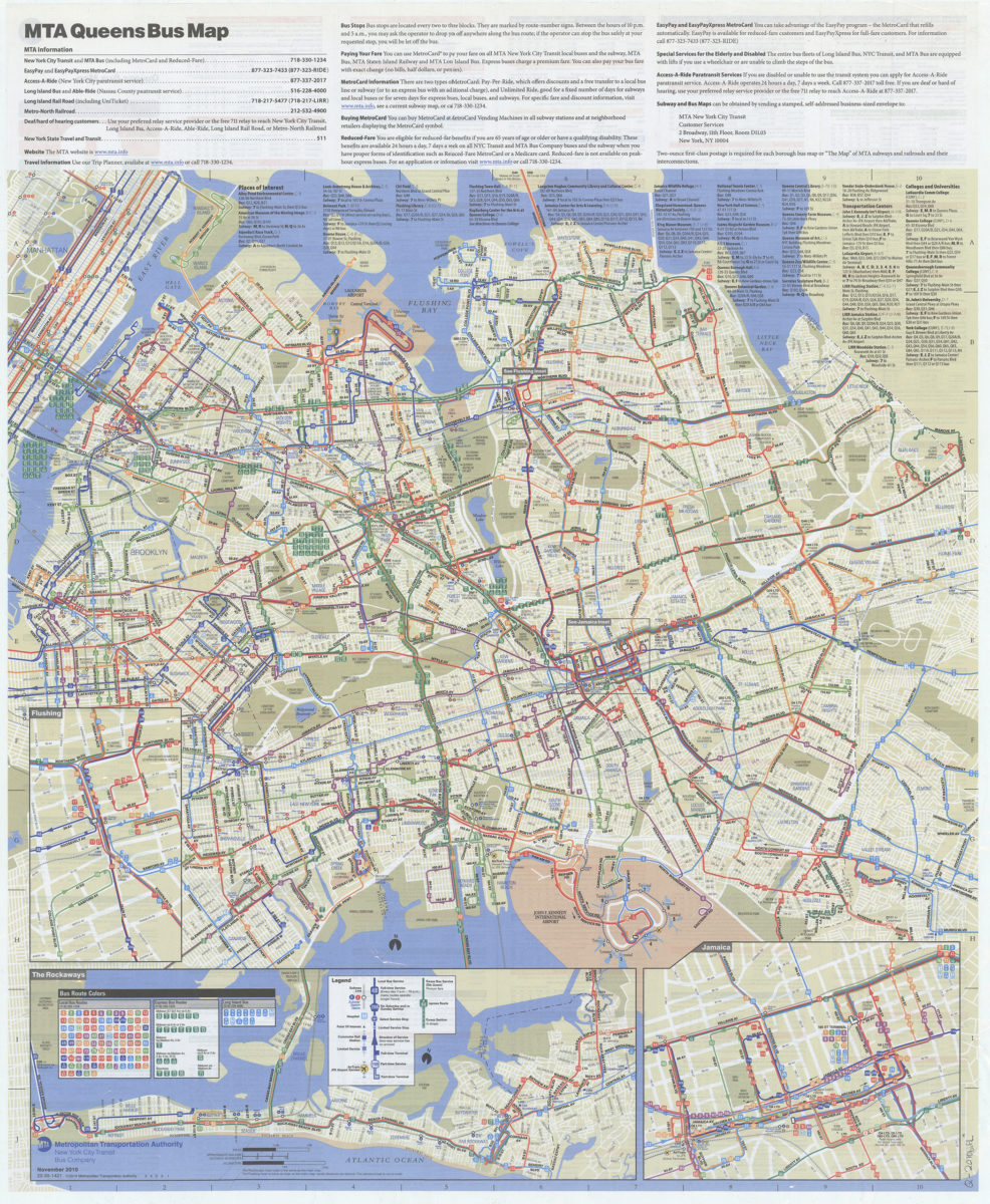
Queens bus map: November 2010: MTA Metropolitan Transportation Authority, New York City Transit Bus Company
Queens bus map: November 2010: MTA Metropolitan Transportation Authority, New York City Transit Bus Company
[2010; 2010]
Staten Island bus map with Staten Island Railway: free, July 2010: MTA New York City Transit
Staten Island bus map with Staten Island Railway: free, July 2010: MTA New York City Transit
[ca. 2010]
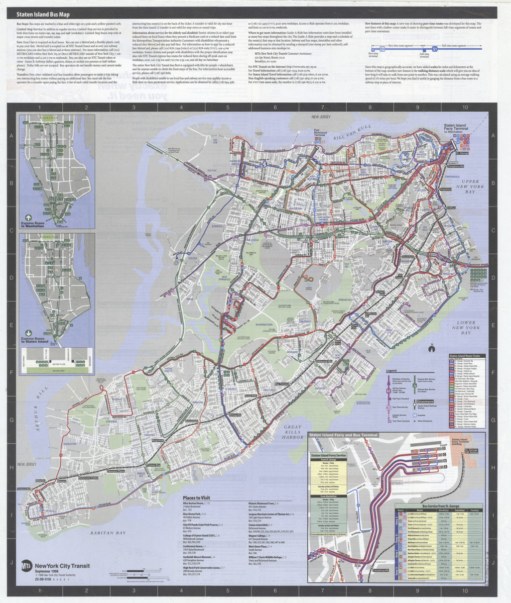
Staten Island bus map: MTA, New York City Transit
Staten Island bus map: MTA, New York City Transit
[ca. 1996]
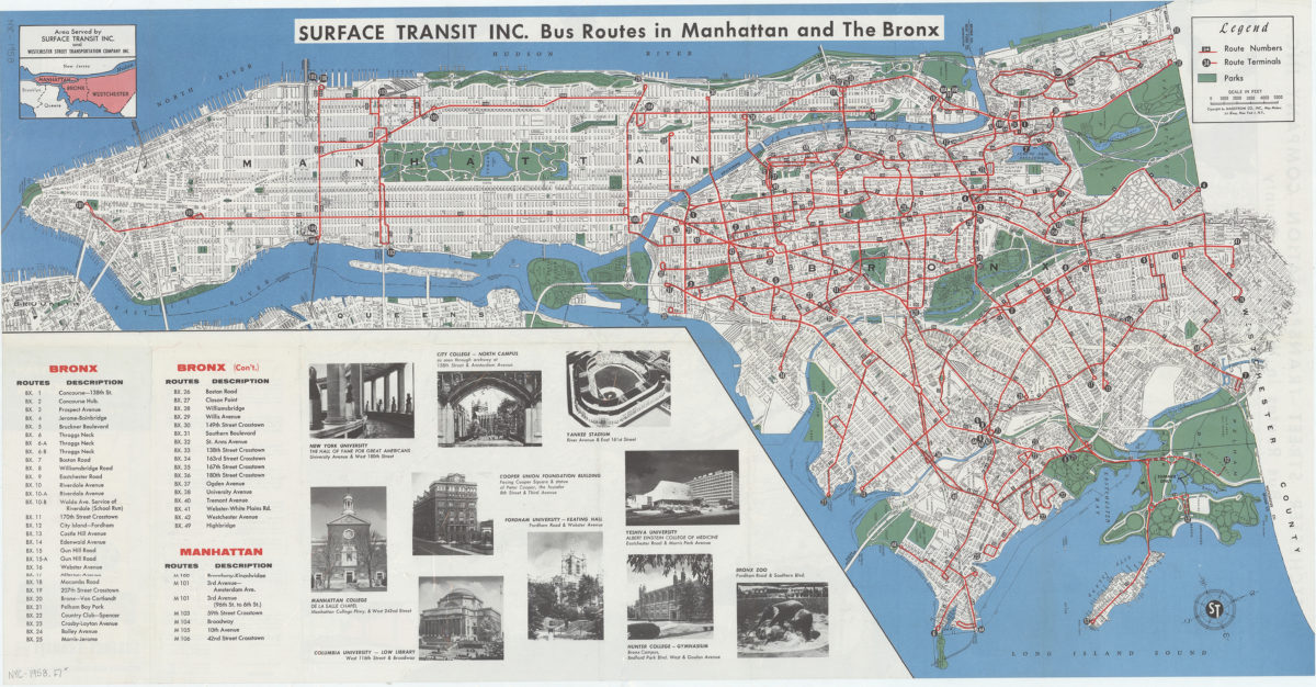
Travel around Manhattan, the Bronx New York City, and Westchester County, New York: route map : Service Transit Inc. and Westchester Street Transportation Company Inc
Travel around Manhattan, the Bronx New York City, and Westchester County, New York: route map : Service Transit Inc. and Westchester Street Transportation Company Inc
[1958]
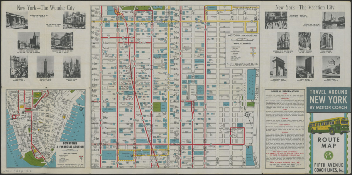
Travel around New York by motorcoach: route map, Fifth Avenue Coach Lines, Inc
Travel around New York by motorcoach: route map, Fifth Avenue Coach Lines, Inc
[1956-1962]
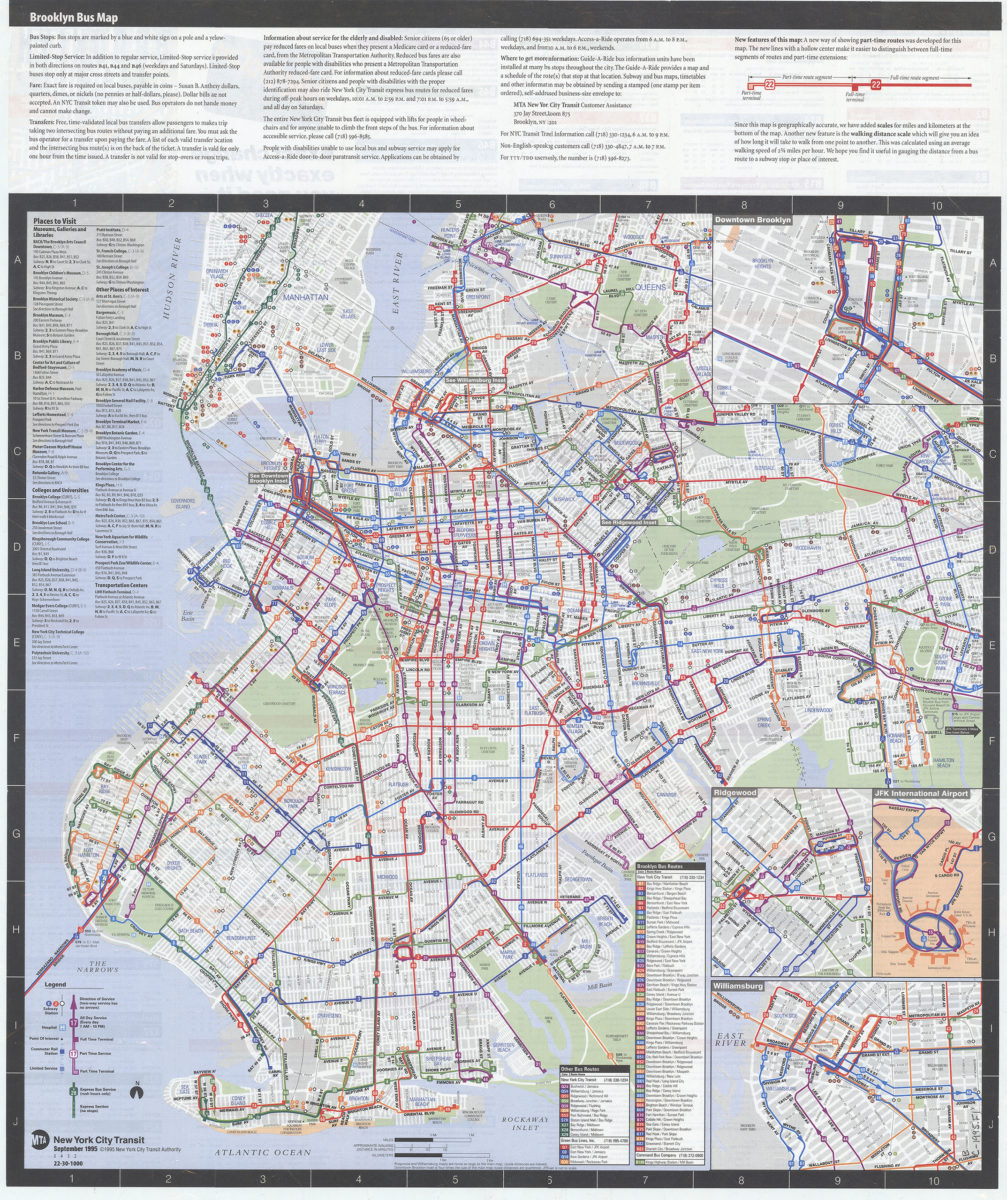
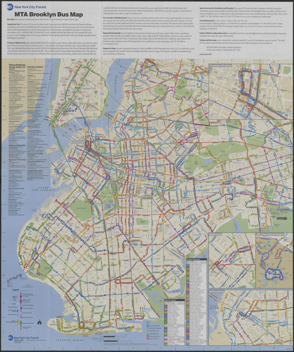
Brooklyn bus map: February 2004, free: MTA New York City Transit
Brooklyn bus map: February 2004, free: MTA New York City Transit
[ca. 2004]
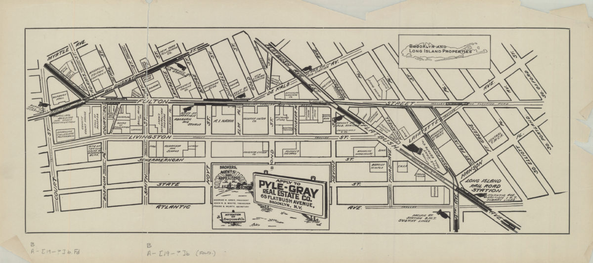
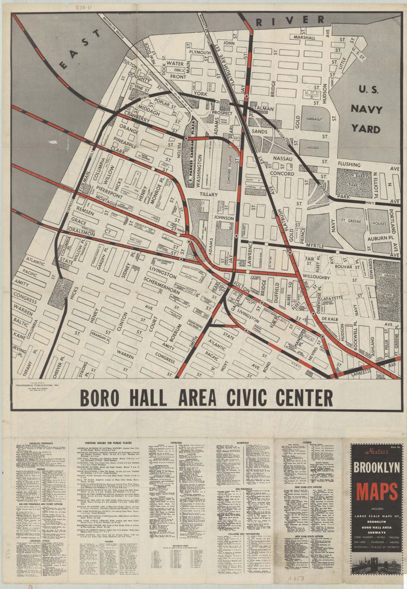
[Map of the Fulton Street area in downtown Brooklyn]
[Map of the Fulton Street area in downtown Brooklyn]
[19??]
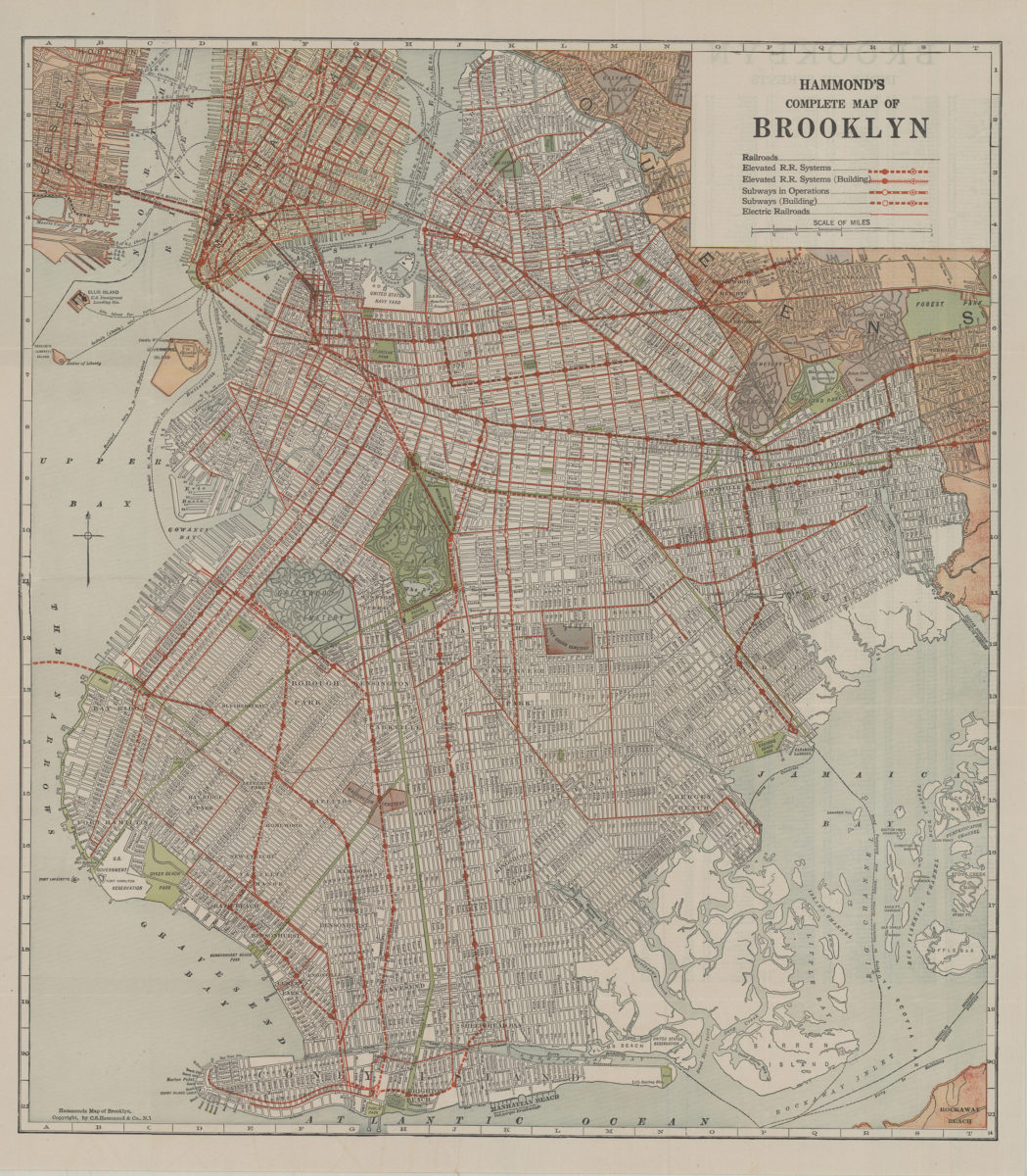
Hammond’s complete map of Brooklyn: copyright by C.S. Hammond Co
Hammond’s complete map of Brooklyn: copyright by C.S. Hammond Co
[192?]
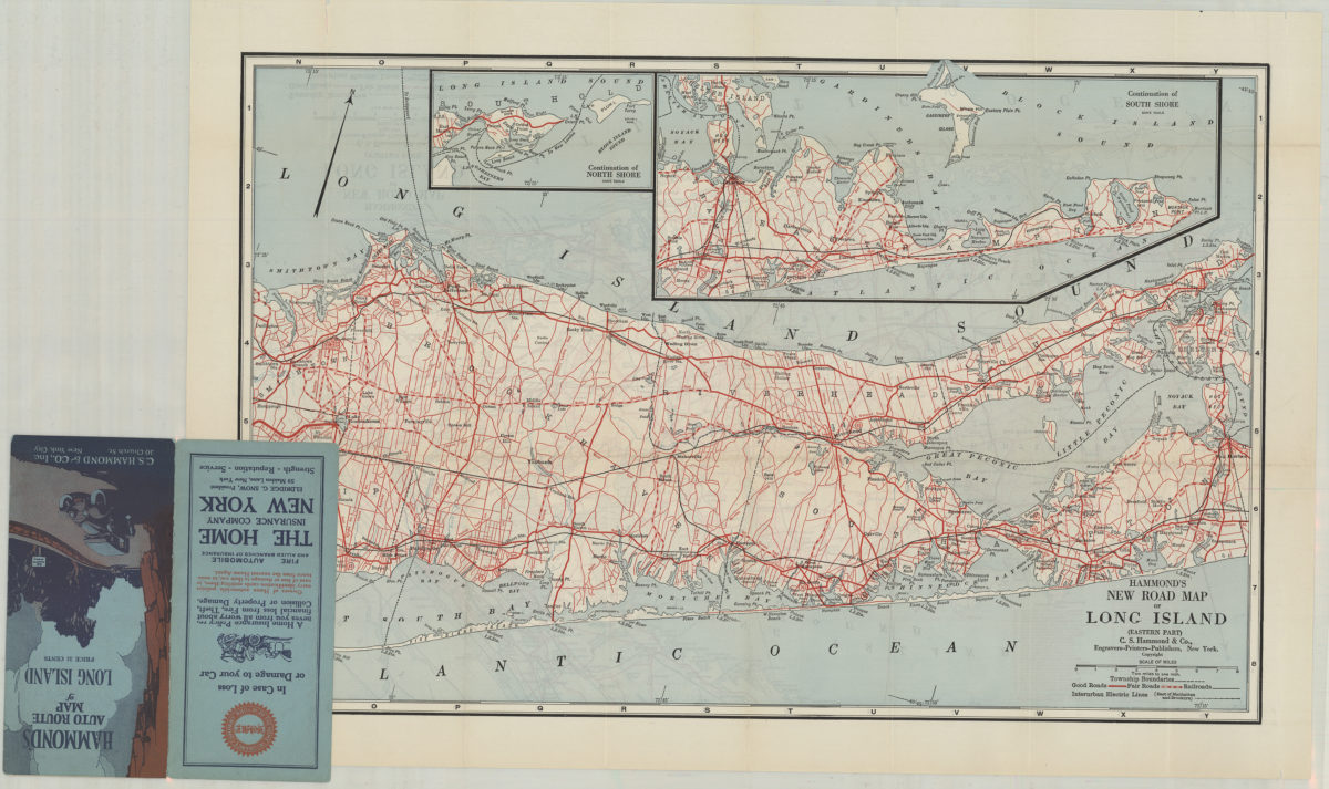
Hammond’s new road map of Long Island: C.S. Hammond & Co
Hammond’s new road map of Long Island: C.S. Hammond & Co
[19??]
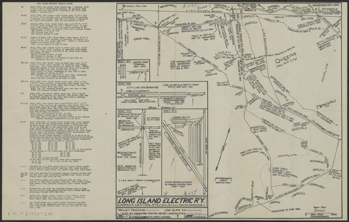
Long Island Electric R’y (Jamaica Central R’ys): with N.Y. and L.I. traction connections: Vincent F. Seyfried, data ; Marvin Landsman, drawing
Long Island Electric R’y (Jamaica Central R’ys): with N.Y. and L.I. traction connections: Vincent F. Seyfried, data ; Marvin Landsman, drawing
[1951]
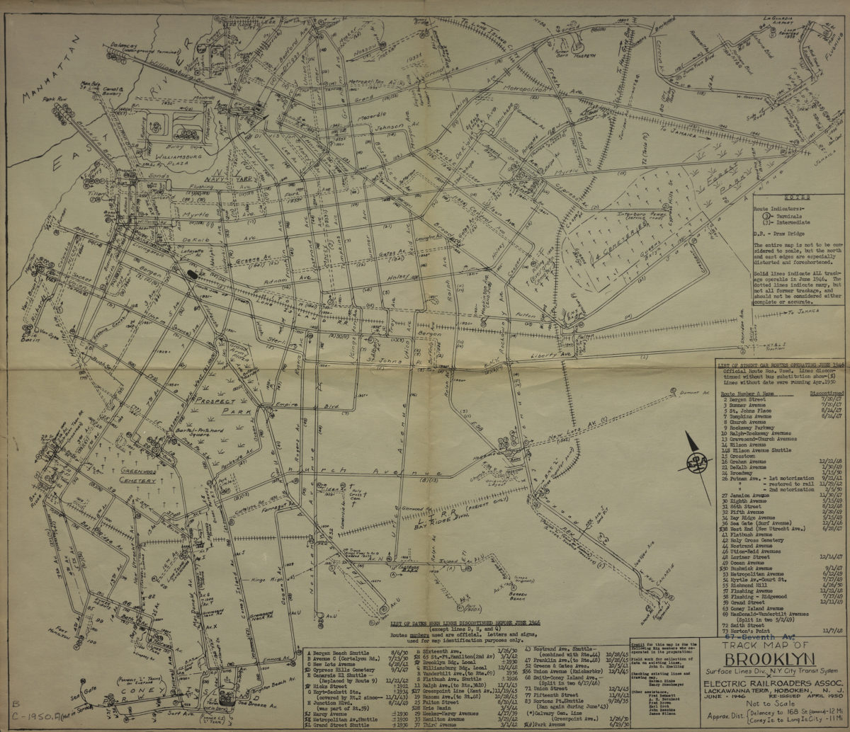
Track map of Brooklyn, Surface Lines Division, N.Y. City Transit System: Electric Railroaders Association
Track map of Brooklyn, Surface Lines Division, N.Y. City Transit System: Electric Railroaders Association
1950
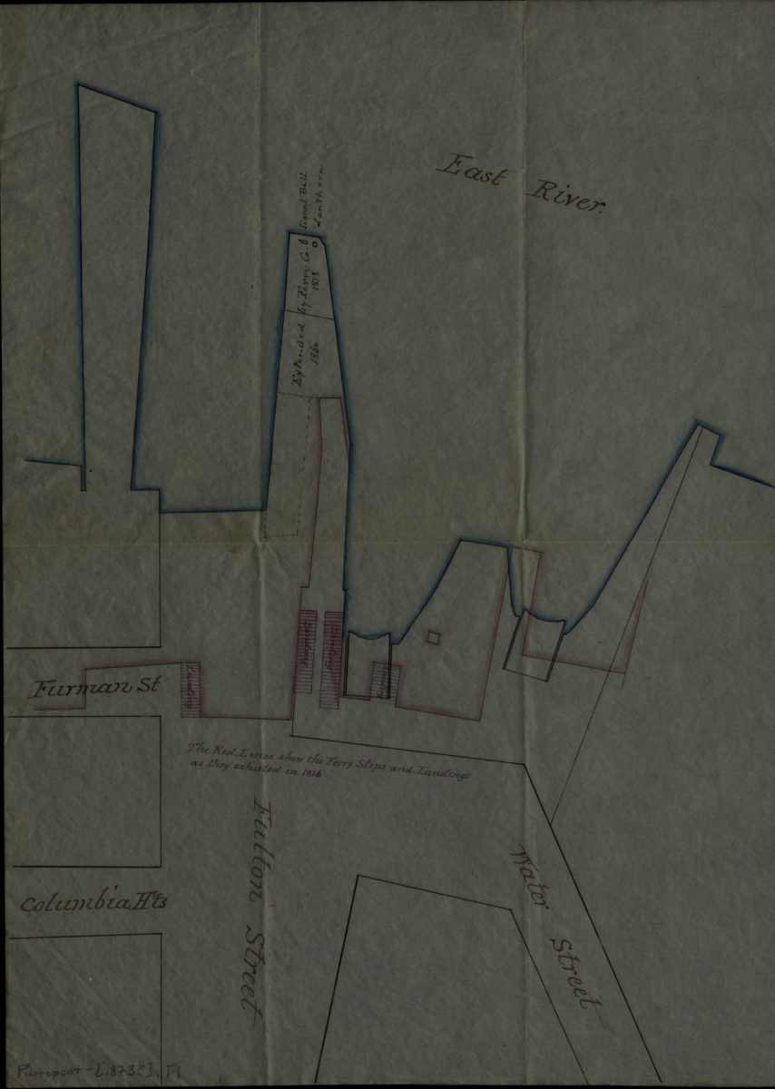
[Ferry slips, landings, and piers at Fulton St.].
[Ferry slips, landings, and piers at Fulton St.].
[1873]
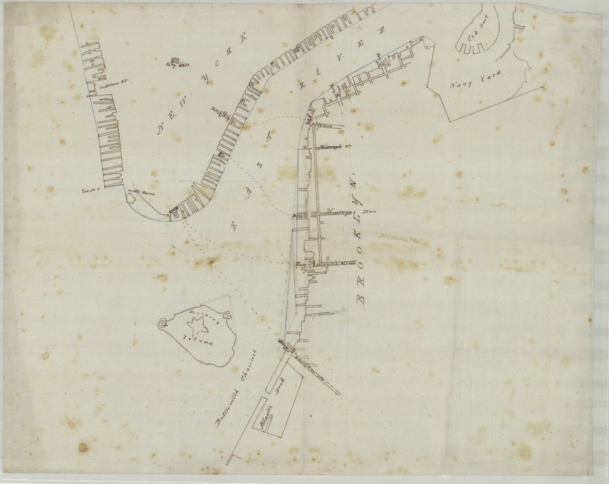
[Map of northwest Brooklyn and Lower Manhattan]
[Map of northwest Brooklyn and Lower Manhattan]
[18??]
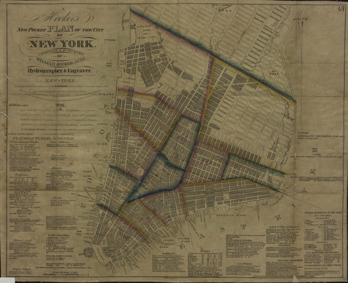
Hooker’s new pocket plan of the city of New York: compiled & surveyed by William Hooker
Hooker’s new pocket plan of the city of New York: compiled & surveyed by William Hooker
1826
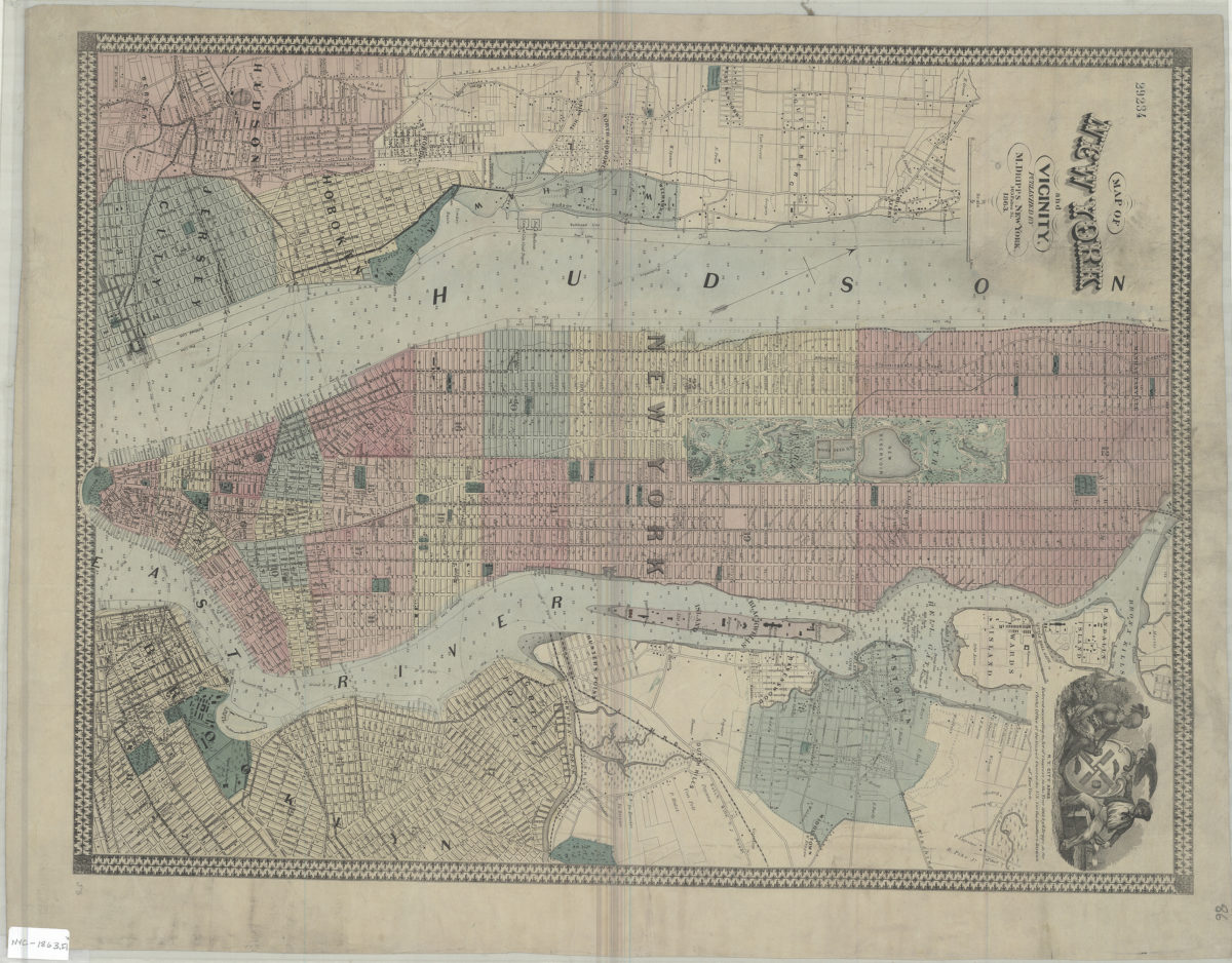
Map of New York and vicinity
Map of New York and vicinity
1863
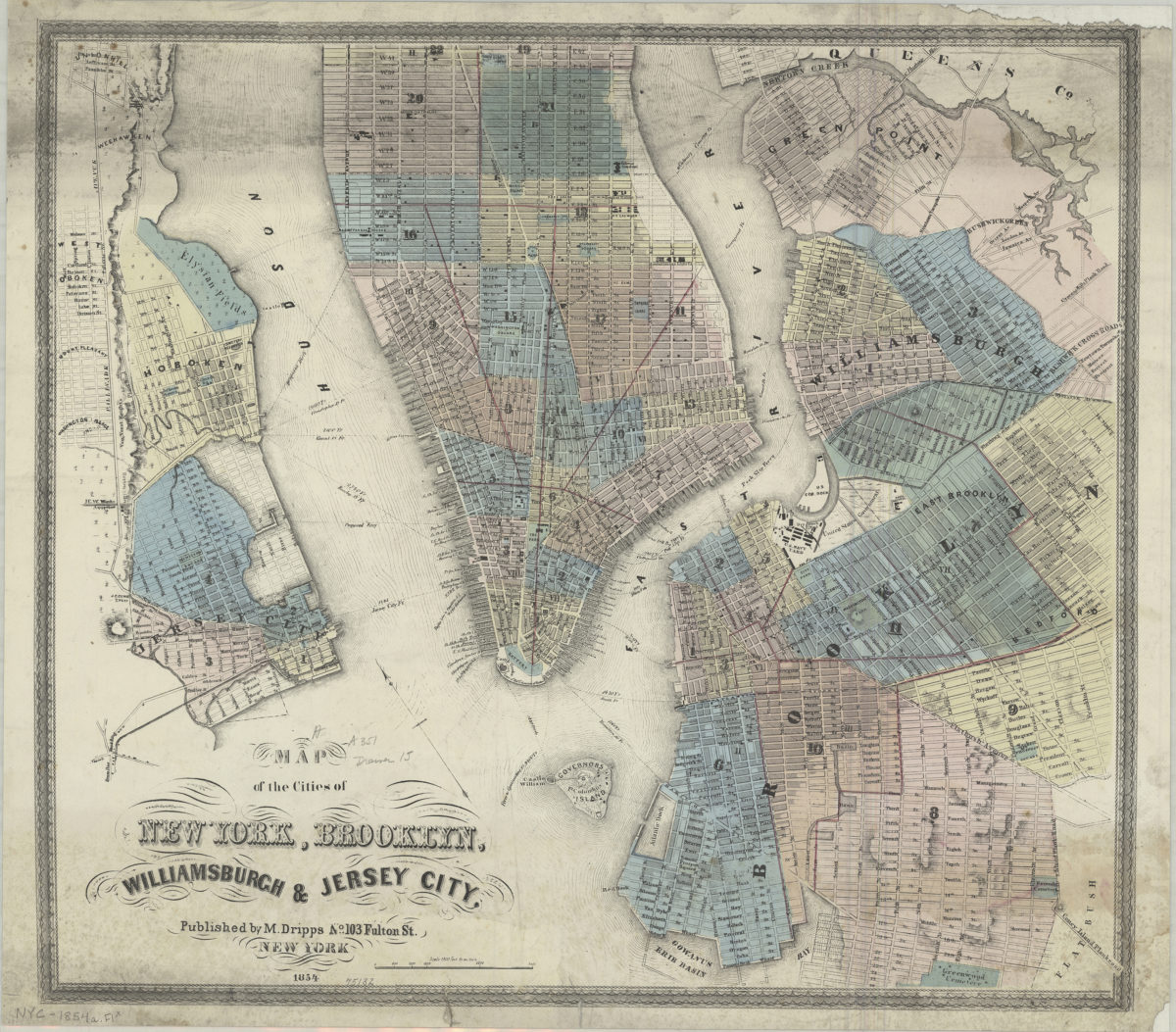
Map of the cities of New York, Brooklyn, Williamsburgh & Jersey City
Map of the cities of New York, Brooklyn, Williamsburgh & Jersey City
1854
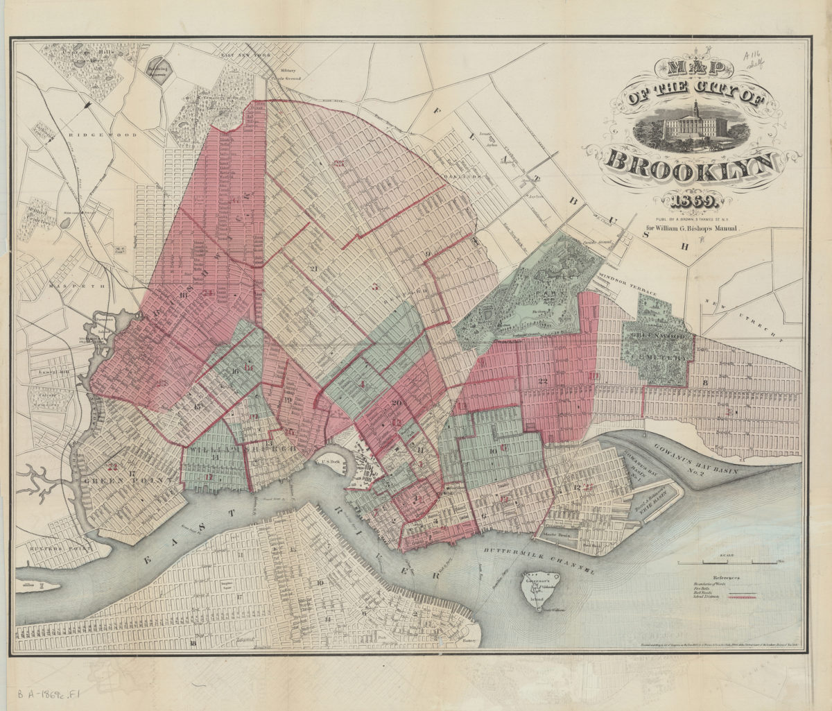
Map of the City of Brooklyn
Map of the City of Brooklyn
1869
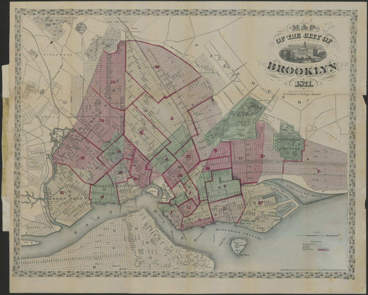
Map of the City of Brooklyn
Map of the City of Brooklyn
1871
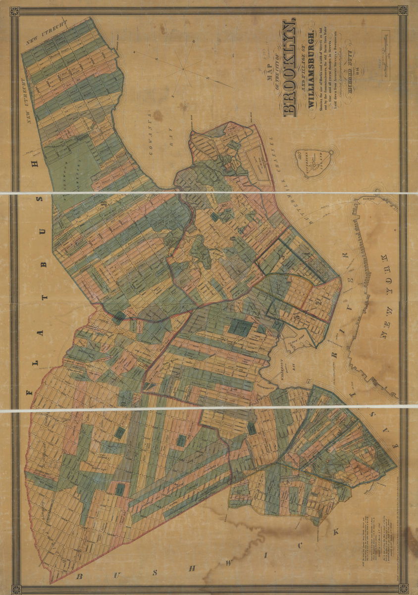
Map of the city of Brooklyn and village of Williamsburgh: showing the size of blocks and width of streets as laid out by the commissioners, the old farm lines, water line, and all recent changes in streets
Map of the city of Brooklyn and village of Williamsburgh: showing the size of blocks and width of streets as laid out by the commissioners, the old farm lines, water line, and all recent changes in streets
1846
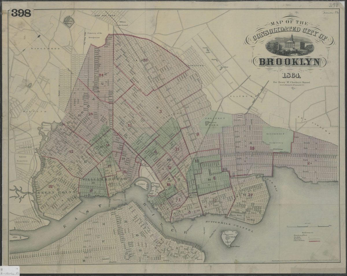
Map of the consolidated City of Brooklyn
Map of the consolidated City of Brooklyn
1864
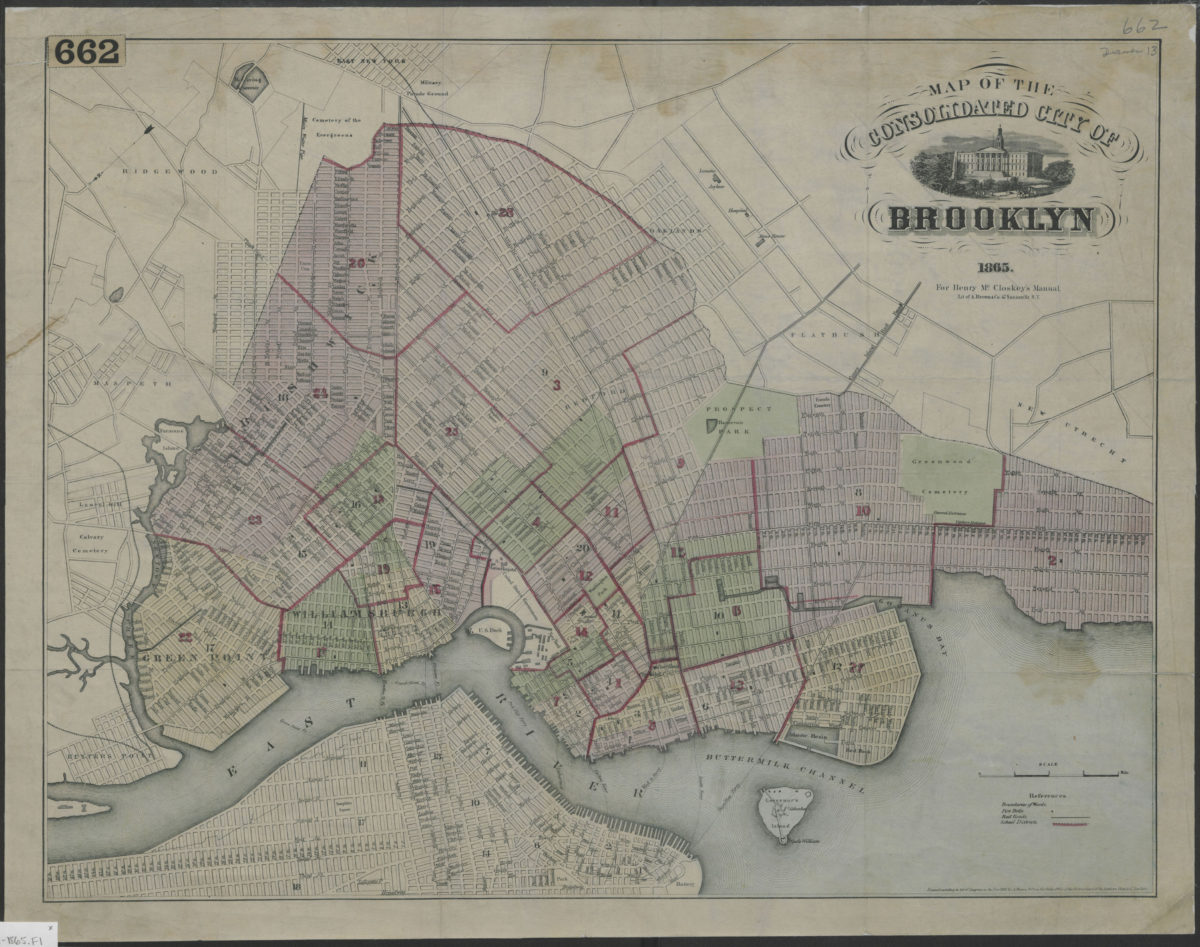
Map of the consolidated City of Brooklyn
Map of the consolidated City of Brooklyn
1865
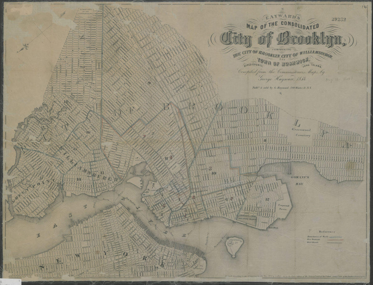
Map of the consolidated City of Brooklyn: comprising the City of Brooklyn, City of Williamsburgh and Town of Bushwick, Kings County, Long Island: compiled from the Commissioners maps by George Hayward
Map of the consolidated City of Brooklyn: comprising the City of Brooklyn, City of Williamsburgh and Town of Bushwick, Kings County, Long Island: compiled from the Commissioners maps by George Hayward
1854
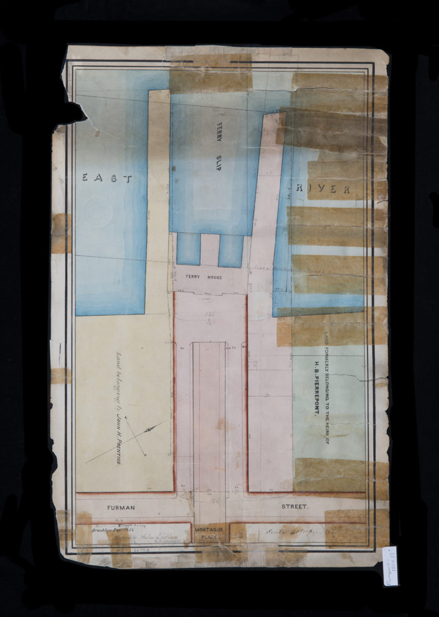
Montague Street Ferry: surveyed by Silas Ludlam ; copied … by Richd. F. Tooms
Montague Street Ferry: surveyed by Silas Ludlam ; copied … by Richd. F. Tooms
September 1854
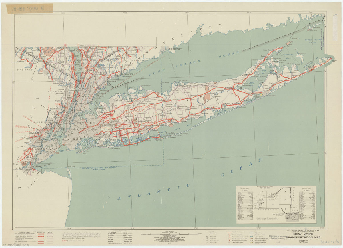
New York transportation map: highways, railroads, canals, air lanes, and dredged channels: compiled and printed by the U.S. Geological Survey for the Bureau of Public Roads
New York transportation map: highways, railroads, canals, air lanes, and dredged channels: compiled and printed by the U.S. Geological Survey for the Bureau of Public Roads
1937
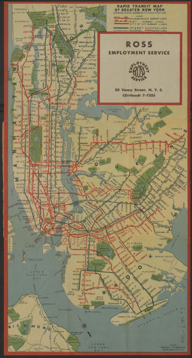
Rapid transit map of greater New York: showing house numbers at each station
Rapid transit map of greater New York: showing house numbers at each station
[193?]
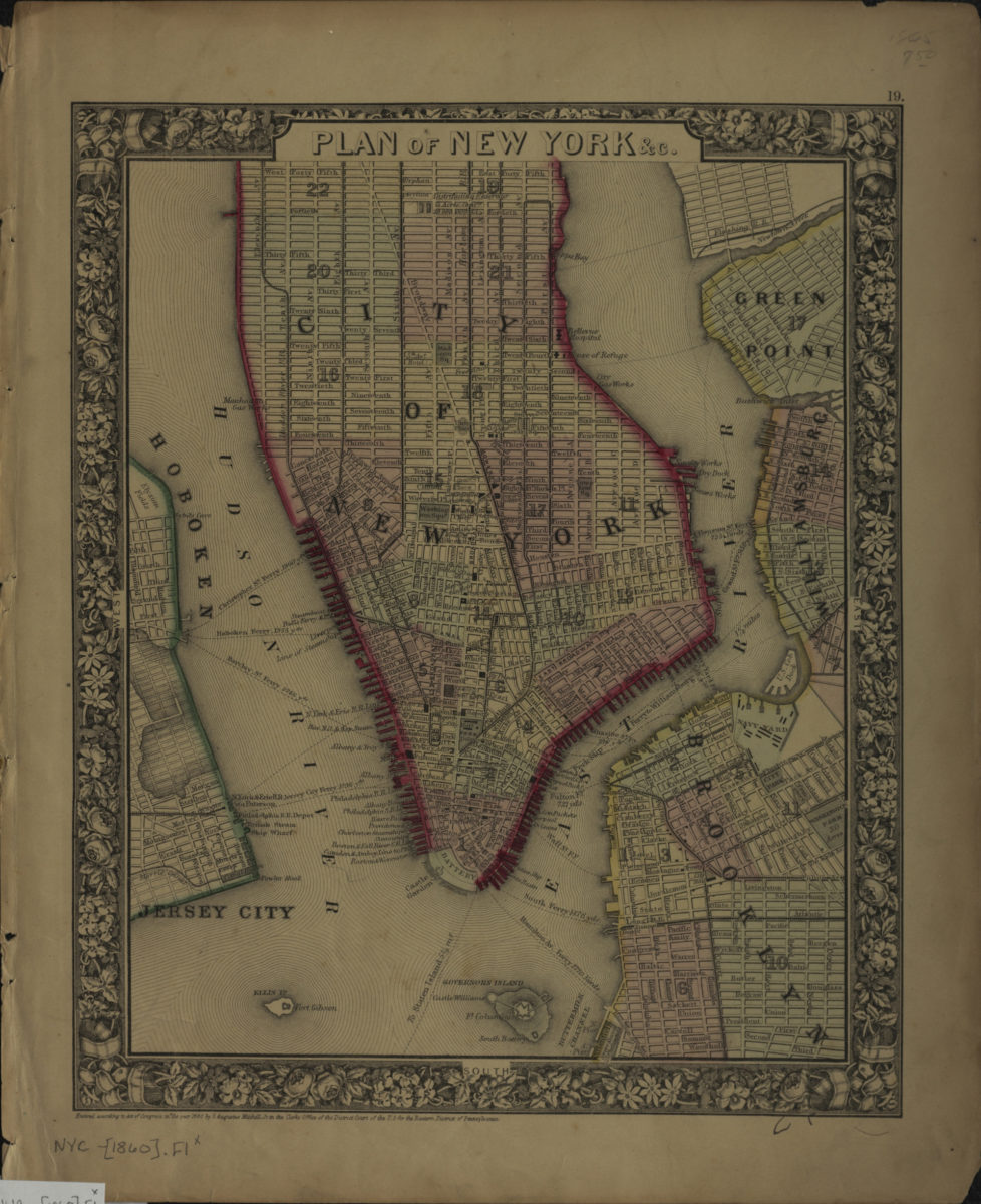
Plan of New York &c
Plan of New York &c
[ca. 1860]
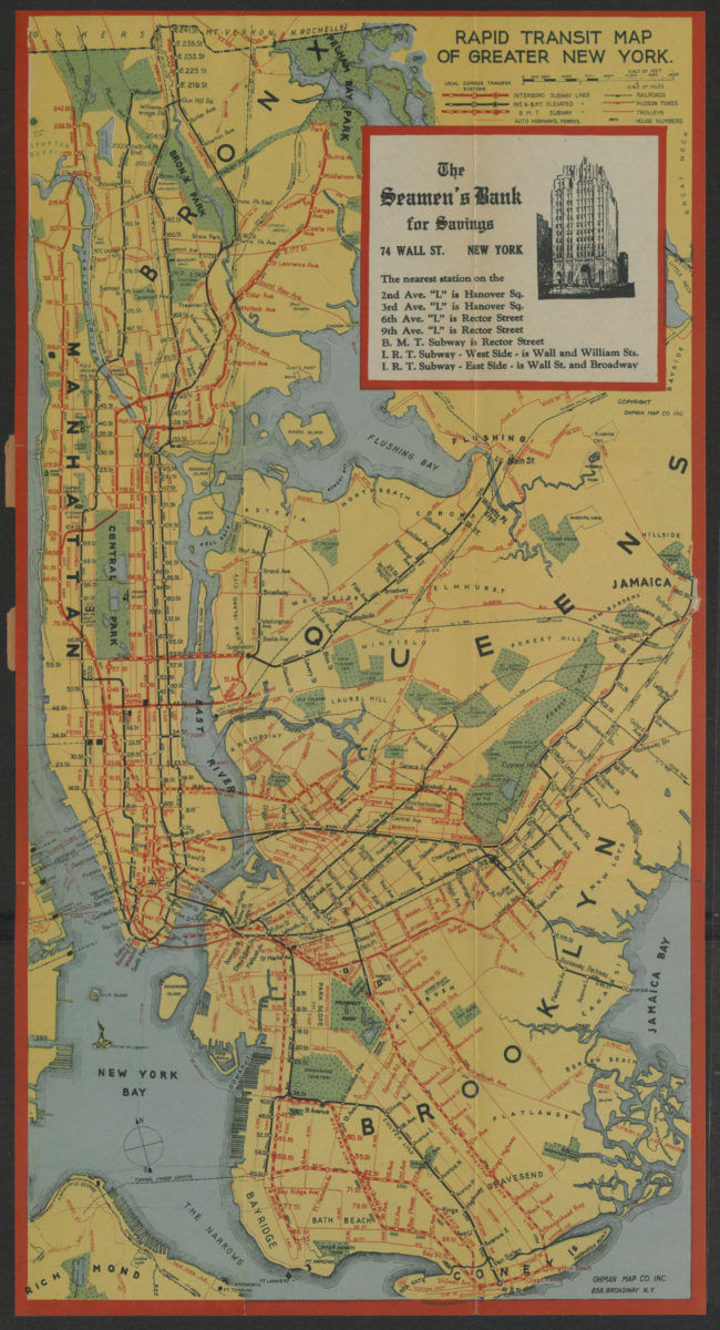
Rapid transit map of greater New York: shows house numbers at each station
Rapid transit map of greater New York: shows house numbers at each station
[1929]
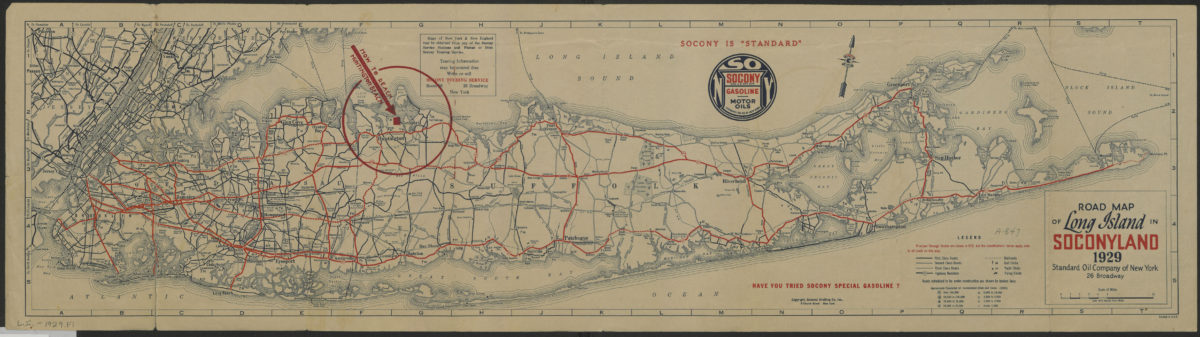
Road map of Long Island in Soconyland, 1929: copyright General Drafting Co., Inc
Road map of Long Island in Soconyland, 1929: copyright General Drafting Co., Inc
[1929]
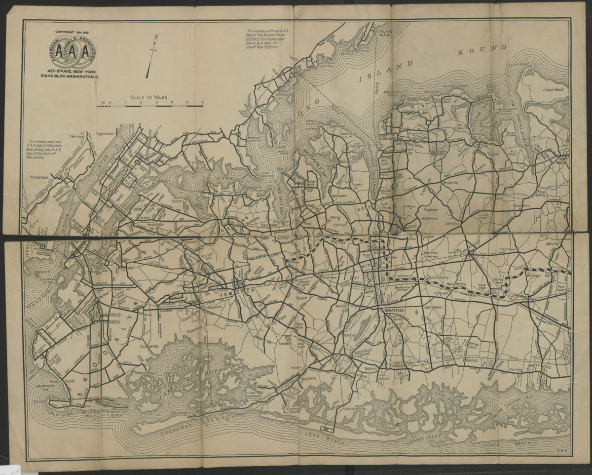
Suburban Long Island: detail of routes in a heavily-traveled and complicated section of the metropolitan district, showing bridges and ferries to and from Manhattan, the Bronx, lower Westchester County and suburban New Jersey
Suburban Long Island: detail of routes in a heavily-traveled and complicated section of the metropolitan district, showing bridges and ferries to and from Manhattan, the Bronx, lower Westchester County and suburban New Jersey
[ca. 1916]
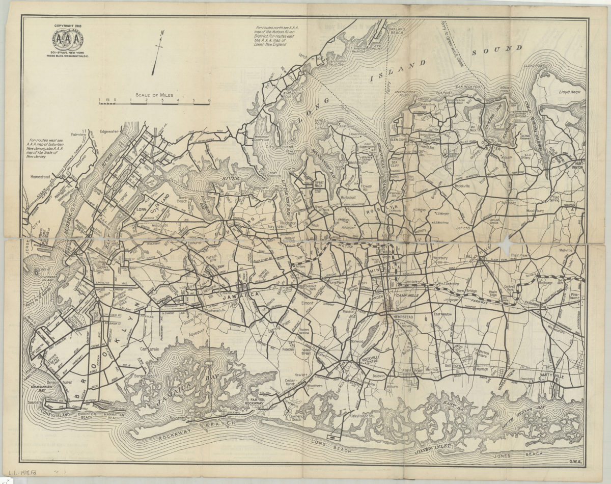
Suburban Long Island: detail of routes in a heavily-traveled and complicated section of the metropolitan district, showing bridges and ferries to and from Manhattan, the Bronx, Lower Westchester County and Suburban New Jersey
Suburban Long Island: detail of routes in a heavily-traveled and complicated section of the metropolitan district, showing bridges and ferries to and from Manhattan, the Bronx, Lower Westchester County and Suburban New Jersey
[ca. 1918]
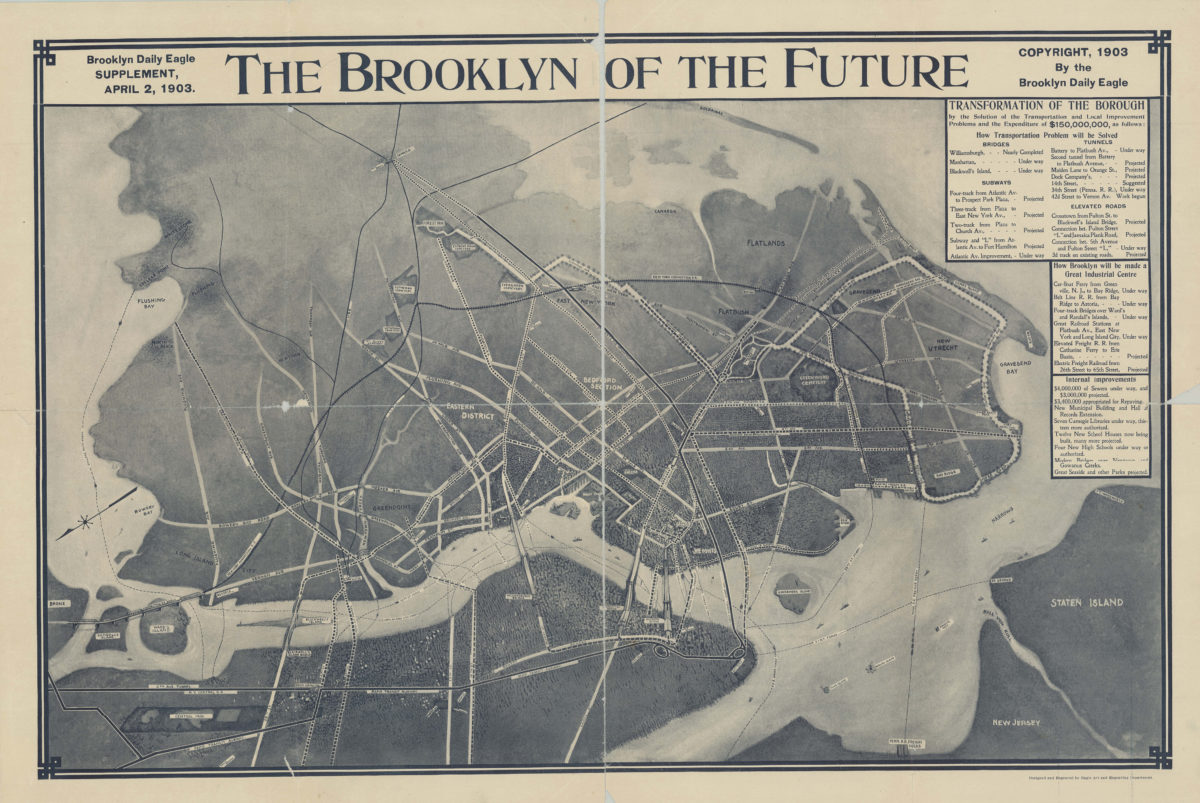
The Brooklyn of the future: Brooklyn Daily Eagle supplement, April 2, 1903
The Brooklyn of the future: Brooklyn Daily Eagle supplement, April 2, 1903
[1903; 1903]
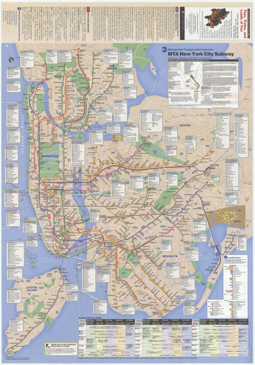
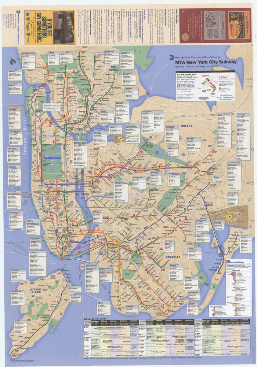
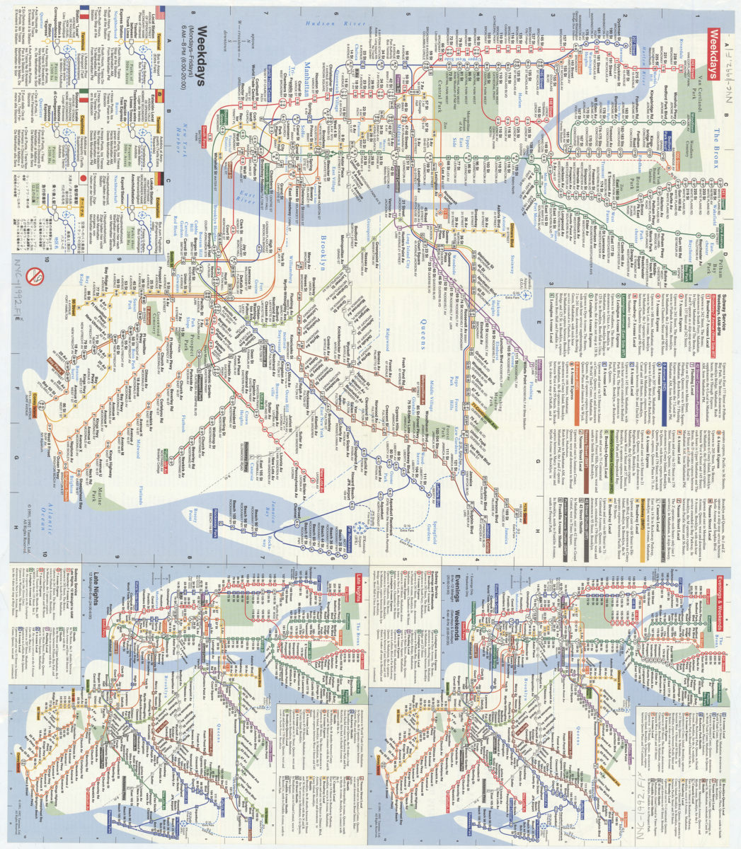
The map, MTA subways and commuter railroads: major connections between MTA subways, rail lines, buses, and other regional transit, MTA Bridges and Tunnels crossings: MTA Metropolitan Transportation Authority
The map, MTA subways and commuter railroads: major connections between MTA subways, rail lines, buses, and other regional transit, MTA Bridges and Tunnels crossings: MTA Metropolitan Transportation Authority
[ca. 2005]
The map, MTA subways and railroads and their interconnections: connections between MTA subway, rail, and bus services, selected connections to other regional transit services: MTA Metropolitan Transportation Authority
The map, MTA subways and railroads and their interconnections: connections between MTA subway, rail, and bus services, selected connections to other regional transit services: MTA Metropolitan Transportation Authority
[ca. 1998]
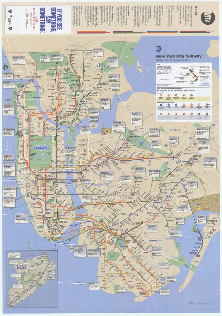
The map: MTA
The map: MTA
March 2011
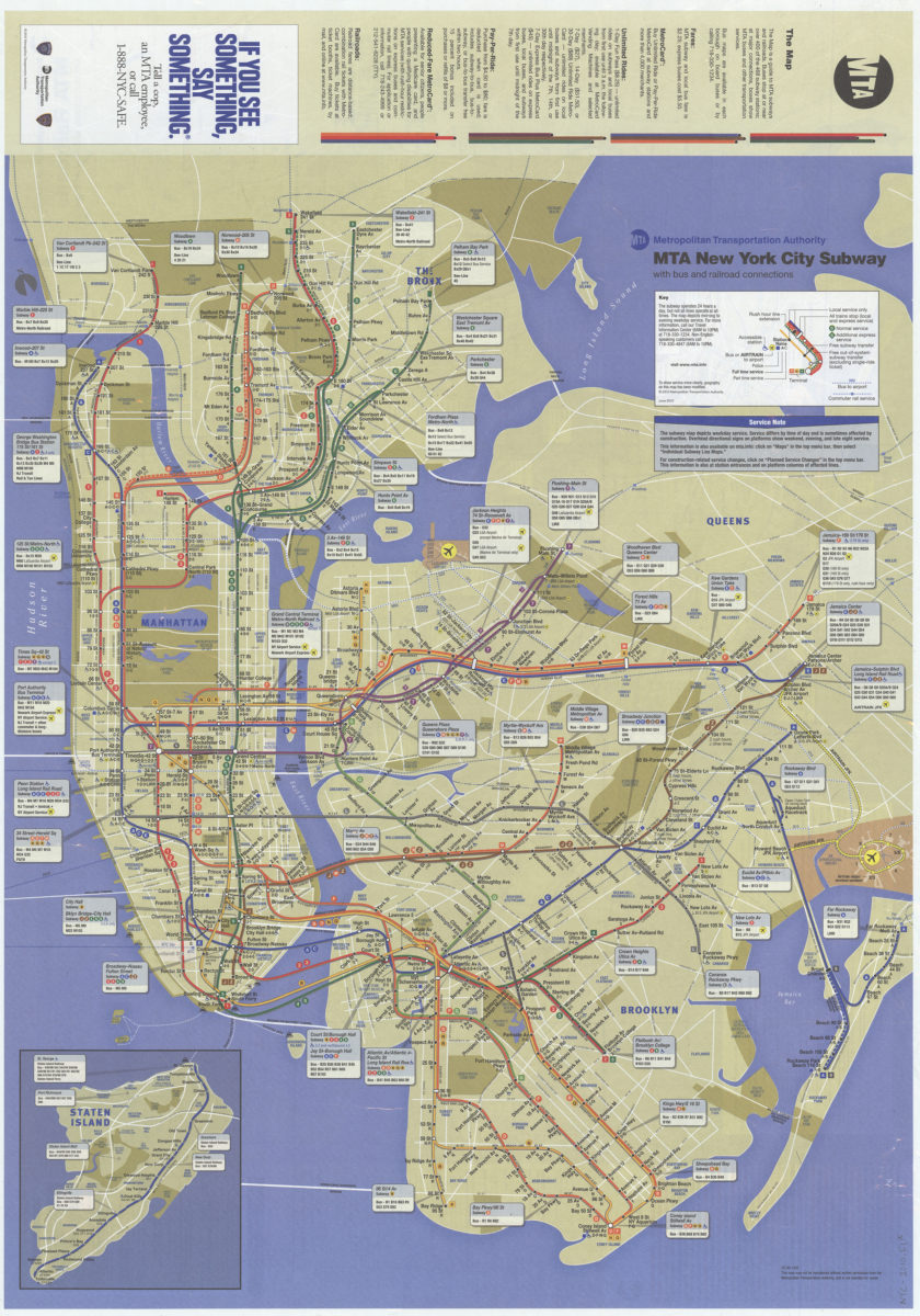
The map: MTA subways and commuter railroads, major connections between MTA subways, rail lines, buses, and other regional transit, MTA Bridges and Tunnels crossings: MTA Metropolitan Transportation Authority
The map: MTA subways and commuter railroads, major connections between MTA subways, rail lines, buses, and other regional transit, MTA Bridges and Tunnels crossings: MTA Metropolitan Transportation Authority
[ca. 2009]
The map: MTA subways and commuter railroads, major connections between MTA subways, rail lines, buses, and other regional transit, MTA Bridges and Tunnels crossings: MTA Metropolitan Transportation Authority
The map: MTA subways and commuter railroads, major connections between MTA subways, rail lines, buses, and other regional transit, MTA Bridges and Tunnels crossings: MTA Metropolitan Transportation Authority
August 2004
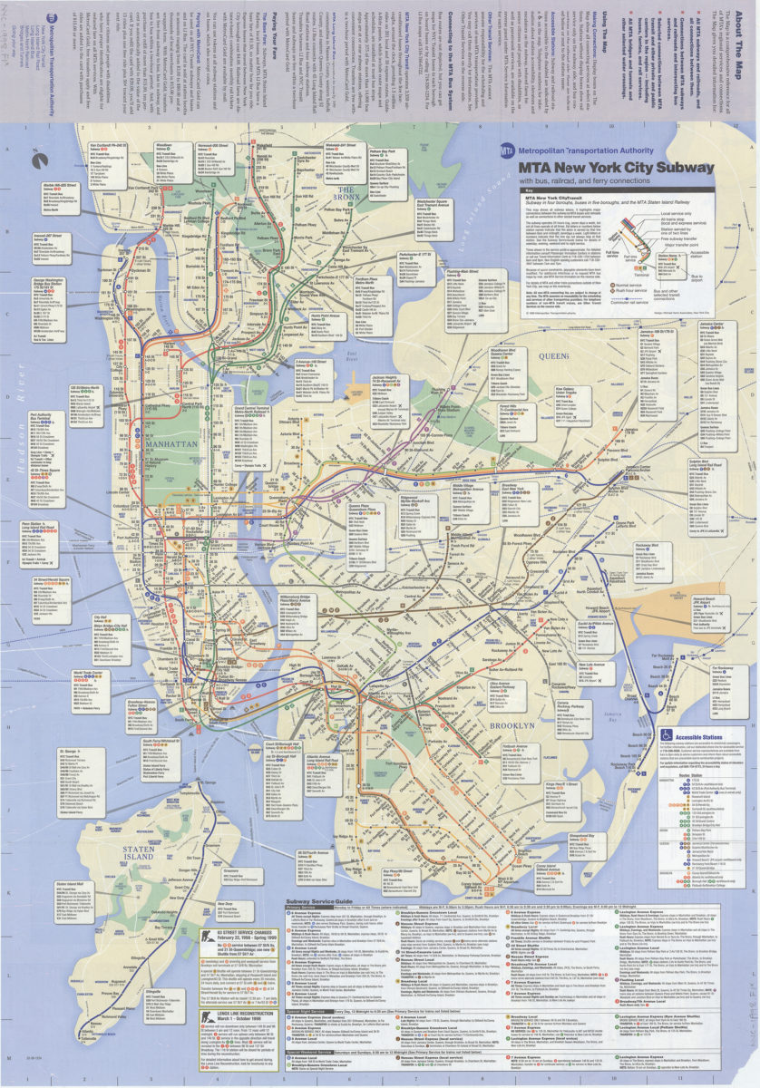
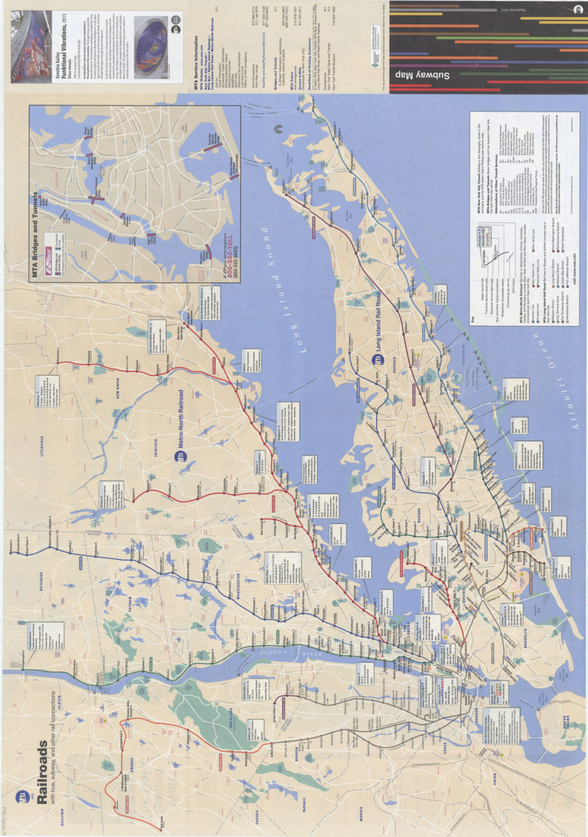
The map: MTA subways and commuter railroads, plus bus connections: MTA Metropolitan Transporation Authority
The map: MTA subways and commuter railroads, plus bus connections: MTA Metropolitan Transporation Authority
November 2009
The map: MTA subways and railroads, plus bus connections: MTA Metropolitan Transporation Authority
The map: MTA subways and railroads, plus bus connections: MTA Metropolitan Transporation Authority
[ca. 2005]
The map: MTA subways and railroads, plus bus connections: MTA Metropolitan Transporation Authority
The map: MTA subways and railroads, plus bus connections: MTA Metropolitan Transporation Authority
[ca. 2006]
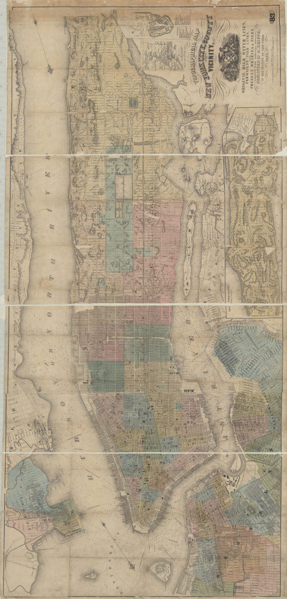
Topographical map of New York City, County and vicinity showing the original high water lines, permanent pier lines, and the present wharves & piers: compiled from authentic surveys
Topographical map of New York City, County and vicinity showing the original high water lines, permanent pier lines, and the present wharves & piers: compiled from authentic surveys
1855
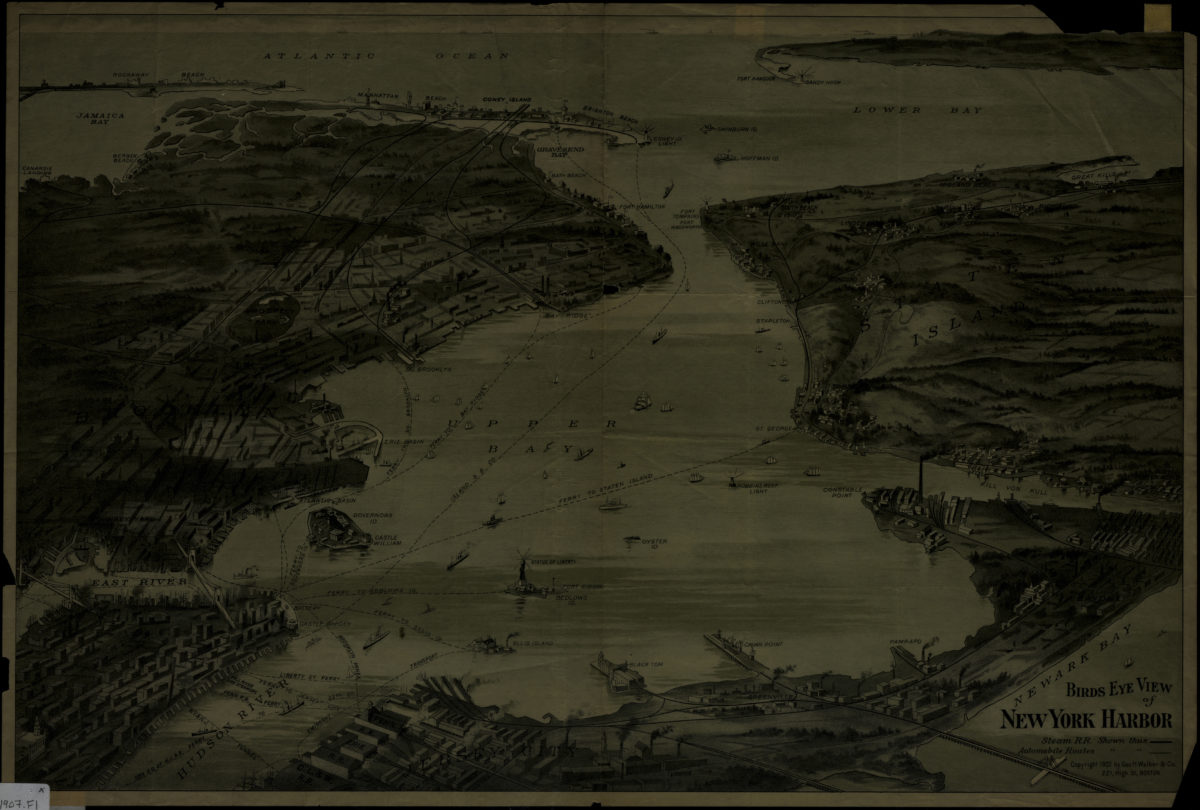
Birds eye view of New York Harbor
Birds eye view of New York Harbor
[1907]
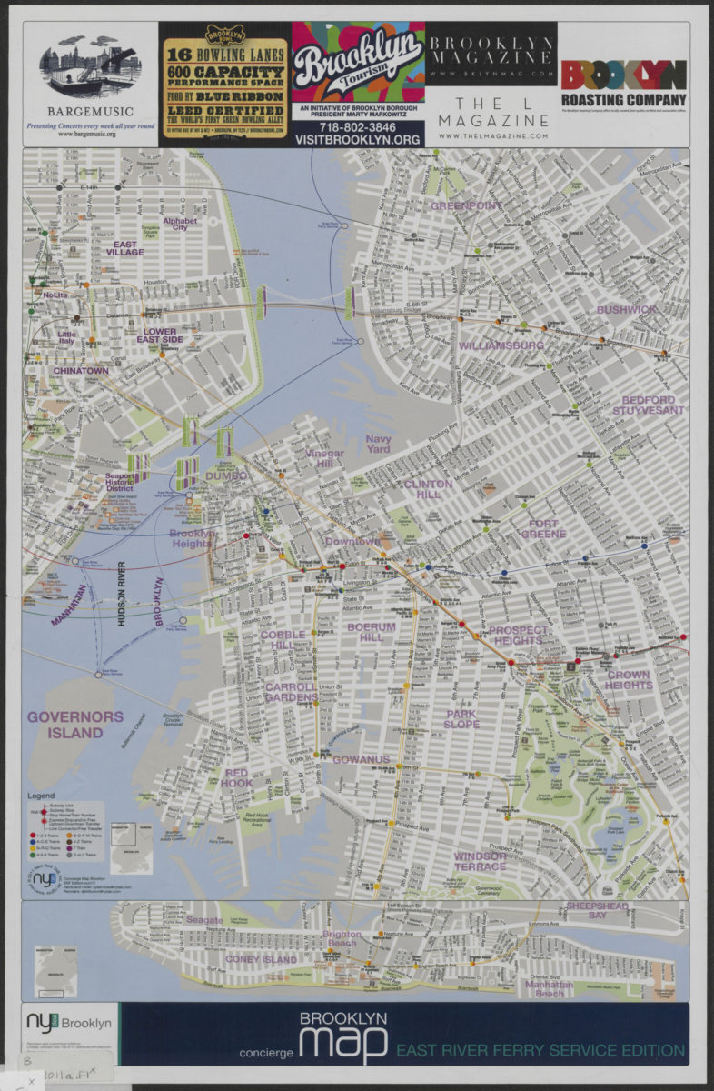
Concierge Brooklyn map: East River Ferry service edition
Concierge Brooklyn map: East River Ferry service edition
[2011; 2011]
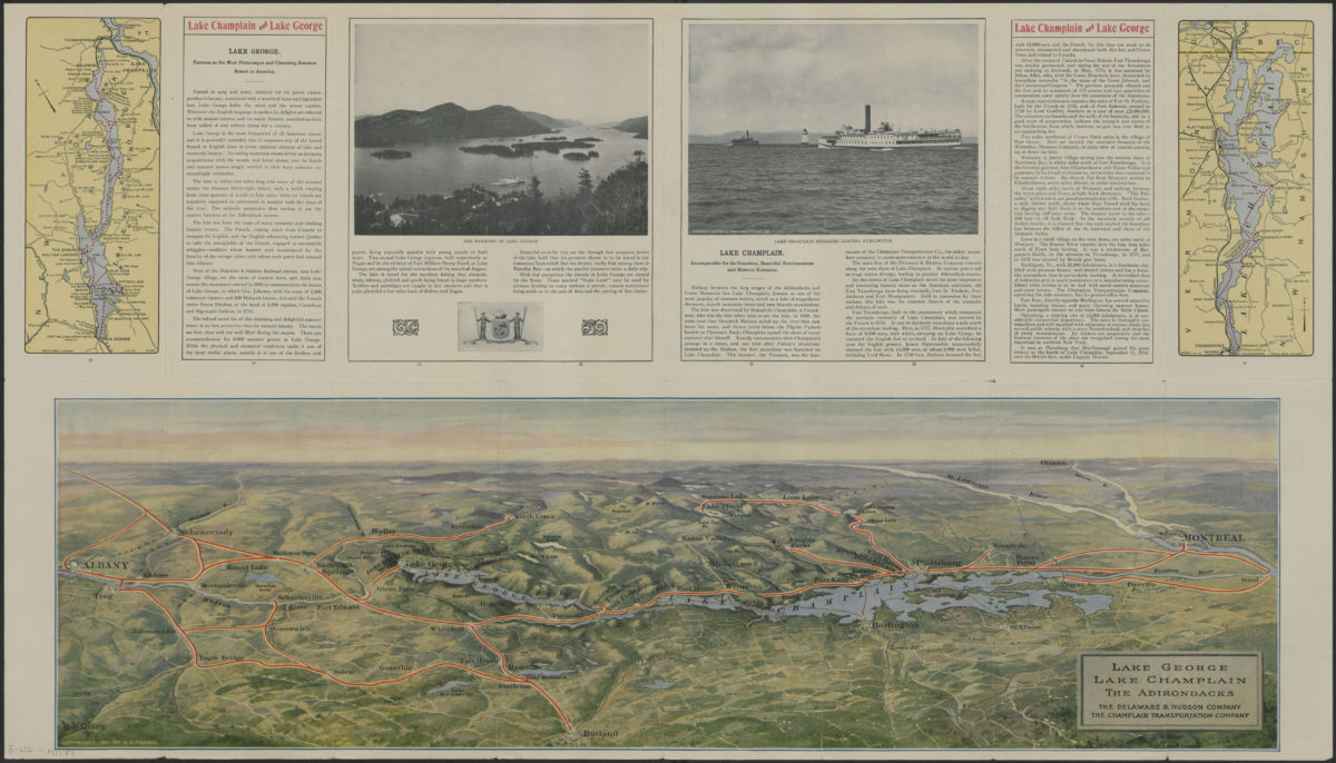
Lake George, Lake Champlain, the Adirondacks: the Delaware & Hudson Company ; the Champlain Transportation Company
Lake George, Lake Champlain, the Adirondacks: the Delaware & Hudson Company ; the Champlain Transportation Company
[1911; 1911]
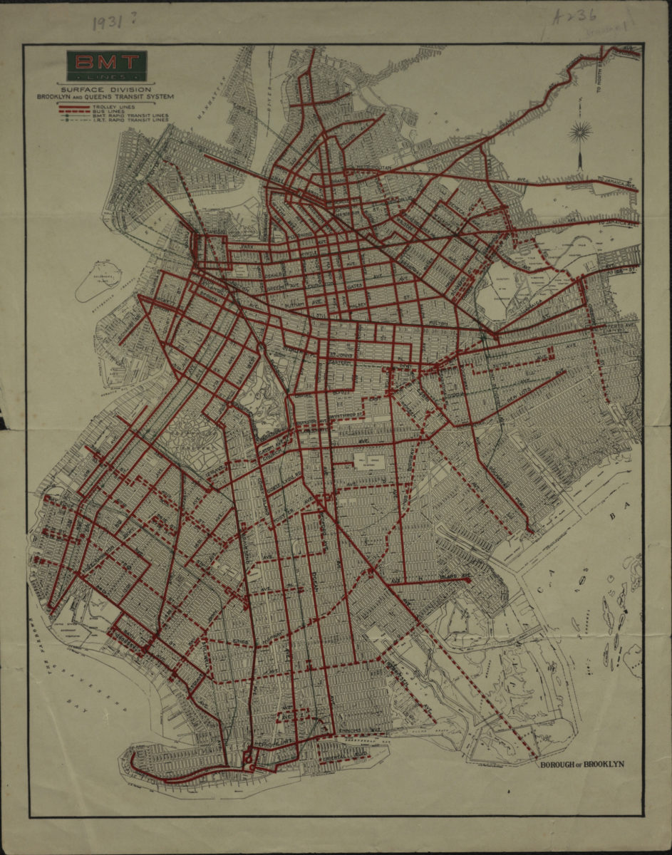
BMT Lines Surface Division, Brooklyn and Queens transit system
BMT Lines Surface Division, Brooklyn and Queens transit system
[193?]
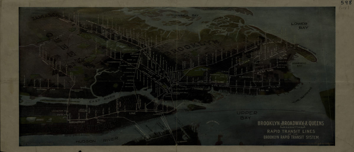
Brooklyn, Broadway (Manhattan), Queens rapid transit lines of the Brooklyn Rapid Transit System: Harry A. Chandler
Brooklyn, Broadway (Manhattan), Queens rapid transit lines of the Brooklyn Rapid Transit System: Harry A. Chandler
[1916-1924]
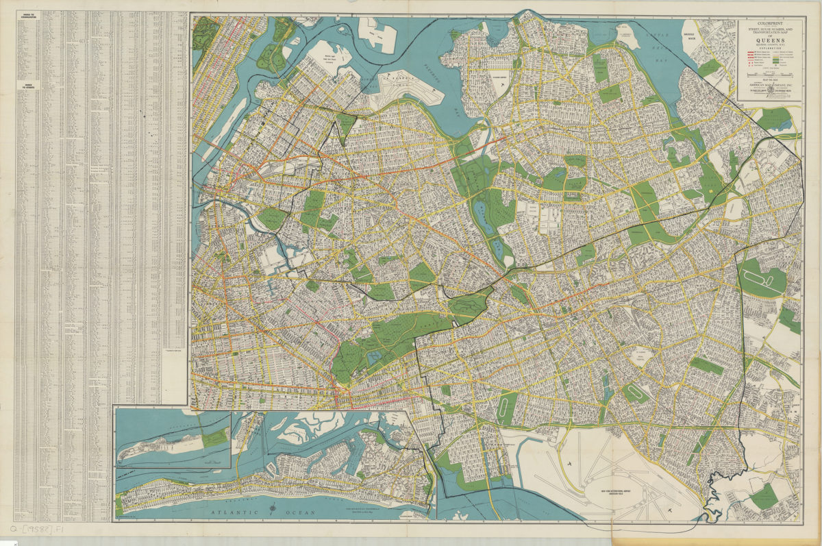
Colorprint street, house number and transportation map of Queens: (Queens County, N.Y.): American Map Company
Colorprint street, house number and transportation map of Queens: (Queens County, N.Y.): American Map Company
[1958]
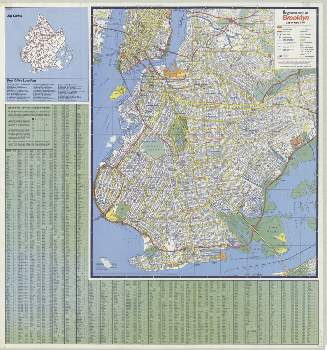
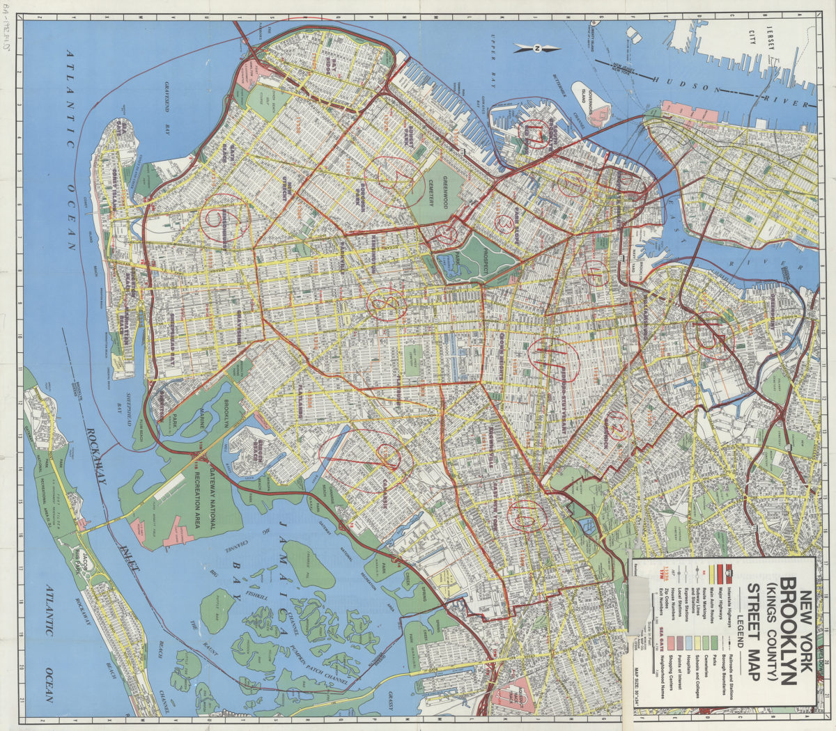
Hagstrom map of Brooklyn, city of New York
Hagstrom map of Brooklyn, city of New York
[ca. 1994]
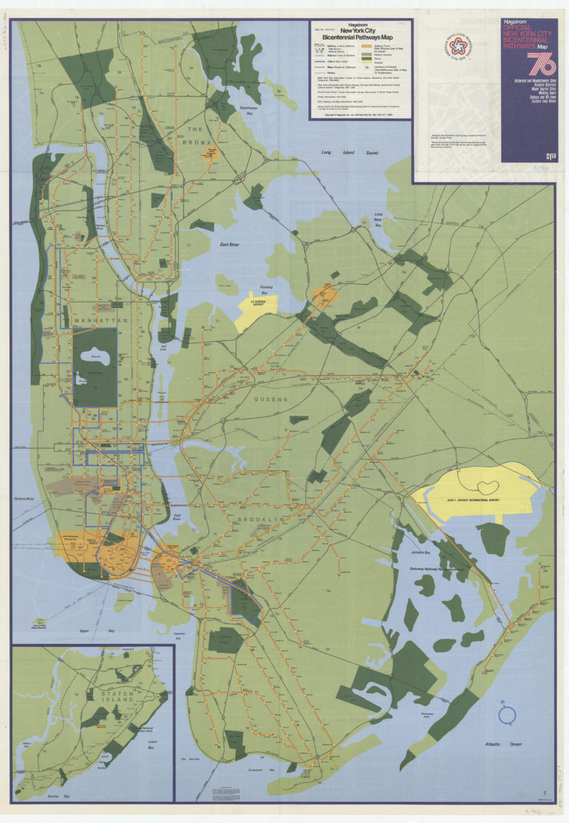
Hagstrom New York City Bicentennial pathways map
Hagstrom New York City Bicentennial pathways map
[1975]
Hagstrom’s map of Brooklyn, New York City: house number and transit guide: compiled, printed, and published by Hagstrom Company Incorporated
Hagstrom’s map of Brooklyn, New York City: house number and transit guide: compiled, printed, and published by Hagstrom Company Incorporated
[1950; 1947]
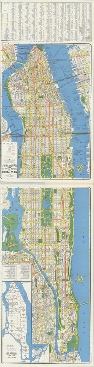
Hagstrom’s map of New York, house number and transit guide: compiled, printed and published by Hagstrom Company Incorporated
Hagstrom’s map of New York, house number and transit guide: compiled, printed and published by Hagstrom Company Incorporated
[1963]
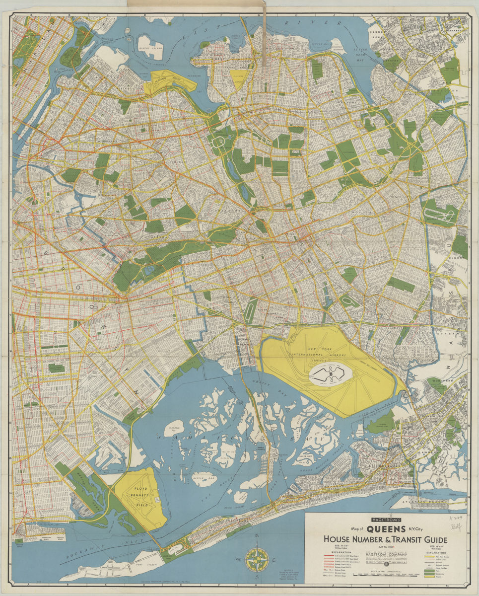
Hagstrom’s map of Queens (New York City): house-number and subway guide: compiled, printed, and published by Hagstrom Map Company, map makers and publishers
Hagstrom’s map of Queens (New York City): house-number and subway guide: compiled, printed, and published by Hagstrom Map Company, map makers and publishers
[1928]
Hagstrom’s map of Queens N.Y. City: house number & transit guide: compiled, printed, and published by Hagstrom Company Incorporated
Hagstrom’s map of Queens N.Y. City: house number & transit guide: compiled, printed, and published by Hagstrom Company Incorporated
[1948]
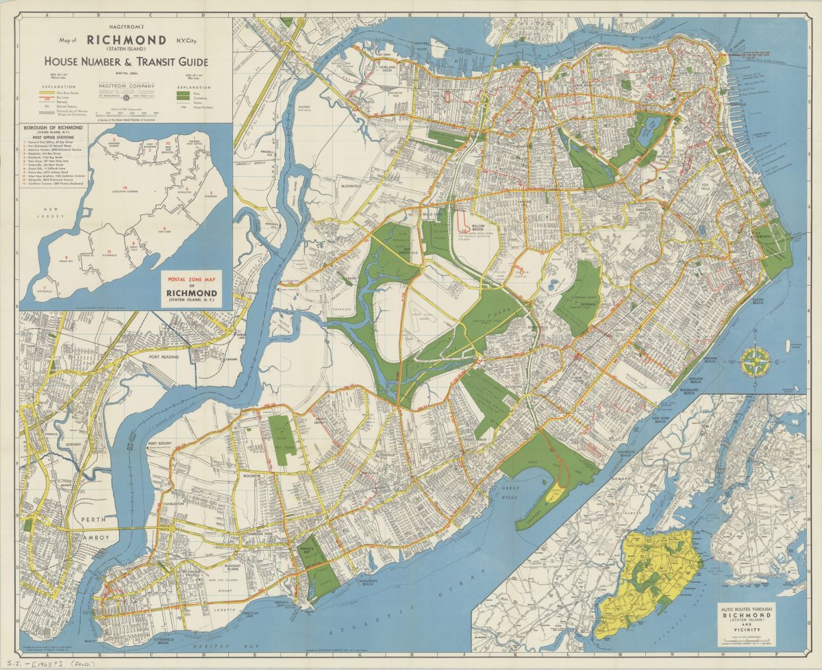
Hagstrom’s map of Richmond (Staten Island), N. Y. City: house number & transit guide: compiled, printed, and published by Hagstrom Company
Hagstrom’s map of Richmond (Staten Island), N. Y. City: house number & transit guide: compiled, printed, and published by Hagstrom Company
[1963]
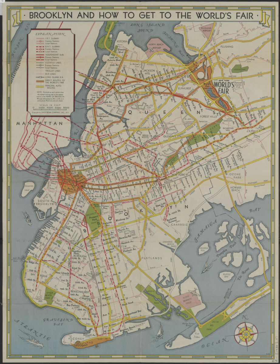
How to get to the New York World’s Fair, and The heart of Brooklyn: issued by the Downtown Brooklyn Association, Inc
How to get to the New York World’s Fair, and The heart of Brooklyn: issued by the Downtown Brooklyn Association, Inc
[1939]
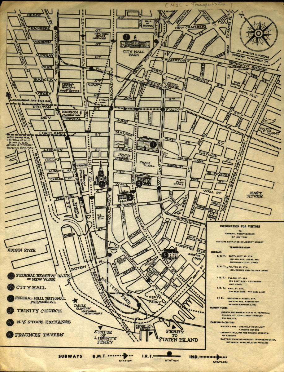
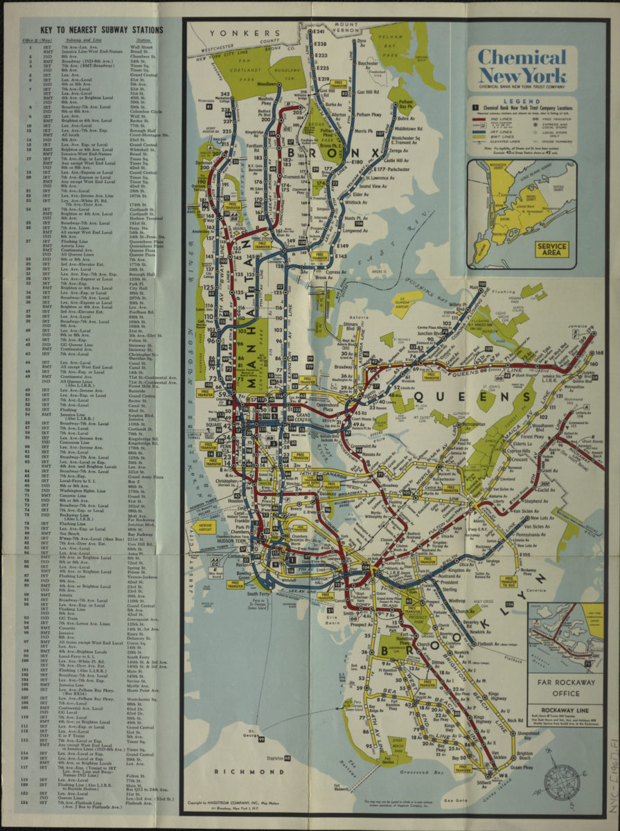
Information for visitors to Federal Reserve Bank of New York
Information for visitors to Federal Reserve Bank of New York
[1956-1966]
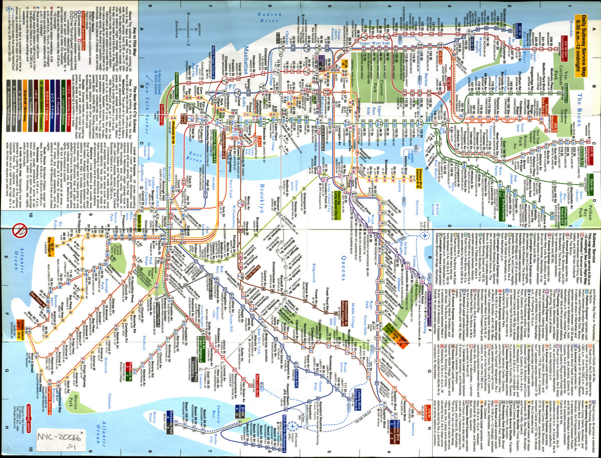
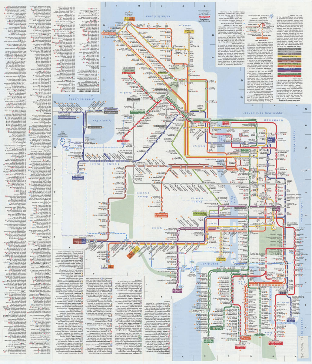
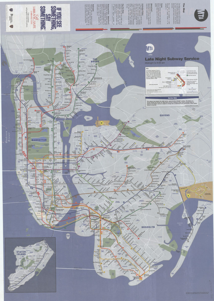
Late night subway service, midnight to 6: 12:00 AM: MTA.info
Late night subway service, midnight to 6: 12:00 AM: MTA.info
[ca. 2012]
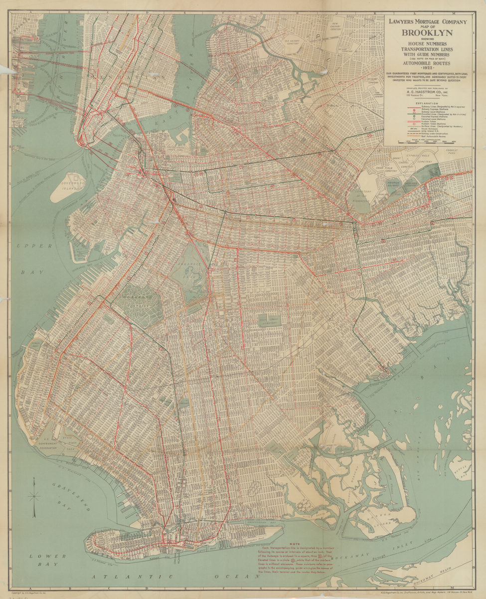
Lawyer’s Mortgage Company map of Brooklyn: showing house-numbers, transportation lines, with guide numbers … automobile routes, 1922: compiled, printed and published A.G. Hagstrom Co., Inc
Lawyer’s Mortgage Company map of Brooklyn: showing house-numbers, transportation lines, with guide numbers … automobile routes, 1922: compiled, printed and published A.G. Hagstrom Co., Inc
1922
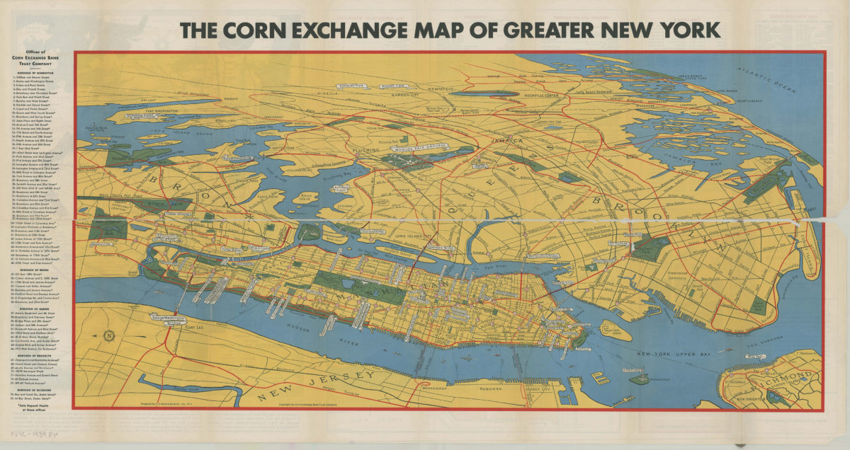
Map of greater New York: New York World’s Fair, 1939: prepared by C.S. Hammond & Co., inc ; copyright by Corn Exchange Bank Trust Company
Map of greater New York: New York World’s Fair, 1939: prepared by C.S. Hammond & Co., inc ; copyright by Corn Exchange Bank Trust Company
[1939]
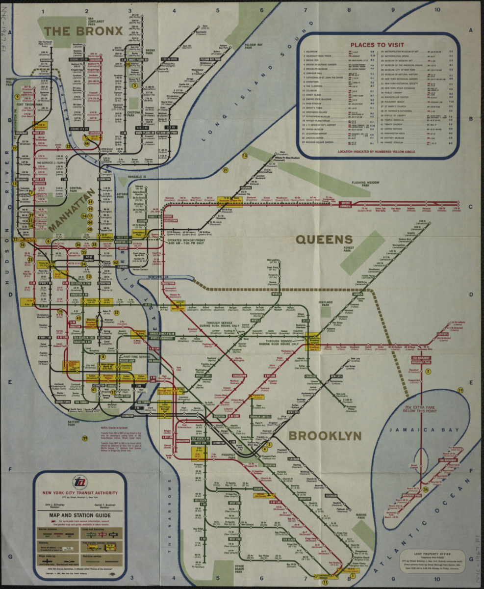
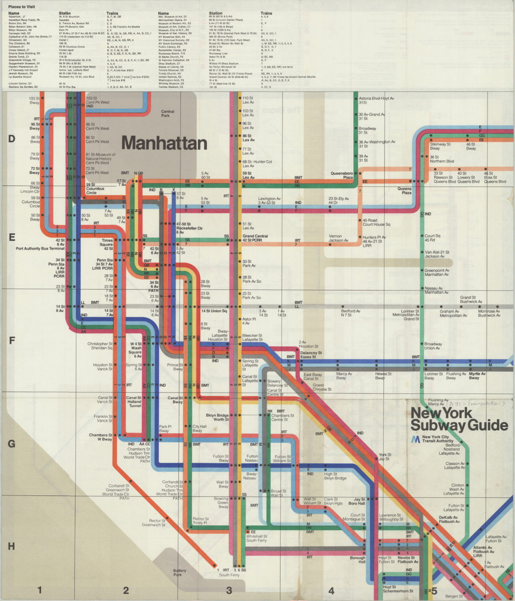
Map and station guide: New York City Transit Authority
Map and station guide: New York City Transit Authority
[ca. 1967]
Map of the New York City subway system: designed by Stephen Voorhies
Map of the New York City subway system: designed by Stephen Voorhies
[1955; 1955]
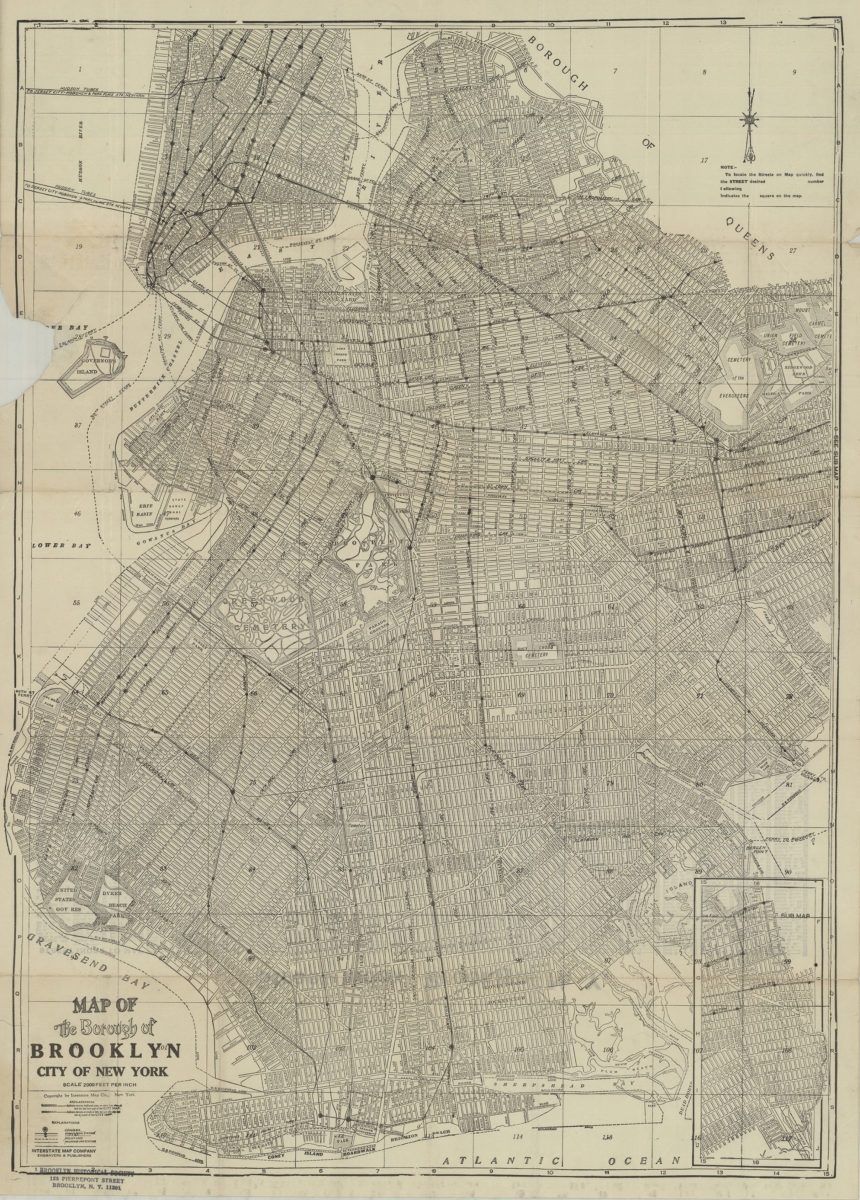
Map of the Borough of Brooklyn, City of New York
Map of the Borough of Brooklyn, City of New York
[19??]
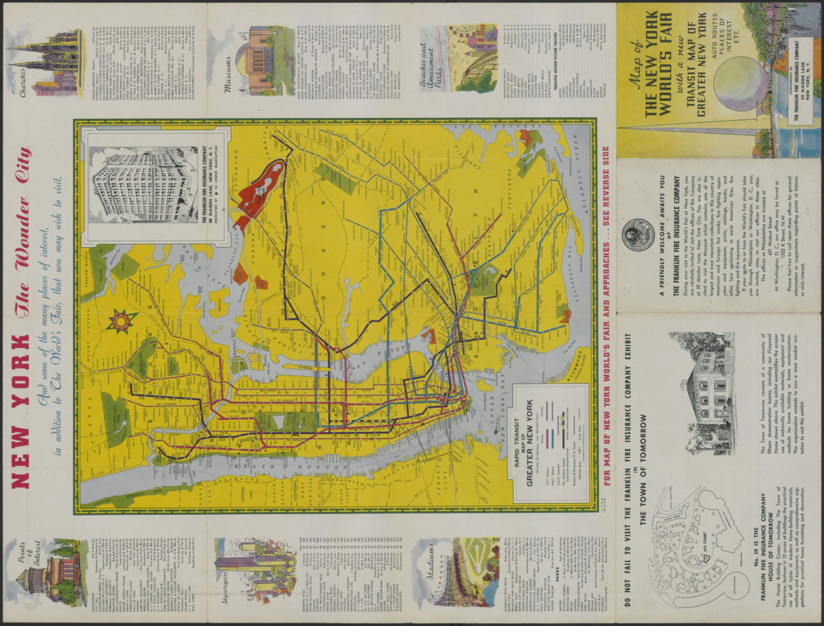
Map of the New York World’s Fair with a new transit map of Greater New York: auto routes, places of interest
Map of the New York World’s Fair with a new transit map of Greater New York: auto routes, places of interest
[1939]
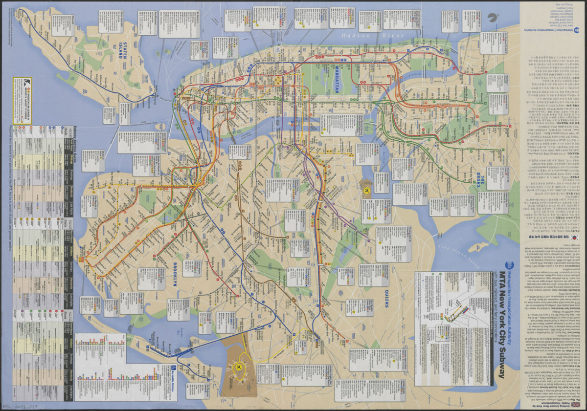
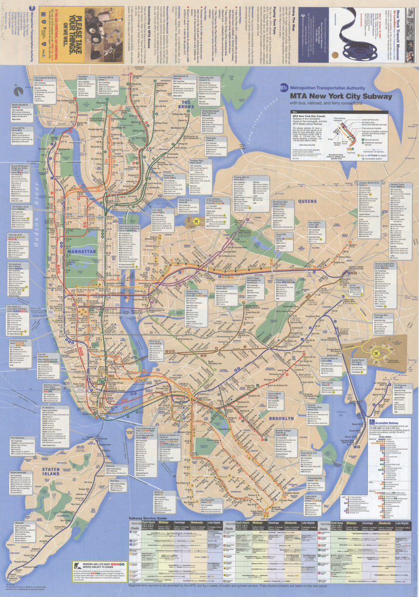
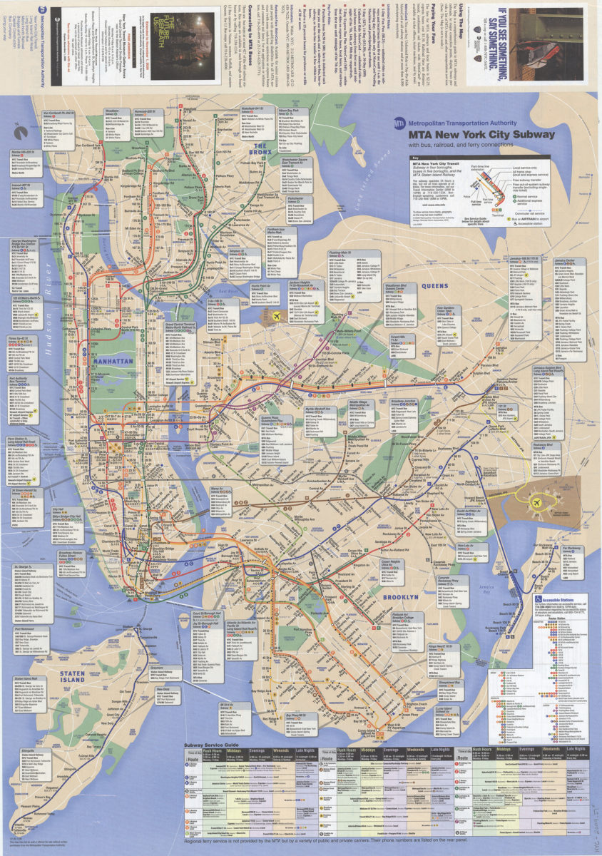
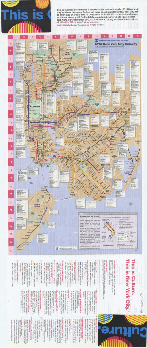
MTA New York City subway with bus, railroad and ferry connections
MTA New York City subway with bus, railroad and ferry connections
[2009; ca. 2009]
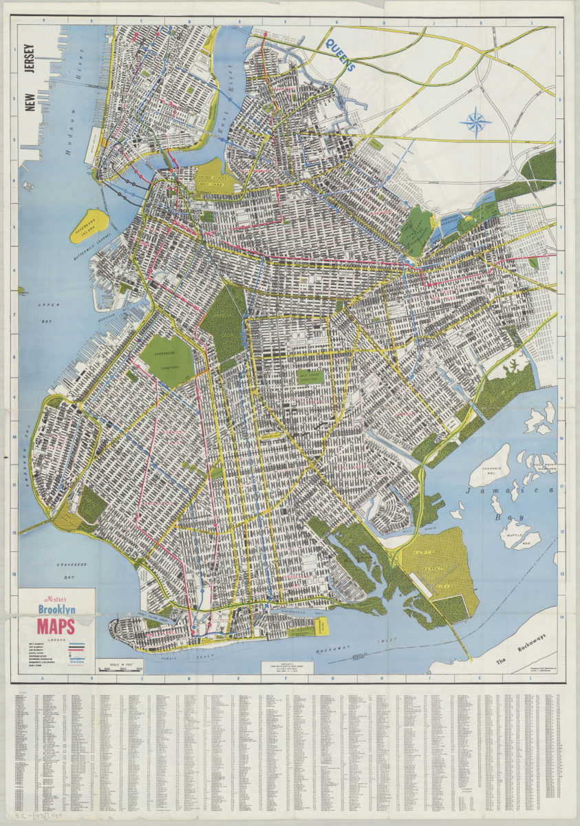
Nester’s Brooklyn maps: cartography by Dante Di Matteo
Nester’s Brooklyn maps: cartography by Dante Di Matteo
[1955; 1955]
New York City subway map
New York City subway map
[1961]
New York City Transit subway map: multilingual : English, Français, Español, Deutsch, Italiano, Nihongo, Chung wen/: MTA-New York City Transit
New York City Transit subway map: multilingual : English, Français, Español, Deutsch, Italiano, Nihongo, Chung wen/: MTA-New York City Transit
[ca. 1996]
New York, Brooklyn (Kings County), street map: Geographia Map Co., Inc
New York, Brooklyn (Kings County), street map: Geographia Map Co., Inc
[ca. 1982]
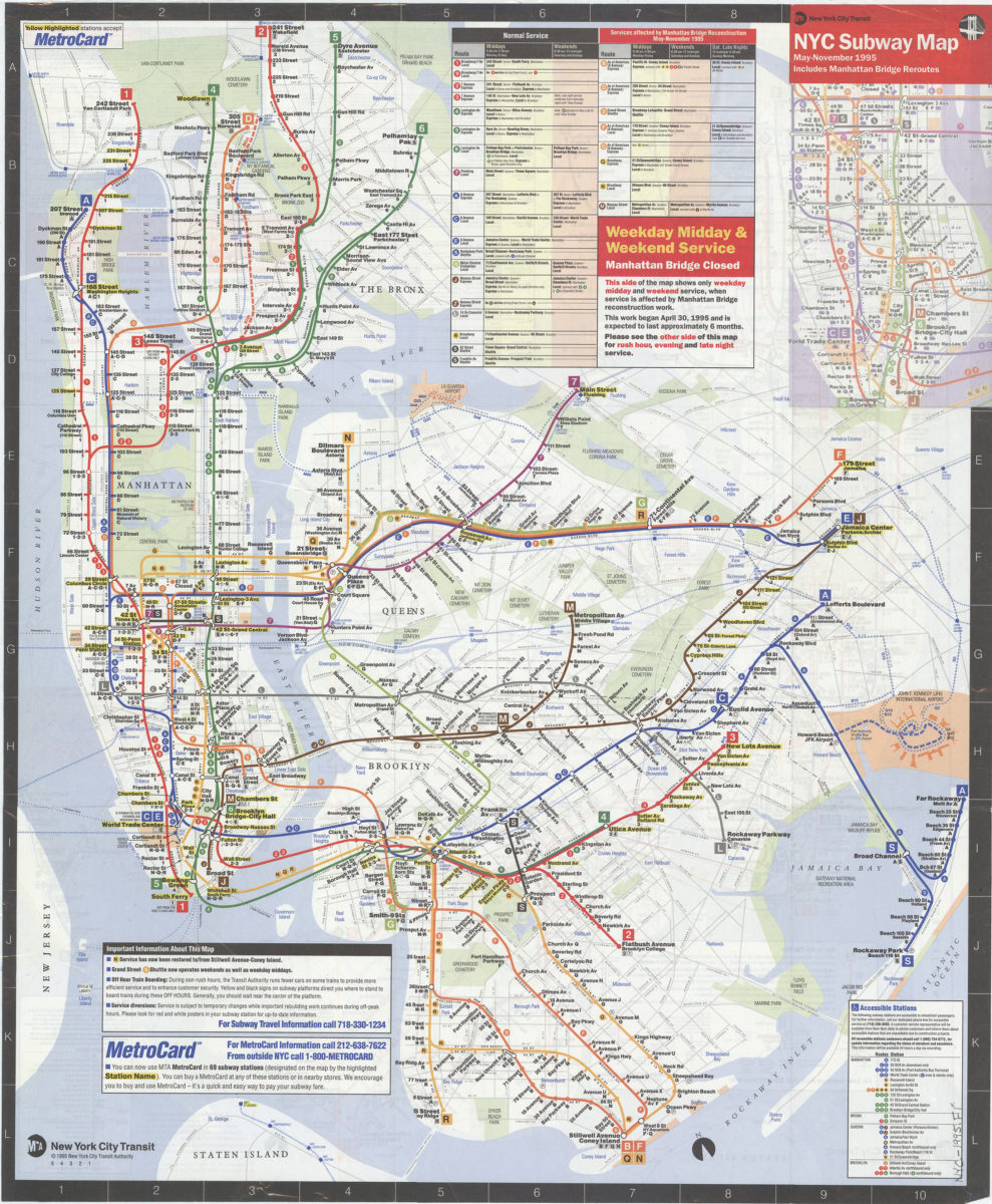
NYC subway map, May-November 1995: includes Manhattan Bridge reroutes: MTA New York City Transit Authority
NYC subway map, May-November 1995: includes Manhattan Bridge reroutes: MTA New York City Transit Authority
[ca. 1995]
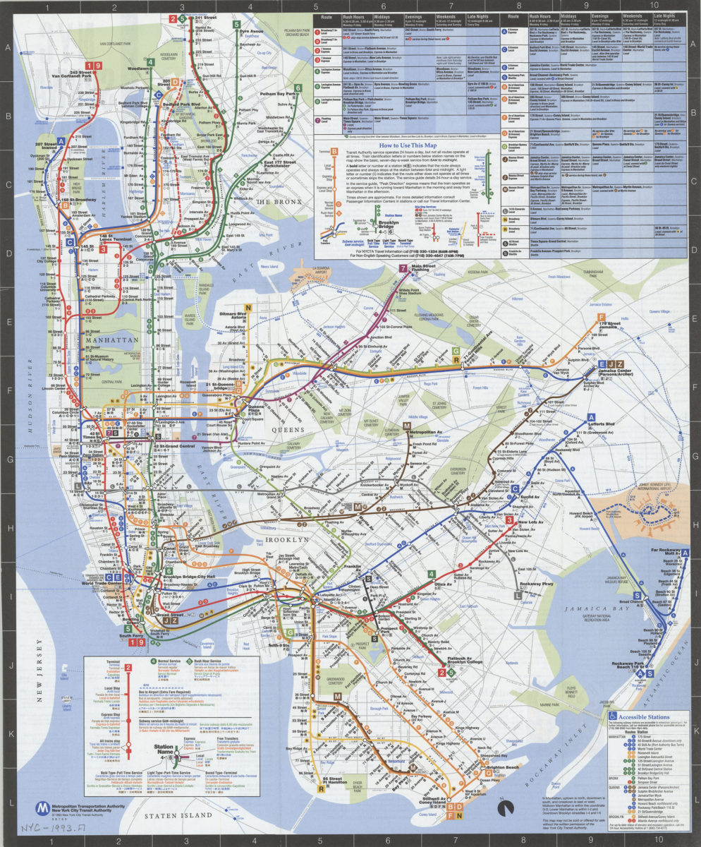
NYC subway map: June 1993, Français, Español, Deutsch, Italiano, English, Nihongo, Chung wen: New York City Transit Authority, Metropolitan Transportation Authority
NYC subway map: June 1993, Français, Español, Deutsch, Italiano, English, Nihongo, Chung wen: New York City Transit Authority, Metropolitan Transportation Authority
[ca. 1993]
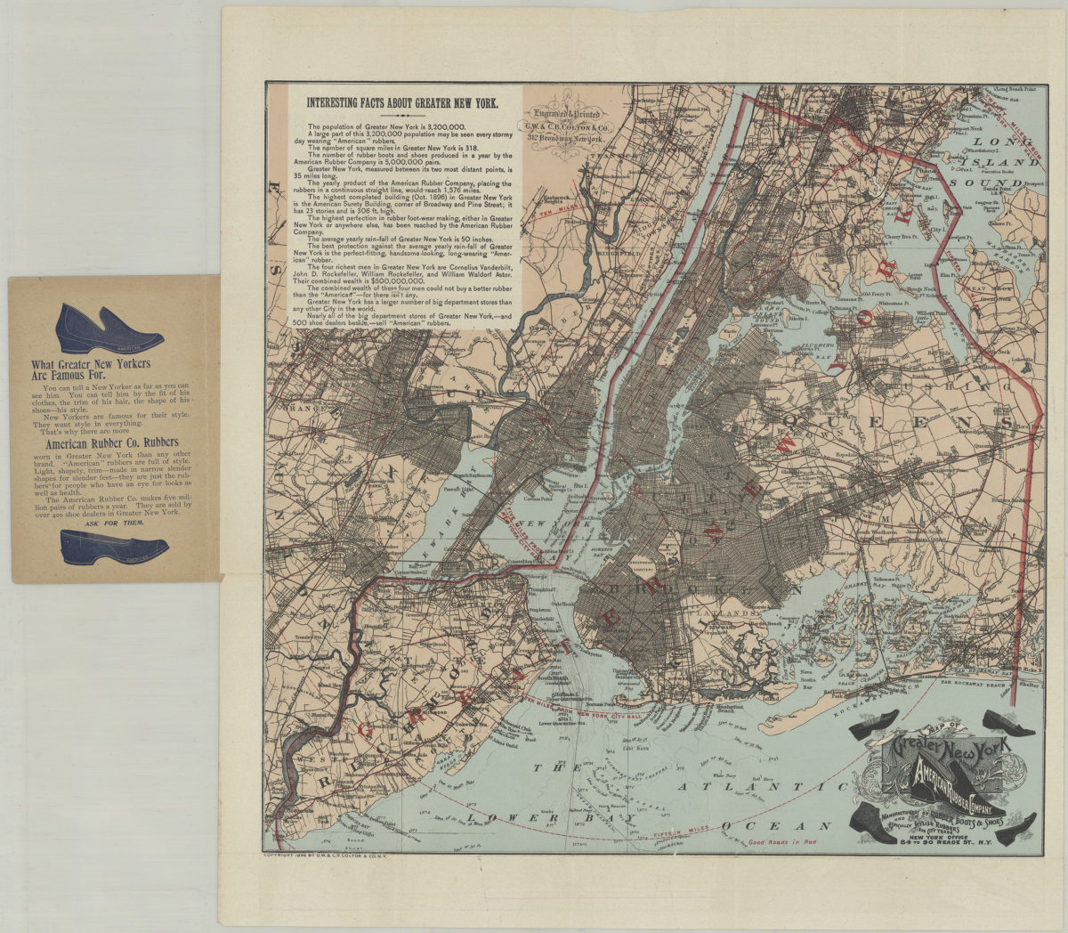
Pocket map of greater New York: showing the good roads in and about greater New York, together with a map of New York City proper
Pocket map of greater New York: showing the good roads in and about greater New York, together with a map of New York City proper
[ca. 1896]
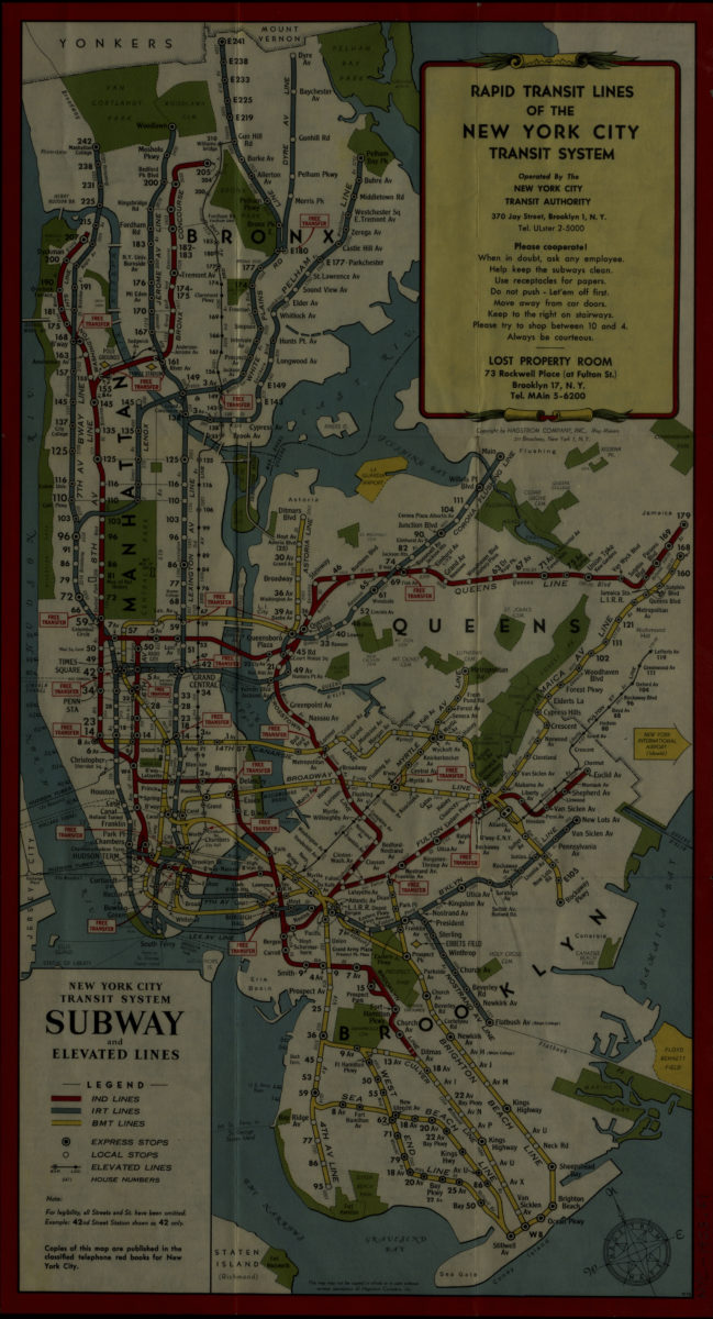
Rapid transit lines of the New York City transit system: operated by the New York City Transit Authority
Rapid transit lines of the New York City transit system: operated by the New York City Transit Authority
[1953]
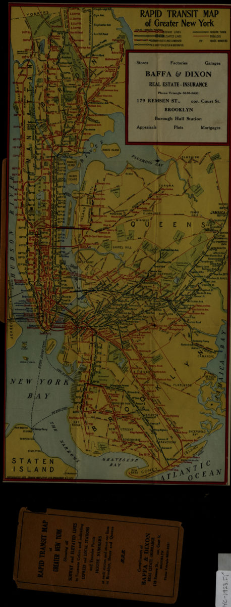
Rapid transit map of greater New York: Ohman Map Co
Rapid transit map of greater New York: Ohman Map Co
1923
The complete map of Brooklyn (New York City): featuring house numbers, transit lines, playgrounds, wading pools, etc.: produced under the direction of Alexander Gross
The complete map of Brooklyn (New York City): featuring house numbers, transit lines, playgrounds, wading pools, etc.: produced under the direction of Alexander Gross
[195?]
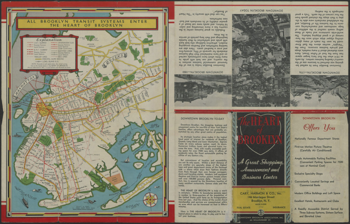
The heart of Brooklyn: a great shopping, amusement and business center: Downtown Brooklyn Association, Inc
The heart of Brooklyn: a great shopping, amusement and business center: Downtown Brooklyn Association, Inc
[1940]
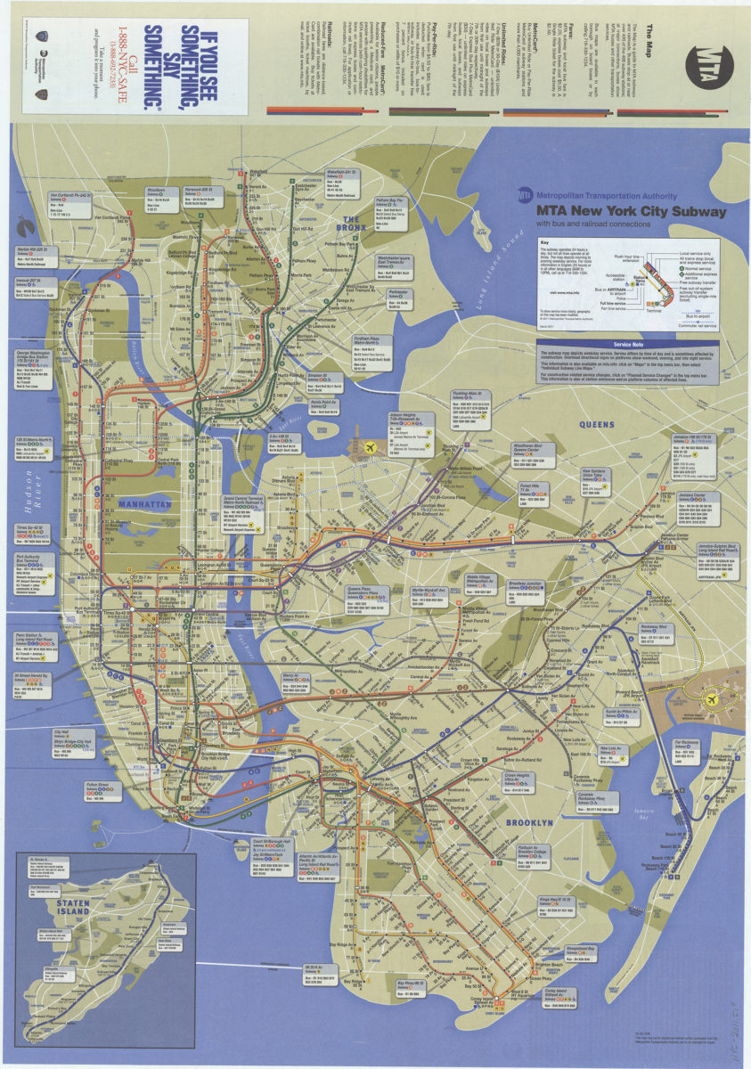
The map: MTA
The map: MTA
2014
The map: MTA
The map: MTA
Sep-15
The map/: MTA
The map/: MTA
[ca. 2010]
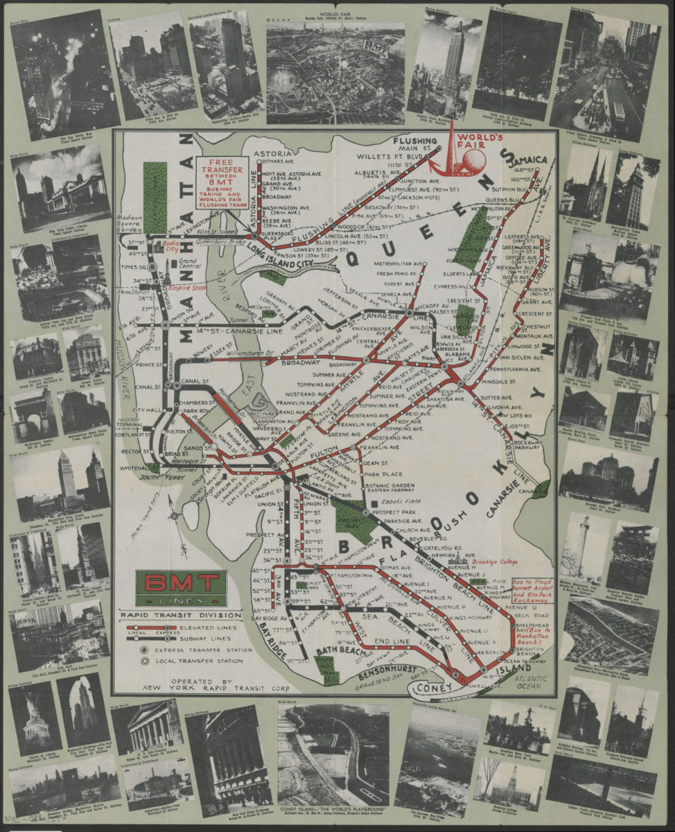
BMT Lines Rapid Transit Division
BMT Lines Rapid Transit Division
[1939]
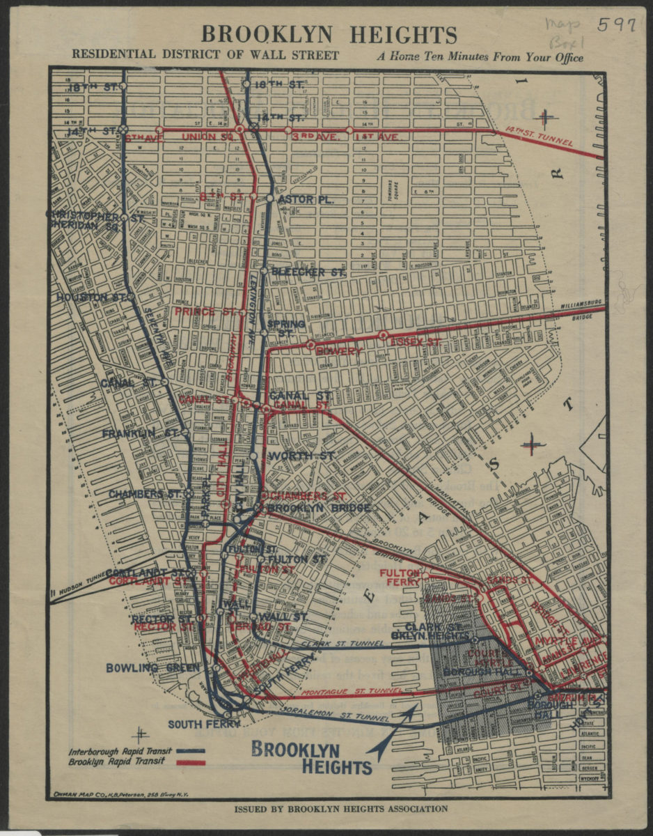
Brooklyn Heights, residential district of Wall Street: a home ten minutes from your office
Brooklyn Heights, residential district of Wall Street: a home ten minutes from your office
[1921]
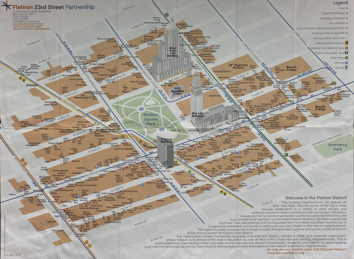
Discover Flatiron map: Flatiron 23rd Street Partnership
Discover Flatiron map: Flatiron 23rd Street Partnership
[2011]
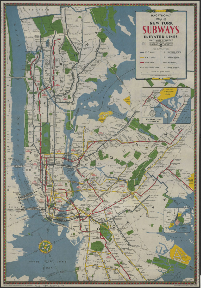
Hagstrom’s map of New York subways, elevated lines: compiled, printed and published by Hagstrom Company Incorporated
Hagstrom’s map of New York subways, elevated lines: compiled, printed and published by Hagstrom Company Incorporated
[200?]
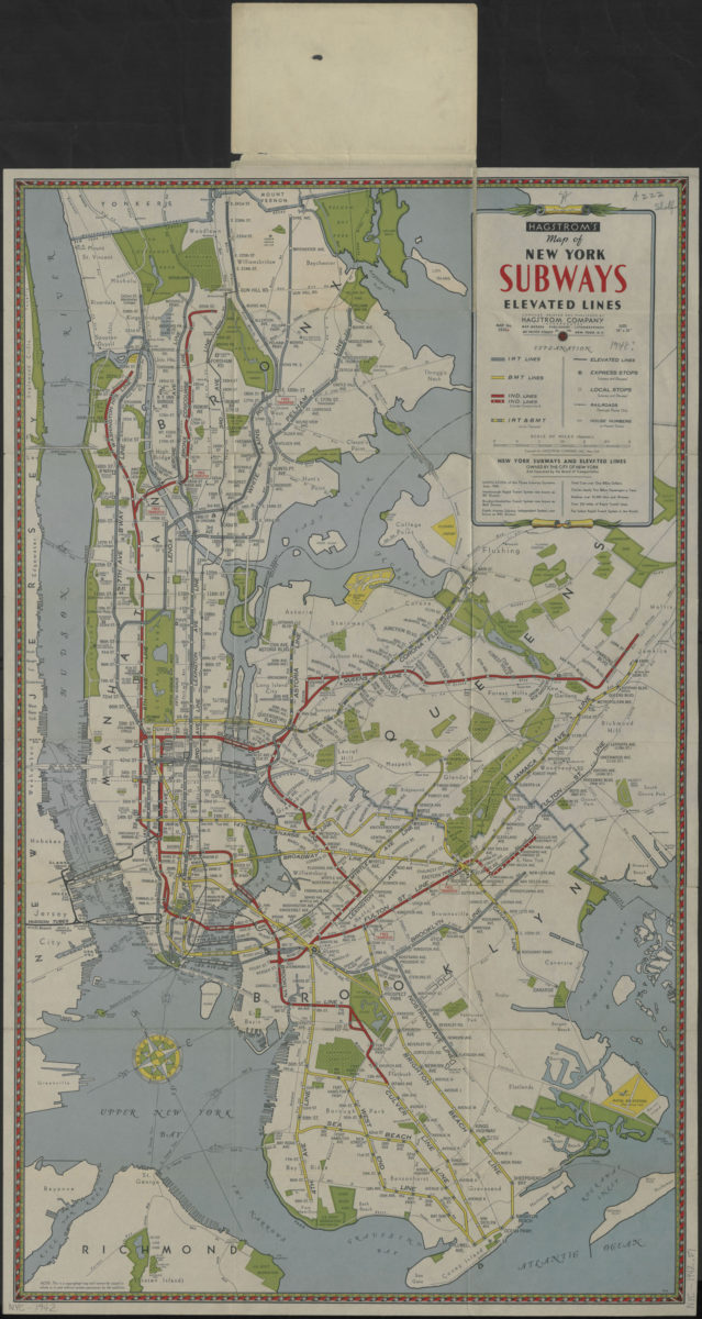
Hagstrom’s map of New York subways, elevated lines: compiled, printed and published by Hagstrom Company, Incorporated
Hagstrom’s map of New York subways, elevated lines: compiled, printed and published by Hagstrom Company, Incorporated
[1942]
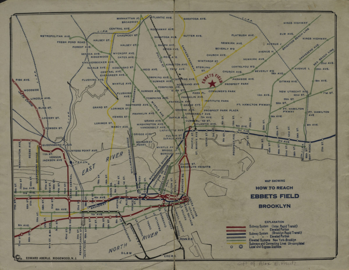
Map showing how to reach Ebbets Field, Brooklyn
Map showing how to reach Ebbets Field, Brooklyn
[1919]
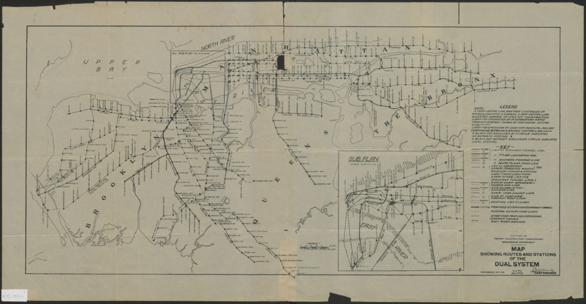
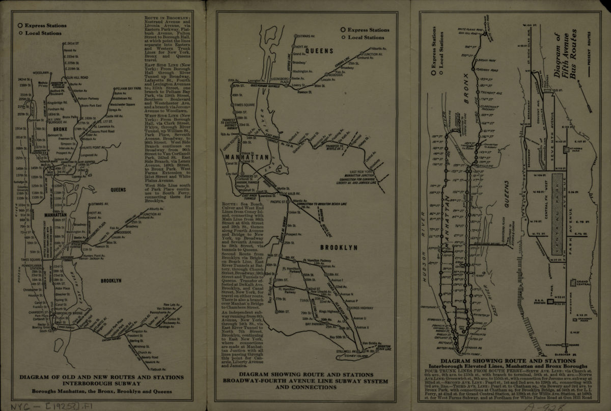
Map showing routes and stations of the dual systems
Map showing routes and stations of the dual systems
1919
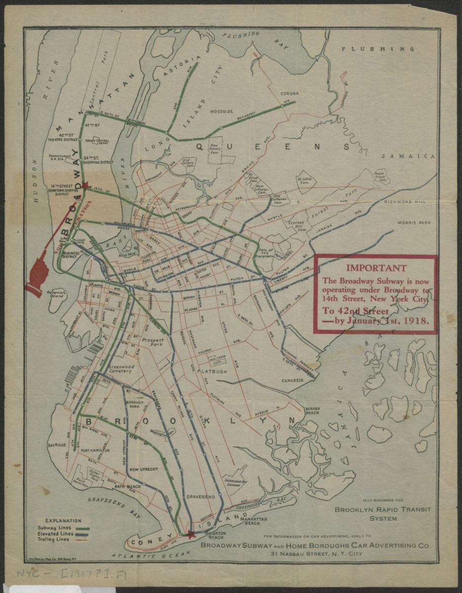
Map showing the Brooklyn Rapid Transit system
Map showing the Brooklyn Rapid Transit system
[1917]
Nester’s Brooklyn maps: produced and designed by Lewis J. Nesterman
Nester’s Brooklyn maps: produced and designed by Lewis J. Nesterman
[1976]
New York City subway map: daily service, late-night service, index of stations & places of interest: Tauranac Maps
New York City subway map: daily service, late-night service, index of stations & places of interest: Tauranac Maps
[2006, ca. 1992]
New York City subway, geographic & non-geographic maps: daytime, evening & late-night service, index of stations, places of interest: Tauranac Maps
New York City subway, geographic & non-geographic maps: daytime, evening & late-night service, index of stations, places of interest: Tauranac Maps
[2011, ca. 2008]
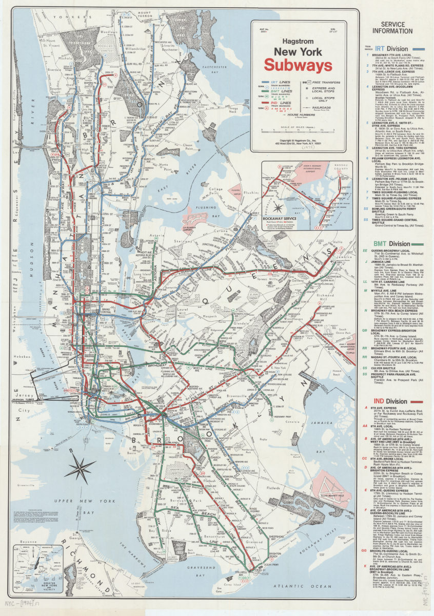
New York subways: Hagstrom
New York subways: Hagstrom
[1974]
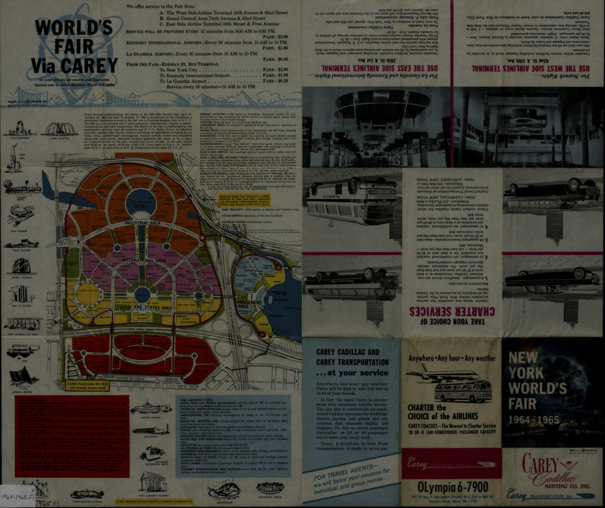
New York World’s Fair 1964-1965: [prepared for] Carey Transportation, Inc. ; published by City Street Directory, Inc
New York World’s Fair 1964-1965: [prepared for] Carey Transportation, Inc. ; published by City Street Directory, Inc
[1964; 1964]
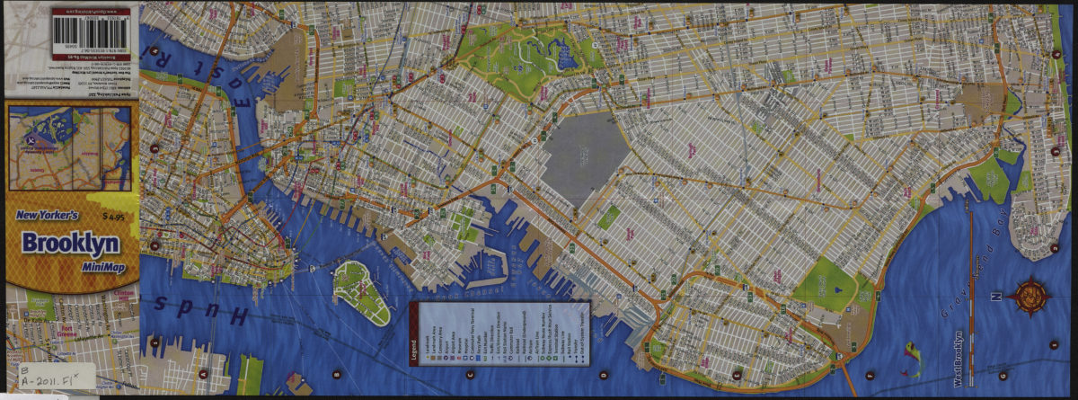
New Yorker’s Brooklyn minimap
New Yorker’s Brooklyn minimap
[2011; 2011]
Rapid transit systems of greater New York: interborough subway and elevated lines, Brooklyn rapid transit subway & elevated lines: compliments of the Corn Exchange Bank
Rapid transit systems of greater New York: interborough subway and elevated lines, Brooklyn rapid transit subway & elevated lines: compliments of the Corn Exchange Bank
[ca. 1925]
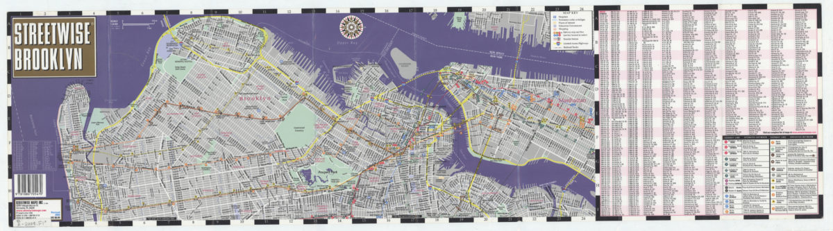
Streetwise Brooklyn: Streetwise Maps, Inc
Streetwise Brooklyn: Streetwise Maps, Inc
[2008; ca. 2000]
Subway map: the New York subway map = Le plan du métro de New York: the New York subway map is a Tauranac map
Subway map: the New York subway map = Le plan du métro de New York: the New York subway map is a Tauranac map
[1992]
The Metropolitan Transportation Authority revised map of rapid transit facilities of New York City Transit Authority: New York City Transit Authority
The Metropolitan Transportation Authority revised map of rapid transit facilities of New York City Transit Authority: New York City Transit Authority
[ca. 1972]
The Metropolitan Transportation Authority revised map of rapid transit facilities of New York City Transit Authority: New York City Transit Authority
The Metropolitan Transportation Authority revised map of rapid transit facilities of New York City Transit Authority: New York City Transit Authority
[ca. 1974]