Center for Brooklyn History
Map Collections
Search
About
Othmer Library & Archives
Queens Neighborhoods
106 records
For neighborhood-specific results, visit the
Search
page, and use the Locations filter.
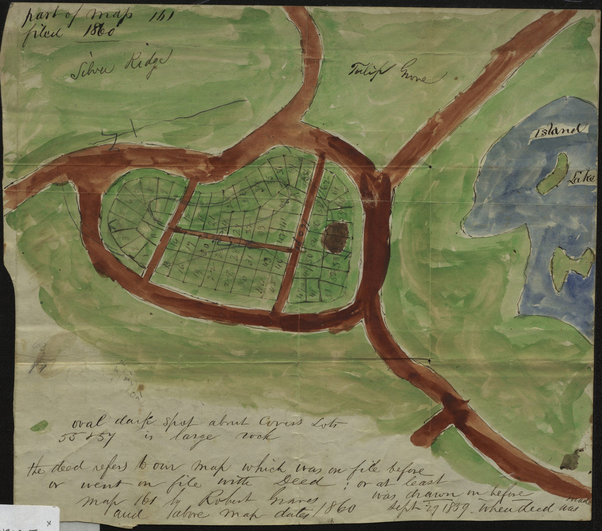
Cedar Knoll, from map 161, Cemetery of Evergeens: [by Robert] Graves, surveyor
Cedar Knoll, from map 161, Cemetery of Evergeens: [by Robert] Graves, surveyor
1860
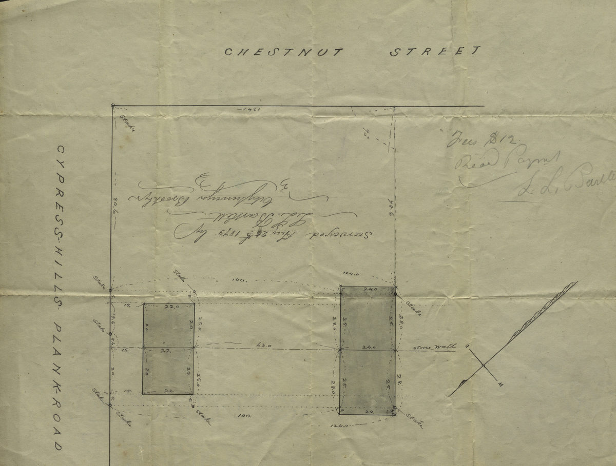
[Map of Chestnut St. and Cypress Hills Plank Road]: surveyed by L.L. Bartlett, city surveyor
[Map of Chestnut St. and Cypress Hills Plank Road]: surveyed by L.L. Bartlett, city surveyor
August 25, 1879
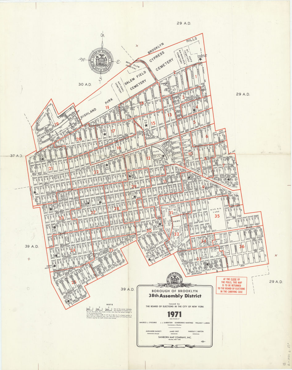
Borough of Brooklyn 38th Assembly District, 1971: issued by the Board of Elections in the City of New York
Borough of Brooklyn 38th Assembly District, 1971: issued by the Board of Elections in the City of New York
1971
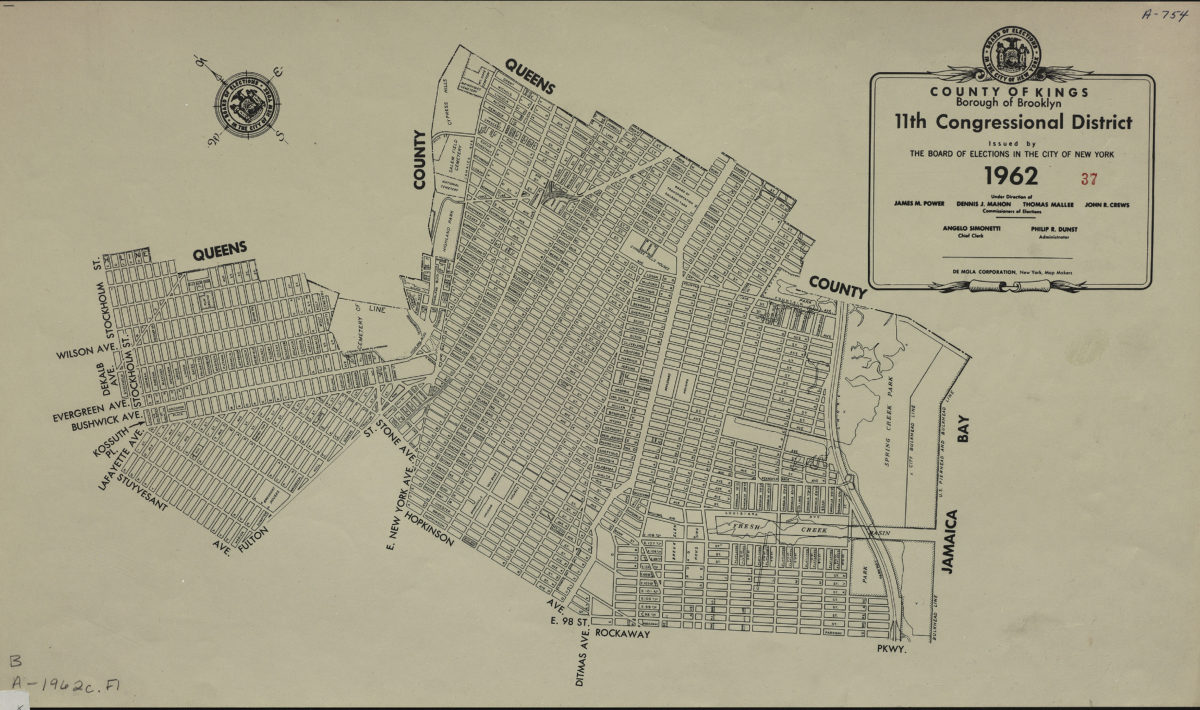
County of Kings, Borough of Brooklyn, 11th Congressional District
County of Kings, Borough of Brooklyn, 11th Congressional District
1962
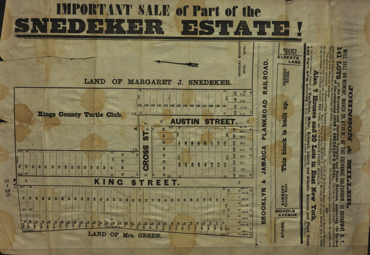
Important sale of part of the Snedeker Estate
Important sale of part of the Snedeker Estate
[187?]
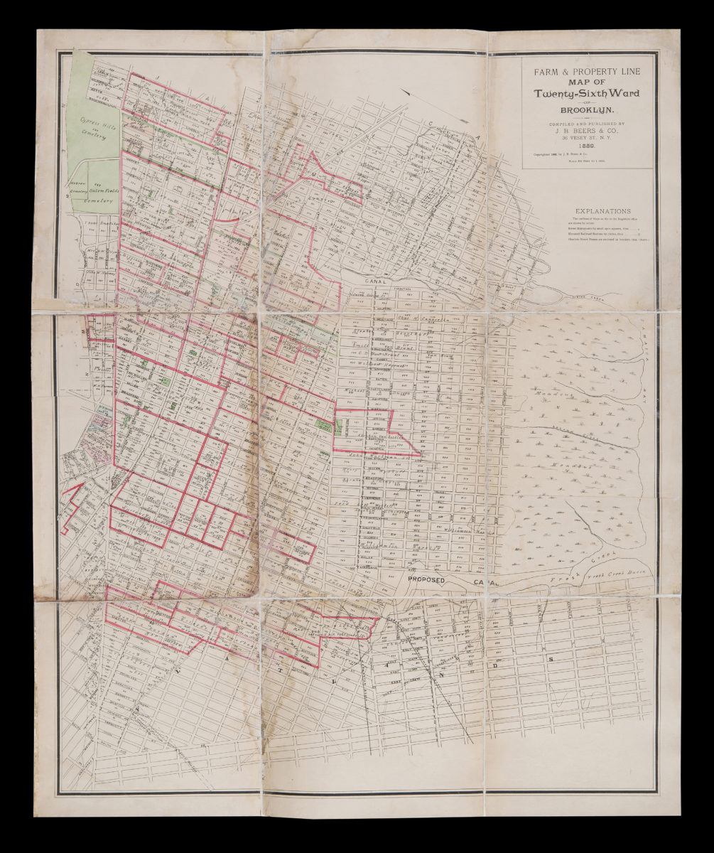
Farm & property line map of Twenty-sixth Ward of Brooklyn: compiled and published by J.H. Beers & Co
Farm & property line map of Twenty-sixth Ward of Brooklyn: compiled and published by J.H. Beers & Co
1889
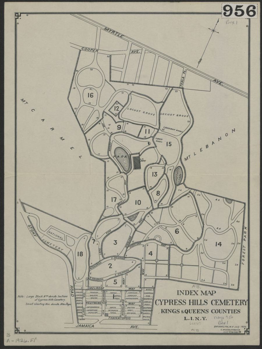
Index map, Cypress Hills Cemetery: Kings & Queens Counties, L.I., N.Y.
Index map, Cypress Hills Cemetery: Kings & Queens Counties, L.I., N.Y.
Jul-26
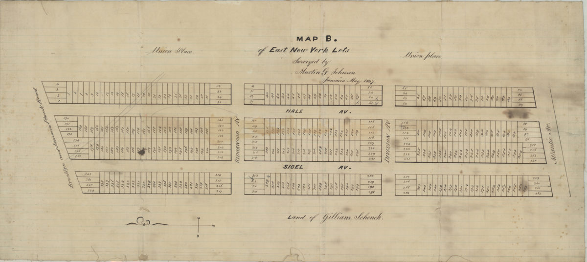
Map B of East New York lots: surveyed by Martin G. Johnson, Jamaica
Map B of East New York lots: surveyed by Martin G. Johnson, Jamaica
May 1867
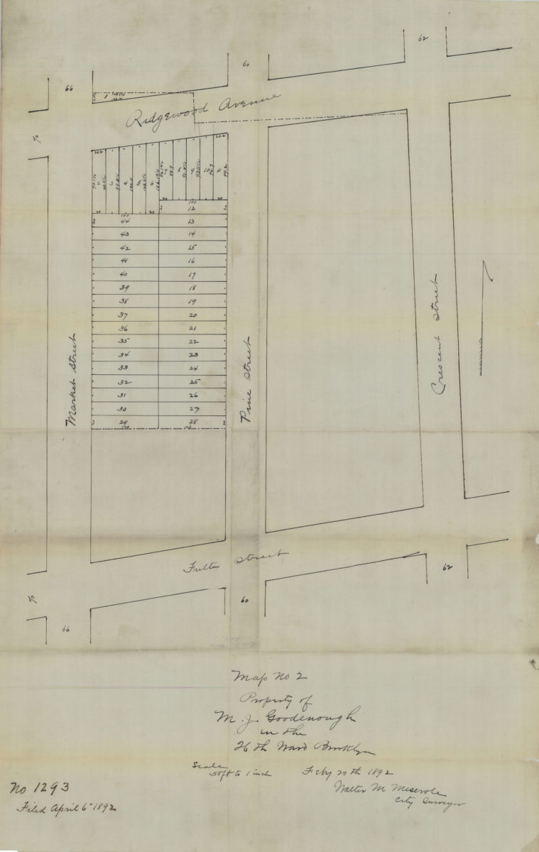
Map no. 2: property of M. J. Goodenough in the 26th Ward, Brooklyn, Feb[ruar]y 20th, 1892: Walter M. Meserole, city surveyor
Map no. 2: property of M. J. Goodenough in the 26th Ward, Brooklyn, Feb[ruar]y 20th, 1892: Walter M. Meserole, city surveyor
1892
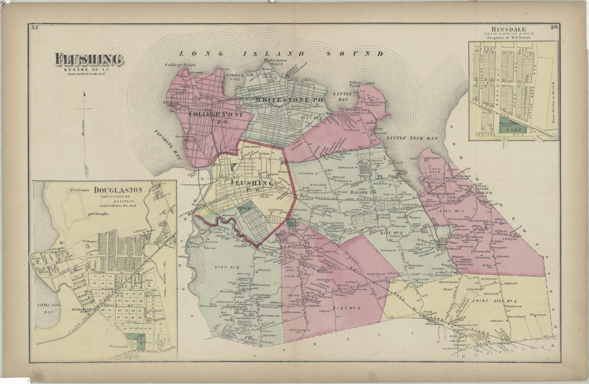
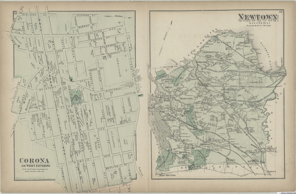
Flushing, Queens Co., L.I.
Flushing, Queens Co., L.I.
[1873]
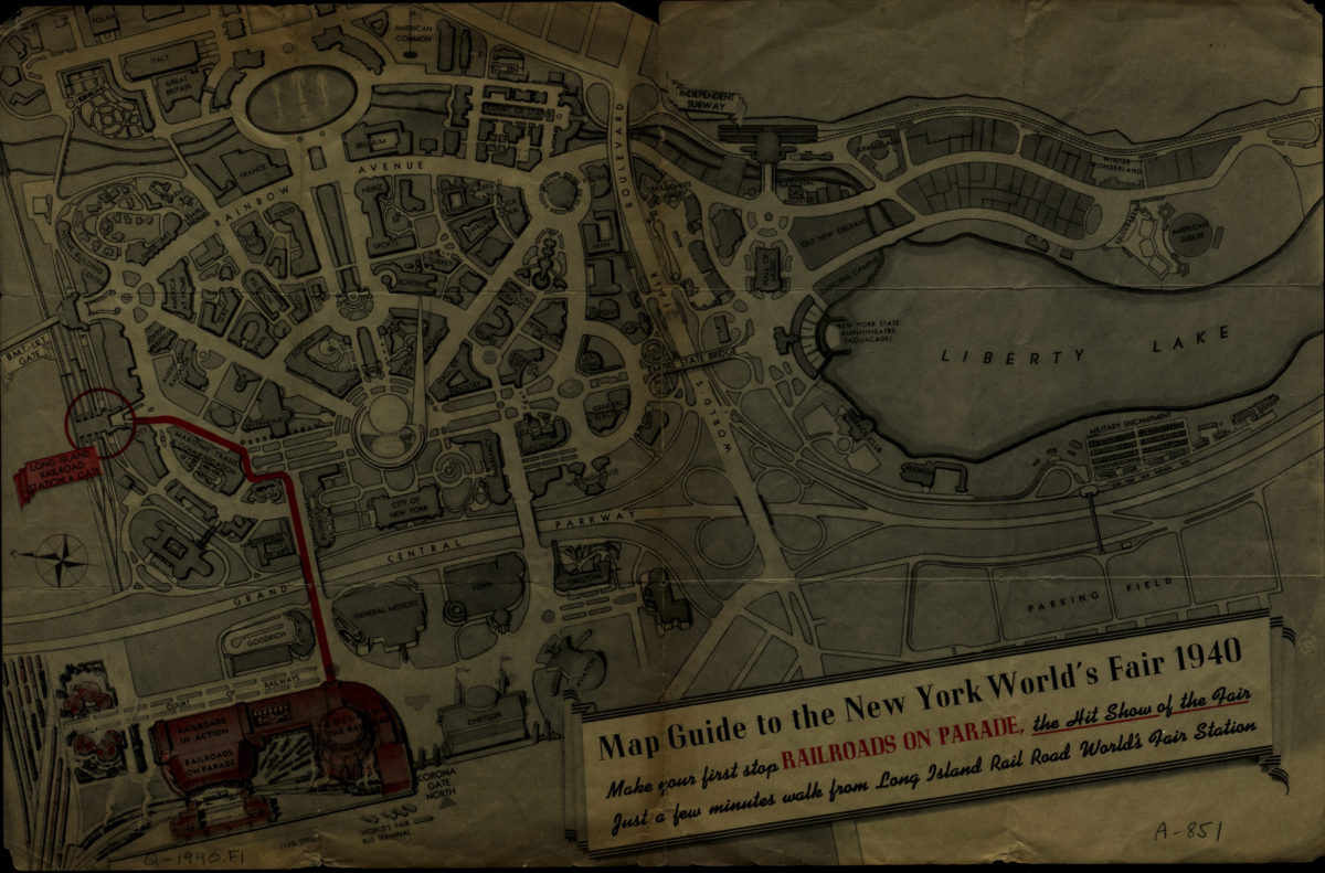
Map guide to the New York World’s Fair 1940
Map guide to the New York World’s Fair 1940
[1940]
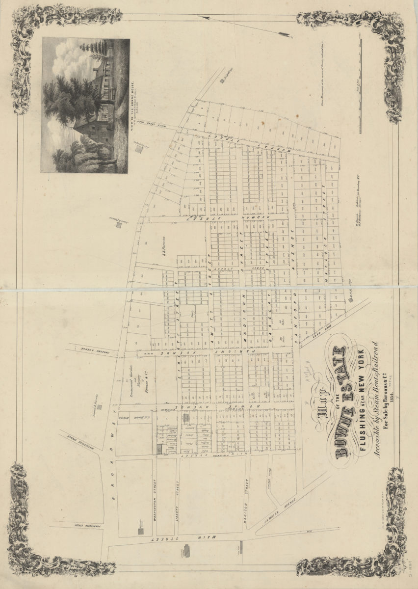
Map of the Bowne Estate, Flushing, near New York, accessible by steam boats & railroad, for sale by Parons & Co.: B.F. Hathenay, surveyor ; H. Daniels, architect
Map of the Bowne Estate, Flushing, near New York, accessible by steam boats & railroad, for sale by Parons & Co.: B.F. Hathenay, surveyor ; H. Daniels, architect
1854
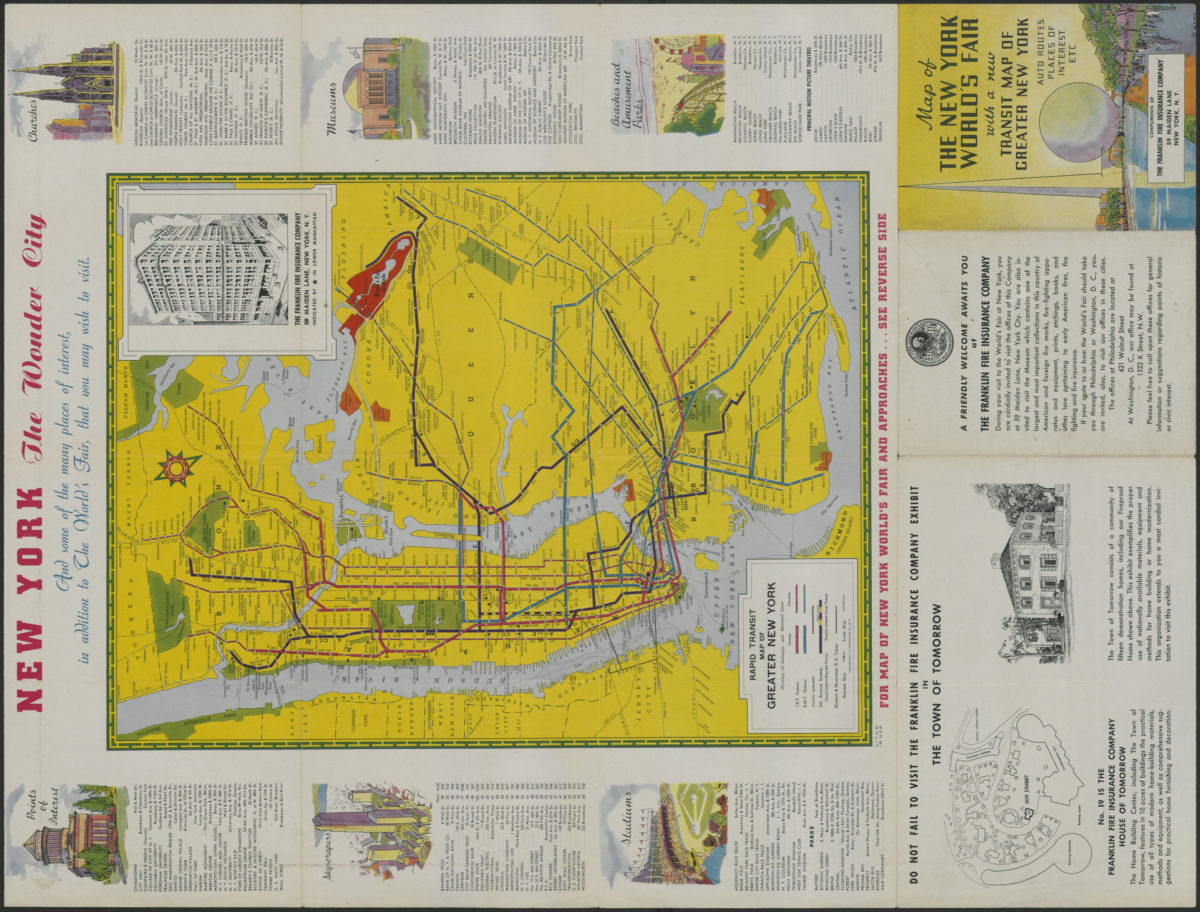
Map of the New York World’s Fair with a new transit map of Greater New York: auto routes, places of interest
Map of the New York World’s Fair with a new transit map of Greater New York: auto routes, places of interest
[1939]
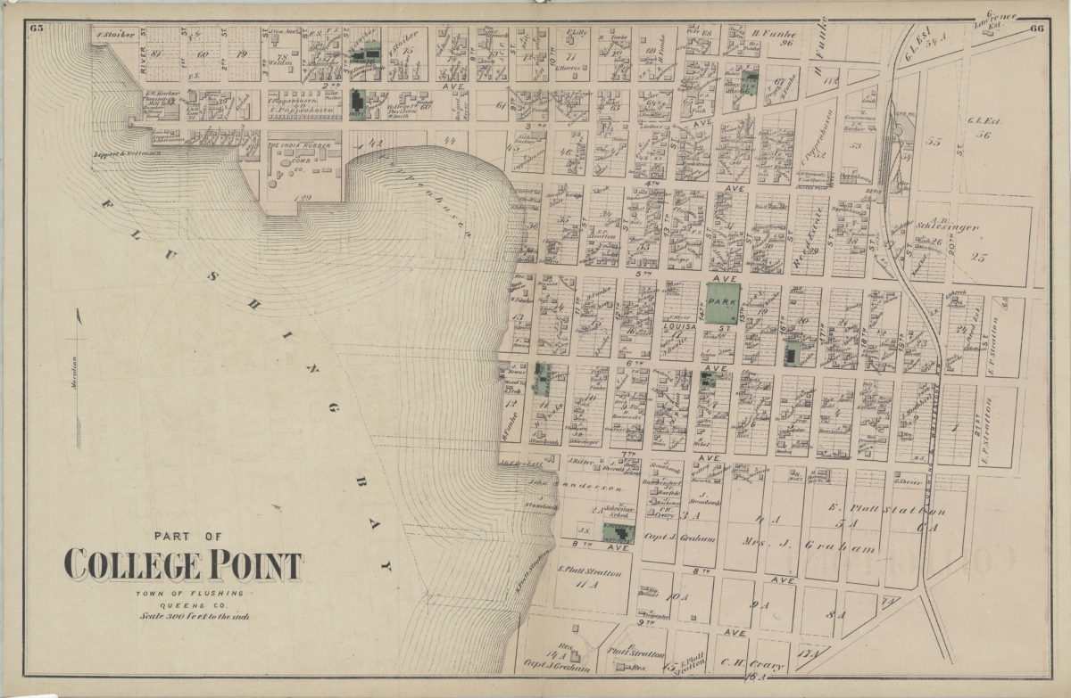
Part of College Point, town of Flushing, Queens Co
Part of College Point, town of Flushing, Queens Co
[1873]
Part of College Point, town of Flushing, Queens Co
Part of College Point, town of Flushing, Queens Co
[1873]
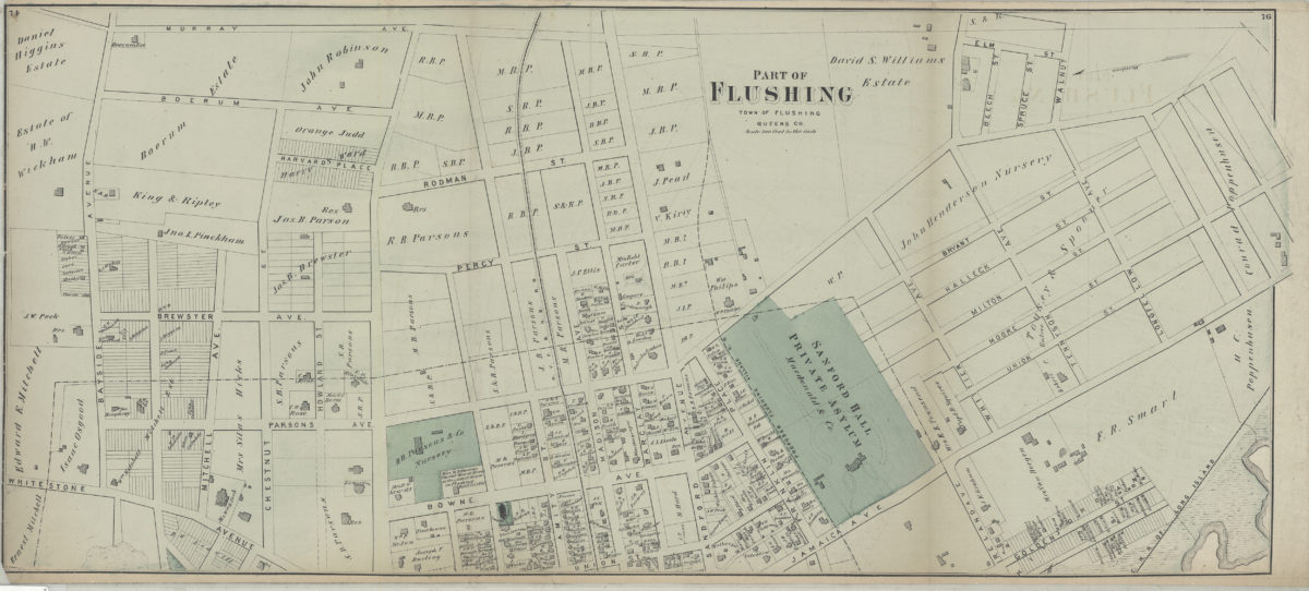
Part of Flushing, town of Flushing, Queens Co
Part of Flushing, town of Flushing, Queens Co
[1873]
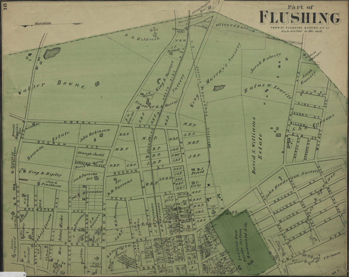
Part of Flushing, town of Flushing, Queens Co
Part of Flushing, town of Flushing, Queens Co
[1873]
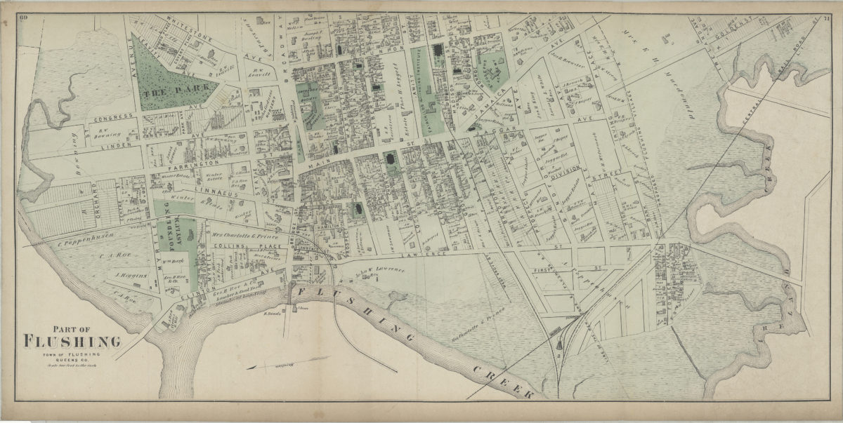
Part of Flushing, town of Flushing, Queens Co., L.I.
Part of Flushing, town of Flushing, Queens Co., L.I.
[1873]
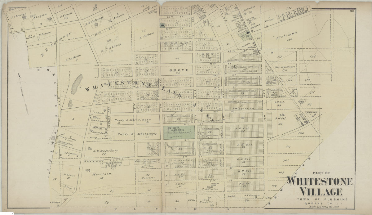
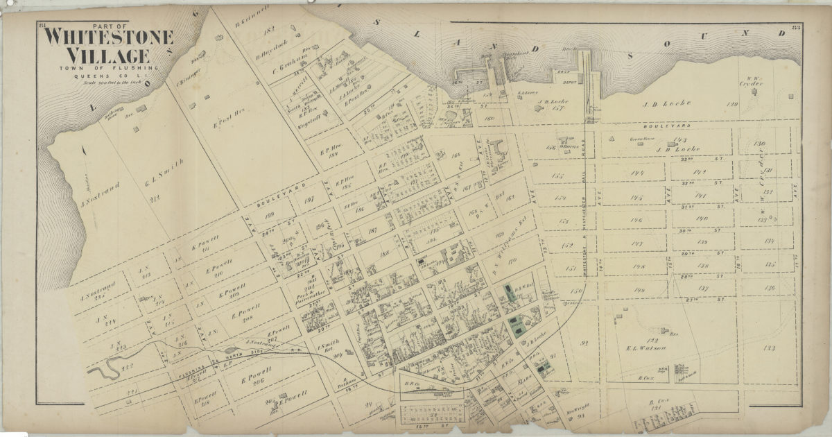
Part of Whitestone Village, town of Flushing, Queens Co., L.I.
Part of Whitestone Village, town of Flushing, Queens Co., L.I.
[1873]
Part of Whitestone Village, town of Flushing, Queens Co., L.I.
Part of Whitestone Village, town of Flushing, Queens Co., L.I.
[1873]
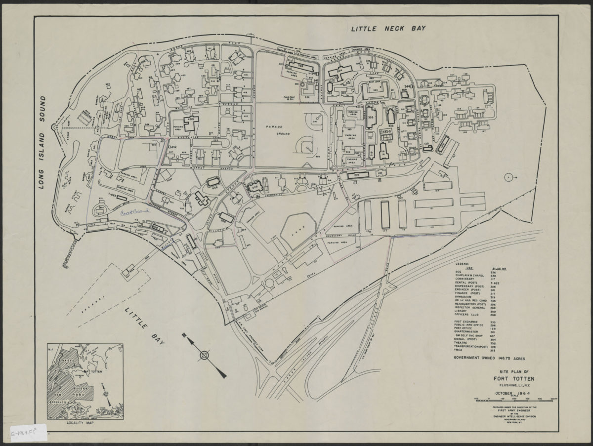
Site plan of Fort Totten, Flushing, L.I., N.Y.: October 1964: prepared under the direction of the First Army Engineer by the Engineer Intelligence Division, Governors Island, N.Y.
Site plan of Fort Totten, Flushing, L.I., N.Y.: October 1964: prepared under the direction of the First Army Engineer by the Engineer Intelligence Division, Governors Island, N.Y.
1964
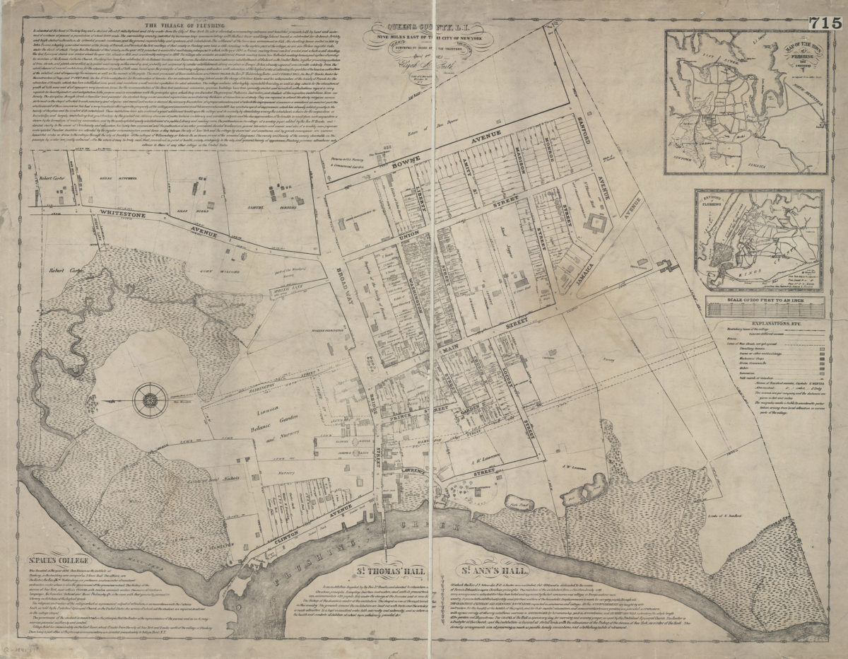
The village of Flushing, Queens County, L.I.: nine miles east of the city of New York : lat. 45° 40ʹ 1ʺN, lon. 73° 09ʹ 58ʺW: surveyed by order of the trustees, April 1st 1841, Elijah A. Smith, surveyor
The village of Flushing, Queens County, L.I.: nine miles east of the city of New York : lat. 45° 40ʹ 1ʺN, lon. 73° 09ʹ 58ʺW: surveyed by order of the trustees, April 1st 1841, Elijah A. Smith, surveyor
[1841]
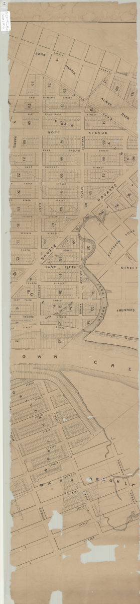
Property of the Roosevelt-Jackson Avenue Land Corporation in the Second Ward Borough of Queens City of New York
Property of the Roosevelt-Jackson Avenue Land Corporation in the Second Ward Borough of Queens City of New York
1923
[Survey maps of Flatlands]
[Survey maps of Flatlands]
[18??]
Heirs of Albert Emmaus, Flatlands
Heirs of Albert Emmaus, Flatlands
[186?]
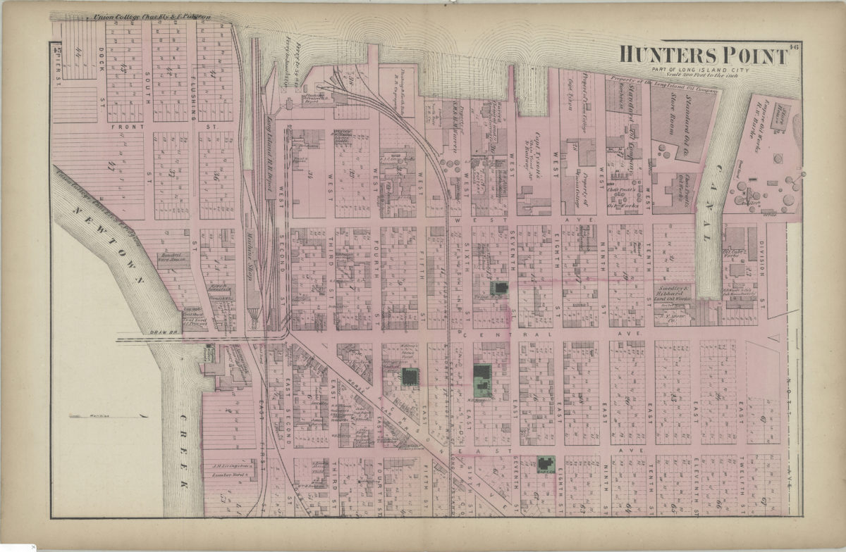
Hunters Point, part of Long Island City
Hunters Point, part of Long Island City
[1873]
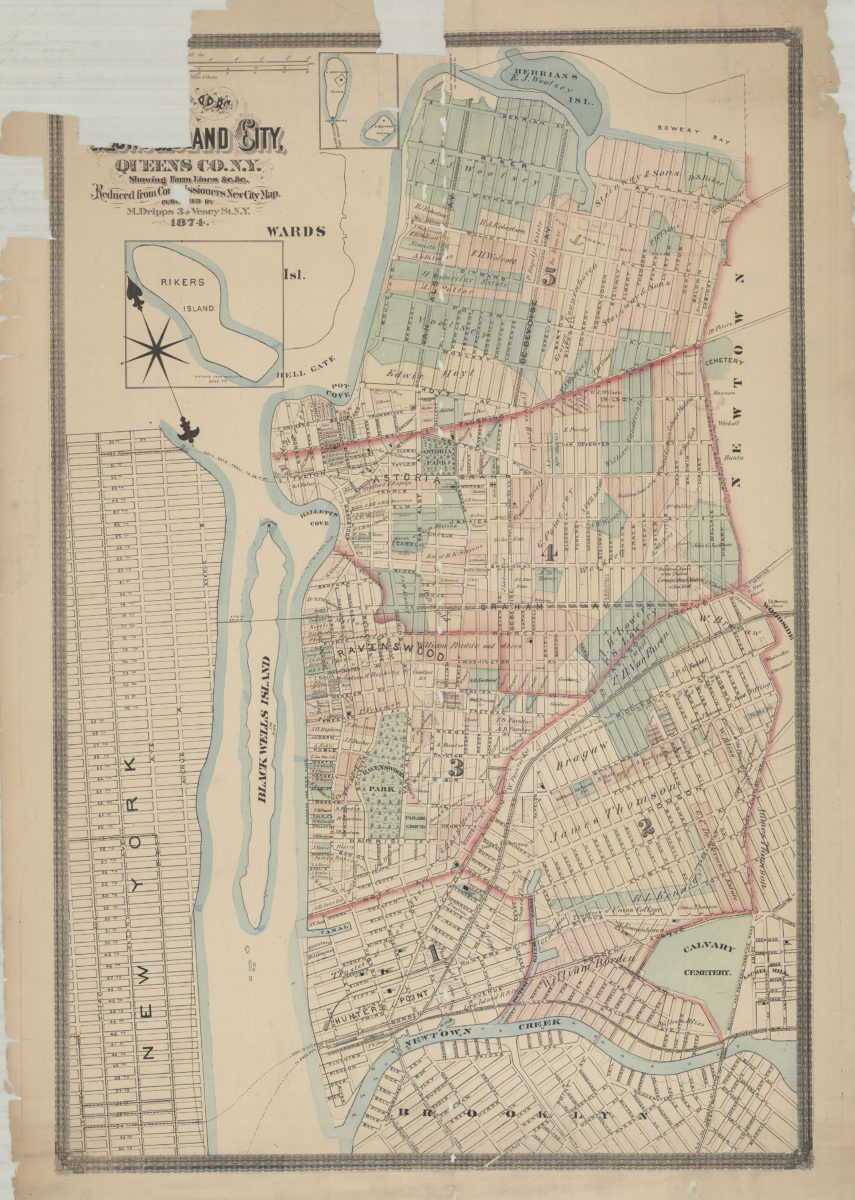
Map of Long Island City, Queens Co. N.Y.: showing farm lines &c. &c.: reduced from Commissioners new city map
Map of Long Island City, Queens Co. N.Y.: showing farm lines &c. &c.: reduced from Commissioners new city map
1874
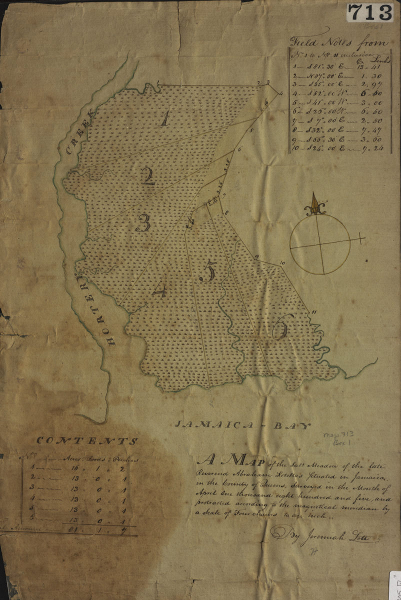
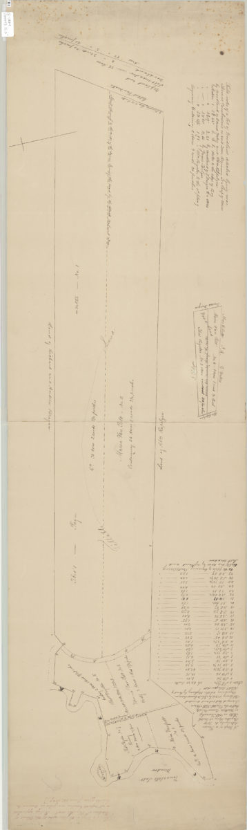
A map of the salt meadow of the late Reverend Abraham Keteltas, situated in Jamaica, in the county of Queens, as surveyed in the month of April: by Jeremiah Lott
A map of the salt meadow of the late Reverend Abraham Keteltas, situated in Jamaica, in the county of Queens, as surveyed in the month of April: by Jeremiah Lott
April 1805
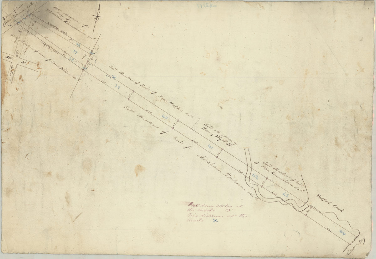
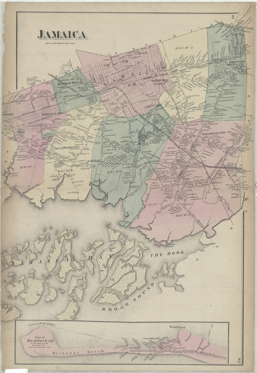
Jamaica
Jamaica
[1873]
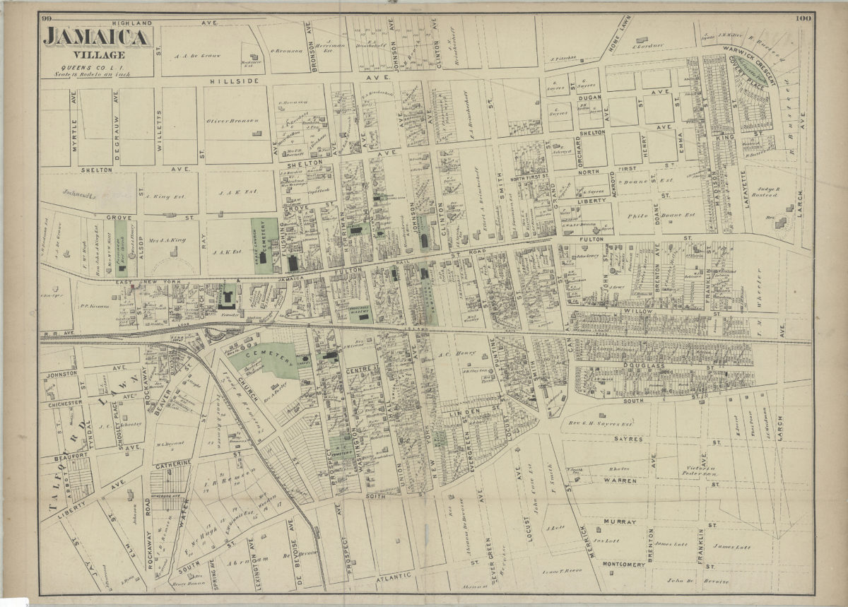
Jamaica Village, Queens Co., L.I.
Jamaica Village, Queens Co., L.I.
[1873]
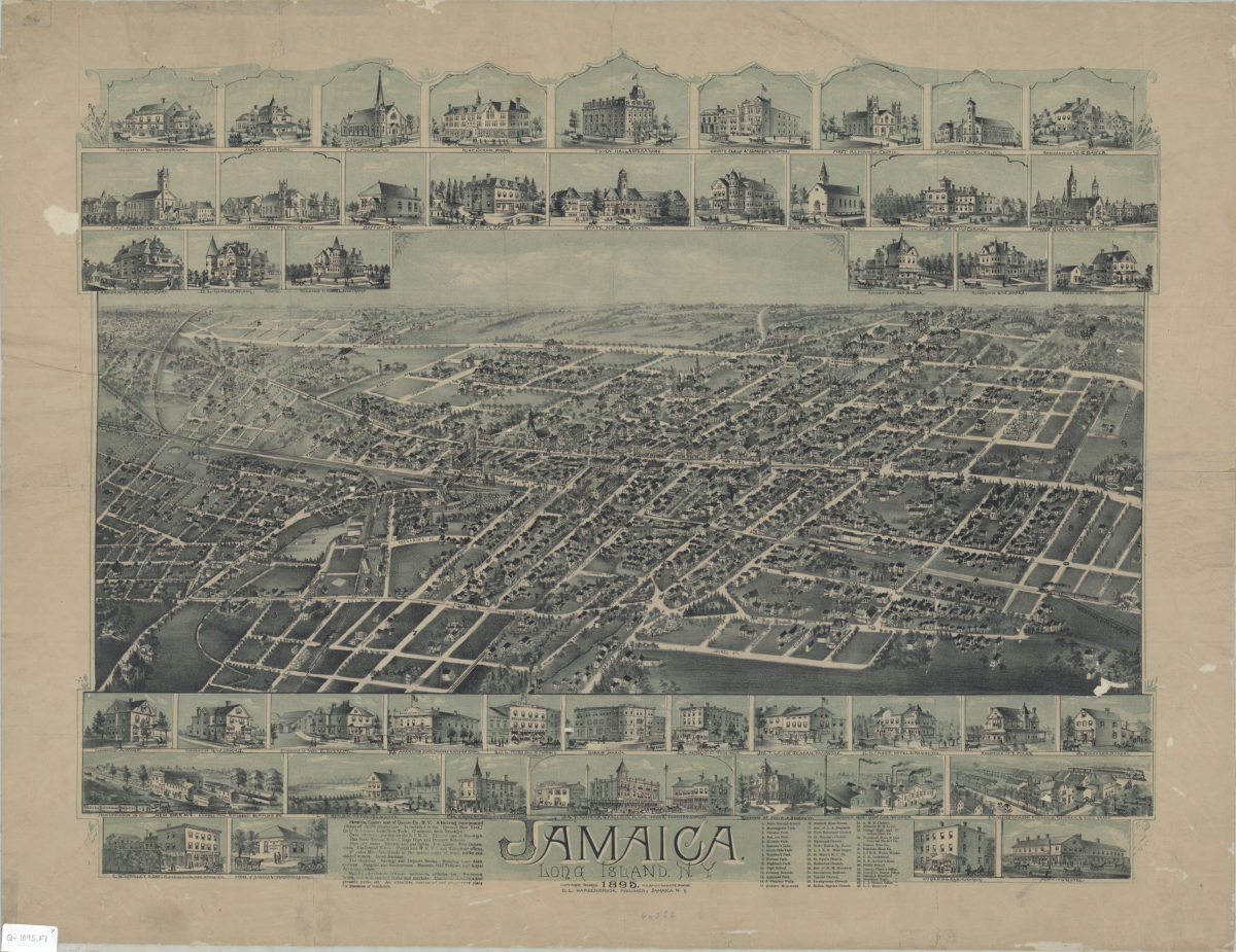
Jamaica, Long Island, N.Y.
Jamaica, Long Island, N.Y.
[ca. 1895]
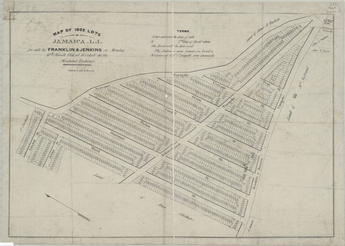
Map of 1,032 lots at Jamaica, L.I., for sale by Franklin & Jenkins on Monday, 16th March, 1835, at 11 o’clock at the Merchants’ Exchange
Map of 1,032 lots at Jamaica, L.I., for sale by Franklin & Jenkins on Monday, 16th March, 1835, at 11 o’clock at the Merchants’ Exchange
1835
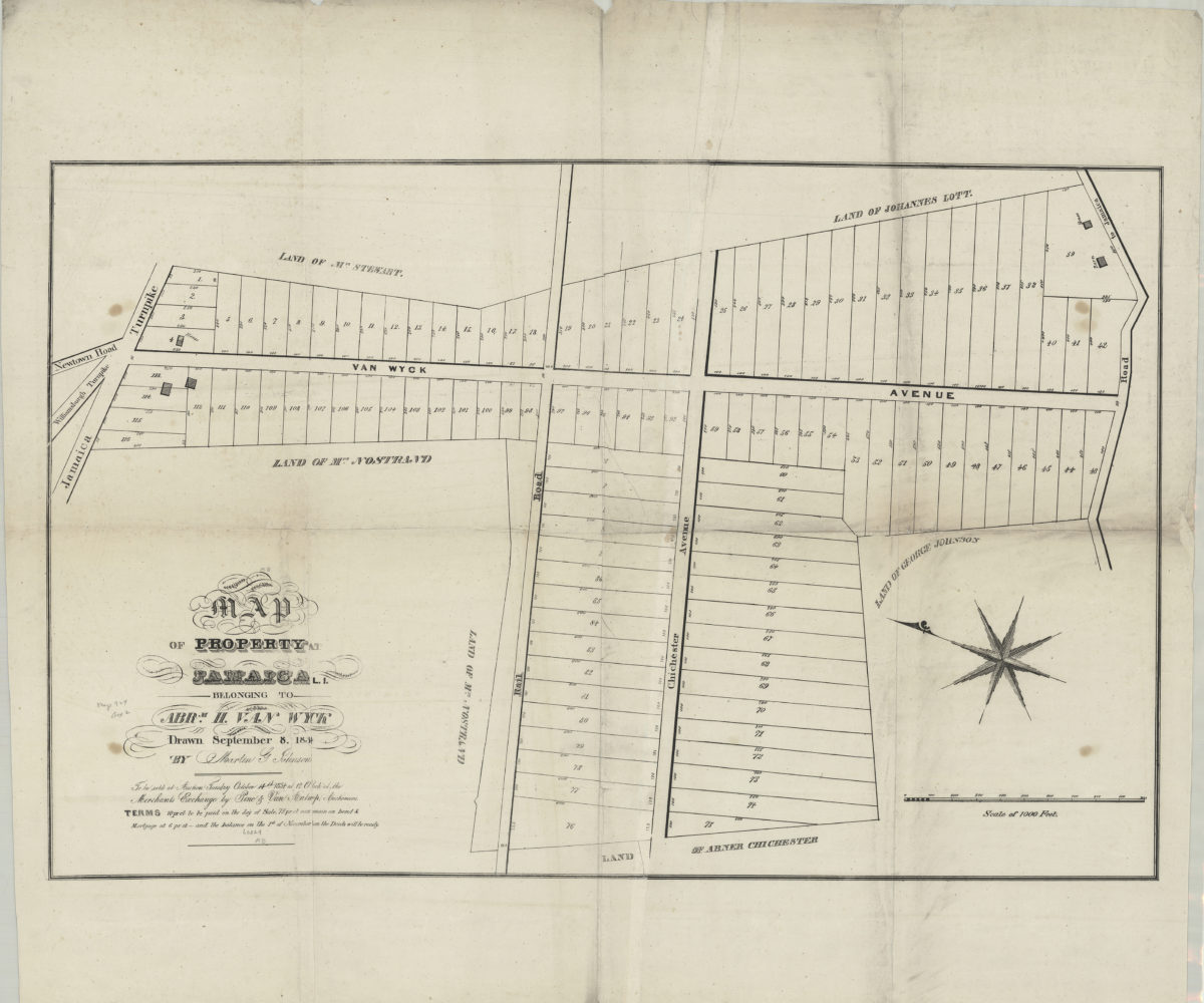
Map of property at Jamaica, L.I., belonging to Abrm. H. Van Wyck, to be sold at auction, Tuesday, October 14th, 1834, at 12 o’clock at the Merchants Exchange by Pine & Van Antwerp, auctioneers: drawn September 8, 1834, by Martin G. Johnson
Map of property at Jamaica, L.I., belonging to Abrm. H. Van Wyck, to be sold at auction, Tuesday, October 14th, 1834, at 12 o’clock at the Merchants Exchange by Pine & Van Antwerp, auctioneers: drawn September 8, 1834, by Martin G. Johnson
[1834]
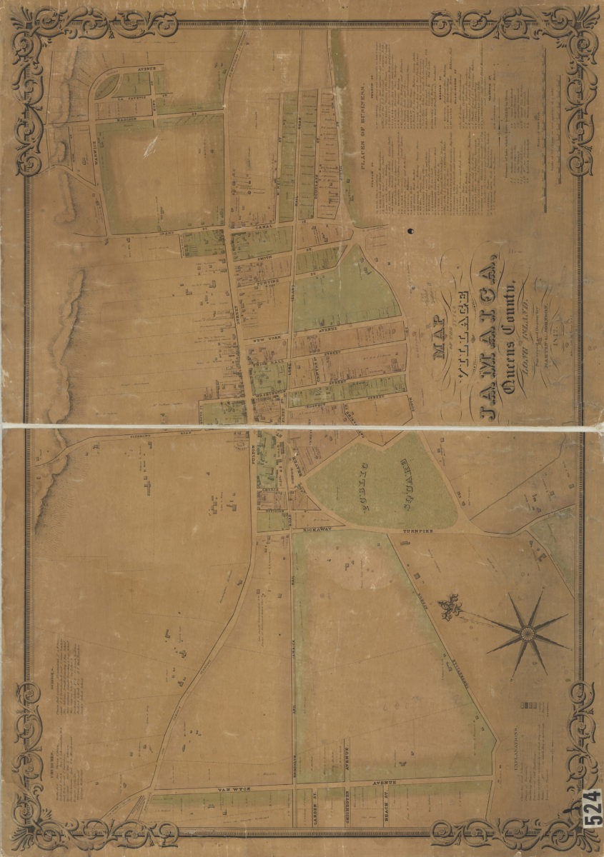
Map of the village of Jamaica, Queens County, Long Island: surveyed and drawn by Martin G. Johnson
Map of the village of Jamaica, Queens County, Long Island: surveyed and drawn by Martin G. Johnson
1842
Woodhaven, town of Jamaica, Queens Co
Woodhaven, town of Jamaica, Queens Co
[1873]
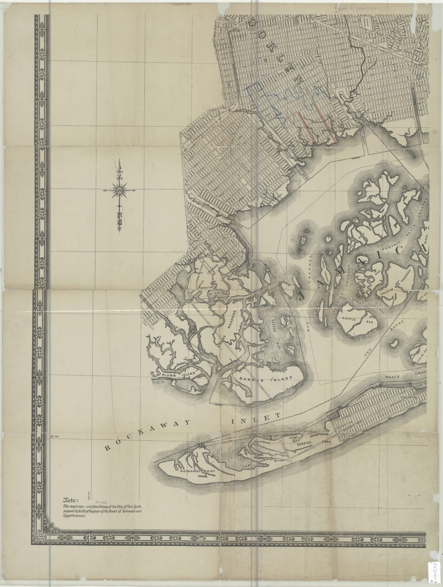
[Map of Jamaica Bay]
[Map of Jamaica Bay]
[19??]
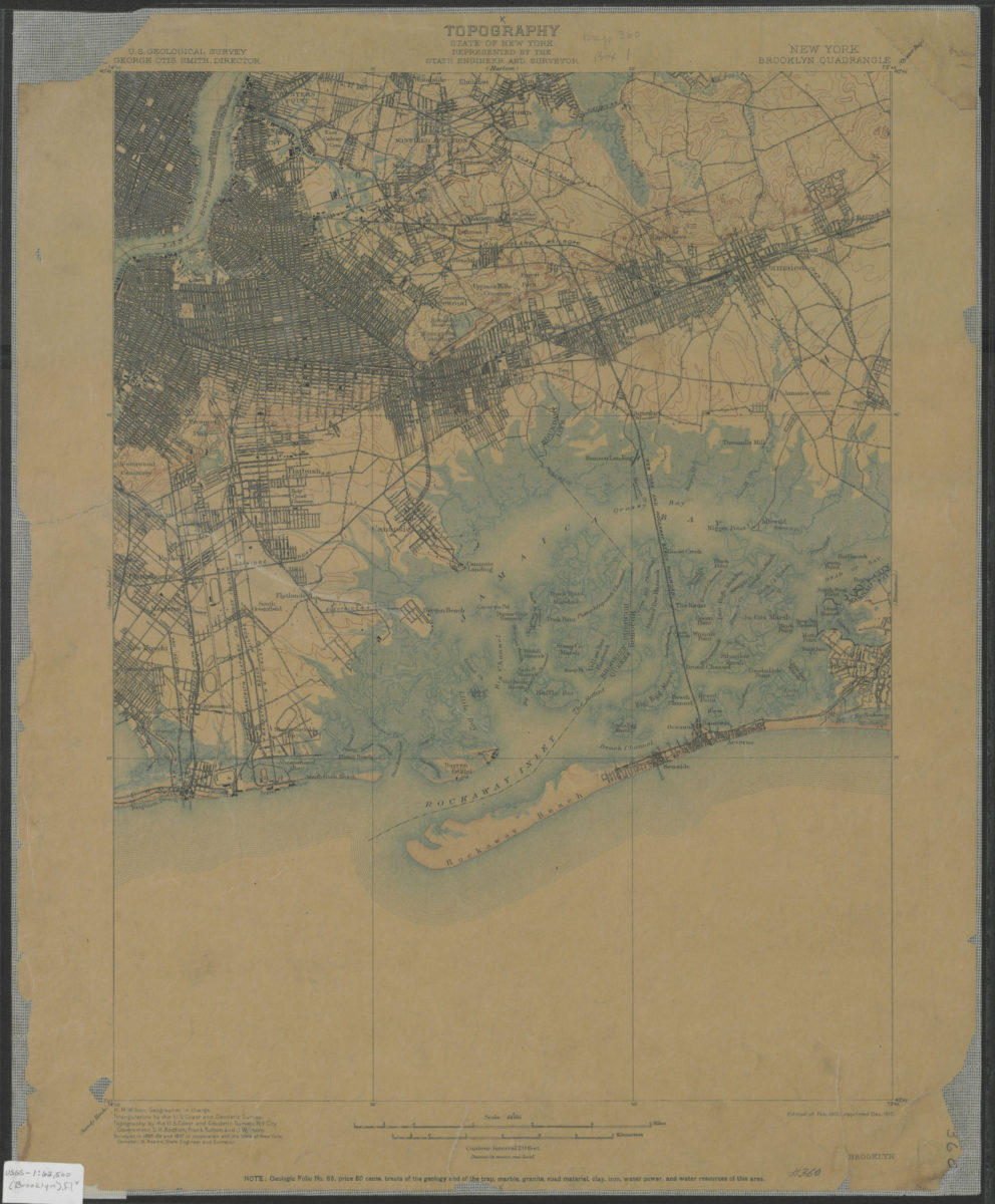
Brooklyn quadrangle, New York: U.S. Geological Survey
Brooklyn quadrangle, New York: U.S. Geological Survey
1900; 1910
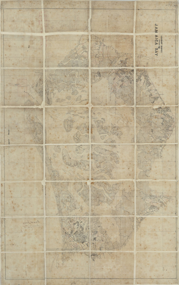
Jamaica Bay: U.S. Coast Survey, A.D. Bache, supt
Jamaica Bay: U.S. Coast Survey, A.D. Bache, supt
[185?]
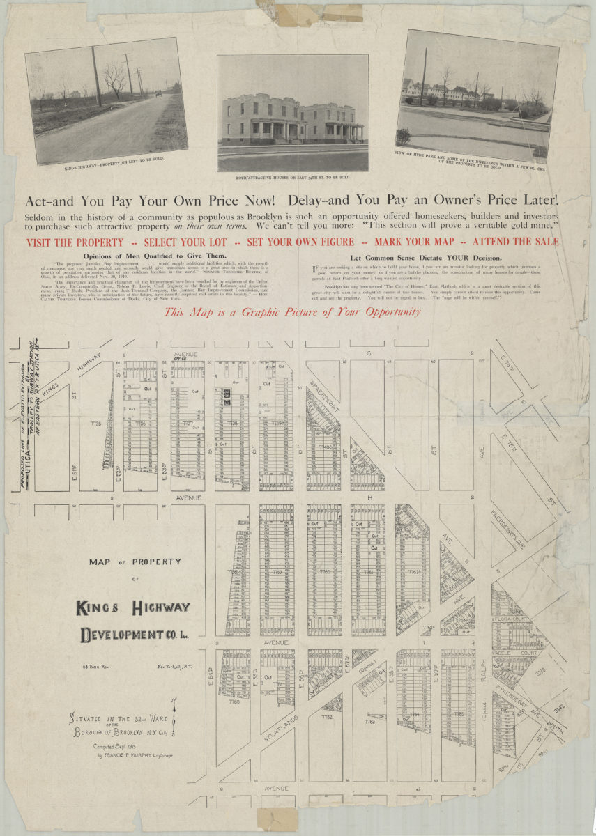
Map of property of Kings Highway Developmental Co. Inc.: situated in the 32nd Ward of the Borough of Brooklyn, N.Y. City: computed Sept. 1915 by Francis P. Murphy, City Surveyor
Map of property of Kings Highway Developmental Co. Inc.: situated in the 32nd Ward of the Borough of Brooklyn, N.Y. City: computed Sept. 1915 by Francis P. Murphy, City Surveyor
1915
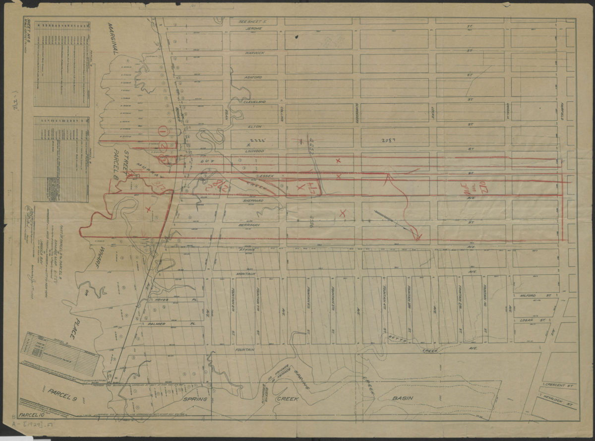
Part of parcel 8 and parcel 9 of damage map in the matter of acquiring title to property required for the improvement of the water front and harbor of the City of New York on Jamaica Bay, City of New York
Part of parcel 8 and parcel 9 of damage map in the matter of acquiring title to property required for the improvement of the water front and harbor of the City of New York on Jamaica Bay, City of New York
1929
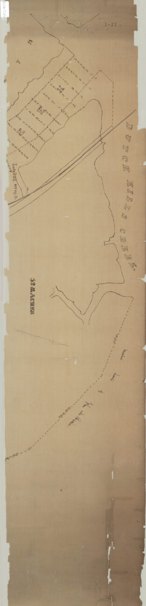
[Map of land near Dutch Kills Creek]
[Map of land near Dutch Kills Creek]
[18??]
[Map of Long Island Ciy]: P.G. Van-Alst, city surveyor, Brooklyn, E.D.
[Map of Long Island Ciy]: P.G. Van-Alst, city surveyor, Brooklyn, E.D.
[18??]
Copy of a map in the possession of the heirs of Thomas S. Payntar, decd
Copy of a map in the possession of the heirs of Thomas S. Payntar, decd
[1849]
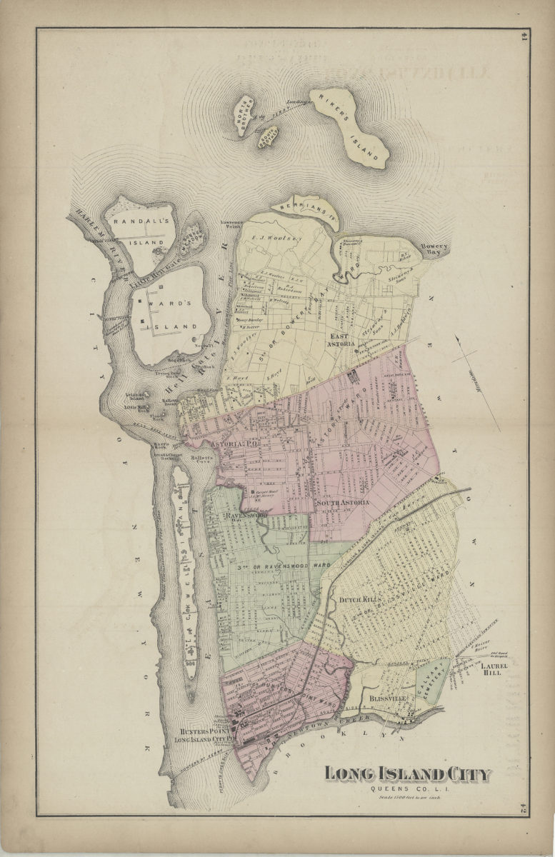
Long Island City, Queens Co., L.I.
Long Island City, Queens Co., L.I.
[1873]
Ravenswood, part of Long Island City
Ravenswood, part of Long Island City
[1873]
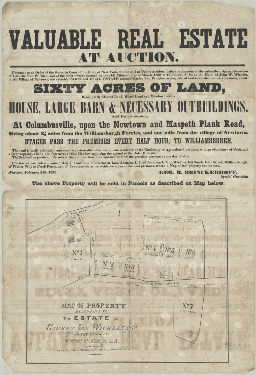
Valuable real estate at auction: pursuant to an order of the Supreme Court of the State of New York, will be sold at public auction … on the (15) fifteenth day of March, 1852, at 10 o’clock, a.m., at the hotel of John W. Wheeler in the village of Newtown, the valuable farm and real estate whereof Garret Van Wicklen, senior, late of said town, died seized, containing about sixty acres of land, being partly cleared land, woodland, and meadow, with a house, large barn & necessary outbuildings
Valuable real estate at auction: pursuant to an order of the Supreme Court of the State of New York, will be sold at public auction … on the (15) fifteenth day of March, 1852, at 10 o’clock, a.m., at the hotel of John W. Wheeler in the village of Newtown, the valuable farm and real estate whereof Garret Van Wicklen, senior, late of said town, died seized, containing about sixty acres of land, being partly cleared land, woodland, and meadow, with a house, large barn & necessary outbuildings
[1852]
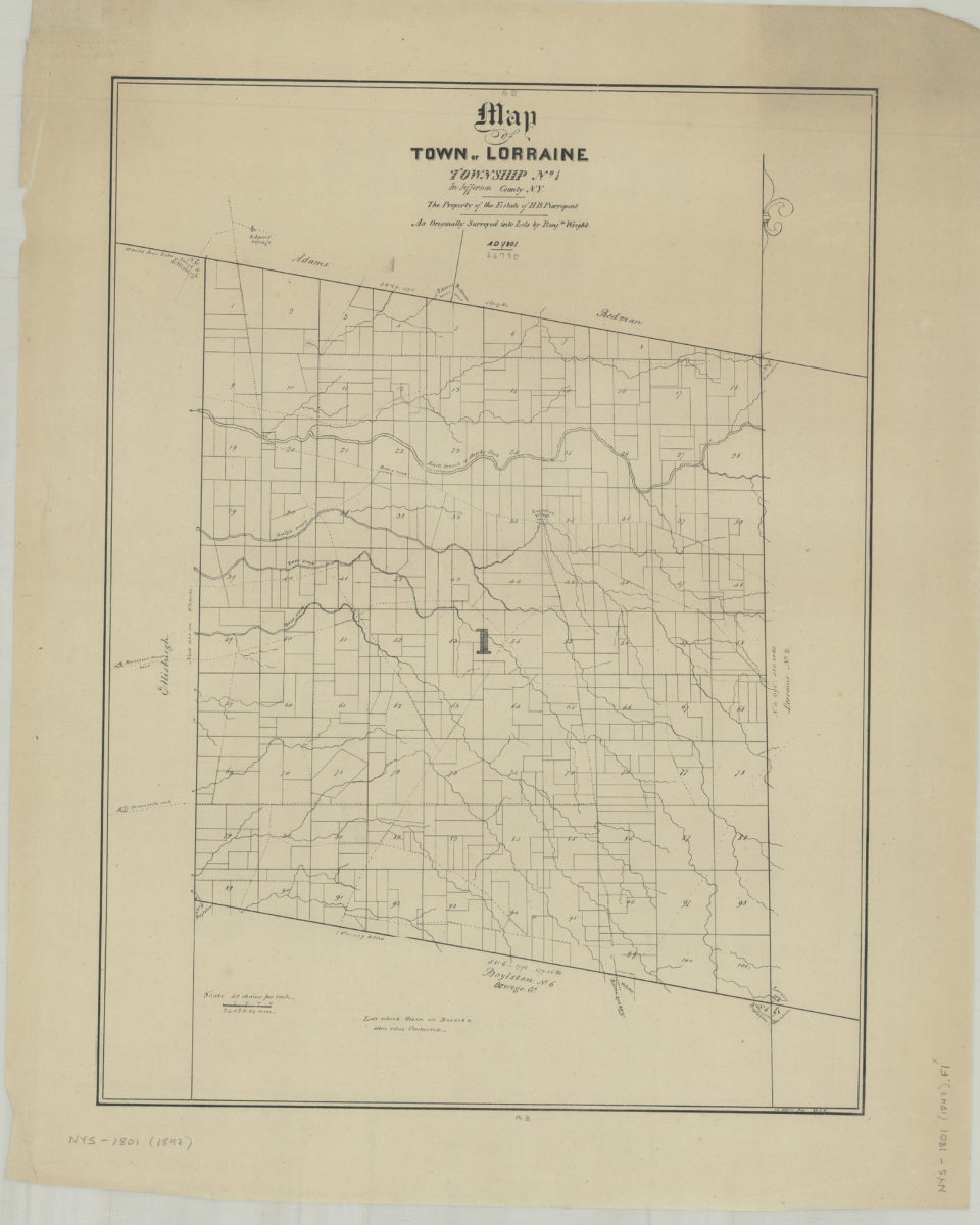
Map of town of Lorraine: Township No. 1 in Jefferson County, N.Y. : the property of the estate of H.B. Pierrepont, as originally surveyed into lots by Benjn. Wright, A.D. 1801: W.C.P., 14 April 1847
Map of town of Lorraine: Township No. 1 in Jefferson County, N.Y. : the property of the estate of H.B. Pierrepont, as originally surveyed into lots by Benjn. Wright, A.D. 1801: W.C.P., 14 April 1847
[1847]
A conjectural plan of the three flats called by the Indians Keskateuw and by the Dutch Amersfort or the Village of Amersfort: made solely to elucidate the text-matter of this book and not purporting to determine what any of the flats comprised
A conjectural plan of the three flats called by the Indians Keskateuw and by the Dutch Amersfort or the Village of Amersfort: made solely to elucidate the text-matter of this book and not purporting to determine what any of the flats comprised
[1924; 1924]
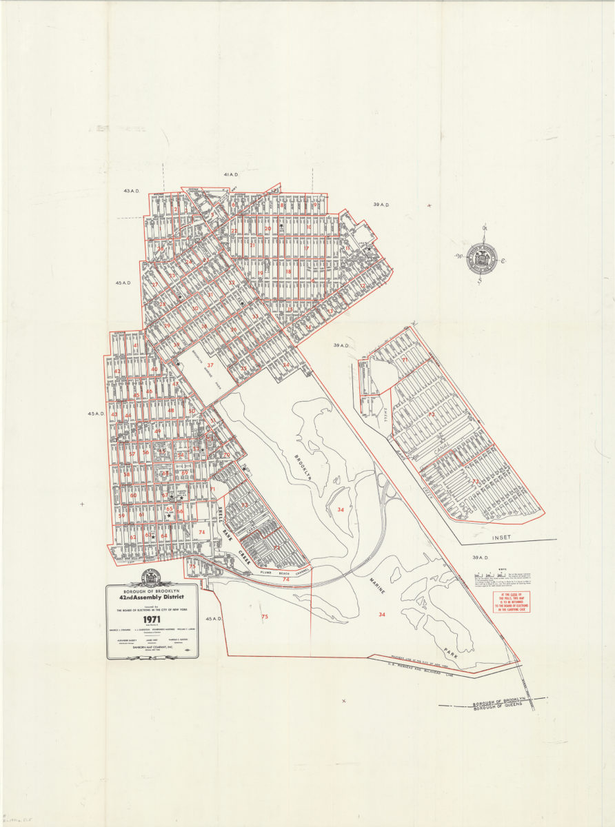
Borough of Brooklyn 42nd Assembly District, 1971: issued by the Board of Elections in the City of New York
Borough of Brooklyn 42nd Assembly District, 1971: issued by the Board of Elections in the City of New York
1971
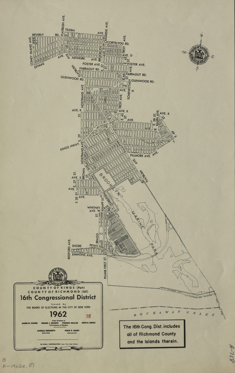
County of Kings, Borough of Brooklyn, 16th Congressional District
County of Kings, Borough of Brooklyn, 16th Congressional District
1962
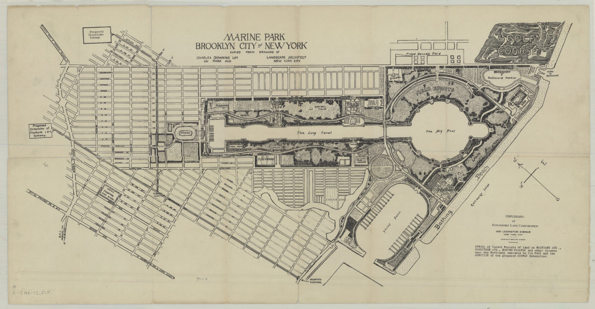
Marine Park, Brooklyn, New York City: copied from drawing of Charles Downing Lay, landscape architect, 101 Park Ave., New York City
Marine Park, Brooklyn, New York City: copied from drawing of Charles Downing Lay, landscape architect, 101 Park Ave., New York City
[1932]
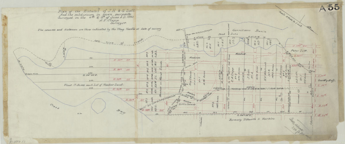
Plan of the estates of J.H. & G. Lott, and the subdivision in seven purparts: surveyed … [by] A.F. Clapp, surveyor
Plan of the estates of J.H. & G. Lott, and the subdivision in seven purparts: surveyed … [by] A.F. Clapp, surveyor
June 4 & 5, 1880
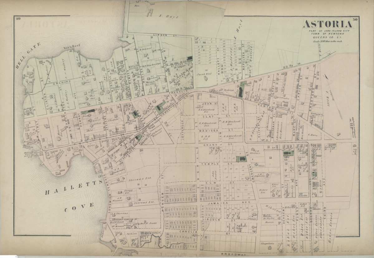
Astoria: part of Long Island City, town of Newtown, Queens Co., L.I.
Astoria: part of Long Island City, town of Newtown, Queens Co., L.I.
[1873]
Continuation sale of 300 desirable lots at Maspeth … being the balance of the Van Mater estate, at auction by Johnson & Miller, auctioneers, on Friday, April 2d, 1869, at twelve o’clock M., at the Exchange Salesroom, No. 111 Broadway, New York
Continuation sale of 300 desirable lots at Maspeth … being the balance of the Van Mater estate, at auction by Johnson & Miller, auctioneers, on Friday, April 2d, 1869, at twelve o’clock M., at the Exchange Salesroom, No. 111 Broadway, New York
[1869]
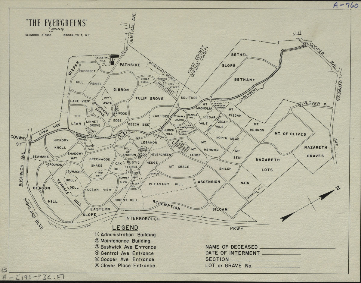
“The Evergreens” cemetery, Brooklyn-New York
“The Evergreens” cemetery, Brooklyn-New York
[195?]
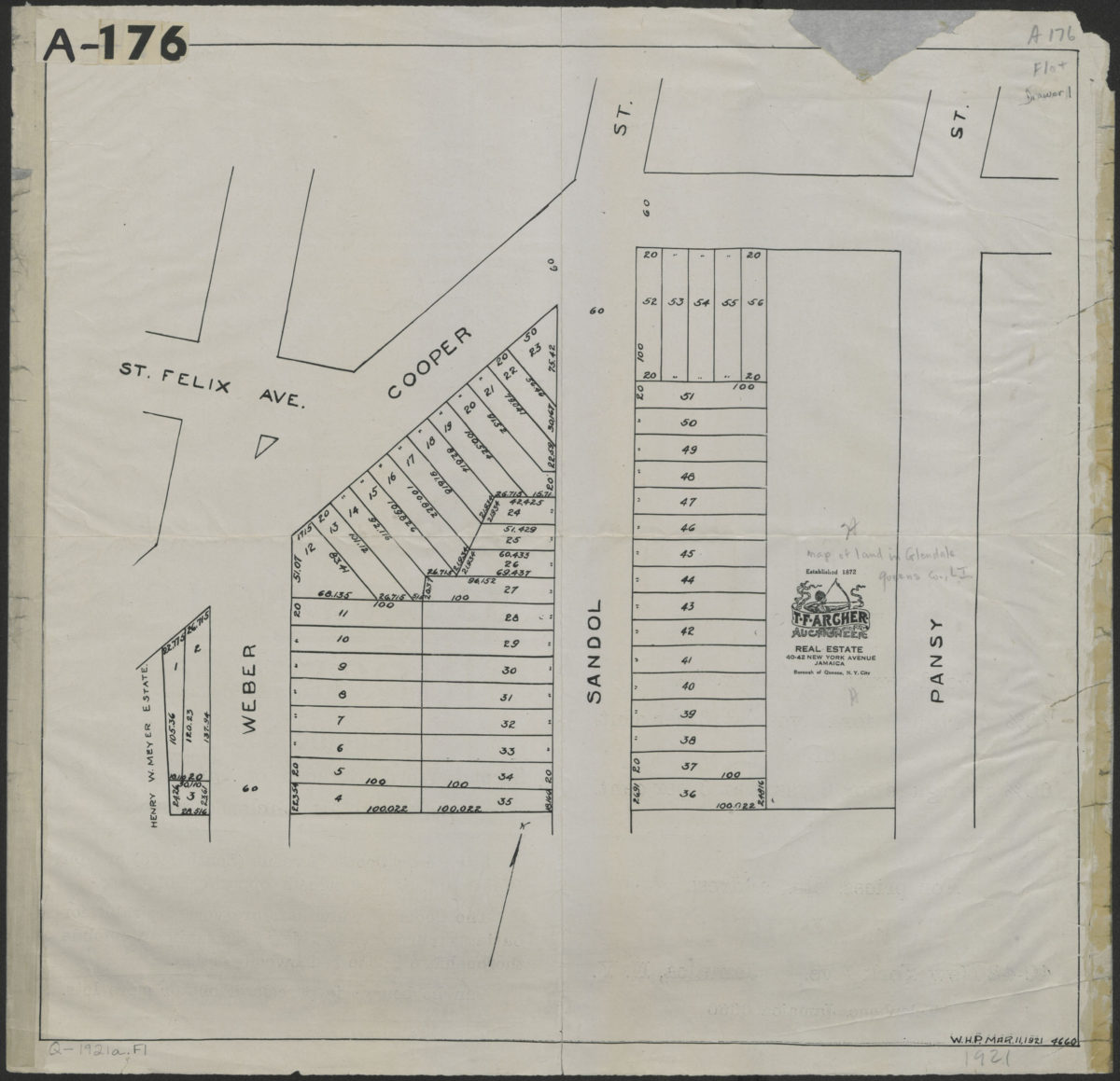
[Map of 53 building lots in Ridgewood, Glendale section, Queens County]
[Map of 53 building lots in Ridgewood, Glendale section, Queens County]
1921
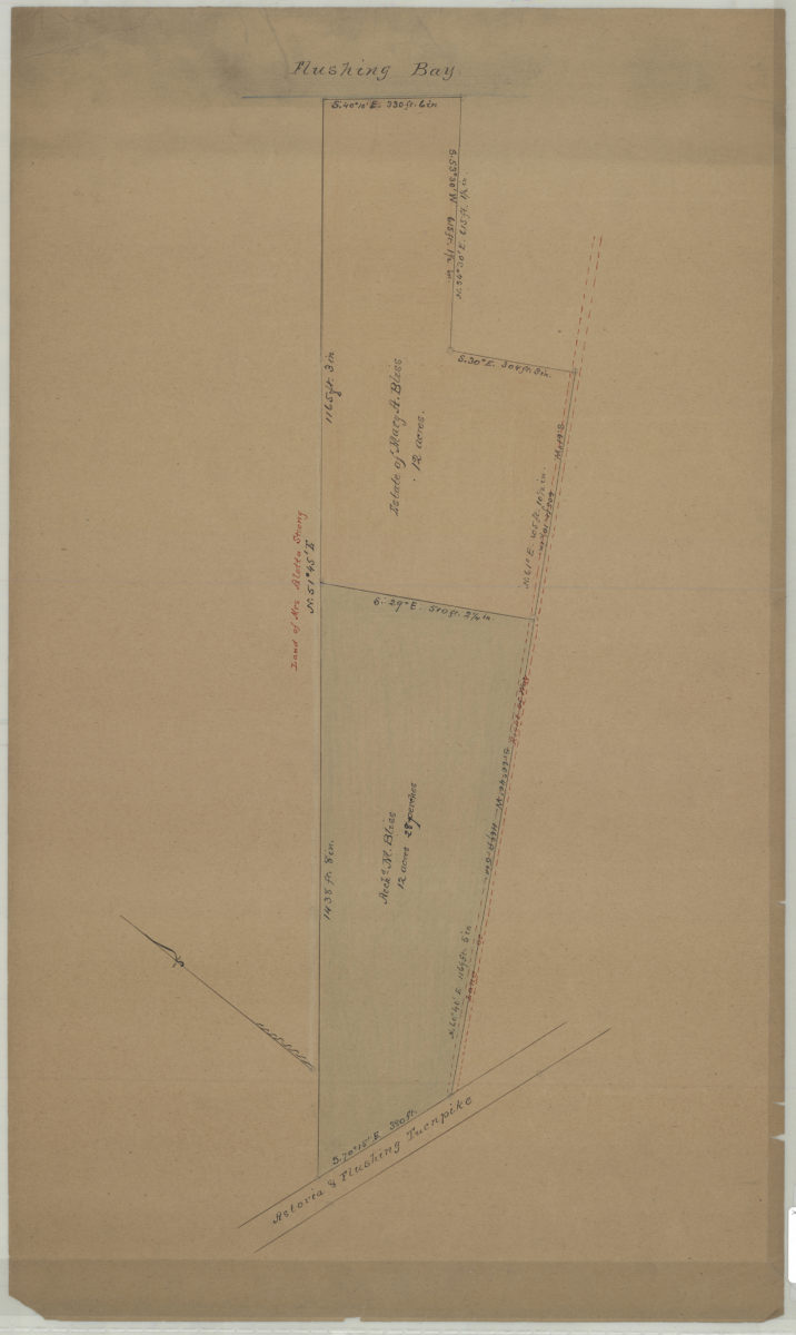
[Map of property between Astoria & Flushing Turnpike and Flushing Bay]
[Map of property between Astoria & Flushing Turnpike and Flushing Bay]
[18??]
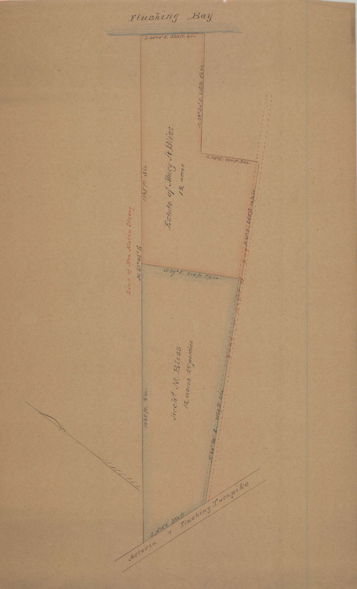
[Map of property between Astoria & Flushing Turnpike and Flushing Bay]
[Map of property between Astoria & Flushing Turnpike and Flushing Bay]
[18??]
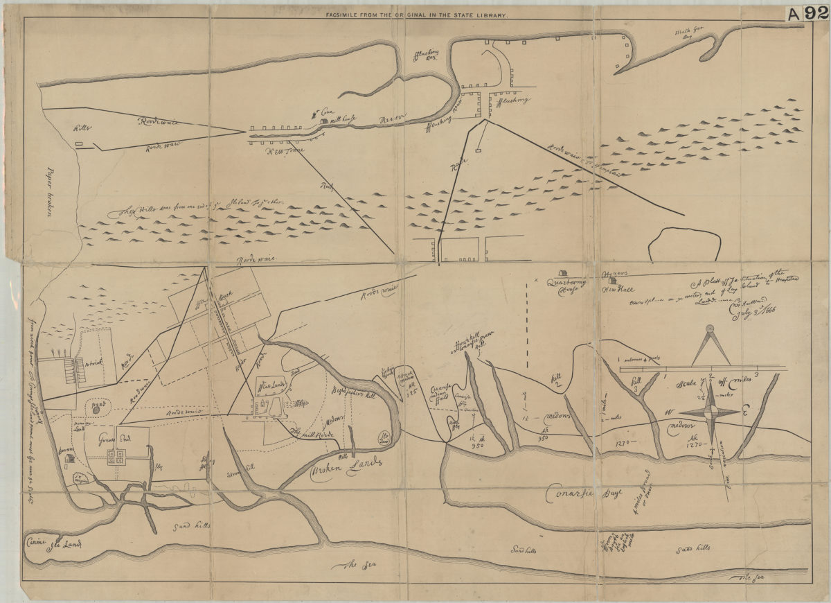
A plott of ye situations of the towns & places on ye wester end of Long Island to Hempstead: laid down by … [text illegible] Hubbard, July 3rd, 1666
A plott of ye situations of the towns & places on ye wester end of Long Island to Hempstead: laid down by … [text illegible] Hubbard, July 3rd, 1666
[18??]
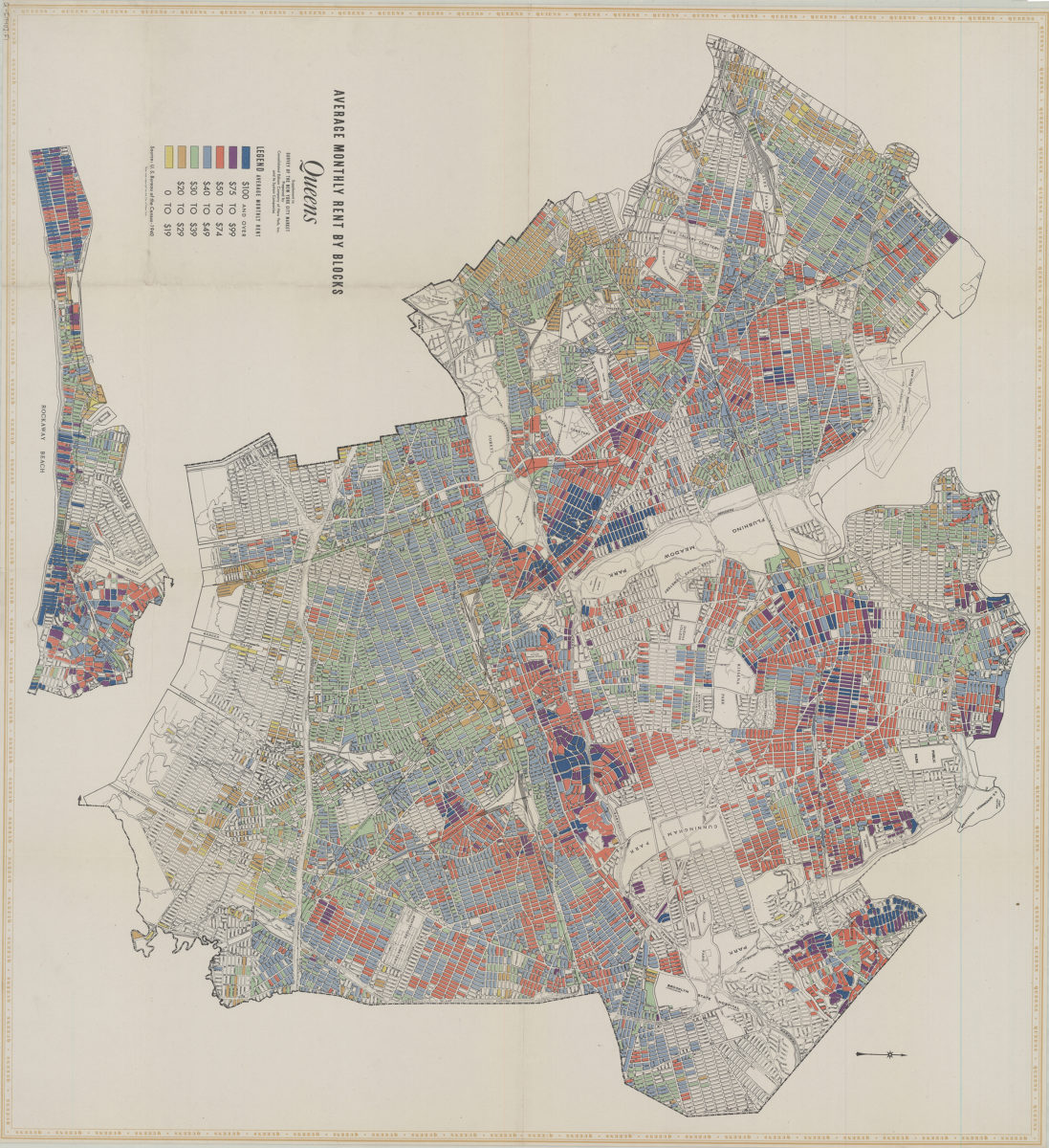
Average monthly rent by blocks, Queens: supplement to Survey of the New York City market: prepared by Consolidated Edison Company of New York, Inc. and its system companies
Average monthly rent by blocks, Queens: supplement to Survey of the New York City market: prepared by Consolidated Edison Company of New York, Inc. and its system companies
[1940]
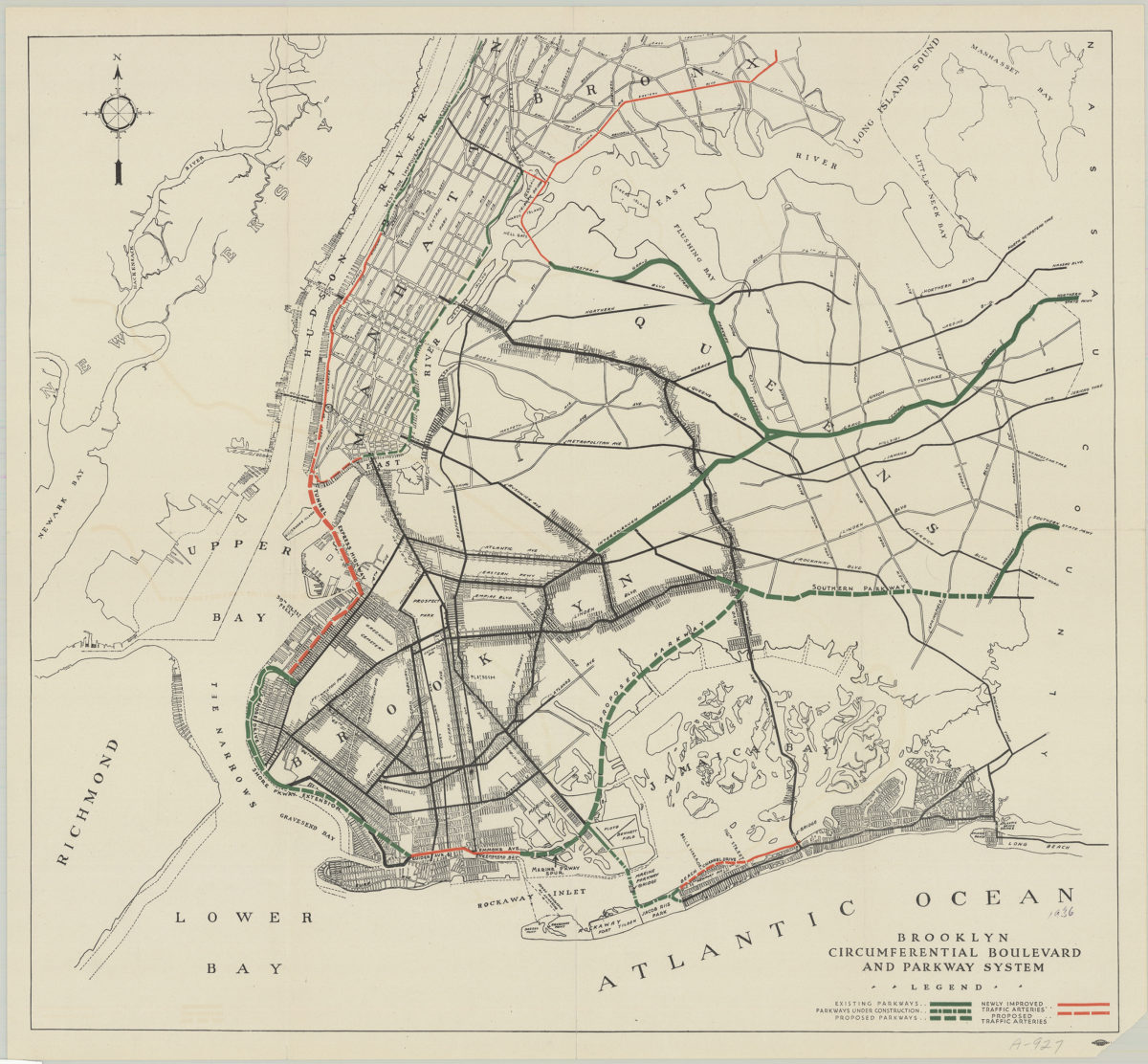
Brooklyn circumferential boulevard and parkway system
Brooklyn circumferential boulevard and parkway system
[193?]
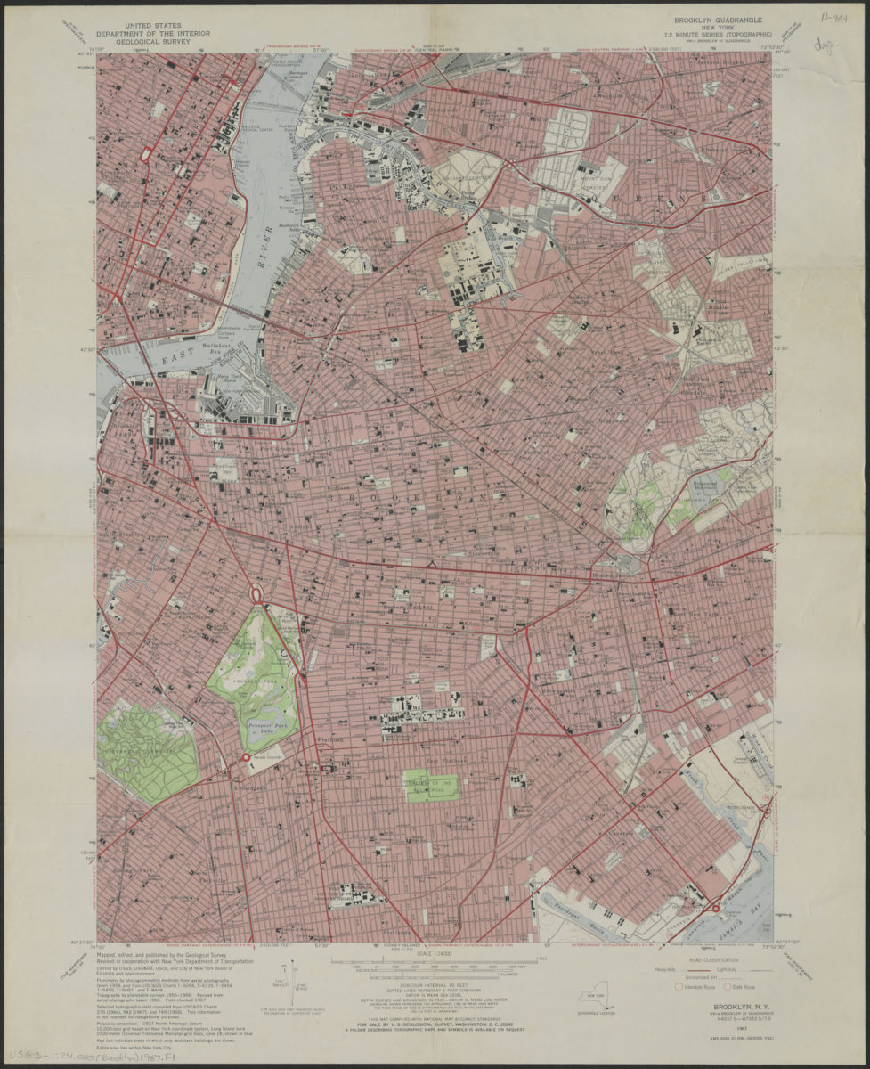
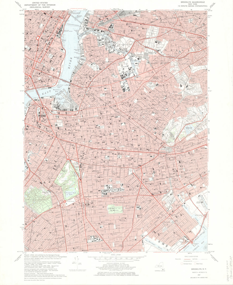
Brooklyn quadrangle, New York
Brooklyn quadrangle, New York
1967
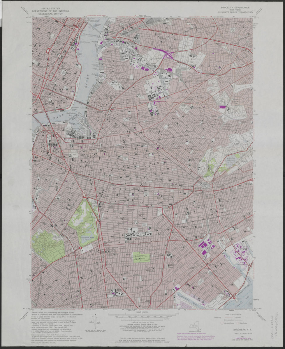
Brooklyn quadrangle, New York
Brooklyn quadrangle, New York
[1969]
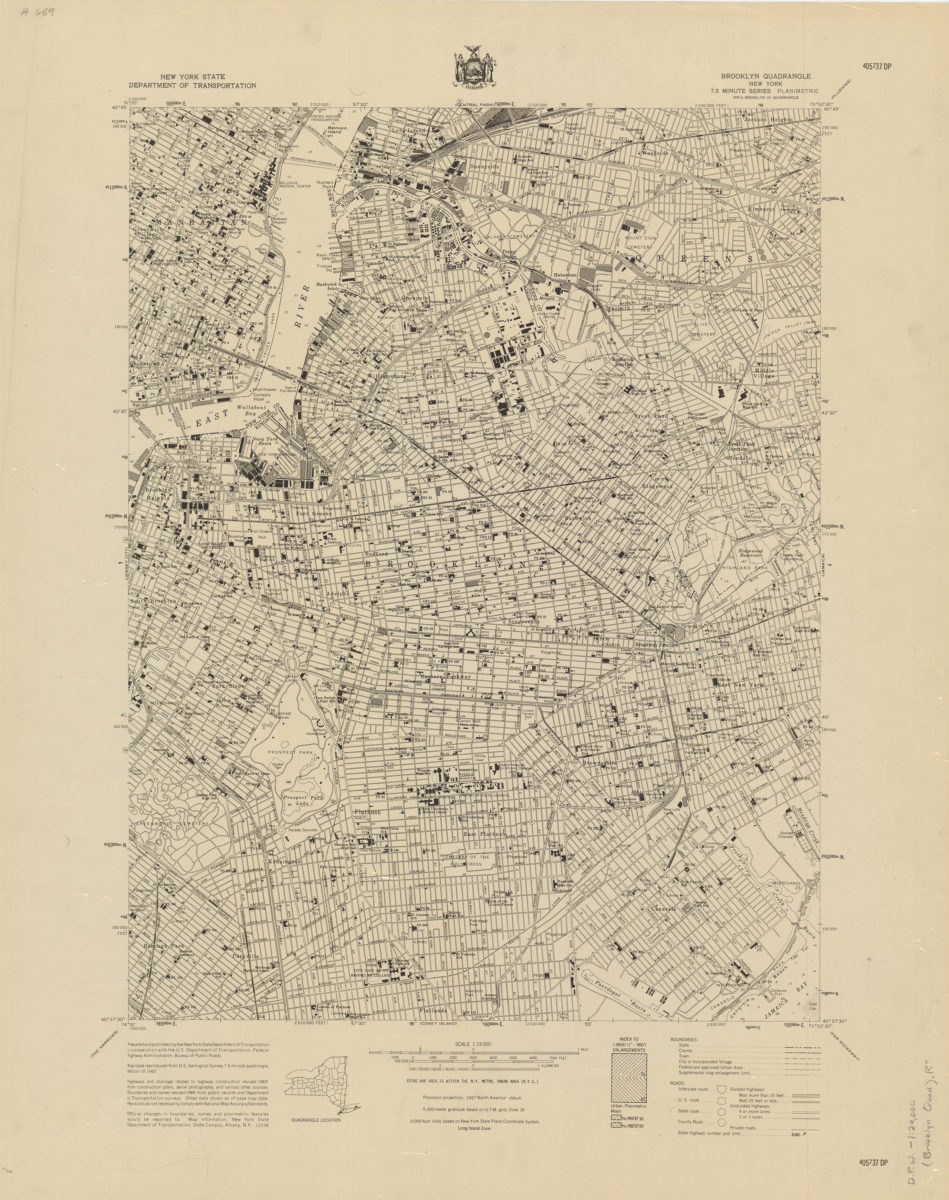
Brooklyn quadrangle, New York: mapped, edited, and published by the Geological Survey ; revised in cooperation with New York Department of Transportation
Brooklyn quadrangle, New York: mapped, edited, and published by the Geological Survey ; revised in cooperation with New York Department of Transportation
1975
Brooklyn quadrangle, New York: mapped, edited, and published by the Geological Survey ; revised in cooperation with New York Department of Transportation
Brooklyn quadrangle, New York: mapped, edited, and published by the Geological Survey ; revised in cooperation with New York Department of Transportation
1979
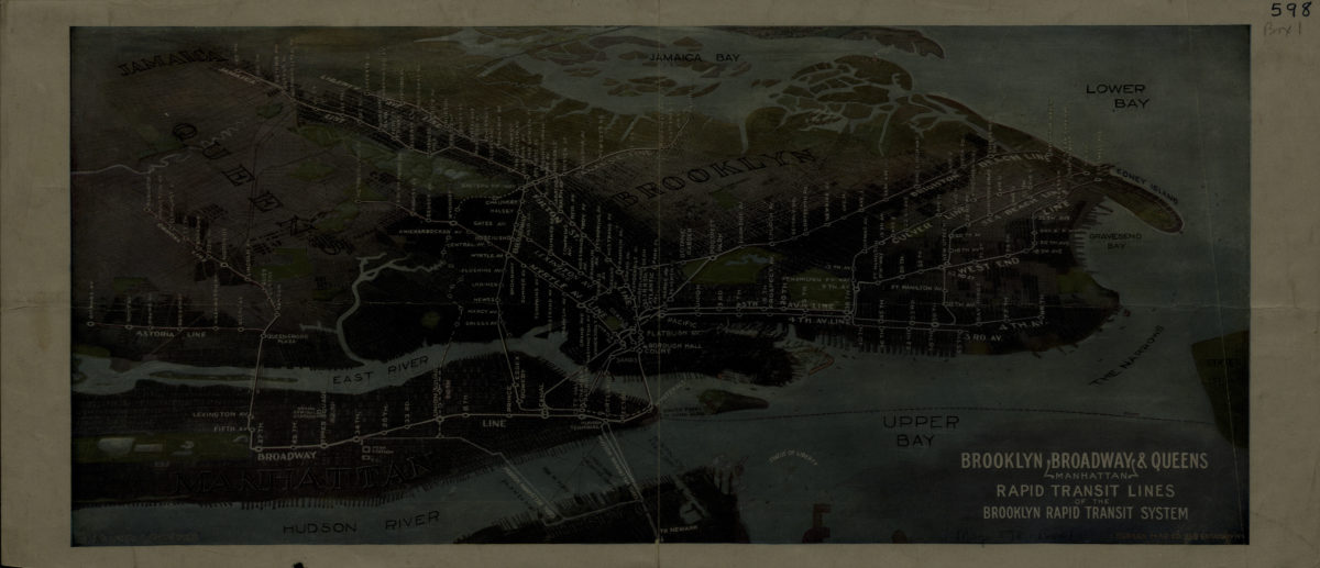
Brooklyn, Broadway (Manhattan), Queens rapid transit lines of the Brooklyn Rapid Transit System: Harry A. Chandler
Brooklyn, Broadway (Manhattan), Queens rapid transit lines of the Brooklyn Rapid Transit System: Harry A. Chandler
[1916-1924]
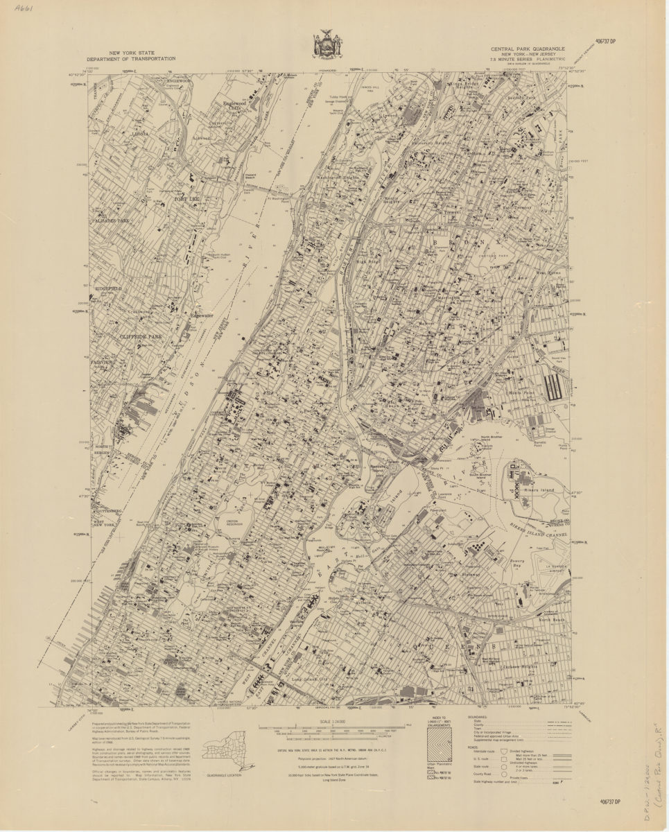
Central Park quadrangle, New York
Central Park quadrangle, New York
[1969]
City & County map of New-York, Brooklyn, Williamsburgh, Jersey City and the adjacent waters: by J.H. Colton
City & County map of New-York, Brooklyn, Williamsburgh, Jersey City and the adjacent waters: by J.H. Colton
1852; [ca. 1845]
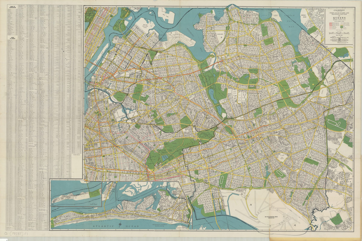
Colorprint street, house number and transportation map of Queens: (Queens County, N.Y.): American Map Company
Colorprint street, house number and transportation map of Queens: (Queens County, N.Y.): American Map Company
[1958]
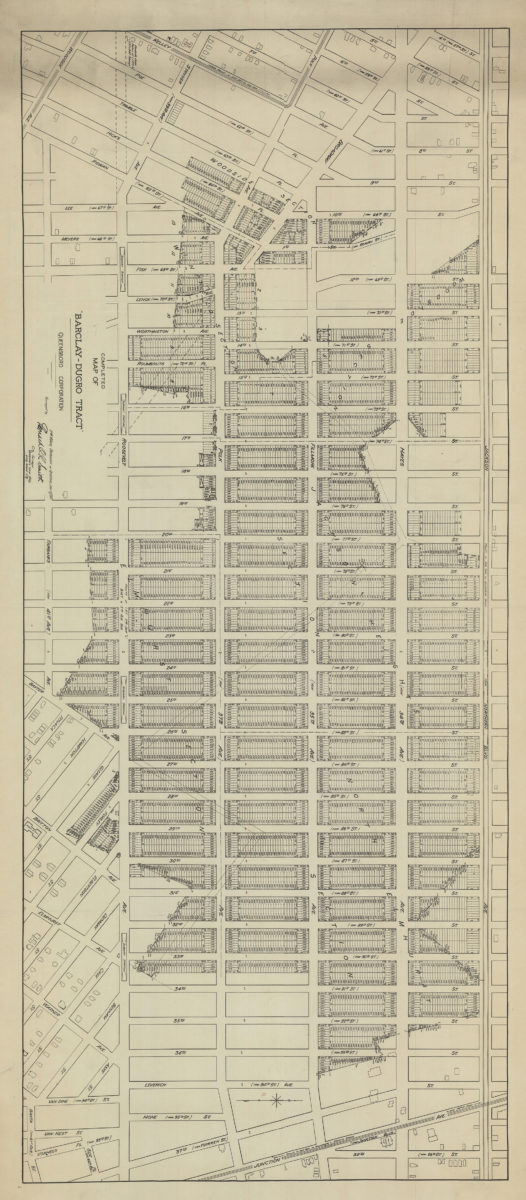
Completed map of the Barclay-Dugro tract
Completed map of the Barclay-Dugro tract
1911
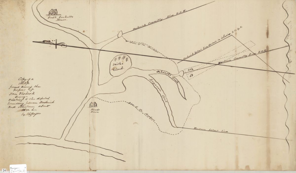
Copy of a map found among the papers of Jan Verkerk, surveyor, relating to the disputed boundary between Bushwick and Newtown about 1672: by T.G. Bergen
Copy of a map found among the papers of Jan Verkerk, surveyor, relating to the disputed boundary between Bushwick and Newtown about 1672: by T.G. Bergen
[18??]
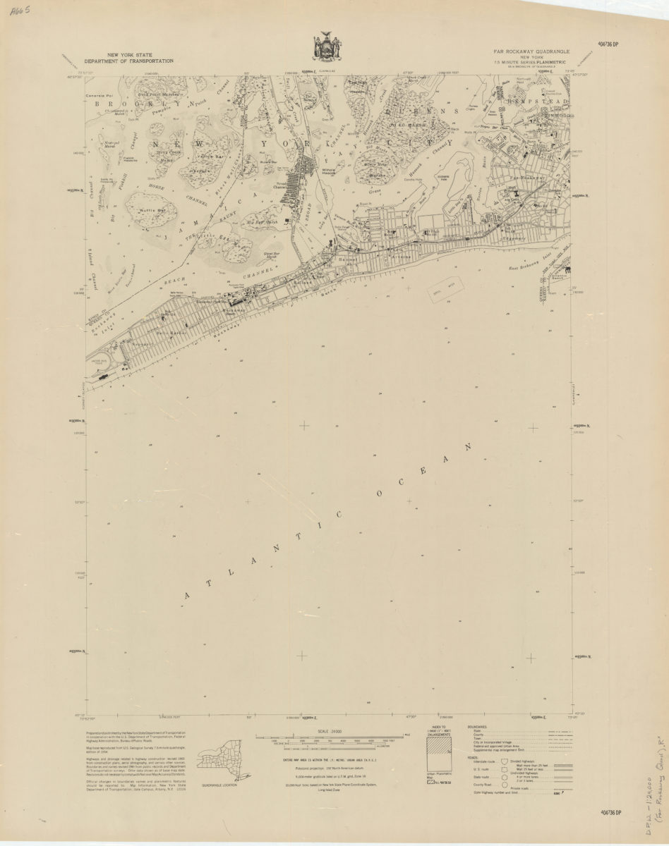
Far Rockaway quadrangle, New York
Far Rockaway quadrangle, New York
[1969]
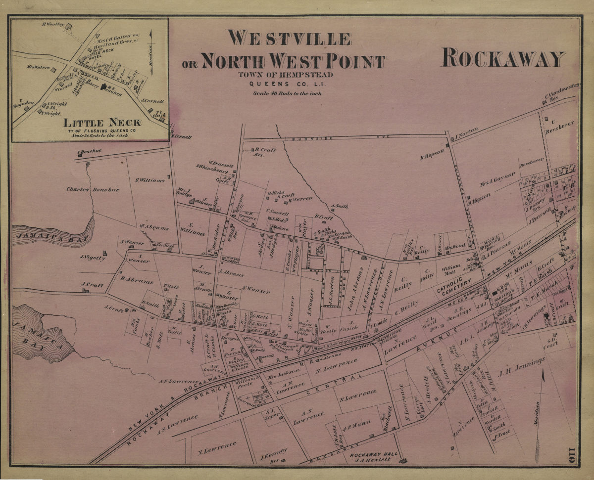
Far Rockaway, town of Hempstead ; Westville or North West Point, town of Hempstead, Queens Co., L.I.
Far Rockaway, town of Hempstead ; Westville or North West Point, town of Hempstead, Queens Co., L.I.
[1873]
Flushing quadrangle, New York
Flushing quadrangle, New York
[1969]
Hagstrom’s map of Queens (New York City): house-number and subway guide: compiled, printed, and published by Hagstrom Map Company, map makers and publishers
Hagstrom’s map of Queens (New York City): house-number and subway guide: compiled, printed, and published by Hagstrom Map Company, map makers and publishers
[1928]
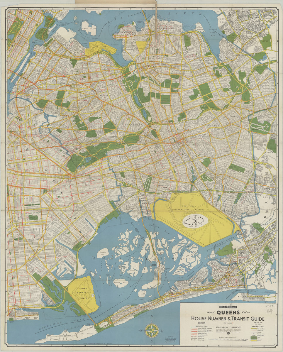
Hagstrom’s map of Queens N.Y. City: house number & transit guide: compiled, printed, and published by Hagstrom Company Incorporated
Hagstrom’s map of Queens N.Y. City: house number & transit guide: compiled, printed, and published by Hagstrom Company Incorporated
[1948]
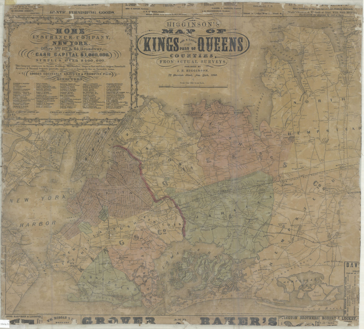
Higginson’s map of Kings and a large part of Queens Counties: from actual surveys
Higginson’s map of Kings and a large part of Queens Counties: from actual surveys
1860
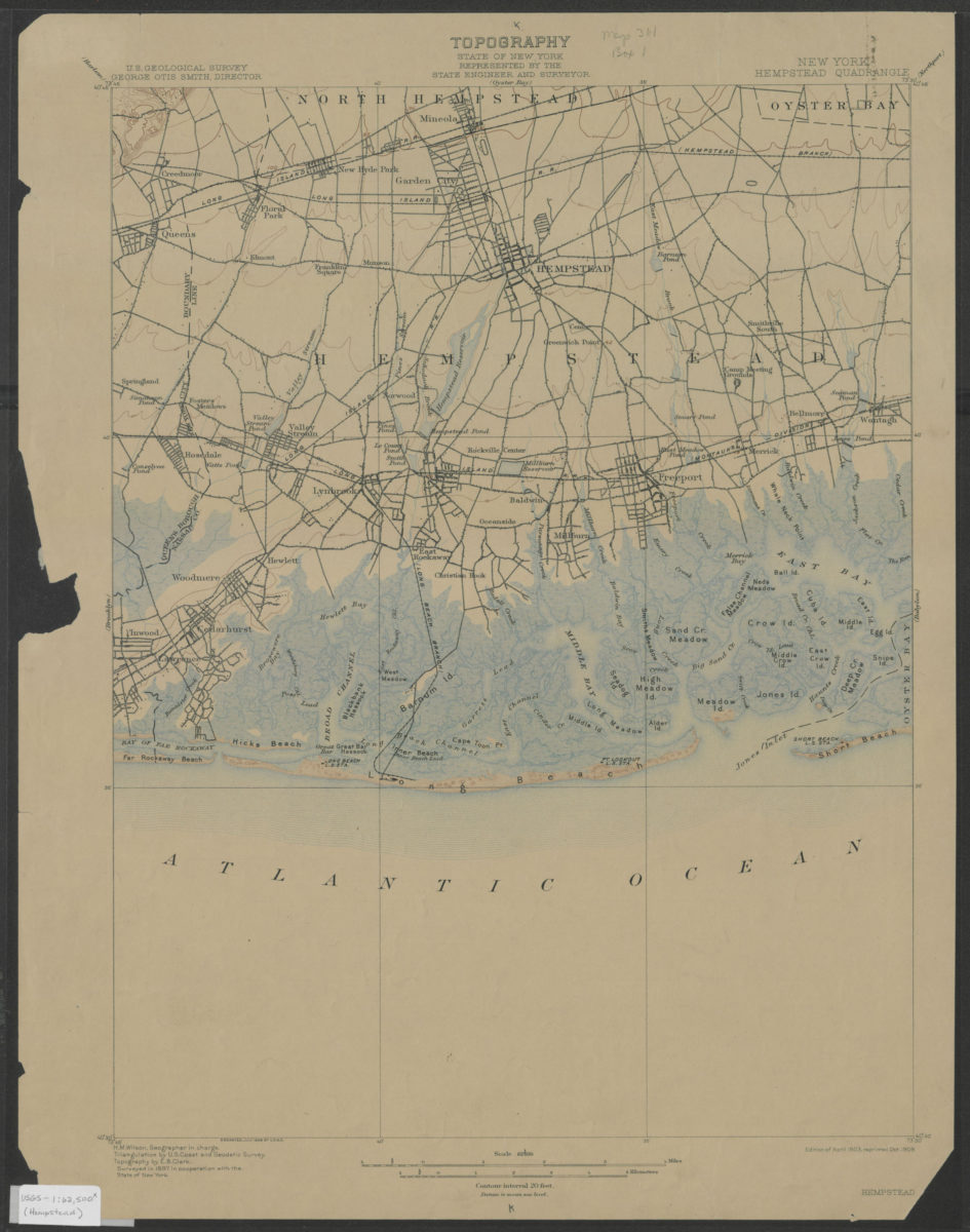
Hempstead quadrangle, New York: U.S. Geological Survey
Hempstead quadrangle, New York: U.S. Geological Survey
1903; 1909
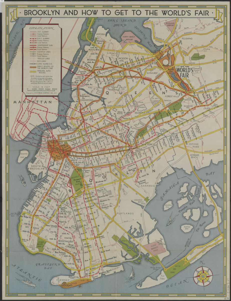
How to get to the New York World’s Fair, and The heart of Brooklyn: issued by the Downtown Brooklyn Association, Inc
How to get to the New York World’s Fair, and The heart of Brooklyn: issued by the Downtown Brooklyn Association, Inc
[1939]
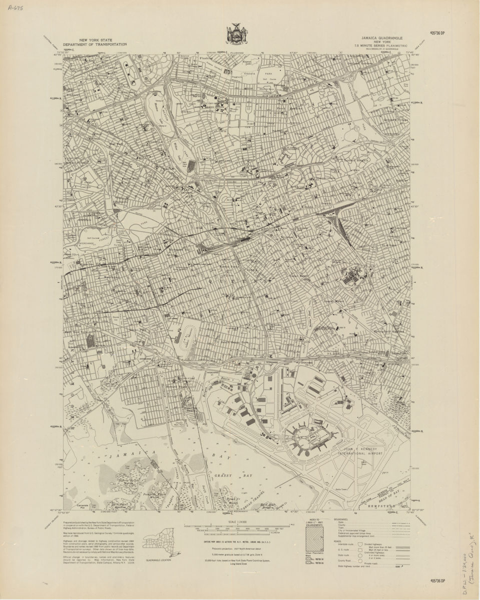
Jamaica quadrangle, New York
Jamaica quadrangle, New York
[1969]
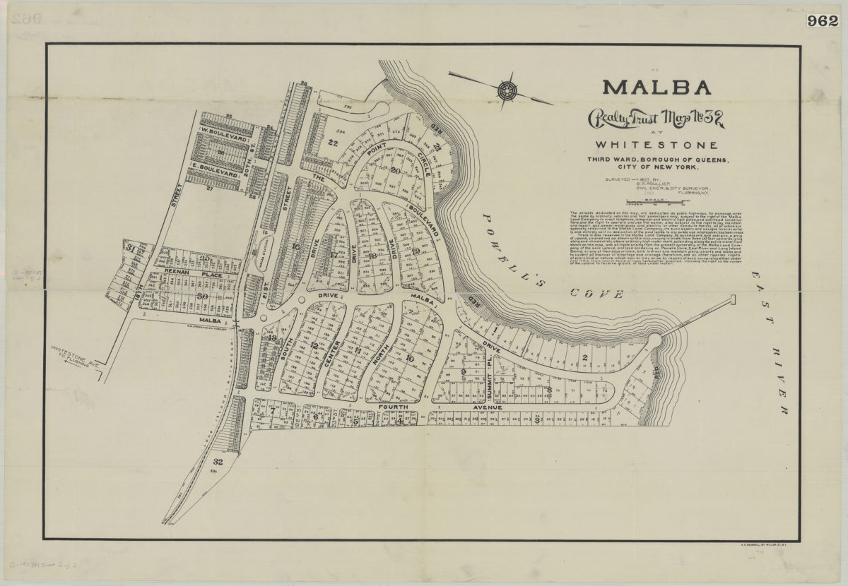
Malba Realty Trust map no. 32, at Whitestone, third ward, borough of Queens, city of New York: surveyed 1907 by G. A. Roullier, civil eng’r & city surveyor, Flushing, N.Y.
Malba Realty Trust map no. 32, at Whitestone, third ward, borough of Queens, city of New York: surveyed 1907 by G. A. Roullier, civil eng’r & city surveyor, Flushing, N.Y.
1907
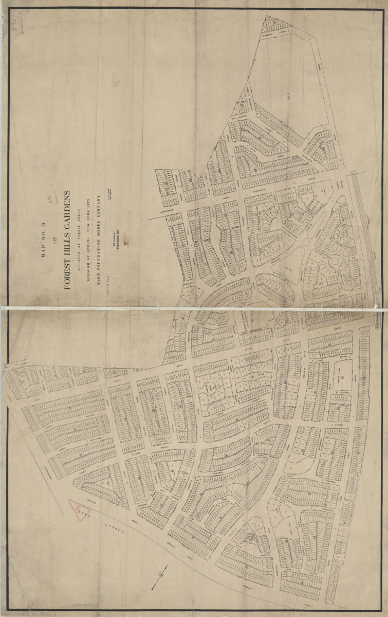
Map no. 6 of Forest Hills Gardens: situated at Forest Hills, Borough of Queens, City of New York : [surveyed for] Sage Foundation Homes Company: C.B. Fancy, civil engineer
Map no. 6 of Forest Hills Gardens: situated at Forest Hills, Borough of Queens, City of New York : [surveyed for] Sage Foundation Homes Company: C.B. Fancy, civil engineer
1921
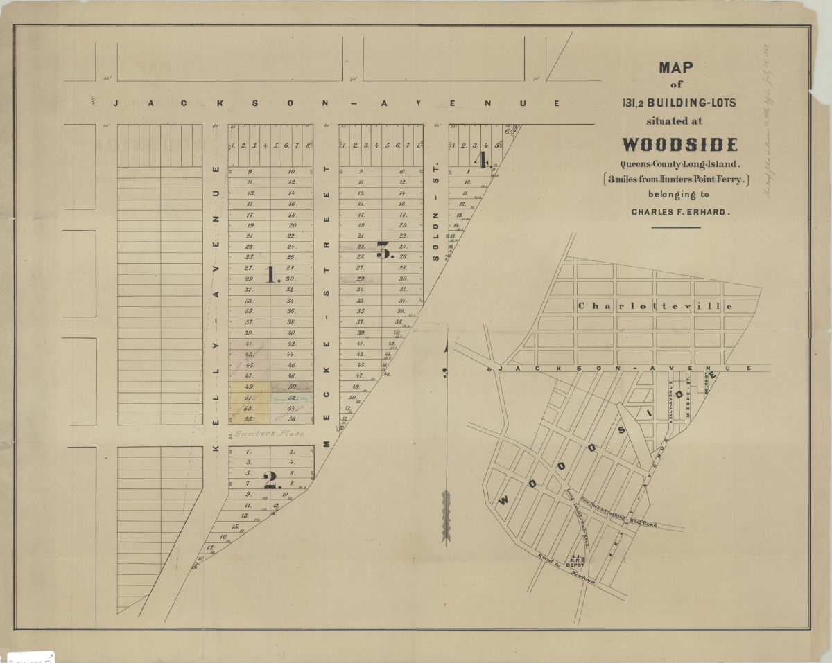
Map of 131, 2 building lots situated at Woodside, Queens County, Long Island, 3 miles from Hunters Point Ferry, belonging to Charles F. Erhard
Map of 131, 2 building lots situated at Woodside, Queens County, Long Island, 3 miles from Hunters Point Ferry, belonging to Charles F. Erhard
[1869]
Map of Creedmoor Lawn: Isaac Coles, surveyor, April 1874
Map of Creedmoor Lawn: Isaac Coles, surveyor, April 1874
[1874]
Map of the village of West Flushing in the township of Newtown, Queens Co. Long Island, New York: comprising the parts laid out and described on sectional maps no. 1, 2, 3, and 4
Map of the village of West Flushing in the township of Newtown, Queens Co. Long Island, New York: comprising the parts laid out and described on sectional maps no. 1, 2, 3, and 4
1854
Map of the villages of Astoria (late Hallett’s Cove) & Ravenswood, Long Island
Map of the villages of Astoria (late Hallett’s Cove) & Ravenswood, Long Island
1840
Map showing Brooklyn automobile routes and car lines approved by the Borough President, July 1919
Map showing Brooklyn automobile routes and car lines approved by the Borough President, July 1919
[1919]
Partition map of the farm of the late Thomas S. Payntar, dec., in Newtown, Queens County, L.I.: as divided among his heirs by Jacob Mott, Peter Hulst, and Jacob Burroughs, commissioners in partition appointed by the Supreme Court:
Partition map of the farm of the late Thomas S. Payntar, dec., in Newtown, Queens County, L.I.: as divided among his heirs by Jacob Mott, Peter Hulst, and Jacob Burroughs, commissioners in partition appointed by the Supreme Court:
August 1864
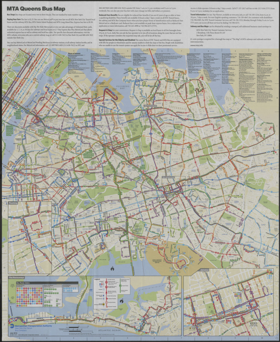
Queens bus map: free, July 2010: MTA Metropolitan Transportation Authority, New York City Transit Bus Company
Queens bus map: free, July 2010: MTA Metropolitan Transportation Authority, New York City Transit Bus Company
[ca. 2010]
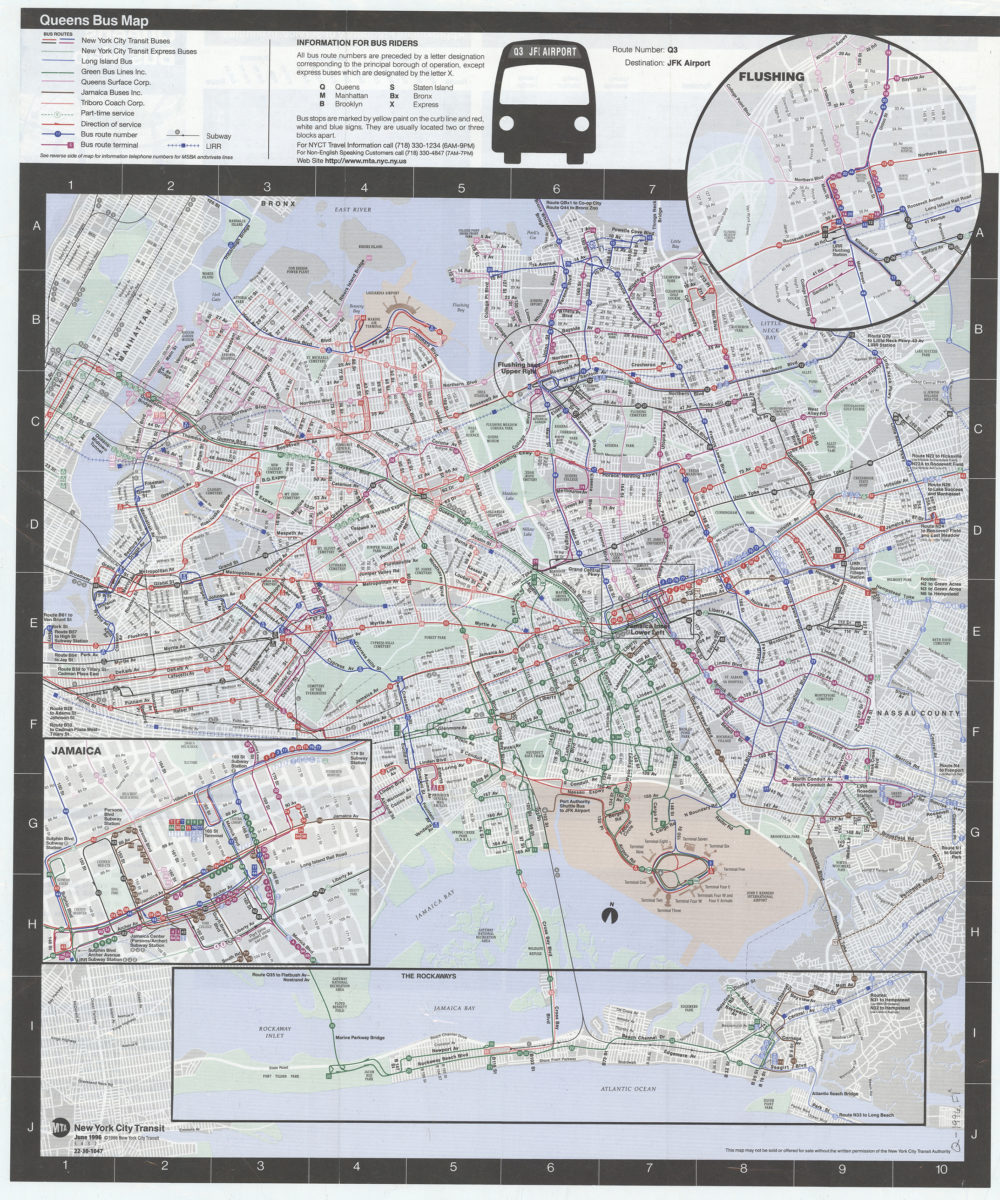
Queens bus map: MTA, New York City Transit
Queens bus map: MTA, New York City Transit
[ca. 1996]
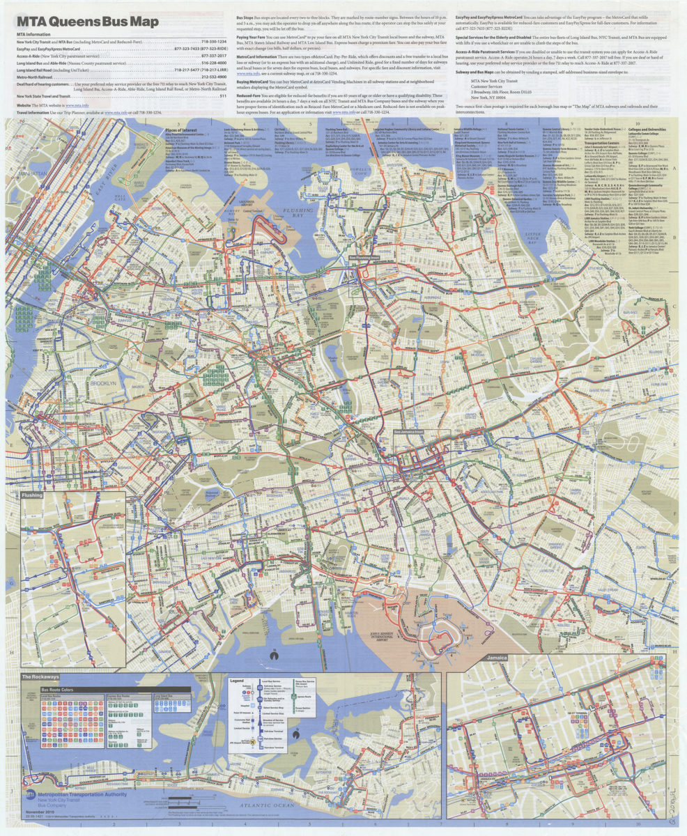
Queens bus map: November 2010: MTA Metropolitan Transportation Authority, New York City Transit Bus Company
Queens bus map: November 2010: MTA Metropolitan Transportation Authority, New York City Transit Bus Company
[2010; 2010]
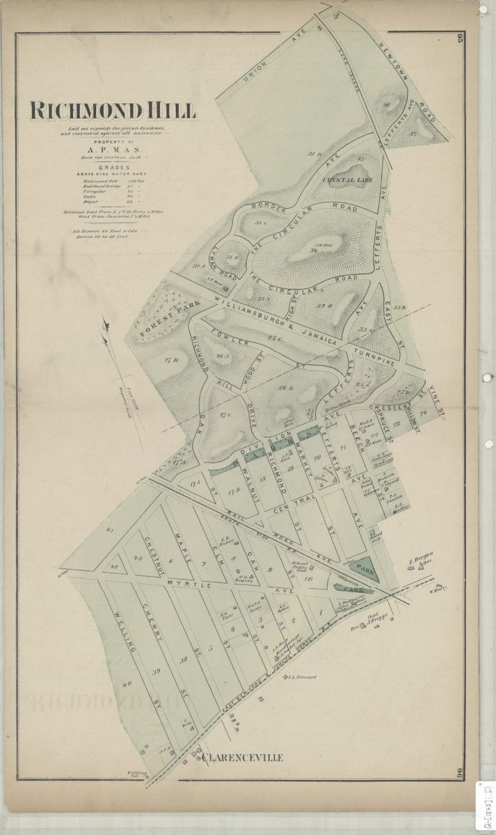
Richmond Hill: laid out expressly for private residences and against all nuisances : property of A.P. Man
Richmond Hill: laid out expressly for private residences and against all nuisances : property of A.P. Man
[1873]
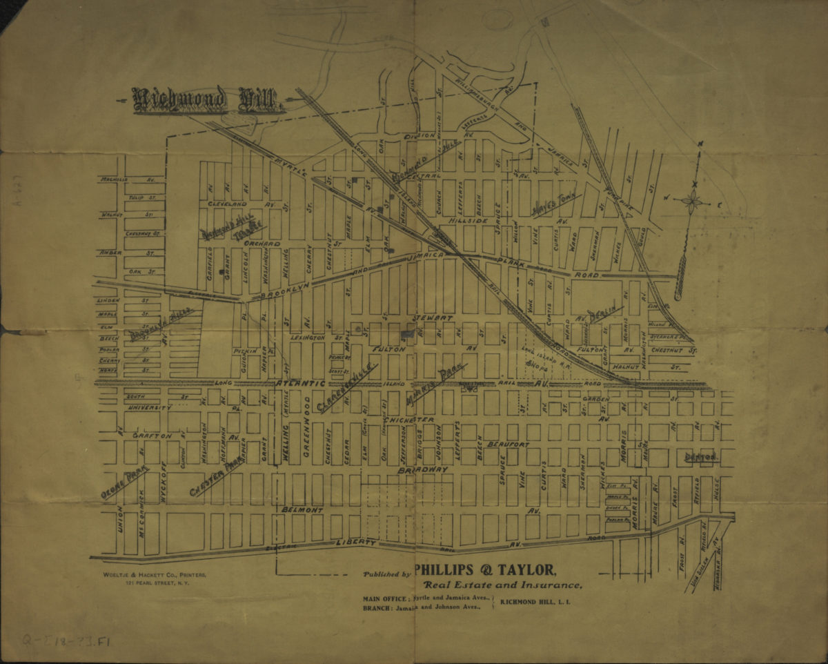
Richmond Hill
Richmond Hill
[189?]
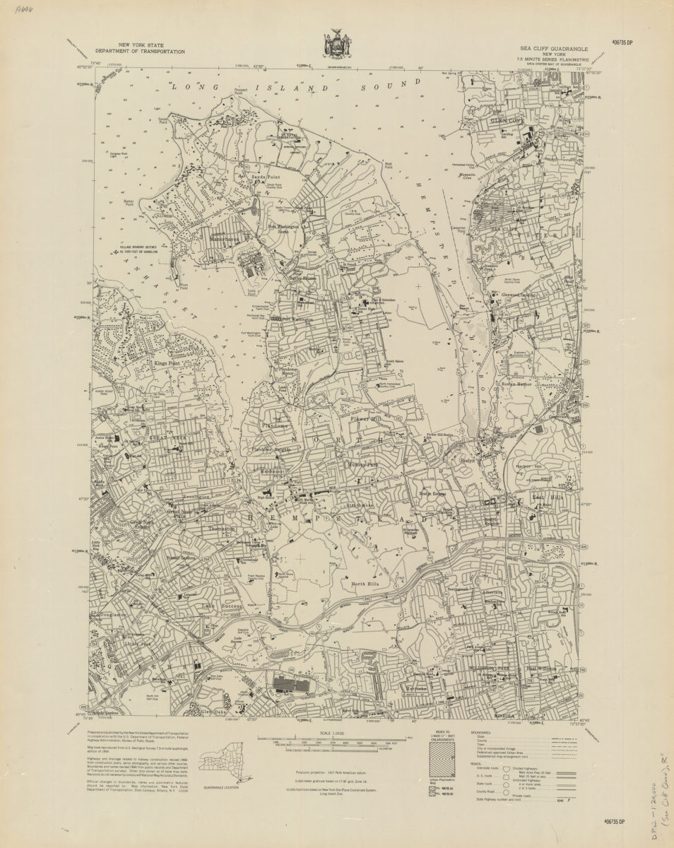
Sea Cliff quadrangle, New York
Sea Cliff quadrangle, New York
[1968]
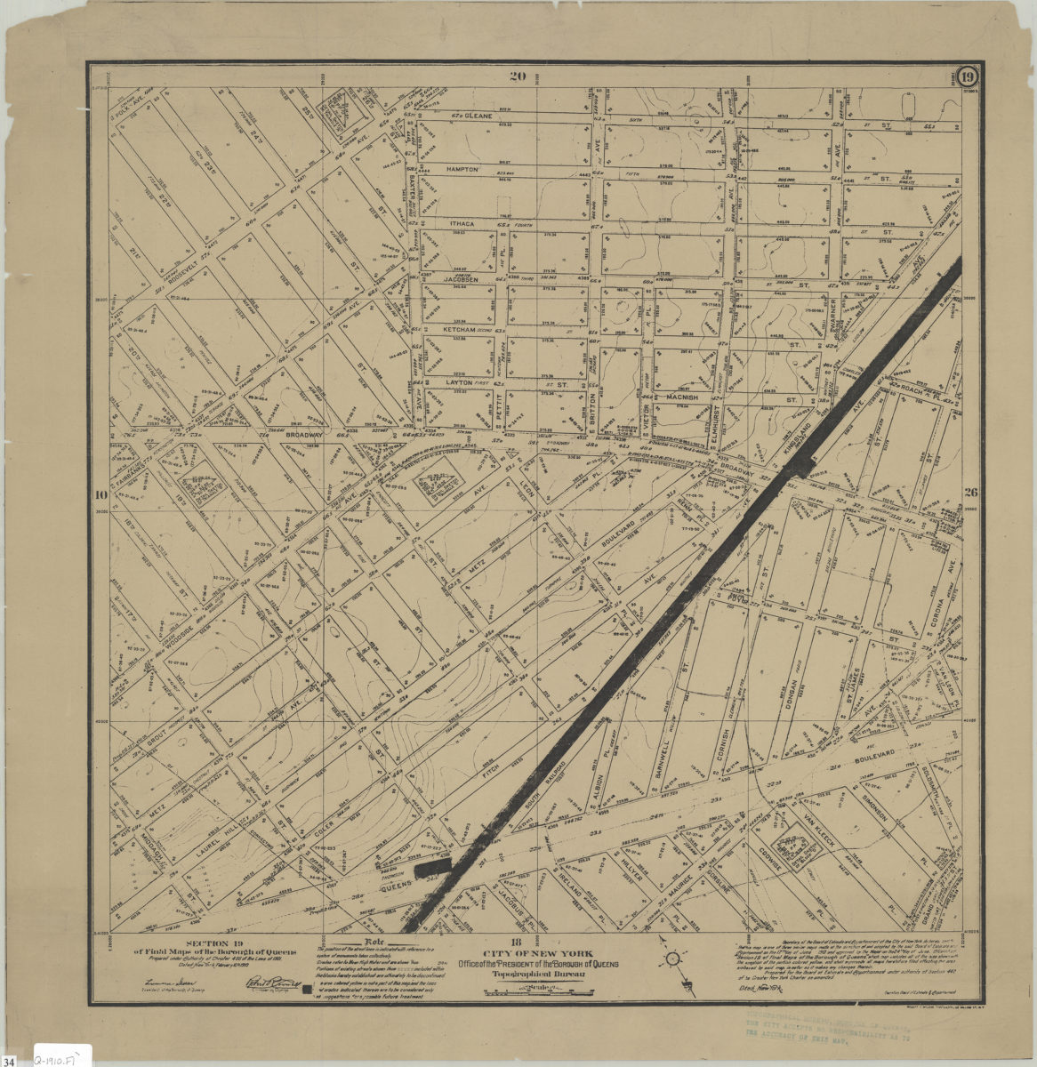
Section 19 of Final maps of the Borough of Queens: City of New York, Borough of Queens, Office of the President, Topographical Bureau
Section 19 of Final maps of the Borough of Queens: City of New York, Borough of Queens, Office of the President, Topographical Bureau
1910
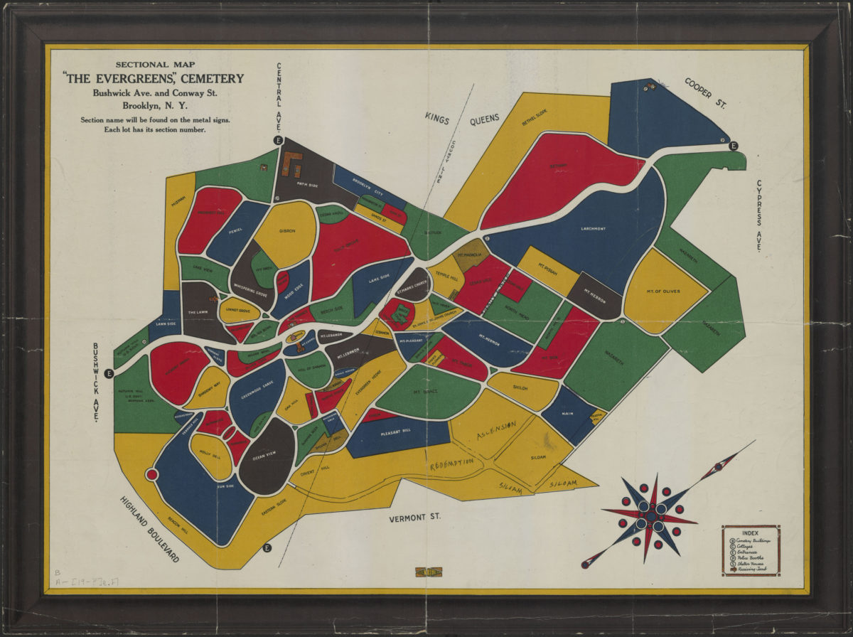
Sectional map: “The Evergreens Cemetery” : Bushwick Ave. and Conway Street, Brooklyn, N.Y.
Sectional map: “The Evergreens Cemetery” : Bushwick Ave. and Conway Street, Brooklyn, N.Y.
[1900-1999]
Shell street guide and metropolitan map of Brooklyn, Queens and Long Island: the H.M. Gousha Company
Shell street guide and metropolitan map of Brooklyn, Queens and Long Island: the H.M. Gousha Company
[1939]
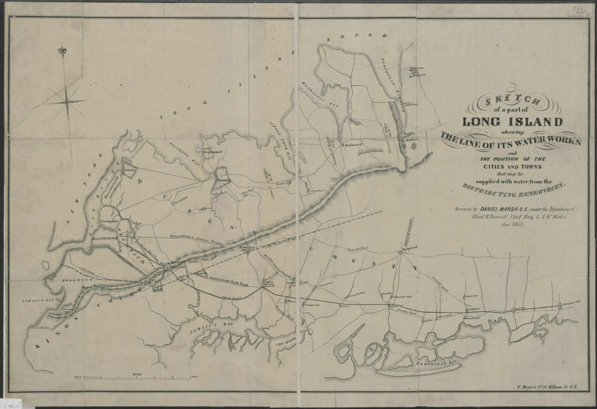
Sketch of a part of Long Island shewing the line of its water works and the position of the cities and towns that may be supplied with water from the distributing reservoirs: surveyed by Daniel Marsh … under the direction of Ward B. Burnett
Sketch of a part of Long Island shewing the line of its water works and the position of the cities and towns that may be supplied with water from the distributing reservoirs: surveyed by Daniel Marsh … under the direction of Ward B. Burnett
January 1853
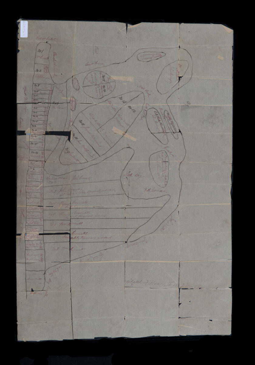
Sketch of beach lots & marsh
Sketch of beach lots & marsh
[18??]
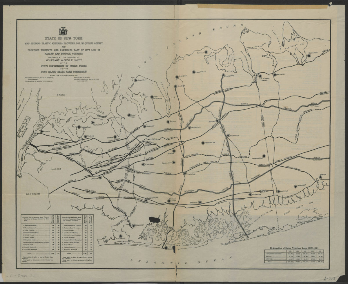
State of New York map showing traffic arteries provided for in Queens County and proposed highways and parkways east of city line in Nassau and Suffolk Counties: prepared at the request of Governor Alfred E. Smith
State of New York map showing traffic arteries provided for in Queens County and proposed highways and parkways east of city line in Nassau and Suffolk Counties: prepared at the request of Governor Alfred E. Smith
[1925]
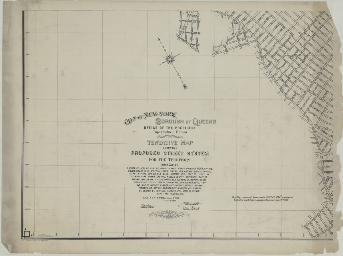
Tentative map showing proposed street system for the territory bounded by Radnor Rd., Avon Rd., Kent Rd. … Jamaica Avenue, 190th St. and Hillside Ave.: City of New York, Borough of Queens, Office of the President, Topographical Bureau
Tentative map showing proposed street system for the territory bounded by Radnor Rd., Avon Rd., Kent Rd. … Jamaica Avenue, 190th St. and Hillside Ave.: City of New York, Borough of Queens, Office of the President, Topographical Bureau
1913
The Narrows quadrangle, New York–New Jersey: 7.5 minute series (topographic): mapped, edited, and published by the Geological Survey ; revised in cooperation with New York Department of Transportation
The Narrows quadrangle, New York–New Jersey: 7.5 minute series (topographic): mapped, edited, and published by the Geological Survey ; revised in cooperation with New York Department of Transportation
1968
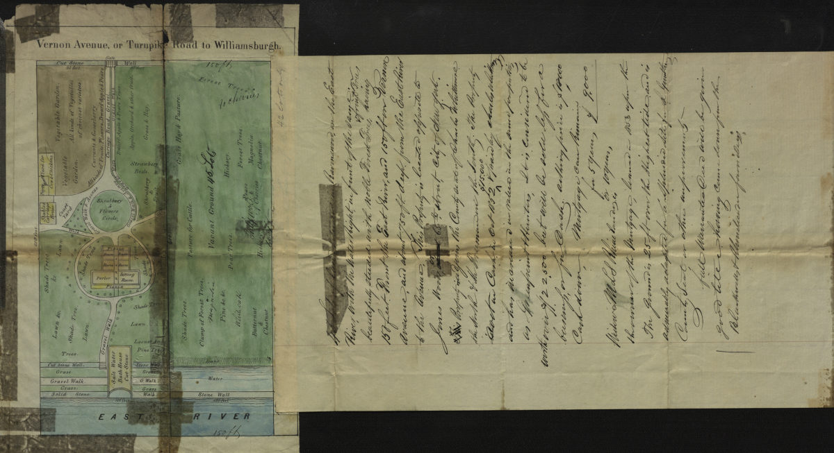
Vernon Avenue, or Turnpike Road to Williamsburgh
Vernon Avenue, or Turnpike Road to Williamsburgh
[1853]
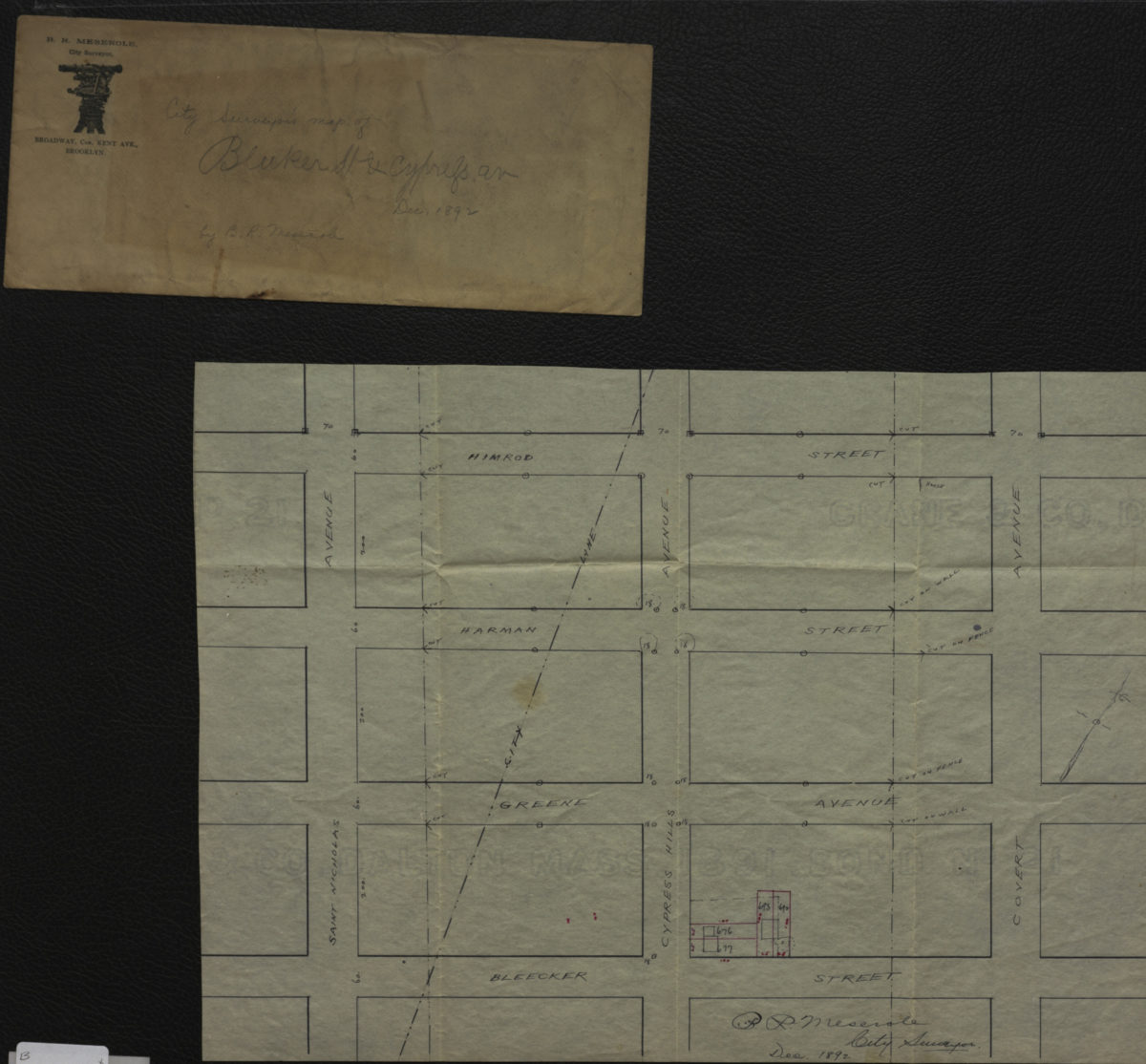
City surveyor’s map of Bleeker [i.e. Bleecker] St. & Cypress Av.: B.R. Meserole city surveyor
City surveyor’s map of Bleeker [i.e. Bleecker] St. & Cypress Av.: B.R. Meserole city surveyor
December 1892
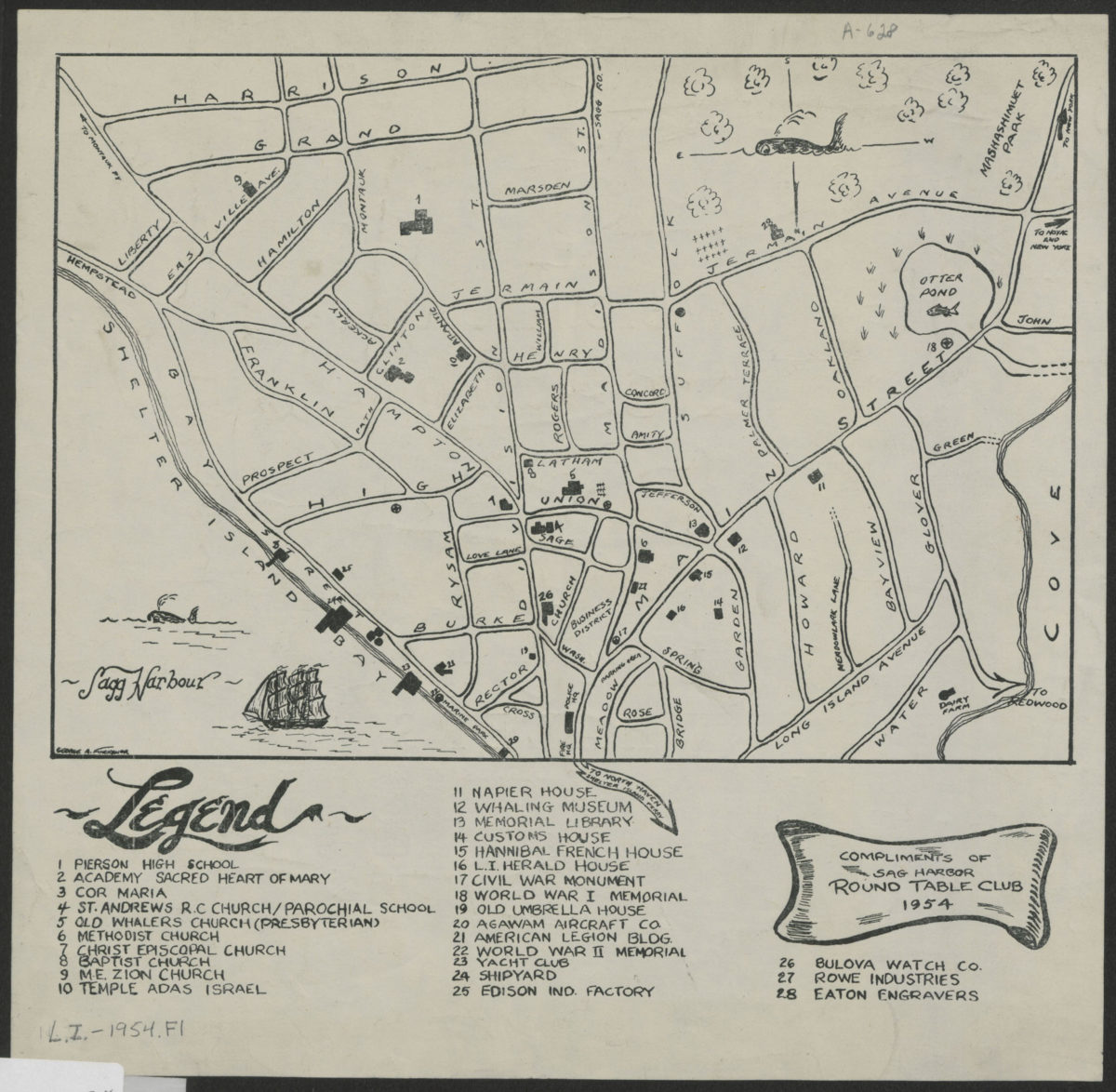
[Map of village of Sag Harbor]
[Map of village of Sag Harbor]
1954
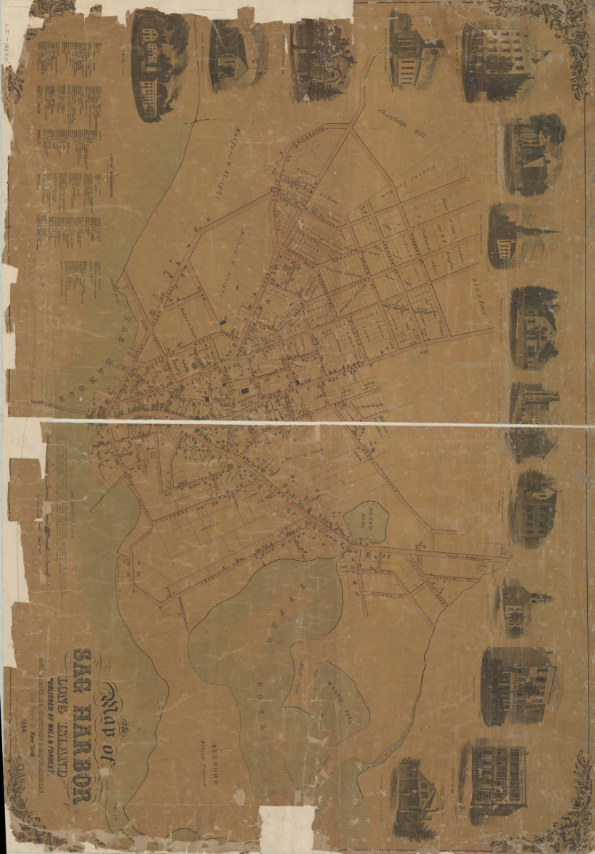
Map of Sag Harbor, Long Island
Map of Sag Harbor, Long Island
1854