Center for Brooklyn History
Map Collections
Search
About
Othmer Library & Archives
Submit search query
Browse 1493 records
Location
Abingdon Square (New York, N.Y.)
1
Adirondack Mountains (N.Y.)
2
Adirondack Park (N.Y.)
1
Albany (N.Y.)
3
Albany County (N.Y.)
1
Albion (Oswego County : Town)
1
Amagansett (N.Y.)
1
Amityville (N.Y.)
1
Annastown (N.Y.)
1
Astoria (New York, N.Y.)
4
Atlantic Basin (New York, N.Y.)
3
Atlantic Coast (North America)
6
Atlantic Ocean.
1
Atlantic States
2
Auburn (N.Y.)
1
Babylon (N.Y. : Town)
2
Babylon (N.Y.)
1
Bath Beach (New York, N.Y.)
8
Battery Park (New York, N.Y.)
3
Bay Ridge (New York, N.Y.)
108
Bay Ridge Park (New York, N.Y.)
1
Bedford (N.Y. : Town)
1
Bedford-Stuyvesant (New York, N.Y.)
67
Bellerose (New York, N.Y.)
1
Belt Parkway (New York, N.Y.)
1
Bensonhurst (New York, N.Y.)
17
Bergen Beach (New York, N.Y.)
3
Bergen County (N.J.)
6
Block Island (R.I. : Island)
2
Blythebourne (New York, N.Y.)
1
Boerum Hill (New York, N.Y.)
6
Borough Park (New York, N.Y.)
23
Boylston (N.Y.)
1
Brandon (N.Y.)
1
Bridgehampton (N.Y.)
1
Brighton Beach (New York, N.Y.)
4
Brightwaters (N.Y.)
1
Bronx (New York, N.Y.)
10
Brookhaven (N.Y. : Town)
3
Brookhaven (N.Y.)
2
Brooklyn (New York, N.Y.)
891
Brooklyn Botanic Garden
2
Brooklyn Heights (New York, N.Y.)
76
Brooklyn-Battery Bridge (New York, N.Y.)
1
Brooklyn-Queens Expressway (New York, N.Y.)
3
Brownsville (New York, N.Y.)
10
Buffalo (N.Y.)
3
Bushwick (New York, N.Y.)
20
Bushwick Park (New York, N.Y.)
1
Buttermilk Channel (New York, N.Y.)
1
Canarsie (New York, N.Y.)
18
Caribbean Area
2
Carroll Gardens (New York, N.Y.)
21
Carroll Park (New York, N.Y.)
1
Cemetery of the Evergreens (New York, N.Y.)
1
Central Park (New York, N.Y.)
3
Champlain Canal (N.Y.)
1
Champlain, Lake
1
City Hall Park (New York, N.Y.)
1
Clermont (N.Y. : Town)
1
Clinton County (N.Y.)
1
Clinton Hill (New York, N.Y.)
10
Cobble Hill (New York, N.Y.)
7
Cold Spring Harbor (N.Y.)
1
College Point (New York, N.Y.)
2
Columbia County (N.Y.)
1
Columbia Street Waterfront District (New York, N.Y.)
3
Columbus Park (New York, N.Y.)
1
Commodore Barry Park (New York, N.Y.)
1
Coney Island (New York, N.Y.)
22
Connecticut
7
Connecticut River
1
Constable (N.Y.)
1
Corona (New York, N.Y.)
2
Cortelyou Farm (New York, N.Y.)
1
Cowenhoven Homestead (Brooklyn, New York, N.Y.)
1
Croton Aqueduct (N.Y.)
3
Croton River Watershed (N.Y.)
2
Crown Heights (New York, N.Y.)
25
Cypress Hills (New York, N.Y.)
8
David Johnson Farm (New York, N.Y.)
1
Delaware County (N.Y.)
1
Delaware River Valley (N.Y.-Del. and N.J.)
1
Denmark (N.Y.)
1
Dickinson (N.Y.)
2
Ditmas Park (New York, N.Y.)
1
Douglaston (New York, N.Y.)
1
Downtown Brooklyn (New York, N.Y.)
29
Duane Street Park (New York, N.Y.)
1
DUMBO Historic District (New York, N.Y.)
7
Dunkirk (N.Y.)
1
Dutchess County (N.Y.)
2
Dyker Heights (New York, N.Y.)
23
East (U.S.)
1
East Elmhurst (New York, N.Y.)
2
East Flatbush (New York, N.Y.)
23
East Hampton (N.Y.)
1
East Harlem (New York, N.Y.)
1
East Midwood (New York, N.Y.)
1
East New York (New York, N.Y.)
16
East Patchogue (N.Y.)
1
East River (N.Y.)
3
Elmhurst (New York, N.Y.)
1
Elmont (N.Y.)
1
Erasmus (New York, N.Y.)
1
Erie Basin (New York, N.Y.)
2
Erie Canal (N.Y.)
3
Erie County (N.Y.)
1
Essex County (N.J.)
4
Fairfield County (Conn.)
5
Far Rockaway (New York, N.Y.)
2
Farragut (New York, N.Y.)
1
ferries
1
Flatbush (New York, N.Y.)
35
Flatiron District (New York, N.Y.)
1
Flatlands (New York, N.Y.)
19
Flushing (New York, N.Y.)
13
Flushing Meadows-Corona Park (New York, N.Y.)
1
Forest Hills Gardens (New York, N.Y.)
1
Fort Brooklyn (New York, N.Y.)
1
Fort Covington (N.Y.)
1
Fort Greene (New York, N.Y.)
22
Fort Hamilton (New York, N.Y.)
31
Fort Montgomery State Historic Site (Highlands, N.Y.)
1
Fort Stanwix (Rome, N.Y.)
1
Fort Totten (N.Y.)
1
Fort Washington (New York, N.Y.)
2
Franklin County (N.Y.)
2
Freeport (N.Y.)
1
Fulton Ferry Historic District (New York, N.Y.)
5
Futurama (New York, N.Y.)
2
Gardiners Bay (N.Y.)
1
Genesee County (N.Y.)
2
Genesee River (Pa. and N.Y.)
1
George, Lake (N.Y. : Lake)
1
Germantown (N.Y. : Town)
1
Gerritsen Beach (New York, N.Y.)
2
Glen Cove (N.Y.)
1
Gowanus (New York, N.Y.)
12
Gowanus Bay (New York, N.Y.)
1
Gowanus Canal (New York, N.Y.)
5
Gramercy Park (New York, N.Y.)
1
Grand Army Plaza (Brooklyn, New York, N.Y.)
1
Gravesend (New York, N.Y.)
25
Great Neck (N.Y.)
3
Green-Wood Cemetery (New York, N.Y.)
2
Greenboro (N.Y.)
1
Greene County (N.Y.)
3
Greenpoint (New York, N.Y.)
38
Greenport (N.Y.)
1
Greenwich Village (New York, N.Y.)
1
Greenwood (New York, N.Y.)
1
Greenwood Lake Region (N.J. and N.Y.)
1
Hanover (N.H.)
1
Hanover Region (N.H.)
1
Harlem (New York, N.Y.)
1
Harrisburgh (N.Y.)
1
Hell Gate (New York, N.Y.)
2
Hempstead (N.Y.)
13
Herbert Von King Park (New York, N.Y.)
1
Hicksville (N.Y.)
1
Hinsdale (New York, N.Y.)
1
Hoboken (N.J.)
1
Holland Tunnel (Jersey City, N.J., and New York, N.Y.)
1
Hudson County (N.J.)
3
Hudson Highlands (N.Y.)
1
Hudson River (N.Y. and N.J.)
7
Hunters Point (New York, N.Y.)
2
Huntington (N.Y.)
7
Inwood (New York, N.Y.)
1
Islip (N.Y.)
5
Ithaca, N.Y.
1
Jamaica (New York, N.Y.)
8
Jamaica Bay (N.Y.)
5
Jefferson County (N.Y.)
1
Jersey City (N.J.)
4
Kensington (New York, N.Y.)
11
Kings County (New York, N.Y.)
8
Kings Highway (New York, N.Y.)
1
Kingslandville (New York, N.Y.)
1
Lakeland (N.Y.)
1
Lawrence (Mercer County, N.J. : Township)
1
Lawrence Beach (N.Y.)
1
Lebanon (N.H.)
1
Lebanon Region (N.H.)
1
Lefferts Park (New York, N.Y.)
1
Lewis County (N.Y.)
2
Lindenhurst (N.Y.)
1
Livingston (N.Y. : Town)
1
Livingston County (N.Y.)
1
Lloyd Harbor (N.Y.)
1
Long Island (N.Y.)
197
Long Island City (New York, N.Y.)
8
Long Island Sound (N.Y. and Conn.)
12
Long Island, Battle of, New York, N.Y., 1776
4
Lorraine (N.Y.)
1
Lower Bay (N.Y. and N.J.)
1
Madison Square Park (New York, N.Y.)
1
Maidenhead (N.J.)
1
Maine, Gulf of
1
Malba (New York, N.Y.)
1
Manhattan (New York, N.Y.)
120
Manhattan Beach (New York, N.Y.)
2
Marine Park (New York, N.Y.)
5
Maritime Provinces
1
Martense Farm (New York, N.Y.)
1
Martinsburg (N.Y.)
1
Marway Farm (New York, N.Y.)
1
Maspeth (New York, N.Y.)
2
Mattituck (N.Y.)
1
Middle Atlantic States
2
Middlesex County (N.J.)
4
Midwood (New York, N.Y.)
9
Mill Basin (New York, N.Y.)
3
Miller Place (N.Y.)
1
Mineola (N.Y.)
1
Mohawk River Valley (N.Y.)
3
Monmouth County (N.J.)
3
Monsignor Mcgolrick Park (New York, N.Y.)
1
Montauk (N.Y.)
4
Morningside Heights (New York, N.Y.)
1
Morris County (N.J.)
3
Napeague Bay (N.Y.)
1
Nassau County (N.Y.)
24
New England
8
New France
1
New Jersey
27
New Lots (New York, N.Y.)
1
New Netherland
2
New Utrecht (New York, N.Y.)
9
New York (N.Y.)
164
New York (State)
95
New York Bight (N.J. and N.Y.)
1
New York Harbor (N.Y. and N.J.)
16
New York Metropolitan Area
40
New York Region
5
Newport County (R.I.)
1
Newtown (New York, N.Y.)
1
Newtown (Queens County, N.Y.)
4
North America
7
North Hempstead (N.Y. : Town)
4
Northport Bay (N.Y. : Bay)
1
Nottingham (New York, N.Y.)
2
Noyack (N.Y.)
1
Ocean Beach (N.Y.)
1
Old Bethpage (N.Y.)
1
Oneida County (N.Y.)
2
Orange County (N.Y.)
7
Orient (N.Y.)
1
Orwell (N.Y.)
2
Osceola (N.Y.)
2
Oswego (N.Y.)
1
Oswego County (N.Y.)
4
Oyster Bay (N.Y.)
9
Park Slope (New York, N.Y.)
16
Parkville (New York, N.Y.)
2
Passaic County (N.J.)
5
Patchogue (N.Y.)
2
Pearsalls (N.Y.)
1
Pennsylvania
4
Pierrepont (N.Y.)
1
Pierrepont Homestead (New York, N.Y.)
6
Pike County (Pa.)
1
Port Jefferson (N.Y.)
1
Port Washington (N.Y.)
1
Prospect Heights (New York, N.Y.)
16
Prospect Lefferts Gardens (Brooklyn, New York, N.Y.)
16
Prospect Park (New York, N.Y.)
25
Prospect Park South (New York, N.Y.)
8
Putnam County (N.Y.)
1
Quechee (Vt.)
1
Quechee Region (Vt.)
1
Queens (New York, N.Y.)
83
Quiogue (N.Y.)
1
Raritan Bay (N.J. and N.Y.)
1
Ravenswood (New York, N.Y.)
4
Red Hook (New York, N.Y.)
19
Rensselaer County (N.Y.)
2
Rhode Island
2
Richmond (N.Y.)
1
Richmond Hill (New York, N.Y.)
2
Ridgewood (New York, N.Y.)
2
Riverhead (N.Y.)
3
Rockaway (New York, N.Y.)
1
Rockaway Beach (New York, N.Y.)
1
Rockland County (N.Y.)
5
Rockville Centre (N.Y.)
2
Rodman (N.Y.)
1
Rosevale (N.Y.)
2
Roslyn (N.Y.)
3
Roslyn Harbor (N.Y.)
1
Roslyn Highlands (N.Y.)
1
Rye (N.Y.)
1
Sag Harbor (N.Y.)
2
Saint Albans (New York, N.Y.)
1
Saint Lawrence River
2
Saltaire (N.Y.)
1
Sand Creek (N.Y.)
1
Saratoga County (N.Y.)
1
Saratoga Springs (N.Y.)
1
Sayville (N.Y.)
1
Schoharie County (N.Y.)
1
Schoharie Creek Valley (N.Y.)
1
Sea Cliff (N.Y.)
1
Sea Gate (New York, N.Y.)
7
Secaucus (N.J.)
1
Sewerage
1
Sheepshead Bay (New York, N.Y.)
13
Shelter Island (N.Y.)
2
Sleepy Hollow (N.Y.)
1
Smithtown (N.Y. : Town)
4
Somerset County (N.J.)
3
South Brooklyn Temperance Village (Brooklyn, New York, N.Y.)
1
South Greenfield (New York, N.Y.)
1
Southampton (N.Y.)
5
Southold (N.Y.)
4
Stapleton (New York, N.Y.)
1
Staten Island (N.Y.)
10
Stony Brook (N.Y.)
1
Stuyvesant Heights (New York, N.Y.)
1
Stuyvesant Square (New York, N.Y.)
1
Suffolk (N.Y.)
1
Suffolk County (N.Y.)
43
Sullivan County (N.Y.)
1
Sunnyside (New York, N.Y.)
1
Sunset Park (New York, N.Y.)
53
Susquehanna River Valley
1
Sussex County (N.J.)
3
Syracuse (N.Y.)
1
Tompkins Square (New York, N.Y.)
1
U.S.
1
Ulster County (N.Y.)
4
Union County (N.J.)
1
Union Square (New York, N.Y.)
1
United States
10
Upper Bay (N.Y. and N.J.)
4
Upper East Side (New York, N.Y.)
1
Upper West Side (New York, N.Y.)
2
Van Pelt Manor House (Brooklyn, New York, N.Y.)
1
Vermont
1
Vinegar Hill Historic District (New York, N.Y.)
4
Wallabout Bay (New York, N.Y.)
6
Washington County (N.Y.)
1
Washington Heights (New York, N.Y.)
2
Washington Square (New York, N.Y.)
1
Weeksville (New York, N.Y.)
7
West Turin (N.Y.)
1
Westchester County (N.Y.)
11
Western Hemisphere
1
Westhampton Beach (N.Y.)
1
Westville (Franklin County, N.Y.)
1
White Plains (N.Y.)
1
White River Junction (Vt.)
1
Whitestone (New York, N.Y.)
3
Williamsburg (New York, N.Y.)
36
Windsor Terrace (New York, N.Y.)
10
Woodhaven (New York, N.Y.)
1
Woodside (New York, N.Y.)
3
Woodstock (Vt.)
1
Woodstock Region (Vt.)
1
Wyoming County (N.Y.)
1
Yaphank (N.Y.)
1
Show 342 more
Subject
Academic libraries
1
Advertising
4
Aeronautical charts
1
African Americans
1
Airports
2
Airways
2
Amusement parks
1
Apartment houses
1
Aqueducts
3
Auctions
32
Automobile racing
1
Baseball teams
1
Bays
5
Bicycle stores
12
Bicycle trails
17
Bookstores
1
Botanical gardens
2
Bridges
13
Brooklyn (New York, N.Y.)
1
Buildings
12
Bulkheads
1
Bus lines
20
Bus travel
22
Cables, Submarine
1
Camp sites, facilities, etc
1
Canals
15
Cartography
1
Cemeteries
17
Central business districts
10
Church property
1
City planning
7
Coasts
4
Community development
2
Counties
1
Country clubs
1
Culture and tourism
1
Cycling
12
Decedents' estates
1
docks
2
Drainage
1
Election districts
36
Electric railroads
5
Elevated highways
1
Ethnic neighborhoods
2
Ethnology
3
Exhibitions
5
Express highways
3
Farms
2
Federal aid to transportation
1
ferries
32
Ferry routes
3
Fills (Earthwork)
4
Fire alarms
4
Fire protection districts
2
Fires
1
Forest reserves
1
Fortification
7
Gardens
1
Gas companies
2
Geology
2
Golf courses
2
Golf resorts
1
Grading (Earthwork)
1
Greenbelts
1
Groundwater
1
Harbors
11
Harlem Heights, Battle of, N.Y.
1
Highway planning
2
Historic buildings
3
Historic districts
4
Historic sites
3
Historical reenactments
1
Housing
4
Ice sheets
1
Indian land transfers
1
Indian trails
1
Indians of North America
6
Iron mines and mining
1
Land grants
12
Land tenure
1
Land titles
1
Land use
5
Landforms
15
Landowners
434
Libraries
1
Lighthouses
1
Literature
1
Local transit
63
Long Island, Battle of, New York, N.Y. , 1776
7
Manuscript Maps
2
Marine terminals
2
Market surveys
4
Marshes
1
Military bases, American
1
Mines and mineral resources
1
Minorities
2
Monorail railroads
1
Names, Geographical
1
Names, Personal
1
Natural areas
1
Nautical charts
14
Neighborhoods
3
New York (N.Y.)
1
New York (State)
1
New York Metropolitan Area
1
Nonsmoking areas
1
Outdoor recreation
1
Parishes
1
Parks
35
Parkways
1
Pavements
3
Pedestrian areas
1
Piers
25
Plank roads
1
Planned communities
2
Ponds
6
Post roads
1
Postal codes
4
Prisons
1
Promenades (Pedestrian areas)
1
Public art
1
Public housing
1
Public lands
1
Racetracks (Horse racing)
1
Railroad terminals
2
Railroads
72
Railroads, Elevated
24
Real estate development
1
Real property
619
Recreation
5
Remote sensing
1
Rent
4
Reservoirs
2
Resorts
3
Riparian rights
13
River channels
1
Rivers
16
Road maps
2
Roads
117
Salt marshes
2
Salt mines and mining
1
School districts
4
Schools
1
Service stations
1
Sewerage
7
Shorelines
3
Smoking cessation
1
Steam-navigation
1
Steamboat lines
4
Steamboats
1
Storm sewers
2
Street addresses
11
Street railroads
8
Streets
46
Submerged lands
17
Subways
55
Swamps
2
Telecommunication
1
Telegraph
1
Tenement houses
1
Tide-waters
2
Topographic maps
1
Tourism
1
Traffic engineering
1
Transatlantic cables
1
Transportation
3
Trees
1
Trials
1
Trolley buses
1
Tunnels
16
Universities and colleges
1
Urban renewal
3
Water-supply
3
Waterfronts
5
Watersheds
5
Waterways
2
Waterworks
5
Wells
2
Wetlands
6
Wharves
1
White Plains, Battle of, White Plains, N.Y., 1776
3
World maps
1
Yacht clubs
1
Zip codes
4
Zoning
2
Show 165 more
Date
18th Century
12
19th Century
945
20th Century
469
21th Century
66
or enter range:
from
to
Genres
Advertisements
30
Aerial views
15
Bathymetric maps
94
Blueprints (reprographic copies)
1
Broadsides
33
Cadastral maps
597
Early maps
35
Early works
3
Facsimiles
1
Historical maps
53
History
2
Index maps
1
Intaglio prints
2
Lithographs
1
Loran charts
3
Manuscript maps
365
Map
191
Maps
6
Military maps
23
Nautical charts
30
Nautical maps
1
Physical maps
4
Pictorial maps
38
Pictorial works
1
Population maps
6
Public utility maps
15
Publishers' cloth bindings (Binding)
1
Remote-sensing maps
1
Road
1
Road maps
83
Statistical maps
8
Thematic maps
60
Topographic maps
70
Tourist maps
55
Transportation maps
120
Zoning maps
55
Show 16 more
Sort by:
Date (earliest)
Date (most recent)
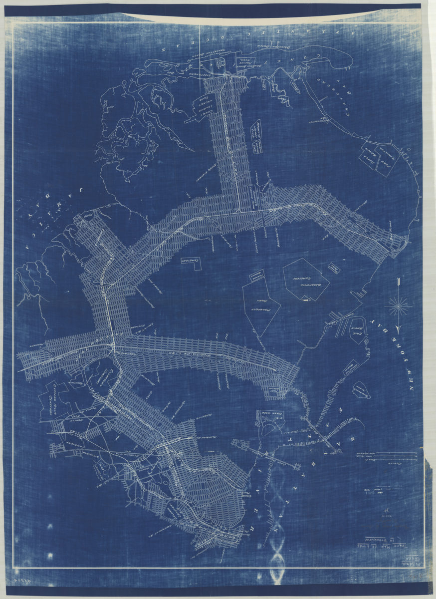
Track map of lines in Brooklyn
Track map of lines in Brooklyn
1898
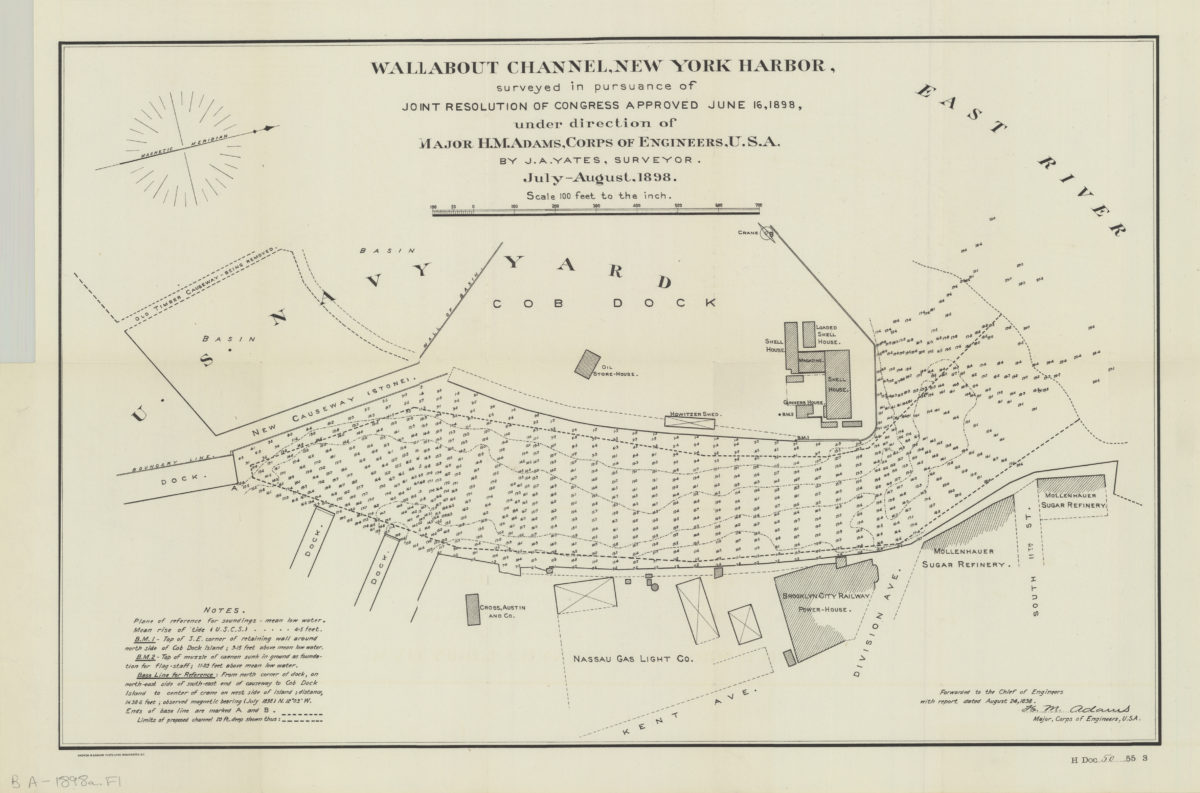
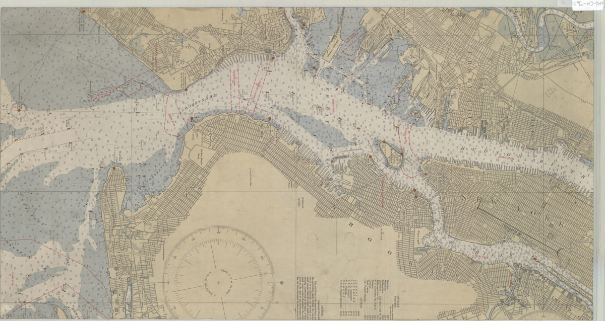
Wallabout Channel, New York Harbor, surveyed in pursuance of joint resolution of Congress approved June 16, 1898: under direction of Major H. M. Adams, Corps of Engineers, U.S.A. by J. A. Yates, surveyor
Wallabout Channel, New York Harbor, surveyed in pursuance of joint resolution of Congress approved June 16, 1898: under direction of Major H. M. Adams, Corps of Engineers, U.S.A. by J. A. Yates, surveyor
1898
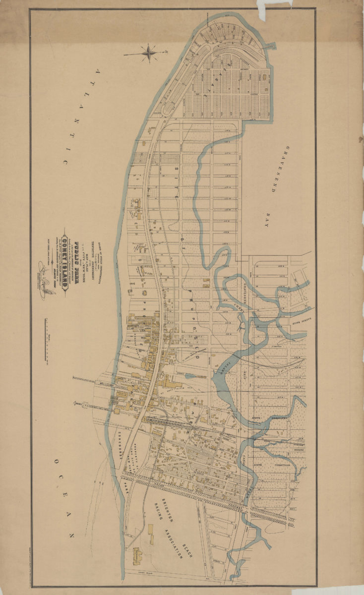
Tentative amendment to the Map or plan of the city of New York, showing a public park in that part of the borough of Brooklyn formerly known as the town of Gravesend and designated Coney Island, from W. 37th St. (Seagate)
Tentative amendment to the Map or plan of the city of New York, showing a public park in that part of the borough of Brooklyn formerly known as the town of Gravesend and designated Coney Island, from W. 37th St. (Seagate)
[1899]
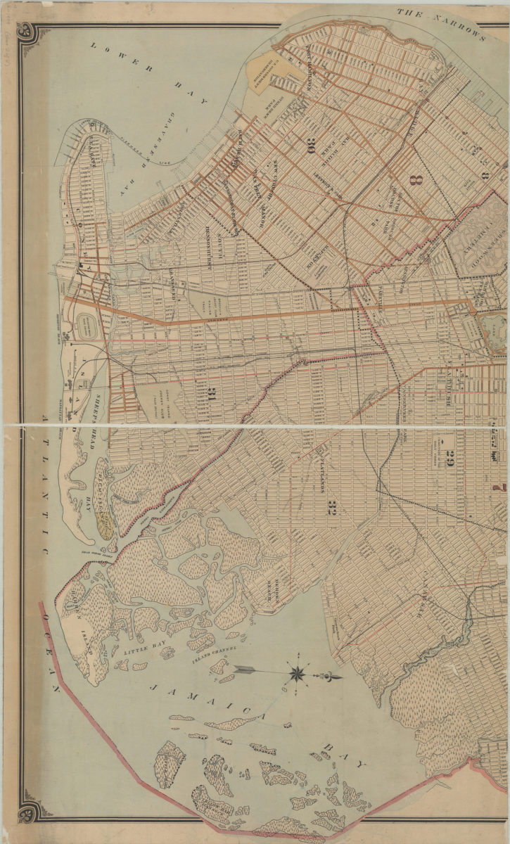
Map of the borough of Brooklyn, city of New York: based upon maps on file in the various city offices ; new system of street pavements, council district and ward boundary lines
Map of the borough of Brooklyn, city of New York: based upon maps on file in the various city offices ; new system of street pavements, council district and ward boundary lines
1899
[Map covering area east from Gravesend Bay to Harway Ave. at Bay 47th St.]: Chas S. Voorhis, city surveyor, Brooklyn, April 8, 1899
[Map covering area east from Gravesend Bay to Harway Ave. at Bay 47th St.]: Chas S. Voorhis, city surveyor, Brooklyn, April 8, 1899
1899
Map of Vanderveer Park West, property of Germania Real Estate and Improvement Co., in the 29th and 32nd Wards of the borough of Brooklyn, city of New York, N.Y.: surveyed August, 1899, by Fred. C. Dennington, city surveyor
Map of Vanderveer Park West, property of Germania Real Estate and Improvement Co., in the 29th and 32nd Wards of the borough of Brooklyn, city of New York, N.Y.: surveyed August, 1899, by Fred. C. Dennington, city surveyor
[1899]
Map of election districts in the town of Hempstead: Thos. V. Smith, civ. eng., Hempstead, July 19, 1899
Map of election districts in the town of Hempstead: Thos. V. Smith, civ. eng., Hempstead, July 19, 1899
[1899]
Map of Brooklyn, Kings County, Long Island: from an entire new survey: by Alexr. Martin
Map of Brooklyn, Kings County, Long Island: from an entire new survey: by Alexr. Martin
[19??]
[Map of Manhattan, from the Battery to 114th St.].
[Map of Manhattan, from the Battery to 114th St.].
[19??]
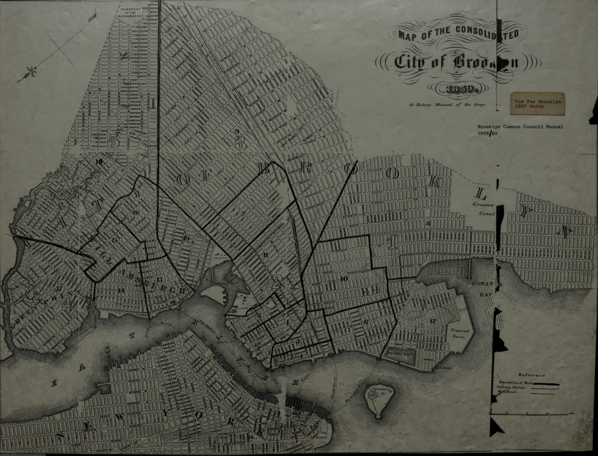
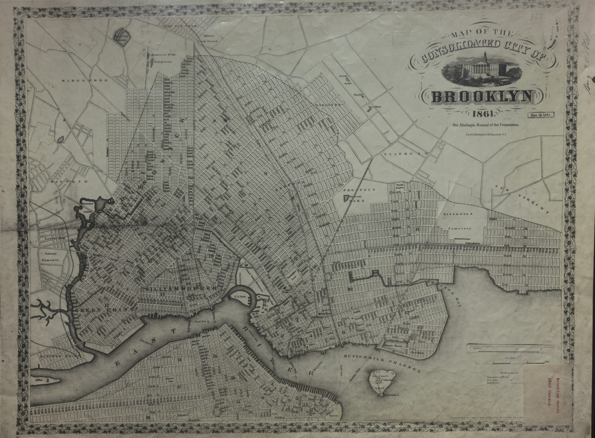
Map of the consolidated city of Brooklyn
Map of the consolidated city of Brooklyn
[19??]
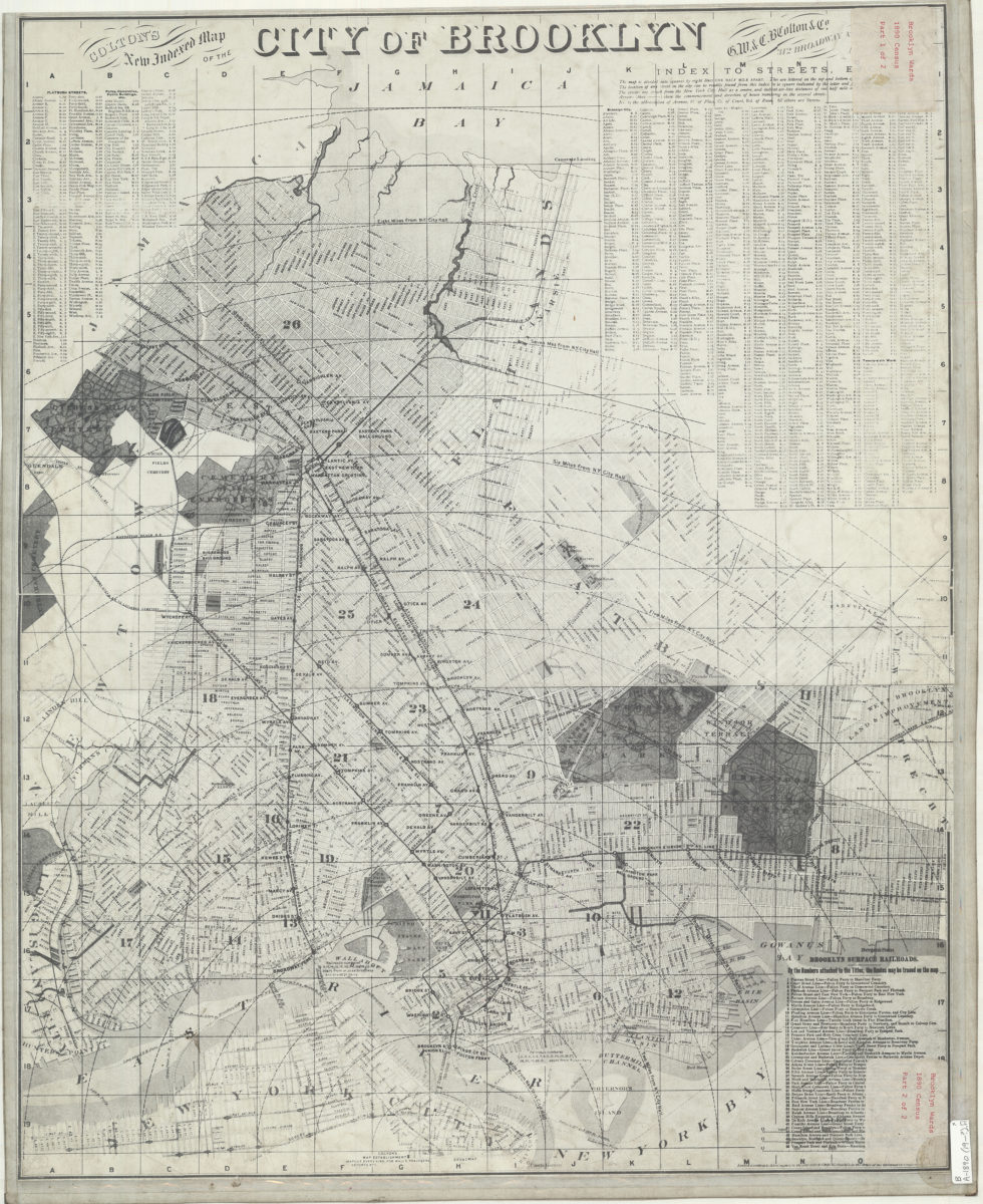
Colton’s new indexed map of the city of Brooklyn
Colton’s new indexed map of the city of Brooklyn
[19??]
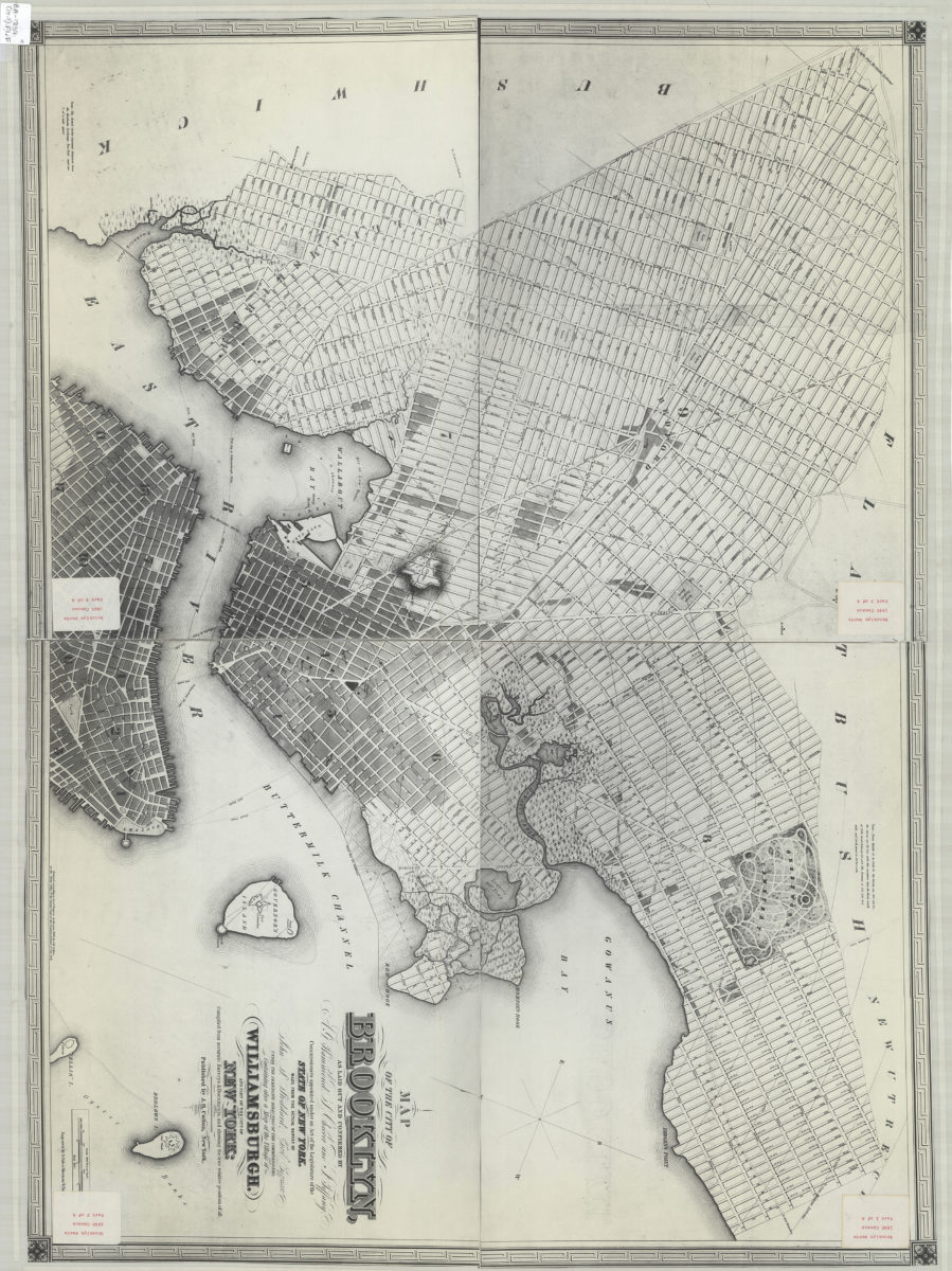
Map of the city of Brooklyn: as laid out and confirmed by A.G. Hammond, S. Cheever and J. Tiffany, commissioners appointed under an Act of the Legislature of the state of New York ; containing also a map of the village of Williamsburgh
Map of the city of Brooklyn: as laid out and confirmed by A.G. Hammond, S. Cheever and J. Tiffany, commissioners appointed under an Act of the Legislature of the state of New York ; containing also a map of the village of Williamsburgh
[19??]
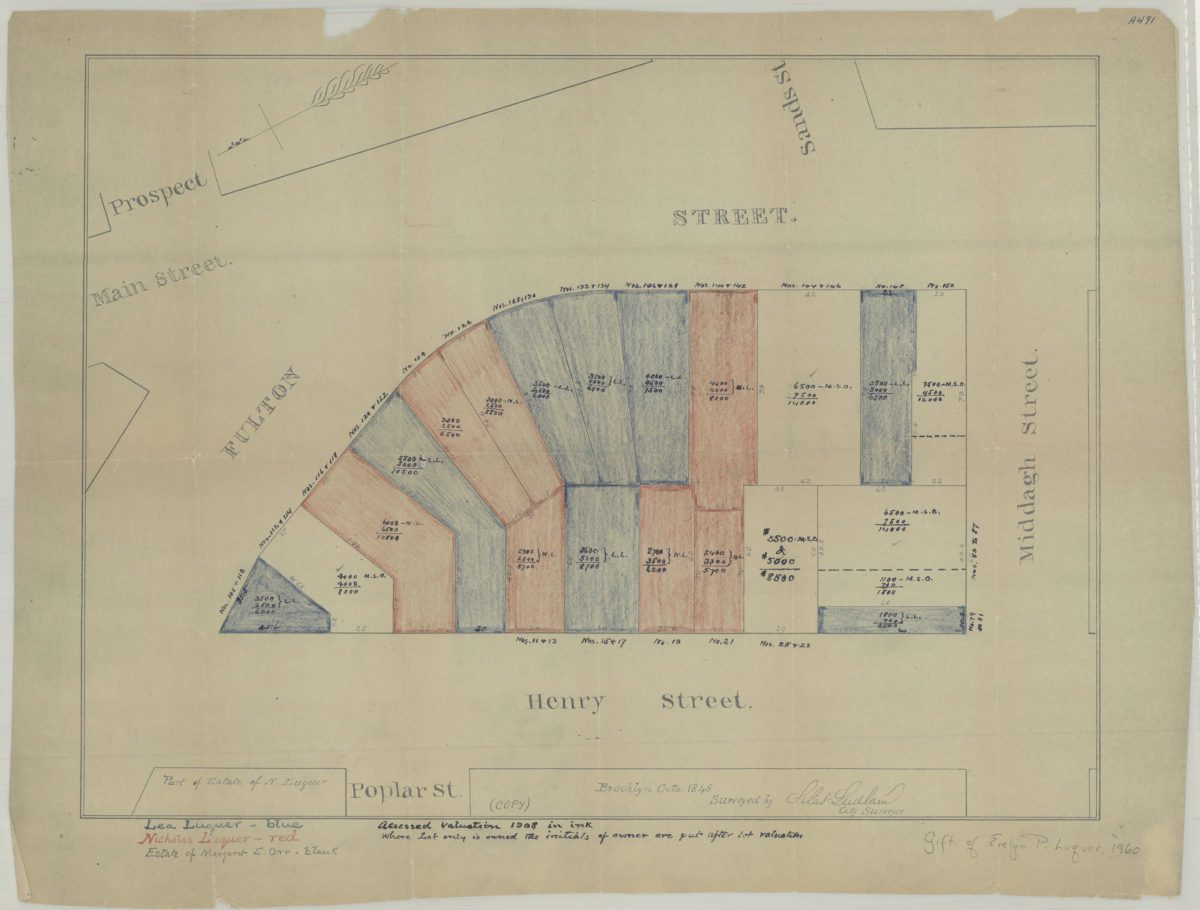
[Map of area bounded by Fulton St., Henry St., and Middagh St.]: surveyed by Silas Ludlam, city surveyor
[Map of area bounded by Fulton St., Henry St., and Middagh St.]: surveyed by Silas Ludlam, city surveyor
[19??]
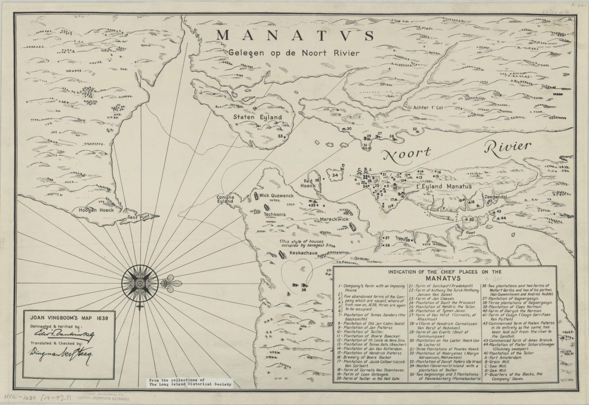
Joan Vingboom’s map 1639
Joan Vingboom’s map 1639
[19??]
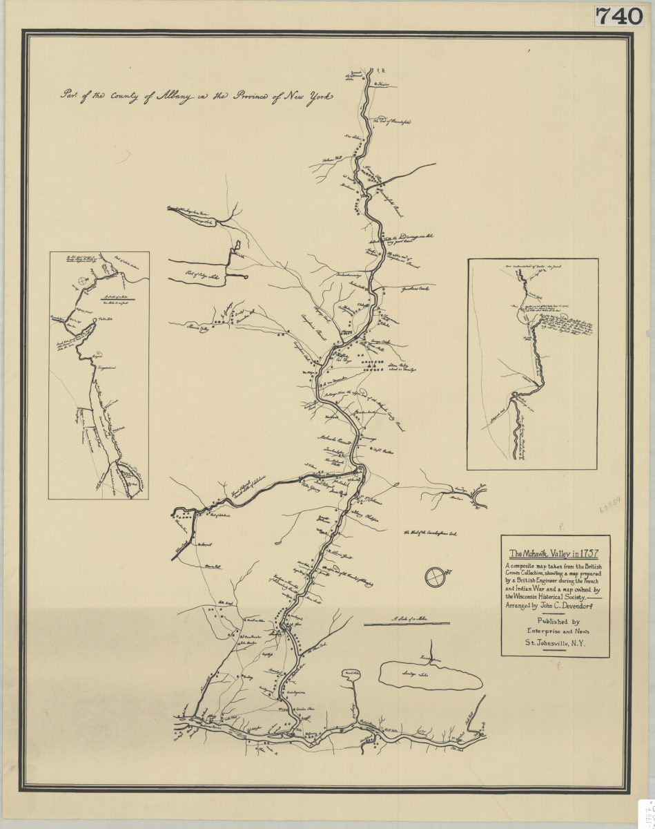
The Mohawk Valley in 1757: a composite map taken from the British Crown Collection, showing a map prepared by a British engineer during the French and Indian War and a map owned by the Wisconsin Historical Society: arranged by John C. Devendorf
The Mohawk Valley in 1757: a composite map taken from the British Crown Collection, showing a map prepared by a British engineer during the French and Indian War and a map owned by the Wisconsin Historical Society: arranged by John C. Devendorf
[19??]
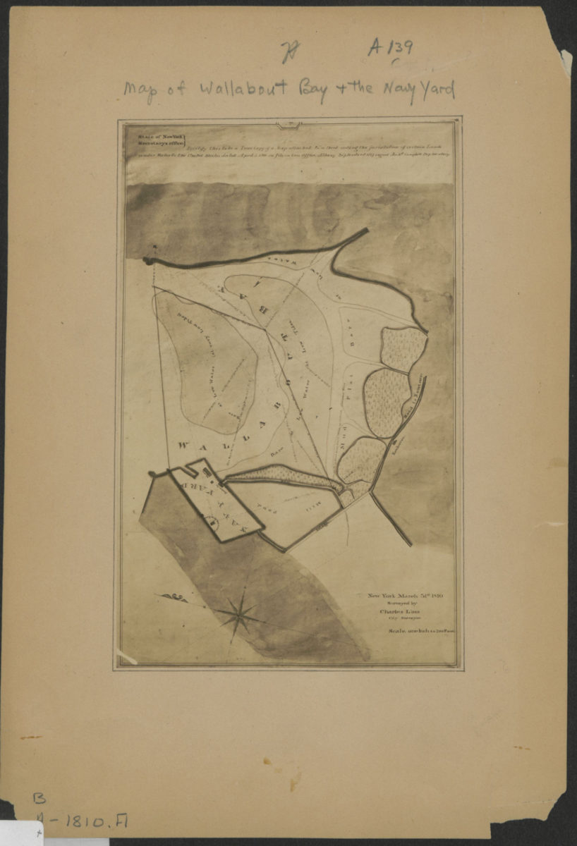
[Map of Wallabout Bay and the Brooklyn Navy Yard]: surveyed by Charles Loss, city surveyor, New York, March 31st, 1810
[Map of Wallabout Bay and the Brooklyn Navy Yard]: surveyed by Charles Loss, city surveyor, New York, March 31st, 1810
[19??]
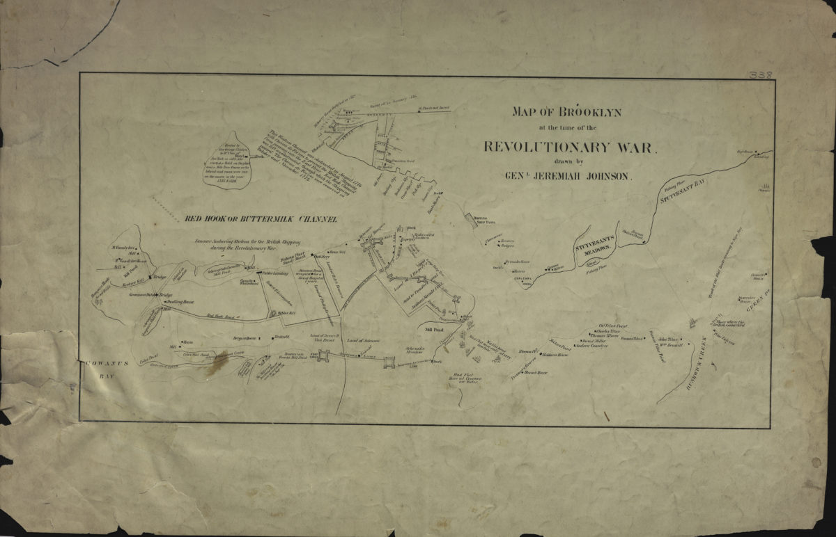
Map of Brooklyn at the time of the Revolutionary War: drawn by Genl. Jeremiah Johnson
Map of Brooklyn at the time of the Revolutionary War: drawn by Genl. Jeremiah Johnson
[19??]
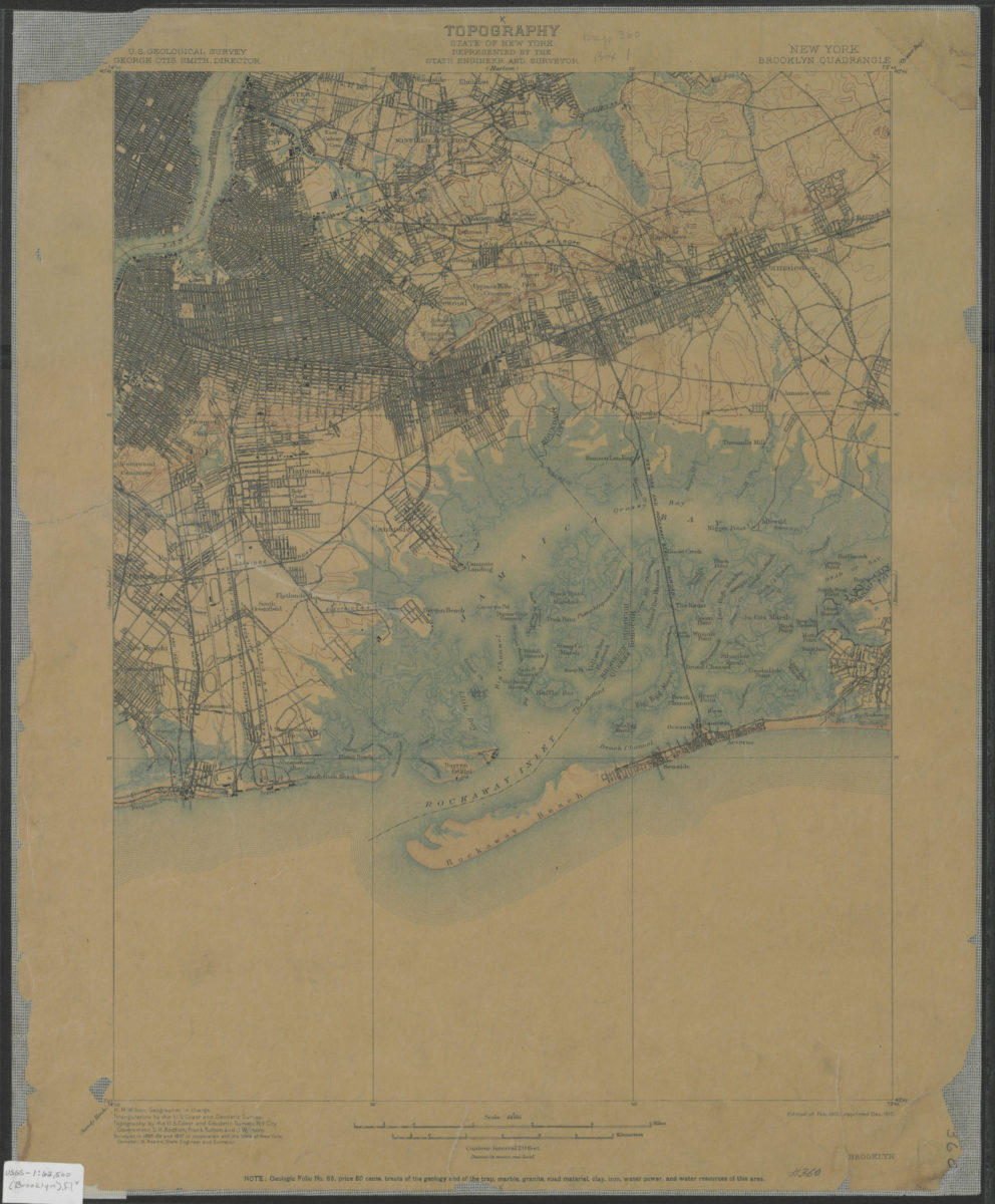
Brooklyn quadrangle, New York: U.S. Geological Survey
Brooklyn quadrangle, New York: U.S. Geological Survey
1900; 1910
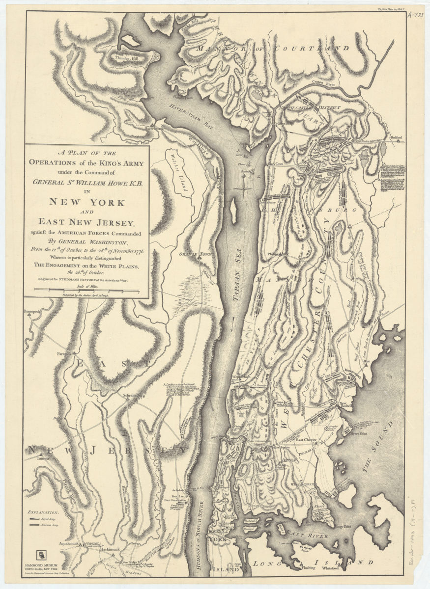
A plan of the operations of the King’s army under the command of General Sr. William Howe, K.B., in New York and East New Jersey against the American forces commanded by General Washington, from the 12th of October, to the 28th of November 1776
A plan of the operations of the King’s army under the command of General Sr. William Howe, K.B., in New York and East New Jersey against the American forces commanded by General Washington, from the 12th of October, to the 28th of November 1776
[19??]
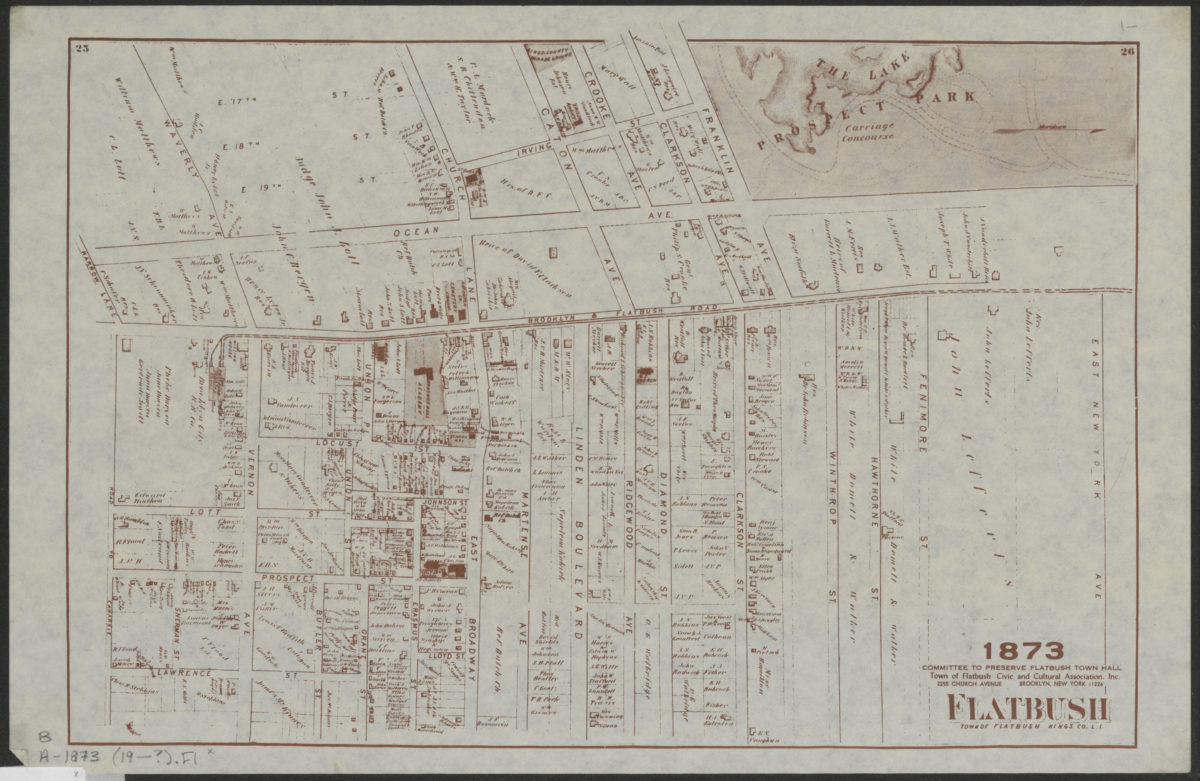
Flatbush, town of Flatbush, Kings Co., L.I.
Flatbush, town of Flatbush, Kings Co., L.I.
[19??]
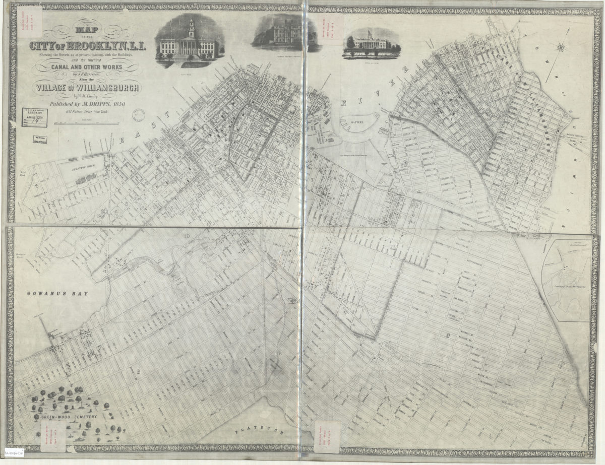
Map of the city of Brooklyn, L.I. : shewing the streets as at present existing, with the buildings, and the intended canal and other works … ; also the village of Williamsburgh
Map of the city of Brooklyn, L.I. : shewing the streets as at present existing, with the buildings, and the intended canal and other works … ; also the village of Williamsburgh
[19??]
Map of the consolidated city of Brooklyn: for Bishop’s Manual of the Corporation
Map of the consolidated city of Brooklyn: for Bishop’s Manual of the Corporation
[19??]
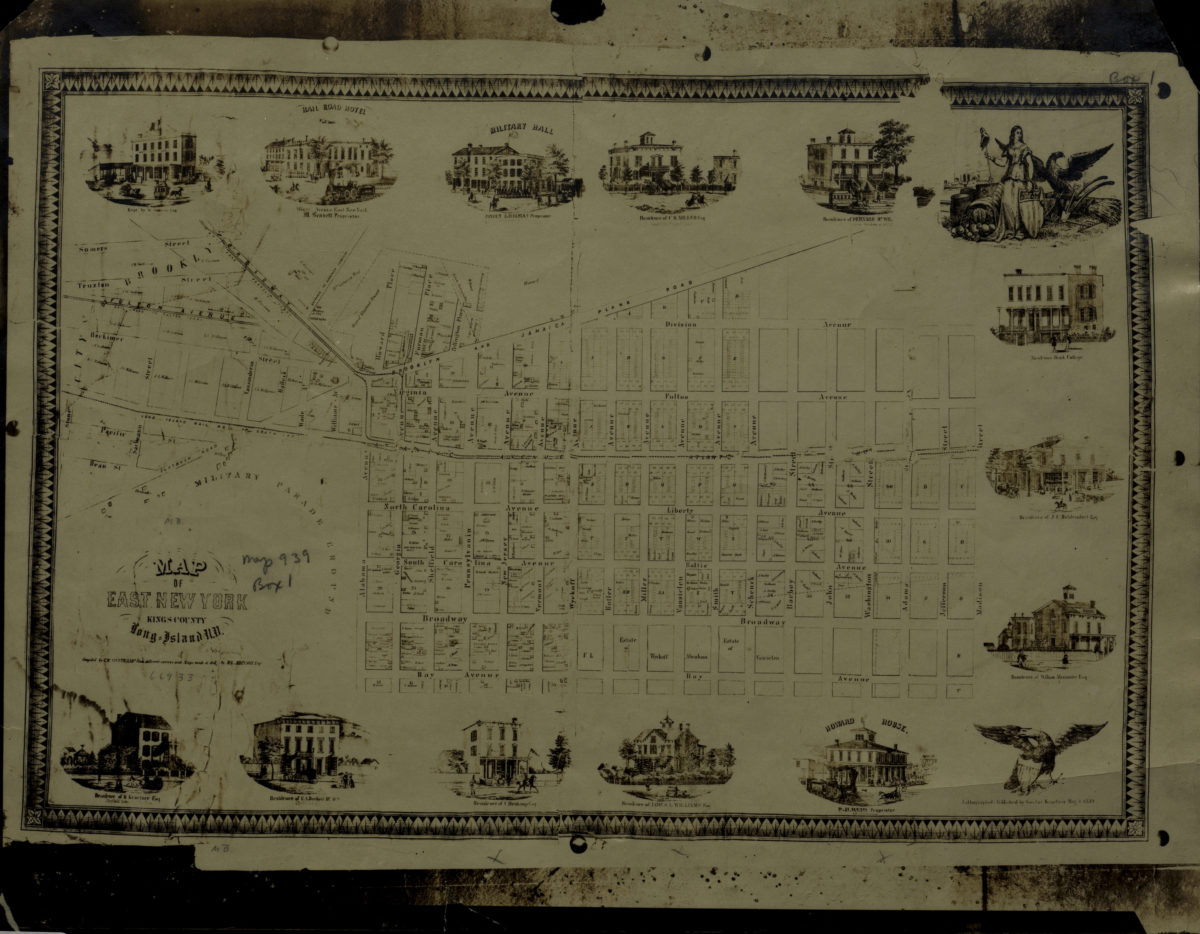
Map of East New York, Kings County, Long Island, N.Y.: compiled by C.W. Heftkamp from different surveys and maps made … by M.G. Johnson, Esqr
Map of East New York, Kings County, Long Island, N.Y.: compiled by C.W. Heftkamp from different surveys and maps made … by M.G. Johnson, Esqr
[19??]
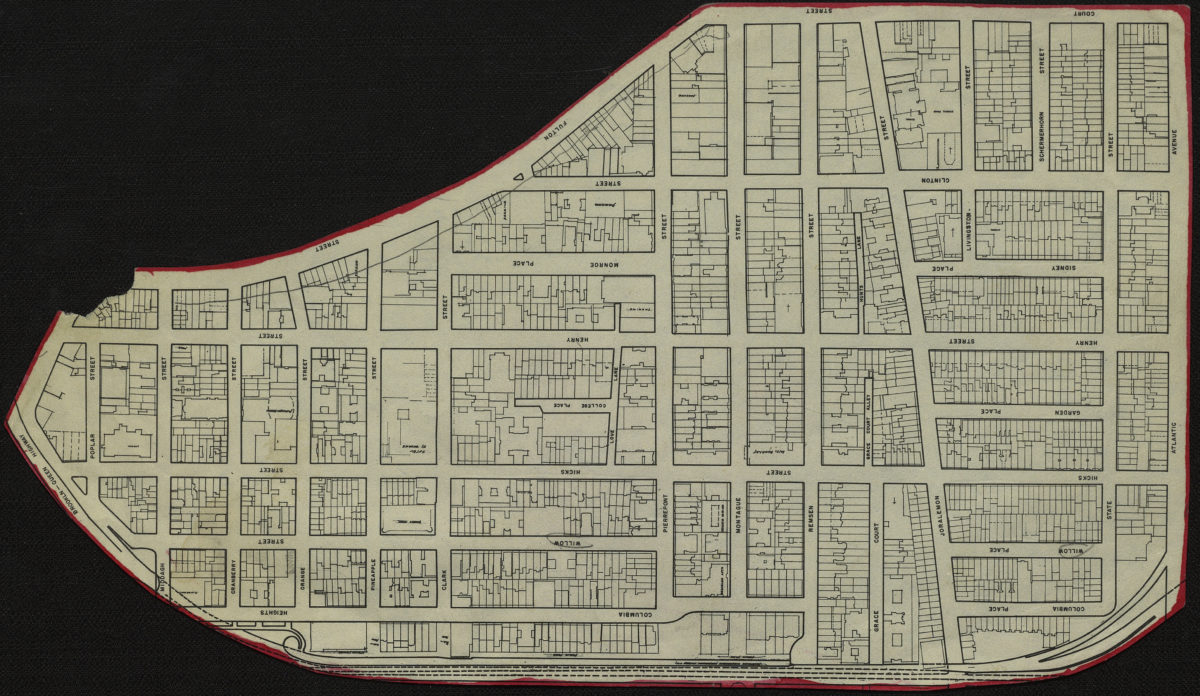
[Map of Brooklyn Heights]
[Map of Brooklyn Heights]
[19??]
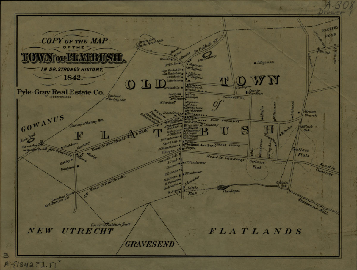
Copy of the map of the town of Flatbush in Dr. Strong’s history, 1842
Copy of the map of the town of Flatbush in Dr. Strong’s history, 1842
[19??]
[Property maps of North Hempstead and Oyster Bay Townships, Nassau County, N.Y.]
[Property maps of North Hempstead and Oyster Bay Townships, Nassau County, N.Y.]
[19??]
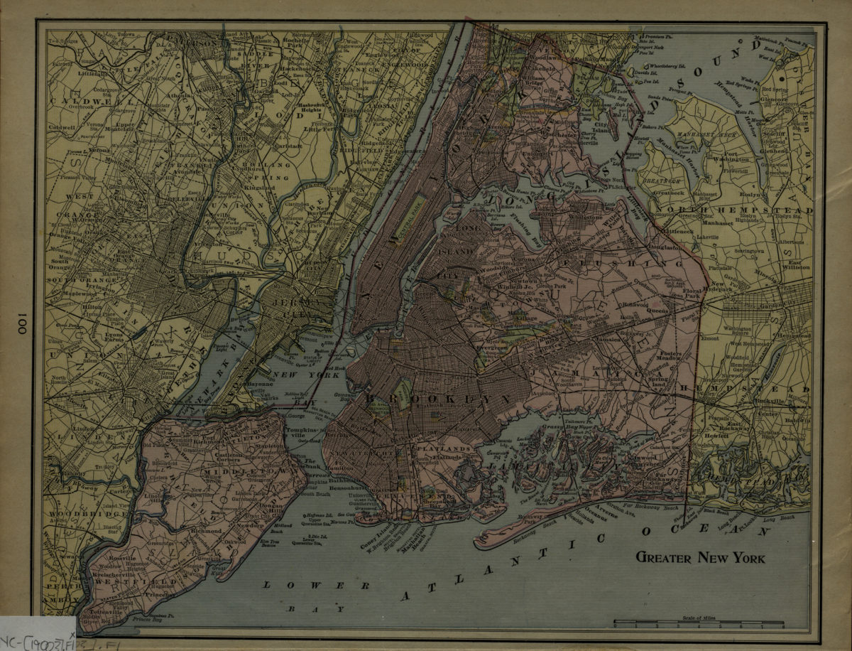
Greater New York
Greater New York
[1900]
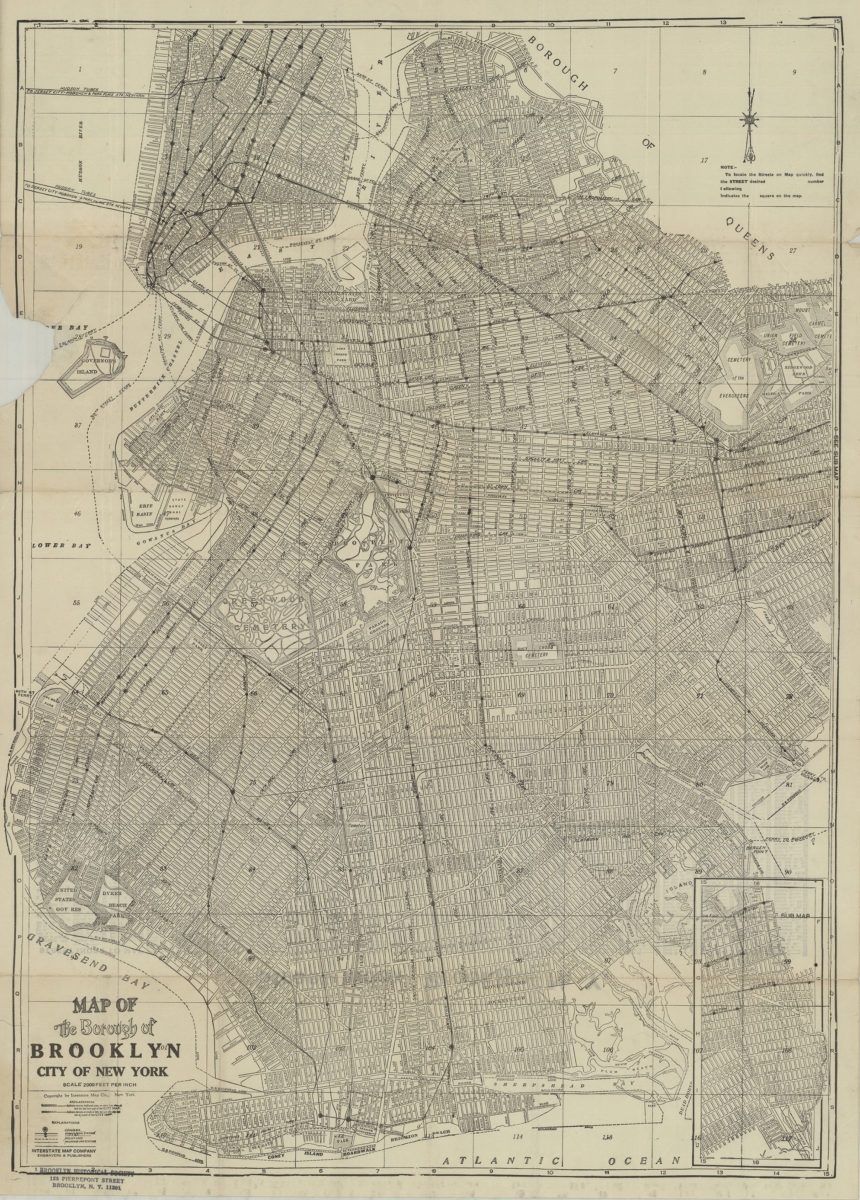
Map of the Borough of Brooklyn, City of New York
Map of the Borough of Brooklyn, City of New York
[19??]
[Map of Mahattan south of Central Park, eastern edge of Brooklyn, southwest edge of New Jersey, and the nothwest edge of Staten Island]
[Map of Mahattan south of Central Park, eastern edge of Brooklyn, southwest edge of New Jersey, and the nothwest edge of Staten Island]
[19??]
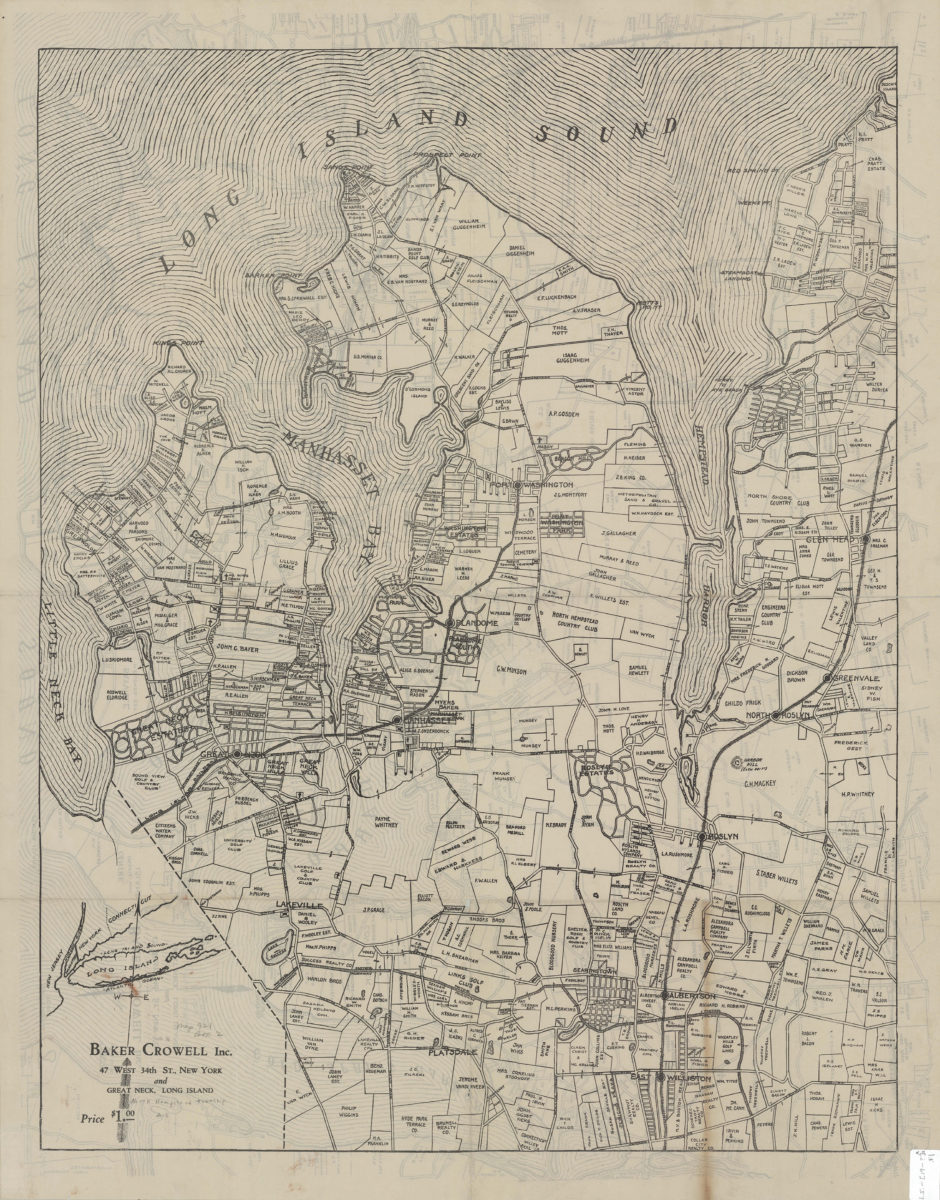
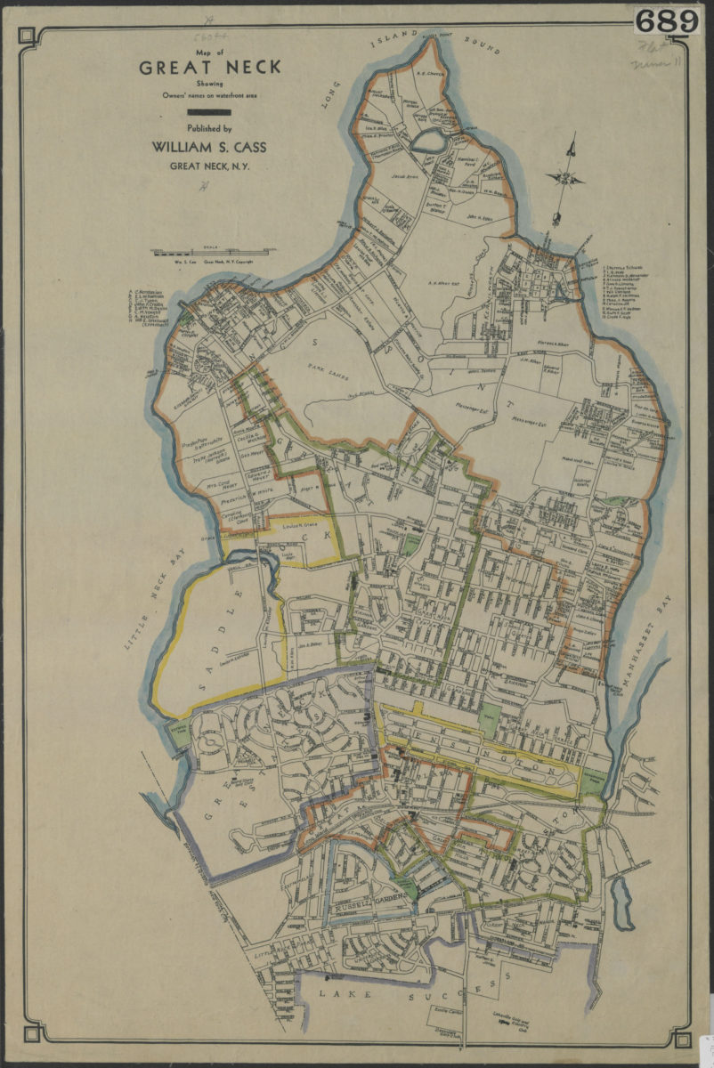
Map of Great Neck: showing owners’ names on waterfront area: published by William S. Cass, Great Neck, N.Y.
Map of Great Neck: showing owners’ names on waterfront area: published by William S. Cass, Great Neck, N.Y.
[19??]
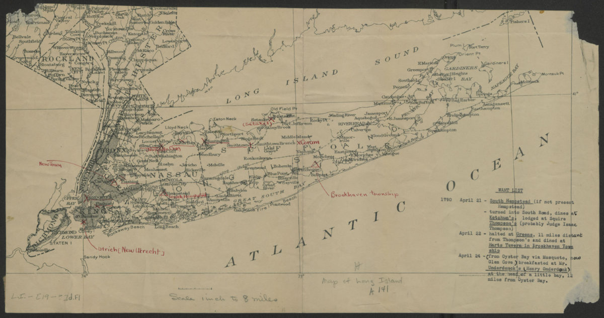
[Map of Long Island]
[Map of Long Island]
[19??]
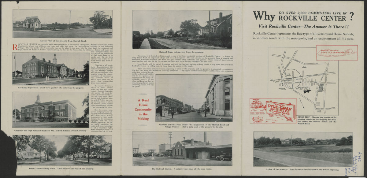
A map of “Rockville Ridge,” Rockville Center, Nassau County, N.Y.
A map of “Rockville Ridge,” Rockville Center, Nassau County, N.Y.
[19??]
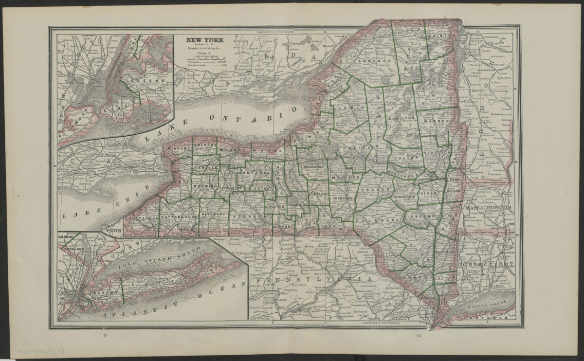
New York
New York
[19??]
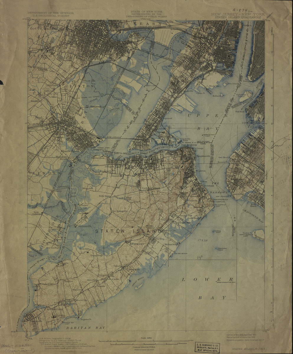
New Jersey- New York: Staten Island Quadrangle
New Jersey- New York: Staten Island Quadrangle
1900
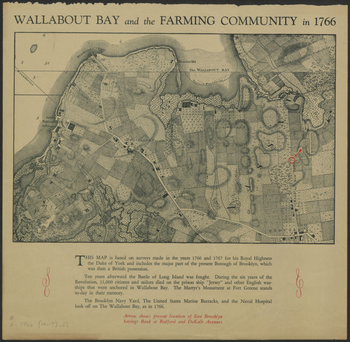
Wallabout Bay and the farming community in 1766
Wallabout Bay and the farming community in 1766
[19??]
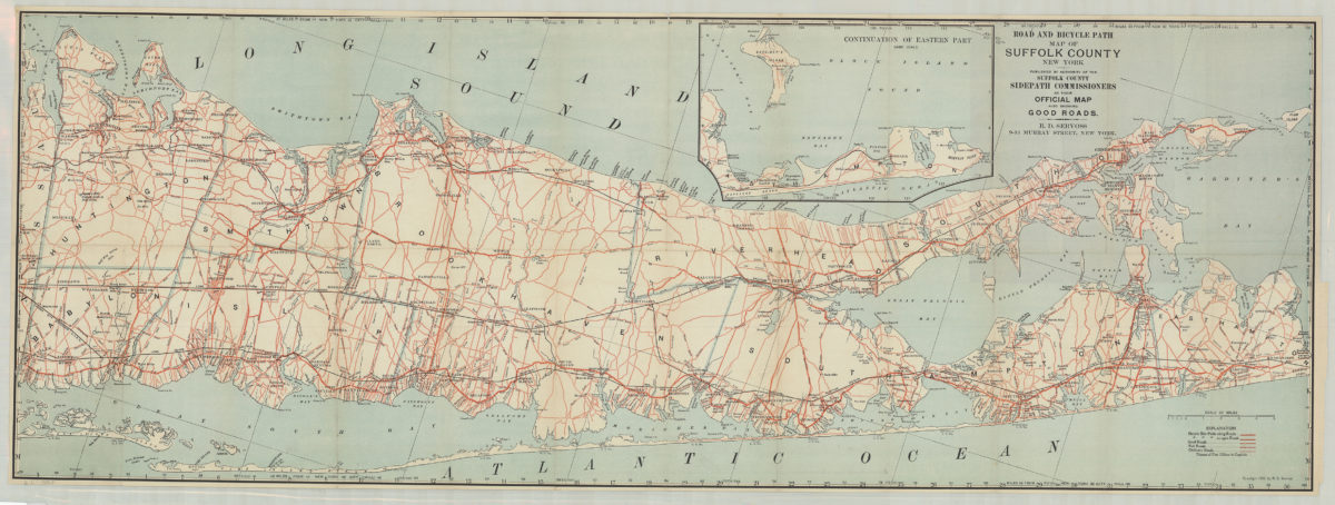
Road and bicycle path map of Suffolk County, New York: R.D. Servoss
Road and bicycle path map of Suffolk County, New York: R.D. Servoss
[ca. 1900]
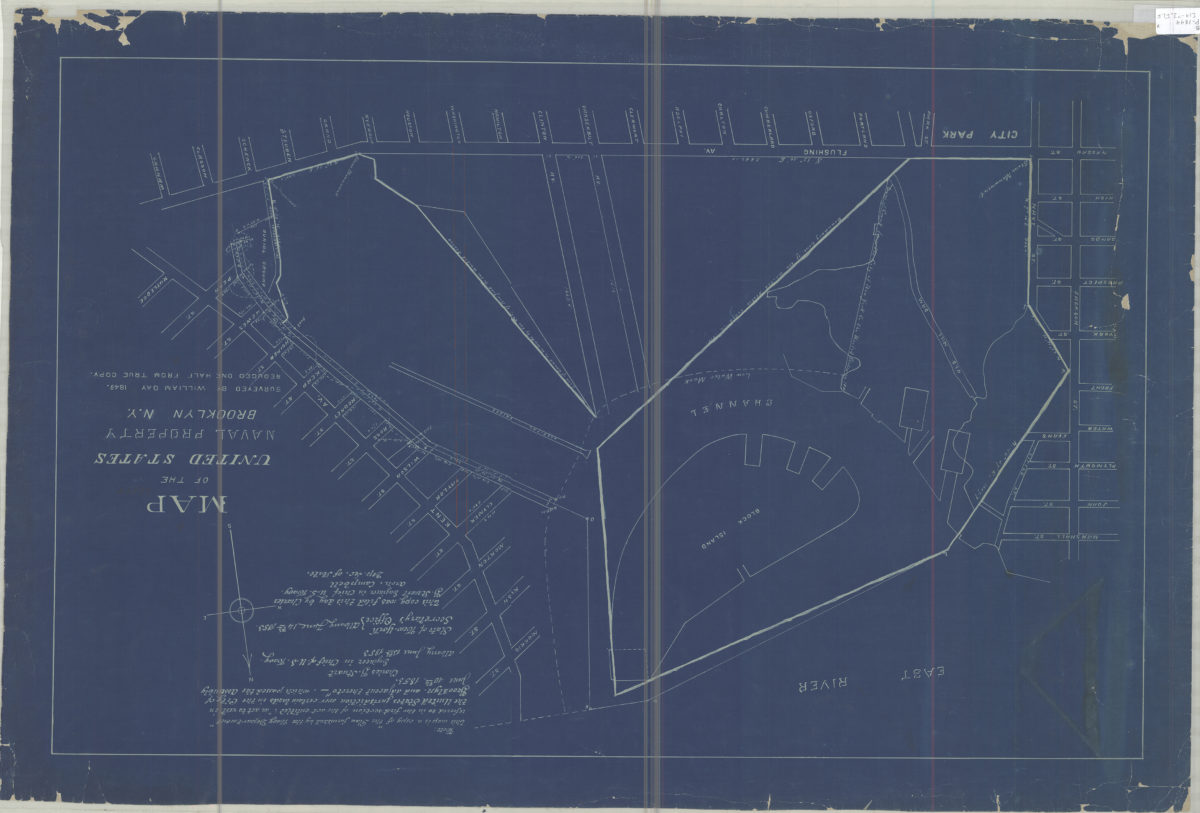
Map of the United States Naval Property, Brooklyn, N.Y.: surveyed by William Day, 1849
Map of the United States Naval Property, Brooklyn, N.Y.: surveyed by William Day, 1849
[19??]
[Map of Jamaica Bay]
[Map of Jamaica Bay]
[19??]
Map of the town of Oyster Bay, N.Y.: John Cox Jr
Map of the town of Oyster Bay, N.Y.: John Cox Jr
[19??]
Orient Park, Brookhaven, L.I.
Orient Park, Brookhaven, L.I.
[19??]
Road map of Long Island: published by Gustav Kobbé
Road map of Long Island: published by Gustav Kobbé
[19??]
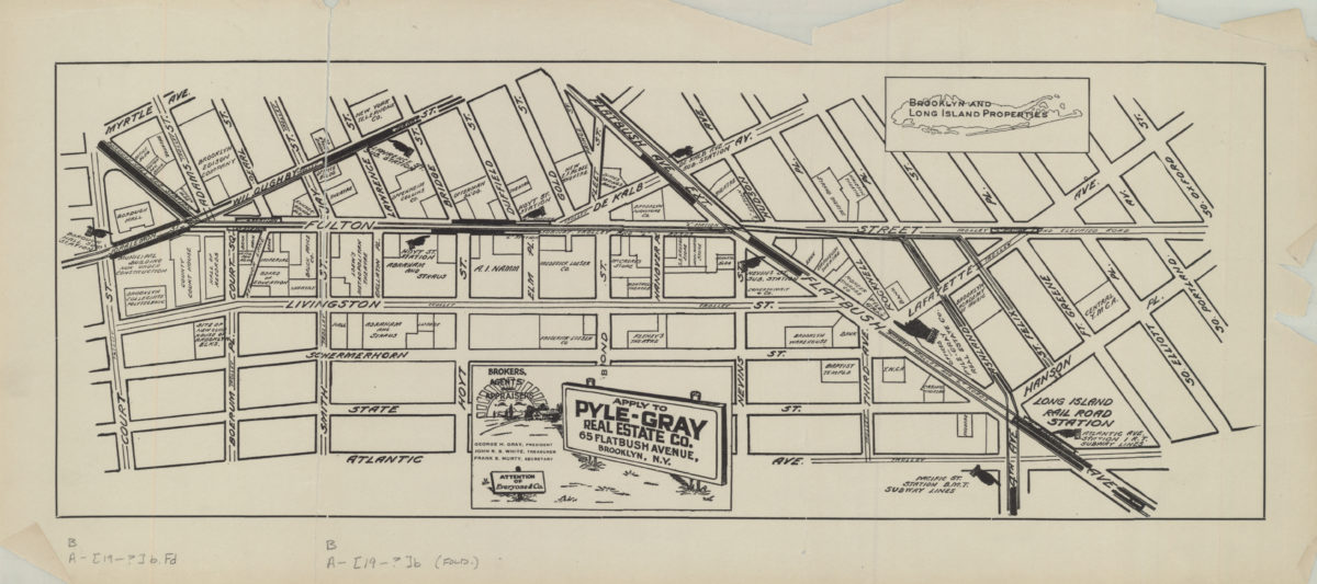
[Map of the Fulton Street area in downtown Brooklyn]
[Map of the Fulton Street area in downtown Brooklyn]
[19??]
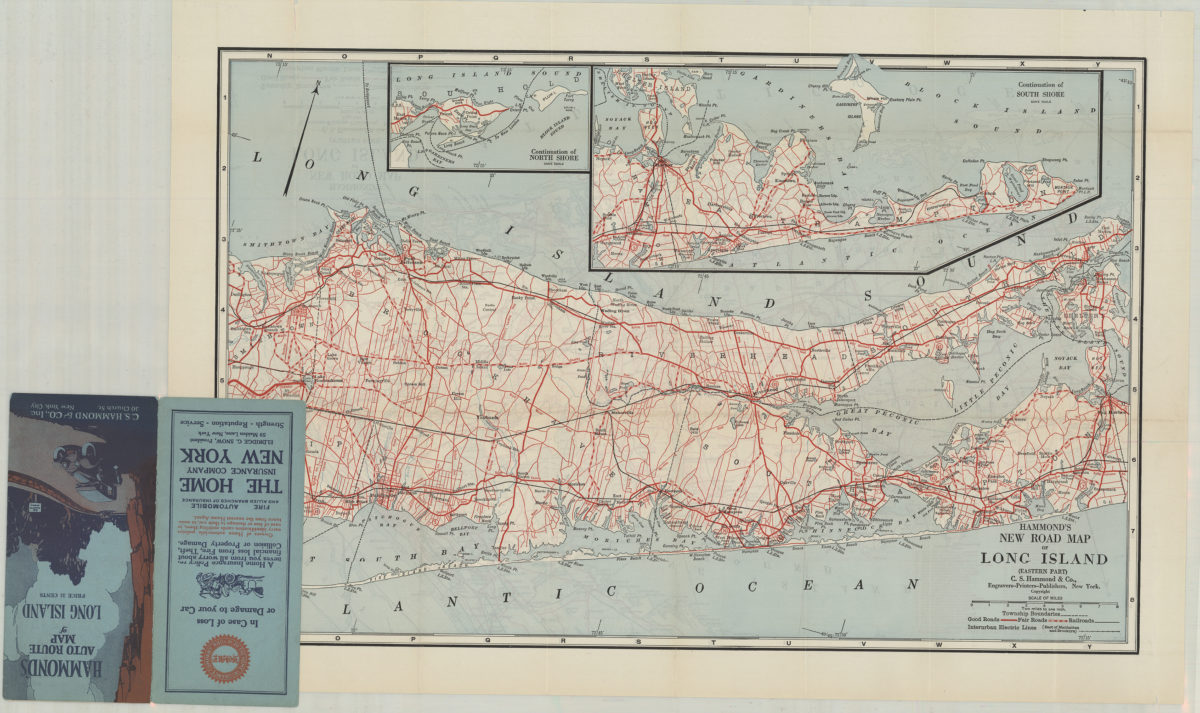
Hammond’s new road map of Long Island: C.S. Hammond & Co
Hammond’s new road map of Long Island: C.S. Hammond & Co
[19??]
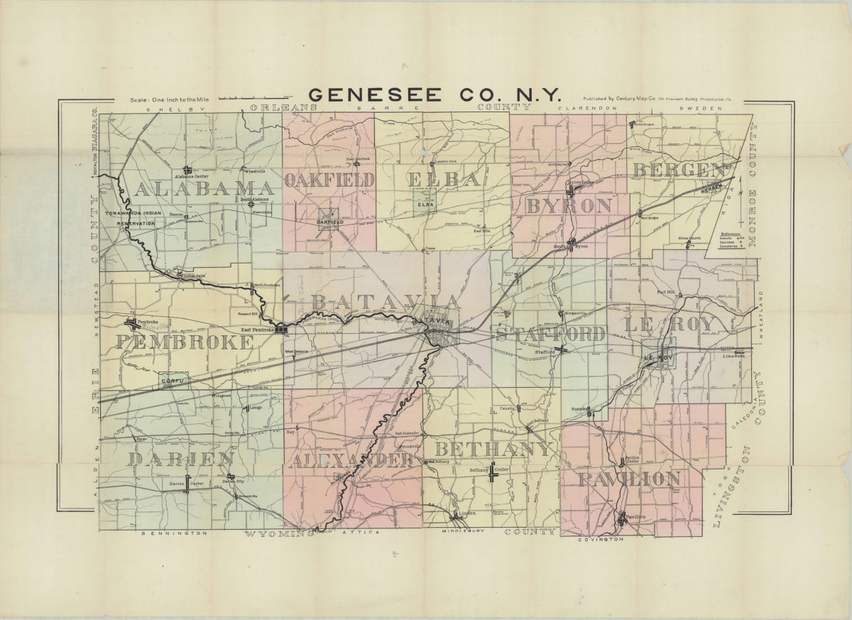
Genesee Co., N.Y.
Genesee Co., N.Y.
[19??]
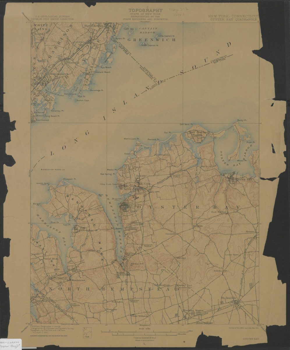
Oyster Bay quadrangle, New York – Connecticut: U.S. Geological Survey
Oyster Bay quadrangle, New York – Connecticut: U.S. Geological Survey
1900; 1911
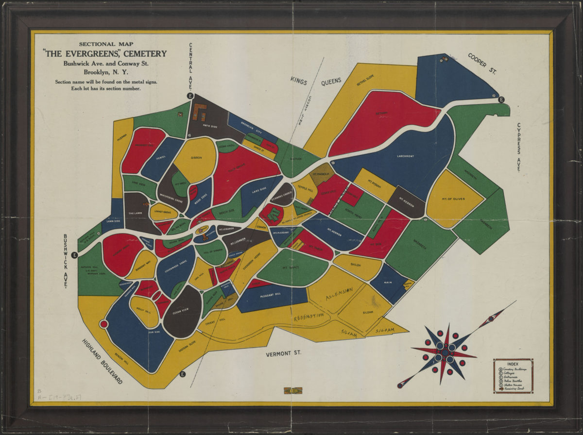
Sectional map: “The Evergreens Cemetery” : Bushwick Ave. and Conway Street, Brooklyn, N.Y.
Sectional map: “The Evergreens Cemetery” : Bushwick Ave. and Conway Street, Brooklyn, N.Y.
[1900-1999]
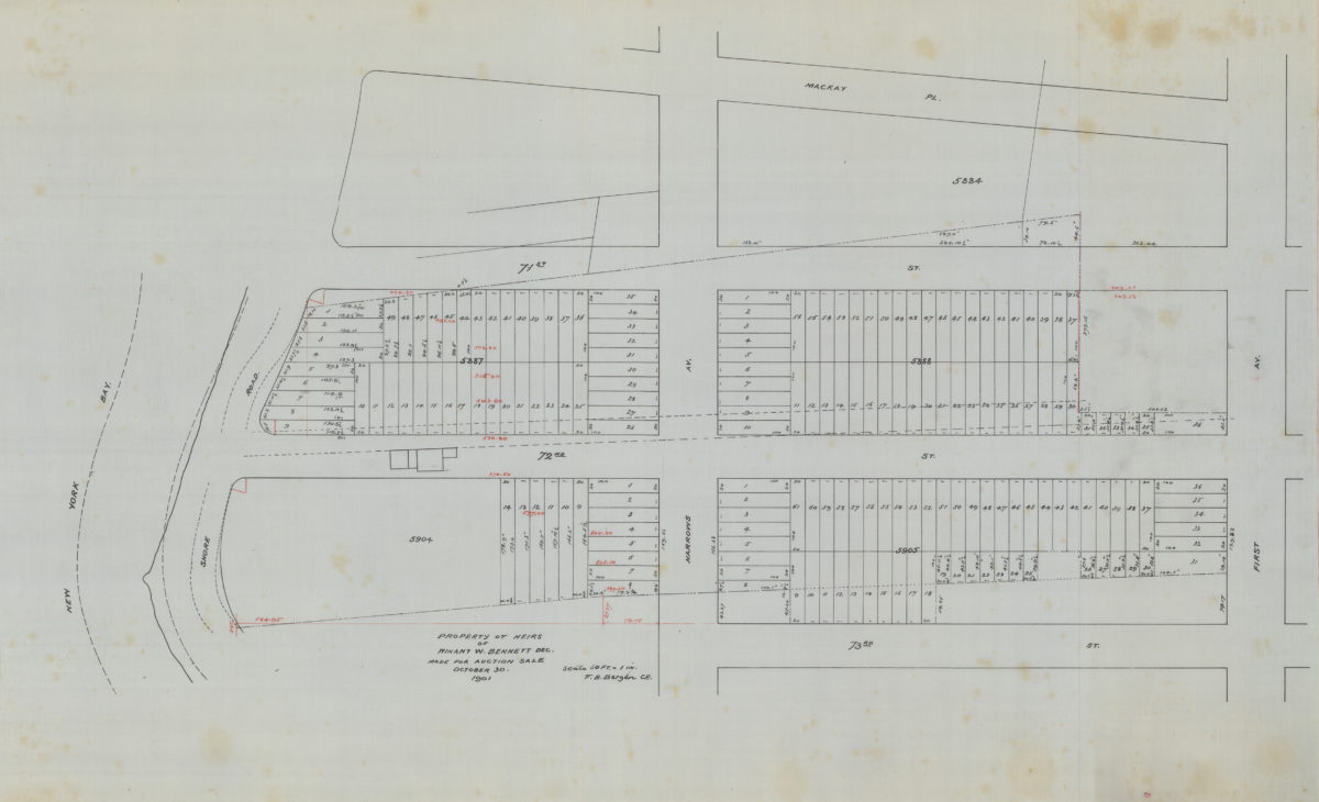
Property of heirs of Winant W. Bennett, dec., made for auction sale: V.B. Bergen, C.E.
Property of heirs of Winant W. Bennett, dec., made for auction sale: V.B. Bergen, C.E.
October 30 1901
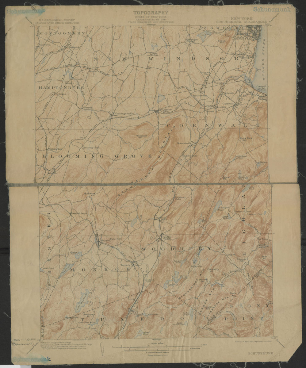
Schunemunk quadrangle, New York: U.S. Geological Survey
Schunemunk quadrangle, New York: U.S. Geological Survey
1902; 1909
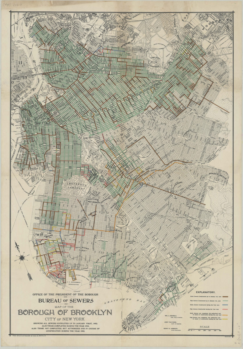
Map of the borough of Brooklyn, city of New York: showing all sewers completed up to January first, 1902. Also those completed during the year 1902. Also those not completed, but authorized and in course of construction during the year 1902
Map of the borough of Brooklyn, city of New York: showing all sewers completed up to January first, 1902. Also those completed during the year 1902. Also those not completed, but authorized and in course of construction during the year 1902
[1902]
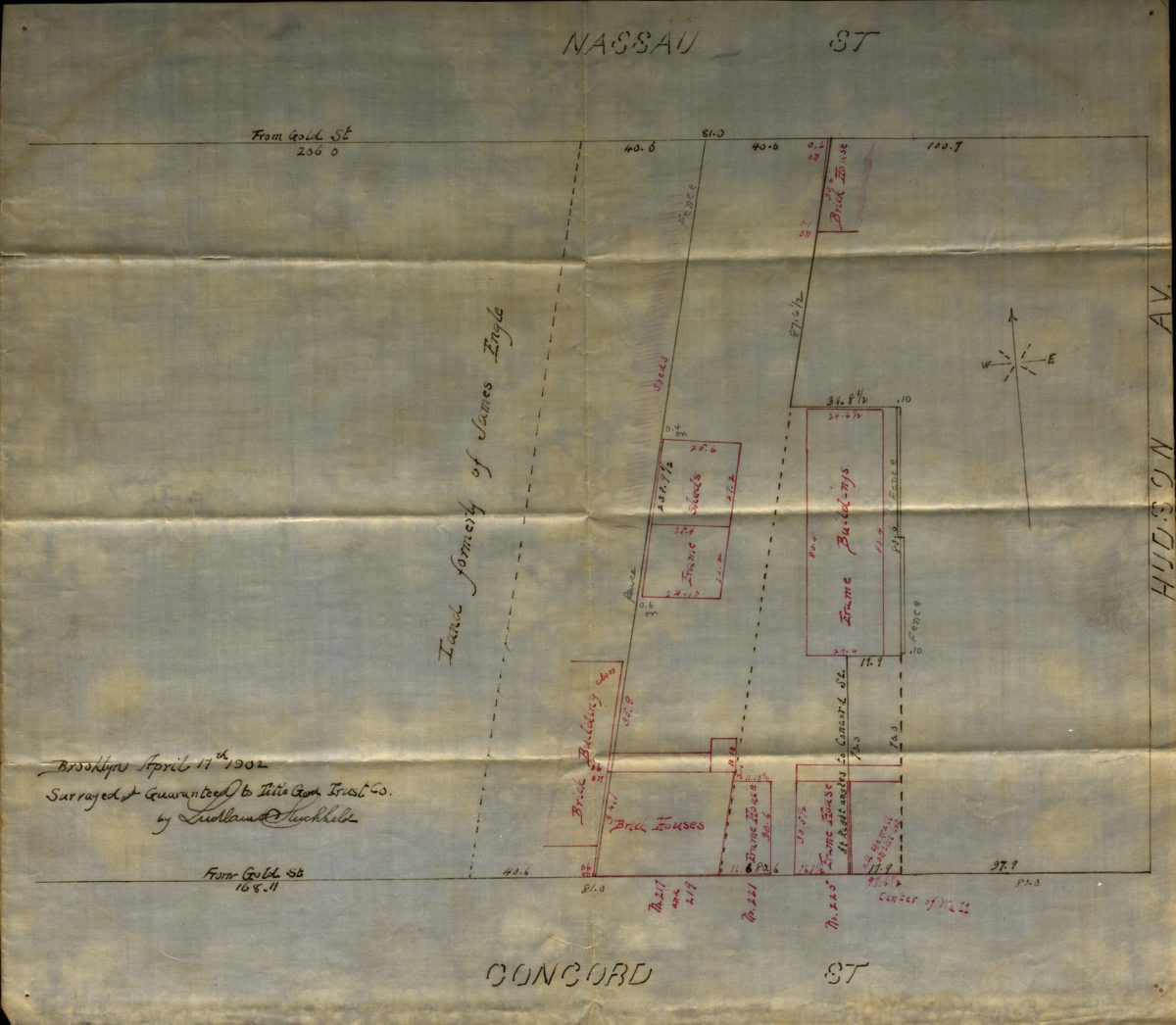
[Map of Hudson Avenue at Nassau Street and Concord Street]
[Map of Hudson Avenue at Nassau Street and Concord Street]
1902
Previous
1
2
3
4
5
6
7
8
9
10
11
12
13
14
15
16
17
18
19
20
21
22
23
24
25
26
27
28
29
30
Next